
Mori Atlas logo
Nature reserveRezerwat przyrody Dolina Kluczwody

Tracing the mapped boundaries and karst landscape geography of a vital Polish nature reserve

Rezerwat przyrody Dolina Kluczwody: A Protected Limestone Valley in Lesser Poland Voivodeship

Rezerwat przyrody Dolina Kluczwody encompasses a significant protected area within the Kraków region, where dramatic limestone cliffs and lush oak-hornbeam forests define the local terrain. Situated on the Kraków-Częstochowa Upland, this reserve acts as a critical enclave within the broader Dolinki Jurajskie Natura 2000 network. The landscape is characterized by steep valley walls, sun-exposed rock swards, and the lively Kluczwoda stream, offering a unique opportunity to study karst processes and diverse microclimates.

limestone valleyoak-hornbeam forestrock swardskarst landscapeNatura 2000Dolinki Krakowskie
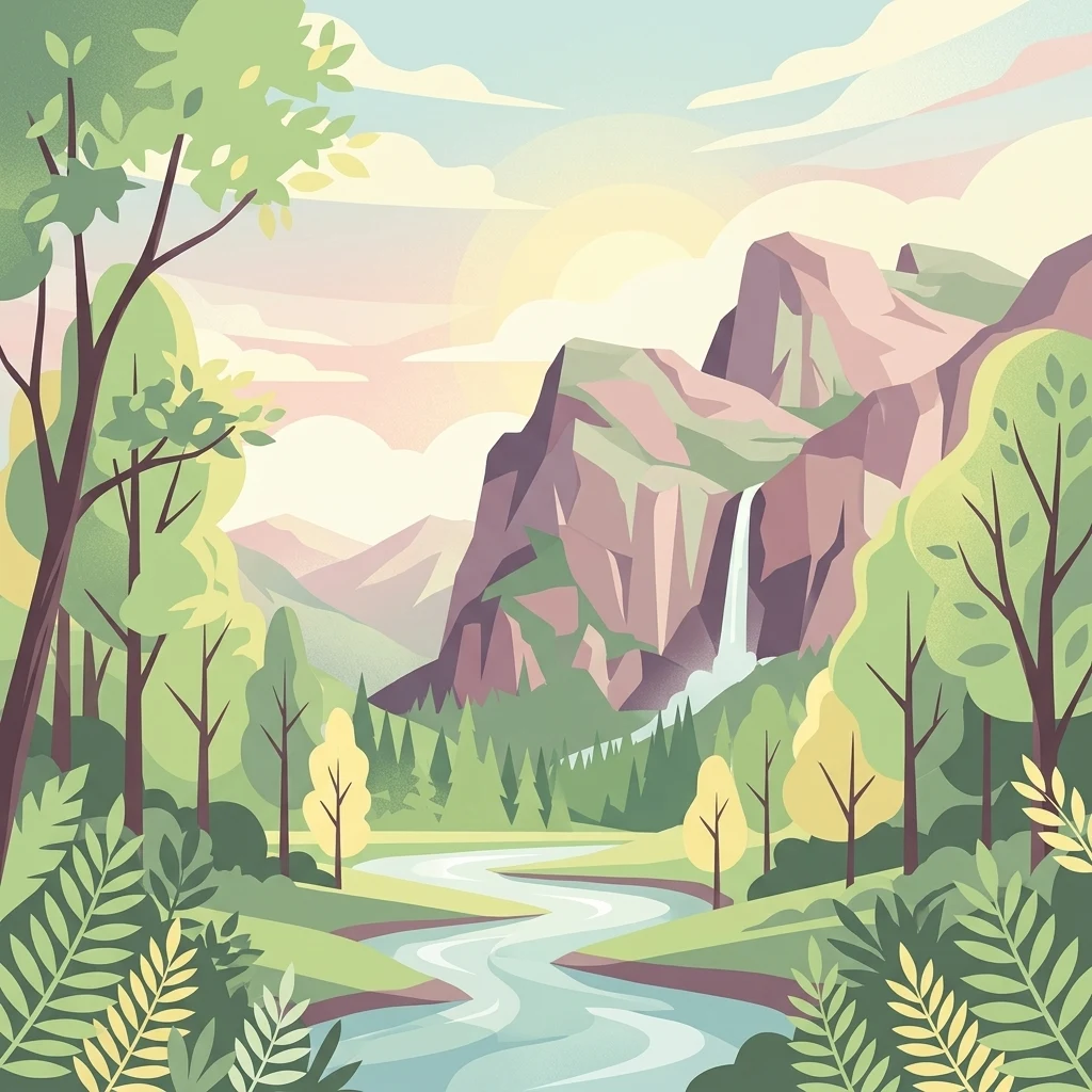
A flat-style vector illustration showing a winding river flowing through a lush green valley towards a large mountain with a waterfall, surrounded by trees and stylized clouds.

Rezerwat przyrody Dolina Kluczwody

Nature reserve

Park overview

Structured park overview, official facts, and landscape profile for Dolina Kluczwody Nature Reserve

Dolina Kluczwody Nature Reserve park facts, protected area profile, and essential visitor context

Review the core facts for Dolina Kluczwody Nature Reserve, including designation, size, terrain, visitor scale, habitats, and operating context in one park-focused overview.

About Dolina Kluczwody Nature Reserve

Dolina Kluczwody Nature Reserve sits in the middle reaches of Kluczwody Valley, a narrow, forested side valley of the Kraków-Częstochowa Upland in southern Poland. It lies on the western slope of the valley, within the village of Zelków in the Zabierzów commune, and falls inside the well-known Dolinki Krakowskie Landscape Park, a chain of picturesque limestone ravines northwest of Kraków. The reserve was created in 1989 to safeguard a representative slice of the area's natural forest cover, its characteristic rock vegetation, and the accompanying valley landscape.

Protected at the level of a Polish landscape nature reserve, the site covers 35.22 hectares of forest administered by the Krzeszowice Forest District, specifically through its Dubie forest subdistrict. The reserve belongs to the partial-protection category, meaning that core natural values are preserved while allowing for traditional, low-intensity use of the surrounding area.

Ecologically, Dolina Kluczwody exemplifies the typical mosaic of the Polish Jurassic uplands: a sheltered gorge of deciduous forest alternating with exposed limestone cliffs. Because the valley sits within a Natura 2000 habitat site, 'Dolinki Jurajskie', its values are recognized beyond national protection. It functions as one of several ecological islands that together sustain habitat continuity for woodland and rock-inhabiting species across the Dolinki Krakowskie region.

Quick facts and research context for Dolina Kluczwody Nature Reserve

Dolina Kluczwody is a landscape nature reserve established in 1989 under the Polish Monitor of 1989, item 9, position 77. It is located on the Olkuska Upland in Małopolskie voivodeship, within the Zabierzów commune and the Kraków district, and forms part of the Dolinki Krakowskie Landscape Park.

The reserve is state-owned forest land administered by Krzeszowice Forest District and covers 35.22 hectares. It is protected under a partial conservation regime and is one of eleven habitat enclaves making up the Natura 2000 site designated as 'Dolinki Jurajskie' (PLH120005).

Protection and recognition

Examine documented terrestrial protection metrics and official international recognition data.

Rezerwat przyrody Dolina Kluczwody Protection Status and Conservation Records

Rezerwat przyrody Dolina Kluczwody maintains a defined terrestrial protection status within the regional conservation network. Structured conservation records provide verified administrative details and official designation context for this protected natural area.

Protection details

Protection scope
Terrestrial
Transboundary protection
No
Park context

Deeper park guide and search-rich context for Dolina Kluczwody Nature Reserve

Dolina Kluczwody Nature Reserve history, landscape, wildlife, and travel context

Explore Dolina Kluczwody Nature Reserve through its history, landscape character, ecosystems, wildlife, conservation priorities, cultural context, and seasonal travel timing in a structured park guide built for atlas discovery and search intent.

Why Dolina Kluczwody Nature Reserve stands out

The reserve is best known for combining a classic Jurassic limestone-valley landscape with ecologically contrasting habitats on one relatively small site: dense oak-hornbeam forest on the shaded slopes, sun-baked limestone rock swards with calcicole plants on the exposed cliffs, and a fast-running stream with small cascades along the valley floor. It also stands out as one of the constituent habitat patches of the broader Natura 2000 site 'Dolinki Jurajskie', and as one of the more scenic side-valleys inside the Dolinki Krakowskie Landscape Park, a popular area for hiking and cycling northwest of Kraków.
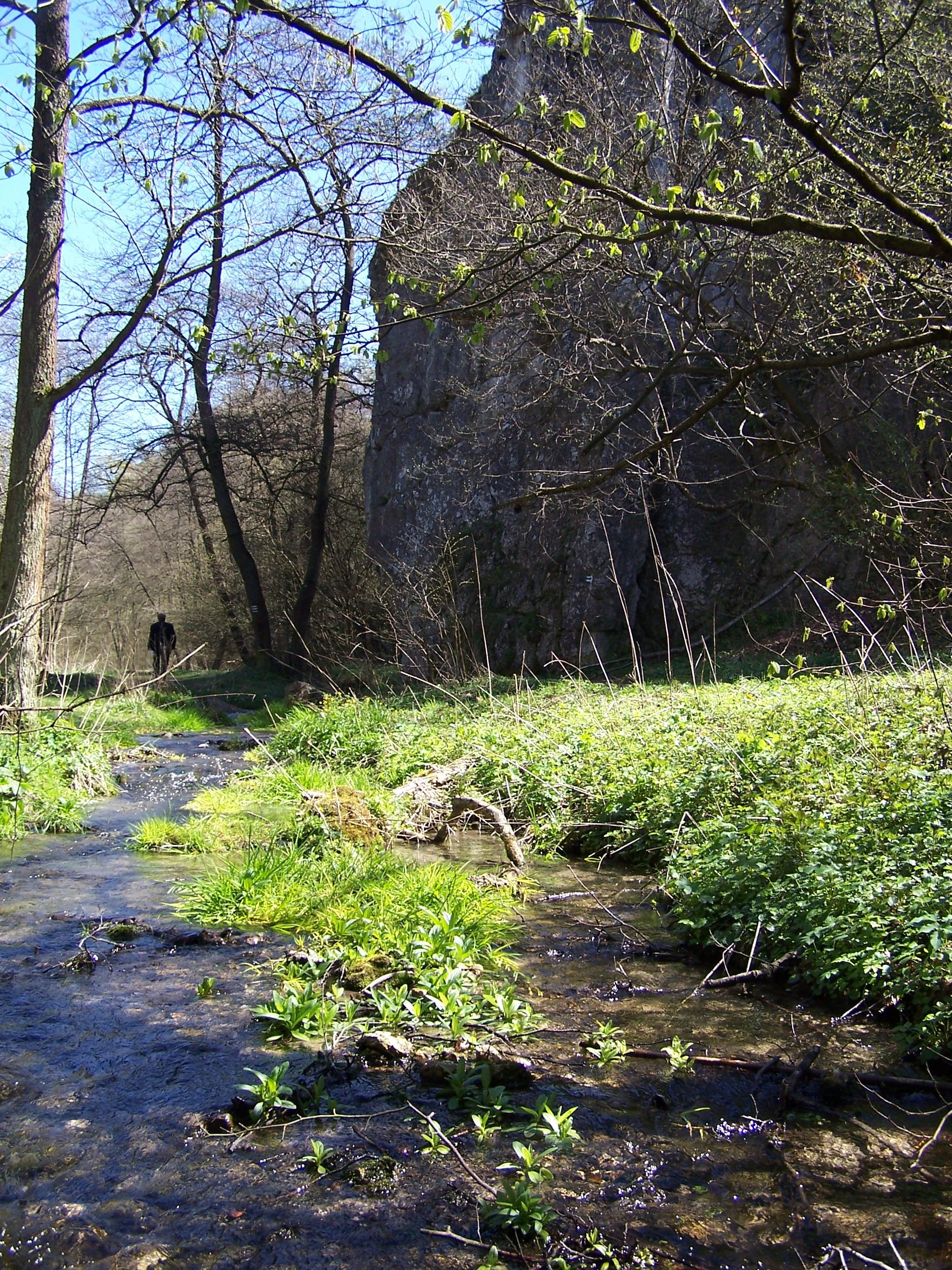
A small shallow stream with green plants growing in the water, flowing past a tall vertical limestone rock wall in a wooded valley under a clear blue sky.
A small stream flowing through the Kluczwody Valley with limestone cliffs in the background.

Dolina Kluczwody Nature Reserve history and protected-area timeline

The reserve was established in 1989 by way of the Polish legal notice published in the official journal M.P. 1989, No. 9, item 77, paragraph 2. Its creation was motivated by the need to preserve a representative fragment of oak-hornbeam forest together with the distinctive rock-sward vegetation and karst-valley scenery of the Kluczwoda area on the Olkuska Upland.

Management responsibility was assigned to the Krzeszowice Forest District, and the reserve has since been maintained within the broader framework of the Dolinki Krakowskie Landscape Park. In later years, its ecological importance was formally recognized at the European level when the surroundings of the Kluczwoda valley were included as one of the eleven enclaves of the Natura 2000 habitat site 'Dolinki Jurajskie' (PLH120005).

Dolina Kluczwody Nature Reserve landscape and geographic character

Dolina Kluczwody occupies the central part of a small, steep-walled limestone valley on the Olkuska Upland, a subregion of the Kraków-Częstochowa Upland. The reserve lies on the western slope, where the terrain drops from a forested plateau down toward the valley floor, producing a pronounced difference between shady, cooler upper slopes and warm, exposed rock faces lower down. This contrast shapes both the scenery and the ecology of the site.

The most striking landscape elements are the rocky outcrops and cliffs lining the western side of the valley. These sunny limestone rocks are partially bare and partially covered by low, grassy vegetation, and they lend the valley its characteristic silhouette. Through the bottom of the gorge runs the Kluczwoda stream, a shallow but lively watercourse that cascades in two small drops along the edge of the reserve, adding movement and sound to an otherwise forested scene. Above the cliffs and along the gentler slopes, continuous forest canopy closes in, framing the valley in green and creating the enclosed, intimate atmosphere typical of the Dolinki Krakowskie valleys.

Dolina Kluczwody Nature Reserve ecosystems, habitats, and plant life

The nature of Dolina Kluczwody is defined by the close interplay of two very different habitats within a single small valley. On the sun-exposed limestone rocks, the reserve protects a community of rock swards populated by calcicole, lime-loving plants adapted to thin soils, intense sunlight, and drought. These patches are a characteristic feature of the Kraków-Częstochowa Upland and belong to the rarest vegetation types in the Polish Jurassic landscape.

The bulk of the reserve, however, is covered by deciduous forest. The woodland represents the classic oak-hornbeam (grąd) type, in which hornbeam, beech, sycamore maple, and ash dominate the canopy, with larch and black alder occupying damper spots along the valley bottom. Between the trees, a rich layer of shrubs, including hazel, wayfaring tree, common spindle, buckthorn, and black elderberry, fills the understorey.

In spring, the forest floor is particularly notable for its flowering plants, which include hepatica, alternate-leaved golden saxifrage, narrow-leaved elecampane, lily of the valley, martagon lily, golden flax, Hungarian thistle, and several orchid species. The combination of flowering-rich deciduous forest with sunny rock vegetation makes Dolina Kluczwody a compact but ecologically diverse site.

Dolina Kluczwody Nature Reserve wildlife and species highlights

Wildlife in Dolina Kluczwody reflects the typical mix of forest and valley-edge habitats found in the Dolinki Krakowskie area. Among larger mammals, wild boar and roe deer are regularly seen in the reserve, while the red fox moves along the forest edges and the valley corridor.

The birdlife includes ground-dwelling and edge species such as the common pheasant as well as aerial insectivores and woodland birds. Common swifts hunt over the open rock faces and valley mouth, Eurasian sparrowhawks patrol the forested slopes, and Eurasian jays are common in the canopy of the oak-hornbeam forest. The combination of cliff, shrub layer, and tall-forest habitat allows several different bird communities to coexist within the small area of the reserve.

Dolina Kluczwody Nature Reserve conservation status and protection priorities

The conservation value of Dolina Kluczwody rests on three overlapping layers of protection. Nationally, it has been a formal nature reserve since 1989, designated primarily to safeguard oak-hornbeam forest, limestone rock swards, and their associated landscape. Regionally, it sits inside the Dolinki Krakowskie Landscape Park, which protects the broader pattern of valleys, forests, and settlements across this part of the Olkuska Upland.

At the European level, the reserve forms one of eleven enclaves of the Natura 2000 habitat site 'Dolinki Jurajskie' (PLH120005). Inclusion in this network means that the site contributes to the conservation of habitat types listed under the EU Habitats Directive that occur in the Polish Jurassic uplands, particularly oak-hornbeam woodlands and calcareous rock swards with their characteristic flora. Together, these layers of recognition make the reserve an ecologically significant component of the wider protected-area system of the Kraków region.

Dolina Kluczwody Nature Reserve cultural meaning and human context

Kluczwody Valley lies within the area historically known as the Jura Krakowsko-Częstochowska, a region defined not only by its natural landscape of limestone cliffs and forested valleys but also by a long tradition of rural settlement. The reserve itself lies on the territory of the village of Zelków, one of several small villages that have shaped land use in the Dolinki Krakowskie for centuries, traditionally mixing agriculture with forest management under state forestry oversight.

Although the reserve itself has no documented monuments, its setting within a working forest district and amid a network of long-established villages reflects the close interaction between the human communities of the Zabierzów commune and the protected natural landscape of the Kraków Upland.

Top sights and standout views in Dolina Kluczwody Nature Reserve

Dolina Kluczwody is notable for packing several distinct Jurassic-Upland habitats into a compact area: oak-hornbeam forest with a rich spring-flowering understorey, sun-exposed limestone swards with calcicole plant communities, and a small cascading stream along the valley floor. The reserve is also one of the eleven habitat enclaves making up the Natura 2000 site 'Dolinki Jurajskie', giving it added significance beyond its national designation.

Best time to visit Dolina Kluczwody Nature Reserve

Because the reserve lies in a temperate Central European climate with warm summers and cold winters, late spring is generally when the valley's botanical character is most striking: the herbaceous layer of the oak-hornbeam forest blooms with hepatica, lily of the valley, martagon lily, and orchids, while the cliff vegetation is fully active on the warm rocks.

Early summer brings lush, fully leafed forest and the most comfortable conditions for walking the valley's marked hiking and cycling routes, while autumn emphasizes the colors of the beech, oak, and larch canopy on the valley slopes. In winter the deciduous trees drop their leaves, opening up views of the limestone cliffs and making the cascading stream a more prominent feature of the landscape.

Monthly climate preview

Long-term monthly temperature and precipitation data recorded at a representative coordinate

Rezerwat przyrody Dolina Kluczwody Climate Normals and Annual Temperature Rhythm

Representative coordinate measurements reveal the annual temperature and precipitation rhythm across Rezerwat przyrody Dolina Kluczwody from nineteen ninety-one to twenty twenty. Examining the complete twelve-month profile provides deeper analytical context on long-term climate normals.
Annual mean8 °C
-3 °C20 °C
Jan-3°
Feb-2°
Mar
Apr
May14°
Jun17°
Jul20°
Aug19°
Sep14°
Oct
Nov
Dec-2°
Warmest month
July

19.6 °C

Coolest month
January

-3.2 °C

Wettest month
July

3.5 mm/day

Driest month
December

1.3 mm/day

Park location guide

Geography guide, regional context, and park location map for Dolina Kluczwody Nature Reserve

Dolina Kluczwody Nature Reserve park geography, regions, and map view in Poland

Understand where Dolina Kluczwody Nature Reserve sits in Poland through a broader geographic reading of the surrounding landscape, nearby location context, and its mapped position within the national park landscape.

How Dolina Kluczwody Nature Reserve fits into Poland

Poland, officially the Republic of Poland, is a Central European country spanning from the Baltic Sea in the north to the Carpathian Mountains in the south. It borders Germany, Czech Republic, Slovakia, Ukraine, Belarus, Lithuania, and Kaliningrad Oblast. The country has a temperate climate, diverse landscapes, and is known for its rich history, cultural heritage, and strong economic position within the EU.

Wider geography shaping Dolina Kluczwody Nature Reserve in Poland

Poland occupies 312,696 km2 in Central Europe, extending from the Baltic Sea coast in the north to the Sudetes and Carpathian Mountains in the south. It borders Germany to the west, Czech Republic and Slovakia to the south, Ukraine and Belarus to the east, and Lithuania and Kaliningrad Oblast to the northeast. The landscape includes lowland plains, uplands, and mountain ranges.

Map view of Dolina Kluczwody Nature Reserve

Use this park location map to pinpoint Dolina Kluczwody Nature Reserve in Poland, understand its exact geographic position, and read its mapped placement within the surrounding landscape more clearly.

Pigeon | © OpenStreetMap contributors

Location context for Dolina Kluczwody Nature Reserve

Lesser Poland Voivodeship

Visual exploration of limestone gorge terrain, rock swards, and forest habitats

Rezerwat przyrody Dolina Kluczwody Photos and Landscape Scenery

Visual documentation of Rezerwat przyrody Dolina Kluczwody reveals the distinct character of its steep limestone gorge, cascading stream, and shaded forest slopes. Studying these protected habitats helps researchers and visitors understand the karst terrain and regional geography of the Jurassic upland.

A small shallow stream with green plants growing in the water, flowing past a tall vertical limestone rock wall in a wooded valley under a clear blue sky.

Park atlas

Compare adjacent limestone valleys and regional nature reserves across the Jurassic Upland.

Parks Near Rezerwat przyrody Dolina Kluczwody and Surrounding Protected Landscapes

Browsing other protected areas near Rezerwat przyrody Dolina Kluczwody reveals connected karst geography and similar woodland habitats throughout the region. Expanding the park comparison provides a broader understanding of southern Poland conservation landscapes and valley ecosystems.
Watercolor illustration showing green hills, scattered trees, and a light sky background
National parkLesser Poland Voivodeship
About 1.7 km away#1 closest

North

Ojców National Park: Karst Geography and Protected Landscape Atlas Entry

Explore the mapped terrain and unique geology of this national park.

Ojców National Park, situated in Lesser Poland Voivodeship, offers a concentrated display of dramatic karst topography. This protected national park is renowned for its towering limestone cliffs, intricate ravines, and over 400 caves, showcasing a unique Jurassic geology. As a vital protected area, its mapped boundaries encompass distinctive rock formations like Hercules' Club and the historic Trail of the Eagles' Nests, providing rich context for landscape discovery and atlas exploration.

Area
21.46 km²
Established
1956
IUCN
II
Relief
Upland
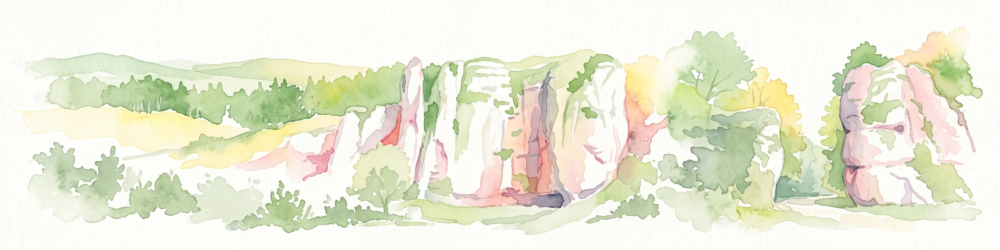
Watercolor painting of limestone rock formations surrounded by trees and green hills, rendered in a soft, panoramic landscape style.
National parkLesser Poland Voivodeship
About 1.7 km away#2 closest

North

Ojcowski Park Narodowy: A Geographic Guide to Poland's Compact Protected Landscape

Jurassic limestone formations and karst valleys in Lesser Poland

Ojcowski Park Narodowy occupies a unique place in the national park system of Poland, defined by its small footprint and high concentration of Jurassic geological features. The terrain includes vertical cliffs, ancient river valleys, and significant cave systems that provide critical habitats for bat populations. Use this mapping resource to understand the park's structural complexity, from its dry ravines to the historic cultural sites integrated into the limestone bedrock.

Area
21.46 km²
Established
1956
Visitors
400K annual
Relief
Upland
Watercolor painting of a rolling landscape featuring a line of evergreen trees and soft hills under a light, warm sky.
Nature reserveLesser Poland Voivodeship
About 7.9 km away#3 closest

Northwest

Dolina Szklarki Nature Reserve: Atlas Map and Protected Landscape Geography

Exploring forest communities and limestone rock formations in Lesser Poland.

Analyze the protected geography of Dolina Szklarki Nature Reserve, a key nature reserve in the Kraków-Częstochowa Upland. The area features a dense concentration of limestone cliffs, distinct forest ecosystems, and karst valley terrain within Lesser Poland Voivodeship.

Area
0.467 km²
Established
1989
Relief
Upland
Climate
Temperate
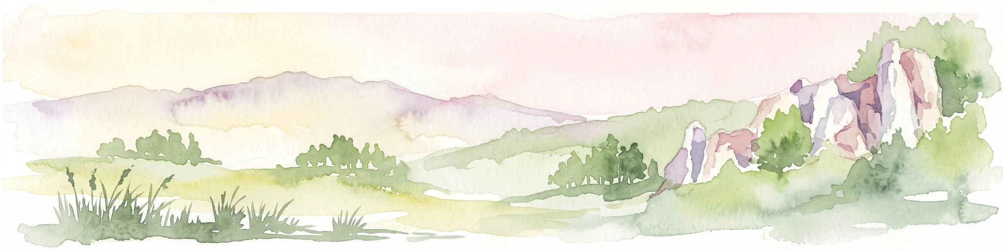
Watercolor painting of a valley landscape with rolling hills, limestone rock formations on the right, and soft green vegetation.
Nature reserveLesser Poland Voivodeship
About 10 km away#4 closest

West

Rezerwat przyrody Dolina Racławki: Protected Limestone Valley and Karst Geography

Explore the forest mosaic and geological cliff features in Lesser Poland

The Rezerwat przyrody Dolina Racławki landscape reserve is a significant protected area in the Olkuska Upland. Spanning a long limestone valley, the reserve features a network of caves, rock shelters, and steep cliffs built from Carboniferous and Jurassic bedrock. Its combination of layered forest communities and protected orchid populations marks it as a vital site for understanding the natural heritage and regional geography of southern Poland.

Area
4.739 km²
Established
1962
Relief
Upland
Climate
Temperate
A horizontal watercolor illustration showing a peaceful river flowing through a lush green valley with distant rolling hills and wild grasses in the foreground.
Nature reserveLesser Poland Voivodeship
About 13 km away#5 closest

Southwest

Rezerwat przyrody Dolina Mnikowska: A Karst Landscape Reserve in Lesser Poland

Mapped limestone gorge and forest protected area geography

Rezerwat przyrody Dolina Mnikowska features a striking limestone gorge and forest ecosystem within the Lesser Poland Voivodeship. This protected area offers a deep look into the karst topography, river-carved cliffs, and diverse habitat zones of the Garb Tenczyński upland region.

Area
0.209 km²
Established
1963
Relief
Upland
Climate
Temperate
Watercolor painting of a pastoral landscape featuring soft, rolling hills, a line of trees, and muted earth tones, presented as a wide, horizontal strip.
Nature reserveLesser Poland Voivodeship
About 13 km away#6 closest

West

Dolina Eliaszówki Nature Reserve: Protected Karst Valley and Forest Geography in Lesser Poland

A study of limestone outcrops and mature forest habitats in southern Poland

Dolina Eliaszówki Nature Reserve encompasses a deeply incised limestone valley characterized by diverse forest communities and complex karst geomorphology. The reserve protects an integrated network of rock outcrops, caves, and springs, framing historical monastic landmarks within a continuous protected forest corridor. It offers an essential view into the layered natural and cultural history of the Kraków-Częstochowa Upland.

Area
1.096 km²
Established
1989
Relief
Upland
Climate
Temperate
A pale, minimalist watercolor illustration depicting a soft, winding river valley surrounded by distant hills and coniferous forests.
Protected landscapeLesser Poland Voivodeship
About 14 km away#7 closest

South

Bielańsko-Tyniecki Park Krajobrazowy Protected Landscape and Regional Geography

Limestone terrain and Vistula valley river corridors in Lesser Poland

Bielańsko-Tyniecki Park Krajobrazowy anchors a complex protected landscape near Kraków, featuring dramatic limestone rock groups, ancient forest complexes, and extensive river meadows. This detailed overview maps its karst caves, Natura 2000 sites, and cultural heritage, documenting the rare overlap of upland ridges and alluvial floodplains within the Lesser Poland Voivodeship.

Area
63.591 km²
Established
1981
Relief
Upland
Climate
Temperate
Protected landscapeLesser Poland Voivodeship
About 14 km away#8 closest

Southwest

Tenczyński Park Krajobrazowy: Protected Landscape and Karst Geography in Lesser Poland

Mapped limestone ridges and forest corridors near Kraków

Discover Tenczyński Park Krajobrazowy, a protected landscape park located in Lesser Poland Voivodeship. This geographic study covers the Garb Tenczyński ridge, where karst limestone formations, small caves, and volcanic outcrops shape a diverse terrain spanning from marshy lowlands to upland forest ridges.

Area
136.581 km²
Established
1981
Relief
Upland
Climate
Temperate

Common questions about visiting, size, designation, and location context for Dolina Kluczwody Nature Reserve

Dolina Kluczwody Nature Reserve FAQs for park facts, access, geography, and protected area context

Find quick answers about Dolina Kluczwody Nature Reserve, including protected-area facts, park geography, trail and visitor context, and how the park fits into its surrounding country and regional landscape.
MoriAtlas Explorer

Continue Your Protected Areas Search Across the Global Atlas

Deepen your exploration by continuing the structured search for national parks and protected areas worldwide. Utilize the comprehensive filtering capabilities to compare different conservation landscapes and refine your understanding of global park geography. Discover more about the distribution and characteristics of protected natural areas.

Global natural geography