
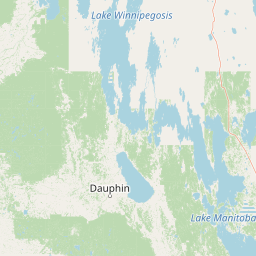
Lakes
Park geography
A detailed look at park boundaries, highland terrain, and regional water features
Geographic Profile and Landscape Context of Riding Mountain National Park in Manitoba
This geographic profile maps the physical characteristics of Riding Mountain National Park within the Manitoba region of Canada. It documents the protected area dimensions, including boundary span and area measurements, while outlining the diverse plateau terrain, boreal forest cover, and interconnected riverine and lacustrine systems. The data provides a structured view of the landscape framework for this protected region.
Related tags
Boreal ForestPrairie TransitionBiosphere ReserveUNESCOFirst Nations Heritage
Where prairie meets boreal forest on the Manitoba Escarpment
Riding Mountain National Park
Riding Mountain National Park is a protected area in southwestern Manitoba, Canada, where the boreal forest of the Canadian Shield gives way to the vast prairie grasslands. Established in 1933, the park covers nearly 3,000 square kilometers of forested upland rising more than 450 meters above the surrounding farmland, creating a dramatic island of wilderness amid agricultural landscape. The park sits within Treaty 2 Territory and has been home to the Cree, Assiniboines, and Ojibwe peoples for thousands of years. What makes Riding Mountain ecologically significant is its position at the convergence of three distinct ecosystems: grasslands, upland boreal forest, and eastern deciduous forest, all protected within a single protected area.
- Location
- Canada
- Park type
- National park
- Established
- 1933
- Area
- 2,969 km²
Location overview
Administrative and regional positioning within Manitoba, Canada
Geographic Location and Regional Context of Riding Mountain National Park
Riding Mountain National Park is located within Canada, positioned in the province of Manitoba. Geographic records outline the regional relationships and country memberships defining the park's location.
- Countries
- Canada
- Regions
- Manitoba
- Primary location
- Manitoba
Boundary and coordinates
Riding Mountain National Park’s outline maps 2,969 km²
Riding Mountain National Park mapped boundary and 2,969 km² area
Riding Mountain National Park has stored boundary geometry that captures its broad shape and recorded scale of 2,969 km². The database does not divide this overall area into land and marine portions or include a perimeter measurement.
- Boundary area
- 3,093.5 km²
- Boundary perimeter
- 385.1 km
- Northernmost point
- 51.0225° N
- Southernmost point
- 50.506° N
- Easternmost point
- 99.5388° W
- Westernmost point
- 101.0943° W
- Geographic centre
- 50.8291° N, 100.2008° W
- North–south span
- 57.5 km
- East–west span
- 109.7 km
Terrain and natural features
Explore highland terrain classifications and recorded lakes, streams, and viewpoints.
Riding Mountain National Park Terrain and Named Natural Features
Riding Mountain National Park features stored highland terrain classifications along with recorded lakes, streams, and viewpoints located within the boundaries. Linked feature cards provide names, types, measurements, and spatial relationships where recorded.
Selected named natural features
Lakes
Kidney Lake
Lakes
Second Lake
Lakes
Moose Lake
Lakes
Bone Lake
Lakes
Fawn Lake
Environmental setting
Interpreting highland relief, forest cover, and seasonal temperate habitats
Environmental Classifications and Physical Setting of Riding Mountain National Park
Recorded landscape features and habitat types provide complementary ways to read the physical setting of Riding Mountain National Park. Connected categories link directly to relevant atlas destinations for regional comparison.
- Relief
- Highland
- Climate
- Temperate
- Water
- Major water bodies
- Forest cover
- Mostly forested
- Seasonality
- Strongly seasonal
Landscape features
Hills · Valleys · Plateau · Cliffs · Forest · Grassland · Wetland · Lakes · Rivers
Habitat types
Grassland · Boreal forest · Temperate broadleaf forest · Wetland · Lacustrine habitat · Riverine habitat
Park atlas
Explore adjacent conservation landscapes, trace regional park geography, and compare protected areas across the Manitoba Escarpment.
Discover Other National Parks and Protected Areas Near Riding Mountain National Park
Explore national parks and protected areas geographically close to Riding Mountain National Park, examining regions with similar boreal forest, prairie, and escarpment landscapes. Compare their conservation profiles, trace ecological transitions across regional geography, and deepen your understanding of diverse protected areas.
Protected areaEstonia
About 106 km away#1 closest
West

Zugvogelschutzgebiet Upper Rousay Lake Protected Area: Regional Map and Geography
Examining the protected landscapes and territorial extent in Estonia.
This resource provides a comprehensive view of the Zugvogelschutzgebiet Upper Rousay Lake protected area in Estonia. Focus on the defined boundaries, mapped terrain, and regional geographic context that identify this site. We provide a structured overview for researchers and geography enthusiasts to understand the spatial distribution and protected land status of this specific wetland environment.
- Area
- 5.73 km²
- Established
- 1948
- Relief
- Lowland
- Climate
- Temperate
Wildlife reserveSaskatchewan
About 175 km away#2 closest
Southwest

Moose Mountain Creek National Wildlife Area Protected Habitat and Geographic Atlas
A preserved prairie wetland complex in southeastern Saskatchewan.
Moose Mountain Creek National Wildlife Area is a federal reserve in Saskatchewan that protects a rare assembly of four distinct habitat types. The land features a functional mix of freshwater marshes, native mixed-grass prairie, and trembling aspen groves. This structured protected area highlights the importance of preserving remnant prairie ecosystems within a broader agricultural region, providing a critical baseline for understanding local geography.
- Area
- 1.63 km²
- Established
- 2025
- IUCN
- IV
- Relief
- Lowland
Wildlife reserveSaskatchewan
About 189 km away#3 closest
West
Zugvogelschutzgebiet Indian Head: A Wildlife Reserve in Saskatchewan Prairie Landscapes
Examining mapped boundaries and protected wetland terrain
Zugvogelschutzgebiet Indian Head represents a significant conservation footprint within the Saskatchewan prairie region. This wildlife reserve integrates managed wetlands and historic nursery grounds, showcasing how agricultural landscapes support migratory bird populations. Gain insight into its terrain, ecoregion placement, and the geographic history of these protected lands through our structured atlas data.
- Area
- 0.32 km²
- Established
- 1924
- Relief
- Lowland
- Scope
- Terrestrial
Wildlife reserveSaskatchewan
223 km away#4 closest
Northwest
Neely Lake Migratory Bird Sanctuary: Boreal Wetland Geography and Protected Landscapes
Essential protected area data for the eastern Saskatchewan boreal fringe
Neely Lake Migratory Bird Sanctuary encompasses a shallow freshwater environment defined by marshy shorelines, wet meadows, and small islands. Situated within the Mid-Boreal Upland, this protected landscape provides crucial stopover habitat for waterfowl moving through the Prairie and Boreal flyways. Gain insight into the terrain, water-body structure, and ecological role of this significant Canadian wildlife reserve.
- Area
- 5.02 km²
- Established
- 1952
- IUCN
- IV
Wildlife reserveSaskatchewan
252 km away#5 closest
West
Wascana Lake Migratory Bird Sanctuary: Geographic Overview and Protected Wetland Boundaries
A vital wildlife reserve located in Regina, Saskatchewan
Explore the unique geography of Wascana Lake Migratory Bird Sanctuary, where a managed reservoir creates a rich wetland habitat for migratory waterfowl. This protected area stands as a significant ecological site within the Saskatchewan prairie landscape, offering a rare look at riparian terrain integration inside a major urban center.
- Area
- 1.04 km²
- Established
- 1956
- Relief
- Lowland
- Climate
- Temperate
Wildlife reserveNorth Dakota
About 265 km away#6 closest
Southwest

Lostwood Wilderness Wildlife Reserve and Prairie Pothole Landscape Geography
Protected northern mixed grass prairie in North Dakota
Lostwood Wilderness protects a unique mosaic of native grasslands and shallow wetlands in northwestern North Dakota. As an essential part of the National Wilderness Preservation System, it preserves a roadless, undeveloped window into the prairie pothole region, offering a clear view of the natural terrain and conservation character of the northern Great Plains.
- Area
- 22.57 km²
- Established
- 1975
- IUCN
- Ib
- Relief
- Lowland
Wildlife reserveSaskatchewan
About 314 km away#7 closest
Northwest
Raven Island National Wildlife Area: Geographic Overview and Protected Island Landscape
Essential conservation geography within Saskatchewan
Located in the saline prairie basins of central Saskatchewan, Raven Island National Wildlife Area is a 112-hectare protected habitat. This site plays a strategic role in the Lenore Lake migratory bird complex, preserving crucial island breeding grounds within a gentle prairie landscape. Explore the physical boundaries and ecological context of this Canadian wildlife reserve.
- Area
- 1.12 km²
- Established
- 1982
- IUCN
- IV
- Scope
- Terrestrial
Protected landscapeNorth Dakota
330 km away#8 closest
Southwest
Little Missouri National Grassland: Geography and Protected Landscape Context
Exploring North Dakota's expansive badlands and prairie terrain
Spanning over a million acres, Little Missouri National Grassland stands as a massive protected landscape in western North Dakota. This area showcases the complex transition where open mixed-grass prairie meets the eroded, rugged badlands of the Little Missouri River corridor. Home to White Butte, the state's highest point, the grassland offers a unique topographic profile of buttes, canyons, and canyons that defines the region's broader geographic and conservation character.
- Area
- 4,163.34 km²
- Established
- 1960
- Relief
- Upland
- Climate
- Temperate
MoriAtlas Explorer
Continue Exploring Riding Mountain National Park's Mapped Geography and Protected Landscapes
To deepen your understanding of Riding Mountain National Park, engage with its specific geographic context and protected landscape details. Further exploration reveals the park's mapped boundaries and its relationship to the surrounding regional geography of Manitoba. This focused discovery aids in building a comprehensive atlas of protected areas and natural terrains.
Browse next
Global natural geography
Explore related park routes
Explore MoriAtlas Global ParksBrowse All MoriAtlas ParksGlobal Park Map DiscoveryMoriAtlas: Browse All CountriesBrowse All MoriAtlas ContinentsNational Park Environment AtlasGrand Canyon National Park AtlasYellowstone National Park AtlasYosemite National Park Atlas and GeographySerengeti National Park AtlasGalápagos National Park Protected LandscapeBanff National Park Geography and AtlasKruger National Park Atlas EntryUluṟu-Kata Tjuṯa National Park AtlasExplore Uluru-Kata Tjuta National Park GeographyPlitvice Lakes National Park AtlasFiordland National Park Protected LandscapeGreat Smoky Mountains National Park AtlasAfghanistan National Parks and Protected AreasAlbania National Parks and Protected AreasAlgeria National Parks and Protected AreasAmerican Samoa National Parks and Protected AreasAndorra National Parks and Protected AreasAngola National Parks and Protected AreasAntarctica National Parks and Protected AreasAntigua and Barbuda Park List