
Why Rio Grande National Forest stands out
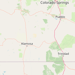
Rio Grande National Forest is best known for encompassing the headwaters of the Rio Grande River and for its position astride the Continental Divide in southwestern Colorado. It is also notable for surrounding the San Luis Valley, recognized as the world's largest agricultural alpine valley, and bordering areas considered among the world's largest high deserts set against mountains. Together, these features give the forest a striking contrast between arid basin landscapes and high alpine terrain within a single protected landscape.
Rio Grande National Forest history and protected-area timeline
Rio Grande National Forest was officially established on July 1, 1908, as part of the early wave of national forest designations under the U.S. Forest Service. Its creation reflected the early 20th-century recognition that the headwaters, high valleys, and forested slopes of the San Luis Valley region needed sustained federal stewardship to protect watersheds, timber resources, and the broader mountain landscape from unregulated use.
Over more than a century since its founding, the forest has grown in conservation significance, particularly through the designation of multiple wilderness areas within and adjoining its borders. These designations, part of the National Wilderness Preservation System, have reinforced the forest's role as a refuge for backcountry landscapes and have shaped how the U.S. Forest Service manages recreation, grazing, and resource use across the region.
Management of the forest remains headquartered in Del Norte, Colorado, with district offices in La Jara and Saguache, reflecting the long-standing pattern of locally rooted administration across the multiple counties the forest spans.
Rio Grande National Forest landscape and geographic character
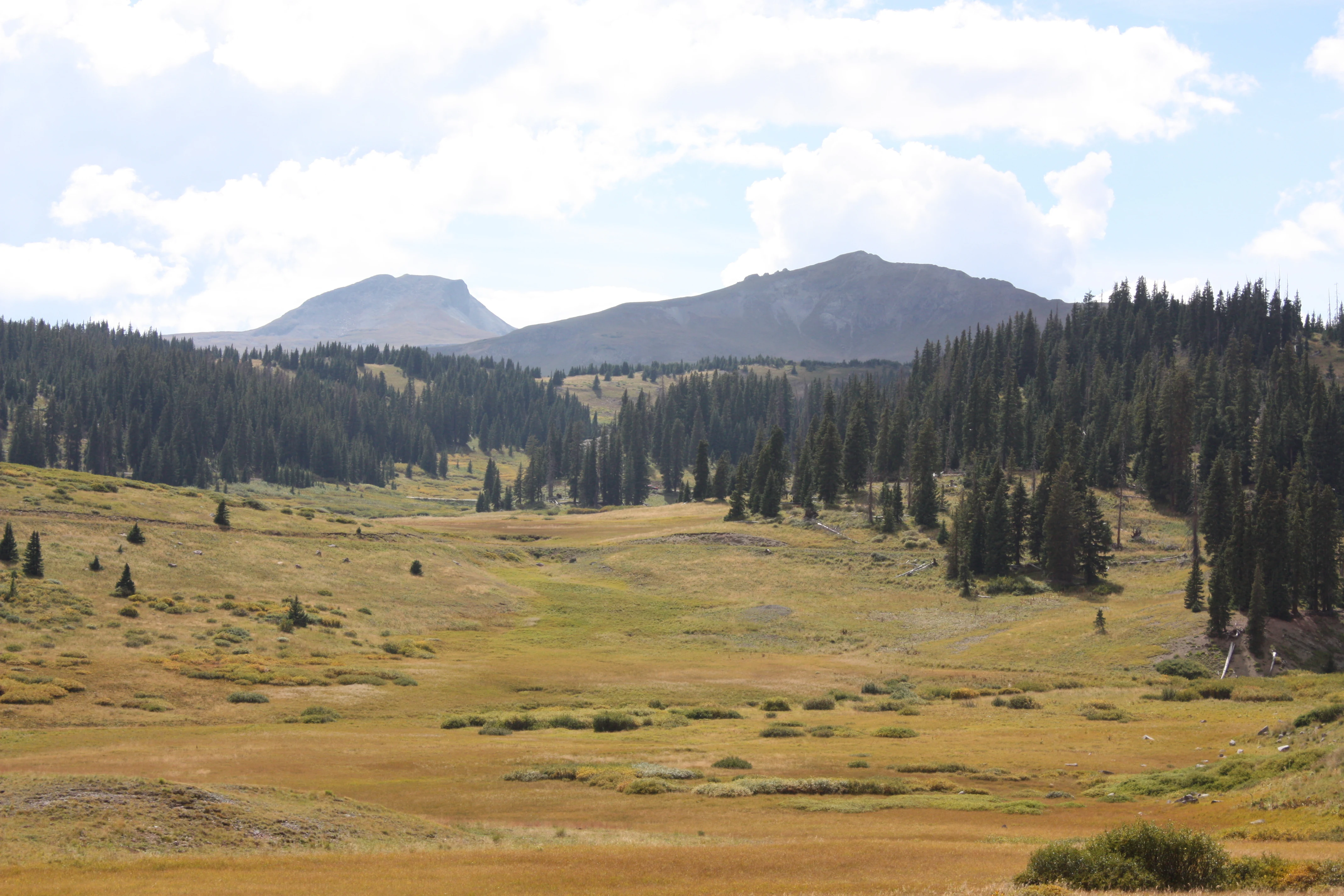
The landscape of Rio Grande National Forest is shaped by extremes of elevation and contrast in terrain. The forest surrounds and partly overlaps the immense flat floor of the San Luis Valley, one of the highest and largest agricultural valleys in the world, while its higher reaches climb into rugged alpine country edged by the Continental Divide.
Mountain ridges, deep valleys, and high passes define much of the forest's interior. Stony Pass, crossing more than 12,500 feet near Silverton, shows the kind of high, exposed terrain that runs through the forest's western reaches. Steep forested slopes give way to open alpine meadows and bare ridges above treeline.
The Continental Divide forms much of the forest's western boundary, separating the Rio Grande watershed from rivers that drain toward the Pacific. This long ridge of high country serves as both a physical border and a major influence on weather, snow accumulation, and vegetation patterns across the forest.
In the lower elevations, the forest meets the arid edges of the San Luis Valley, where mountain landscapes transition into the high desert steppe. This blend of high arid basin and snowy alpine terrain within one continuous protected landscape gives Rio Grande National Forest a layered, varied topography that few other Colorado forests match.
Rio Grande National Forest ecosystems, habitats, and plant life
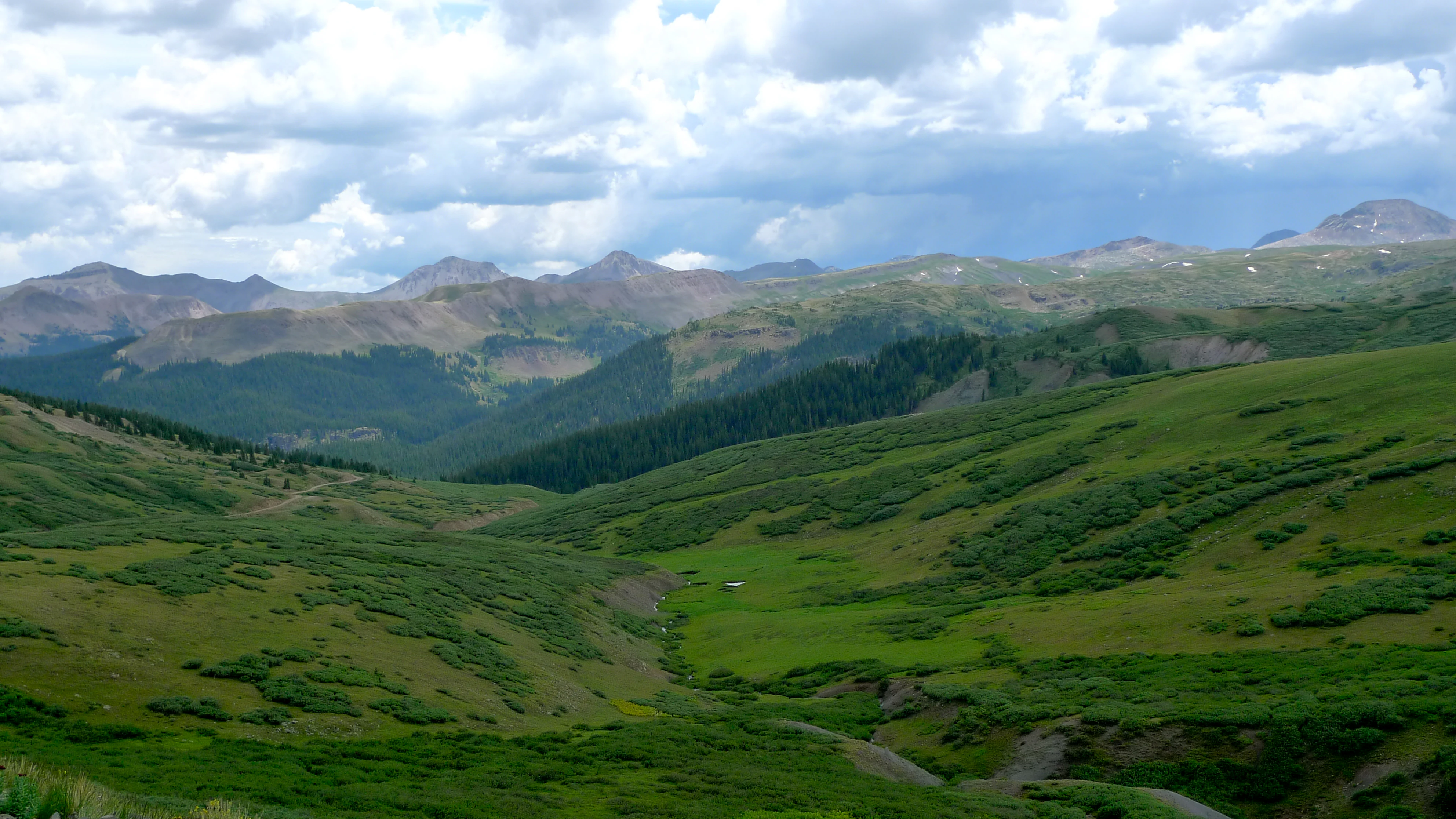
Ecologically, Rio Grande National Forest spans an unusually wide gradient of environments, from the arid edges of the San Luis Valley up through montane forests to high alpine zones along the Continental Divide. This vertical range supports a corresponding variety of plant communities and habitat types.
At lower elevations, the forest transitions into the dry, grass-dominated landscapes of the high desert, while mid-elevations carry dense coniferous forest cover typical of the southern Rockies. Higher elevations give way to open alpine meadows, exposed rock, and the kinds of tundra-like environments that characterize the upper reaches of the Rockies.
Watersheds throughout the forest are critical to regional ecology. Snowmelt from the high peaks feeds streams and rivers that descend through forested terrain into the San Luis Valley and beyond. These water-rich corridors shape vegetation, support wildlife movement, and link the forest's ecosystems to downstream landscapes.
The combination of designated wilderness areas, national forest land, and adjacent public lands creates large, connected habitat blocks that are vital for species needing room to roam. The forest's mix of climates, elevations, and moisture conditions supports a broad spectrum of ecological communities within southwestern Colorado.
Rio Grande National Forest wildlife and species highlights
Although detailed wildlife information is limited in the source material, the forest's varied elevations and habitats suggest strong potential for wildlife typical of the southern Rocky Mountains. Coniferous forests, alpine meadows, and watersheds of the Rio Grande headwaters traditionally support species associated with montane and subalpine environments.
Large wilderness tracts within and adjoining the forest, including La Garita, Sangre de Cristo, South San Juan, and Weminuche wilderness areas, provide refuges for wildlife that depend on remote, undisturbed terrain. These wilderness zones act as core habitat within the larger forested landscape.
The forest's position along the Continental Divide and around the San Luis Valley also places it along important migration corridors and seasonal ranges for both resident and migratory species. The combination of forest cover, alpine openings, and valley-edge habitats supports diverse seasonal use by wildlife throughout the year.
Rio Grande National Forest conservation status and protection priorities
Conservation significance is central to Rio Grande National Forest's identity. As the birthplace of the Rio Grande, it protects the upper watershed of one of North America's most important rivers, ensuring water quality and flow regimes that ripple far beyond its boundaries.
Designated wilderness areas within and adjacent to the forest, including La Garita, Sangre de Cristo, South San Juan, and Weminuche wildernesses, form a substantial part of the National Wilderness Preservation System. These zones preserve some of the least-disturbed backcountry in the southern Rockies and protect ecological processes that depend on minimal human influence.
The forest also plays a key role in conserving the broader ecosystem mosaic of southwestern Colorado. Its position between dry high desert, montane forest, and alpine environments creates a gradient of habitat types that is rare at this scale. By protecting this transition zone, the forest helps maintain ecological connectivity across the southern Rocky Mountain region.
Rio Grande National Forest cultural meaning and human context
The San Luis Valley, which the forest surrounds, has a long and distinct cultural history as one of the earliest settled regions of Colorado, with Hispanic and Hispano communities, ancestral ranching traditions, and a deep agricultural heritage. The valley's identity is closely linked to the surrounding mountains that define its basin.
The forest's wilderness areas and high passes, including routes like Stony Pass, have historical significance as travel corridors, mineral exploration routes, and connections between isolated mountain communities. Old roads and trails still visible in the landscape speak to generations of human interaction with this rugged terrain.
Today, the cultural fabric of nearby communities in Del Norte, La Jara, Saguache, and other towns remains closely tied to the forest as a source of livelihood, recreation, and regional identity.
Top sights and standout views in Rio Grande National Forest
The forest's most striking feature is its pairing of the great flat agricultural expanse of the San Luis Valley with the towering alpine ridges of the Continental Divide, all within one managed landscape.
It is also notable for being the birthplace of the Rio Grande, giving it hydrological importance that extends far beyond Colorado. The presence of multiple designated wilderness areas, particularly large tracts like Sangre de Cristo and Weminuche, anchors its role as a premier backcountry destination in the southern Rockies.
The forest's nine-county footprint, century-long history since 1908, and role as a transition zone between desert and alpine environments make it a defining natural asset of southwestern Colorado.
Best time to visit Rio Grande National Forest
Climate data from the Rio Grande Reservoir area shows short, mild summers with comfortable daytime highs, while winters are long and cold with substantial snowfall. Summer months tend to be the most accessible season for high-country travel, with warmer temperatures, snow-free lower trails, and active wildlife.
Late spring can still bring snow at higher elevations, but it offers the advantage of full water flows, lush meadows, and quieter conditions. Autumn brings cooler weather and changing vegetation, often offering some of the clearest mountain views of the year.
Winter brings deep snowpack, especially at higher elevations, making backcountry travel more challenging but also transforming the forest into a snowy alpine landscape. Visitors in winter should expect very cold temperatures, particularly at high elevations.