Mori Atlas logo
Wildlife reserveRockpile Mountain Wilderness

Mapping the rocky ridges, granite summits, and unroaded terrain of this unique Missouri wilderness landscape

Rockpile Mountain Wilderness: A Protected Wilderness Area in the Southeastern Ozarks of Missouri

Rockpile Mountain Wilderness preserves a rugged stretch of the eastern Ozark highlands, defined by an ancient granite cairn atop a prominent ridge. Spanning the land south of Little Grass Mountain, this wildlife reserve offers a clear example of steep, rocky terrain within the Mark Twain National Forest. The area serves as a significant site for understanding Ozark geography through its mosaic of stony slopes, thin soils, and isolated woodland patches.

wilderness areaOzark highlandsMadison County MissouriMark Twain National Forestrocky ridgegranite cairn

Rockpile Mountain Wilderness

Wildlife reserve

Park overview

Structured park overview, official facts, and landscape profile for Rockpile Mountain Wilderness

Rockpile Mountain Wilderness park facts, protected area profile, and essential visitor context

Review the core facts for Rockpile Mountain Wilderness, including designation, size, terrain, visitor scale, habitats, and operating context in one park-focused overview.

About Rockpile Mountain Wilderness

Rockpile Mountain Wilderness sits in the southeastern Ozarks of Missouri, within the Mark Twain National Forest. It is a relatively small congressionally designated wilderness area, covering roughly four thousand acres across a broken ridge in Madison County. The nearest community of any size is Fredericktown, to the northeast, and the broader setting is one of mixed forest, rocky terrain, and rural Ozark countryside typical of this part of the state.

The defining physical feature of the area is the ridge itself, which extends from Little Grass Mountain on the north to the national forest boundary some four miles to the south. Along this ridge the slopes are steep and rocky, exposing the granite and other hard rocks characteristic of the eastern Ozark uplift. The result is a landscape of jumbled outcrops, stony ground, and intermittent forest cover that contrasts with the deeper hollows and broader ridge tops found elsewhere in the surrounding national forest.

The wilderness also carries a meaningful human story. Crowning the mountain is an ancient ring of granite stones that was piled up long ago, almost certainly by Indigenous hands. The cairn has drawn interest both as an archaeological feature and as a landmark, and it remains the most recognizable single element of the wilderness. Together, the rugged topography and the prominent cultural feature combine to give Rockpile Mountain Wilderness a character that is more distinctive than its modest size would suggest.

Quick facts and research context for Rockpile Mountain Wilderness

Rockpile Mountain Wilderness is a U.S. Forest Service wilderness area located in Madison County, Missouri, within the Mark Twain National Forest. It lies in the southeastern Ozark region of the state, near the small city of Fredericktown.

The wilderness was officially established in 1980 and covers approximately 4,238 acres. It is classified at the highest level of protection available to national forest lands, reflecting its status as a congressionally designated wilderness area. The terrain is dominated by a broken ridge with steep, rocky slopes, while the area's identity is closely tied to the ancient granite cairn that crowns the mountaintop and gives the wilderness its name.

Protection and recognition

Documented terrestrial protection scope and conservation designation facts

Rockpile Mountain Wilderness Protection Status and Recognition Data

Rockpile Mountain Wilderness maintains a recorded terrestrial protection scope within official conservation inventories. Detailed records outline the foundational protected area designation history and administrative recognition parameters.

Protection details

Protection scope
Terrestrial
Transboundary protection
No
Park context

Deeper park guide and search-rich context for Rockpile Mountain Wilderness

Rockpile Mountain Wilderness history, landscape, wildlife, and travel context

Explore Rockpile Mountain Wilderness through its history, landscape character, ecosystems, wildlife, conservation priorities, cultural context, and seasonal travel timing in a structured park guide built for atlas discovery and search intent.

Why Rockpile Mountain Wilderness stands out

Rockpile Mountain Wilderness is best known for the ancient ring of piled granite that sits on its summit, the feature from which the area takes its name. Most interpreters believe this rock pile was constructed as an Indigenous cairn, and the presence of such a notable archaeological feature on top of an otherwise ordinary Ozark ridge gives the wilderness a distinctive cultural as well as natural identity. Beyond the namesake cairn, the wilderness is recognized for its unroaded ridge-and-slope terrain. The broken ridge that forms the core of the area, running south from Little Grass Mountain to the national forest boundary, preserves a classic example of rugged eastern Ozark topography within an otherwise managed national forest landscape.

Rockpile Mountain Wilderness history and protected-area timeline

Rockpile Mountain Wilderness became part of the National Wilderness Preservation System in 1980, when Congress formally designated it as a wilderness area within the Mark Twain National Forest. The designation placed the area under the highest level of protection available to national forest lands, restricting road building, motorized use, and most forms of development so that the landscape could remain in a primitive condition.

The cultural history of the area is older than its federal protection. The rock pile that gives the wilderness its name is believed to be an Indigenous cairn built by earlier inhabitants of the region, well before Euro-American settlement. The feature was already well known locally before the wilderness designation, and it has remained a focal point of interest for visitors and researchers interested in the prehistory of the eastern Ozarks.

Under U.S. Forest Service stewardship, the wilderness has continued to function as a small, low-impact preserve within a much larger working national forest. Because of its compact size and rugged terrain, it has remained a quiet, lightly visited area, with its management priorities focused on preserving wilderness character rather than accommodating heavy recreation use.

Rockpile Mountain Wilderness landscape and geographic character

The terrain of Rockpile Mountain Wilderness is built around a single broken ridge that runs roughly north to south through the heart of the area. To the north the ridge connects with Little Grass Mountain, while to the south it tapers off toward the boundary of the Mark Twain National Forest about four miles away. This elongated ridgeline gives the wilderness a clear linear structure that varies in width as it crosses the more broken ground in between.

The slopes that fall away from this ridge are notably steep and rocky, with exposed granite and other resistant stones typical of the eastern Ozark landscape. The combination of narrow ridgetops and stony side slopes creates a jumbled, often rough ground surface that limits easy travel and discourages large-scale vegetation growth. In many places the underlying rock shows through the thin soils, reinforcing the rugged feel of the area.

Drainage on the slopes feeds into small creeks and hollows that work their way outward from the central ridge. The result is a mosaic of rocky openings, stunted woodland, and denser forest patches that fits the broader pattern of the southeastern Ozarks. The overall visual impression is of a compact, rugged tract defined more by its stone and its slopes than by any single dramatic peak.

Rockpile Mountain Wilderness ecosystems, habitats, and plant life

Rockpile Mountain Wilderness lies within the eastern Ozark ecological region, where forests of oak and hickory dominate the uplands and more mesic hardwoods occupy the protected hollows and lower slopes. Because much of the wilderness is composed of steep, rocky ground, the vegetation pattern is patchy, with thin-soiled ridgetops and outcrops supporting open, stunted growth while deeper pockets of soil carry taller, more continuous hardwood cover.

The broken topography creates a range of microhabitats within a relatively short distance. Sheltered north-facing slopes hold cooler, moister conditions and a denser understory, while sunny south-facing slopes and exposed rock surfaces support more drought-tolerant vegetation. This kind of small-scale variation is characteristic of Ozark wildernesses and contributes to the sense that the area, despite its modest size, holds a varied natural character.

Wildfire, wind, and erosion have all helped shape the present forest condition, and the rugged terrain has limited intensive human disturbance within the wilderness boundary. As a result, the vegetation retains a relatively natural pattern, with ecological processes still operating much as they do in other unroaded parts of the Mark Twain National Forest.

Rockpile Mountain Wilderness wildlife and species highlights

The wildlife community of Rockpile Mountain Wilderness reflects the broader eastern Ozark fauna typical of unroaded forest tracts in the Mark Twain National Forest. Hardwood forests of this kind support white-tailed deer, wild turkey, and gray squirrel as common residents, along with smaller mammals such as raccoon, opossum, and various furbearers adapted to the mix of forest and rocky edge habitat.

Rockpile Mountain Wilderness conservation status and protection priorities

As a congressionally designated wilderness, Rockpile Mountain Wilderness enjoys the highest level of protection available within the National Forest System. This means that roads, motorized vehicles, mechanical equipment, and most forms of permanent infrastructure are prohibited, and the area is managed to preserve its wilderness character rather than to support intensive resource use.

The conservation value of the wilderness lies in its combination of rugged terrain and its position within the much larger Mark Twain National Forest. By keeping a segment of the surrounding forest landscape in an unroaded, essentially primitive condition, the wilderness provides a refuge for wildlife and a buffer against the fragmentation that has affected other parts of the eastern Ozarks.

The presence of the ancient cairn atop the mountain adds a cultural conservation dimension as well. The site is afforded protection both as a wilderness landscape and as a fragile archaeological feature, and it is one of the elements that helps distinguish Rockpile Mountain Wilderness from other, similarly small wilderness tracts in the region.

Rockpile Mountain Wilderness cultural meaning and human context

The most significant cultural element associated with Rockpile Mountain Wilderness is the ancient stack of granite stones that crowns the mountain and gives the area its name. Most interpretations hold that this feature is an Indigenous cairn constructed by earlier inhabitants of the eastern Ozark region, meaning that the wilderness preserves not only natural values but also a tangible link to the prehistoric human presence in the area.

Beyond the cairn itself, the broader cultural setting is that of the southeastern Missouri Ozarks, a region with a long history of small-scale farming, forestry, and rural settlement. Although the wilderness itself has been deliberately protected from modern development, it sits within a landscape whose surrounding communities have shaped the identity of the Mark Twain National Forest for generations.

Top sights and standout views in Rockpile Mountain Wilderness

Rockpile Mountain Wilderness is a compact but rugged Ozark wilderness whose identity is anchored by a single distinctive feature: the ancient granite cairn that sits atop the mountain and gives the area its name. The cairn, most likely the work of Indigenous peoples, is unusual enough to have shaped the cultural and historical perception of the entire wilderness.

Equally important is the physical setting. The wilderness preserves a steep, rocky ridge running south from Little Grass Mountain toward the national forest boundary, offering a textbook example of small-scale eastern Ozark terrain. Combined with its 1980 wilderness designation and its place within the Mark Twain National Forest, these natural and cultural highlights give Rockpile Mountain Wilderness a clear and memorable identity despite its modest size.

Best time to visit Rockpile Mountain Wilderness

The most comfortable periods to experience Rockpile Mountain Wilderness generally align with the milder seasons common to the Missouri Ozarks. Spring brings fresh green growth in the surrounding national forest and active wildlife movement across the ridges, while autumn offers cooler temperatures and the broader seasonal color display of the eastern hardwood forests.

Summer visits are possible but tend to be warm and humid, and the rugged, rocky terrain of the wilderness makes heat and humidity more challenging for those moving through the slopes. Winter brings a quieter atmosphere but also harsher conditions and shorter daylight, and icy rock surfaces can make the steep ground more difficult to travel. Conditioned, well-prepared visitors can enjoy the area across much of the year, with spring and fall typically offering the most rewarding combination of weather and scenery.

Monthly climate preview

Long-term representative monthly averages for temperature and precipitation

Rockpile Mountain Wilderness Climate Normals and Annual Temperature Rhythm

Historical data records monthly temperature variations alongside daily precipitation rates across the representative coordinate. Complete twelve-month records provide broader analytical context for regional environmental patterns.
Annual mean13 °C
0 °C26 °C
Jan
Feb
Mar
Apr13°
May18°
Jun23°
Jul26°
Aug25°
Sep21°
Oct14°
Nov
Dec
Warmest month
July

25.9 °C

Coolest month
January

-0.5 °C

Wettest month
April

4.4 mm/day

Driest month
January

2.4 mm/day

Park location guide

Geography guide, regional context, and park location map for Rockpile Mountain Wilderness

Rockpile Mountain Wilderness park geography, regions, and map view in United States of America

Understand where Rockpile Mountain Wilderness sits in United States of America through a broader geographic reading of the surrounding landscape, nearby location context, and its mapped position within the national park landscape.

How Rockpile Mountain Wilderness fits into United States of America

The United States of America is a federal presidential republic and one of the world's largest countries by area and population. It consists of 50 states across a vast territory spanning multiple time zones, with its capital in Washington, D.C. and largest city in New York City. The nation has a diverse economy, influential political system, and significant cultural and military presence globally.

Wider geography shaping Rockpile Mountain Wilderness in United States of America

The United States occupies a vast territory in North America, bordered by Canada to the north and Mexico to the south. The 48 contiguous states stretch from the Atlantic to the Pacific Ocean, while Alaska occupies the northwestern region and Hawaii is an archipelago in the Pacific. The country encompasses diverse terrain including the Rocky Mountains, Appalachian Mountains, Great Plains, and extensive river systems.

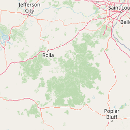
Map view of Rockpile Mountain Wilderness

Use this park location map to pinpoint Rockpile Mountain Wilderness in United States of America, understand its exact geographic position, and read its mapped placement within the surrounding landscape more clearly.

Pigeon | © OpenStreetMap contributors

Location context for Rockpile Mountain Wilderness

Madison CountyMissouri
Recorded earthquake history

Explore Historical Earthquake Records for Rockpile Mountain Wilderness

Access a structured catalogue of seismic events recorded in the area surrounding Rockpile Mountain Wilderness. This resource allows for the review of historical data by magnitude and epicentre proximity, supporting a clearer understanding of regional seismic records across the Ozark highlands.

Rockpile Mountain Wilderness Earthquake History

Catalogued events

2 events

Strongest magnitude

Magnitude 3.5

Most recent event

Mar 12, 2002

This history includes earthquakes recorded inside the park or within 50 km of its borders

Park atlas

Compare regional park geography and adjacent wild terrain across the eastern Ozarks

Exploring Parks Near Rockpile Mountain Wilderness and Surrounding Protected Landscapes

Browse protected areas near Rockpile Mountain Wilderness to examine connected ridge terrain, forested slopes, and federal wilderness designations throughout the region. Comparing adjacent park geography provides broader context for understanding the rugged upland landscapes of Missouri.
National parkMissouri
Park boundaries overlap#1 closest

West

Mark Twain National Forest: Geography and Protected Area Atlas of Southern Missouri

Mapping the karst terrain and ancient ridges of the Ozark Highlands

Mark Twain National Forest represents a sprawling conservation area within the Missouri Ozark Highlands. Its geography is defined by volcanic mountain remnants, rocky glades, and significant river corridors like the Eleven Point National Scenic River. This record provides insight into the forest's complex mapped boundaries, seven designated wilderness areas, and the distinctive karst geology that characterizes this unique American landscape.

Area
6,037.3 km²
Established
1939
Relief
Upland
Climate
Temperate
Wildlife reserveMissouri
About 52 km away#2 closest

South

Mingo Wilderness: Missouri Protected Wildlife Reserve and Wetland Geography

Primitive bottomland forest and swamp landscape

Mingo Wilderness encompasses 8,000 acres of protected bottomland hardwood forest and cypress-tupelo swamp in southeastern Missouri. As a federally designated wilderness area embedded within a national wildlife refuge, it provides a quiet, primitive habitat characterized by slow-moving creek corridors and varied seasonal wetlands.

Area
32 km²
Established
1976
IUCN
Ib
Relief
Lowland
Watercolor painting of a wide, rolling landscape featuring layered sandstone bluffs and green forested hills against a light background.
Protected landscapeIllinois
77 km away#3 closest

East

Shawnee National Forest: Exploring the Protected Landscapes of the Illinois Shawnee Hills

Mapped sandstone formations and glacial terrain in southern Illinois

Spanning nearly 289,000 hectares, Shawnee National Forest is the largest body of public land in Illinois. The area is defined by its dramatic sandstone bluffs, deep canyons, and seven designated wilderness areas that provide a rare rugged topography within the American Midwest. Explore the complex geography of this forest, from its glacial-sculpted river watersheds to its diverse hardwood habitats and historic reforestation sites.

Area
2,017.83 km²
Established
1933
Relief
Upland
Climate
Temperate
A soft watercolor illustration featuring rolling green hills, a winding stream, and a forested treeline against a pale sky.
Wildlife reserveMissouri
93 km away#4 closest

Southwest

Irish Wilderness: Missouri Ozark Protected Area and Karst Landscape Atlas

Federally protected wilderness in the Eleven Point River landscape

Spanning the rugged terrain of the Missouri Ozarks, Irish Wilderness is a federally protected area known for its distinct karst geography. Visitors can study the network of caves, sinkholes, and springs that define the local environment, alongside historical remnants of frontier settlement. The area serves as a primary example of wilderness preservation within the Mark Twain National Forest, balancing sensitive cave ecosystems with forested ridge landscapes.

Area
65.87 km²
Established
1984
IUCN
Ib
Relief
Upland
National parkMissouri
130 km away#5 closest

North

Gateway Arch National Park: National Park Geographic Atlas and Map Boundaries

Explore protected landscape context and regional setting.

Gateway Arch National Park represents a unique protected landscape within Missouri, contributing to the broader national park atlas. This entry focuses on its specific geographic identity and mapped boundaries, offering structured data for understanding its role. Discover the factual landscape context and regional importance of Gateway Arch National Park for informed geographic exploration.

Area
0.78 km²
Established
2018
IUCN
II
Visitors
1.2M annual
Wildlife reserveIllinois
162 km away#6 closest

East

Lusk Creek Wilderness: An Atlas of Protected Sandstone Canyons and Forests in Southern Illinois

Mapping rugged wilderness terrain and forest ecological recovery.

Lusk Creek Wilderness serves as a key protected landscape in southern Illinois, featuring extensive sandstone canyon systems and dense hardwood woodland. This area offers a unique look at the geological and forested character of the Shawnee region, documented through its boundaries, elevation changes, and natural landmarks. Use this geographic entry to examine the rugged, roadless character of the state largest wilderness designation and its place within the wider regional drainage system.

Area
25.47 km²
Established
1990
IUCN
Ib
Relief
Upland
Watercolor painting of rock formations and surrounding green trees on a plain white background.
Wildlife reserveIllinois
174 km away#7 closest

East

Garden of the Gods Wilderness: A Protected Sandstone Plateau in Southern Illinois

Explore geologic boundaries, sandstone hoodoos, and forested wilderness terrain

Garden of the Gods Wilderness represents a critical protected area within the Shawnee National Forest, notable for its unglaciated sandstone geography. This 3,318-acre wilderness offers an intimate view of ancient carboniferous rock formations, including prominent hoodoos and clifftop overlooks that provide expansive sightlines across the southern Illinois landscape.

Area
13.43 km²
Established
1990
Relief
Upland
Climate
Temperate
A watercolor painting showing a stylized landscape with rolling green hills, a band of trees, and a pale pink lake surface under a soft morning sky.
Protected landscapeUnited States of America
199 km away#8 closest

East

Land Between the Lakes National Recreation Area: Mapped Geography and Protected Landscapes

An inland peninsula preserved between two major river reservoirs.

Land Between the Lakes National Recreation Area occupies a distinct narrow land bridge between Kentucky Lake and Lake Barkley. This protected landscape contains a dense mix of forested ridges, stream valleys, and managed wildlife prairies. The area is integral to the lower Ohio River Valley geography, showcasing the results of long-term watershed management and large-scale ecological restoration within the United States.

Area
693.1 km²
Established
1963
Visitors
2M annual
Relief
Lowland

Common questions about visiting, size, designation, and location context for Rockpile Mountain Wilderness

Rockpile Mountain Wilderness FAQs for park facts, access, geography, and protected area context

Find quick answers about Rockpile Mountain Wilderness, including protected-area facts, park geography, trail and visitor context, and how the park fits into its surrounding country and regional landscape.
MoriAtlas Explorer

Continue Your Protected Areas Search Across the Global Atlas

Deepen your exploration by continuing the structured search for national parks and protected areas worldwide. Utilize the comprehensive filtering capabilities to compare different conservation landscapes and refine your understanding of global park geography. Discover more about the distribution and characteristics of protected natural areas.

Global natural geography