
Mori Atlas logo
Protected landscapeRøstøyan landskapsvernområde

A remote Arctic archipelago defined by dramatic seabird cliffs and nutrient-rich maritime waters.

Røstøyan Landskapsvernområde: Exploring the Protected Coastal Landscapes and Marine Geography of Nordland, Norway

Røstøyan Landskapsvernområde stands as a significant protected landscape at the outermost fringe of the Norwegian Sea in Nordland. This geographic entity encompasses a cluster of eroded, treeless islands and shallow marine waters that provide an essential habitat for large-scale seabird colonies. By tracing the boundaries of these cliff-edged islands and sheltered bays, you gain a clearer understanding of the oceanic terrain and maritime ecosystem dynamics that define this remote northern frontier.

seabird cliffsatlantic puffin colonyouter-oceanic islandscoastal landscapemarine protected areaRamsar wetland
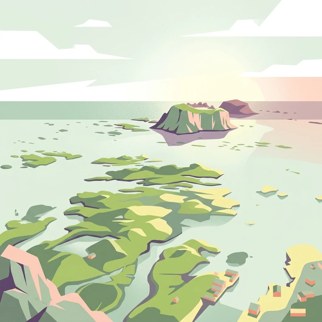
A digital illustration showing an aerial view of an archipelago with green islands surrounded by light blue water, with small buildings visible on the shore and a prominent larger island in the distance.

Røstøyan landskapsvernområde

Protected landscape

Park overview

Structured park overview, official facts, and landscape profile for Røstøyan Landscape Protection Area

Røstøyan Landscape Protection Area park facts, protected area profile, and essential visitor context

Review the core facts for Røstøyan Landscape Protection Area, including designation, size, terrain, visitor scale, habitats, and operating context in one park-focused overview.

About Røstøyan Landscape Protection Area

Røstøyan landskapsvernområde occupies a remote and visually dramatic position at the western edge of the Lofoten-Vesterålen island system, in the Røst municipality of Nordland. The protection area encompasses a chain of small oceanic islands and the surrounding marine waters, capturing a complete coastal-marine landscape unit rather than just terrestrial habitat. Most of the official area is sea, with land area limited to narrow strips of cliff and grassy plateau on each island.

The defining visual identity of the area comes from its seabird cliffs, locally known as fuglefjell, sheer rock faces that face the open Norwegian Sea. These cliffs tower above wave-washed foreshores and drop directly into deep water, a profile that has historically made the area one of the most productive seabird breeding grounds in Norway. Above the cliffs, low mats of maritime vegetation support a thin but ecologically important terrestrial habitat on an otherwise sea-dominated reserve.

The area is scientifically important as well. A dedicated field station on Hernyken supports ongoing seabird research, particularly into puffin population dynamics, feeding ecology, and the influence of marine conditions on breeding success. This long-term research presence has helped turn Røstøyan into a reference site for studying North Atlantic seabird populations, especially in the context of shifting ocean conditions in the Norwegian and Barents seas.

By combining seabird cliff habitat, shallow marine embayment, and open ocean exposure within a single contiguous reserve, the protection area conserves both breeding habitat and the feeding grounds seabirds depend on throughout the breeding season. The dual designation as a landscape protection area and Ramsar site reflects this combined terrestrial-marine and ecological-cultural significance.

Quick facts and research context for Røstøyan Landscape Protection Area

Røstøyan landskapsvernområde was formally established in 2002 and is located in Røst municipality in Nordland county, Norway. It carries dual protection status as both a landscape protection area (landskapsvernområde) and a Ramsar wetland site, with the Ramsar designation applied in 2011. The reserve's total area is dominated by sea, with land features confined to a small group of treeless outer-oceanic islands. Five seabird cliff islands host Norway's largest colony of Atlantic puffins, and a dedicated seabird research station operates on Hernyken.

Park context

Deeper park guide and search-rich context for Røstøyan Landscape Protection Area

Røstøyan Landscape Protection Area history, landscape, wildlife, and travel context

Explore Røstøyan Landscape Protection Area through its history, landscape character, ecosystems, wildlife, conservation priorities, cultural context, and seasonal travel timing in a structured park guide built for atlas discovery and search intent.

Why Røstøyan Landscape Protection Area stands out

Røstøyan is best known as the home of Norway's largest Atlantic puffin colony, concentrated on the five seabird cliff islands of Vedøya, Storfjellet, Ellevsnyken, Trenyken, and Hernyken. These steep, grass-topped islets rise abruptly from cold Atlantic waters, creating the characteristic profile of a classic Norwegian seabird cliff ecosystem. The area's high-latitude, low-vegetation island environment produces one of the densest and most study-worthy seabird concentrations in mainland northern Europe.
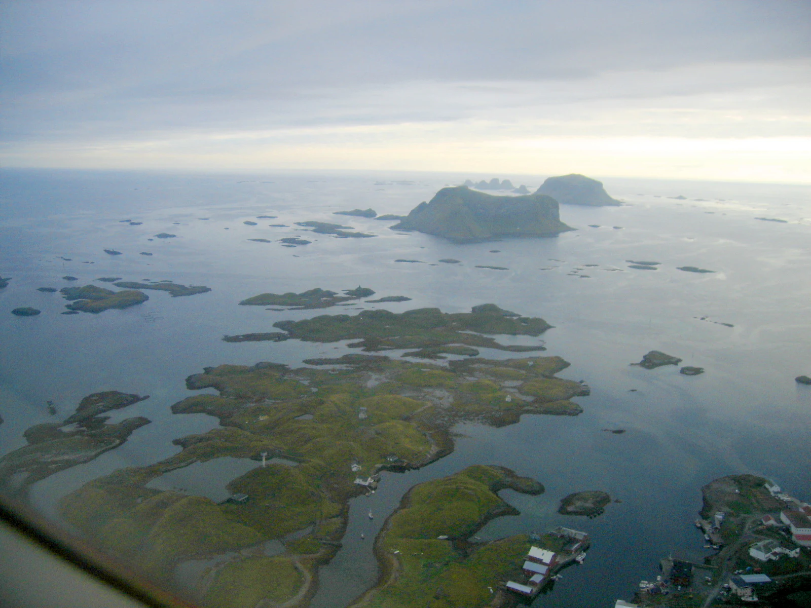
An aerial shot looking over the Røst archipelago in Norway, with many small grassy islands scattered across blue coastal waters under a cloudy sky.
Aerial view of the Røst island group, showcasing the characteristic scattered islets and rocky terrain of the Røstøyan landskapsvernområde.

Røstøyan Landscape Protection Area history and protected-area timeline

Røstøyan landskapsvernområde was formally established as a protected landscape area in 2002, recognizing the natural and cultural landscape value of the island cluster and surrounding waters in Røst. The protection was grounded in the area's combined importance for botany, geology, and wildlife, traits that together characterize the geography of the outermost Røst archipelago.

Following its establishment as a Norwegian landscape protection area, the site was also recognized internationally under the Ramsar Convention in 2011. This Ramsar designation highlighted the wetland values of the area, particularly the shallow marine environments and seabird cliff habitats that meet the criteria for internationally important wetland sites. The combination of Norwegian landscape protection framework and international Ramsar status has strengthened long-term protection for the area.

Alongside the formal administrative history, Røstøyan has developed a long running research tradition centered on Hernyken, where a seabird field station has been used for sustained scientific monitoring of breeding seabirds, especially Atlantic puffins. This research history, sustained across decades, has become part of the identity of the protected area itself.

Røstøyan Landscape Protection Area landscape and geographic character

The landscape of Røstøyan is defined by an outer oceanic island group set on the edge of the Norwegian Sea. The islands are low, eroded, and treeless, with steep sea cliffs and gentle, grass-covered upper plateaus that drop abruptly to the sea. This combination of high cliffs and shallow skies, with little vegetation apart from maritime grasses and mosses, gives the islands their characteristic step profile when seen from the water.

The five principal seabird cliff islands, Vedøya, Storfjellet, Ellevsnyken, Trenyken, and Hernyken, dominate the visible landscape. Between Trenyken and Hernyken lies the shallow marine embayment of Hærnykflaget, a sheltered stretch of water that contrasts with the open Atlantic exposure around the rest of the islands. The interplay between exposed cliff coasts and sheltered shallows produces a varied seascape within a relatively small geographic footprint.

Surrounded by deep water channels and set far from the mainland, the islands have a strongly oceanic character. There are no forests, no significant freshwater systems, and almost no human-built structures visible in the protected landscape itself, leaving an unusually unmodified coastal scenery even by Norwegian Arctic standards.

Røstøyan Landscape Protection Area ecosystems, habitats, and plant life

The protected area captures a complete mosaic of outer-oceanic habitats, from bare rock cliffs and grassy maritime slopes to shallow marine embayments and deeper ocean waters. On land, vegetation is limited to hardy maritime plants adapted to salt spray, wind exposure, and a short growing season. This thin but specialized vegetation layer supports a small but distinctive terrestrial ecological community.

In the marine zone, the shallow waters around Hærnykflaget and the channels between the islands are rich in nutrients, sustaining high concentrations of small fish and invertebrates. These feeding grounds are critical to the breeding cycle of the area's seabirds, linking marine productivity directly to cliff-top nesting success each summer.

The combination of cliffs, oceanic exposure, and shallow productive sea creates a tightly coupled marine-terrestrial ecosystem. Energy and nutrients move from the surrounding ocean up through fish stocks to breeding seabirds and back to the cliffs and surrounding sea as guano, maintaining the high biological productivity that defines the area.

Røstøyan Landscape Protection Area wildlife and species highlights

The wildlife profile of Røstøyan is overwhelmingly dominated by seabirds. The reserve hosts Norway's largest population of Atlantic puffin, breeding across the five seabird cliff islands. Other cliff-nesting seabirds typical of Norwegian outer-coast colonies also use the same habitats, taking advantage of the vertical rock faces ledges and burrows above the sea.

The marine waters within and around the reserve support the prey base for these colonies. Cold, clean, nutrient-rich Atlantic waters stock the area with small pelagic fish that feed both the breeding adults and, in some species, the chicks during the summer breeding season. This dependable prey supply is a primary reason why such a large seabird community has been able to persist here.

Because of the dense breeding colonies, the area also supports predators and scavengers typical of seabird cliff ecosystems. The ornithological importance of the site is high enough that long-term population monitoring from the Hernyken field station has become a defining characteristic of conservation work in the area.

Røstøyan Landscape Protection Area conservation status and protection priorities

Conservation significance at Røstøyan operates on two complementary levels. Nationally, the area is protected as a Norwegian landscape protection area, securing protection for both natural and cultural landscape values: the geology, botany, and wildlife that define the island group. This framework has been in place since 2002 and provides the base legal protection for the reserve.

Internationally, the area's designation as a Ramsar site since 2011 brought recognition under the Convention on Wetlands, highlighting the seabird cliffs and adjacent marine waters as a wetland of global importance. The Ramsar framework strengthens the protection status of the archipelago's coastal and marine habitats and reflects their ecological importance beyond national borders.

Together, the dual designations ensure protection of both the breeding cliffs and the marine feeding grounds on which the seabird populations depend. The presence of the Hernyken field station also gives the reserve a strong scientific basis for monitoring and adaptive conservation, supporting long-term protection of one of Norway's most important seabird areas.

Røstøyan Landscape Protection Area cultural meaning and human context

Røstøyan carries long-standing cultural significance as part of the outermost inhabited fringe of the Norwegian coast, where the boundary between human maritime life and the open ocean has shaped local identity for centuries. Røst municipality, in which the protected area lies, belongs to a chain of communities whose culture has historically been tied to fishing, small-scale seafaring, and seasonal use of outer islands for bird harvesting and resource gathering.

Although the protected islands themselves are uninhabited, the surrounding community heritage gives the area cultural meaning beyond its ecological value. The framework of landscape protection explicitly invokes both natural and cultural landscape values in the rationale for protection, recognizing that the human history of Røst is part of what makes this coastal-marine landscape significant as a place.

Top sights and standout views in Røstøyan Landscape Protection Area

Røstøyan's strongest quality is the combination of a world-class seabird cliff ecosystem with a Ramsar-protected marine and coastal landscape at the edge of the Norwegian Sea. The five named offshore islands, each carrying its own seabird cliff profile, together host Norway's largest puffin colony while the surrounding waters supply the prey base that those colonies depend on.

The research tradition at the Hernyken field station adds an unusual scientific depth to the area. Decades of seabird monitoring have turned Røstøyan into one of the most studied North Atlantic seabird sites in Norway, reinforcing both its conservation importance and its value as a reference site for understanding seabird population change.

Best time to visit Røstøyan Landscape Protection Area

The character of a visit to Røstøyan is shaped strongly by the seasonal cycle of the high-latitude North Atlantic coast. In late spring and summer, the islands host the full breeding cycle of the seabird colonies, with the cliffs at their most active and the surrounding waters at their most biologically productive. This is the period when the ecological character of the reserve is most visible from the sea.

In autumn and winter, weather conditions in this exposed outer archipelago become harsher, seas are rougher, and daylight is sharply reduced. Conditions for visiting the area are therefore strongly seasonal; any visit is shaped by the weather-sensitive maritime environment, and the seabird life that defines the area is concentrated into the warmer months.
Monthly climate preview

Long-term temperature ranges and monthly precipitation averages for Nordland

Røstøyan landskapsvernområde Climate Normals and Annual Weather Patterns

Representative coordinate records show measured monthly mean temperatures spanning from negative figures to over twelve degrees alongside varying daily precipitation rates. Examining the full twelve-month profile provides complete historical averages for detailed geographic study.
Annual mean7 °C
3 °C12 °C
Jan
Feb
Mar
Apr
May
Jun
Jul12°
Aug12°
Sep11°
Oct
Nov
Dec
Warmest month
August

12.4 °C

Coolest month
February

2.8 °C

Wettest month
December

3.5 mm/day

Driest month
May

1.5 mm/day

Park location guide

Geography guide, regional context, and park location map for Røstøyan Landscape Protection Area

Røstøyan Landscape Protection Area park geography, regions, and map view in Norway

Understand where Røstøyan Landscape Protection Area sits in Norway through a broader geographic reading of the surrounding landscape, nearby location context, and its mapped position within the national park landscape.

How Røstøyan Landscape Protection Area fits into Norway

Norway, officially the Kingdom of Norway, is a Nordic country in Northern Europe located on the Scandinavian Peninsula. It encompasses mainland Norway, the Arctic islands of Svalbard and Jan Mayen, and maintains dependencies including Bouvet Island and Antarctic claims. The country has a population of about 5.6 million and is bordered by Sweden, Finland, and Russia. Norway is a unitary parliamentary constitutional monarchy with Oslo as its capital and largest city.

Wider geography shaping Røstøyan Landscape Protection Area in Norway

Norway occupies the western and northern portions of the Scandinavian Peninsula in Northern Europe. The country shares a long eastern border with Sweden, and borders Finland and Russia to the northeast. Norway has an extensive coastline facing the Skagerrak, North Sea, Norwegian Sea, and Barents Sea. The terrain is predominantly mountainous with numerous fjords along the coastline.

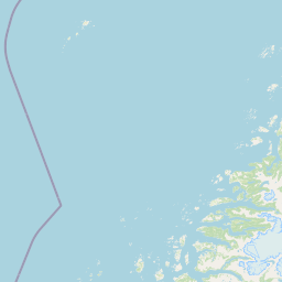
Map view of Røstøyan Landscape Protection Area

Use this park location map to pinpoint Røstøyan Landscape Protection Area in Norway, understand its exact geographic position, and read its mapped placement within the surrounding landscape more clearly.

Pigeon | © OpenStreetMap contributors

Location context for Røstøyan Landscape Protection Area

Nordland

Visualizing the coastal terrain, seabird cliffs, and oceanic island habitats of Norway

Røstøyan landskapsvernområde Photos and Landscape Scenery

Visual documentation captures the rugged coastal terrain, steep seabird cliffs, and exposed marine waters defining the Røstøyan landskapsvernområde protected landscape. Examining photographic records reveals the distinct ecological character and remote island topography shaping this northern Atlantic archipelago.

An aerial shot looking over the Røst archipelago in Norway, with many small grassy islands scattered across blue coastal waters under a cloudy sky.

Park atlas

Compare surrounding marine environments, coastal landscapes, and regional island reserves.

Explore Other Parks and Protected Areas Near Røstøyan Landskapsvernområde

Browsing other parks near Røstøyan landskapsvernområde allows visitors to discover connected coastal ecosystems and protected island landscapes across the wider region. Examining adjacent marine environments helps contextualize the unique seabird habitats and oceanic topography defining the northern archipelago.
Watercolor painting showing a landscape with green hills, distant mountains, and scattered vegetation
National parkNordland
About 54 km away#1 closest

Northeast

Lofotodden National Park: Iconic Arctic Coastal Protected Landscape in Nordland

Mapped terrain and protected area details for a dramatic Nordic landscape.

Delve into the protected landscape of Lofotodden National Park, a key protected area within Norway's Nordland county. This national park showcases the dramatic convergence of the Lofotenveggen mountain range with the North Atlantic coast, featuring rugged granite peaks and unique coastal terrain. MoriAtlas offers a structured view of its mapped boundaries and geographic context, facilitating detailed discovery of this significant Arctic natural heritage.

Area
99 km²
Established
2018
IUCN
II
Relief
Mountain
Watercolor illustration showing mountains, a river, and colorful landscape regions
National parkNorway
About 115 km away#2 closest

Southeast

Saltfjellet, Svartisen National Park: Glacial Terrain & Protected Arctic Wilderness

Norway's vast national park with Svartisen glacier and unique flora.

Saltfjellet, Svartisen National Park spans over 2,100 square kilometers of diverse protected wilderness in Northern Norway. Renowned for Svartisen, Scandinavia's second-largest glacier, its landscape transitions from coastal influences to alpine plateaux. The park's calcareous bedrock supports a rich flora, rare in the region, contributing to its distinct geographic identity. Explore the mapped boundaries and natural terrain of this significant protected landscape.

Area
2,192 km²
Established
1989
IUCN
II
Relief
Mixed relief
Watercolor illustration of a landscape with rolling hills, forests, and distant mountains
National parkNordland
About 116 km away#3 closest

East

Sjunkhatten National Park: Norway's Protected National Park Identity and Geographic Atlas

Mapped landscape context and regional geography details.

Explore the structured geographic data and protected landscape context for Sjunkhatten National Park, a significant national park in Nordland, Norway. This page provides detailed insights into its mapped boundaries and regional setting, offering an atlas-driven view of its natural terrain. Understand how this protected area contributes to the broader geography of Norway through factual, map-oriented discovery.

Area
417.5 km²
Established
2010
IUCN
II
Relief
Mountain
A watercolor painting showing a stylized landscape with rolling green hills, a calm body of water in the foreground, and purple mountains in the background.
Marine protected areaNordland
About 118 km away#4 closest

East

Saltstraumen Marine Protected Area: Geographic Mapping and Tidal Landscape Features

Coastal fjord passage and protected marine terrain in Nordland

Located in Nordland, Saltstraumen represents a critical marine protected area where extreme tidal forces carve a dramatic, narrow passage between fjord systems. Explore the intersection of tidal currents, island geography, and protected marine habitat through a focused look at this Northern Norwegian natural wonder and its surrounding coastal topography.

Visitors
150K annual
Access
Easy access
Scope
Marine
Water
Water-dominated
National parkNorway
About 121 km away#5 closest

Southeast

Láhko National Park: Northern Norway's Protected Arctic Landscape and Geographic Atlas Entry

Mapped boundaries and terrain of a key Finnmark national park.

Láhko National Park is a significant protected area within Norway's Finnmark region, representing a vast expanse of sub-Arctic wilderness and characteristic tundra ecosystems. This park serves as a crucial element in the atlas of northern European protected lands, offering insights into the geographic features and ecological integrity of high-latitude environments. Explore Láhko National Park through MoriAtlas to understand its landscape context, mapped terrain, and its role in preserving Nordic wilderness.

IUCN
II
Watercolor illustration showing mountains, a river, and forests in a landscape
National parkNordland
About 164 km away#6 closest

East

Rago National Park: Northern Norway's Protected Mountain Wilderness and Transboundary Atlas

Explore the mapped terrain and unique landscape context of this significant protected area.

Rago National Park is a protected national park in Nordland, Norway, recognized for its challenging mountainous terrain and its crucial role as part of a vast transboundary protected area complex spanning into Sweden. The park's landscape features alpine lakes and glaciers, offering a stark representation of northern Scandinavian mountain wilderness. Understanding Rago National Park provides insight into regional conservation efforts and the geographic significance of large-scale protected lands in Europe.

Area
171 km²
Established
1971
IUCN
II
Relief
Mountain
Watercolor illustration of a landscape with rolling hills, a river, and trees
National parkNordland
About 165 km away#7 closest

East

Junkerdal National Park: Protected Arctic-Alpine Landscape in Nordland, Norway

Explore mapped boundaries and unique geographic context.

Delve into Junkerdal National Park, a significant protected area within Nordland county, Norway. This national park is celebrated for its rich arctic-alpine flora, including rare plant species that thrive at their southernmost European range. The varied landscape, shaped by glacial activity, features dramatic mountain valleys and alpine plateaus, offering a distinct geographic profile. Understand its protected status and mapped terrain, providing a critical point of discovery for regional landscape context.

Area
682 km²
Established
2004
IUCN
II
Relief
Mountain
Watercolor illustration of a winding river through a green landscape with distant mountains
National parkNorrbotten County
About 177 km away#8 closest

East

Padjelanta National Park: Sweden's Largest National Park Protected Plateau Landscape

Explore subarctic terrain, large lakes, and Laponia World Heritage Site geography.

Padjelanta National Park, situated in Norrbotten County, is Sweden's largest national park. It features a distinctive subarctic plateau ecosystem centered around two vast lakes, offering a starkly open landscape compared to adjacent alpine areas. This protected area is renowned for its exceptional botanical and lichen diversity, a vital part of the Laponia World Heritage Site. Users can explore its mapped geography, unique terrain, and the cultural significance of this expansive arctic wilderness.

Area
1,984 km²
Established
1963
IUCN
II
Relief
Highland

Common questions about visiting, size, designation, and location context for Røstøyan Landscape Protection Area

Røstøyan Landscape Protection Area FAQs for park facts, access, geography, and protected area context

Find quick answers about Røstøyan Landscape Protection Area, including protected-area facts, park geography, trail and visitor context, and how the park fits into its surrounding country and regional landscape.
MoriAtlas Explorer

Continue Your Protected Areas Search Across the Global Atlas

Deepen your exploration by continuing the structured search for national parks and protected areas worldwide. Utilize the comprehensive filtering capabilities to compare different conservation landscapes and refine your understanding of global park geography. Discover more about the distribution and characteristics of protected natural areas.

Global natural geography