
Mori Atlas logo
Nature reserveRotoroa Island

Exploring the ecological restoration, heritage, and island terrain of the Hauraki Gulf

Rotoroa Island Nature Reserve: An Atlas of Protected Landscapes and Maritime Geography

Rotoroa Island stands as a significant conservation sanctuary in the Hauraki Gulf, functioning as a vital pest-free refuge for endangered species and a large-scale native reforestation project. This protected nature reserve showcases a managed island landscape, balancing regenerating bushland with a unique collection of preserved heritage sites. Visitors and researchers use this geographic context to understand the island as a key node in the regional network of protected maritime environments near the Auckland Region.

islandhauraki gulfconservation sanctuarypest-free islandnative reforestationendangered species
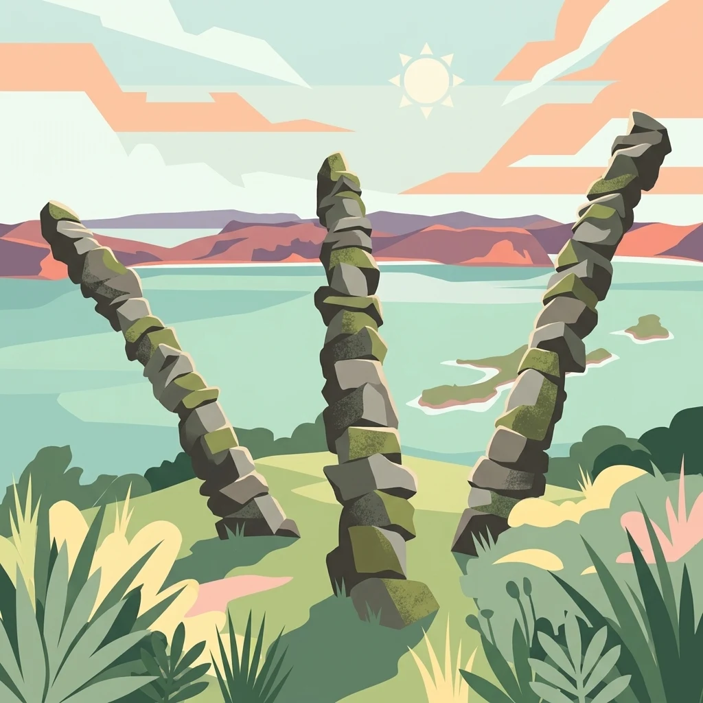
A digital illustration of three tall, thin stone stacks or pillars rising from a grassy island landscape, with a wide body of water and distant hills in the background under a stylized sun.

Rotoroa Island

Nature reserve

Park overview

Structured park overview, official facts, and landscape profile for Rotoroa Island

Rotoroa Island park facts, protected area profile, and essential visitor context

Review the core facts for Rotoroa Island, including designation, size, terrain, visitor scale, habitats, and operating context in one park-focused overview.

About Rotoroa Island

Rotoroa Island is a small but ecologically significant island in the New Zealand Hauraki Gulf, located between Waiheke Island and the broader gulf approaches. Its proximity to Auckland, combined with its protected status, has turned it into both a scientific refuge and a publicly accessible open-space destination since it was reopened to visitors in 2011.

The island's modern identity is shaped by three overlapping stories. The first is natural: a maritime island with limited freshwater, surrounded by the warmer waters of the inner Hauraki Gulf. The second is historical: Māori had only a transient presence because of the absence of natural springs, and the islands visited by Europeans were sold in 1826 through a deed translated by Thomas Kendall. The third is social and institutional, with the Salvation Army operating a treatment facility here from the early twentieth century until 2005, after which philanthropists Neal and Annette Plowman arranged a long lease and established an open public trust.

What makes Rotoroa distinctive today is the way these layers have been deliberately combined. More than 20,000 pines were removed and over 400,000 native trees planted in 27 species before public opening, transforming the vegetation profile into a regenerating native forest. The old Salvation Army buildings, a wool-shed style museum by architect Rick Pearson, a small hostel, and the Kaitiaki sculpture by Chris Booth now sit alongside a working endangered-species programme that has welcomed takahē, brown kiwi, pāteke, saddleback and native skinks.

Quick facts and research context for Rotoroa Island

Rotoroa Island sits in the Hauraki Gulf east of Waiheke Island, within the Auckland Region of New Zealand. It covers roughly 82 hectares, has no permanent residents, and lies just over an hour by ferry from the Auckland ferry terminal. The island is managed as a pest-free conservation sanctuary in partnership with Auckland Zoo, and is administered through the Rotoroa Island Trust under a 99-year arrangement with the Salvation Army.

Protection and recognition

Examine the terrestrial protected area classification and official records for Rotoroa Island.

Rotoroa Island Protection Status and Documented Conservation Scope

Rotoroa Island maintains a documented terrestrial protection scope within the regional conservation inventory. Structured records organize available designation history and administrative context for this protected natural area.

Protection details

Protection scope
Terrestrial
Park context

Deeper park guide and search-rich context for Rotoroa Island

Rotoroa Island history, landscape, wildlife, and travel context

Explore Rotoroa Island through its history, landscape character, ecosystems, wildlife, conservation priorities, cultural context, and seasonal travel timing in a structured park guide built for atlas discovery and search intent.

Why Rotoroa Island stands out

Rotoroa is best known as a translocation site for endangered New Zealand birds, particularly takahē and Coromandel brown kiwi. The island's pest-free status makes it one of the safer refuges in the gulf, and it has been deliberately developed as a stepping stone for breeding populations of species that have struggled on the mainland. At the same time, the takahē recovery programme, kiwi crèche programme and large-scale native replanting have made it a visible symbol of active island restoration in the Auckland region.
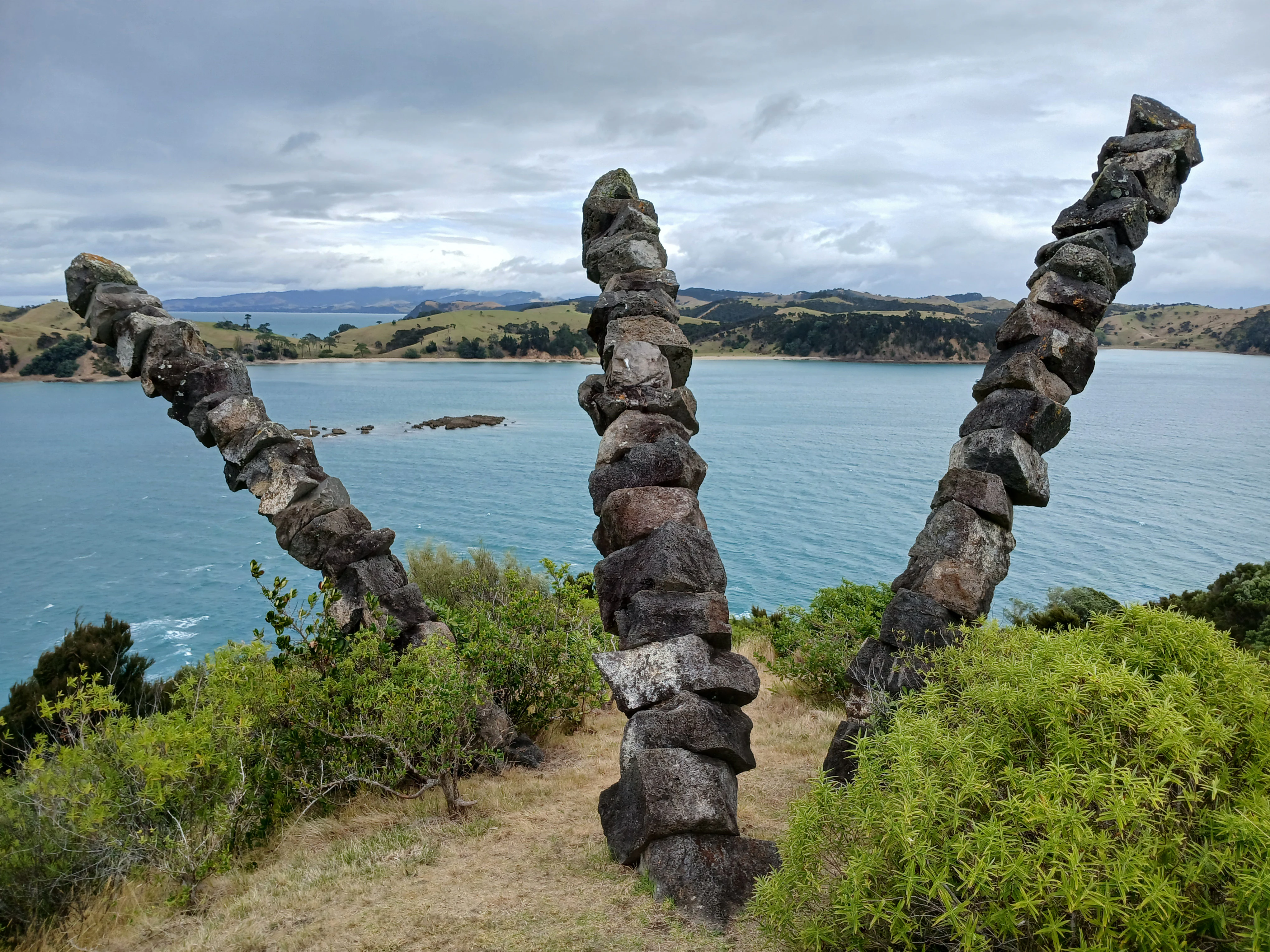
Three tall, slender stacks of dark volcanic rocks, resembling abstract towers, stand on a grassy ridge overlooking a wide blue bay with rolling hills in the background.
The Kaitiaki sculpture by Chris Booth on Rotoroa Island, overlooking the Hauraki Gulf.

Rotoroa Island history and protected-area timeline

For Māori, Rotoroa was never a settlement island because of its lack of springs or dependable freshwater sources, and it was treated as a place to visit rather than occupy. The first well-documented European-era act affecting the island was the 1826 purchase by the New Zealand Company aboard the Rosanna, in which Rotoroa, Pakatoa and Pakihi were sold for a double-barreled gun, eight muskets and a barrel of gunpowder. The deed was translated and co-signed by Thomas Kendall and witnessed by company men and Māori signatories.

In 1908, the Salvation Army bought the island for £400 from the Ruthe family as an extension of its alcohol and drug rehabilitation work on neighbouring Pakatoa, where men were treated at Home Bay on Rotoroa while women were treated on Pakatoa. The facility remained in operation for nearly a century before closing in 2005. A few years later, the Plowman family negotiated a 99-year lease from the Salvation Army, established the Rotoroa Island Trust and committed to a programme of restoration and public access. The island opened to the public in February 2011 for the first time in more than a century.

Since reopening, the trust has overseen removal of plantation pines, the planting of hundreds of thousands of native trees, the development of a museum in a wool-shed style building, the restoration of holiday homes and a hostel, and the installation of the Kaitiaki sculpture by Chris Booth in 2011. These projects have framed the island's present-day identity around heritage retention, ecological restoration and public access.

Rotoroa Island landscape and geographic character

Rotoroa is a small, low-lying Hauraki Gulf island of roughly 82 hectares, ringed by coastline typical of the inner gulf and backed by terrain that was historically dominated by exotic pine plantation before restoration began. The absence of natural springs shapes both its human history and its ecological character, while the relatively warm gulf waters around it contribute to a mild maritime climate.

The visual character of the island is now one of regenerating native bush rather than the older plantation forest that once covered most of it. Cleared pine areas have been replaced by mixed native plantings across the interior, while coastal edges, walking tracks and open grassed areas around the former treatment facility give the island a varied mosaic of habitats. The southern point hosts the Kaitiaki sculpture and offers an open landscape framing point across the gulf towards Waiheke and the Coromandel approaches.

Because the island is small and pest-free, its landscape is also a managed landscape. Tracks, accommodation areas and heritage buildings are concentrated, while large parts of the interior are deliberately left as quiet regenerating forest for wildlife. The combination of open coastal views, native canopy and surprisingly intact built heritage gives Rotoroa a sense of layered space unusual for an island of its size.
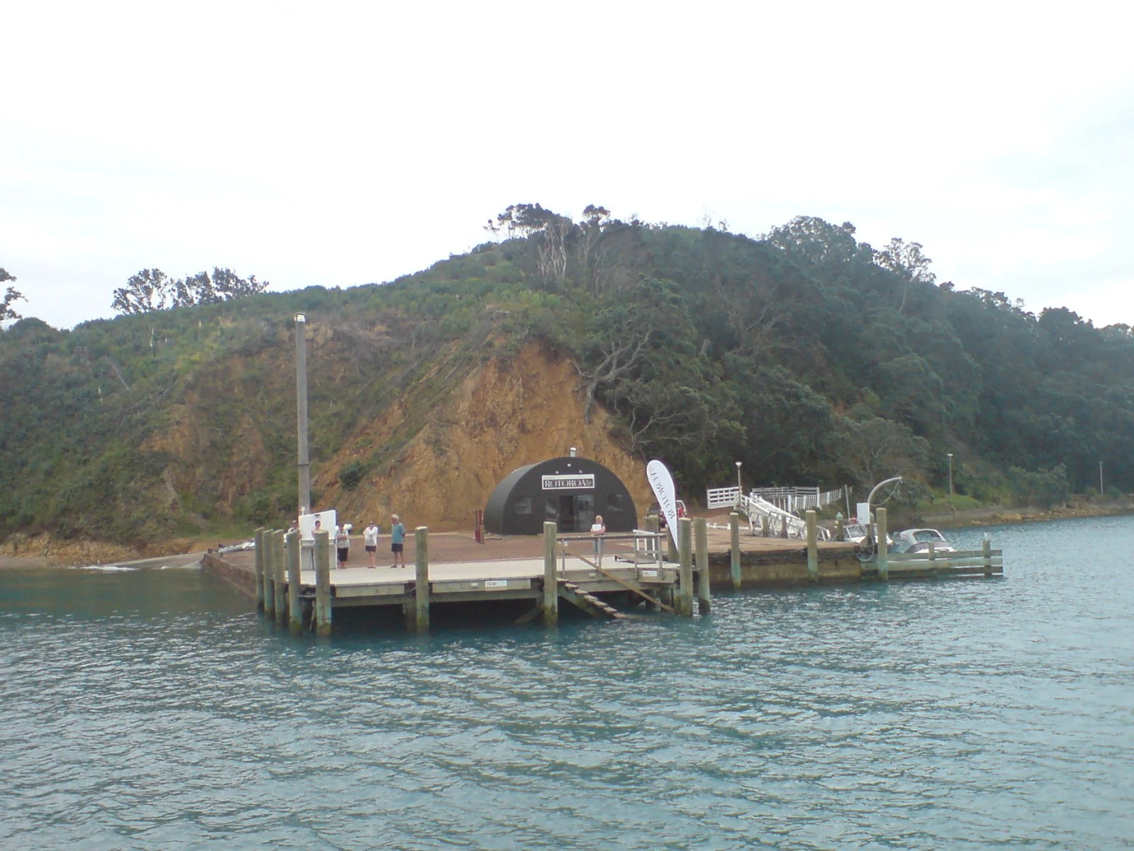
A view from the water looking at a wooden ferry pier on Rotoroa Island, featuring a dark rounded shelter building at the base of a grassy, forested hill.
The ferry wharf and visitor shelter at the entrance to Rotoroa Island.

Rotoroa Island ecosystems, habitats, and plant life

Rotoroa's ecological identity is built around its pest-free status, established through an extensive eradication programme, and the subsequent use of the island as a refuge for endangered native species. Following the removal of pests and the large-scale restoration of native vegetation, the trust and its partners have worked to build a functioning native ecosystem where several threatened birds and reptiles now breed in relative safety.

The vegetation profile is dominated by planted native forest, comprising 27 species and over 400,000 trees planted before the 2011 public opening, alongside a mature fringe that includes remnant coastal vegetation. Kauri seedlings donated by the Kauri 2000 Trust and BNZ have been added to the plantings, giving the canopy a more representative New Zealand character than the earlier exotic pine cover. The trust has described the island as carbon neutral, with the planted trees calculated to offset more than twice the emissions produced on-site.

Ecologically, the island now functions less as a wild forest and more as an actively curated conservation habitat. Native reptiles such as shore skinks and moko skinks are present, while the understorey and open grassy clearings provide varied foraging conditions for translocated birds. The pest-free boundary is critical, because many of the species released here would face heavy predation if returned to the mainland without intensive control.
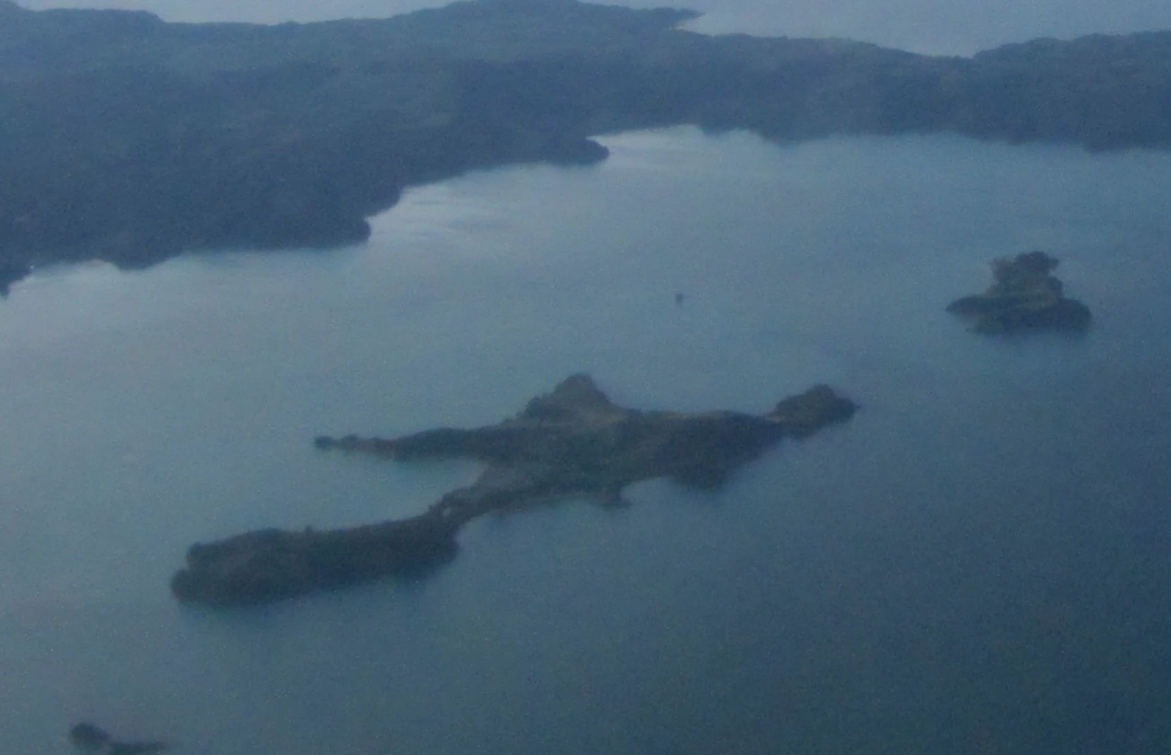
An aerial perspective of Rotoroa Island surrounded by ocean, showing its irregular shape and grassy landscape.
Aerial view of Rotoroa Island in the Hauraki Gulf, New Zealand.

Rotoroa Island wildlife and species highlights

Wildlife is one of the core reasons Rotoroa has public interest today. The island's pest-free environment makes it suitable for a number of New Zealand's most threatened native bird species, which have been translocated here as part of national recovery programmes. Among the species associated with Rotoroa are takahē, pāteke (brown teal), tīeke (saddleback), grey-faced petrels, weka and North Island brown kiwi.

Kiwi are particularly prominent. Rotoroa acts as a crèche for Coromandel brown kiwi, with chicks released to the island when they are only a few weeks old and weighing around 250 to 300 grams, allowing them to grow up largely free from mammal predation. Every two years, the trust conducts a kiwi muster: once the kiwi reach roughly one kilogram, they are considered better able to defend themselves against stoats and feral cats, and some are returned to the Coromandel while others are moved to nearby Motutapu Island to start a new population.

Takahē are another focus. The Takahē Recovery Programme, managed by the Department of Conservation in partnership with iwi and Fulton Hogan, has identified Rotoroa as a safe site and one of the sanctuaries working toward a national breeding-pair target. Smaller species such as popokotea (whitehead), along with reintroduced skinks, round out the fauna profile and contribute to a community that covers forest birds, wetland-associated ducks and ground-dwelling reptiles.

Rotoroa Island conservation status and protection priorities

Conservation sits at the heart of Rotoroa's modern purpose. Once a privately run rehabilitation island with a plantation pine cover, the property has been deliberately re-engineered as a sanctuary where pest-free status, native reforestation and species translocation work together. The trust partnered with Auckland Zoo to design and implement the wildlife programme, and the island's protected status underpins the credibility of its recovery work.

The conservation model combines several elements: complete pest eradication, replacement of exotic plantation with mixed native forest, ongoing monitoring of released species, and active cooperation with national recovery programmes for brown kiwi and takahē. By providing a secure nursery environment for chicks and a safe adult habitat for vulnerable populations, Rotoroa adds directly to the resilience of species that have been pushed to the edge on the mainland by introduced predators.

Beyond species-specific work, the island offers a model of small-scale island restoration in a heavily populated region. Within an hour of central Auckland, an 82-hectare island has been converted from a working institutional site to a publicly accessible sanctuary with a self-declared carbon-neutral forest profile, demonstrating how brief but intensive restoration can produce both ecological and community value.

Rotoroa Island cultural meaning and human context

Rotoroa's cultural context is layered rather than singular. The earliest layer is Māori, with a documented pattern of visit rather than settlement driven by the absence of freshwater, and a shared 1826 land transaction involving neighbouring islands that remains part of the documented history of European contact in the gulf.

The next major layer is the Salvation Army era, which left a built environment of treatment buildings, a wharf and shelters that still define parts of the island. The treatment programme itself, addressing alcohol and drug rehabilitation separately for men on Rotoroa and women on Pakatoa, represents an important chapter in New Zealand's social welfare history. The closure of that programme in 2005, followed by the long lease and the establishment of the Rotoroa Island Trust, marked a deliberate shift from institutional use to public access and ecological restoration.

Contemporary cultural markers include the Rotoroa Island Museum, designed in the form of a New Zealand wool shed; the holiday homes and hostel that were restored for public stays; and the Kaitiaki sculpture by Chris Booth, which reflects a guardianship ethic and gives the southern end of the island an interpretive focal point. Together, these features give Rotoroa a cultural identity that fuses indigenous contact history, early twentieth-century social care and modern conservation philanthropy.

Top sights and standout views in Rotoroa Island

Rotoroa Island combines three distinctive draws in a small Hauraki Gulf footprint: a pest-free endangered-species sanctuary, an active native reforestation project with hundreds of thousands of planted trees, and a set of preserved heritage buildings from the Salvation Army's long-running rehabilitation programme. Its kiwi crèche work and takahē breeding-site role directly contribute to national species recovery efforts, while its museum, hostel and restored holiday homes make the island accessible to visitors from Auckland.

The island's compactness is part of its appeal. Visitors can engage with wildlife conservation, native bush restoration, coastal scenery and built heritage within a single short visit, and the location east of Waiheke gives it a strong sense of being a 'real gulf island' despite its proximity to the city. The combination of science, restoration and heritage makes Rotoroa stand out from purely beach-oriented gulf destinations.

Best time to visit Rotoroa Island

Rotoroa has a mild, maritime Hauraki Gulf climate, with warm summers and mild winters, allowing visits to be comfortable across much of the year. The warmer months, roughly late spring through early autumn, are generally the most pleasant for walking the tracks, enjoying coastal views and combining a day visit with beach or picnic time, as well as for seeing native bush and associated birdlife at their most active.

Cooler months can still work well for visitors focused on heritage buildings, the museum and quiet contemplation of the restoration project, though shorter days reduce the scope for outdoor exploration. Because the island is pest-free and ecologically managed, the best experiences generally come from aligning visits with favourable weather, comfortable walking conditions and a willingness to allow time for both wildlife observation and the island's heritage sites.

Monthly climate preview

Long-term monthly temperature averages and precipitation patterns for Rotoroa Island

Rotoroa Island Climate Normals: Annual Temperature and Precipitation Rhythm

Representative coordinates record measured monthly temperature and precipitation values across the year for Rotoroa Island. Examining the complete twelve-month climatology profile reveals detailed variations in average minimum and maximum temperatures.
Annual mean16 °C
11 °C20 °C
Jan20°
Feb20°
Mar19°
Apr17°
May15°
Jun12°
Jul11°
Aug12°
Sep13°
Oct14°
Nov16°
Dec18°
Warmest month
February

20.3 °C

Coolest month
July

11.4 °C

Wettest month
July

3.7 mm/day

Driest month
January

1.8 mm/day

Park location guide

Geography guide, regional context, and park location map for Rotoroa Island

Rotoroa Island park geography, regions, and map view in New Zealand

Understand where Rotoroa Island sits in New Zealand through a broader geographic reading of the surrounding landscape, nearby location context, and its mapped position within the national park landscape.

How Rotoroa Island fits into New Zealand

New Zealand is an island nation in the southwestern Pacific Ocean comprising two main islands and numerous smaller islands. Located east of Australia across the Tasman Sea, it features varied topography with the Southern Alps running along the South Island and volcanic terrain on the North Island. The country was settled by Maori people between 1280 and 1350, followed by European exploration beginning in 1642, and became a Dominion in 1907 before gaining full independence in 1947.

Wider geography shaping Rotoroa Island in New Zealand

New Zealand lies in the southwestern Pacific Ocean, east of Australia across the Tasman Sea. The country consists of two main islands, the North Island and South Island, plus over 600 smaller islands. The North Island features volcanic plateaus and hills while the South Island is dominated by the Southern Alps mountain range. The country has a long coastline and is surrounded by the Pacific Ocean.

Map view of Rotoroa Island

Use this park location map to pinpoint Rotoroa Island in New Zealand, understand its exact geographic position, and read its mapped placement within the surrounding landscape more clearly.

Pigeon | © OpenStreetMap contributors

Location context for Rotoroa Island

Auckland Region

Explore high-resolution photography documenting native forest restoration, coastal terrain, and wildlife habitats.

Rotoroa Island Photos and Scenery: Visualizing Hauraki Gulf Protected Landscapes

Visual records capture the regenerating native canopy, open coastal margins, and pest-free sanctuary environments across the protected island landscape. Detailed photography provides an essential visual reference for understanding the terrain, habitats, and conservation geography of the Hauraki Gulf.

Three tall, slender stacks of dark volcanic rocks, resembling abstract towers, stand on a grassy ridge overlooking a wide blue bay with rolling hills in the background.

A takahe bird with iridescent blue and green feathers and a bright red beak standing in green grass.

A view from the water looking at a wooden ferry pier on Rotoroa Island, featuring a dark rounded shelter building at the base of a grassy, forested hill.

An aerial perspective of Rotoroa Island surrounded by ocean, showing its irregular shape and grassy landscape.

Park atlas

Compare adjacent maritime sanctuaries and regional conservation landscapes

Explore Parks Near Rotoroa Island and Surrounding Protected Natural Areas

Browse other protected areas and maritime sanctuaries located near Rotoroa Island across the wider regional geography. Extending the search helps visitors compare similar island ecosystems and conservation projects throughout the surrounding coastal territory.
Regional parkAuckland Region
About 9.9 km away#1 closest

West

Whakanewha Regional Park: Mapping the Protected Landscapes and Wetlands of Waiheke Island

Coastal forest and wetland geography in the Auckland Region

Whakanewha Regional Park serves as a vital protected area on Waiheke Island, known for its mature broadleaf forests and significant freshwater wetlands. The park provides a compact yet varied landscape of stream valleys and coastal ridgelines, representing a key component of the regional geography within the Hauraki Gulf, sheltered from broader environmental pressures.

Area
2.7 km²
Established
2007
Relief
Upland
Climate
Temperate
Regional parkAuckland Region
About 13 km away#2 closest

South

Waitawa Regional Park: Coastal Geography and Recreation Landscapes in Auckland

Mapped terrain along the Tāmaki Strait shoreline

Waitawa Regional Park serves as a notable example of repurposed land within the Auckland Region, featuring an open coastal landscape on the Tāmaki Strait. This protected space, formerly an industrial explosives site, now offers a unique geography of grassy tracks, beach access, and historical remnants. Its layout provides a specialized atlas view of coastal development and public land use for outdoor activity.

Area
1.88 km²
Established
2013
Relief
Upland
Climate
Temperate
A horizontal watercolor painting of a coastal island landscape with rolling green hills, pale distant mountains, and coastal greenery.
Wildlife reserveAuckland
About 23 km away#3 closest

West

Motuihe Island Wildlife Reserve: Protected Landscapes and Hauraki Gulf Geography

Ecological restoration and coastal island history near Auckland

Motuihe Island represents a significant case study in island conservation, featuring intensive native forest regeneration and successful wildlife reintroduction. The mapped landscape details an elongated island geography defined by coastal beaches, sandstone terrain, and rich archaeological layers, serving as a prominent protected reserve for the Auckland region.

Area
1.79 km²
Relief
Lowland
Climate
Subtropical
Access
Moderate access
Regional parkWaikato Region
About 25 km away#4 closest

South

Waharau Regional Park: Protected Coastal Forest and Hunua Ranges Gateway

Geographic landscape transition in the Waikato region

This protected area offers a deep look into the transition from native forest hill country to estuarine environments along the Firth of Thames. Spanning 170 hectares, it serves as a functional geographic corridor between the Hunua Ranges and the Hauraki Gulf, showcasing layered history and varied topography within the Waikato region.

Area
1.7 km²
Established
1979
Relief
Upland
Climate
Temperate
A flat-style digital illustration showing a winding river through a valley with pine trees, steep rock cliffs, and a waterfall under a soft sun.
Nature reserveAuckland
About 39 km away#5 closest

Southwest

Puhinui Reserve: Protected Nature Reserve and Volcanic Geography in Auckland, New Zealand

Coastal wetlands, maar craters, and working agricultural lands

Explore the physical geography of Puhinui Reserve, a protected nature reserve in South Auckland. This site encompasses rare saltmarsh habitat, active volcanic maar features, and estuarine environments situated on the shores of the Manukau Harbour. Gain insight into the volcanic ash, alluvium, and peat soil structures that define this unique transitional landscape.

Area
1.99 km²
Established
1991
Relief
Lowland
Climate
Temperate
A horizontal, minimalist watercolor painting showing stylized rolling hills in shades of light green, pale yellow, and soft pink against a white background.
Protected areaWaikato Region
About 47 km away#6 closest

Southeast

Coromandel Forest Park: Geography and Protected Area Overview in Waikato, NZ

Native bushland, valley systems, and conservation geography.

Coromandel Forest Park comprises an expansive system of forested hills and valleys covering the heart of the Coromandel Peninsula. This protected area features dense native ecosystems, ranging from the accessible Kauaeranga Valley to the ecologically significant southern blocks. Use this atlas perspective to understand the terrain, boundaries, and conservation value of this essential Waikato Region landscape.

Area
718.99 km²
Established
1971
Relief
Upland
Climate
Temperate
A pale, minimalist watercolor painting showing a grassy island or shoreline with a small cluster of trees, set against a quiet body of water and soft, distant rolling hills.
Protected areaAuckland Region
About 48 km away#7 closest

West

Motumānawa / Pollen Island: Protected Marine Reserve and Scientific Landscape in Auckland

A coastal shellbank island refuge within the Waitematā Harbour.

Motumānawa / Pollen Island is an essential protected area near the Rosebank Peninsula, serving as a sanctuary for native bird populations and estuarine vegetation. Its status as both a scientific and marine reserve highlights the importance of small-scale coastal conservation within a major metropolitan harbour landscape in New Zealand.

Established
2006
Relief
Lowland
Scope
Marine
Water
Water-dominated
A soft watercolor illustration showing the low-lying shape of Motuora Island surrounded by calm water, with a distant hilly coastline in the background.
Nature reserveNorth Island
About 50 km away#8 closest

Northwest

Motuora Nature Reserve: Protected Coastal Island Geography and Restoration Map

Predator-free ecological sanctuary in the Hauraki Gulf

Motuora occupies a key position in the Hauraki Gulf, offering a well-mapped look at coastal island restoration in New Zealand. This protected area features a regenerated forest interior and cliff-edged terrain, serving as an important mainland-island site for avian conservation, including kiwi and petrel colonies.

Area
0.8 km²
Established
1965
Relief
Lowland
Climate
Subtropical

Common questions about visiting, size, designation, and location context for Rotoroa Island

Rotoroa Island FAQs for park facts, access, geography, and protected area context

Find quick answers about Rotoroa Island, including protected-area facts, park geography, trail and visitor context, and how the park fits into its surrounding country and regional landscape.
MoriAtlas Explorer

Continue Your Protected Areas Search Across the Global Atlas

Deepen your exploration by continuing the structured search for national parks and protected areas worldwide. Utilize the comprehensive filtering capabilities to compare different conservation landscapes and refine your understanding of global park geography. Discover more about the distribution and characteristics of protected natural areas.

Global natural geography