Mori Atlas logo
Wildlife reserveSabi Sand Game Reserve

Tracing the river systems, concession mosaics, and ecological boundaries of this South African sanctuary

Sabi Sand Game Reserve: A Comprehensive Geographic Overview of Protected Lowveld Landscapes

Sabi Sand Game Reserve represents a critical protected landscape within the Mpumalanga province of South Africa, defined by the convergence of the Sand and Sabie Rivers. This sprawling wildlife reserve creates a seamless ecological transition with Kruger National Park, allowing for natural wildlife movement across a vast expanse of Lowveld bushveld. Its geography is characterized by riparian corridors, granite outcrops, and a mosaic of private concessions that prioritize conservation and habitat preservation. The reserve remains a significant focus for those mapping southern African protected areas and understanding the regional terrain that supports its extensive predator populations.

private game reservelowveldsavannabig fiveleopard viewinglion prides

Sabi Sand Game Reserve

Wildlife reserve

Park overview

Structured park overview, official facts, and landscape profile for Sabi Sand Game Reserve

Sabi Sand Game Reserve park facts, protected area profile, and essential visitor context

Review the core facts for Sabi Sand Game Reserve, including designation, size, terrain, visitor scale, habitats, and operating context in one park-focused overview.

About Sabi Sand Game Reserve

Sabi Sand Game Reserve is a collective term for a cluster of private game reserves that share a long, unfenced border with Kruger National Park in the South African Lowveld. The reserve's name is a simple derivation from its two main rivers: the Sabie, which marks its southern boundary with Kruger, and the Sand, which threads through the interior and historically gave early settlers and prospectors access into the bushveld.

The geography of Sabi Sand is classic Lowveld: gently undulating terrain, mixed woodland and open grassy plains, riverine forest along the Sand and Sabie corridors, and granite outcrops that punctuate vast stretches of bush. This mosaic of habitats supports dense populations of herbivores and, in turn, a thriving community of predators. Because the fences with Kruger were removed long ago, wildlife circulates freely, and the area effectively functions as a single vast ecological unit with its famous neighbour.

Sabi Sand is also notable for the structure of its conservation and tourism model. Rather than being a single government-run park, it is a federation of private concessions, each with its own lodges and brand identity, but governed collectively through the Sabi Sand Wildtuin. Concessions such as Mala Mala, Londolozi, Singita, Sabi Sabi, Lion Sands, Exeter, Chitwa Chitwa, Djuma, Elephant Plains, Cheetah Plains, Arathusa, Simbambili, Nottens, Inyati, Idube, Dulini, Leopard Hills, Savanna, and Ulusaba all sit within its boundaries.

This unusual arrangement has allowed Sabi Sand to combine significant biological and conservation value with high-end tourism. Generations of guides, researchers, and trackers have worked within these reserves, contributing to long-term datasets on leopard, lion, hyena, and wild dog populations. The reserve has also been influential in shaping modern conservation photography and citizen-led predator monitoring, with several of the most well-known individual leopards and lion prides identified by name across decades of observation.

Quick facts and research context for Sabi Sand Game Reserve

Sabi Sand Game Reserve lies in Mpumalanga province in northeastern South Africa, directly adjacent to the western border of Kruger National Park. The combined area of its private reserves totals roughly 650 square kilometres of Lowveld bushveld. The reserve was established in 1948 and is governed collectively by the Sabi Sand Wildtuin (SSW). Wildlife ranges freely across the shared boundary with Kruger, and the reserve is well known for hosting all of the Big Five, with particularly strong leopard sightings due to generations of habituation.

Protection and recognition

Documented terrestrial protection scope and conservation designation records

Sabi Sand Game Reserve Protection Status and International Recognition Data

Sabi Sand Game Reserve maintains a documented terrestrial protection scope across its regional landscape. Structured records outline available designation history and international recognition sources for conservation analysis.

Protection details

Protection scope
Terrestrial
Transboundary protection
No
Park context

Deeper park guide and search-rich context for Sabi Sand Game Reserve

Sabi Sand Game Reserve history, landscape, wildlife, and travel context

Explore Sabi Sand Game Reserve through its history, landscape character, ecosystems, wildlife, conservation priorities, cultural context, and seasonal travel timing in a structured park guide built for atlas discovery and search intent.

Why Sabi Sand Game Reserve stands out

Sabi Sand is best known for its remarkable leopard sightings, the habituation of several large predator prides that have been tracked for decades, and an almost unmatched density of luxury photographic safari lodges. The reserve's leopard viewing has become so consistent that it has effectively set the gold standard for African leopard tourism. The reserve is equally associated with its patchwork of famous private concessions: Mala Mala, Londolozi, Singita, and Sabi Sabi, all of which are household names in the safari world. This concentration of storied private reserves, blending conservation work with premium hospitality, gives Sabi Sand a cultural status in the safari industry that few reserves can match.
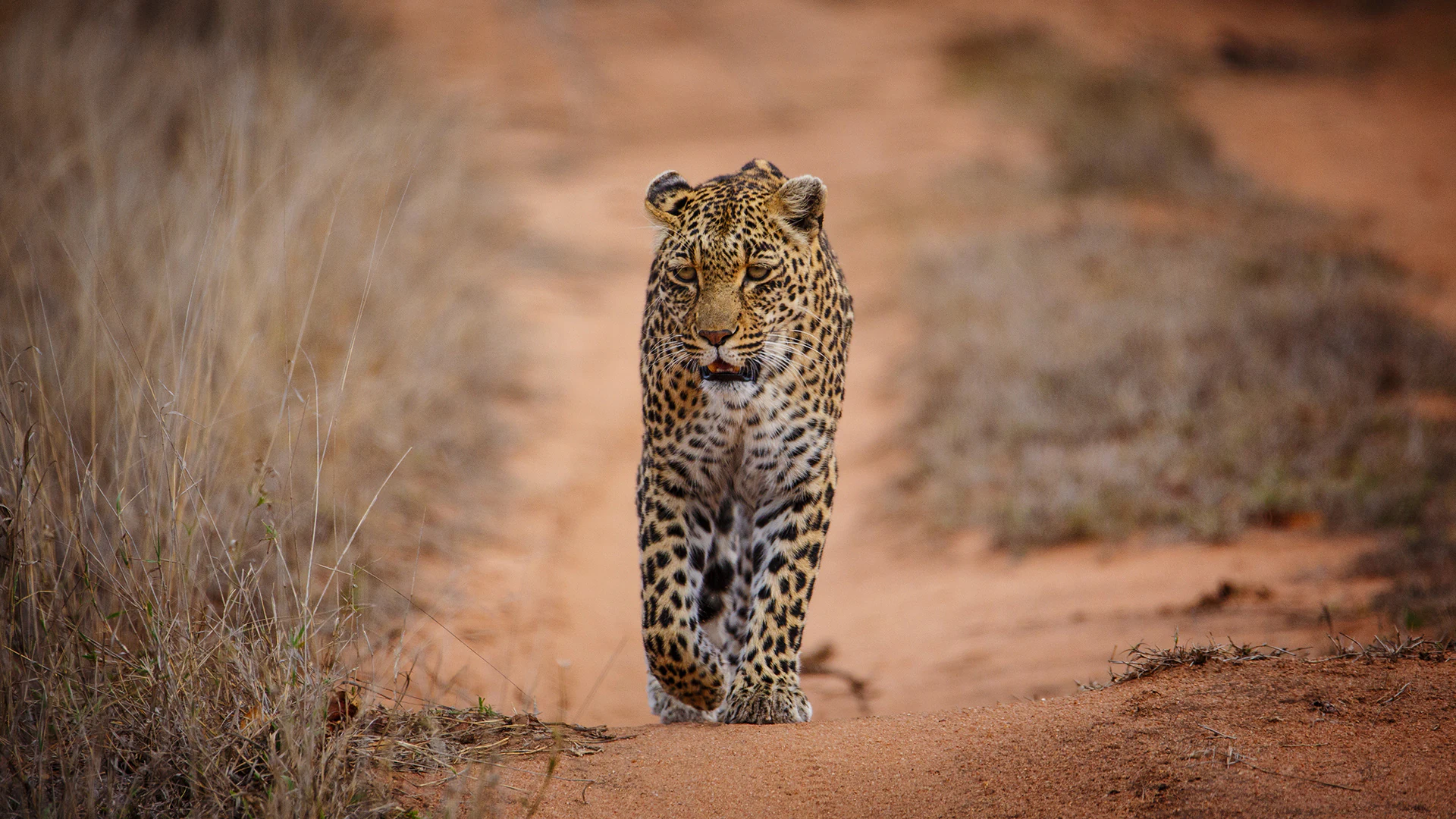
A spotted African leopard walks directly toward the camera along a dry, dusty dirt path bordered by dry grasses.
An African leopard walking along a dirt track in Sabi Sand Game Reserve.

Sabi Sand Game Reserve history and protected-area timeline

Sabi Sand Game Reserve was established in 1948, in the years following the creation of Kruger National Park and the development of the surrounding Lowveld as a safari region. Its origin reflects the broader pattern of South African conservation in the mid-twentieth century, when private landowners and hunting operators in the Lowveld began transitioning their properties toward photographic tourism and wildlife preservation.

Over the decades that followed, individual properties within Sabi Sand evolved from family-run farms and hunting blocks into dedicated wildlife reserves. Some, like Mala Mala and Singita, became internationally recognised brands, while others such as Londolozi pioneered the model of private conservation land that blended high-end hospitality with long-term ecological research. The federation structure that governs the reserve today, under the Sabi Sand Wildtuin (SSW), emerged from this gradual consolidation of adjacent properties.

A particularly important chapter in Sabi Sand's history is the removal or non-maintenance of fences between the private reserves and Kruger National Park. As a result of this open boundary policy, the reserve effectively became part of a vast network of protected land through which wildlife moves without restriction. By the early 2000s, Sabi Sand had become one of the most economically significant private conservation regions in southern Africa, with its lodges contributing significantly to regional employment and conservation funding.

Sabi Sand Game Reserve landscape and geographic character

The landscape of Sabi Sand is quintessentially Lowveld, characterised by flat to gently undulating bushveld that sits at the foot of the eastern escarpment. Elevation changes are subtle, and the horizon is dominated by stands of knob thorn, marula, leadwood, and mopane, interrupted by open grassy clearings known locally as 'openings'.

The reserve's two defining rivers, the Sand and the Sabie, cut through this terrain and provide ribbons of denser riparian vegetation. Along their banks grow tall, leafy trees, reeds, and fig species, contrasting with the drier surrounding woodland. Granite koppies and rocky outcrops occasionally rise above the bush, offering vantage points for predators and panoramic views for visitors.

In the wetter summer months the bush turns lush and green, with seasonal pans dotted across the landscape, while the dry winter months reduce visibility and push game toward permanent water sources. The result is a landscape that, while visually less dramatic than mountainous or coastal parks, offers unusually clear game viewing conditions across vast stretches of open and broken bush.

Sabi Sand Game Reserve ecosystems, habitats, and plant life

Ecologically, Sabi Sand sits within the savanna biome of northeastern South Africa, predominantly classified as mixed Lowveld bushveld with sections of mopane woodland. The signature habitat is a mosaic of broad-leafed trees, thornveld, and grass-dominated plains, intersected by the Sand and Sabie river systems, whose riparian zones add ecological complexity and support species that depend on denser cover and water.

The reserve benefits from being ecologically continuous with Kruger National Park, which greatly expands the effective size of the ecosystem for wide-ranging species such as elephants, African wild dogs, and large carnivores. This connectivity has been central to Sabi Sand's biodiversity profile, ensuring genetic exchange for large mammals and supporting resilient populations of herbivores that sustain the predator community.

Beyond the obviously charismatic large mammals, the reserve is ecologically rich in less conspicuous ways. The rivers and seasonal pans sustain aquatic species, while the woodland habitats support diverse bird communities and a wide variety of reptiles and insects. The combination of varied microhabitats and a large connected landscape gives Sabi Sand a strong identity as a balanced, fully functional savanna ecosystem rather than a single-species showcase.

Sabi Sand Game Reserve wildlife and species highlights

Sabi Sand is internationally recognised for its predator sightings, particularly of African leopards. Decades of careful habituation, alongside consistent vehicle-based viewing, have produced some of the most reliable leopard encounters in Africa. Several individual leopards and lineage lines have been identified and named across multiple generations, contributing to a unique long-term dataset on leopard behaviour and demography.

Lions are equally prominent, with multiple large prides holding territories across the reserve. Some prides are the subject of long-running research and have become iconic in their own right, with distinct individuals known by name. The reserve is also home to spotted hyenas, African wild dogs (painted dogs), and Cape wild dogs, the latter being especially significant as one of Africa's most endangered carnivores.

The herbivore community supporting these predators is robust and includes African elephants, Cape buffalo, greater and lesser kudu, impala, wildebeest, zebra, giraffe, waterbuck, nyala, hippo, and many other ungulates. According to figures associated with the reserve, the wider ecosystem supports around 145 mammal species, 500 bird species, 110 reptile species, and 45 fish species, much of this biodiversity shared with neighbouring Kruger.

Sabi Sand Game Reserve conservation status and protection priorities

Sabi Sand holds substantial conservation significance because of the scale of its private protected area network and its ecological continuity with Kruger National Park. The open boundary with Kruger effectively increases the protected area available to wide-ranging species, particularly large predators and elephants, and supports the long-term viability of populations that would otherwise be vulnerable to fragmentation.

Many of the individual reserves within Sabi Sand have been active in applied conservation. Concessions have invested heavily in anti-poaching operations, predator monitoring, and habitat management. Several are involved in research partnerships studying leopard, lion, and wild dog ecology, contributing long-term datasets that inform broader conservation strategies across South Africa and beyond.

The federation model itself is an important conservation concept: a group of independently operated reserves bound by shared environmental standards and governance. Sabi Sand Wildtuin (SSW) coordinates policies across concessions, including tourism carrying capacity, land-use practices, and biosecurity measures. The economic value generated by high-end tourism is, in turn, reinvested into conservation, creating a model in which private land use and ecological preservation are tightly linked.

Sabi Sand Game Reserve cultural meaning and human context

Sabi Sand sits in a region with a layered human history, from Iron Age agricultural communities along the Limpopo and its tributaries to later colonial-era settlement and farming in the Lowveld. The names Sabie and Sand reflect the Afrikaans-era toponyms that took hold during European settlement, when the area was gradually converted from cattle and crop farming into game ranching and safari tourism.

The reserve and its neighbours sit within a broader regional identity shaped by the Kruger-to-Canyon biosphere and by Mpumalanga's strong association with safari tourism. Many of the lodges in Sabi Sand host guests from around the world, and the conservation work within the reserve draws on partnerships with South African universities, NGOs, and international researchers. The presence of long-established private reserves has also created a distinctive local culture around guiding, tracking, and field guiding as a profession, with several Sabi Sand concessions being training grounds for some of southern Africa's most respected guides.

Top sights and standout views in Sabi Sand Game Reserve

Sabi Sand's standout features include its open boundary with Kruger National Park, allowing wildlife to roam across an unusually large connected landscape; its exceptional leopard viewing that has set the standard for safari experiences across Africa; and the worldwide fame of its private concessions such as Mala Mala, Londolozi, Singita, and Sabi Sabi.

Equally notable is the reserve's role in long-term predator research and monitoring, providing valuable datasets on leopards, lions, and wild dogs, and the federation model of governance under Sabi Sand Wildtuin (SSW). Together, these elements make Sabi Sand not only a premier safari destination but also a significant contributor to private conservation practice in South Africa.

Best time to visit Sabi Sand Game Reserve

Because Sabi Sand is a year-round safari destination, the seasonal differences are more about atmosphere and viewing style than about whether the park is open. The dry winter months, typically from about May through August, are often considered the most comfortable period to visit. Vegetation thins, water sources become predictable, and animals gather around rivers and waterholes, which can make predator and herbivore viewing especially productive.

The summer months, from roughly November through March, bring heat, humidity, and rain, transforming the bush into a lush green landscape. Although thicker vegetation can make game harder to spot, this is a rewarding time for birding, dramatic skies, and the birth of young animals, while predator sightings can remain strong around rivers. Visitors should plan around their preferences for climate, scenery, and photographic conditions rather than strict operational openings.
Monthly climate preview

Long-term temperature and precipitation patterns across twelve recorded months

Sabi Sand Game Reserve Climate Normals and Monthly Weather Records

Sabi Sand Game Reserve maintains measured long-term temperature extremes and monthly precipitation shifts derived from representative coordinate sampling. Analyzing the complete twelve-month climatology dataset reveals detailed variations in average minimum and maximum readings.
Annual mean21 °C
16 °C25 °C
Jan24°
Feb24°
Mar23°
Apr21°
May19°
Jun17°
Jul16°
Aug19°
Sep22°
Oct23°
Nov24°
Dec25°
Warmest month
December

24.6 °C

Coolest month
July

16.4 °C

Wettest month
January

4.5 mm/day

Driest month
July

0.3 mm/day

Park location guide

Geography guide, regional context, and park location map for Sabi Sand Game Reserve

Sabi Sand Game Reserve park geography, regions, and map view in South Africa

Understand where Sabi Sand Game Reserve sits in South Africa through a broader geographic reading of the surrounding landscape, nearby location context, and its mapped position within the national park landscape.

How Sabi Sand Game Reserve fits into South Africa

South Africa is the southernmost country in Africa, spanning 1.22 million km² with a population of over 63 million. The country operates with three capital cities, Pretoria (executive), Cape Town (legislative), and Bloemfontein (judicial), and is renowned for its biodiversity, national parks, and multicultural society.

Wider geography shaping Sabi Sand Game Reserve in South Africa

South Africa occupies the southernmost region of Africa, with coastline along both the Atlantic Ocean to the west and the Indian Ocean to the east. The interior features elevated plateaus including the Highveld, with the Drakensberg escarpment marking the eastern highlands. The country shares borders with Namibia, Botswana, Zimbabwe, Mozambique, Eswatini, and Lesotho.

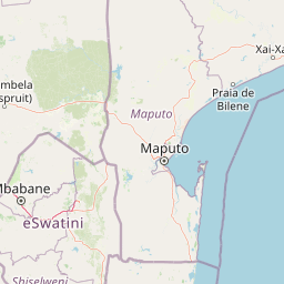
Map view of Sabi Sand Game Reserve

Use this park location map to pinpoint Sabi Sand Game Reserve in South Africa, understand its exact geographic position, and read its mapped placement within the surrounding landscape more clearly.

Pigeon | © OpenStreetMap contributors

Location context for Sabi Sand Game Reserve

Mpumalanga

Visual reference of Lowveld bushveld, riverine habitats, and wildlife environments

Sabi Sand Game Reserve Photos, Landscapes, and Protected Area Scenery

Visual records capture the low undulating bushveld, granite outcrops, and riverine corridors defining Sabi Sand Game Reserve. Photographic documentation reveals the terrain, vegetation patterns, and protected habitats shaping this famous South African conservation landscape.

A spotted African leopard walks directly toward the camera along a dry, dusty dirt path bordered by dry grasses.

A large male lion with a full mane and a younger lion cub feeding on the remains of a large animal in a grassy savanna environment.

Park atlas

Compare adjacent Lowveld wildlife reserves and regional conservation areas

Other Parks Near Sabi Sand Game Reserve and Connected Protected Landscapes

Browsing other parks near Sabi Sand Game Reserve allows conservation researchers and wildlife observers to evaluate connected Lowveld habitats and contiguous savanna ecosystems. Extending the geographic review beyond individual concessions provides a clearer perspective on regional protected landscapes and shared wildlife migration corridors across South Africa.
National parkSouth Africa
About 6 km away#1 closest

North

Kruger National Park: South Africa's Iconic National Park for Geographic Discovery

Explore savanna landscapes and mapped protected area boundaries.

Kruger National Park serves as a paramount example of a protected landscape, offering a rich tapestry of savanna ecosystems and varied terrain across South Africa's Lowveld. This canonical entry details its vast geographic scope, approximately 19,623 square kilometres, and its status as the nation's first national park. Understand the park's environmental context, from the Lebombo Mountains to the Limpopo River, and its integral role within larger transfrontier conservation initiatives, providing critical insight for atlas-based geographic exploration.

Area
19,623 km²
Established
1926
IUCN
II
Visitors
1.7M annual
Wildlife reserveMpumalanga
About 22 km away#2 closest

Northwest

Manyeleti Game Reserve: Protected Area Boundaries and Lowveld Landscape Mapping

Ecological connectivity within the Mpumalanga conservation mosaic.

Manyeleti Game Reserve offers significant insights into the Lowveld landscape of Mpumalanga. Known for its unfenced connection to neighboring wildlife areas, the reserve provides a case study in contiguous protected land management and bushveld geography that sustains large mammal populations across regional boundaries.

Area
227.5 km²
Established
1967
Water
Minor water
Season
Year-round
Wildlife reserveLimpopo
About 48 km away#3 closest

Northwest

Thornybush Game Reserve: A Protected Wildlife Landscape in Limpopo, South Africa

Mapped savanna corridors and riverine ecological zones

Located in the Limpopo province of South Africa, Thornybush Game Reserve is an essential private wildlife area known for its open savanna and rich riparian vegetation. By maintaining an unfenced boundary with the neighboring national park, it acts as a critical extension of the Greater Kruger wilderness. This entry details its geographical scope, terrain features, and its function as a managed, integrated component of the regional conservation landscape.

Area
140 km²
Water
Minor water
Nature reserveMpumalanga
About 55 km away#4 closest

North

Timbavati Private Nature Reserve: Protected Landscape and Regional Map Overview

Savanna bushveld geography in Mpumalanga, South Africa

Spanning over 534 square kilometres, Timbavati Private Nature Reserve provides a crucial habitat mosaic within the Mpumalanga region. The area is defined by its pioneering unfenced conservation model, linking private land with the Greater Kruger National Park to protect a broad spectrum of woodland habitats and diverse savanna ecosystems.

Area
534 km²
Established
1956
Relief
Upland
Climate
Subtropical
Wildlife reserveLimpopo
About 64 km away#5 closest

Northwest

Kapama Game Reserve: Geographic Atlas and Protected Landscape Map of Limpopo

Explore the diverse terrain and riverine ecosystems of this South African wildlife reserve

Kapama Game Reserve sits within the Limpopo Lowveld, featuring a complex mix of open savanna, mixed bushveld, and dense riverine corridors shaped by the Blyde River. This record provides a detailed look at the reserve as a functional piece of the greater regional conservation landscape, highlighting its topography and its role in protecting South Africa's native habitat.

Area
130 km²
Established
1993
Scope
Terrestrial
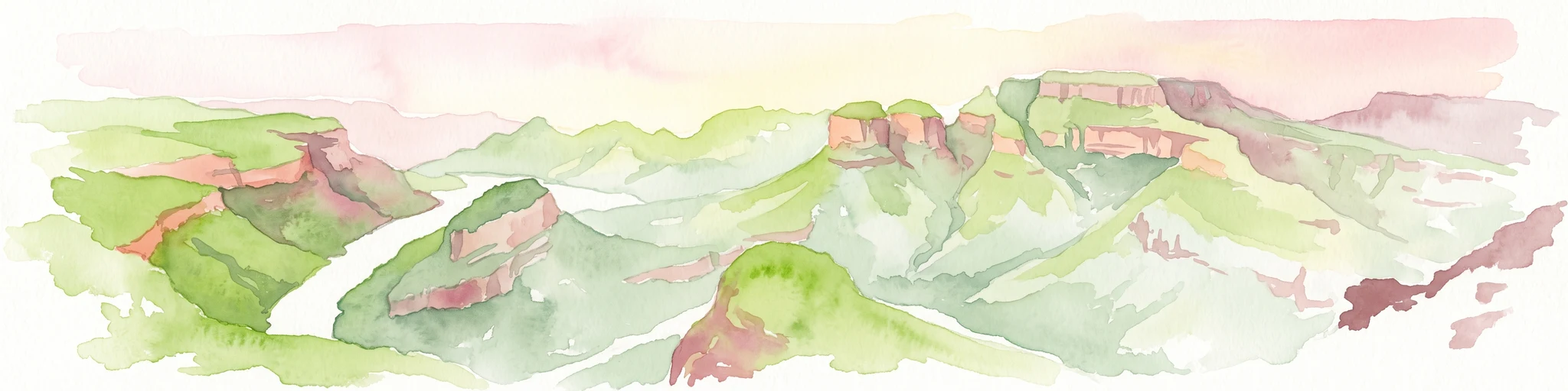
A horizontal watercolor painting depicting the Blyde River Canyon with green slopes, reddish cliff faces, and a winding river.
Nature reserveMpumalanga
About 76 km away#6 closest

West

Blyde River Canyon Nature Reserve: Escarpment Geography and Protected Landscape Map

Mapping river-carved canyons and plateau ecosystems in Mpumalanga

Blyde River Canyon Nature Reserve protects a vast stretch of the Mpumalanga Drakensberg, characterized by vertical cliffs, rocky massifs, and deep river gorges. This atlas-focused resource highlights the reserve's geological landmarks, including the Three Rondavels and Bourke's Luck Potholes, offering a clear view of the complex terrain and protected natural boundaries defining this northeastern South African landscape.

Area
290 km²
Established
1965
Relief
Mountain
Climate
Subtropical
Nature reserveLimpopo
About 92 km away#7 closest

Northwest

Balule Nature Reserve: Mapping the Protected Lowveld Savannah and Olifants River Corridor

An open-system wilderness integral to the Greater Kruger ecological network.

Explore the geographic identity of Balule Nature Reserve, a vast protected area in South Africa characterized by its integration with the Greater Kruger wilderness. The terrain encompasses a rich mix of mopane-dominated woodland, riverine forest along the Olifants River, and open subtropical bushveld that supports significant wildlife migrations.

Area
400 km²
Relief
Lowland
Climate
Subtropical
Access
Moderate access
A soft watercolor illustration showing rolling green hills with sparse native vegetation, set against a pale, warm-toned horizon.
Biosphere reserveLimpopo
About 92 km away#8 closest

Northwest

Kruger to Canyons Biosphere: An Atlas of Protected Lands and Geographic Diversity in Limpopo

Integrated conservation across savanna, canyon, and montane ecosystems

Covering the stretch between the Letaba and Sabie Rivers, this biosphere reserve serves as a vital conservation landscape in South Africa. Its unique geography captures the transition from rugged escarpment cliffs to open bushveld, showcasing a high density of protected land and biodiversity. Use this map-oriented resource to understand the structural role of the biosphere as a model for landscape-scale environmental management and its geographic placement within the Limpopo province.

Area
28,748.1 km²
Established
2001
Relief
Mixed relief
Access
Access unknown

Common questions about visiting, size, designation, and location context for Sabi Sand Game Reserve

Sabi Sand Game Reserve FAQs for park facts, access, geography, and protected area context

Find quick answers about Sabi Sand Game Reserve, including protected-area facts, park geography, trail and visitor context, and how the park fits into its surrounding country and regional landscape.
MoriAtlas Explorer

Continue Your Protected Areas Search Across the Global Atlas

Deepen your exploration by continuing the structured search for national parks and protected areas worldwide. Utilize the comprehensive filtering capabilities to compare different conservation landscapes and refine your understanding of global park geography. Discover more about the distribution and characteristics of protected natural areas.

Global natural geography