Mori Atlas logo
Nature reserveSalmonsdam Nature Reserve

Understanding the mountain fynbos, river systems, and geological features of this protected Overberg valley.

Salmonsdam Nature Reserve: Mapped Protected Landscapes and Geography in the Western Cape

Salmonsdam Nature Reserve protects a diverse mountain catchment in the Overberg region, offering a compressed landscape transition from rocky Akkedisberg ridges to the marshy flats of Die Weivlakte. The reserve maintains a vital mosaic of Afromontane forest and mountain fynbos, defined by the steep gorge of Keeromskloof and the cascading waters of the Paardensberg River. This protected area remains a significant geological study of the Western Cape, featuring notable cave systems and interconnected river valley terrain.

nature reserveOverbergWestern CapeCapeNaturemountain fynbosAfromontane forest

Salmonsdam Nature Reserve

Nature reserve

Park overview

Structured park overview, official facts, and landscape profile for Salmonsdam Nature Reserve

Salmonsdam Nature Reserve park facts, protected area profile, and essential visitor context

Review the core facts for Salmonsdam Nature Reserve, including designation, size, terrain, visitor scale, habitats, and operating context in one park-focused overview.

About Salmonsdam Nature Reserve

Salmonsdam Nature Reserve sits in the Overberg region of the Western Cape, between the Whale Coast lowlands and the inland Cape fold mountains. Although small by national standards, the reserve captures a complete mountain catchment, from the headwaters of the Paardensberg River in the rugged northeast to the marshy valley lowlands in the southwest. This compactness, combined with topographic diversity, is central to what makes Salmonsdam distinctive among CapeNature's reserves.

The gorge of Keeromskloof defines the upper park. From here the river descends through the steeply folded terrain of the Akkedisberg mountains, gathering small tributaries including the Watervalkloof stream, which drops over a series of steps known as the Zigzag Falls. Lower in the valley, the river slows and spreads into Die Weivlakte, a soft, marshy plain that gives the reserve much of its ecological contrast. The highest point lies near the northeastern corner, where a radio mast sits on terrain reaching about 637 meters above sea level, while the rounded Perdeberg peak on the northern edge forms a recognizable ridge line.

Ecologically, Salmonsdam protects a transition between mountain fynbos on the exposed slopes and patches of Afromontane forest in the sheltered, moister valleys and gorges. Riverine thicket and wetland vegetation fringe the Paardensberg River, creating a layered landscape of rocky ridges, forested kloofs, waterfalls, and valley mires. The reserve's location about 150 kilometers from Cape Town puts it in a region known for its mixture of farming, coastal tourism, and protected natural landscapes.

As a CapeNature reserve, Salmonsdam also has cultural and local-historical associations. Local tradition holds that its name refers to Robert Salmond, the captain of HMS Birkenhead, lost along the nearby coast in 1852. While the reserve's main draw is the natural landscape, this connection to regional maritime and settler history adds another layer to its identity within the Overberg.

Quick facts and research context for Salmonsdam Nature Reserve

Salmonsdam Nature Reserve is a CapeNature-managed protected area in the Overberg region of the Western Cape, South Africa. It encompasses the catchment area of the Paardensberg River within the Akkedisberg mountains.

Established as a nature reserve in 1962 by the former Cape Provincial Administration, Salmonsdam covers approximately 834 hectares and lies roughly 20 kilometers east of Stanford. Its terrain ranges from a gorge called Keeromskloof down through forested slopes and small waterfalls to a marshy lowland known as Die Weivlakte, with caves such as Elandskrans and Leopard Cave marking its eastern side.

Protection and recognition

Documented protection history, management scope, and official designation metrics

Salmonsdam Nature Reserve Protection Status and Terrestrial Conservation Scope

Salmonsdam Nature Reserve maintains a defined terrestrial protection scope within the regional conservation network. Documented status metrics and management records provide verified baseline facts for this protected landscape.

Protection details

Protection scope
Terrestrial
Transboundary protection
No
Park context

Deeper park guide and search-rich context for Salmonsdam Nature Reserve

Salmonsdam Nature Reserve history, landscape, wildlife, and travel context

Explore Salmonsdam Nature Reserve through its history, landscape character, ecosystems, wildlife, conservation priorities, cultural context, and seasonal travel timing in a structured park guide built for atlas discovery and search intent.

Why Salmonsdam Nature Reserve stands out

Salmonsdam is best known for the scenic valley of the Paardensberg River, which descends from the gorge of Keeromskloof through a series of small waterfalls (the Zigzag Falls) into the marshy lowland known as Die Weivlakte. The reserve is a recognized example of the Overberg's mountain fynbos and Afromontane forest mosaic, set within a relatively undisturbed river catchment. It is also appreciated for its accessible cave systems, including Elandskrans Caves and Leopard Cave, and for combining a wide variety of habitats, from rocky ridges and gorges to forested riverbanks and wetland flats, within a compact protected area.

Salmonsdam Nature Reserve history and protected-area timeline

Salmonsdam was formally declared a nature reserve in 1962 by the Cape Provincial Administration, the regional authority responsible for conservation in what was then the Cape Province. This placed the valley of the Paardensberg River under formal protection and laid the basis for its later management.

After the restructuring of provincial conservation bodies in the early post-apartheid era, oversight of the reserve passed to CapeNature, the public institution now responsible for protected-area management across the Western Cape. CapeNature continues to administer Salmonsdam, integrating it into its broader network of smaller reserves that protect representative fynbos, forest, and riverine habitats in the Overberg.

The reserve's name itself carries a layer of local history. According to tradition, Salmonsdam was named for Robert Salmond, captain of HMS Birkenhead, which sank off the nearby coast at Gansbaai in 1852 in one of the most famous shipwrecks of the colonial era. Although the precise origin of the name is part of local lore rather than fully documented, the association has endured in regional storytelling and gives the place a strong human-historical resonance alongside its natural significance.

Salmonsdam Nature Reserve landscape and geographic character

Salmonsdam's landscape is defined by the Akkedisberg mountains and the river valley they enclose. The terrain follows the Paardensberg River from a narrow upper gorge, through a strongly dissected middle section, down to a broader wetland plain. This vertical and ecological compression, from rocky summit ridges to marshy flats within just a few kilometers, is one of the reserve's defining features.

The upper reserve is dominated by Keeromskloof, a steep gorge where the river begins its descent. From here the valley widens as tributaries enter, including the Watervalkloof stream, which drops over a sequence of small cascades known collectively as the Zigzag Falls. These water features give the reserve much of its scenic character and create the moist microclimates that support patches of Afromontane forest.

Lower down, the river slows and spreads into Die Weivlakte, a marshy area of wet soils, sedge-like vegetation, and seasonal softness that contrasts sharply with the rocky upper slopes. On the eastern side of Keeromskloof, the cliffs host the entrances to the Elandskrans Caves and Leopard Cave, adding a karst-like dimension to the surrounding mountain scenery. The highest point in the park sits at the base of a radio mast at about 637 meters above sea level, near the rounded Perdeberg peak just below on the northern boundary.

Salmonsdam Nature Reserve ecosystems, habitats, and plant life

Salmonsdam protects a string of contrasting habitats along a single river catchment. The exposed upper slopes and ridges carry Cape mountain fynbos typical of the Overberg's inland ranges, with their characteristic mix of low shrubs, restios, and hardy mountain flora adapted to wind, sun, and thin soils.

In the sheltered kloofs and gorges, especially around Keeromskloof and the Watervalkloof stream corridor, microclimates are cooler and moister. These conditions support patches of Afromontane forest and thicket, where evergreen trees, tree ferns, and lianas create a markedly different vegetation world than on the open slopes above. The transition between these forest patches and the surrounding fynbos is one of the ecological highlights of the reserve.

Along the Paardensberg River and particularly in Die Weivlakte, riverine and wetland vegetation takes over, with sedges, reeds, and water-loving plants forming a marshy ribbon through the valley. This riparian corridor connects the upper catchment to the broader Overberg landscape, and supports wetland-dependent birds, insects, and small mammals. Combined, these habitats give Salmonsdam an unusually rich ecological palette for its size.

Salmonsdam Nature Reserve wildlife and species highlights

Salmonsdam's wildlife is shaped by the meeting of fynbos, forest, and wetland habitats within a compact catchment. The fynbos slopes support small mammals and birds adapted to low shrub cover, while the forested kloofs around Keeromskloof and Watervalkloof provide shelter for more shade-dependent species, including birds and arboreal mammals drawn to the moister microclimates.

The reserve's abundance of rocky cliffs and caves, including Leopard Cave and the Elandskrans Caves, also creates habitat for cave-associated species and bats, as well as cover for mammals such as leopard that historically ranged through these mountains. The Wetland of Die Weivlakte and the broader river corridor are particularly important for waterbirds and a range of smaller wetland species, as well as amphibians tied to the moist valley conditions.

The reserve's combination of fynbos, forest patches, cliffs, caves, and marshland gives it a layered wildlife profile typical of the Cape fold mountains, where species turnover across small distances is high and habitat heterogeneity drives biodiversity.

Salmonsdam Nature Reserve conservation status and protection priorities

Salmonsdam is primarily valued for the protection of an intact mountain catchment in the Overberg. By safeguarding the upper valley, gorge, and lower marshlands of the Paardensberg River under CapeNature management, the reserve helps secure both biodiversity and the hydrological function of this section of the Akkedisberg mountains. Catchment protection of this kind is increasingly important in the Western Cape, where mountain fynbos, Afromontane forest fragments, and freshwater wetlands are all under pressure from climate change, invasives, and land-use change.

The reserve also contributes to broader conservation networks in the region. Its fynbos slopes link ecologically with surrounding mountain landscapes, while its forest patches and the Die Weivlakte wetland act as stepping stones and refuges for species that depend on these habitat types. The protected status of Salmonsdam ensures that these natural patterns remain connected rather than fragmented, and that invasive species and other management concerns can be addressed through coordinated CapeNature programs.

Cultural and historical conservation values are also present. The reserve's name, its standing caves such as Elandskrans, and its association with regional maritime history give Salmonsdam an additional dimension beyond purely ecological protection.

Salmonsdam Nature Reserve cultural meaning and human context

Salmonsdam carries a notable layer of cultural memory tied to the maritime history of the Western Cape's Whale Coast. Local tradition links the reserve's name to Robert Salmond, captain of HMS Birkenhead, lost with many of his crew at Gansbaai in 1852. While the precise origin of the name is part of regional folklore, the story has become part of how the place is understood locally.

The reserve also has a broader Overberg cultural context. The surrounding region has long been shaped by farming and small rural towns such as Stanford, with Salmonsdam sitting at the interface between agricultural lowlands and protected mountain landscape. The caves of Elandskrans and Leopard Cave also carry cultural weight as features of the local terrain, known to generations of Overberg residents and visitors for their presence and their evocative names.

Today, Salmonsdam functions as both a natural refuge and a small but meaningful cultural landmark in the local landscape, where the memory of historic shipwrecks, the rural Overberg way of life, and the wild character of the Akkedisberg mountains come together in a single protected valley.

Top sights and standout views in Salmonsdam Nature Reserve

Compact CapeNature reserve protecting the full catchment of the Paardensberg River in the Akkedisberg mountains, set in the Overberg about 20 kilometers east of Stanford.

Standout features include the steep gorge of Keeromskloof, the stepped Zigzag Falls along the Watervalkloof stream, the marshy valley of Die Weivlakte, and the caves of Elandskrans and Leopard Cave on the eastern cliffs. Together, these elements produce a varied landscape where fynbos ridges, Afromontane forest patches, and wetland habitat all coexist within a protected Western Cape valley.

Best time to visit Salmonsdam Nature Reserve

The Western Cape's mediterranean climate means that late spring and early summer typically bring the richest fynbos displays on Salmonsdam's open slopes, with cooler conditions favorable to hiking the gorge and waterfall trails.

Autumn and winter are wetter, which keeps the Afromontane forest patches in Keeromskloof and around Watervalkloof looking lush and the Zigzag Falls flowing strongly, though trails can be muddy and weather more changeable. Summer visits are warm and dry, with marshland lowlands of Die Weivlakte reduced to a calmer wetland, and longer daylight hours for exploring the higher parts of the reserve.
Monthly climate preview

Long-term monthly temperature and precipitation patterns across the reserve

Salmonsdam Nature Reserve Climate Normals and Annual Temperature Rhythm

Representative coordinate records show measured monthly averages ranging from cooler mid-year minimums to warmer summer maximums alongside consistent precipitation rhythms. Reviewing the complete twelve-month profile provides deeper analytical insight into long-term climate normals across the protected landscape.
Annual mean17 °C
13 °C21 °C
Jan21°
Feb21°
Mar20°
Apr17°
May16°
Jun14°
Jul13°
Aug13°
Sep14°
Oct16°
Nov18°
Dec20°
Warmest month
February

20.9 °C

Coolest month
July

12.9 °C

Wettest month
July

2 mm/day

Driest month
February

0.8 mm/day

Park location guide

Geography guide, regional context, and park location map for Salmonsdam Nature Reserve

Salmonsdam Nature Reserve park geography, regions, and map view in South Africa

Understand where Salmonsdam Nature Reserve sits in South Africa through a broader geographic reading of the surrounding landscape, nearby location context, and its mapped position within the national park landscape.

How Salmonsdam Nature Reserve fits into South Africa

South Africa is the southernmost country in Africa, spanning 1.22 million km² with a population of over 63 million. The country operates with three capital cities, Pretoria (executive), Cape Town (legislative), and Bloemfontein (judicial), and is renowned for its biodiversity, national parks, and multicultural society.

Wider geography shaping Salmonsdam Nature Reserve in South Africa

South Africa occupies the southernmost region of Africa, with coastline along both the Atlantic Ocean to the west and the Indian Ocean to the east. The interior features elevated plateaus including the Highveld, with the Drakensberg escarpment marking the eastern highlands. The country shares borders with Namibia, Botswana, Zimbabwe, Mozambique, Eswatini, and Lesotho.

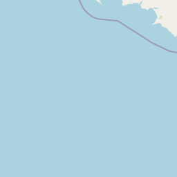
Map view of Salmonsdam Nature Reserve

Use this park location map to pinpoint Salmonsdam Nature Reserve in South Africa, understand its exact geographic position, and read its mapped placement within the surrounding landscape more clearly.

Pigeon | © OpenStreetMap contributors

Location context for Salmonsdam Nature Reserve

OverbergWestern Cape
Park atlas

Compare regional mountain fynbos reserves and neighboring Western Cape conservation areas

Explore Parks Near Salmonsdam Nature Reserve and Surrounding Protected Landscapes

Visitors exploring Salmonsdam Nature Reserve can browse adjacent protected areas across the Overberg region to compare neighboring mountain catchments and forest habitats. Extending the geographic review reveals broader regional conservation networks and related wilderness terrain throughout the surrounding mountain zones.
National parkWestern Cape
About 24 km away#1 closest

Southeast

Agulhas National Park: National Park Protected Landscape and Geographic Atlas

Mapped boundaries and regional geography in Western Cape.

Agulhas National Park is a protected national park in South Africa's Western Cape, vital for understanding regional geography and mapped landscape features. This entry focuses on its identity as a conservation area, detailing its protected landscape context and geographic setting within the broader atlas of Southern Africa. Explore the specific park boundaries and the unique terrain that defines this significant natural area.

Area
209.59 km²
Established
1998
IUCN
II
Relief
Lowland
A horizontal watercolor illustration depicting soft green rolling hills in the background, a line of light green trees in the midground, and foreground vegetation with tall reeds near a calm pinkish water channel.
Nature reserveWestern Cape
About 34 km away#2 closest

Southwest

Dyer Island Nature Reserve Complex: Protected Marine Islands and Coastal Ecosystems

A critical conservation node in the Western Cape

The Dyer Island Nature Reserve Complex encompasses a series of low lying, wind-swept rocky islets that function as a cornerstone for South African marine research. By preserving the crucial breeding grounds of African penguins and providing a hub for the Cape fur seal population, this reserve defines a unique stretch of the Western Cape marine geography where high concentrations of predators and prey interact.

Established
1988
IUCN
Ia
Water
Water-dominated
A watercolor illustration of a wide landscape featuring a calm body of water in the foreground, rolling green hills, and purple-toned mountains in the background.
Nature reserveWestern Cape
About 69 km away#3 closest

West

Kogelberg Nature Reserve: Protected Mountain Geography in the Western Cape, South Africa

Coastal mountain fynbos and protected river ecosystems

Situated in the Western Cape of South Africa, Kogelberg Nature Reserve protects an exceptional concentration of fynbos vegetation and rugged sandstone terrain. The area spans coastal mountain ridges, riparian corridors, and forest-filled ravines, serving as a landmark for botanical diversity and protected-landscape mapping in the region.

Area
30 km²
Relief
Mountain
Scope
Terrestrial
Water
Major water bodies
National parkWestern Cape
About 81 km away#4 closest

Northeast

Bontebok National Park: A Unique Protected Landscape in South Africa's Western Cape

Mapping the endemic bontebok's habitat and diverse fynbos.

Bontebok National Park represents a singular achievement in conservation, dedicated to protecting the rare bontebok antelope and showcasing the extraordinary biodiversity of the Cape Floristic Region. Located in the Western Cape, this smallest of South Africa's national parks features a landscape of fynbos-covered foothills beneath the Langeberg Mountains, with the Breede River defining its southern edge. Explore its mapped boundaries and unique ecosystems, offering a concentrated natural discovery experience within a UNESCO World Heritage Site.

Area
27.86 km²
Established
1931
IUCN
II
Relief
Mixed relief
Watercolor painting of a mountain landscape with green foreground hills and soft purple mountain ranges in the background.
Nature reserveWestern Cape
About 82 km away#5 closest

Northwest

Jonkershoek Nature Reserve: A Detailed Atlas of Mountain Catchment and Fynbos Ecology

Protected mountain geography near Stellenbosch, Western Cape

Jonkershoek Nature Reserve serves as a primary water source for the surrounding Western Cape landscape. This profile outlines the reserve's role in the Cape Floral Region, detailing its complex mountain topography, river headwaters, and significant fynbos plant communities that characterize the terrain.

Area
110 km²
Relief
Mountain
Climate
Mediterranean
Access
Easy access
Biosphere reserveWestern Cape
About 95 km away#6 closest

Northwest

Cape Winelands Biosphere Reserve: Geographic Overview and Protected Area Mapping

Western Cape mountain terrain and sustainable landscape integration

The Cape Winelands Biosphere Reserve serves as a model for integrated landscape management in South Africa. Situated along the Cape Fold Belt, this reserve protects crucial water catchments and endemic floral habitats while encompassing a globally recognized wine-producing region. Access detailed mapping of its core, buffer, and transition zones to see how conservation persists within a working agricultural environment.

Area
1,243.4 km²
Established
2007
Relief
Mountain
Climate
Mediterranean
National parkWestern Cape
About 105 km away#7 closest

Northwest

Table Mountain National Park: Mapped Protected Landscape and Geographic Context in Western Cape

National Park details focused on atlas exploration and regional geography.

Table Mountain National Park is a designated national park within the Western Cape region, offering a distinct geographic profile for atlas exploration. This entity provides detailed mapped boundaries and landscape context, crucial for understanding its role as a protected area in South Africa. Users can explore the specific geography that defines this park and its place within the broader regional context, making it a key point of interest for structured geographic discovery and map-based research.

Area
221 km²
Established
1998
Relief
Mountain
Climate
Mediterranean
Nature reserveCape Town
About 114 km away#8 closest

Northwest

Tygerberg Nature Reserve: Geographic Mapping of a Cape Town Protected Landscape

Renosterveld shale ridges and urban conservation context

Tygerberg Nature Reserve stands as a compact, high-value protected area within Cape Town, safeguarding hundreds of plant species and threatened Renosterveld habitats. The park landscape features a recognizable chain of shale hills punctuated by historic termite mounds known as heuweltjies, offering a window into the regional ecology and natural history of the Western Cape.

Area
3 km²
Established
1973
Relief
Upland
Climate
Mediterranean

Common questions about visiting, size, designation, and location context for Salmonsdam Nature Reserve

Salmonsdam Nature Reserve FAQs for park facts, access, geography, and protected area context

Find quick answers about Salmonsdam Nature Reserve, including protected-area facts, park geography, trail and visitor context, and how the park fits into its surrounding country and regional landscape.
MoriAtlas Explorer

Continue Your Protected Areas Search Across the Global Atlas

Deepen your exploration by continuing the structured search for national parks and protected areas worldwide. Utilize the comprehensive filtering capabilities to compare different conservation landscapes and refine your understanding of global park geography. Discover more about the distribution and characteristics of protected natural areas.

Global natural geography