
Mori Atlas logo
Nature reserveSaubach und Niedgesbach bei Schmitten

Examining the ecological value of stream valleys and historic meadowlands in the Hochtaunuskreis.

Saubach und Niedgesbach bei Schmitten Nature Reserve: A High Taunus Protected Landscape

(Naturschutzgebiet Saubach und Niedgesbach bei Schmitten)

Saubach und Niedgesbach bei Schmitten comprises 58 hectares of protected upland valley terrain within the Hochtaunuskreis district of Hesse, Germany. This nature reserve provides a critical map reference for those studying the intersection of High Taunus stream ecosystems and traditional cultural landscapes. By preserving the habitat along the Saubach and Niedgesbach watercourses, the area maintains a distinct segment of the regional geography shaped by post-war land use transitions.

nature reserveHigh Taunusstream valleymeadowlandcultural landscapeabandoned pasture
A flat-design illustration showing a verdant green valley with a river, forested hills, and a sunrise, reminiscent of the landscape in the Saubach und Niedgesbach nature reserve.

Saubach und Niedgesbach bei Schmitten

Nature reserve

Park overview

Structured park overview, official facts, and landscape profile for Saubach und Niedgesbach bei Schmitten

Saubach und Niedgesbach bei Schmitten park facts, protected area profile, and essential visitor context

Review the core facts for Saubach und Niedgesbach bei Schmitten, including designation, size, terrain, visitor scale, habitats, and operating context in one park-focused overview.

About Saubach und Niedgesbach bei Schmitten

Saubach und Niedgesbach bei Schmitten is a compact High Taunus nature reserve focused on two parallel small valleys running west from Schmitten im Taunus. Its protected landscape is defined by the woodland meadows and stream corridors of the Saubach and the Niedgesbach, set within the broader network of low mountains that lie north of Frankfurt am Main. The reserve sits between the localities of Seelenberg and Finsternthal, locations that themselves belong to the traditional rural character of the Hochtaunuskreis.

The reserve covers about 58 hectares and is notable for the unusually rich plant diversity that developed along the two valleys. The reserve's elevated position, combined with the relatively harsh upland climate of the High Taunus, historically restricted land use here to pasture. As in other parts of the Taunus, traditional meadowland shaped by generations of grazing slowly gave way to new vegetation patterns once agricultural use declined in the second half of the twentieth century. The reserve was created specifically to safeguard this transition landscape before further natural change altered its character.

Because the reserve is small and embedded in a broader rural landscape, its significance is as much about cultural landscape dynamics as about biodiversity. The 1995 designation came with restrictions, including a prohibition on pasturing animals within the reserve, and stirred meaningful local debate. The site illustrates how even modest valley landscapes can carry strong ecological, historical, and community importance when viewed alongside the broader High Taunus protected-area network.

Quick facts and research context for Saubach und Niedgesbach bei Schmitten

Saubach und Niedgesbach bei Schmitten is a designated nature reserve (Naturschutzgebiet) in the municipality of Schmitten im Taunus, in the Hochtaunuskreis district of Hesse in central Germany. It was formally placed under protection on 30 November 1995, covering approximately 58 hectares of land west of Schmitten. The reserve protects the wooded meadow-valley systems of two small High Taunus streams, the Saubach and the Niedgesbach, between the village districts of Seelenberg and Finsternthal. Its designation was contested at the time by local residents and farmers concerned about restrictions on grazing.

Protection and recognition

Examine documented protected area designation data and registry details

Saubach und Niedgesbach bei Schmitten Protection Status and Records

Registry records compile official protection status metrics and administrative designations for Saubach und Niedgesbach bei Schmitten. Structured database entries provide verifiable conservation context and reference identifiers for natural area research.

Protection details

WDPA ID
165327
Park context

Deeper park guide and search-rich context for Saubach und Niedgesbach bei Schmitten

Saubach und Niedgesbach bei Schmitten history, landscape, wildlife, and travel context

Explore Saubach und Niedgesbach bei Schmitten through its history, landscape character, ecosystems, wildlife, conservation priorities, cultural context, and seasonal travel timing in a structured park guide built for atlas discovery and search intent.

Why Saubach und Niedgesbach bei Schmitten stands out

The reserve is best known for protecting a pair of small upland stream valleys that developed a particularly noteworthy plant diversity after their traditional use as pasture land was abandoned in the post-war era. It is also known as a notable local case study in the debate between formal nature protection and the continuation of traditional cultural landscapes in the High Taunus.
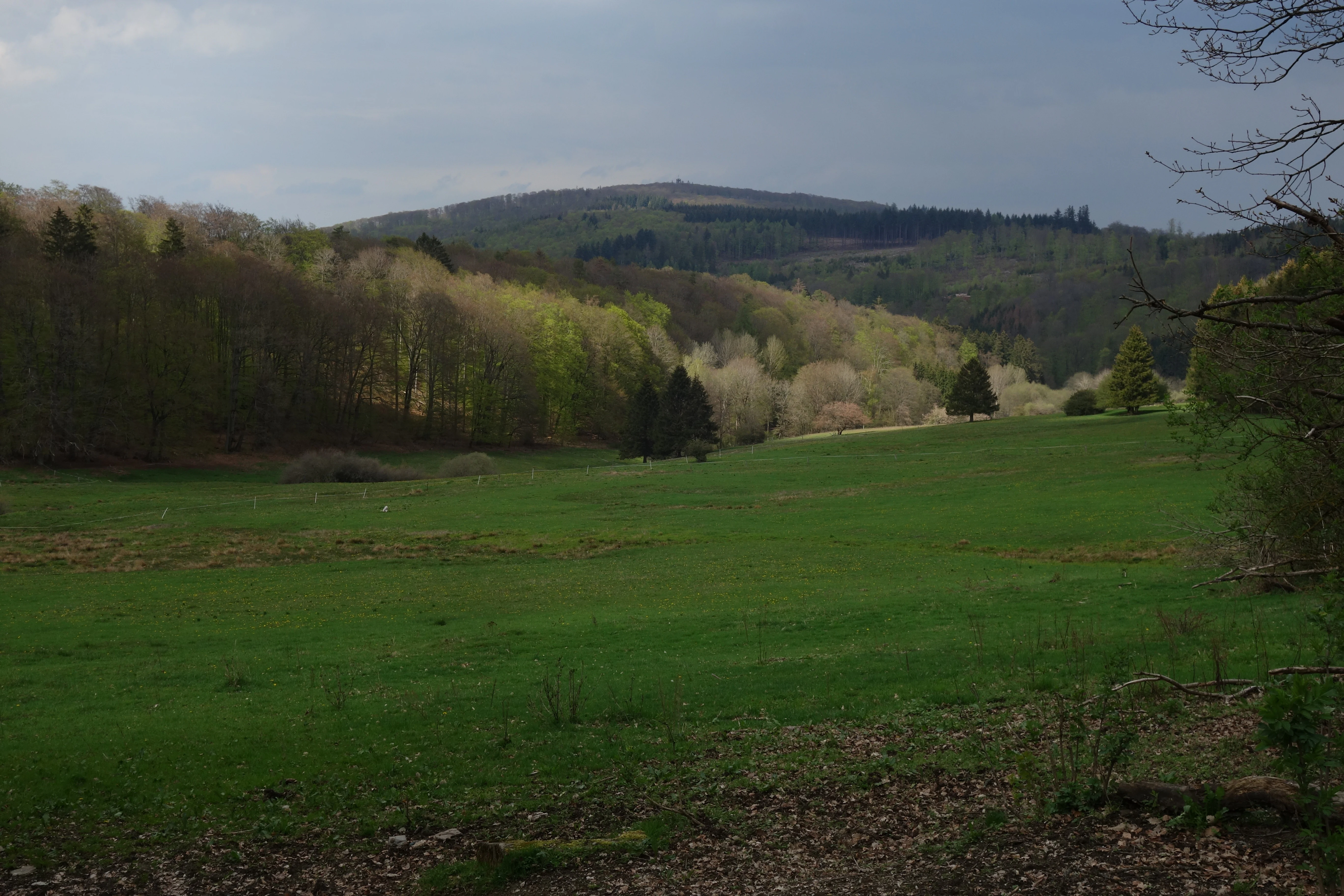
A wide landscape view of a green meadow valley surrounded by deciduous forest and rolling hills under an overcast sky.
A scenic view over the meadow valleys of the Saubach and Niedgesbach nature reserve toward the forested hills.

Saubach und Niedgesbach bei Schmitten history and protected-area timeline

The protected area at Saubach und Niedgesbach bei Schmitten was formally established on 30 November 1995, when the regional ordinance dated 30 November 1995 brought roughly 58 hectares of stream-valley landscape around the Saubach and Niedgesbach under nature reserve status. The decision followed years of change in how the high-elevation meadows in these valleys were used.

Historically the area was primarily suited for grazing rather than crop farming, due to its altitude in the High Taunus. Similar patterns shaped comparable sites such as the Reifenberger Wiesen. After the Second World War, mechanization and broader changes in agriculture made extensive pasture management of such high-elevation valleys economically unviable. Many of the meadows were abandoned and gradually colonized by shrubs, which in turn supported a more diverse mix of plants than the cultivated pasture had previously maintained.

Although this ecological shift made the area valuable for protection, it also set up a conflict over traditional land use. Section 3, item 18 of the 1995 ordinance prohibited the grazing of animals within the reserve, a measure that residents and farmers in the affected communities warned would undermine the protected character of the land. Despite interventions by local political figures including the CDU state legislator Brigitte Kölsch, the designation as a Naturschutzgebiet went ahead. Today the site is part of a broader list of nature reserves in the Hochtaunuskreis, alongside neighbours such as the Reifenberger Wiesen and the Schmittröder Wiesen.

Saubach und Niedgesbach bei Schmitten landscape and geographic character

The protected landscape consists of two small, parallel High Taunus stream valleys on the western side of Schmitten, defined by the Saubach and the Niedgesbach. The terrain is shaped by moderately steep valley slopes and a soft valley floor, framed by surrounding hills including the neighbouring Seelenberg and, looking outward, the prominent Pferdskopf with its observation tower. The area sits at a relatively high elevation within the Taunus range, which is reflected in the cool local climate and the predominantly upland character of the meadows that remain.

Saubach und Niedgesbach bei Schmitten ecosystems, habitats, and plant life

Ecologically, the reserve captures a transition between open meadowland, shrubby regrowth, and mixed forest along two small upland streams. The combination of former pasture land that has been left to develop on its own, together with the moist soils of the stream valleys, has produced a notably diverse plant community for an area of this size. Without continued management the open character would be expected to shift further toward forest succession, which is part of what makes the site interesting both ecologically and from a cultural-landscape perspective.

Saubach und Niedgesbach bei Schmitten conservation status and protection priorities

The conservation significance of the reserve lies in safeguarding a small but ecologically rich transition landscape in the High Taunus, where former grazing meadows have developed high plant diversity after agricultural abandonment. Its 1995 designation established formal protection through the regional nature reserve ordinance, including a prohibition on grazing within the boundaries. The site is recorded in international databases such as the World Database on Protected Areas, and forms part of the network of Naturschutzgebiete in the Hochtaunuskreis that collectively protect fragments of traditional Taunus cultural landscape.

Saubach und Niedgesbach bei Schmitten cultural meaning and human context

The reserve has cultural significance as a preserved example of the High Taunus cultural landscape, where the interplay between traditional upland grazing, rural community life, and modern nature conservation has been openly debated. Local residents and farmers in Schmitten and the surrounding villages, including Seelenberg and Finsternthal, expressed concern that ending grazing inside the protected area would erode the very land character that made the place valuable. The reserve therefore stands as a small but insightful chapter in the broader story of how the Taunus foothill communities have negotiated landscape protection in the late twentieth century.

Top sights and standout views in Saubach und Niedgesbach bei Schmitten

A compact 58-hectare protected valley landscape in the High Taunus, capturing both the Saubach and the Niedgesbach stream systems between Seelenberg and Finsternthal west of Schmitten. The site is distinctive for combining high plant diversity in abandoned upland meadows with a sensitive cultural landscape of formerly grazed valley floors. Its 1995 designation also makes it a notable example of how small nature reserves in the Hochtaunuskreis emerged from contested local debates over the future of traditional Taunus agriculture.

Best time to visit Saubach und Niedgesbach bei Schmitten

The reserve is best experienced in late spring through early autumn, when the meadow valleys, stream corridors, and surrounding Taunus hills are most accessible on foot and the plant diversity of the former pasture meadows is most visible. Cooler months can also highlight the wooded character of the slopes and the broader views toward nearby peaks such as the Pferdskopf, though conditions underfoot may be wetter in the stream valleys during this period.

Monthly climate preview

Long term representative monthly temperature and precipitation data for Hochtaunuskreis

Saubach und Niedgesbach bei Schmitten Climate Normals and Temperature Rhythms

Historical climate records for Saubach und Niedgesbach bei Schmitten indicate a steady annual cycle of measured temperatures and precipitation rates from representative coordinate sampling. Detailed monthly profiles provide complete comparative context for researchers analyzing long term environmental conditions across the protected terrain.
Annual mean9 °C
0 °C19 °C
Jan
Feb
Mar
Apr
May12°
Jun16°
Jul19°
Aug18°
Sep14°
Oct
Nov
Dec
Warmest month
July

18.5 °C

Coolest month
January

-0.4 °C

Wettest month
December

2.5 mm/day

Driest month
April

1.6 mm/day

Park location guide

Geography guide, regional context, and park location map for Saubach und Niedgesbach bei Schmitten

Saubach und Niedgesbach bei Schmitten park geography, regions, and map view in Germany

Understand where Saubach und Niedgesbach bei Schmitten sits in Germany through a broader geographic reading of the surrounding landscape, nearby location context, and its mapped position within the national park landscape.

How Saubach und Niedgesbach bei Schmitten fits into Germany

Germany is a federal republic in Western and Central Europe with a population of over 83 million across sixteen constituent states. It is Europe's largest economy by nominal GDP and a major global exporter and importer. The capital is Berlin, and the country borders Denmark, Poland, Czech Republic, Austria, Switzerland, France, Luxembourg, Belgium, and the Netherlands.

Wider geography shaping Saubach und Niedgesbach bei Schmitten in Germany

Germany is located in Western and Central Europe, spanning 357,022 km². It borders Denmark to the north, Poland and the Czech Republic to the east, Austria and Switzerland to the south, and France, Luxembourg, Belgium, and the Netherlands to the west. The country has coastlines on the Baltic Sea and North Sea to the north, with the Alps located in the southern region.

Map view of Saubach und Niedgesbach bei Schmitten

Use this park location map to pinpoint Saubach und Niedgesbach bei Schmitten in Germany, understand its exact geographic position, and read its mapped placement within the surrounding landscape more clearly.

Pigeon | © OpenStreetMap contributors

Location context for Saubach und Niedgesbach bei Schmitten

Hochtaunuskreis

Visual exploration of High Taunus stream valleys, meadowlands, and protected terrain

Saubach und Niedgesbach bei Schmitten Landscape Photos and Scenery

Visual documentation of Saubach und Niedgesbach bei Schmitten reveals the intricate terrain of parallel upland stream valleys and neglected pastoral meadows. Photographic records capture the delicate balance between wooded slopes and traditional cultural landscapes across the High Taunus range.

A wide landscape view of a green meadow valley surrounded by deciduous forest and rolling hills under an overcast sky.

Park atlas

Compare nearby nature reserves and regional stream valleys across the High Taunus hills

Exploring Parks Near Saubach und Niedgesbach bei Schmitten and Surrounding Protected Landscapes

Visitors exploring Saubach und Niedgesbach bei Schmitten can discover other protected areas sharing similar upland valley terrain and cultural heritage. Comparing adjacent nature reserves provides deeper insight into regional conservation networks and woodland meadow ecosystems.
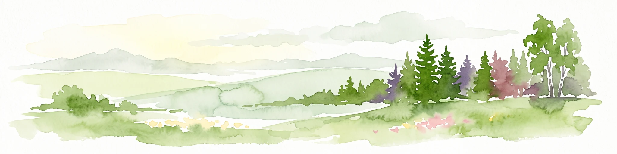
A watercolor painting of a rolling landscape featuring open fields in the foreground, distant hills, and a cluster of pine and deciduous trees on the right side.
Nature reserveHochtaunuskreis
About 4.5 km away#1 closest

Northwest

Riedelbacher Heide Nature Reserve: Geographic Map and Landscape Analysis of the Taunus

A preserved open heathland within the forested Hintertaunus uplands

Riedelbacher Heide offers a focused look at an 8.4 hectare nature reserve located on the high plateau of the eastern Hintertaunus. This area provides valuable insight into the ecological and cultural history of the Taunus, where historical grazing practices shaped a distinctive mosaic of open, sun-exposed vegetation. The reserve serves as a critical example of traditional land management in a predominantly forested low-mountain geography.

Area
0.084 km²
Established
1969
A soft, impressionistic watercolor painting of a meadow with wildflowers in the foreground, rolling hills and trees in the midground, and a faint mountain range in the background.
Nature reserveHochtaunuskreis
About 4.9 km away#2 closest

South

Reifenberger Wiesen Nature Reserve: Geographic Profile and Protected Meadow Boundaries

High Taunus mountain meadows within the Hochtaunuskreis region.

Located in the High Taunus mountains, Reifenberger Wiesen provides a concentrated example of mountain hillside meadows. This nature reserve features specialized nutrient-poor grasslands that host diverse botanical communities, supported by its distinct north-facing slope geography and proximity to the headwaters of the Weil river, forming a critical ecological link in the Hessian landscape.

Area
0.234 km²
Established
1983
A horizontal watercolor painting depicting a gentle stream flowing through a lush meadow with trees and hills in the background.
Nature reserveHessen
About 6.1 km away#3 closest

Northwest

Oberes Dombachtal Nature Reserve: Valley Geography and Protected Landscapes in Hessen

Mapping rare floodplain habitats in the eastern Taunus foothills

Oberes Dombachtal protects a specialized valley system characterized by relict alder woodland, purple moor-grass stands, and near-natural stream segments. Located in the eastern Taunus, the reserve serves as a crucial link for local biodiversity, offering a concentrated look at the valley-floor ecosystems that define this part of the Hessen landscape. Its geography demonstrates the importance of small-scale corridor protection for stream health.

Area
0.187 km²
Established
1995
IUCN
IV
Relief
Upland
A horizontal watercolor painting showing a soft, impressionistic landscape with rolling green hills and patches of forest under a pale, muted sky.
Nature reserveHessen
About 9.9 km away#4 closest

South

Burghain Falkenstein Nature Reserve: Protected Woodland Map and Regional Geography

A forest enclave in the Taunus uplands of Hessen, Germany

Burghain Falkenstein stands as a prominent nature reserve and Natura 2000 site located on the slopes of the Burgberg. This compact protected area features a mosaic of beech and ravine forests, providing a rare green massif amidst the urban sprawl of the Taunus foothills. The reserve documents a complex history where natural woodland succession intersects with medieval fortification remains, offering a concentrated study of regional forest geography near Frankfurt am Main.

Area
0.363 km²
Established
1966
IUCN
IV
Relief
Mountain
A watercolor illustration of a serene valley landscape with a small winding stream running through grassy meadows, bordered by trees in the distance.
Nature reserveHesse
About 10 km away#5 closest

Southwest

Dattenbachtal zwischen Kröftel und Vockenhausen Nature Reserve in Hesse, Germany

Stream valley and protected riparian landscape mapping

This nature reserve protects a vital section of the Dattenbach stream valley between the villages of Kröftel and Vockenhausen. Spanning cross-district boundaries in the Taunus foothills, the site is defined by its two-parcel structure and its role in preserving headwater stream habitats within the larger Hessian landscape.

Area
0.909 km²
Established
1993
Nature reserveHessen
About 11 km away#6 closest

South

Krebsbachtal bei Ruppertshain: Protected Stream Valley and Conservation Geography

Nature reserve and FFH site in the Hessian Taunus

Located in the western foothills of the Taunus, Krebsbachtal bei Ruppertshain is a protected nature reserve and Natura 2000 site. It features a linear valley landscape defined by the Fischbach stream corridor and dense mixed deciduous forest. The reserve plays a crucial role in maintaining regional ecological continuity within the Rhine-Main area, providing a distinct geographic boundary near the Rossert massif.

Area
0.845 km²
Established
1992
IUCN
IV
Relief
Upland
A watercolor illustration of a gentle valley landscape with rolling green hills, scattered trees, and a small stream meandering through the center.
Nature reserveHesse
About 11 km away#7 closest

Northeast

Röllbachtal bei Usingen: A Protected Stream Valley and Nature Reserve in Hesse

Mapping riparian restoration and low mountain valley habitats

Röllbachtal bei Usingen represents a key protected landscape in the Eastern Hintertaunus of Germany. The nature reserve manages a narrow stream corridor characterized by alder and ash riparian forests, wet meadows, and tall herb floodplain vegetation. This area provides a clear view into the successful restoration of valley habitats and the broader network of protected natural spaces across the Hochtaunuskreis region.

Area
0.739 km²
Established
1999
Relief
Upland
Climate
Temperate
A soft watercolor painting depicting rolling green hills and a forested landscape under a pale, sunrise-hued sky.
Nature reserveHessen
About 12 km away#8 closest

South

Rossert - Hainkopf - Dachsbau Nature Reserve: Geography and Protected Taunus Forest Landscapes

A preserved ridge system in the Hessen region of Germany

The Rossert - Hainkopf - Dachsbau nature reserve represents a compact but ecologically vital ridge system in the Taunus foothills. Spanning over 120 hectares of mixed forest, this protected area preserves the transition between woodland and open meadow while securing the headwaters of the Wellbach stream within its geographic boundaries.

Area
1.19 km²
Established
1977
IUCN
IV

Common questions about visiting, size, designation, and location context for Saubach und Niedgesbach bei Schmitten

Saubach und Niedgesbach bei Schmitten FAQs for park facts, access, geography, and protected area context

Find quick answers about Saubach und Niedgesbach bei Schmitten, including protected-area facts, park geography, trail and visitor context, and how the park fits into its surrounding country and regional landscape.
MoriAtlas Explorer

Continue Your Protected Areas Search Across the Global Atlas

Deepen your exploration by continuing the structured search for national parks and protected areas worldwide. Utilize the comprehensive filtering capabilities to compare different conservation landscapes and refine your understanding of global park geography. Discover more about the distribution and characteristics of protected natural areas.

Global natural geography