

Viewpoints
Park geography
Analyzing the physical terrain, regional expanse, and protected natural features
Comprehensive Geographic Profile and Mapped Boundaries of Saxon Switzerland National Park
Saxon Switzerland National Park spans 93.5 square kilometers within the Saxony region of Germany. This geography profile details the physical characteristics of the area, including a maximum elevation of 556 meters, mountain relief, and diverse habitat types such as temperate forests and riverine systems. Explore structured data regarding the regional location, perimeter measurements, and internal peaks.
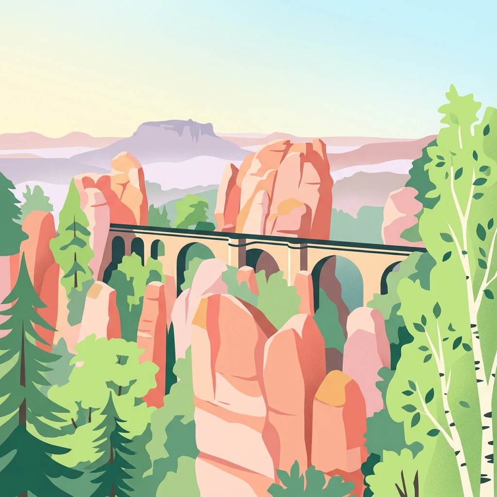
Germany's dramatic sandstone canyon wilderness in the Elbe Sandstone Mountains
Saxon Switzerland National Park
Saxon Switzerland National Park is a protected area in the German state of Saxony, established in 1990 as part of the former East Germany's national park program. The park encompasses 93.5 square kilometers of rugged sandstone terrain in the heart of the Elbe Sandstone Mountains, a landscape characterized by deeply fissured canyons, dramatic cliff formations, and unique rock towers that have made the region famous throughout Central Europe. The park is divided into two geographically separate areas in the Sächsische Schweiz-Osterzgebirge district, with the western section centered around the iconic Bastei rock formation and the eastern region encompassing the Schrammsteine rocks and Großer Winterberg, the park's highest peak at 556 meters. Approximately 40 percent of the park's area is covered in woodland, with the park forming part of a larger 710 square kilometer natural landscape that extends across the border into the Czech Republic as Bohemian Switzerland National Park. The park receives approximately 1.7 million visitors annually and supports significant tourism infrastructure while maintaining its conservation mission.
- Location
- Germany
- Park type
- National park
- Established
- 1990
- Area
- 93.5 km²
- Highest point
- 556 m
Location overview
Regional placement and national classification within Saxony
Geographic Location of Saxon Switzerland National Park in Germany
Saxon Switzerland National Park is situated entirely within the state of Saxony in Germany. Official records detail a terrestrial placement with no marine, coastal, island, or transboundary areas.
- Countries
- Germany
- Regions
- Saxony
- Primary location
- Germany
- Geographic setting
- Inland
Boundary and coordinates
Matching 93.5 km² records with geometry
Saxon Switzerland National Park mapped boundary and land area
Saxon Switzerland National Park is mapped across 93.5 km², matching its recorded land area. The geometry helps readers understand the national park’s footprint without representing official legal limits.
- Boundary area
- 93.8 km²
- Boundary perimeter
- 132.3 km
- Northernmost point
- 50.9971° N
- Southernmost point
- 50.8839° N
- Easternmost point
- 14.4022° E
- Westernmost point
- 14.0185° E
- Geographic centre
- 50.9302° N, 14.2247° E
- North–south span
- 12.6 km
- East–west span
- 27 km
Elevation and terrain
Highland topography, peak measurements, and recorded natural features
Saxon Switzerland National Park Terrain and Elevation Range Geography
Recorded elevation metrics outline highland relief spanning from 110 meters to 556 meters at the highest point. Mapped natural feature cards detail specific peaks, viewpoints, and streams located within the protected boundary.
- Minimum elevation
- 110 m
- Maximum elevation
- 556 m
- Highest point
- 556 m
Selected named natural features
Viewpoints
Felsenburg
Peaks
Bastei
305 m
Peaks
Mittlerer Bussardturm
Viewpoints
Kleine Bastei
Viewpoints
Ferdinandaussicht
Environmental setting
Temperate highland terrain, forest cover, and regional habitat types
Saxon Switzerland National Park Environmental Classification and Physical Setting
Stored landscape features and forest classifications frame the physical setting of Saxon Switzerland National Park as complementary interpretive categories. Recorded environmental attributes connect directly to relevant atlas destinations across the protected region.
- Relief
- Highland
- Climate
- Temperate
- Water
- Minor water
- Forest cover
- Partial forest
- Seasonality
- Year-round
Landscape features
Mountains · Cliffs · Valleys · Forest · Rivers · Lakes · Waterfalls
Habitat types
Temperate broadleaf forest · Temperate coniferous forest · Boreal forest · Riverine habitat · Wetland
Park atlas
Map the surrounding protected areas and compare unique sandstone canyon landscapes with adjacent regional terrain.
Explore Other National Parks and Protected Areas Near Saxon Switzerland National Park
Explore national parks and diverse protected areas located near Saxon Switzerland National Park, tracing the geographic spread of conservation landscapes across the Elbe Sandstone Mountains and surrounding terrain. Compare these regional park entities to gain essential context for understanding the varied geology, ecosystems, and human interaction that define Central European protected area geography.
National parkCzechia
Park boundaries overlap#1 closest
South

Bohemian Switzerland National Park: Czech Sandstone Protected Landscape and Map Exploration
Discover its unique terrain and protected area geography.
Bohemian Switzerland National Park is a protected area in the Czech Republic known for its exceptional sandstone geology. This national park showcases a dramatic landscape of towering rock formations, deep gorges, and striking canyons, forming a significant part of the Elbe Sandstone Mountains. Through MoriAtlas, users can explore its mapped protected boundaries, understand its regional geographic context, and appreciate its unique natural heritage.
- Area
- 79 km²
- Established
- 2000
- IUCN
- II
- Relief
- Mixed relief
Nature reserveSachsen
About 3.3 km away#2 closest
North

Gimpelfang Nature Reserve: Mapped Forest Ecosystems and Protected Terrain in Sachsen
Ancient deciduous stands and brook-valley landscapes.
Gimpelfang is a ten-hectare nature reserve in the Saxon Switzerland district, notable for its mature broadleaf forest that escaped historical spruce planting. The site offers a window into regional ecology with its diverse brook-side ash and alder habitats and strictly protected total-reserve core, providing a dense, research-focused look at native woodland conservation in the German landscape.
- Area
- 0.103 km²
- Established
- 1961
- IUCN
- IV
Natural monumentÚstecký kraj
About 6.2 km away#3 closest
Southeast
Meandry Chřibské Kamenice: Geography of a Bohemian Natural Monument
Protected river meanders and sandstone valley terrain in northern Bohemia
Meandry Chřibské Kamenice serves as a vital protected area in the Czech Republic, specifically preserving the natural river dynamics of the Chřibská Kamenice stream. Its narrow floodplain, characterized by evolving meanders, riparian woodland, and marshy habitats, offers a focused look at how watercourses shape the sandstone landscapes of the Ústecký kraj region.
- Area
- 0.085 km²
- Established
- 1996
- IUCN
- III
- Relief
- Lowland
Natural monumentÚstí nad Labem Region
About 7.1 km away#4 closest
Northeast
Vlčice Natural Monument: Protected Acidophilic Beech Forest in the Ústí nad Labem Region
Mapped upland terrain and old-growth forest conservation
Vlčice represents a highly preserved fragment of old acidophilic beech forest in the northern Czech Republic. Characterized by its granodiorite geology and rolling upland terrain, the site provides a sanctuary for specialized forest species and serves as an important study area for natural woodland development within the broader Ústí nad Labem Region.
- Area
- 0.273 km²
- Established
- 2022
- IUCN
- IV
- Relief
- Upland
Nature reserveSachsen
8.4 km away#5 closest
West
Dresdner Elbtalhänge Nature Reserve: Geography, Mapped Boundaries, and Landscape Context
An essential nature reserve along the Elbe valley in Sachsen
Dresdner Elbtalhänge captures the striking transition between the flat Elbe floodplain and the Westlausitz hill region. This detailed atlas entry covers the reserve's unique geomorphology, including its incised ravine systems, south-facing oak forests, and exposed rock formations that define its protected character within Sachsen.
- Area
- 203.6 km²
- Established
- 2007
- IUCN
- IV
Natural monumentÚstecký kraj
About 9.8 km away#6 closest
Southeast
Sojčí rokle Natural Monument: Atlas and Geography of the Ústecký kraj Sandstone Gorge
A protected ravine sanctuary within the Bohemian Switzerland landscape region.
The Sojčí rokle natural monument features a deep, moist sandstone gorge that sustains a specialized microclimate. Located near Janská in the Ústecký kraj, the site serves as a vital ecological corridor with unique oak-hornbeam forests and rare plant life, representing the intricate rock-carved geography that defines the wider protected landscape of northern Bohemia.
- Area
- 0.035 km²
- Established
- 2016
- IUCN
- IV
- Relief
- Upland
Nature reserveGermany
About 11 km away#7 closest
West
Elbinseln Pillnitz und Gauernitz: A Study in Protected Saxon River Landscapes
Examining floodplain geography and rare river island ecosystems
Located in the Elbe valley between Dresden and Meissen, Elbinseln Pillnitz und Gauernitz preserves the final natural river islands within the state of Saxony. This protected nature reserve anchors a vital network of alluvial soils, riparian woodlands, and unarmored riverbanks, offering a unique perspective on the dynamic floodplain geography of Germany's major river corridors.
- Area
- 0.235 km²
- Established
- 2006
- IUCN
- IV
- Relief
- Lowland

Nature reserveGermany
About 12 km away#8 closest
West
Spargründe bei Dohna: Nature Reserve and Protected Valley Landscapes in Germany
Examining the crystalline ravines and forest ecosystems of the Saxon landscape
Spargründe bei Dohna stands as a distinct nature reserve at the northern margin of the Elbtalschiefergebirge. The site encompasses narrow, steeply-sided valleys carved into Dohna Granodiorite, creating a rugged terrain of rocky ridges and shaded deciduous woodland. This geographic overview examines the boundaries and natural features of the reserve, highlighting its role within the wider Müglitztal protected area network.
- Area
- 0.373 km²
- Relief
- Upland
- Climate
- Temperate
- Access
- Easy access
MoriAtlas Explorer
Continue Exploring Saxon Switzerland National Park's Geographic Atlas
Delve deeper into the structured geographic data and mapped landscape context of Saxon Switzerland National Park. Understanding its protected area identity provides a gateway to exploring adjacent terrains and regional park distributions, enhancing your comprehension of Germany's protected natural heritage through focused atlas navigation.
Browse next
Global natural geography
Explore related park routes
Explore MoriAtlas Global ParksBrowse All MoriAtlas ParksGlobal Park Map DiscoveryMoriAtlas: Browse All CountriesBrowse All MoriAtlas ContinentsNational Park Environment AtlasGrand Canyon National Park AtlasYellowstone National Park AtlasYosemite National Park Atlas and GeographySerengeti National Park AtlasGalápagos National Park Protected LandscapeBanff National Park Geography and AtlasKruger National Park Atlas EntryUluṟu-Kata Tjuṯa National Park AtlasExplore Uluru-Kata Tjuta National Park GeographyPlitvice Lakes National Park AtlasFiordland National Park Protected LandscapeGreat Smoky Mountains National Park AtlasAfghanistan National Parks and Protected AreasAlbania National Parks and Protected AreasAlgeria National Parks and Protected AreasAmerican Samoa National Parks and Protected AreasAndorra National Parks and Protected AreasAngola National Parks and Protected AreasAntarctica National Parks and Protected AreasAntigua and Barbuda Park List