
Mori Atlas logo
Nature reserveSchachen und Reintal

Mapping the geographic boundaries and diverse high altitude terrain of this protected German wilderness

Schachen und Reintal Nature Reserve: An Alpine Protected Landscape in the Wetterstein Mountains

(Naturschutzgebiet 'Schachen und Reintal')

Schachen und Reintal is a significant nature reserve nestled within the Wetterstein range of Oberbayern, Germany. This protected area encompasses a dramatic alpine landscape, stretching from the deep Reintal valley and the iconic Schachen plateau to the high altitude limestone ridges of the Jubiläumsgrat. Through structured geographic mapping, the reserve reveals a complex mosaic of natural forest, alpine grasslands, and rocky habitats that sustain key populations of black grouse and ptarmigan.

alpine landscapenature reserveWetterstein mountainsnatural forestalpine grasslandslimestone habitats
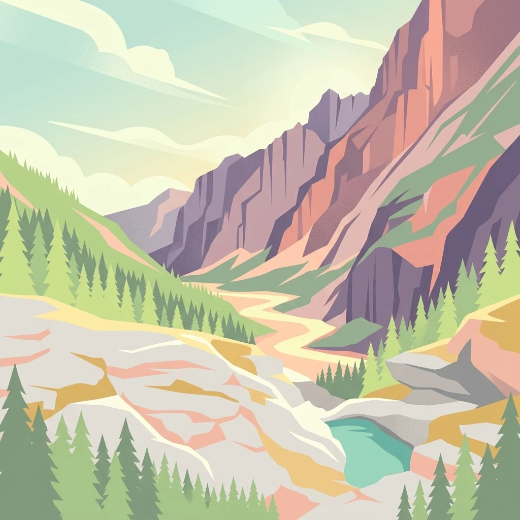
An illustration of a deep mountain valley with steep rocky cliffs on the right, evergreen pine trees on the left and right, and a small turquoise pond in the lower right foreground.

Schachen und Reintal

Nature reserve

Park overview

Structured park overview, official facts, and landscape profile for Schachen und Reintal Nature Reserve

Schachen und Reintal Nature Reserve park facts, protected area profile, and essential visitor context

Review the core facts for Schachen und Reintal Nature Reserve, including designation, size, terrain, visitor scale, habitats, and operating context in one park-focused overview.

About Schachen und Reintal Nature Reserve

Schachen und Reintal occupies a central position within the Wetterstein mountains, one of the most striking limestone ranges of the Northern Limestone Alps. The reserve stretches across the boundary between the municipalities of Garmisch-Partenkirchen and Mittenwald, with its southern edge defined by the Germany-Austria state border. Its westernmost reaches anchor on the Zugspitzplatt plateau and the Brunntalkopf and Innere Höllentalspitze, while its eastern boundary lies near the Ferchensee area, just northeast of the Untere Wettersteinspitze. The northern boundary follows the famous Jubiläumsgrat ridge, passing over the Hochblassen and the Hohen Gaif, before curving toward the Keilschrofen and the Ferchensee.

The protected landscapes within the reserve include the lower and upper Reintal valleys, traversed by the Partnach river from its headwaters down to the Mitterklamm gorge, the Schachen plateau with its small Schachensee, and the historic Wettersteinalm. Several mountain huts and buildings, such as the Reintalangerhütte, the Bockhütte, the Oberreintalhütte, the Meilerhütte, the Königshaus am Schachen, the Schachenhaus, and the Jubiläumsgrathütte, lie within the reserve and contribute to its character as both a working cultural landscape and a conservation area.

Ecologically, Schachen und Reintal represents a strong example of multi-zone alpine protection. The reserve preserves coniferous forests, mixed mountain forests, gorge and slope forests, and riparian gallery forests, much of which qualifies as natural forest with minimal intervention. Above and between these wooded zones, open alpine grasslands and species-rich calcareous dry grasslands occupy rocky terrain and scree slopes, creating a varied mosaic of habitats across the steep vertical gradient.

The reserve is part of the larger Wettersteingebirge FFH site and is registered in the World Database on Protected Areas, confirming both its national and European conservation significance. Its location between major alpine settlements and its blend of conservation, traditional alpine land use, and historic buildings, including the famously eclectic Königshaus am Schachen, make it a landscape where ecological protection and alpine heritage meet on a meaningful scale.

Quick facts and research context for Schachen und Reintal Nature Reserve

Schachen und Reintal is a designated nature reserve in the district of Garmisch-Partenkirchen, Upper Bavaria, established on 1 October 1970 under a Bavarian state ordinance. It spans roughly 39.6 square kilometers across the border municipalities of Garmisch-Partenkirchen and Mittenwald, with elevations ranging from about 902 meters up to 2743 meters.

The reserve is classified as an IUCN Category IV Habitat/Species Management Area and forms part of the larger Wettersteingebirge Natura 2000 (FFH) site. Administration falls under the Landratsamt Garmisch-Partenkirchen, and the area's identification NSG-00092.01 reflects its preserved combined forest and alpine landscape character.

Protection and recognition

Explore documented protected area designations and Natura 2000 records.

Schachen und Reintal Protection Status and International Recognition Data

Schachen und Reintal maintains documented protection status backed by verified Natura 2000 recognition sources and regional conservation inventories. Official database records trace international designations and management frameworks associated with this protected landscape.
Park context

Deeper park guide and search-rich context for Schachen und Reintal Nature Reserve

Schachen und Reintal Nature Reserve history, landscape, wildlife, and travel context

Explore Schachen und Reintal Nature Reserve through its history, landscape character, ecosystems, wildlife, conservation priorities, cultural context, and seasonal travel timing in a structured park guide built for atlas discovery and search intent.

Why Schachen und Reintal Nature Reserve stands out

Schachen und Reintal is best known for safeguarding a largely intact high-alpine landscape in the heart of the Wetterstein range, including the dramatic Reintal valley, the iconic Schachen plateau, and surrounding ridges bounded by the Jubiläumsgrat. The reserve is particularly valued for its large, protected forest zones, which are designated as natural forest, and for the contrast between rugged limestone terrain, alpine pastures, and dense mixed forest types. It is also recognized for protecting threatened alpine birdlife, notably a significant breeding population of black grouse and one of the area's important ptarmigan populations. These features, combined with the historical presence of the Königshaus am Schachen and the traditional Schachenhaus, give the reserve a distinctive identity that blends strict ecological protection with a long Alpine cultural heritage.
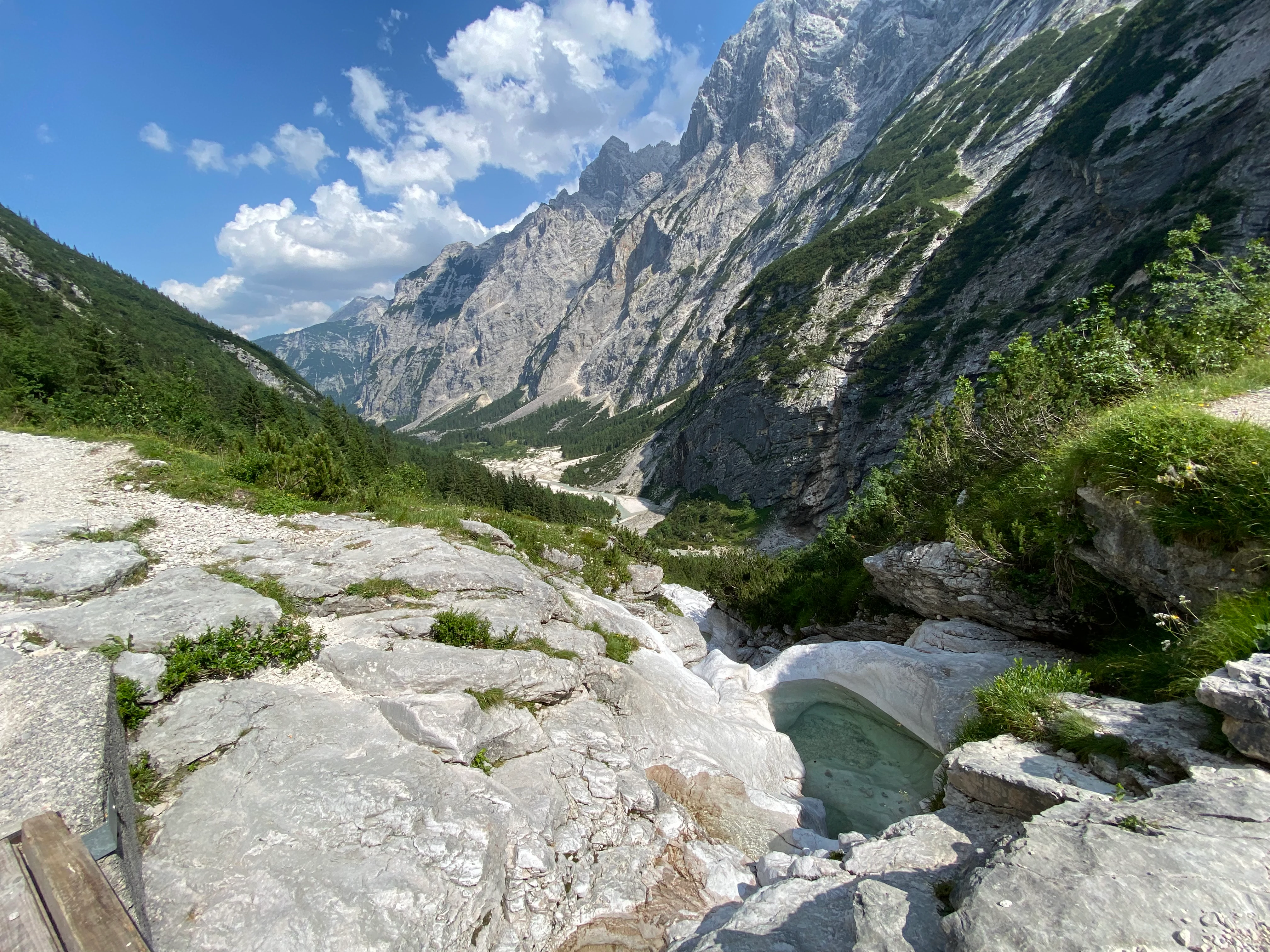
A wide angle landscape shot showing a rocky alpine valley with a small natural pool in the foreground and towering mountain peaks under a blue sky.
A view into the Reintal valley surrounded by the steep, rocky slopes of the Wetterstein mountains.

Schachen und Reintal Nature Reserve history and protected-area timeline

The protection of Schachen und Reintal is rooted in mid-twentieth-century conservation efforts in the Bavarian Alps. Earlier protected areas already recognized parts of the region as valuable, including the Schachen im Wettersteingebirge nature reserve established in 1943 by the Regierungspräsident of the district, and the Wetterstein landscape protection area (Landschaftsschutzgebiet) authorized by the Landkreis Garmisch-Partenkirchen in 1961.

These overlapping protections were consolidated on 9 September 1970, when Bavarian Interior Minister Bruno Merk signed the Landesverordnung über das Naturschutzgebiet 'Schachen und Reintal', forming a single nature reserve from the previously fragmented designations. The ordinance came into force on 1 October 1970 and brought the historic Schachen protection zone, the broader Wetterstein landscape reserve, and additional alpine terrain under one unified legal and conservation framework that has remained in place since.

Schachen und Reintal Nature Reserve landscape and geographic character

Schachen und Reintal encompasses a compact but highly varied slice of the Wetterstein mountains. The terrain ranges from the high-altitude, glacially shaped Zugspitzplatt in the west to the deeply incised valleys of the Reintal, traversed by the Partnach river with its dramatic gorges near Mitterklamm. The northern boundary follows the sharp, exposed line of the Jubiläumsgrat, including the Hochblassen, Hohen Gaif, and Mauerschartenkopf, making the reserve a visually dominant feature in the range.

The southern limit runs along the international border with Austria, giving the reserve an open, transboundary feel even though it is administratively defined as a single protected unit on the German side. Within this perimeter, the Schachen plateau, with its small Schachensee, forms a recognizable mid-elevation landmark, while the Wettersteinalm adds an open, pastoral landscape that contrasts with the surrounding rock and forest. Elevations span from about 902 meters to roughly 2743 meters, producing a striking topographical gradient visible from valley floor to high alpine ridges.

Schachen und Reintal Nature Reserve ecosystems, habitats, and plant life

Ecologically, the reserve is structured around the interaction between forest, rock, and alpine grassland habitats. Large parts of the protected area are forested with coniferous stands, mixed mountain forests, gorge and slope forests, and narrow gallery forests along watercourses, with much of this timber classified as natural forest and managed with minimal intervention.

Above the tree line and along rocky outcrops, the reserve supports open alpine grasslands and calcareous, nutrient-poor dry grasslands adapted to thin soils and harsh exposure. Scree slopes and rock faces connect these open habitats with the wooded zones below, producing a connected habitat mosaic that is typical of the Northern Limestone Alps. The vertical relief and the protection of natural forest patches together give the area strong value for typical and rare alpine species that depend on undisturbed transitions between woodland, rock, and open ground.

Schachen und Reintal Nature Reserve wildlife and species highlights

Wildlife conservation is central to the identity of Schachen und Reintal. The reserve supports one of the area's most important breeding populations of black grouse (Birkhuhn), a species classified as endangered and highly dependent on the kind of mosaic alpine habitats the reserve preserves. It also holds significant stable populations of Alpine ptarmigan (Alpenschneehuhn), another high-alpine specialist that requires the open rocky terrain, sparse vegetation, and limited disturbance found within the protected boundaries.

These bird species illustrate how the reserve combines forest protection with protection of open alpine terrain, maintaining the structural and climatic conditions that allow sensitive alpine fauna to persist in the Wetterstein range.

Schachen und Reintal Nature Reserve conservation status and protection priorities

Schachen und Reintal functions as a strict habitat and species management area, classified as IUCN Category IV, with a focus on safeguarding natural processes and habitat quality rather than allowing intensive development. The reserve's protection status is grounded in the 1970 Bavarian state ordinance, and its conservation framework is reinforced by inclusion in the Wettersteingebirge FFH site of the European Natura 2000 network, linking it to continent-wide biodiversity goals.

The conservation value of the reserve is shaped by its large natural forest zones, its intact alpine grassland-rock-forest mosaic, and the presence of vulnerable alpine bird populations. By keeping most of the forested area as natural forest, the reserve supports long-term ecological stability, while the protected alpine meadows and rocky habitats ensure that open-ground species also retain sufficient space. Its position between the Wetterstein range and the Austrian frontier further enhances its role as a refuge for alpine species that depend on extensive, interconnected high-mountain habitats.

Schachen und Reintal Nature Reserve cultural meaning and human context

The cultural dimension of Schachen und Reintal is closely woven into its landscape, with several iconic alpine buildings lying within the protected zone. The most famous is the Königshaus am Schachen, built as a royal mountain retreat and still surrounded by its small botanical garden, while the Schachenhaus serves as a more functional hub for visitors to the plateau. The Wettersteinalm contributes an active traditional alpine farming presence.

In addition, mountain huts such as the Reintalangerhütte, Bockhütte, Oberreintalhütte, Meilerhütte, and Jubiläumsgrathütte reflect a long-standing alpine hiking and mountain culture, linking the reserve's protected ecosystems to the broader Bavarian alpine tradition of pastoral land use, alpine hospitality, and high-mountain recreation.

Top sights and standout views in Schachen und Reintal Nature Reserve

Schachen und Reintal stands out for the striking concentration of different alpine landscape types within a single protected unit, from high alpine meadows and limestone scree to extensive natural forest and deep river valleys. Its position along the Jubiläumsgrat and beneath the Zugspitzplatt places it at the heart of one of Germany's most iconic mountain ranges.

Key highlights include the dramatic Reintal valley, the historically distinct Schachen plateau with its famous Königshaus, the Partnach headwaters and Mitterklamm gorge, and the large unbroken stretches of natural forest. The reserve's protected populations of black grouse and ptarmigan add a strong biodiversity dimension, while its status as a Natura 2000 site in the Wetterstein range underlines its wider European conservation importance.

Best time to visit Schachen und Reintal Nature Reserve

Schachen und Reintal is best experienced during the alpine summer and early autumn months, when the valley and alpine meadows are largely snow-free and hiking routes, including those leading to the Schachen plateau and the Reintal huts, are accessible. Late spring can still bring significant snow on higher trails, while deep winter conditions make most alpine routes inaccessible and require specialized equipment.

Visitors interested in wildlife may find periods of late spring and early summer especially interesting, when alpine bird activity increases. Those drawn to the cultural landmarks, including the Königshaus am Schachen and the Wettersteinalm, generally visit in the warmer months, when these sites are open and the surrounding scenery is most comfortable for mountain walking.

Monthly climate preview

Track monthly precipitation averages and baseline temperature cycles across representative terrain.

Schachen und Reintal Climate Normals and Long Term Temperature Rhythms

Schachen und Reintal exhibits measured annual temperature swings from sub zero winter minimums to warm summer maximums alongside consistent precipitation rhythms. Reviewing the complete monthly climate normals and weather by month dataset provides deeper context for long term environmental conditions.
Annual mean6 °C
-4 °C15 °C
Jan-4°
Feb-3°
Mar
Apr
May10°
Jun13°
Jul15°
Aug15°
Sep11°
Oct
Nov
Dec-3°
Warmest month
July

15.1 °C

Coolest month
January

-4.1 °C

Wettest month
June

5.8 mm/day

Driest month
February

2.3 mm/day

Park location guide

Geography guide, regional context, and park location map for Schachen und Reintal Nature Reserve

Schachen und Reintal Nature Reserve park geography, regions, and map view in Germany

Understand where Schachen und Reintal Nature Reserve sits in Germany through a broader geographic reading of the surrounding landscape, nearby location context, and its mapped position within the national park landscape.

How Schachen und Reintal Nature Reserve fits into Germany

Germany is a federal republic in Western and Central Europe with a population of over 83 million across sixteen constituent states. It is Europe's largest economy by nominal GDP and a major global exporter and importer. The capital is Berlin, and the country borders Denmark, Poland, Czech Republic, Austria, Switzerland, France, Luxembourg, Belgium, and the Netherlands.

Wider geography shaping Schachen und Reintal Nature Reserve in Germany

Germany is located in Western and Central Europe, spanning 357,022 km². It borders Denmark to the north, Poland and the Czech Republic to the east, Austria and Switzerland to the south, and France, Luxembourg, Belgium, and the Netherlands to the west. The country has coastlines on the Baltic Sea and North Sea to the north, with the Alps located in the southern region.

Map view of Schachen und Reintal Nature Reserve

Use this park location map to pinpoint Schachen und Reintal Nature Reserve in Germany, understand its exact geographic position, and read its mapped placement within the surrounding landscape more clearly.

Pigeon | © OpenStreetMap contributors

Location context for Schachen und Reintal Nature Reserve

Oberbayern
Recorded earthquake history

Review the Recorded Earthquake History for Schachen und Reintal

Examine the historical catalogue of seismic events recorded in the vicinity of Schachen und Reintal. This resource, powered by MoriAtlas, allows for the exploration of documented earthquake data and epicentral proximity to the protected landscape of the Wetterstein mountains.

Schachen und Reintal Earthquake History

Catalogued events

81 events

Strongest magnitude

Magnitude 4.6

Most recent event

Aug 8, 2020

This history includes earthquakes recorded inside the park or within 50 km of its borders

Visual exploration of Wetterstein mountain terrain, limestone habitats, and protected alpine valleys

Schachen und Reintal Photos and Alpine Landscape Scenery

Visual documentation of Schachen und Reintal reveals the dramatic topography of the Wetterstein range, encompassing deep glacial valleys and rocky limestone ridges. Examining these protected area images provides clear insight into natural forest zones, alpine grasslands, and high mountain terrain.

A wide angle landscape shot showing a rocky alpine valley with a small natural pool in the foreground and towering mountain peaks under a blue sky.

Park atlas

Compare adjacent mountain reserves and connected regional geography across the Wetterstein range.

Parks Near Schachen und Reintal: Exploring Surrounding Alpine Protected Landscapes

Browsing other protected areas near Schachen und Reintal reveals wider patterns of alpine topography and valley ecosystems across the broader mountain range. Comparing adjacent reserves helps contextualize local limestone terrain, high elevation forests, and transboundary conservation networks.
Nature reserveOberbayern
Mapped location lies within the park boundary#1 closest

East

Naturwaldreservat Wettersteinwald: Protected Nature Reserve and Alpine Forest Geography

Oberbayern, Germany; subalpine forest conservation and limestone mountain terrain

Uncover the ecological structure of Naturwaldreservat Wettersteinwald, one of the oldest nature forest reserves in the Bavarian Alps. Located on steep Wetterstein limestone, the area encompasses a compact mosaic of spruce and stone pine, protecting essential habitat for rare saproxylic beetle species within its defined 42 hectare boundaries.

Area
0.426 km²
Established
1978
Relief
Mountain
Climate
Alpine
A horizontal watercolor painting showing a range of light-colored, jagged mountain peaks in the background with a green coniferous forest and a small body of water in the foreground.
Nature reserveTyrol
About 3.9 km away#2 closest

East

Arnspitze Group Nature Reserve: Mapped Limestone Ridge and Alpine Geography

A historic protected massif in the Austrian Tyrol.

The Arnspitze Group represents a vital limestone ridge ecosystem within the Northern Limestone Alps. This nature reserve, spanning the border region, displays significant karst formations and forested slopes. Gain insight into the ridge layout, summit heights, and the protected status that defines this essential Tyrolean mountain chain through detailed map-based discovery.

Area
12.5 km²
Established
1942
Relief
Mountain
Climate
Alpine
Nature reserveBavaria
About 8.7 km away#3 closest

Northwest

Naturwald Kramer Nature Reserve: Protected Alpine Forest Boundaries in Bavaria

Mapping natural forest dynamics across the Ammergauer Alps

Naturwald Kramer represents a major forest protection zone in the Bavarian Alps. This area spans a rugged vertical mosaic of mountain mixed forests and snow heath pine woodlands on dolomite bedrock, providing essential insight into non-intervention forestry and diverse alpine mountain terrain.

Area
15.91 km²
Established
2020
IUCN
IV
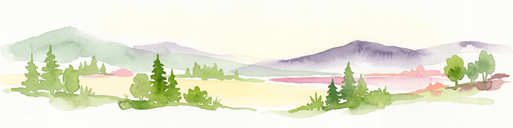
A horizontal watercolor illustration of a landscape with green pine trees in the foreground, a pale yellow meadow, and soft purple and green rolling mountains in the background against a white background.
Nature reserveBavaria
About 47 km away#4 closest

Northeast

Schellenbergmoor Nature Reserve: Geographic Mapping of Bavarian Pre-Alpine Wetland Landscapes

Protected peatland terrain in the Tölzer Moorachse corridor

Schellenbergmoor functions as a protected nature reserve situated in the pre-Alpine hill and moorland zone of Upper Bavaria. This site preserves rare raised and transitional bog habitats, serving as a critical node for hydrology and ecosystem connectivity between Lake Starnberg and the Loisach river basin.

Established
1987
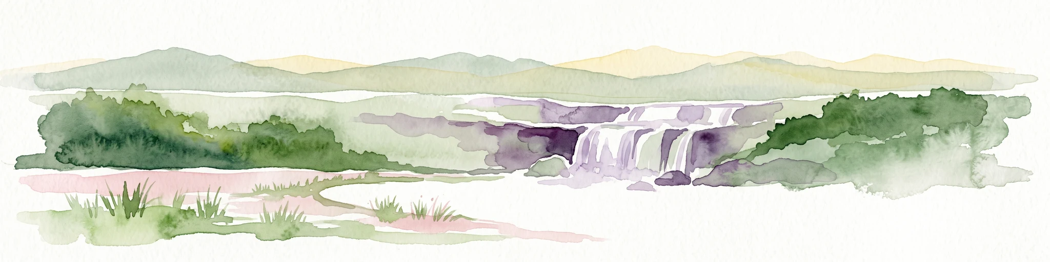
Watercolor illustration of a lush natural ravine with a small cascading waterfall, surrounded by green forest slopes and distant rolling hills.
Nature reserveBavaria
About 64 km away#5 closest

Northwest

Rohrbachtobel im Wirlinger Forst Nature Reserve and Bavarian Pre-Alpine Forest Geography

Mapped protected gorge landscapes and molasse geology in the Oberallgäu district

Rohrbachtobel im Wirlinger Forst offers a unique look at small-scale protected landscapes in Germany. This nature reserve features a dramatic stream-cut gorge and serves as a natural habitat for diverse plant species, including European yew and multiple orchid varieties, within the wider context of the Bavarian pre-Alpine forest zone.

Area
0.14 km²
Established
1959
Relief
Upland
Scope
Terrestrial
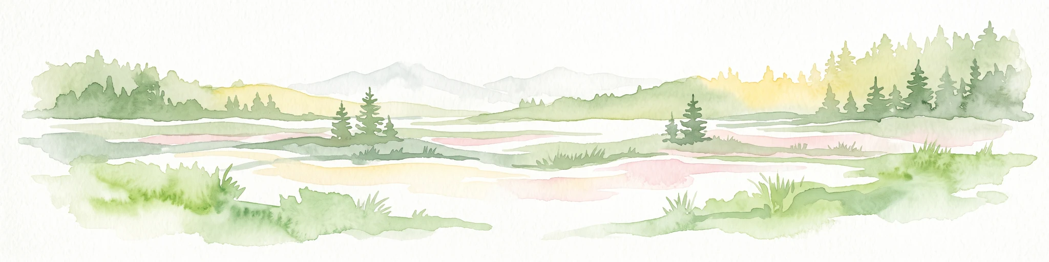
A horizontal watercolor illustration depicting a soft, atmospheric landscape with marshy ground, scattered evergreen trees, and distant hills.
Nature reserveLandkreis Oberallgäu
About 66 km away#6 closest

Northwest

Schönleitenmoos im Wierlinger Forst Protected Nature Reserve and Allgäu Bog Landscape

Raised bog geography on the Rhine-Danube watershed in Germany.

Schönleitenmoos im Wierlinger Forst is a compact nature reserve characterized by its well-preserved raised bog sequence and post-glacial origins. This site in the Oberallgäu district is essential for studying peatland vegetation zones and the rare occurrence of the rust-leaved alpine rose outside the high Alps, offering a detailed perspective on Bavarian landscape formation.

Area
0.23 km²
Established
1960
Nature reserveBavaria
About 71 km away#7 closest

West

Nagelfluhkette Nature Park: Mapping the Alpine Ridges and Conglomerate Landscapes

A cross-border nature reserve in the Bavarian Alps.

Nagelfluhkette Nature Park is defined by its dramatic vertical transitions and unique Nagelfluh conglomerate geology. This protected area connects valley wetlands like the Großer Alpsee with steep mountain summits along the Hochgrat ridge. The region serves as an essential example of integrated conservation, linking forests, high-altitude moorlands, and traditional alpine agricultural landscapes across the Bavarian and Vorarlberg border.

Area
480 km²
Established
2008
Relief
Mountain
Climate
Alpine
National parkAustria
71 km away#8 closest

East

Hohe Tauern National Park: Regional Geography and Protected Alpine Mountain Terrain

Major protected area in the heart of the Austrian Alps

Hohe Tauern National Park protects a grand scale of alpine terrain, including towering summits above 3,000 meters and the longest glacial systems in the country. This atlas record provides insights into the park's vertical landscape, encompassing glacial valleys, waterfalls, and diverse ecological zones that define the High Tauern mountain range in Austria.

Common questions about visiting, size, designation, and location context for Schachen und Reintal Nature Reserve

Schachen und Reintal Nature Reserve FAQs for park facts, access, geography, and protected area context

Find quick answers about Schachen und Reintal Nature Reserve, including protected-area facts, park geography, trail and visitor context, and how the park fits into its surrounding country and regional landscape.
MoriAtlas Explorer

Continue Your Protected Areas Search Across the Global Atlas

Deepen your exploration by continuing the structured search for national parks and protected areas worldwide. Utilize the comprehensive filtering capabilities to compare different conservation landscapes and refine your understanding of global park geography. Discover more about the distribution and characteristics of protected natural areas.

Global natural geography