Mori Atlas logo
Nearby park discovery

Geographic context and mapped park distribution in the regional alpine corridor

Protected Areas and Surrounding Natural Landscapes Near Schachen und Reintal, Oberbayern

Analyze the regional geography surrounding Schachen und Reintal through a comparative look at nearby protected areas and natural habitats. This view maps the distribution of adjacent alpine landscapes, forested corridors, and limestone terrain features to provide a clear picture of the wider ecological network within Oberbayern and the border region.

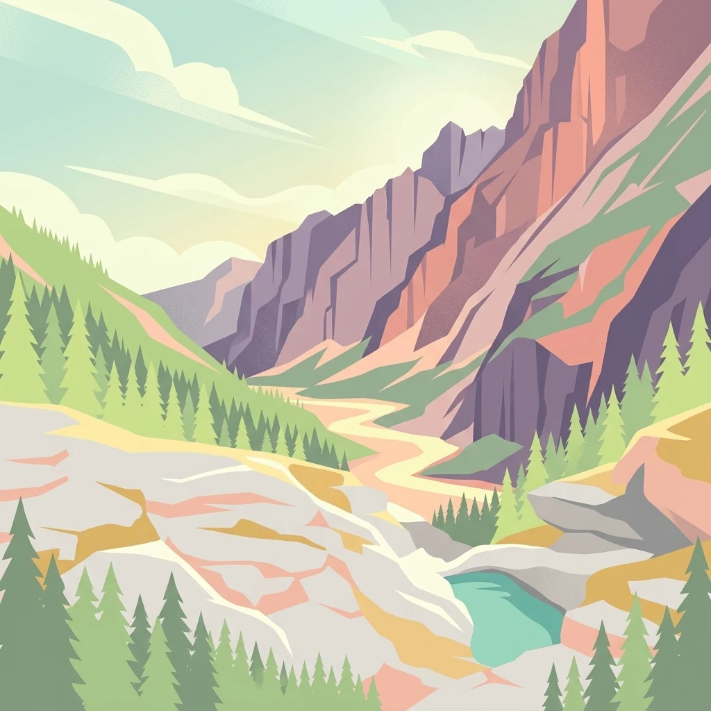
An illustration of a deep mountain valley with steep rocky cliffs on the right, evergreen pine trees on the left and right, and a small turquoise pond in the lower right foreground.

An Alpine protected area on the German-Austrian border, guarding the Reintal valley and the Schachen plateau in the Wetterstein mountains

Schachen und Reintal Nature Reserve

Schachen und Reintal is a German nature reserve (Naturschutzgebiet) located in the Wetterstein mountains of Upper Bavaria, on the border between Germany and Austria. Covering about 39.6 square kilometers across the municipalities of Garmisch-Partenkirchen and Mittenwald, the reserve protects a sweeping Alpine landscape that includes the upper Reintal valley, the Oberreintal, the Schachen plateau with its small mountain lake, and the historic Wettersteinalm. The protected area is defined by dramatic mountain scenery, ranging from the Zugspitzplatt plateau in the west to the Ferchensee area in the east, and from the Innere Höllentalspitze and Jubiläumsgrat ridge in the north to the international border in the south. It is part of the Natura 2000 network through the larger Wettersteingebirge FFH site and includes extensive natural forest as well as alpine grasslands and rocky habitats. Beyond its ecological role, the reserve also has notable cultural and historical identity, anchored by landmarks such as the Schachenhaus and the Königshaus am Schachen, alongside several alpine huts. It is best known for preserving intact Alpine habitats, significant black grouse populations, and important stands of ptarmigan, reflecting both its biodiversity value and its long tradition of Alpine land use.

Location
Germany
Park type
Nature reserve
Established
1970
Area
39.6 km²
Highest point
2,743 m
Schachen und Reintal Protected Area Atlas
Regional park map

See the ranked park cluster in its geographic setting

Nearby parks around Schachen und Reintal Nature Reserve

This regional map shows the same 20 nearby parks ranked below around Schachen und Reintal Nature Reserve. Select a ranked marker to highlight that park’s boundary where boundary data is available.
Reference park: Schachen und Reintal Nature ReserveRanked nearby parkSelected boundary: Schachen und Reintal Nature Reserve20 nearby parks shown
20 nearby parks

Distance ranked regional park geography and surrounding protected landscapes

Parks and Protected Areas Geographically Near Schachen und Reintal

Explore a ranked collection of protected areas situated close to Schachen und Reintal based on direct geographic proximity and boundary separation. Analyzing surrounding park environments and regional context reveals broader patterns in alpine conservation without assuming identical habitats.
Nature reserveOberbayern
Mapped location lies within the park boundary#1 closest

East

Naturwaldreservat Wettersteinwald: Protected Nature Reserve and Alpine Forest Geography

Oberbayern, Germany; subalpine forest conservation and limestone mountain terrain

Uncover the ecological structure of Naturwaldreservat Wettersteinwald, one of the oldest nature forest reserves in the Bavarian Alps. Located on steep Wetterstein limestone, the area encompasses a compact mosaic of spruce and stone pine, protecting essential habitat for rare saproxylic beetle species within its defined 42 hectare boundaries.

Area
0.426 km²
Established
1978
Relief
Mountain
Climate
Alpine
A horizontal watercolor painting showing a range of light-colored, jagged mountain peaks in the background with a green coniferous forest and a small body of water in the foreground.
Nature reserveTyrol
About 3.9 km away#2 closest

East

Arnspitze Group Nature Reserve: Mapped Limestone Ridge and Alpine Geography

A historic protected massif in the Austrian Tyrol.

The Arnspitze Group represents a vital limestone ridge ecosystem within the Northern Limestone Alps. This nature reserve, spanning the border region, displays significant karst formations and forested slopes. Gain insight into the ridge layout, summit heights, and the protected status that defines this essential Tyrolean mountain chain through detailed map-based discovery.

Area
12.5 km²
Established
1942
Relief
Mountain
Climate
Alpine
Nature reserveBavaria
About 8.7 km away#3 closest

Northwest

Naturwald Kramer Nature Reserve: Protected Alpine Forest Boundaries in Bavaria

Mapping natural forest dynamics across the Ammergauer Alps

Naturwald Kramer represents a major forest protection zone in the Bavarian Alps. This area spans a rugged vertical mosaic of mountain mixed forests and snow heath pine woodlands on dolomite bedrock, providing essential insight into non-intervention forestry and diverse alpine mountain terrain.

Area
15.91 km²
Established
2020
IUCN
IV
A horizontal watercolor illustration of a landscape with green pine trees in the foreground, a pale yellow meadow, and soft purple and green rolling mountains in the background against a white background.
Nature reserveBavaria
About 47 km away#4 closest

Northeast

Schellenbergmoor Nature Reserve: Geographic Mapping of Bavarian Pre-Alpine Wetland Landscapes

Protected peatland terrain in the Tölzer Moorachse corridor

Schellenbergmoor functions as a protected nature reserve situated in the pre-Alpine hill and moorland zone of Upper Bavaria. This site preserves rare raised and transitional bog habitats, serving as a critical node for hydrology and ecosystem connectivity between Lake Starnberg and the Loisach river basin.

Established
1987
Watercolor illustration of a lush natural ravine with a small cascading waterfall, surrounded by green forest slopes and distant rolling hills.
Nature reserveBavaria
About 64 km away#5 closest

Northwest

Rohrbachtobel im Wirlinger Forst Nature Reserve and Bavarian Pre-Alpine Forest Geography

Mapped protected gorge landscapes and molasse geology in the Oberallgäu district

Rohrbachtobel im Wirlinger Forst offers a unique look at small-scale protected landscapes in Germany. This nature reserve features a dramatic stream-cut gorge and serves as a natural habitat for diverse plant species, including European yew and multiple orchid varieties, within the wider context of the Bavarian pre-Alpine forest zone.

Area
0.14 km²
Established
1959
Relief
Upland
Scope
Terrestrial
A horizontal watercolor illustration depicting a soft, atmospheric landscape with marshy ground, scattered evergreen trees, and distant hills.
Nature reserveLandkreis Oberallgäu
About 66 km away#6 closest

Northwest

Schönleitenmoos im Wierlinger Forst Protected Nature Reserve and Allgäu Bog Landscape

Raised bog geography on the Rhine-Danube watershed in Germany.

Schönleitenmoos im Wierlinger Forst is a compact nature reserve characterized by its well-preserved raised bog sequence and post-glacial origins. This site in the Oberallgäu district is essential for studying peatland vegetation zones and the rare occurrence of the rust-leaved alpine rose outside the high Alps, offering a detailed perspective on Bavarian landscape formation.

Area
0.23 km²
Established
1960
Nature reserveBavaria
About 71 km away#7 closest

West

Nagelfluhkette Nature Park: Mapping the Alpine Ridges and Conglomerate Landscapes

A cross-border nature reserve in the Bavarian Alps.

Nagelfluhkette Nature Park is defined by its dramatic vertical transitions and unique Nagelfluh conglomerate geology. This protected area connects valley wetlands like the Großer Alpsee with steep mountain summits along the Hochgrat ridge. The region serves as an essential example of integrated conservation, linking forests, high-altitude moorlands, and traditional alpine agricultural landscapes across the Bavarian and Vorarlberg border.

Area
480 km²
Established
2008
Relief
Mountain
Climate
Alpine
National parkAustria
71 km away#8 closest

East

Hohe Tauern National Park: Regional Geography and Protected Alpine Mountain Terrain

Major protected area in the heart of the Austrian Alps

Hohe Tauern National Park protects a grand scale of alpine terrain, including towering summits above 3,000 meters and the longest glacial systems in the country. This atlas record provides insights into the park's vertical landscape, encompassing glacial valleys, waterfalls, and diverse ecological zones that define the High Tauern mountain range in Austria.

A soft watercolor painting showing rolling green hills and a forested ridgeline against a pale sky on a white background.
Nature reserveBaden-Württemberg
72 km away#9 closest

Northwest

Adelegg Nature Reserve: Geographic Profile of an Alpine-Influenced Forested Ridge in Baden-Württemberg

Mapping deep ravine terrain and protected forest mosaics in Germany

The Adelegg nature reserve represents a vital Natura 2000 site within the Westallgäu region. This protected area features a striking vertical relief composed of steep, forested slopes and high-elevation grasslands. Explore the geographic layout of this ridge, which includes a complex array of calcareous beech forests, rare orchid habitats, and diverse ravine ecosystems that define this rugged southwestern German landscape.

Area
6.33 km²
Established
2019
Relief
Mountain
Climate
Temperate
A watercolor painting showing a panoramic view of a wetland with coniferous trees, soft green forest lines, and reddish bog vegetation against a pale background.
Nature reserveBaden-Württemberg
75 km away#10 closest

West

Bodenmöser und Hengelesweiher Nature Reserve: Mapped Geography and Protected Wetland Atlas

A diverse mosaic of peatlands and lakes in Westallgäu

Bodenmöser und Hengelesweiher represents a significant conservation network in southwestern Germany. This detailed view covers the distribution of calcareous fens, raised bogs, and dark-water pools that characterize the pre-Alpine hill landscape. Learn about the geographic configuration of this protected site as it bridges nutrient-poor lake ecosystems with surrounding alder woodlands and wet meadow corridors near Isny im Allgäu.

Area
7.59 km²
Established
2019
A pale, minimalist watercolor illustration of layered mountain silhouettes in the background and a green, forested foreground.
Nature reserveTyrol
About 84 km away#11 closest

East

Kaiser Mountains Nature Reserve: Alpine Limestone Landscapes and Regional Geography in Tyrol

A comprehensive look at the Wilder Kaiser and Zahmer Kaiser ridges

The Kaiser Mountains stand as a monumental feature within the Northern Limestone Alps. This nature reserve offers a unique geographic profile, from sheer, pale Wetterstein limestone walls to broad alpine pastures and pine-covered ridges. Its radial drainage patterns and self-contained massif structure provide an essential case study for understanding the diverse mountain terrain that defines the heart of the Austrian Tyrol.

Area
102 km²
Established
1963
Relief
Mountain
Climate
Alpine
Protected landscapeBaden-Württemberg
About 88 km away#12 closest

Northwest

Uferbewuchs der Eschach Protected Landscape and Riparian Corridor Map

Riparian conservation within the Riß-Aitrach-Platten of Baden-Württemberg

Tracing the protected linear riparian corridors of the Eschach stream, this area is a significant example of urban-edge conservation in Germany. It maintains continuous stream-bank vegetation through the Leutkirch municipal landscape, linking directly to broader floodplain habitats of the Aitrach river system through its glacial-plateau geographic setting.

Established
1953
IUCN
V
Watercolor painting of a mountain range with a lake, green hills, and a sunset sky
National parkTrentino-Alto Adige/Südtirol
88 km away#13 closest

South

Stelvio National Park National Park: Protected Landscape and Regional Geographic Context

Explore its mapped boundaries and natural terrain.

Navigate Stelvio National Park, a designated national park in Italy's Trentino-Alto Adige/Südtirol region, through a map-centric lens. This page provides critical context for understanding the park's protected landscape, its geographic position within the Alps, and its mapped terrain. Utilize MoriAtlas to grasp the park's boundaries and its place in regional geography for structured natural landscape discovery.

Established
1935
IUCN
II
Relief
Mountain
Scope
Terrestrial
National parkGraubünden
89 km away#14 closest

Southwest

Swiss National Park: Geographic Context and Protected Alpine Wilderness in Graubünden

A comprehensive look at the Engadin valley's premier wilderness sanctuary

Spanning over 170 square kilometers in the canton of Graubünden, the Swiss National Park offers an unparalleled example of a strictly protected Alpine ecosystem. This atlas profile details the park's distinct topography, from the subalpine pine forests near the Ofenpass to the delicate karst lake basins at Macun, providing a deep look into its history as a central reference site for wilderness restoration and geological research.

Area
170.3 km²
Established
1914
IUCN
Ia
Relief
Mountain
A horizontal watercolor illustration showing a winding stream moving through a flat marshy landscape with scattered trees and distant rolling hills.
Nature reserveBavaria
About 92 km away#15 closest

North

Schwarzhölzl Nature Reserve: Protected Lowland Peatland and Forest Geography in Bavaria

Essential protected area map and habitat overview

Schwarzhölzl is a specialized nature reserve in Bavaria protecting a rare mosaic of peat birch forest, bog pines, and wet meadows. As an ecological remnant of the vast Dachauer Moos, this site provides a deep look into the lowland wetland terrain and the specific conservation landscape managed within the Munich green belt. Explore the mapped boundaries and structural geography of this significant protected lowland site.

Area
0.795 km²
Established
1994
Relief
Lowland
Climate
Temperate
A soft, panoramic watercolor painting featuring green, rolling hills and a winding river or stream through a forested landscape against a bright, hazy sky.
Nature reserveBaden-Württemberg
99 km away#16 closest

Northwest

Altdorfer Wald Nature Reserve: Geographic Atlas and Protected Landscape Overview

Mire, spring, and forest ecosystems in Baden-Württemberg

The Altdorfer Wald nature reserve consolidates a significant network of watercourses, peatlands, and old-growth forest stands across the Upper Swabian Pre-Alpine hills. This protected area stands as a primary focal point for understanding the interplay between hydrological richness, calcareous deposits, and diverse temperate forest habitats within the regional geography of Baden-Württemberg.

Area
13.71 km²
Established
2019
Relief
Upland
Climate
Temperate
A soft watercolor painting showing a wide, high-altitude alpine plateau with rolling hills, scattered small lakes, and distant mountain ridgelines.
Nature reserveGraubünden
About 100 km away#17 closest

Southwest

Macun-Seen Nature Reserve: Protected Alpine Plateau and Cirque Lake Landscape

High-altitude basin and crystalline geological features in Graubünden

Located in the Lower Engadine region of Graubünden, the Macun-Seen nature reserve is a significant high-altitude basin formed by glacial action. This protected exclave contains 23 small cirque lakes across a silicate plateau, offering a distinct ecological profile and expansive views of peaks approaching 3000 metres. It stands as a prime example of preserved alpine terrain within the broader Swiss National Park context.

Area
3.6 km²
Established
2000
Relief
Mountain
Climate
Alpine
A soft, horizontal watercolor painting showing rolling green hills, a winding river or lake, and misty mountain silhouettes in the background against a white backdrop.
Regional parkGraubünden
About 101 km away#18 closest

Southwest

Biosfera Val Müstair Regional Park: Alpine Landscapes and UNESCO Biosphere Geography

Protected glacial terrain and cultural alpine valleys in eastern Switzerland.

Discover the distinctive natural geography of Biosfera Val Müstair, where a dry inner-Alpine climate meets high-altitude glacial features like the Lai da Rims. This regional park protects an extensive area of Graubünden, balancing rare ecosystems, broad alluvial fans, and the traditional alpine economy of the Romansh-speaking community.

Area
198.65 km²
Established
2011
Relief
Mountain
Climate
Alpine
A watercolor painting showing a panoramic view of a wetland with water, grasses in the foreground, green hills, and purple-toned mountains in the distance.
Nature reserveVorarlberg
About 104 km away#19 closest

West

Rhine Delta Nature Reserve: Mapped Wetlands and Alpine Foothills Geography in Vorarlberg

A dynamic freshwater delta and critical bird habitat in Austria

The Rhine Delta constitutes the largest wetland biotope on Lake Constance, characterized by ongoing sediment deposits and an evolving shoreline. Its geography includes dense riparian forests, alluvial plains, and shallow bays that provide refuge for diverse amphibians and birds. This nature reserve serves as a prime example of large-scale wetland conservation nestled between the Alpine foothills and the open waters of the lake.

Area
20.65 km²
Established
1982
Relief
Lowland
Climate
Temperate
A soft watercolor painting of a rolling landscape featuring a winding river, grassy plains, and distant hills in muted green, pink, and yellow tones.
Protected landscapeBodenseekreis
About 106 km away#20 closest

West

Spätwürmeiszeitliche Terrassen zwischen Burnau, Prestenberg, Vorderreute, Buch und Krumbach Geography

A protected landscape site in the Bodenseekreis district

Spätwürmeiszeitliche Terrassen zwischen Burnau, Prestenberg, Vorderreute, Buch und Krumbach is defined by its series of level river terraces resulting from Würm ice age glacial retreat. Spanning roughly 22 hectares near the Schwarzach river, the site remains a vital example of fluvioglacial geomorphology and regional landscape preservation within the pre-Alpine foreland.

Area
0.22 km²
Established
1963
Relief
Upland
Climate
Temperate
Distance methodology

Geographic measurements, not driving distances

How nearby park distances are calculated

Distances use park boundaries whenever the available geometry allows it. When one or both boundaries are missing, the mapped park locations provide a clearly labelled estimate. Every value represents straight-line geographic separation and does not use roads or routing.

Boundary distance

Calculated between the nearest points of both park boundaries.

Location-to-boundary estimate

Estimated from one mapped park location to the nearest boundary of the other park.

Mapped-location estimate

Estimated between the mapped locations of both parks.

MoriAtlas Explorer

Analyze the Geography and Protected Boundaries of Schachen und Reintal

Continue exploring the intricate landscape patterns of the Schachen und Reintal nature reserve through our MoriAtlas mapping tools. Gain deeper insights into the regional geography and alpine terrain that define this protected area in the heart of the Wetterstein mountains, from its limestone peaks to its forest-clad valleys.