
Mori Atlas logo
Nature reserveNaturschutzgebiet Schlangenberg

Mapping the distinctive heavy metal grasslands and limestone geology of the Stolberg region

Naturschutzgebiet Schlangenberg: An Atlas of Protected Mining Landscapes and Rare Flora

Naturschutzgebiet Schlangenberg represents a critical protected area situated within the Städteregion Aachen, where unique geological conditions have fostered an extraordinary habitat for metallophyte plant communities. This reserve features a complex mosaic of heavy-metal heath, orchid-rich beech woodland, and remnants of centuries of mineral extraction. By tracing the topography of its Devonian limestone ridge, explorers can gain insight into how industrial history and botanical rarity converge within the broader Eifel foothill landscape.

nature reservemetallophyte floraheavy-metal grasslandcalamine vegetationgalmei floraorchid beech forest
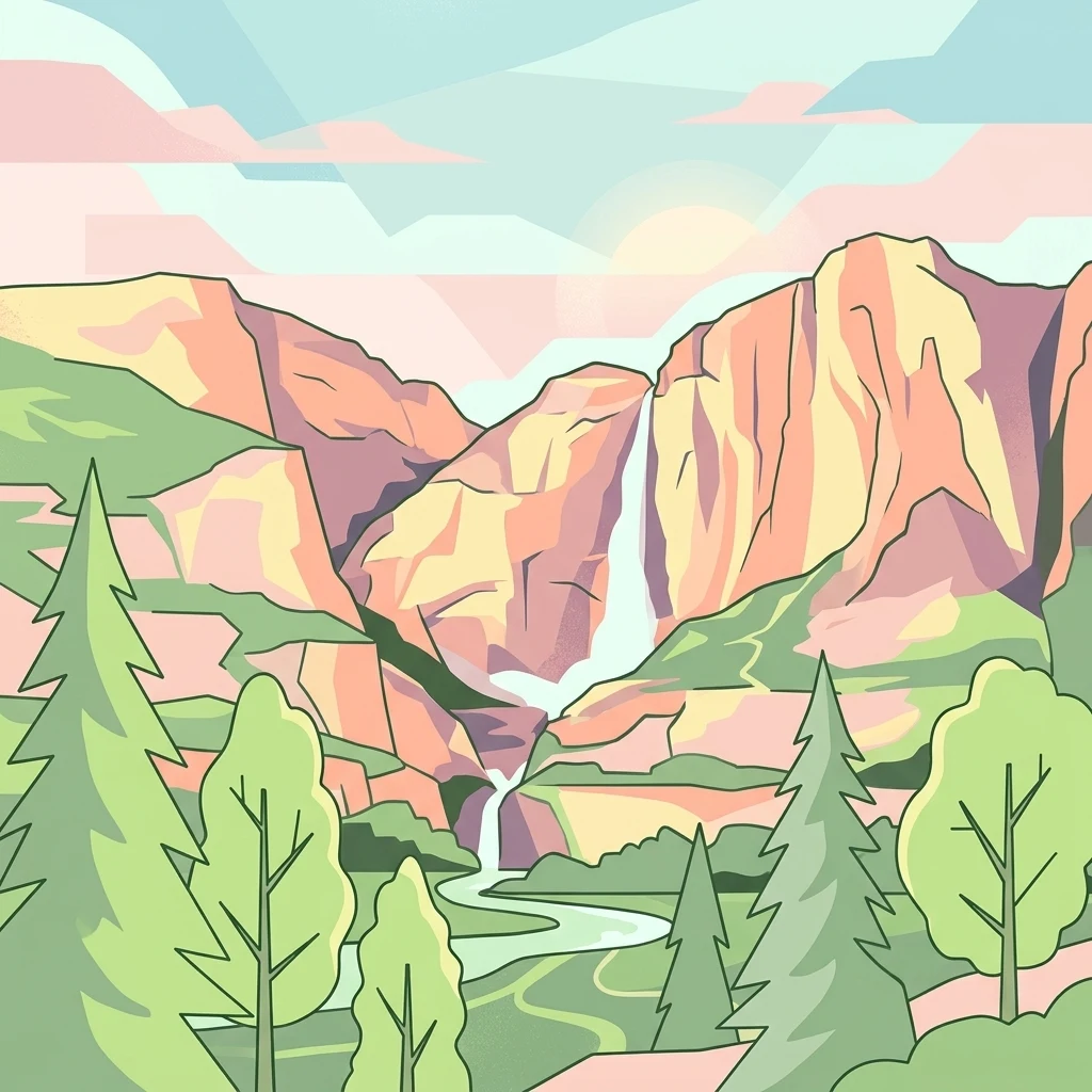
A graphic illustration of a mountainous landscape with a tall waterfall cascading between cliffs, flowing into a river below, surrounded by pine and deciduous trees in a soft, geometric style.

Naturschutzgebiet Schlangenberg

Nature reserve

Park overview

Structured park overview, official facts, and landscape profile for Schlangenberg Nature Reserve

Schlangenberg Nature Reserve park facts, protected area profile, and essential visitor context

Review the core facts for Schlangenberg Nature Reserve, including designation, size, terrain, visitor scale, habitats, and operating context in one park-focused overview.

About Schlangenberg Nature Reserve

Schlangenberg Nature Reserve is a small but ecologically extraordinary protected area in the western part of North Rhine-Westphalia, near the Belgian and Dutch borders. It sits on a hill of the same name east of Stolberg, within the Städteregion Aachen, and stretches across about 124 hectares of a landscape that at first glance looks scarred and barren. The soil here is heavily contaminated with zinc, lead, and cadmium, the legacy of mining that began in pre-Roman times and continued in earnest from the eighteenth century onward. Whereas most plants cannot tolerate such substrates, a unique assemblage of metallophytes has colonised them, turning what looked like industrial wasteland into one of Europe's most important botanical refugia.

The geological foundation of the reserve is a ridge of Devonian limestone, originally deposited in a tropical sea around 400 million years ago. Mineral-rich solutions invaded this porous rock around 200 million years later, forming zinc, lead, and iron ores including the distinctive schalenblende structures that gave the hill its mineral fame. Surface erosion of these ores produced secondary calamine deposits rich in zinc carbonate, which in turn generated the unusual soils that now define the reserve's ecology. The hill reaches about 276 metres above sea level and lies along the L12 road near the district of Breinigerberg.

Ecologically, the reserve combines several very different habitats within a compact footprint. The most famous of these is the open heavy-metal heath and nutrient-poor grassland (Magerrasen) where the Galmei flora grows. This is interspersed with scattered shrubs, small water bodies, and in places dense pioneer scrub. In the northwestern part of the reserve, a sweet woodruff beech forest (Waldmeister-Buchenwald) creates a cooler, shadier contrast. Scattered through this woodland are stands of orchid beech forest that host rare terrestrial orchids such as the Dark-red Helleborine, the Bird's-nest Orchid, and the White Helleborine.

The reserve has been formally protected since 1975, though its conservation story is one of gradual ecological recovery rather than pristine untouched nature. After the closure of the last mining structures in the early twentieth century, the area passed through phases of military use, motor-cross activity, and natural recolonisation, before being recognised as a protected site. Modern management, led by the Biologische Station im Kreis Aachen, focuses on keeping the open habitats open through targeted tree removal, controlled grazing with sheep and goats, and careful visitor routing. A small information centre in the former Breinigerberg school explains the intertwined stories of geology, mining, and conservation that have shaped this small but remarkable landscape.

Quick facts and research context for Schlangenberg Nature Reserve

Schlangenberg Nature Reserve lies in the Städteregion Aachen in western North Rhine-Westphalia, just east of Stolberg, and covers roughly 124 hectares of land centred on a hill of the same name. It has been a formally protected nature reserve since 1975 and falls under the landscape plan of Aachen, administered by the lower landscape authority of the Städteregion.

The reserve is classified as an IUCN Category IV habitat and species management area. Its defining feature is a heavy-metal contaminated substrate derived from historical zinc and lead mining, which sustains a globally significant Galmei flora. It is part of a wider cluster of protected areas in the Stolberg region and includes both open metallophyte heath and patches of orchid-rich beech woodland.

Protection and recognition

Documented terrestrial protection metrics and management scope

Naturschutzgebiet Schlangenberg Protection Status and Conservation Data

Terrestrial protection status records provide a foundational baseline for understanding the conservation boundaries of Naturschutzgebiet Schlangenberg. Global database identifiers ground each administrative attribute in verified territorial registers without relying on unverified designations.

Protection details

Protection scope
Terrestrial
Transboundary protection
No
WDPA ID
165400
Park context

Deeper park guide and search-rich context for Schlangenberg Nature Reserve

Schlangenberg Nature Reserve history, landscape, wildlife, and travel context

Explore Schlangenberg Nature Reserve through its history, landscape character, ecosystems, wildlife, conservation priorities, cultural context, and seasonal travel timing in a structured park guide built for atlas discovery and search intent.

Why Schlangenberg Nature Reserve stands out

Schlangenberg is best known for its Galmei flora, a group of specialist plants that thrive on zinc-, lead-, and cadmium-rich soils that are toxic to most other vegetation. The reserve harbours several nationally rare metallophytes, including the Yellow Calamine Violet (Viola calaminaria), the Calamine Thlaspi (Thlaspi calaminare), the Calamine Sea Pink (Armeria maritima subsp. elongata), and the Aachen Calamine Fescue (Festuca aquisgranensis), some of which have refugial populations here dating back to glacial periods. The reserve is equally recognised for its geological and industrial past, where centuries of zinc and calamine mining on a Devonian limestone ridge shaped the very soils that now support this rare flora. The combination of a heavy-metal heath ecosystem with patches of orchid beech woodland, more than 300 recorded butterfly species, and visible remnants of early industrial mining makes Schlangenberg a textbook example of how human industrial activity can, paradoxically, create highly valuable biodiversity habitats.
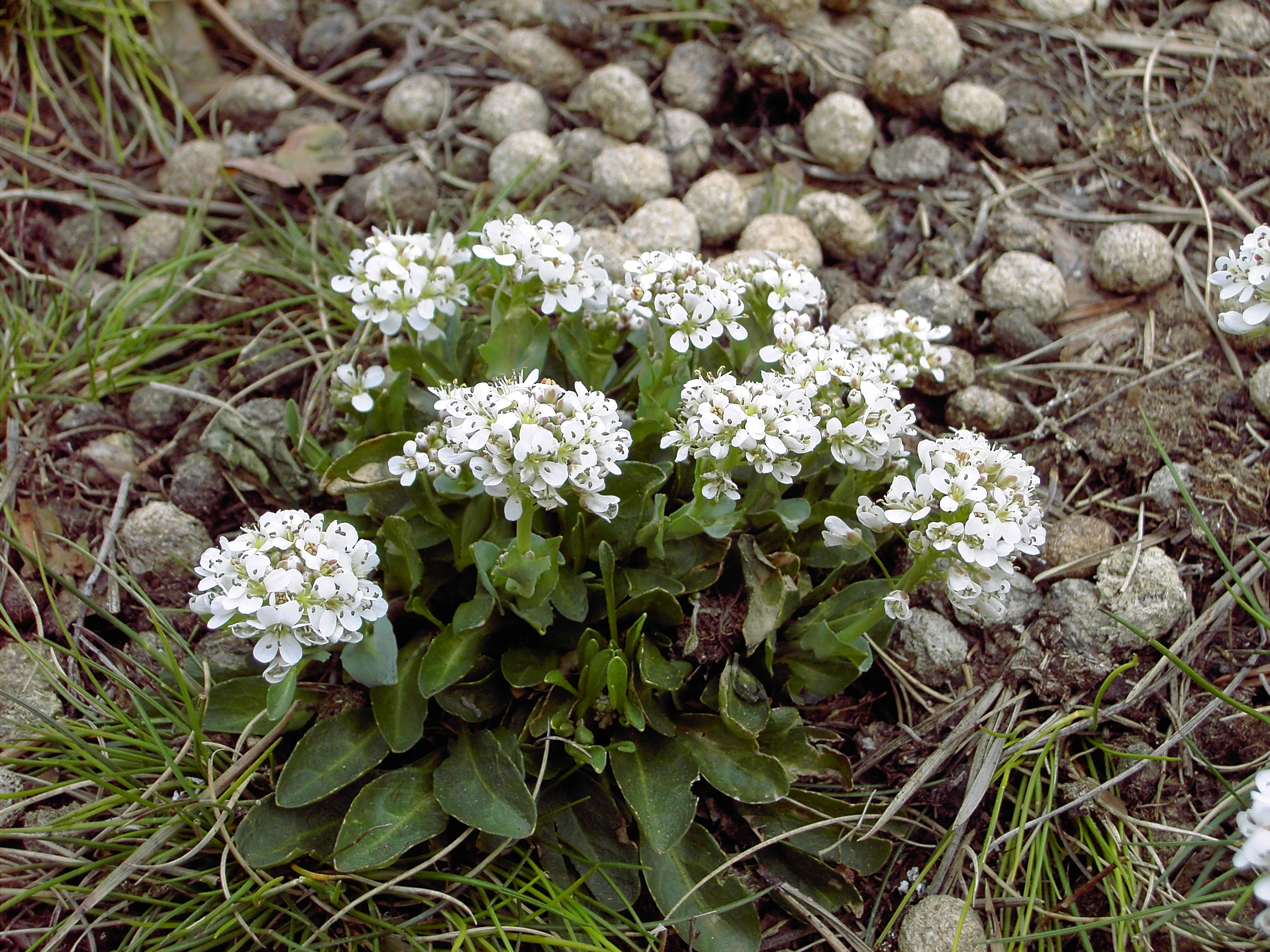
A close-up view of small white flowers known as Noccaea caerulescens growing from rocky, pebble-covered soil among scattered grasses.
Zinc violet or alpine pennycress (Noccaea caerulescens subsp. calaminaris) thriving in the metal-rich soil of Schlangenberg.

Schlangenberg Nature Reserve history and protected-area timeline

The history of Schlangenberg is inseparable from the history of mining. The hill and its surroundings were already being prospected for metal ores in Celtic times, and Roman occupation between roughly 100 and 400 AD is documented by more than twenty-five coin finds and the remains of Roman buildings in the area. After the medieval period, the site became increasingly important for the brass industry centred in Stolberg, where eighteenth-century copper masters built a near-monopoly on European brass production because local calamine ore could be combined with copper ore brought from the Harz mountains.

Until around 1800, ore was extracted almost entirely through surface digging, leaving the Schlangenberg region heavily pitted and contaminated with zinc, lead, and cadmium. From 1800 onward, deeper mining techniques allowed shafts to descend to about 105 metres, supported by pumping and drainage tunnels that emptied groundwater into the nearby Vichtbach. Between roughly 1850 and 1860, an early industrial mining complex developed on the hill, controlled successively by the Eschweiler Bergwerksverein, the Stolberger Gesellschaft, and the Allianz Anonyme Gesellschaft für Bergbau und Hüttenbetrieb bei Stolberg. A modern processing facility was erected in 1853, and from 1856 control passed entirely to the Eschweiler Gesellschaft.

By the 1870s the mine was in decline: an annual output of up to about 6,600 tonnes, produced by around 700 workers including roughly 200 hewers, had begun to exhaust the ore body. Operations were halted during the Franco-Prussian War in 1871, briefly reopened in 1881, and finally abandoned in 1883. Shifting corporate economics, in particular the need to purchase coal rather than produce it, made smelting unprofitable. A headframe for extracting sulphur-bearing iron ore for sulphuric acid production remained on the site until 1915, and the last mine structures were demolished in 1921.

The contamination left by mining earned the area the popular nickname Balkan, a reference to its devastated appearance. In the absence of any systematic restoration, nature was left to reclaim the toxic ground on its own. After the Second World War, the site was used as a military training ground, first by Belgian troops and later by the German Bundeswehr, and its traces of that era, including foxholes and access restrictions, still mark parts of the landscape. It was not until 1975 that the area received formal nature reserve status, bringing an end to motor-cross disturbance and beginning the more deliberate conservation management that continues today. A 2011 intervention removed around 6,000 pines to restore large open Magerrasen habitat, and annual short-term grazing by sheep and goat herds has since been used to maintain the open character of the reserve.

Schlangenberg Nature Reserve landscape and geographic character

The landscape of Schlangenberg is shaped almost entirely by its geology. The reserve lies on a narrow limestone ridge of Devonian age, a remnant of an ancient marine reef in which fossilised coral structures can still be found. Over hundreds of millions of years, uplift and erosion exposed the limestone at the surface, and secondary mineralisation converted parts of it into zinc and lead ore deposits that were later mined. The result today is a relatively low hill of about 276 metres above sea level, sitting within the broader rolling landscape of the northern Eifel foothills and forming a modest but prominent landmark visible from the nearby L12 road.

Around this central hill, the terrain alternates between shallow slopes, sunken mining pits (Pingen), patches of exposed rocky ground, and areas of scrubby pioneer vegetation. The upper slopes and ridge crests are generally the most open and exposed, while the lower areas hold denser vegetation and small woodland stands. The combination of historic surface disturbance and ongoing management has produced a patchwork texture of bare soil, low grassland, and scattered shrubs that gives the reserve a distinctive semi-open character unusual in the region.

Despite its industrial past, the Schlangenberg landscape has a quiet, almost austere attractiveness: the views stretch across the Stolberg valley toward the surrounding agricultural and forested countryside, while the reserve itself feels more like a steppe or heath than a typical Central European forest. Small water bodies and damp depressions, created as part of the 2011 restoration work, add further variety to the topography and support amphibians and moisture-loving plants in an otherwise dry, mineral-rich setting.
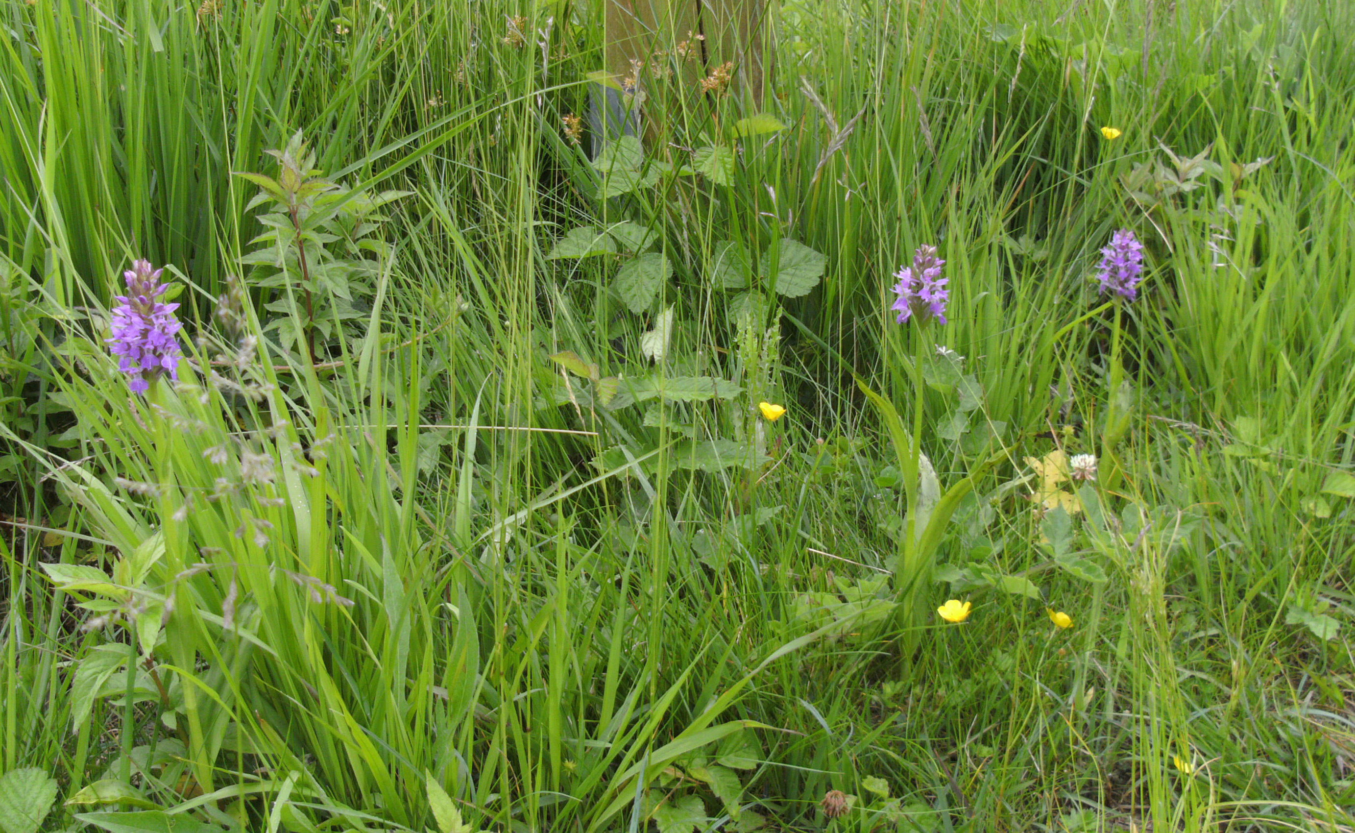
Several purple flowering orchids growing amidst tall green grass and smaller yellow wildflowers.
Wild orchids blooming in a grassy meadow within the Schlangenberg nature reserve.

Schlangenberg Nature Reserve ecosystems, habitats, and plant life

Ecologically, Schlangenberg Nature Reserve is defined by the unusual chemistry of its soils. The calamine-rich substrates contain such high concentrations of zinc, cadmium, and lead that they are hostile to almost all ordinary plants. This selective toxicity has allowed a specialised Galmei flora to flourish in relative isolation from competition, creating what botanists consider a refugial habitat with species traces reaching back to cold stages of the Pleistocene.

The most characteristic vegetation type is open metallophyte heath and dry grassland (Schwermetallrasen), dominated by Calamine fescues and a range of zinc-tolerant wildflowers. This open landscape is interspersed with low shrubs and patches of bare, rust-tinged soil. In the northwestern part of the reserve, the habitat shifts abruptly to mature deciduous woodland: a sweet woodruff beech forest in which the herb layer is dominated by the namesake woodruff and a diverse mix of spring geophytes. Within and around this woodland are stands of orchid-rich beech forest, where unusual substrates and microclimate support several nationally rare orchids.

Because the area that is now the reserve was heavily disturbed by mining, military use, and informal recreation, much of its current biodiversity is the result of natural recolonisation combined with active restoration. The 2011 removal of about 6,000 pines reopened large areas for grassland and heath regeneration, and targeted grazing keeps the open structure from being lost again. The contrast between the toxic, zinc-stained open ground and the cool, orchid-rich beech forest within a few hundred metres of one another is one of the reserve's most fascinating ecological features.
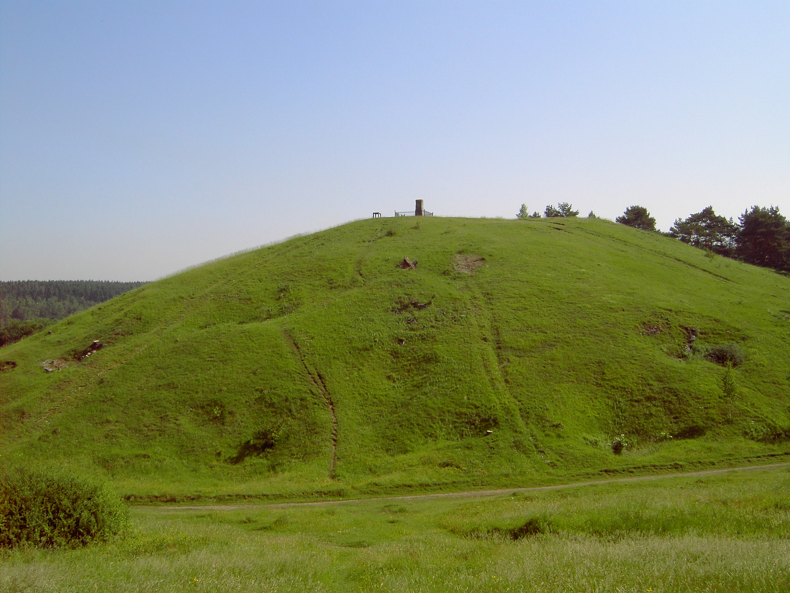
A green, grass-covered hill under a clear sky with a small structure on the summit.
The grass-covered Schlangenberg hill, a notable site within the nature reserve.

Schlangenberg Nature Reserve wildlife and species highlights

Although Schlangenberg is primarily celebrated for its flora, it also supports a remarkably rich invertebrate fauna. More than 300 species of butterflies and moths have been recorded, including both widespread species such as the Painted Lady, Red Admiral, and Swallowtail, and rarer metallophyte-associated species like the Small Blue, the Violet Fritillary, and the Thyme Burnet moth. The open heavy-metal heaths are particularly good habitat for these insects, and the reserve is also well known for its grasshopper populations, which include the Wart-biter, the Stripe-winged Grasshopper, and the large Great Green Bush-cricket. The Rose Chafer beetle is another characteristic inhabitant of the warm, open slopes.

The metallophyte heaths and surrounding scrub also provide habitat for reptiles, including occasional sightings of the smooth snake (Coronella austriaca), one of Europe's rarest snakes. Among birds, the largely tree-less character of the reserve makes it suitable for species of open country; both the Woodlark and the Red-backed Shrike are recorded as regular users of the habitat. The varied soil, microclimate, and abundance of insects together support a complex food web that is unusual for an area of this size.

A particular conservation project is the attempt by the Biologische Station im Kreis Aachen to re-establish the Yellow-bellied Toad (Bombina variegata) on the site. The small water bodies created during the 2011 restoration work are intended to provide breeding habitat for this once-native amphibian, and their success is being closely monitored. The result is a reserve whose wildlife value lies not in charismatic large mammals, but in a dense and specialised community of insects, reptiles, amphibians, and open-habitat birds.
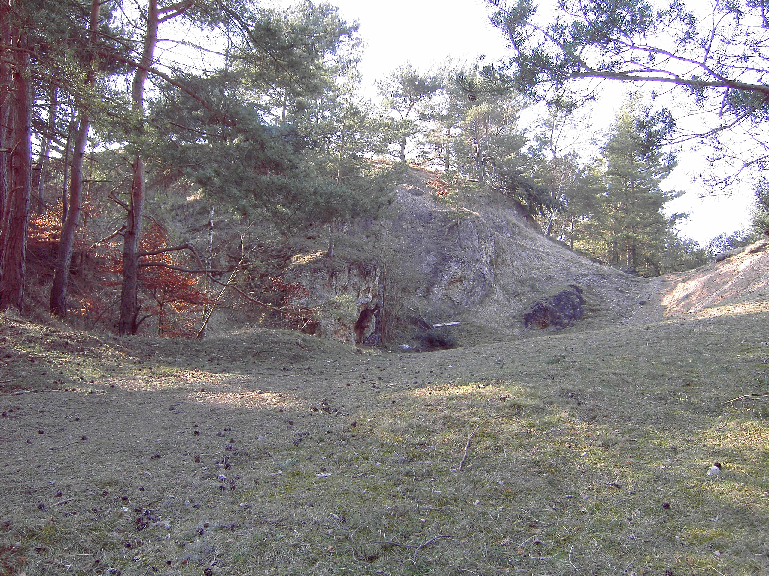
A view of the collapsed Hillemann 1 mine adit entrance built into a rocky hillside, surrounded by trees and grassy terrain.
The remains of the historical Hillemann 1 mine adit within the Schlangenberg nature reserve.

Schlangenberg Nature Reserve conservation status and protection priorities

Schlangenberg Nature Reserve is conserved primarily because of its exceptional botanical values. The Galmei flora that it protects is recognised across Europe as one of the most important metallophyte communities on the continent, and several of its species, such as Viola calaminaria and Thlaspi calaminare, have very limited global distributions. Without active protection, this flora would be highly vulnerable to scrub encroachment, trampling, and direct habitat loss.

The conservation approach combines formal protection under the Nature Conservation Act with active management. Pine encroachment has been the most visible long-term threat, as pines tolerate heavy-metal soils better than many broadleaf trees and would gradually close the open heath if left unchecked. The 2011 removal of some 6,000 pines, followed by annual grazing with sheep and goats, is designed to keep the Magerrasen open and to maintain habitat for thermophilic insects, reptiles, and orchids. Visitor pressure is managed through a network of designated paths, and the small information centre at Breinigerberg helps to raise awareness of how easily these fragile habitats can be damaged.

At a broader scale, Schlangenberg forms part of a wider network of protected areas in the Stolberg region and is included in landscape planning for the Städteregion Aachen. Its IUCN Category IV designation reflects the importance of active management in maintaining both the open heavy-metal heath and the orchid-rich woodland. The reserve is a clear example of how industrial contamination, combined with careful scientific conservation, can produce biodiversity value far beyond what would be expected of such a small site.

Schlangenberg Nature Reserve cultural meaning and human context

The cultural identity of Schlangenberg is closely tied to the long mining history of the Stolberg region. The hill was already known to Celtic prospectors, and Roman occupation in the first centuries AD left tangible traces in the landscape, including building foundations and coin finds. The industrial era, above all, defined the local economy and folklore: the brass masters of Stolberg built a European centre of brass production on the back of Schlangenberg's calamine ore, and even after mining ended, the name Balkan, used colloquially for the contaminated terrain, kept the memory of the industrial past alive in everyday speech.

Traditional mining heritage is reflected in numerous place names still used on and around the hill: named shafts such as Bleigrube, Hillmann, Königreich, and Schlangenberg I and II, and named ore bodies such as Adolphsgang, Gosselingang, and Hermannsteingang keep the vocabulary of historical mining legible on the ground. Remains of timbering, collapsed adits, and the remnants of foxholes from the post-war military period together create a layered palimpsest of human use that is still visible to careful visitors.

Local cultural institutions have worked actively to keep this heritage alive. In 1991, the Heimatverein of Breinigerberg, supported by the city of Stolberg, established an information centre in the old Breinigerberg school, presenting both the natural history of the reserve and an exhibition of mining artefacts. The site is also connected to the broader identity of the Eifel region as a landscape of small protected natural treasures, sitting alongside other Stolberg nature reserves such as Brockenberg, Hammerberg, and Schomet.
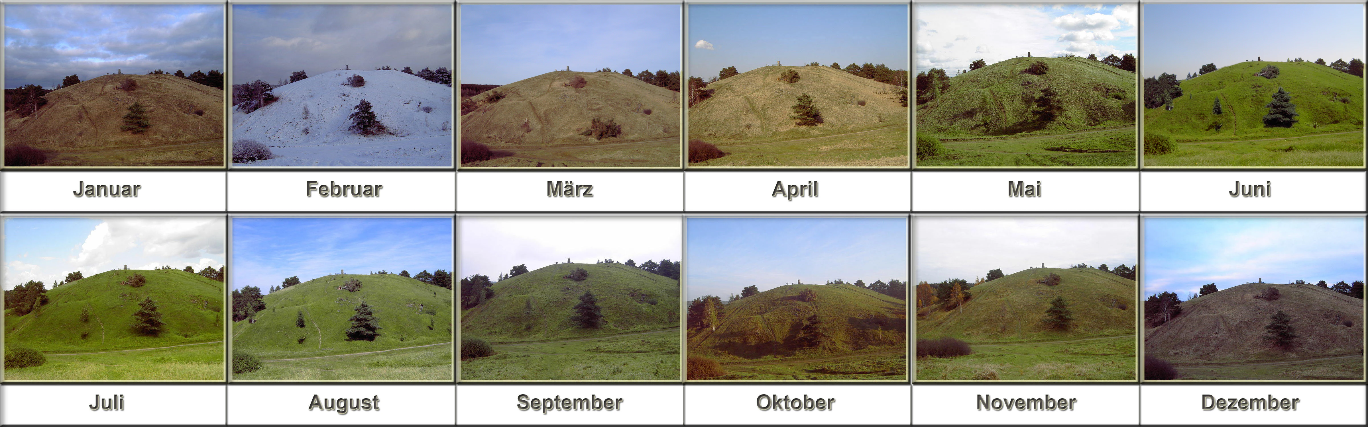
A grid of twelve photographs showing the same hill in the Schlangenberg nature reserve throughout each month of the year, from January to December, illustrating seasonal changes in vegetation and snow cover.
A composite overview of the Schlangenberg nature reserve showing the landscape across all twelve months of the year.

Top sights and standout views in Schlangenberg Nature Reserve

Schlangenberg Nature Reserve combines three layers of value that make it distinctive for its size. Its botanical highlight is the Galmei flora on heavy-metal soils, including globally rare metallophytes such as Viola calaminaria and Thlaspi calaminare, growing in open heath alongside Calamine fescues and inland Armeria maritima populations.

Its geological and industrial highlight is the Devonian limestone ridge mineralised by zinc and lead ores, whose surface workings and named shafts document more than 2,000 years of mineral extraction. The postwar military phase and the 2011 restoration efforts add a further modern chapter to that story.

Its ecological highlight is the juxtaposition within a single small reserve of open metallophyte grassland, scrubland, sweet woodruff beech forest, and orchid-rich beech woodland, supporting more than 300 recorded butterfly species, a strong grasshopper community, reptiles such as the smooth snake, and a reintroduction programme for the Yellow-bellied Toad.

Best time to visit Schlangenberg Nature Reserve

Spring and early summer are particularly rewarding at Schlangenberg, when the Galmei-Täschelkraut flowers between March and April and a sequence of orchids and metallophyte wildflowers come into bloom across the open heaths and beech woodland edges. Late spring also offers the best chance to see butterflies and grasshoppers at their most active across the warm, open slopes.

Late summer and early autumn can also be pleasant, especially for viewing the landscape character of the reserve and the interplay between open heath, scrub, and woodland; insects remain abundant and the grasses and shrubs take on warm colours. Winters tend to be quieter atmospherically, with sparser vegetation cover, but they make the underlying mining features of the hill, such as old pits and shaft depressions, more visible. Visitors should generally avoid disturbing the ground vegetation, which is fragile and partly toxic, and stick to established paths despite the temptation to explore the old mining sites.
Monthly climate preview

Long term representative point measurements and weather by month for Städteregion Aachen

Naturschutzgebiet Schlangenberg Climate Normals, Annual Temperature and Precipitation Rhythm

Historical data records a measured annual temperature range from negative averages in winter months to warm summer maximums alongside consistent daily precipitation patterns. Examining the complete twelve month profile provides detailed monthly climate normals for analyzing long term environmental conditions.
Annual mean8 °C
0 °C17 °C
Jan
Feb
Mar
Apr
May11°
Jun15°
Jul17°
Aug17°
Sep13°
Oct
Nov
Dec
Warmest month
July

17 °C

Coolest month
January

-0 °C

Wettest month
December

3.1 mm/day

Driest month
April

1.9 mm/day

Park location guide

Geography guide, regional context, and park location map for Schlangenberg Nature Reserve

Schlangenberg Nature Reserve park geography, regions, and map view in Germany

Understand where Schlangenberg Nature Reserve sits in Germany through a broader geographic reading of the surrounding landscape, nearby location context, and its mapped position within the national park landscape.

How Schlangenberg Nature Reserve fits into Germany

Germany is a federal republic in Western and Central Europe with a population of over 83 million across sixteen constituent states. It is Europe's largest economy by nominal GDP and a major global exporter and importer. The capital is Berlin, and the country borders Denmark, Poland, Czech Republic, Austria, Switzerland, France, Luxembourg, Belgium, and the Netherlands.

Wider geography shaping Schlangenberg Nature Reserve in Germany

Germany is located in Western and Central Europe, spanning 357,022 km². It borders Denmark to the north, Poland and the Czech Republic to the east, Austria and Switzerland to the south, and France, Luxembourg, Belgium, and the Netherlands to the west. The country has coastlines on the Baltic Sea and North Sea to the north, with the Alps located in the southern region.

Map view of Schlangenberg Nature Reserve

Use this park location map to pinpoint Schlangenberg Nature Reserve in Germany, understand its exact geographic position, and read its mapped placement within the surrounding landscape more clearly.

Pigeon | © OpenStreetMap contributors

Location context for Schlangenberg Nature Reserve

Städteregion Aachen

Explore protected area views, rare habitats, and limestone terrain imagery

Naturschutzgebiet Schlangenberg Photos and Landscape Scenery Visual Guide

Visual documentation captures the unique heavy metal grasslands, rocky ridges, and specialized calamine flora defining the protected landscape. Examining these field photographs reveals the distinct terrain, rare plant habitats, and ecological character of the nature reserve.

A close-up view of small white flowers known as Noccaea caerulescens growing from rocky, pebble-covered soil among scattered grasses.

Several small yellow flowers, known as calamine violets, growing amongst dry grass and low-lying vegetation.

Several purple flowering orchids growing amidst tall green grass and smaller yellow wildflowers.

A green, grass-covered hill under a clear sky with a small structure on the summit.

A view of the collapsed Hillemann 1 mine adit entrance built into a rocky hillside, surrounded by trees and grassy terrain.

A wide, outdoor landscape shot of a hilly, partially cleared terrain with sparse trees and shrubs under a clear blue sky, indicative of ecological restoration.

A grid of twelve photographs showing the same hill in the Schlangenberg nature reserve throughout each month of the year, from January to December, illustrating seasonal changes in vegetation and snow cover.

Park atlas

Compare adjacent conservation areas and regional habitats across the northern Eifel foothills.

Parks Near Naturschutzgebiet Schlangenberg And Surrounding Protected Landscapes

Browsing other parks near Naturschutzgebiet Schlangenberg reveals connected ecological reserves and protected landscapes across the surrounding region. Comparing these nearby terrain types and botanical habitats provides broader geographical context for German conservation areas.
A wide panoramic watercolor painting showing a landscape with a winding light green river or meadow in the foreground, a band of green trees in the middle ground, and purple mountains in the background against a white sky.
Nature reserveNordrhein-Westfalen
About 2.2 km away#1 closest

Southwest

Naturschutzgebiet Schomet: Mapping the Protected Limestone Ridge and Reclaimed Quarry Landscapes

Nature reserve geography in Stolberg, Nordrhein-Westfalen

Examine the distinct geomorphology of Naturschutzgebiet Schomet, where abandoned Carboniferous limestone quarries have evolved into sheltered refuges for hornbeam forest and spring flora. This protected area offers insight into the regional geology of the Eifel foothills, showcasing how human-modified landscapes serve as important ecological corridors for amphibians and rare butterfly species within the broader Stolberg municipal network.

Area
12.81 km²
Established
2005
IUCN
IV
A soft watercolor painting showing a meandering stream winding through green meadows and trees with distant purple hills.
Nature reserveNorth Rhine-Westphalia
About 4.1 km away#2 closest

Northwest

Münsterbusch zwischen Hamm und Haumühle Nature Reserve: Geography and Protected Landscapes

Ecological terrain and Inde valley floodplain mapping

Located in the Städteregion Aachen, Münsterbusch zwischen Hamm und Haumühle offers a compact yet diverse protected terrain. This nature reserve maps as a valuable corridor of oak-hornbeam forests, wet meadows, and specialized grasslands, showcasing the intersection of industrial history and botanical heritage within western Germany.

Established
2004
IUCN
IV
A horizontal watercolor illustration depicting rolling, soft-toned hills and a line of stylized trees in greens and pinks against a white background.
Nature reserveNordrhein-Westfalen
About 7.3 km away#3 closest

Southwest

Naturschutzgebiet Schmithof: A Geological and Ecological Protected Area in Nordrhein-Westfalen

Mapped limestone quarries and traditional coppice forest landscapes

Located within the Städteregion Aachen, Naturschutzgebiet Schmithof protects a significant conjunction of geological and biological values. The site features an abandoned limestone quarry set against a backdrop of historic oak-hornbeam forest. This reserve provides a clear window into the local terrain, where calcareous grassland soils support rare flora and reflect ongoing habitat succession within a protected landscape context.

Area
0.048 km²
Established
1988
IUCN
IV
Relief
Lowland
A watercolor painting depicting rolling, soft-toned green hills and a foreground of trees and riparian vegetation.
Nature reserveNorth Rhine-Westphalia
About 7.6 km away#4 closest

South

Laubwald am Hasselbachgraben Nature Reserve in North Rhine-Westphalia

Protected Eifel forest and riparian stream landscape

Located in the Städteregion Aachen, Laubwald am Hasselbachgraben preserves a distinct mix of European beech, oak, and spruce. The reserve is anchored by the Hasselbach stream valley and the landmark Kreitzberg Naturwaldzelle, providing a critical study of near-natural woodland structure within the northern Eifel region.

Area
2.88 km²
Established
1999
IUCN
IV
Relief
Upland
Nature reserveGermany
About 7.8 km away#5 closest

Northeast

Korkus Nature Reserve: A Detailed Geographic Overview of Protected Woodland in Germany

Mapping the historic mining terrain and stream-valley ecology

Korkus Nature Reserve offers a focused view into the woodland mosaic of the Städteregion Aachen. This protected area preserves a unique synthesis of stream-bordered forest and remnants of ancient iron extraction, providing a distinct geographic footprint within the broader context of North Rhine-Westphalia.

Area
5.208 km²
Established
1990
IUCN
IV
A soft watercolor illustration showing a winding river flowing through a forested valley with gentle rolling hills in the background.
Nature reserveGermany
About 9.2 km away#6 closest

Southwest

Naturschutzgebiet Oberlauf der Inde im Münsterwald: Germany Protected Nature Reserve Atlas

Headwater streams and rare wetland habitats in the Aachen region.

Situated in the Münsterwald near Aachen, this nature reserve protects the intact headwaters of the Inde and Fobisbach streams. The area is characterized by a complex, compact landscape of alder carr, spring-fed bogs, and Molinia grasslands, offering a rare window into the natural hydrology and wetland vegetation of the region.

Area
0.299 km²
Established
1988
Relief
Upland
Climate
Temperate
Watercolor painting of a rolling stream valley with soft green hills and light water
Nature reserveStädteregion Aachen
About 11 km away#7 closest

South

Kelzer- und Saarscher Bachtal: Protected Brook Valley Geography and Forest Terrain

Nature reserve exploration in the Städteregion Aachen landscape

The Kelzer- und Saarscher Bachtal nature reserve protects a vital network of brook valley habitats, including deciduous forest remnants, wet heath, and cascading stream sections. This area offers a clear look at local hydrologic restoration and the structural diversity found within the Eifel district, providing a focused view for those interested in regional protected-land geography.

Area
0.46 km²
Established
1999
IUCN
IV
Nature reserveGermany
About 11 km away#8 closest

West

Wurmtal Nature Reserve: Mapping the Protected River Valley and Floodplain Geography

Protected riparian habitat in North Rhine-Westphalia

Wurmtal protects a diverse river corridor characterized by free-meandering stretches, soft-wood floodplain forests, and distinct industrial-heritage landmarks. This atlas entry provides insight into the valley's structural geography, including its steep erosion cliffs, gravel-bed river dynamics, and role as a significant ecological migration route within the regional landscape.

Established
1989
Relief
Lowland
Scope
Terrestrial
Water
Water-dominated

Common questions about visiting, size, designation, and location context for Schlangenberg Nature Reserve

Schlangenberg Nature Reserve FAQs for park facts, access, geography, and protected area context

Find quick answers about Schlangenberg Nature Reserve, including protected-area facts, park geography, trail and visitor context, and how the park fits into its surrounding country and regional landscape.
MoriAtlas Explorer

Continue Your Protected Areas Search Across the Global Atlas

Deepen your exploration by continuing the structured search for national parks and protected areas worldwide. Utilize the comprehensive filtering capabilities to compare different conservation landscapes and refine your understanding of global park geography. Discover more about the distribution and characteristics of protected natural areas.

Global natural geography