
Mori Atlas logo
Nature reserveSchönower Heide

Tracing the open heathlands, glacial dunes, and wetland mosaics of this German nature reserve

Schönower Heide Nature Reserve and Protected Landscape in the Brandenburg Region

(Naturschutzgebiet Schönower Heide)

Schönower Heide spans 533 hectares of protected land on the northwestern edge of Schönow, serving as a notable example of habitat restoration on former military training grounds. The reserve captures a distinct mosaic of post-glacial sandy soils, where open Calluna heathlands, inland dunes, and the Rohrpfuhl wetland create a rare lowland ecosystem. Through careful management of its natural terrain and wild grazing initiatives, the site provides a clear view into the ecological character of the Brandenburg landscape.

heathlandinland dunessand heathpine woodlandwetlandRohrpfuhl
A flat vector-style illustration of a landscape with a river flowing through a valley surrounded by rocky cliffs, pine trees, a waterfall, and a setting sun.

Schönower Heide

Nature reserve

Park overview

Structured park overview, official facts, and landscape profile for Schönower Heide

Schönower Heide park facts, protected area profile, and essential visitor context

Review the core facts for Schönower Heide, including designation, size, terrain, visitor scale, habitats, and operating context in one park-focused overview.

About Schönower Heide

Schönower Heide lies on sandy soils deposited during the last ice age in the Wandlitz-Ladeburg outwash plain, an environment that naturally favours heath and dry grassland rather than tall, closed forest. Today the reserve is a mosaic of open habitats: extensive heather stands, sandy dry grasslands with silvergrass and other pioneer plants, inland dunes, small wetland areas around the Rohrpfuhl, and patches of birch and pine woodland that reflect a long history of human use.

The site is owned by the city of Berlin and has been managed since 2000 by the Berliner Forsten as a formal Naturschutzgebiet, with simultaneous European Fauna-Flora-Habitat status. Its purpose is to conserve habitats listed under Annex I of the EU Habitats Directive, particularly dry heaths with heather and broom, sandy dry grasslands with silvergrass and bent grasses, and a range of wetland and bog margin communities. The reserve is small in regional terms, but its concentration of habitat types within a single walkable area gives it strong value for both biodiversity conservation and public education.

Schönower Heide also illustrates a wider European theme of former military training land being converted into nature reserves. The combination of trampled soil, burned patches, vehicle tracks and removed vegetation unintentionally kept the landscape unusually open, and the reserve now combines traditional management such as sheep grazing and controlled burning with a more recent approach using wild ungulates inside a large fenced enclosure. Visitor infrastructure, including marked circular trails, an observation tower and information boards, makes the reserve accessible without intruding on sensitive areas, much of which remain closed to visitors due to residual munitions contamination.

Quick facts and research context for Schönower Heide

Schönower Heide is a nature reserve of about 533 hectares in the Landkreis Barnim of Brandenburg, Germany, located northwest of Schönow, a district of Bernau bei Berlin. It has been a designated Naturschutzgebiet since 1 December 2000, and is simultaneously notified as a European Fauna-Flora-Habitat site under the EU Habitats Directive. The reserve is owned by the State of Berlin and managed by the Berliner Forsten. Its IUCN management category is Category V, a protected landscape or seascape.

The landscape combines inland dunes, open Calluna heath, sandy dry grassland and a wetland complex around the Rohrpfuhl and the headwaters of the Lietzengraben. A fenced wild grazing project introduced fallow deer, red deer and mouflon in 2009 to keep shrubs and trees from encroaching on the heath. The reserve is crossed by circular walking trails of about 1.5 and 5 kilometres and includes an observation tower and visitor information panels.

Protection and recognition

Documented terrestrial designation history, management scope, and Natura 2000 records

Schönower Heide Protection Status and International Recognition Data

Schönower Heide maintains documented terrestrial protection status established in the year 2000 alongside verified Natura 2000 recognition records. Visitors can review official designation history and administrative scope through structured conservation data.

International recognition

Protection details

Protection scope
Terrestrial
Designated year
2000
Transboundary protection
No
WDPA ID
319086
Park context

Deeper park guide and search-rich context for Schönower Heide

Schönower Heide history, landscape, wildlife, and travel context

Explore Schönower Heide through its history, landscape character, ecosystems, wildlife, conservation priorities, cultural context, and seasonal travel timing in a structured park guide built for atlas discovery and search intent.

Why Schönower Heide stands out

Schönower Heide is best known for its open inland dune and sand heath landscape, a rare lowland habitat type in Brandenburg that was unintentionally preserved through a century of military use. Large stands of common heather, known in German as Besenheide, dominate the central part of the reserve, together with pioneer plant communities typical of acidic, nutrient-poor sandy soils. The reserve is also recognised for its ongoing wild animal grazing project, in which fallow deer, red deer and European mouflon are kept within a fenced area to maintain open heathland conditions. Combined with its designation as a European Fauna-Flora-Habitat, this combination of dry heath, dune, bog and species-rich grassland makes the Schönower Heide a notable case study of habitat restoration on former military training land, easily accessible from the Berlin metropolitan region.
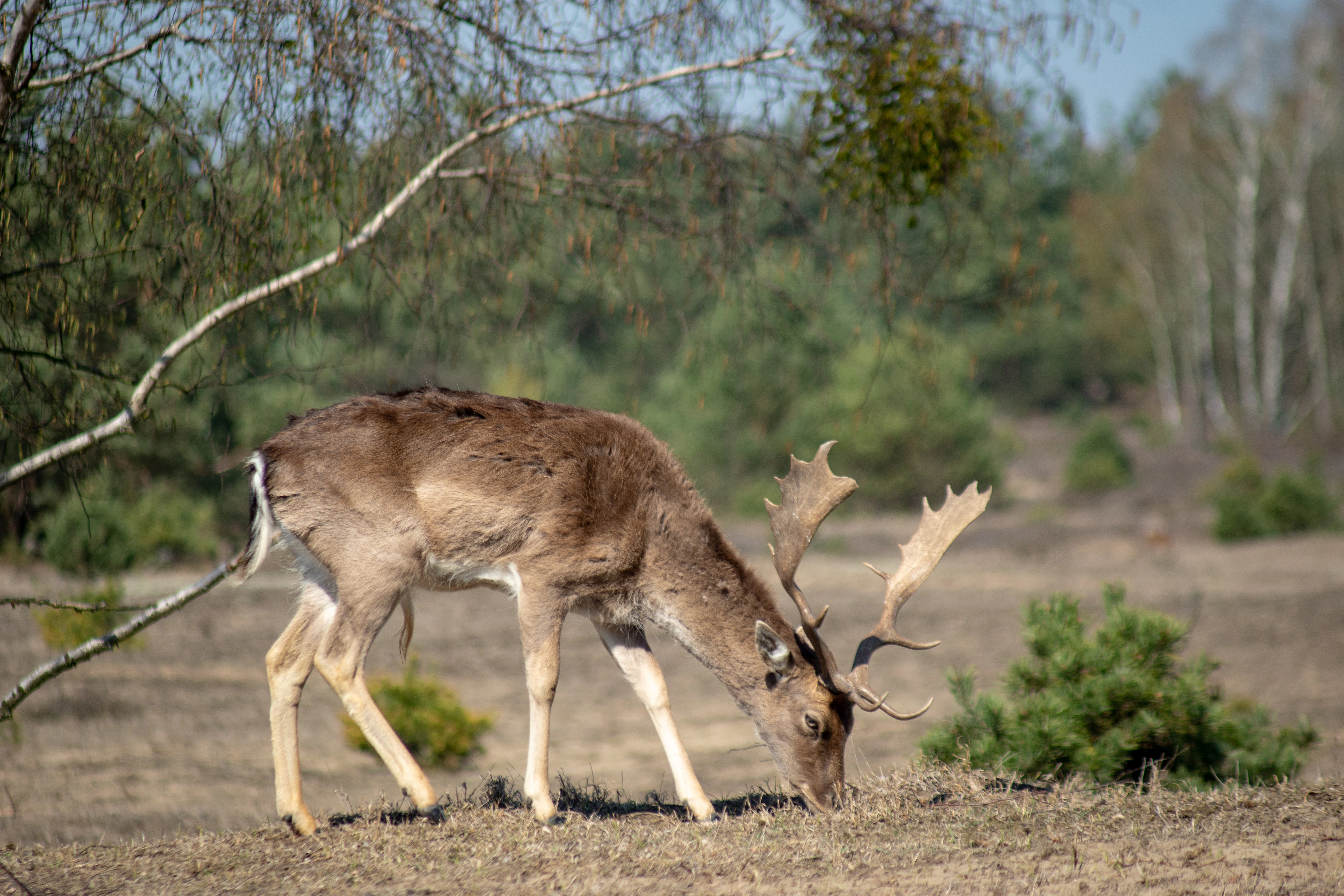
A fallow deer with antlers grazing on sparse vegetation in an open heathland setting.
A fallow deer grazing in the Schönower Heide landscape.

Schönower Heide history and protected-area timeline

The original mixed deciduous forests of the Schönower Heide were exploited from the Middle Ages onward for firewood, timber and woodland grazing. The nutrient-poor glacial sands of the Wandlitz-Ladeburg outwash plain, combined with this sustained removal of nutrients, gradually impoverished the soils. The result was a transition toward moss and lichen-dominated vegetation, which already carried many features of the open heath that defines the reserve today.

Major population losses during the Thirty Years' War briefly reduced the pressure on the woodlands, but a 1757 division of the area between the royal authorities of Mühlenbeck and the town of Bernau reflected increasing efforts to formalise land use and curb unregulated extraction of wood and litter. From the nineteenth century onward, systematic reforestation shifted large parts of the surrounding Bernau-Schönwalde-Wandlitz region into extensive pine forest.

The defining turn came in the early twentieth century. Around 1900, the city of Berlin purchased land near the settlement of Birkbusch, later renamed Hobrechtsfelde, to establish a city estate and sewage farms, bringing significant portions of the heath into Berlin's ownership. A forest area damaged by caterpillar defoliation was first used as a military training ground by imperial guards, then by the Reichswehr, and from 1946 until 1991 by Soviet forces stationed near Bernau. Tank and infantry activity cleared roughly 125 hectares of woodland, while fires from live ammunition repeatedly burned back vegetation during summer months and maintained the open character of the heath.

Following German reunification, the Schönower Heide was transferred to the State of Berlin and placed under the Berliner Forsten. High levels of unexploded munitions made large parts inaccessible for ordinary use. In 2000 the area was designated a nature reserve and an EU Fauna-Flora-Habitat site. Subsequent restoration work included sheep grazing, removal of former military buildings and tracks, large-scale mowing and a controlled winter burn in 2004. Visitor access was gradually opened from 2004 with a new entrance, parking areas and circular walking trails, and in 2009, fallow deer, red deer and mouflon were introduced into a fenced 140-hectare enclosure as a permanent grazing project to keep the heath open.

Schönower Heide landscape and geographic character

The Schönower Heide sits on the sandy outwash plain left by the glaciers of the Weichselian ice age, a geological setting that gives the reserve its defining scenery. The land surface is gently undulating, with low inland dunes, broad sandy flats and shallow depressions that hold small wetland areas. Because the soils are poor and dry, they support only thin pioneer plant communities and low scrub, producing expansive open vistas rather than closed forest.

In the southern part of the reserve, a clearly visible inland dune illustrates the area's glacial inheritance, while central sections are dominated by wide stands of common heather interspersed with silvergrass swards and other sandy grassland species. In the northeast, a former wet depression now carries tall herb and grass communities, and to the west, immediately along the L 30 country road, the 26-hectare Rohrbruch wetland forms a striking contrast to the dry heath. This wetland lies in the headwaters of the Lietzengraben and is characterised by alder, sedge and tall herb vegetation.

Overall, the landscape reads as a mosaic in which dry and wet habitats are unusually close together, with open foreground views interrupted by small clumps of birch, Scots pine, aspen and juniper. The flat topography and the absence of major elevations mean that the reserve's visual scale is defined by openness rather than relief.
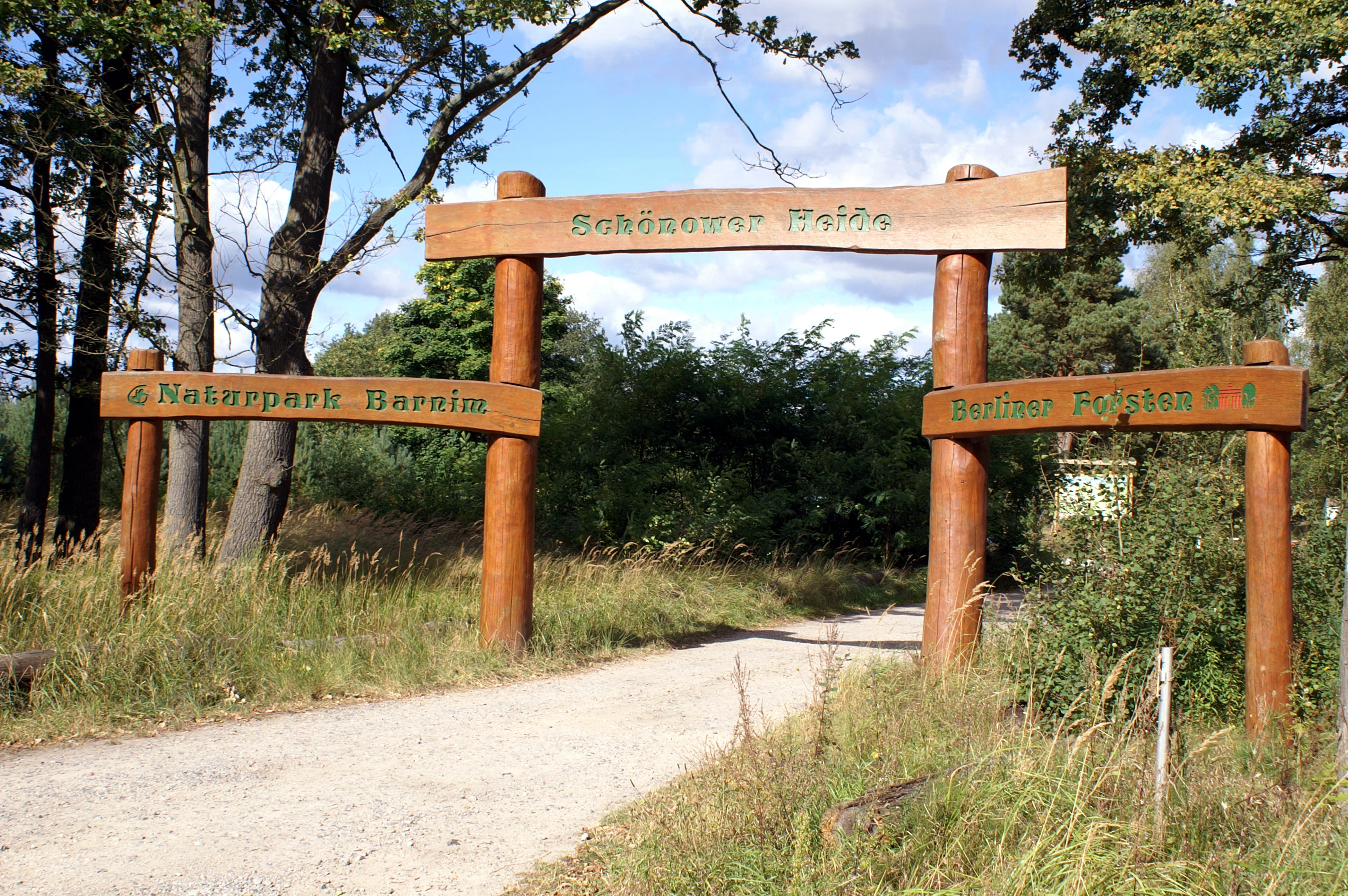
A rustic wooden archway serves as the entrance to the Schönower Heide nature reserve, with signs attached to the posts identifying the park and the Barnim Nature Park.
Wooden entrance gateway marking the access to the Schönower Heide nature reserve.

Schönower Heide ecosystems, habitats, and plant life

The nature of the Schönower Heide reflects the interaction between geology, history and active management. The central Calluna heath is the ecological heart of the reserve and supports the typical species of Berlin-Brandenburg sand heathlands, including common heather itself, juniper, silvergrass, mouse-ear hawkweed, biting stonecrop and the sand immortelle. A vegetation survey in 2008 recorded around 200 plant species, with around 40 lichen species adding to the conservation value of the open sandy surfaces.

Around the dry heath, sandy dry grasslands form what ecologists call pioneer vegetation on acidic, nutrient-poor substrates. These grasslands pass at their edges into small pockets of taller vegetation dominated by aspen, birch and Scots pine, reflecting the dynamic tension between open heath woodland and incipient forest. The wetland margins, particularly the Rohrbruch, contribute a markedly different ecological character, with alder carr, sedge communities and tall herb fringes that have their own distinctive species mix.

Taken together, these habitats create a compact but ecologically diverse reserve in which dry heath, dune grassland, wet meadow, scrub and early forest all occur within walking distance. The current management strategy, including sheep grazing, controlled burning and large ungulate grazing, is designed to keep the open habitats dominant and to favour natural successional processes wherever possible.
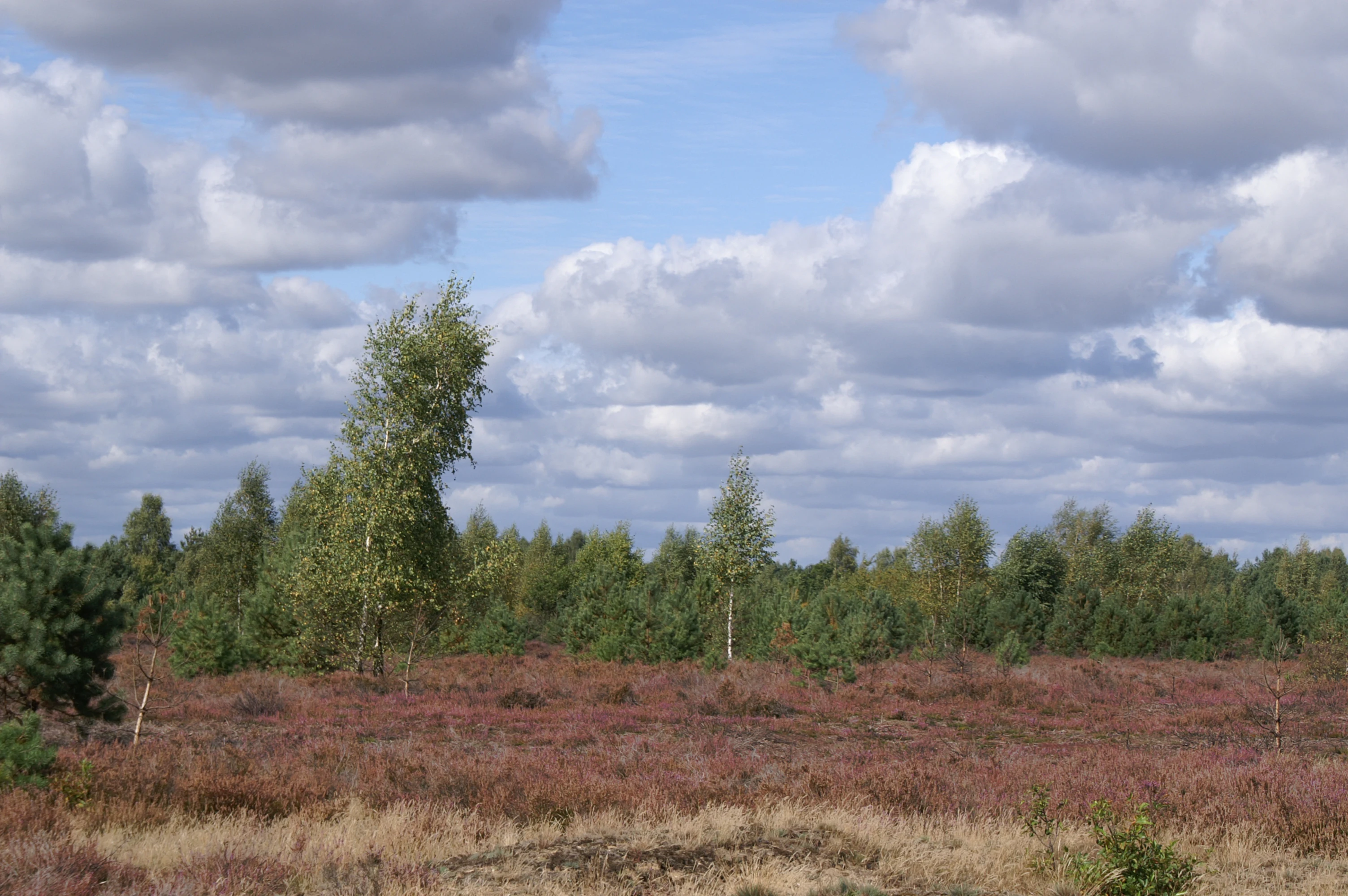
A wide view of open heathland with low shrubs and scattered small trees under a sky filled with fluffy white clouds.
Autumn landscape in the Schonower Heide nature reserve.

Schönower Heide wildlife and species highlights

The wildlife of the Schönower Heide is shaped by the warmth of its open sandy surfaces and by the proximity of dry heath, dune and wetland elements within a single protected area. Heat-loving invertebrates are particularly well represented, including sand lizards, butterflies, tiger beetles, darter dragonflies, wild bees and various grasshopper species. Around 200 plant species and a rich lichen flora provide the resource base for this invertebrate community.

The birdlife is the reserve's most prominent faunal asset. A 2001 breeding bird survey recorded 61 species, including a significant share of threatened habitat specialists. Species of conservation concern documented in the reserve include whinchat, woodlark, Eurasian hoopoe, European stonechat, Eurasian woodcock, European nightjar, great grey shrike and tawny pipit. More common breeding birds include willow warbler, tree pipit, yellowhammer, skylark, chaffinch and common blackbird. The removal of old rubble and building remains in the early years of the reserve had a measurable negative effect on whinchat pairs in particular, illustrating how sensitive some species are to small changes in habitat structure.

Since 2009, fallow deer, red deer and European mouflon have lived in a 140-hectare fenced area within the reserve, with populations expected to rise gradually toward around 140 animals. Their grazing pressure is intended to suppress shrub and tree regrowth, including the heather itself through mouflon browsing. From 2012, Konik ponies joined the grazing regime in the southeastern woodlands of the reserve, complementing earlier cattle grazing in the Bucher Forst and former sewage farm areas around Hobrechtsfelde, with the combined effect of maintaining a varied mosaic of open and lightly wooded habitats rather than closed forest.
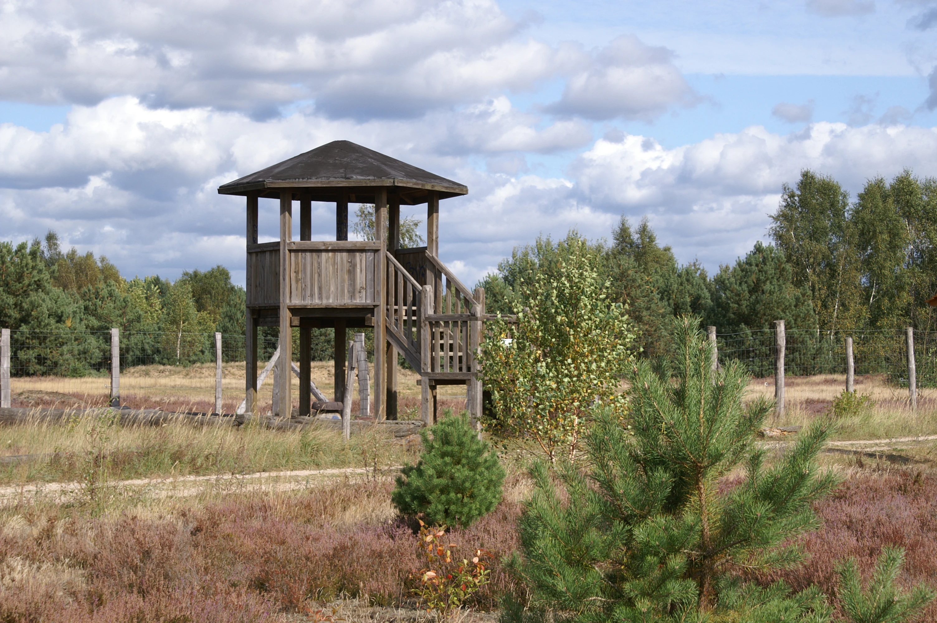
A wooden observation tower stands in an open, grassy landscape with scattered small trees and a wooden fence, under a cloudy sky.
A wooden observation tower situated within the open heathland of Schönower Heide.

Schönower Heide conservation status and protection priorities

The conservation significance of the Schönower Heide lies in its role as a refuge for several Annex I habitat types of the European Habitats Directive, notably dry heaths with common heather and broom, Inland dunes with open Corynephorus and Agrostis grasslands, and various wetland and bog margin communities. Its designation as a European Fauna-Flora-Habitat site under Directive 92/43/EWG places it within the Natura 2000 network and underlines its role in maintaining habitat connectivity in the Barnim region.

National conservation status comes from its designation as a Naturschutzgebiet in December 2000 and its IUCN Category V classification as a protected landscape. The stated conservation goal is to maintain and develop the heath and its associated plant communities, including sedge swamp, alder carr, white moss-pine and willow-buckthorn communities, along with the characteristic dry heath and dry grassland habitats. A second explicit goal is to secure the populations of threatened animal species for which the reserve provides feeding and breeding habitat, particularly groups such as birds, amphibians, reptiles, butterflies, wild bees, grasshoppers, dragonflies, beetles and spiders.

Active management distinguishes the reserve from a purely passive protection site. The Berliner Forsten combine traditional measures such as sheep grazing, mowing and controlled burning with a more recent wild ungulate grazing project, supported scientifically by the Eberswalde University for Sustainable Development and the Leibniz Institute for Zoo and Wildlife Research in Berlin. Their research addresses both the effectiveness of wild grazing in preventing shrub encroachment and its consequences for other species, including potential effects on heather nectar availability for pollinating insects. Residual munitions contamination continues to shape practical management, and large zones of the reserve remain closed to visitors for safety reasons.

Schönower Heide cultural meaning and human context

The Schönower Heide is closely tied to the cultural landscape of the Barnim region north of Berlin and to the historical entanglement of this area with the administration of the Prussian capital and its hinterland. The heath lies near the village of Schönow, which has been part of Bernau bei Berlin since 2003, and near Hobrechtsfelde, a settlement renamed in 1908 after the Berlin city planner James Hobrecht. The acquisition of large estates by the city of Berlin around 1900, for use as city farms and sewage farms, marked a turning point in tying the local landscape economically to the growth of the metropolis.

The reserve also carries a distinctive twentieth-century military memory. Its open character was, in large part, shaped by the successive presence of imperial German, Reichswehr and Soviet forces, with the latter using parts of the heath as a training area from 1946 to 1991. The traces of this period, including cleared forest, building foundations and, today, residual munitions contamination, are part of the site's identity and are referenced in local publications such as the Hobrechtsfelde anniversary volume and Otto Koch's 1934 community history of Schönow.

A more contemporary cultural layer comes from the Interessenverein Schönower Heide, founded in 2006, which organises guided tours, environmental education activities and practical conservation workdays, including a children's group known as the Heidekinder. This volunteer involvement reflects the heath's place in the local identity of the Barnim communities and links conservation, public education and regional heritage in a single ongoing effort.

Top sights and standout views in Schönower Heide

Among the standout features of the Schönower Heide are its extensive Calluna sand heath, its inland dune landforms and its unusually intact combination of dry heath, sandy dry grassland and wetland habitats within a compact reserve. The visitor infrastructure is modest but well designed, with an observation tower that opens up wide views over the heath, two circular trails of roughly 1.5 and 5 kilometres and information panels explaining both the natural history and the wild grazing project.

The 2009 wild animal grazing initiative, which keeps fallow deer, red deer and European mouflon inside a fenced 140-hectare area, is a distinctive feature that differentiates the reserve from many smaller Brandenburg heaths and offers visitors a realistic chance to observe game in a near-natural setting. Combined with the site's status as a European Fauna-Flora-Habitat, its origin as former military training land and its proximity to Berlin, the Schönower Heide represents a tightly layered example of sand heathland restoration in a lowland setting, easily accessible from the wider Berlin-Brandenburg metropolitan region.

Best time to visit Schönower Heide

The Schönower Heide is most visually striking in late summer and early autumn, when the common heather is in full bloom and turns the central parts of the reserve into broad bands of purple, against which the pale inland dune sand and scattered pines stand out sharply. This is also the season when most of the heath's characteristic insects, including butterflies, dragonflies and wild bees, are most active and visible along the trails.

Spring and early summer bring their own appeal, with migrant breeding birds such as woodlark, whinchat and Eurasian hoopoe present in the area, and the wetland sections around the Rohrpfuhl and Lietzengraben at their lushest. Winter visits are possible for the most determined walkers, but visitors should be aware that significant parts of the reserve remain closed year-round because of residual munitions contamination, regardless of season.

Monthly climate preview

Long-term representative averages tracking temperature and precipitation rhythm in Brandenburg

Schönower Heide Climate Normals and Measured Annual Temperature Patterns

Representative coordinate records show measured monthly temperature swings from sub-zero winter minimums to warm summer maximums alongside consistent daily precipitation. Detailed monthly climate profiles provide complete twelve-month normals for analyzing long-term environmental patterns across Schönower Heide.
Annual mean9 °C
-1 °C20 °C
Jan-1°
Feb
Mar
Apr
May14°
Jun18°
Jul20°
Aug20°
Sep15°
Oct
Nov
Dec
Warmest month
July

20.3 °C

Coolest month
January

-0.9 °C

Wettest month
July

2.4 mm/day

Driest month
April

1.1 mm/day

Park location guide

Geography guide, regional context, and park location map for Schönower Heide

Schönower Heide park geography, regions, and map view in Germany

Understand where Schönower Heide sits in Germany through a broader geographic reading of the surrounding landscape, nearby location context, and its mapped position within the national park landscape.

How Schönower Heide fits into Germany

Germany is a federal republic in Western and Central Europe with a population of over 83 million across sixteen constituent states. It is Europe's largest economy by nominal GDP and a major global exporter and importer. The capital is Berlin, and the country borders Denmark, Poland, Czech Republic, Austria, Switzerland, France, Luxembourg, Belgium, and the Netherlands.

Wider geography shaping Schönower Heide in Germany

Germany is located in Western and Central Europe, spanning 357,022 km². It borders Denmark to the north, Poland and the Czech Republic to the east, Austria and Switzerland to the south, and France, Luxembourg, Belgium, and the Netherlands to the west. The country has coastlines on the Baltic Sea and North Sea to the north, with the Alps located in the southern region.

Map view of Schönower Heide

Use this park location map to pinpoint Schönower Heide in Germany, understand its exact geographic position, and read its mapped placement within the surrounding landscape more clearly.

Pigeon | © OpenStreetMap contributors

Location context for Schönower Heide

Brandenburg

Photographic reference covering post glacial dunes, wetland habitats, and open terrain character.

Visual Exploration of Schönower Heide Landscapes, Sand Heath, and Protected Scenery

Visual records capture the distinctive topography of open sand heath, inland dunes, and wetland mosaics across the reserve. Photographic documentation clarifies how post glacial soils and managed wild grazing sustain rare lowland habitats.

A fallow deer with antlers grazing on sparse vegetation in an open heathland setting.

A wide shot of a sandy, open heath landscape with a small pile of weathered branches in the foreground, scattered trees in the midground, and a clear blue sky above.

A rustic wooden archway serves as the entrance to the Schönower Heide nature reserve, with signs attached to the posts identifying the park and the Barnim Nature Park.

A wide view of open heathland with low shrubs and scattered small trees under a sky filled with fluffy white clouds.

A wooden observation tower stands in an open, grassy landscape with scattered small trees and a wooden fence, under a cloudy sky.

A meadow filled with dried grasses and low shrubs, surrounded by trees with autumn foliage.

Park atlas

Discover related Brandenburg nature reserves and regional lowland conservation areas

Parks Near Schönower Heide and Surrounding Protected Landscapes to Compare

Browsing parks near Schönower Heide reveals neighboring sand heaths, post-glacial outwash plains, and connected wetland habitats across the surrounding region. Comparing these protected areas provides broader geographic context for lowland ecosystem restoration and regional conservation networks.
A watercolor illustration of a rural landscape with low hills, trees, and grassy meadow areas.
Nature reserveBrandenburg
About 1.9 km away#1 closest

Southeast

Faule Wiesen bei Bernau Nature Reserve: Mapped Landscapes and Geography of Brandenburg

A vital Panke river corridor protecting rare meadow and woodland biomes.

Spanning 37 hectares near the northern edge of Berlin, Faule Wiesen bei Bernau offers a study in contrasting landscapes. The reserve features open wet meadows and small ponds alongside sandy dry grasslands and oak woodlands. It remains an essential ecological link within the Barnim district, preserving critical habitats for amphibians and orchids within the broader Brandenburg geography.

Area
0.37 km²
Established
2000
Relief
Lowland
Scope
Terrestrial
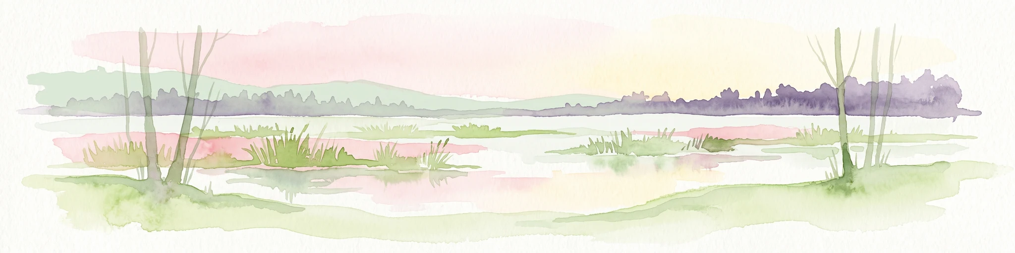
A horizontal watercolor illustration of a wetland scene with soft pink and green tones, showing sparse trees on the banks of a shallow, marshy water area under a pale sky.
Nature reserveBrandenburg
About 3 km away#2 closest

South

Ausstichgelände Röntgental: Brandenburg Nature Reserve and Protected Wetland Atlas

Mapped ecological landscapes on the Berlin metropolitan fringe

Investigate the detailed geography of Ausstichgelände Röntgental, a compact nature reserve in Brandenburg. Formed from nineteenth-century railway sand quarries, this protected area features a diverse mosaic of reed beds, open water, and alder carr forest. The site provides a compelling case study of post-industrial ecological recovery within the broader Barnim Nature Park landscape.

Area
0.248 km²
Established
1990
IUCN
IV
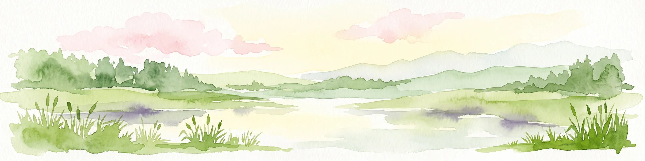
A watercolor painting of a serene fen or wetland with reeds in the foreground, calm water, and rolling hills in the background under a soft pastel sky.
Nature reserveBarnim District
About 3.3 km away#3 closest

East

Ladeburger Schaeferpfuhle: Nature Reserve and Protected Landscape in Barnim District

Mapped lowland fen ecosystems and habitat geography

Located in the Barnim District of Germany, Ladeburger Schaeferpfuhle is a designated nature reserve defined by its post-glacial lowland fen terrain. This area preserves a mosaic of wet meadows, shrub thickets, and pools that support specialized plant and wildlife populations. The site serves as a vital example of regional hydrology, maintaining open landscapes through traditional grazing practices that protect this fragile habitat.

Area
0.267 km²
Established
2000
Relief
Lowland
Climate
Temperate
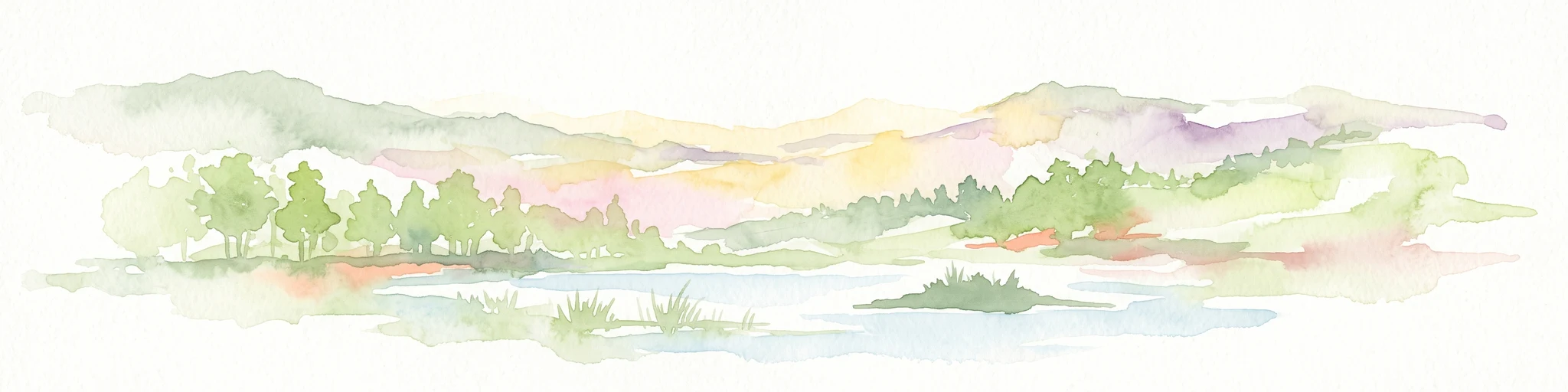
Watercolor illustration showing a soft landscape with a pond, marsh vegetation, and a background of rolling hills or meadows.
Nature reserveBerlin
About 3.4 km away#4 closest

South

Mittelbruch Nature Reserve: Mapped Wetland Geography and Protected Landscape in Berlin

Examining lowland peat diggings and protected moorland ecosystems

Mittelbruch stands as a compact nature reserve in northeastern Berlin, featuring a layered landscape of former peat diggings and open moor meadows. This area plays a critical role in urban conservation by providing essential refuge for waterbirds and diverse meadow flora. Utilize the atlas to study the reserve's internal geography, including its managed reed belts and surrounding forest edges that form a distinct ecological mosaic within the city landscape.

Area
0.282 km²
Established
1997
IUCN
IV
Relief
Lowland
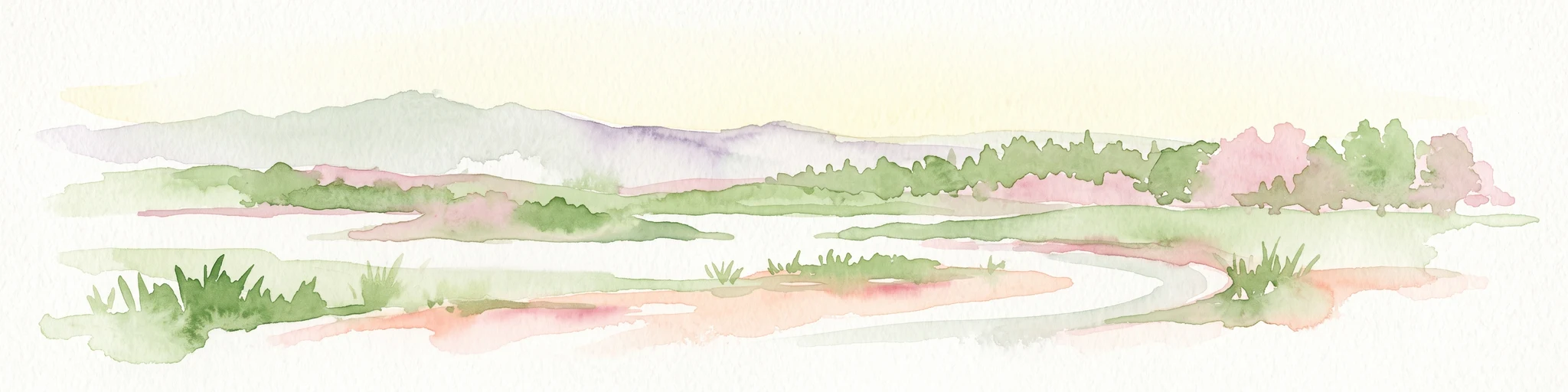
A horizontal watercolor painting depicting a marshy landscape with ponds, green vegetation, and soft distant hills against a light background.
Nature reserveBerlin
About 6.8 km away#5 closest

Southwest

Karower Teiche Nature Reserve: Mapped Protected Wetland Geography in Northeast Berlin

Transitional lowland fen and pond mosaic

Karower Teiche protects a unique 128 hectare wetland mosaic in the Pankow district of Berlin. Centered on four shallow ponds and extensive reedbeds, the reserve maintains a vital ecological corridor between the Barnim plateau and the Berlin glacial valley. This site provides essential habitat for amphibians and reed-specialist birds within an urban setting.

Area
1.286 km²
Established
1994
IUCN
IV
Relief
Lowland
A soft watercolor painting featuring green grasses in the foreground, calm water, and a tree line along the horizon.
Nature reserveBrandenburg
About 7 km away#6 closest

Southwest

Schönerlinder Teiche Nature Reserve in Brandenburg: Protected Landscape and Geographic Atlas

Explore the wetland mosaic, bird-rich ponds, and grazing conservation areas

Schönerlinder Teiche offers a rare look at post-agricultural land transformation, featuring ponds, meadows, and reed habitats in the Brandenburg region. This nature reserve serves as an essential bird sanctuary and educational site, with water buffalo and Konik horses contributing to ongoing habitat maintenance. View the detailed geography of this protected area and its role within the wider Barnim Nature Park network.

Area
0.408 km²
Established
1997
IUCN
IV
Relief
Lowland
A watercolor painting of a flat, marshy landscape with soft green trees in the midground and pale hills under a light sky in the background.
Nature reserveBerlin
10 km away#7 closest

South

Falkenberger Rieselfelder Nature Reserve: A Detailed Atlas of Berlin Protected Lands

Reclaimed wetland geography and urban conservation habitats

Falkenberger Rieselfelder acts as an ecologically rich refuge where former industrial irrigation fields have been repurposed into a mosaic of seasonal pools and meadows. Located on the urban fringe of Berlin, this nature reserve offers a unique look at how conservation grazing and habitat management support species like the great crested newt within a dense metropolitan region.

Area
0.881 km²
Established
1995
IUCN
IV
Relief
Lowland
Watercolor painting of a peaceful wetland landscape with lush green trees, reeds, and soft hills in the background under a light sky.
Nature reserveBerlin
About 11 km away#8 closest

South

Malchower Aue Nature Reserve: A Detailed Atlas of Urban Protected Landscapes in Berlin

Wetland habitats and glacial terrain within the Berlin city limits.

Malchower Aue stands as a protected enclave of wetland diversity featuring a system of reed-fringed peat-cutting ponds, wet meadows, and rare dry-grassland vegetation on historical soil mounds. This site provides a vital geographic perspective on how post-glacial relief and human land-use history shape protected areas within the modern urban landscape of Berlin.

Area
0.222 km²
Established
1995
Relief
Lowland
Climate
Temperate

Common questions about visiting, size, designation, and location context for Schönower Heide

Schönower Heide FAQs for park facts, access, geography, and protected area context

Find quick answers about Schönower Heide, including protected-area facts, park geography, trail and visitor context, and how the park fits into its surrounding country and regional landscape.
MoriAtlas Explorer

Continue Your Protected Areas Search Across the Global Atlas

Deepen your exploration by continuing the structured search for national parks and protected areas worldwide. Utilize the comprehensive filtering capabilities to compare different conservation landscapes and refine your understanding of global park geography. Discover more about the distribution and characteristics of protected natural areas.

Global natural geography