
Mori Atlas logo
Nature reserveSchweenssand

Mapping the Elbe estuary floodplain, tidal channels, and diverse wetland habitats

Schweenssand Nature Reserve: A Protected Freshwater Tidal Landscape in Hamburg Germany

(Naturschutzgebiet Schweenssand)

Schweenssand serves as a critical nature reserve along the southern banks of the Süderelbe in Hamburg. This protected landscape encompasses a dynamic stretch of the Elbe tidal freshwater reach, where shifting river currents, tidal flats, and reedbeds create a complex mosaic of wetland terrain. By maintaining these floodplain forests and sediment-rich channels, the area preserves one of the most botanically significant environments within the city, serving as a vital habitat for native bird populations.

freshwater tidal flatsElbe floodplainreedbedsfloodplain foresttidal nature reserveHamburg
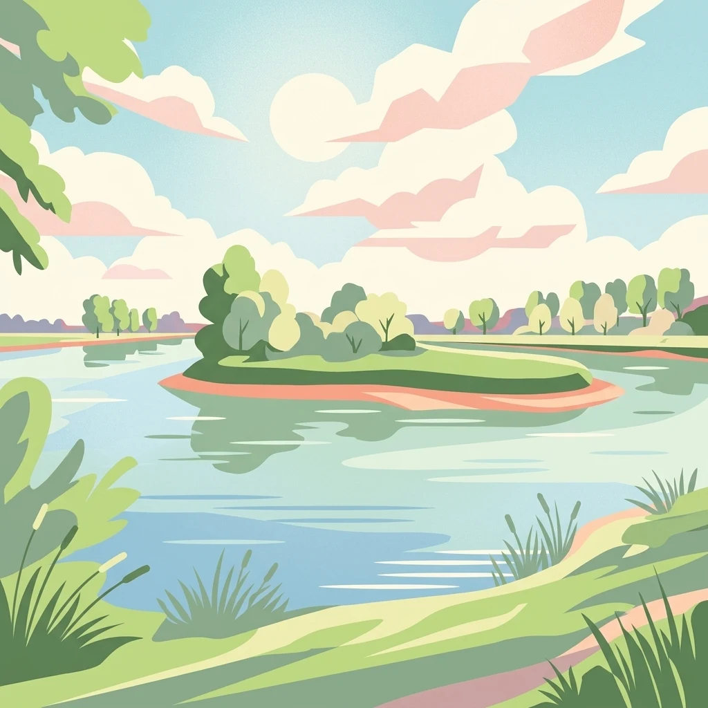
A flat-style digital illustration depicting a calm river, a small grassy island with trees, and lush riverbanks under a bright, partly cloudy sky.

Schweenssand

Nature reserve

Park overview

Structured park overview, official facts, and landscape profile for Schweenssand

Schweenssand park facts, protected area profile, and essential visitor context

Review the core facts for Schweenssand, including designation, size, terrain, visitor scale, habitats, and operating context in one park-focused overview.

About Schweenssand

Schweenssand is a compact but ecologically dense nature reserve on the southern edge of Hamburg, where the Elbe splits into its northern and southern branches. The site lies on the outer side of the Süderelbe dike, in the Neuland district of the Harburg borough, and runs roughly from stream kilometer 611 to 614.5, beginning just inside the Lower Saxony boundary and ending near the Süderelbe railway bridge. The Bundesautobahn 1 crosses the reserve where it bridges the Süderelbe near stream kilometer 613, dividing the protected area into two sections.

The defining character of the reserve is its dynamism. Schweenssand sits squarely in the Elbe's tidal freshwater reach, with the river rising and falling twice a day and continuously reshaping the land. Freshwater tidal flats scored by tidal channels give way to sand and mudflats, which border floodplain forest remnants and broad reed beds. The interaction between the moving water and the more stable, vegetated zones creates the gradient of habitats that gives the site its unusually high biodiversity.

Set against this landscape, the reserve acts as an important refuge within an otherwise heavily engineered river corridor. Together with the Heuckenlock reserve on the opposite bank, it forms the Natura 2000 FFH-Gebiet Heuckenlock/Schweenssand, anchoring a protected footprint across both sides of the Süderelbe. Although small, Schweenssand is a key piece of Hamburg's network of protected areas on the Elbe, and its 700 recorded plant species make it one of the most botanically diverse locations in the entire city.

Quick facts and research context for Schweenssand

Schweenssand is a 35 hectare nature reserve in Hamburg-Harburg, situated on the southern shore of the Süderelbe within the Elbe's tidal freshwater stretch. It was designated as a protected area on 31 August 1993 and is classified as an IUCN Category IV Habitat/Species Management Area. The site belongs to the FFH-Gebiet Heuckenlock/Schweenssand, a Natura 2000 habitat that also includes the Heuckenlock reserve opposite on the northern bank.

Protection and recognition

Documented protection records and administrative framework for Schweenssand

Schweenssand Protection Status and Designated Terrestrial Conservation Scope

Terrestrial protection records for Schweenssand outline the documented administrative framework and official conservation scope. Verified database entries track the official designation history without assuming external management outcomes.

Protection details

Protection scope
Terrestrial
Transboundary protection
No
WDPA ID
165521
Park context

Deeper park guide and search-rich context for Schweenssand

Schweenssand history, landscape, wildlife, and travel context

Explore Schweenssand through its history, landscape character, ecosystems, wildlife, conservation priorities, cultural context, and seasonal travel timing in a structured park guide built for atlas discovery and search intent.

Why Schweenssand stands out

Schweenssand is best known as one of the most botanically rich sites in Hamburg, with roughly 700 plant species recorded, including rare species such as the Wiebelschmiele (a marsh grass) and Schierlings-Wasserfenchel, which are characteristic of the freshwater tidal zone of the Elbe. It is also recognized for its classic Elbe floodplain mosaic: freshwater tidal flats with tidal channels, sand and mudflats, floodplain forest remnants, and extensive reed beds, all under tidal influence. The reserve is equally valued for its birdlife. The mix of reed, ancient-looking floodplain woodland with substantial deadwood, and sheltered bays attracts reed warblers, penduline tits, golden orioles, nightingales, long-eared owls, and various woodpeckers, while the calm edges of the river serve as nursery habitat for young fish.
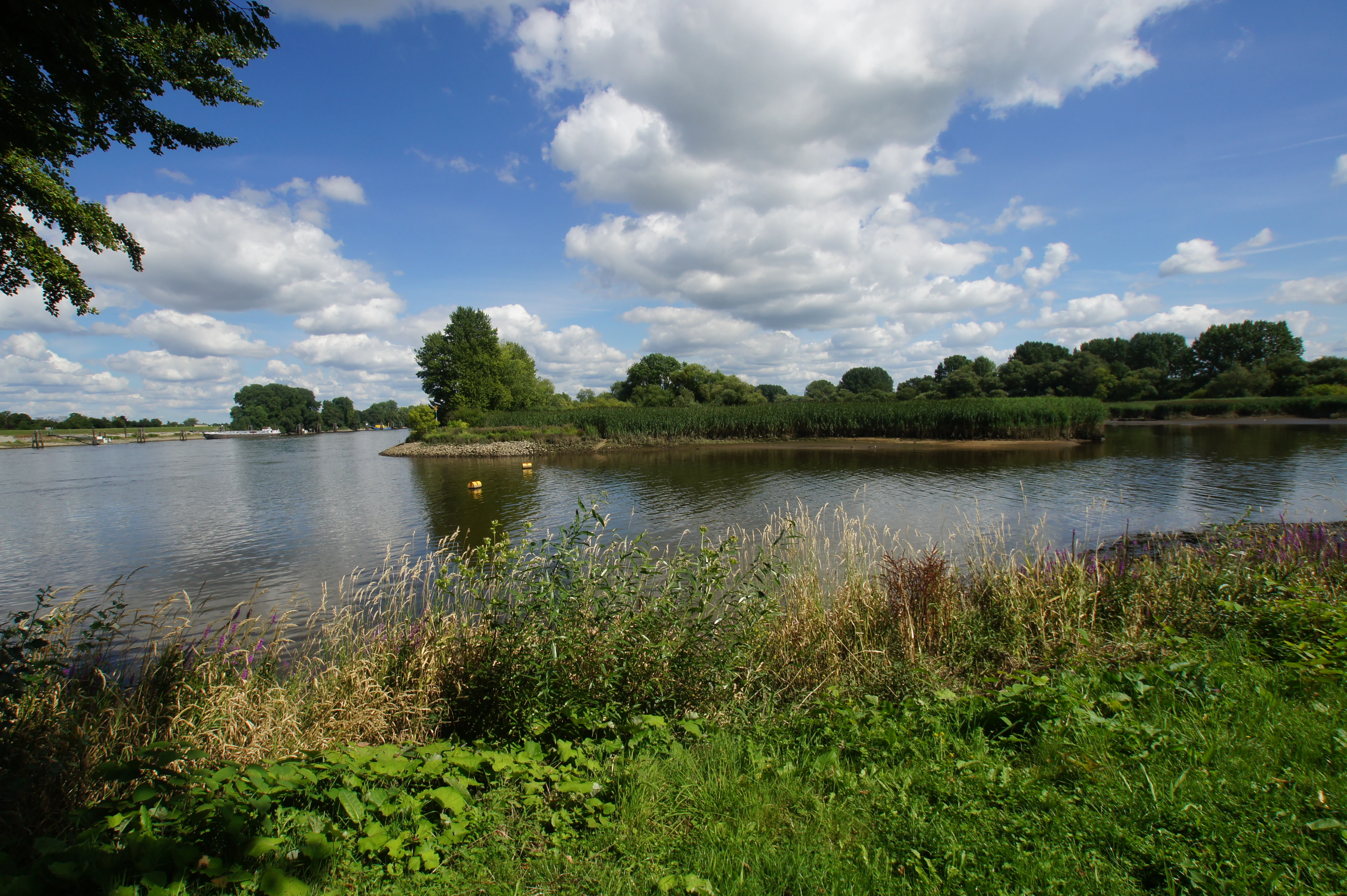
A wide view of a calm river or tidal creek surrounded by green banks, trees, and tall reeds under a blue sky with scattered clouds.
A scenic view of the tidal creek and lush vegetation within the Schweenssand nature reserve.

Schweenssand history and protected-area timeline

Schweenssand has been formally protected since 31 August 1993, when it was designated as a Naturschutzgebiet under Hamburg law. The designation required the relocation of four watersports clubs that had their moorings in the area; these clubs subsequently moved to the Harburger Binnenhafen in nearby Harburg.

The reserve has since been incorporated into the broader European conservation framework as part of the FFH-Gebiet Heuckenlock/Schweenssand, a Natura 2000 habitat site created together with the Heuckenlock nature reserve on the opposite northern bank of the Süderelbe. On the ground, the area is cared for by the Gesellschaft für ökologische Planung, a nature conservation association that handles practical management under the oversight of Hamburg's environmental authorities.

Schweenssand landscape and geographic character

The landscape of Schweenssand is shaped continuously by the Elbe. The reserve stretches along the southern bank of the Süderelbe over about 3.5 stream kilometers, occupying the outer dike area in a band up to 250 meters wide. Its terrain combines freshwater tidal flats laced with tidal channels, exposed sand and mudflats, surviving patches of floodplain forest along the higher margins, and large reed beds.

Because the site sits in the Elbe's tidal freshwater reach, the land is regularly inundated and drained. This produces a shifting mosaic of wet and drier zones rather than a single habitat type. The river's flow reshapes channels, redistributes sediments, and influences what grows where, lending the reserve the character of a working floodplain rather than a static patch of greenery. The flow of the Bundesautobahn 1 across the Süderelbe cuts the protected area into two sections near stream kilometer 613, a reminder of how tightly this small reserve is wedged into an intensively used landscape.

Schweenssand ecosystems, habitats, and plant life

Ecologically, Schweenssand is defined by the unusual overlap of freshwater tidal influence, floodplain forest, and reed communities. The combination of saturated reedbeds, backwater channels, and ancient-looking floodplain woodland with abundant deadwood supports a layered biota of plants, invertebrates, fish, and birds, making the roughly 35 hectare site one of the richest in Hamburg.

Vegetation reflects the transition from open water to higher ground. Reed and cattail species such as common reed, narrow-leaved and broad-leaved cattail, salt club-rush, bulrush, common club-rush, reed grass, and bur reed dominate the wet zones, while marsh marigold brightens similar areas. Along drift lines grow dock, knotweed, ragwort-like groundsels (Greiskräuter), and various sedges that blend into larger stands of couch grass on drier patches. The presence of so many species in a small footprint is largely a product of the site's tidal dynamism, which constantly opens fresh bare ground for colonization while still maintaining stable, vegetated refuges.

Schweenssand wildlife and species highlights

The reedbeds and floodplain forest of Schweenssand together host a rich and varied fauna. Calm edges and slow-moving bays of the Süderelbe serve as important nursery habitat for juvenile fish, while the dense reed and the soft stream margins provide feeding and shelter for invertebrates and amphibians.

Birds are particularly diverse. Reed-dwelling warblers, including the Eurasian reed warbler and marsh warbler, nest in the tall vegetation, while the penduline tit, golden oriole, and nightingale use the transition between reed and woodland. The floodplain forest, much of it in a near-natural state with significant amounts of old and dead wood, supports long-eared owl and several species of woodpeckers. This mix of breeding habitat, fish nursery, and invertebrate-rich margins makes Schweenssand an unusually productive small site within Hamburg's protected area network.

Schweenssand conservation status and protection priorities

Schweenssand's conservation importance lies in its role as one of the last remaining pieces of freshwater tidal Elbe floodplain within Hamburg. By protecting both the soft, dynamic habitats of riverbank and tidal flats and the more stable fringes of reed and ancient-looking floodplain forest, the reserve safeguards a habitat complex that has largely disappeared elsewhere along the urban Elbe.

The site's formal recognition extends beyond German nature reserve status. Together with the Heuckenlock reserve across the river, Schweenssand forms the Natura 2000 habitat site FFH-Gebiet Heuckenlock/Schweenssand, giving it European-level significance under the EU Habitats Directive. IUCN classifies the area as Category IV, a Habitat/Species Management Area, reflecting the active role of site management in maintaining the reedbeds, the high-deadwood floodplain woodland, and the open tidal flats that together sustain its exceptional plant and bird diversity.

Schweenssand cultural meaning and human context

The reserve's history reflects the long human use of the Elbe riverbank in Hamburg. Until its 1993 protection, the waters off Schweenssand hosted moorings for four watersports clubs, and the site's transformation into a strictly protected area required those clubs to relocate to the Harburg inner harbor. The reserve is now cared for by the Gesellschaft für ökologische Planung, a local nature conservation association, under the framework of Hamburg's environmental administration, embedding the area in both the city's industrial harbor heritage and its modern conservation tradition.

Top sights and standout views in Schweenssand

Schweenssand packs a surprising amount of ecological value into a compact footprint. Highlights include roughly 700 recorded plant species, including Wiebelschmiele and the Elbe-typical Schierlings-Wasserfenchel, freshwater tidal flats peppered with tidal channels, ancient-looking floodplain forest rich in deadwood, and reedbeds that support nesting warblers, penduline tits, golden orioles, and nightingales.

The reserve is also notable as the southern half of the FFH-Gebiet Heuckenlock/Schweenssand, giving the 35 hectare Hamburg site direct European conservation significance, and as a working example of how a former recreational boating area was restored to a state-managed floodplain sanctuary.

Best time to visit Schweenssand

The character of a visit to Schweenssand shifts with the seasons and the tides. Spring and early summer bring the most active birdlife, with reed warblers, marsh warblers, and other songbirds settling into nesting territories in the reedbeds and along the edges of the floodplain forest; this is also when marsh marigolds and other wetland flowers are most visible in the wetter zones.

Late summer and autumn highlight the plant diversity that makes the site famous, when many of the 700 recorded species can be observed in their mature form. Because the reserve lies in the Elbe's tidal freshwater reach, visitors should be aware that the river rises and falls with the tide throughout the year, which influences access along the outer dike area and gives the landscape an ever-changing appearance regardless of season.

Monthly climate preview

Long-term representative records of annual temperature and precipitation rhythms

Schweenssand Climate Normals and Measured Monthly Temperature Ranges

Representative coordinate measurements capture recorded monthly temperature variations and precipitation distribution patterns across Schweenssand. Examining the complete twelve-month statistical profile clarifies long-term meteorological normals without relying on short-term forecasts.
Annual mean9 °C
1 °C18 °C
Jan
Feb
Mar
Apr
May13°
Jun16°
Jul18°
Aug18°
Sep14°
Oct
Nov
Dec
Warmest month
July

18 °C

Coolest month
January

0.5 °C

Wettest month
July

2.6 mm/day

Driest month
April

1.4 mm/day

Park location guide

Geography guide, regional context, and park location map for Schweenssand

Schweenssand park geography, regions, and map view in Germany

Understand where Schweenssand sits in Germany through a broader geographic reading of the surrounding landscape, nearby location context, and its mapped position within the national park landscape.

How Schweenssand fits into Germany

Germany is a federal republic in Western and Central Europe with a population of over 83 million across sixteen constituent states. It is Europe's largest economy by nominal GDP and a major global exporter and importer. The capital is Berlin, and the country borders Denmark, Poland, Czech Republic, Austria, Switzerland, France, Luxembourg, Belgium, and the Netherlands.

Wider geography shaping Schweenssand in Germany

Germany is located in Western and Central Europe, spanning 357,022 km². It borders Denmark to the north, Poland and the Czech Republic to the east, Austria and Switzerland to the south, and France, Luxembourg, Belgium, and the Netherlands to the west. The country has coastlines on the Baltic Sea and North Sea to the north, with the Alps located in the southern region.

Map view of Schweenssand

Use this park location map to pinpoint Schweenssand in Germany, understand its exact geographic position, and read its mapped placement within the surrounding landscape more clearly.

Pigeon | © OpenStreetMap contributors

Location context for Schweenssand

Hamburg

Explore protected area views, freshwater tidal flats, and natural river habitats in Hamburg

Schweenssand Landscape Photos and Scenery: Visualizing the Elbe Floodplain

Visual records capture the dynamic terrain, exposed mudflats, and surviving floodplain forests across Schweenssand. Examining these protected area images clarifies how tidal freshwater processes shape the local plant communities and river ecosystems.

A wide view of a calm river or tidal creek surrounded by green banks, trees, and tall reeds under a blue sky with scattered clouds.

Park atlas

Discover surrounding regional geography and connected protected areas along the Elbe estuary

Explore Parks Near Schweenssand and Related Protected Landscapes

Continue exploring regional river wetlands and protected landscapes adjacent to Schweenssand. Comparing nearby nature reserves reveals wider ecological patterns across the tidal freshwater habitats of Hamburg.
Nature reserveLower Saxony
About 10 km away#1 closest

South

Stemmbruch Nature Reserve: Protected Lowland Bog Geography in Lower Saxony, Germany

A resilient moorland habitat near the Seeve floodplain

Stemmbruch serves as a vital nature reserve in the Harburg district, protecting a rare hanging spring bog system. This compact protected area features a mosaic of bog pools, heath, and swamp woodland, demonstrating the complex hydrologic connectivity between the sandy geest ridge and the surrounding northern German lowland plains.

Area
0.56 km²
Established
1989
IUCN
IV
Relief
Lowland
Nature reserveLandkreis Harburg
About 12 km away#2 closest

West

Wulmstorfer Heide mit Bornberg: Protected Nature Reserve and Glacial Landscape Map

Regional geography and habitat network in Landkreis Harburg, Lower Saxony

This protected area features a unique mosaic of dry heath, nutrient-poor grassland, and mature broadleaf woodland. Located near the Hamburg border, it provides an essential habitat refuge within the Harburger Berge, characterized by sandy glacial soils and former military training terrain that supports specialized reptiles, amphibians, and bird species.

Area
2.72 km²
Established
2024
IUCN
IV
Relief
Upland
Nature reserveHamburg
About 14 km away#3 closest

Southeast

Zollenspieker Nature Reserve: Geographic Overview and Protected Riverine Landscapes

Tidal Elbe floodplain and inland brack wetland ecology

Located in the Hamburg borough of Bergedorf, Zollenspieker protects a significant stretch of the tidal Elbe. This nature reserve contains approximately 80 hectares of diverse terrain, from freshwater mudflats exposed at low tide to sheltered oak-dominated forests and old brack wetlands known as Carlsbrack and Riepenburger Brack.

Area
0.8 km²
Established
1988
IUCN
IV
Relief
Lowland
Nature reserveLower Saxony
About 27 km away#4 closest

Southeast

Wittsaal Nature Reserve: Mapped Wetland Geography and Protected Landscape in Lower Saxony

A rare mosaic of moor ponds and swamp woodland

Wittsaal is a specialized nature reserve in the Lüneburg region of Lower Saxony, Germany. The area protects a peat-cut moor pond currently undergoing natural silting, surrounded by willow-dominated swamp woodland, reedbeds, and sedge marshes. This compact site provides a critical, quiet refuge for wetland ecology within a wider landscape of agricultural fields and transitional glacial terrain.

Area
0.13 km²
Established
1985
IUCN
IV
Relief
Lowland
Nature reserveLandkreis Stade
About 31 km away#5 closest

West

Steinbeckforst Nature Reserve: Geography and Protected Area Context in Landkreis Stade

Ancient beech forests and lowland brook valley landscapes.

Steinbeckforst serves as a critical nature reserve in Lower Saxony, characterized by century-old beech stands and sandy ground moraine topography. This geographic profile examines how the forest and Steinbeck brook valley function as a protected habitat corridor within the wider district of Stade.

Area
0.7 km²
Established
2018
IUCN
IV
Watercolor painting showing a wide, panoramic view of a marshy landscape with green fields, winding water channels, and faint pink clouds in the sky.
Nature reservePinneberg
About 32 km away#6 closest

North

Himmelmoor Nature Reserve and Mapped Peatland Landscape in Pinneberg, Germany

Detailed geography of a restored raised bog

Trace the extensive bog terrain of Himmelmoor in Pinneberg, Germany. This former raised bog is now a focal point for large-scale wetland rewetting. Explore the site's flat, waterlogged geography, industrial heritage, and its protected status as a crucial natural mosaic within the broader regional landscape.

Established
2022
Relief
Lowland
Climate
Temperate
Access
Easy access
A horizontal watercolor painting depicting a rolling heathland landscape with purple heather, evergreen trees, and a central water feature under a soft sky.
Protected landscapeLower Saxony
About 34 km away#7 closest

South

Naturpark Lüneburger Heide: Protected Landscape Map and Regional Geography

An expansive cultural landscape in northern Lower Saxony

Spanning over 1,000 square kilometers, Naturpark Lüneburger Heide preserves the largest contiguous inland heathlands in Central Europe. Use this atlas resource to understand the park's glacial terrain, including karst sinkholes and natural springs, as well as its status as a model region for sustainable conservation and traditional land management practices.

Area
1,097.85 km²
Established
1922
IUCN
V
Relief
Lowland
Nature reserveLower Saxony
About 34 km away#8 closest

Southeast

Streitmoor Nature Reserve Geography and Mapped Protected Land in Lower Saxony

A study in compact bog and wetland succession

Streitmoor provides a detailed look at a terrestrialized pond moor within the Lüneburg district. The site contains a layered sequence of peat mosses, cottongrass, and woodland, mapping the natural transition between open bog basins and dry forest margins in northwestern Germany.

Area
0.13 km²
Established
1972
IUCN
IV
Relief
Lowland

Common questions about visiting, size, designation, and location context for Schweenssand

Schweenssand FAQs for park facts, access, geography, and protected area context

Find quick answers about Schweenssand, including protected-area facts, park geography, trail and visitor context, and how the park fits into its surrounding country and regional landscape.
MoriAtlas Explorer

Continue Your Protected Areas Search Across the Global Atlas

Deepen your exploration by continuing the structured search for national parks and protected areas worldwide. Utilize the comprehensive filtering capabilities to compare different conservation landscapes and refine your understanding of global park geography. Discover more about the distribution and characteristics of protected natural areas.

Global natural geography