

Mori Atlas logo
Protected landscapeShawnee National Forest

An atlas of glacial-carved sandstone bluffs, dense hardwood forests, and federally designated wilderness areas.

Shawnee National Forest: Mapping the Protected Landscapes and Geological Terrain of Southern Illinois

Shawnee National Forest represents a significant protected area within the Shawnee Hills of southern Illinois, encompassing a vast region shaped by Pleistocene glaciers and complex erosional history. This expansive landscape provides a unique look at diverse ecosystems ranging from upland oak-hickory woodlands to river corridors and deep, rock-carved canyons. The forest serves as a vital geographic anchor, featuring iconic formations like the Garden of the Gods and the Little Grand Canyon, alongside a history of conservation that transformed former farmlands into a thriving Midwest wilderness.

national forestsouthern IllinoisShawnee Hillssandstone formationshardwood forestwilderness areas

Shawnee National Forest

Protected landscape

Park overview

Structured park overview, official facts, and landscape profile for Shawnee National Forest

Shawnee National Forest park facts, protected area profile, and essential visitor context

Review the core facts for Shawnee National Forest, including designation, size, terrain, visitor scale, habitats, and operating context in one park-focused overview.

About Shawnee National Forest

Shawnee National Forest is a large federally protected forest in southern Illinois and the largest unit of public land in the state. Administered by the U.S. Forest Service, it occupies a substantial portion of the Shawnee Hills, a low and ancient mountain range that runs roughly east to west through the southern part of Illinois. The forest spans parts of nine counties, with its administrative center in Harrisburg and field offices in Jonesboro and Vienna.

The forest's geography is unusually varied for the Midwest. Although it lies near the agricultural heartland of Illinois, the highly dissected Shawnee Hills produce rugged terrain with steep ravines, bluff lines, rock outcrops, springs, swamps, and broad reservoir-fed valleys. The result is a region where visitors can walk among sandstone towers and natural bridges in the morning and stand on broad hardwood ridges by afternoon.

Protection and management of the land began in earnest during the 1930s. Before that period, much of what is now the forest consisted of depleted farmland whose soils had been badly eroded. Through federal acquisition and intensive conservation work, including extensive plantings carried out by the Civilian Conservation Corps, the landscape was gradually regenerated into the mix of pine stands and hardwood forests visible today. Over the following decades, a strong tradition of environmental engagement shaped the forest's modern identity, leading to the collaborative 2006 Forest Management Plan and ongoing efforts to maintain the area's biodiversity.

For visitors, Shawnee National Forest offers one of the most concentrated outdoor recreation landscapes in Illinois, including seven designated wilderness areas, well-known rock climbing sites, lake recreation areas, scenic drives, and popular eclipse-viewing vantage points. Its combination of wilderness character, geological drama, and easy Midwestern accessibility gives it a unique role in the U.S. National Forest system.

Quick facts and research context for Shawnee National Forest

Shawnee National Forest is the largest publicly owned land area in Illinois and the state's only federally designated national forest. It stretches across parts of Pope, Jackson, Union, Hardin, Alexander, Saline, Gallatin, Johnson, and Massac counties, with headquarters in Harrisburg and ranger offices in Jonesboro and Vienna.

Established during the New Deal era, the forest was officially designated by President Franklin D. Roosevelt in September 1939 from the earlier Illini and Shawnee Purchase Units. It contains seven federally designated wilderness areas, notable geological features such as Little Grand Canyon and Hicks Dome, and recreation sites including Pounds Hollow and Jackson Falls. In 2016, the forest was honored on the America the Beautiful Quarters series.

Protection and recognition

Documented terrestrial conservation scope and established 1939 timeline facts

Shawnee National Forest Protection Status and Designation History

Shawnee National Forest maintains a documented terrestrial protection status established in 1939. Official records outline the foundational designation history and management scope without international recognition sources.

Protection details

Protection scope
Terrestrial
Designated year
1939
Transboundary protection
No
Park context

Deeper park guide and search-rich context for Shawnee National Forest

Shawnee National Forest history, landscape, wildlife, and travel context

Explore Shawnee National Forest through its history, landscape character, ecosystems, wildlife, conservation priorities, cultural context, and seasonal travel timing in a structured park guide built for atlas discovery and search intent.

Why Shawnee National Forest stands out

Shawnee National Forest is best known for its dramatic sandstone rock formations and wilderness canyons within an otherwise agricultural and forested region of the American Midwest. Garden of the Gods Wilderness, Little Grand Canyon, Pomona Natural Bridge, and Millstone Bluff are among its signature geological landmarks, each shaped by the area's glacial history and the erosion of Shawnee Hill sandstone. Equally distinctive is the forest's patchwork of ecosystems, where upland hardwoods, pine plantings, swamps, and deep ravines coexist with seven designated wilderness areas. This combination of accessible outdoor recreation, geological variety, and surprisingly rich biodiversity in southern Illinois is what sets Shawnee apart from more uniform forest landscapes elsewhere in the state.
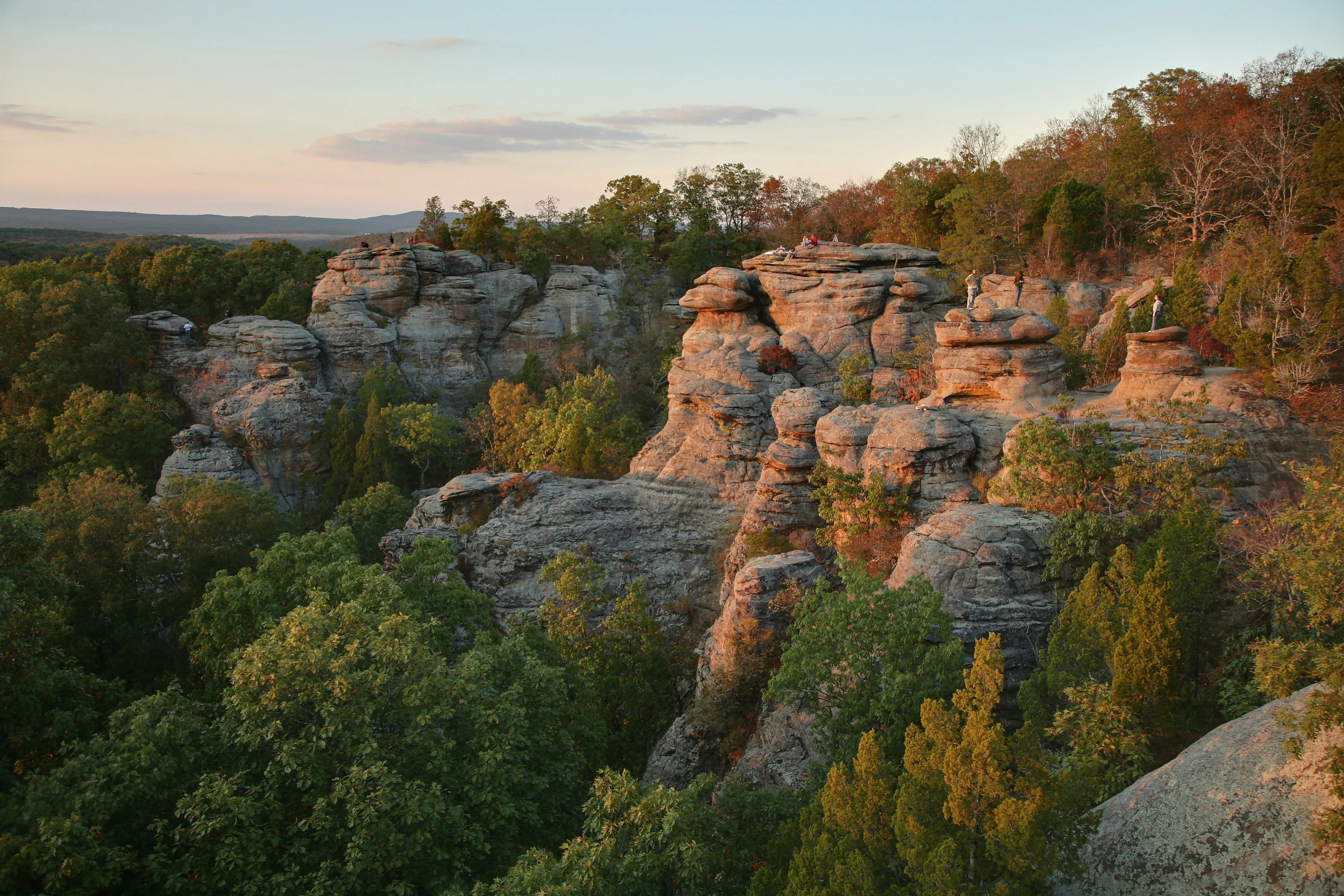
Garden of the Gods Sunset
Sunset at the Garden of the Gods rock formations in Shawnee National Forest, Illinois

Shawnee National Forest history and protected-area timeline

The forest's administrative history begins with the Illini and Shawnee Purchase Units, which were consolidated and officially designated as Shawnee National Forest in September 1939 by President Franklin D. Roosevelt. However, the story of the land itself starts earlier, during the early twentieth century, when much of what is now the forest was exhausted farmland suffering from severe soil erosion.

During the 1930s and 1940s, the Civilian Conservation Corps undertook large-scale reforestation across the region, planting pine trees to stabilize slopes and rebuild soil. This CCC work laid the foundation for much of the present-day forested landscape and contributed to the mix of planted pine stands and naturally regenerating hardwood forests that defines the Shawnee today.

In the 1980s and 1990s, the forest became a focal point for environmental activism, with groups ranging from Earth First! to the Sierra Club engaging in debates over land management and conservation. The Forest Service's adoption of the 2006 Forest Management Plan, developed in collaboration with environmental organizations and the public, marked a shift toward a more cooperative planning approach. The forest's significance has also been recognized at the national level through its appearance on the America the Beautiful Quarters series in 2016.

Shawnee National Forest landscape and geographic character

The Shawnee Hills, the ancient upland range that hosts the forest, sit at the southern edge of a region shaped by Ice Age glaciers. During the Illinoian Stage, the southern margin of the Laurentide Ice Sheet reached into what is now the forest area, producing the terminal moraines, blocked drainages, and meltwater-carved features that still define the topography.

Little Grand Canyon is one of the forest's most striking landscape features, a rock canyon more than 200 feet deep carved into the Big Muddy River watershed by a small creek and cut by ice blocks sliding off the glacier's face. Cedar Lake, an artificial reservoir near Murphysboro and Carbondale, occupies a creek system whose unusually asymmetrical watershed was shaped when the glacier blocked north-flowing drainages and forced meltwater to run northwest along the ice front.

Elsewhere in the forest, erosion-resistant sandstone has produced distinctive rock cities, natural bridges like Pomona Natural Bridge, isolated bluffs such as Millstone Bluff, and the dramatic formations of Garden of the Gods. Hicks Dome, an igneous feature in Hardin County, adds a rare geological dimension to a region otherwise defined by sedimentary terrain, and continues to be the subject of scientific discussion regarding its origin.
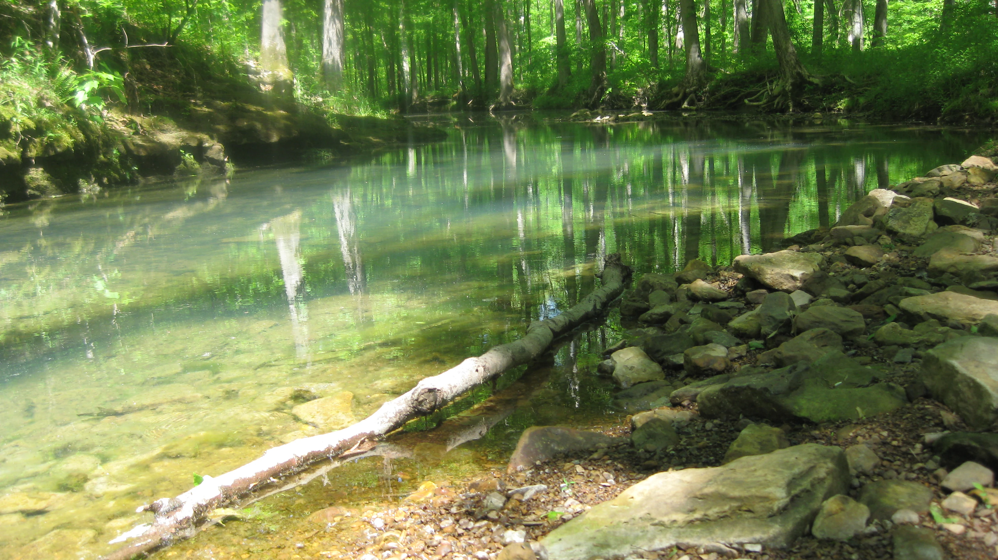
Lick Creek in Panther Den
Lick Creek runs through the Panther Den area, requiring multiple crossings along the Panther Den Loop trail.

Shawnee National Forest ecosystems, habitats, and plant life

Shawnee National Forest protects a surprising diversity of habitats for its location in the lower Midwest. The region's dissected hills support upland oak-hickory hardwood forests, while lower slopes and valleys contain mixed mesophytic communities with greater plant variety. The Civilian Conservation Corps plantings of pine during the 1930s and 1940s added extensive pine stands that remain a notable, though contrasting, feature of the modern forest.

The forest's wetlands, swamps, springs, and riparian corridors along rivers such as the Big Muddy create pockets of habitat that contrast sharply with the drier uplands. Deep, shaded ravines, including Little Grand Canyon, shelter relict plant communities with surprising northern affinities, while other ravines and bluffs support more typical southern Illinois vegetation. The combination of these varied microhabitats contributes to a richness in plant and animal life well beyond what one might expect from the region's latitude.
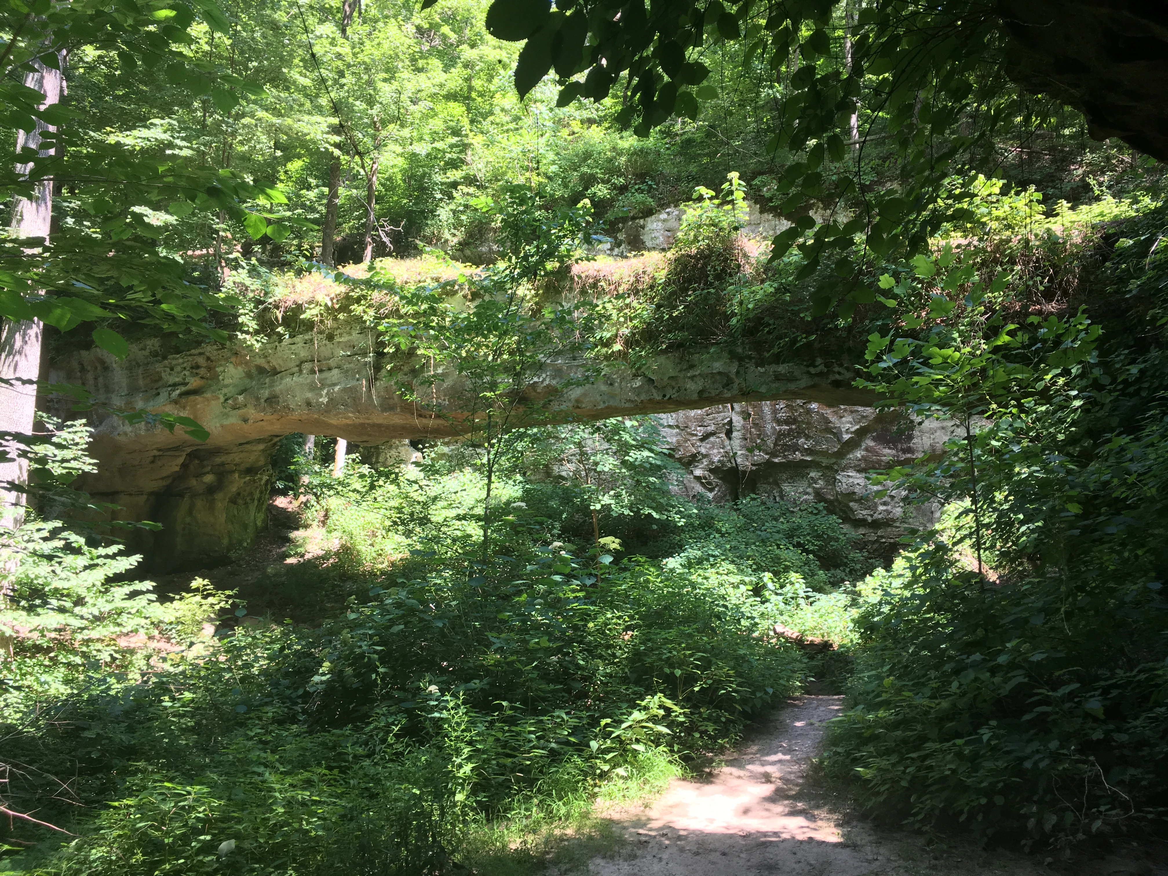
Pomona Natural Bridge
The Pomona Natural Bridge located within Shawnee National Forest in 2016

Shawnee National Forest wildlife and species highlights

Although the Wikipedia source provides limited detail on individual species, the forest's mosaic of habitat types supports a wide range of wildlife typical of southern Illinois, including white-tailed deer, wild turkey, various songbird communities, and game fish in its reservoirs. The wilderness areas, swamps, and rock outcrops each create different conditions for animal life, and the presence of raptors nesting on clifflines and bluffs adds to the forest's ornithological value.

The forest's relatively undisturbed wilderness tracts, combined with extensive forested corridors, make it an important refuge for native wildlife in an otherwise heavily agricultural region. The 2006 Forest Management Plan explicitly emphasized biodiversity as a key management objective, recognizing the forest's role in supporting habitat continuity for species that depend on large, connected forest patches.
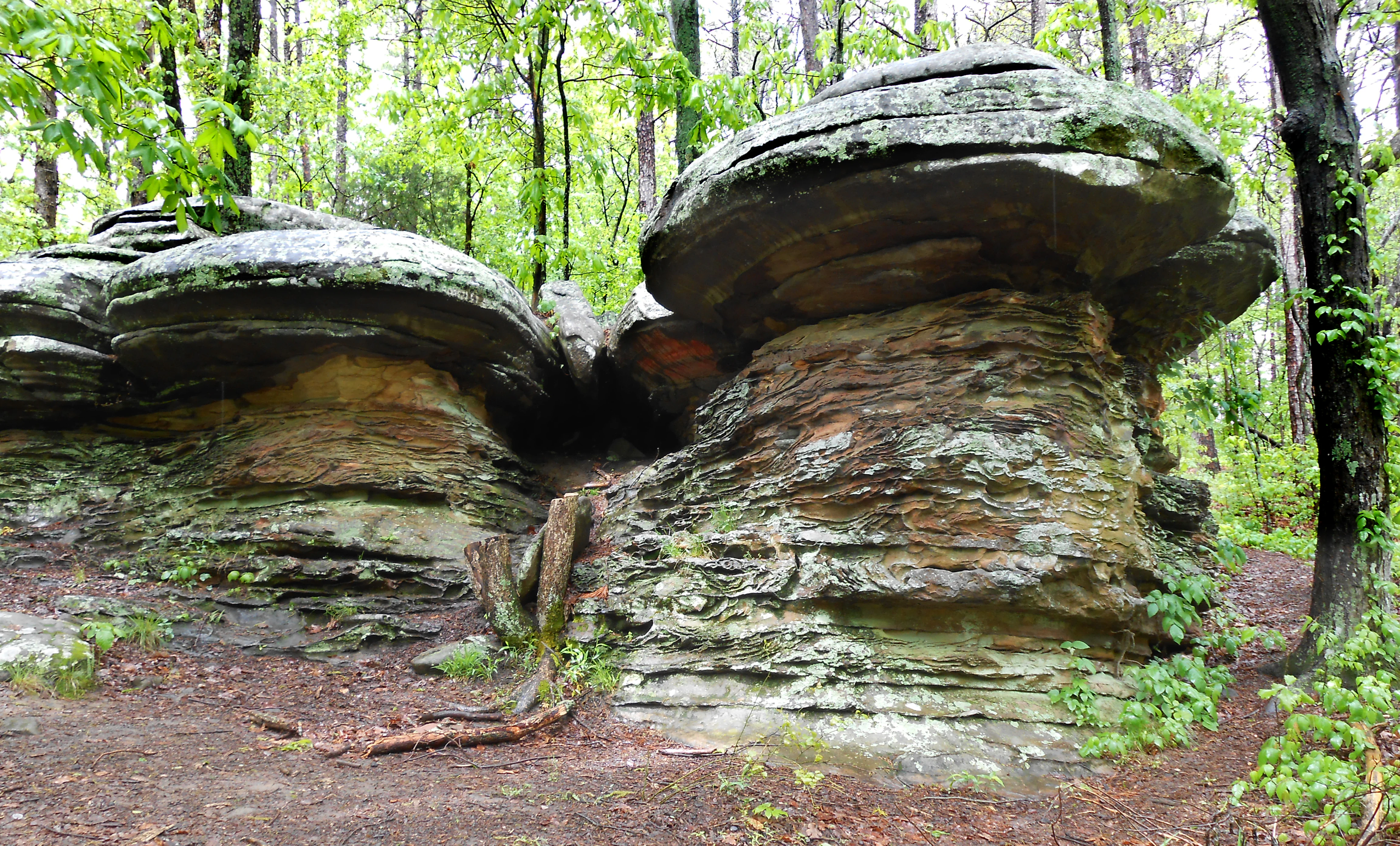
Mushroom shaped rock formations at Garden of the Gods
Rock formations near a hiking trail in the Shawnee National Forest

Shawnee National Forest conservation status and protection priorities

As the largest single public-landholding in Illinois, Shawnee National Forest plays an outsized conservation role in a state where most of the land base is privately owned and agricultural. Its extensive hardwood forests, swamp systems, and protected wilderness areas anchor regional biodiversity and help maintain ecological connectivity across southern Illinois.

The forest's conservation story begins with the reclamation of eroded farmland during the 1930s and continues through modern planning. The 2006 Forest Management Plan, developed in collaboration with environmental organizations and public groups, was designed specifically to maintain and enhance the forest's biodiversity. The presence of seven designated wilderness areas within the National Wilderness Preservation System further strengthens its long-term protection status and highlights its enduring role as a refuge for both ecological processes and the species that depend on them.

Shawnee National Forest cultural meaning and human context

The landscape of Shawnee National Forest carries the imprint of human use and recovery. The arrival of farming and timber cutting in the nineteenth and early twentieth centuries degraded much of the region, leaving badly eroded hillsides that became the target of New Deal-era conservation programs. The work of the Civilian Conservation Corps in particular became a defining chapter in the region's cultural and ecological history.

In more recent decades, the forest has been shaped by a strong tradition of grassroots environmental engagement, with activist movements, national conservation organizations, and local stakeholders all contributing to debates over land use. This history of civic involvement has become an important part of the forest's identity and continues to influence how it is managed and appreciated today.

Top sights and standout views in Shawnee National Forest

Shawnee National Forest stands out for the unusual concentration of rugged, scenic landscapes within the Shawnee Hills, including sandstone rock formations, deep canyons like Little Grand Canyon, natural bridges such as Pomona Natural Bridge, and prominent bluff sites like Millstone Bluff. Garden of the Gods Wilderness is perhaps the single most recognizable landmark.

The forest also features seven federally designated wilderness areas, a wide array of outdoor recreation opportunities from rock climbing to lake recreation, and a meaningful conservation history rooted in New Deal-era land reclamation and decades of collaborative planning.

Best time to visit Shawnee National Forest

Shawnee National Forest can be enjoyed in every season, each offering a different character. Spring brings vibrant forest growth, flowing creeks, and erupting wildflowers across the hardwood hills, while summer offers long days that are well suited to lake recreation, swimming, and exploring shaded canyons. Fall is especially notable for hardwood color across the ridges and valleys, attracting visitors from across the Midwest. Winter tends to be quieter, with crisp conditions that reveal the forest's rock formations and wide scenic overlooks, though weather can vary and some areas may be less accessible.
Monthly climate preview

Long-term representative monthly temperature and precipitation data for Illinois

Shawnee National Forest Climate Normals and Annual Temperature Patterns

Recorded measurements outline the structured annual temperature and precipitation rhythm across twelve distinct monthly intervals for Shawnee National Forest. Detailed long-term averages provide precise baseline climate normals for comparison against broader regional environmental baselines.
Annual mean14 °C
0 °C26 °C
Jan
Feb
Mar
Apr14°
May19°
Jun24°
Jul26°
Aug25°
Sep22°
Oct15°
Nov
Dec
Warmest month
July

25.7 °C

Coolest month
January

0.2 °C

Wettest month
April

4.3 mm/day

Driest month
August

2.5 mm/day

Park location guide

Geography guide, regional context, and park location map for Shawnee National Forest

Shawnee National Forest park geography, regions, and map view in United States of America

Understand where Shawnee National Forest sits in United States of America through a broader geographic reading of the surrounding landscape, nearby location context, and its mapped position within the national park landscape.

How Shawnee National Forest fits into United States of America

The United States of America is a federal presidential republic and one of the world's largest countries by area and population. It consists of 50 states across a vast territory spanning multiple time zones, with its capital in Washington, D.C. and largest city in New York City. The nation has a diverse economy, influential political system, and significant cultural and military presence globally.

Wider geography shaping Shawnee National Forest in United States of America

The United States occupies a vast territory in North America, bordered by Canada to the north and Mexico to the south. The 48 contiguous states stretch from the Atlantic to the Pacific Ocean, while Alaska occupies the northwestern region and Hawaii is an archipelago in the Pacific. The country encompasses diverse terrain including the Rocky Mountains, Appalachian Mountains, Great Plains, and extensive river systems.

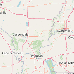
Map view of Shawnee National Forest

Use this park location map to pinpoint Shawnee National Forest in United States of America, understand its exact geographic position, and read its mapped placement within the surrounding landscape more clearly.

Pigeon | © OpenStreetMap contributors

Location context for Shawnee National Forest

Illinois
Recorded earthquake history

View the Recorded Earthquake History for Shawnee National Forest

Access a detailed catalogue of seismic events recorded near Shawnee National Forest. Use this MoriAtlas resource to review historical earthquake data, including magnitudes and epicentre distances, for a clearer understanding of the regional seismic context in southern Illinois.

Shawnee National Forest Earthquake History

Catalogued events

43 events

Strongest magnitude

Magnitude 4.8

Most recent event

Sep 27, 2019

This history includes earthquakes recorded inside the park or within 50 km of its borders

Visual reference for sandstone formations, wilderness canyons, and forest habitats

Shawnee National Forest Photos, Landscapes, and Protected Area Scenery

Visual documentation of Shawnee National Forest reveals the dramatic sandstone bluffs, deep canyons, and diverse woodland habitats that define southern Illinois. Examining these protected landscapes provides clear insight into the glacial topography and rugged terrain characterizing the region.

Garden of the Gods Sunset

Millstone Bluff

Lick Creek in Panther Den

Pomona Natural Bridge

Mushroom shaped rock formations at Garden of the Gods

Park atlas

Compare regional geography, sandstone canyons, and nearby protected areas across the Midwest.

Explore Parks Near Shawnee National Forest And Surrounding Protected Landscapes

Visitors browsing Shawnee National Forest can examine other protected areas sharing similar glacial topography, upland hardwood forests, and rugged sandstone geology. Expanding the geographic scope helps place regional conservation landscapes and midwestern wilderness terrain into broader context.
Wildlife reserveIllinois
Park boundaries overlap#1 closest

Northeast

Garden of the Gods Wilderness: A Protected Sandstone Plateau in Southern Illinois

Explore geologic boundaries, sandstone hoodoos, and forested wilderness terrain

Garden of the Gods Wilderness represents a critical protected area within the Shawnee National Forest, notable for its unglaciated sandstone geography. This 3,318-acre wilderness offers an intimate view of ancient carboniferous rock formations, including prominent hoodoos and clifftop overlooks that provide expansive sightlines across the southern Illinois landscape.

Area
13.43 km²
Established
1990
Relief
Upland
Climate
Temperate
Wildlife reserveIllinois
Park boundaries overlap#2 closest

East

Lusk Creek Wilderness: An Atlas of Protected Sandstone Canyons and Forests in Southern Illinois

Mapping rugged wilderness terrain and forest ecological recovery.

Lusk Creek Wilderness serves as a key protected landscape in southern Illinois, featuring extensive sandstone canyon systems and dense hardwood woodland. This area offers a unique look at the geological and forested character of the Shawnee region, documented through its boundaries, elevation changes, and natural landmarks. Use this geographic entry to examine the rugged, roadless character of the state largest wilderness designation and its place within the wider regional drainage system.

Area
25.47 km²
Established
1990
IUCN
Ib
Relief
Upland
Protected landscapeUnited States of America
28 km away#3 closest

Southeast

Land Between the Lakes National Recreation Area: Mapped Geography and Protected Landscapes

An inland peninsula preserved between two major river reservoirs.

Land Between the Lakes National Recreation Area occupies a distinct narrow land bridge between Kentucky Lake and Lake Barkley. This protected landscape contains a dense mix of forested ridges, stream valleys, and managed wildlife prairies. The area is integral to the lower Ohio River Valley geography, showcasing the results of long-term watershed management and large-scale ecological restoration within the United States.

Area
693.1 km²
Established
1963
Visitors
2M annual
Relief
Lowland
National parkMissouri
39 km away#4 closest

West

Mark Twain National Forest: Geography and Protected Area Atlas of Southern Missouri

Mapping the karst terrain and ancient ridges of the Ozark Highlands

Mark Twain National Forest represents a sprawling conservation area within the Missouri Ozark Highlands. Its geography is defined by volcanic mountain remnants, rocky glades, and significant river corridors like the Eleven Point National Scenic River. This record provides insight into the forest's complex mapped boundaries, seven designated wilderness areas, and the distinctive karst geology that characterizes this unique American landscape.

Area
6,037.3 km²
Established
1939
Relief
Upland
Climate
Temperate
Wildlife reserveMissouri
About 74 km away#5 closest

Southwest

Mingo Wilderness: Missouri Protected Wildlife Reserve and Wetland Geography

Primitive bottomland forest and swamp landscape

Mingo Wilderness encompasses 8,000 acres of protected bottomland hardwood forest and cypress-tupelo swamp in southeastern Missouri. As a federally designated wilderness area embedded within a national wildlife refuge, it provides a quiet, primitive habitat characterized by slow-moving creek corridors and varied seasonal wetlands.

Area
32 km²
Established
1976
IUCN
Ib
Relief
Lowland
Wildlife reserveMissouri
77 km away#6 closest

West

Rockpile Mountain Wilderness: Mapping the Rugged Ridge Landscapes of the Southeastern Ozarks

A federally protected wilderness within Missouri's Mark Twain National Forest

Explore the distinct geography of Rockpile Mountain Wilderness, where a steep granite ridge runs from Little Grass Mountain toward the national forest boundary. This protected area features unique cultural history in the form of an Indigenous stone cairn and showcases the eroded, rocky character of the eastern Ozark highlands. Use this resource to understand the boundary and terrain of this significant wilderness tract.

Area
17.15 km²
Established
1980
IUCN
Ib
Relief
Mountain
National parkMissouri
96 km away#7 closest

Northwest

Gateway Arch National Park: National Park Geographic Atlas and Map Boundaries

Explore protected landscape context and regional setting.

Gateway Arch National Park represents a unique protected landscape within Missouri, contributing to the broader national park atlas. This entry focuses on its specific geographic identity and mapped boundaries, offering structured data for understanding its role. Discover the factual landscape context and regional importance of Gateway Arch National Park for informed geographic exploration.

Area
0.78 km²
Established
2018
IUCN
II
Visitors
1.2M annual
Protected landscapeIndiana
125 km away#8 closest

Northeast

Hoosier National Forest: Geographic Overview of Indiana Protected Wilderness and Woodlands

Mapping the karst terrain and forest corridors of southern Indiana.

Hoosier National Forest defines the landscape of southern Indiana with its rolling unglaciated hills and ridge systems. Discover the mapped geography of this protected area, including its rare prairie-like barrens, sandstone cliff formations, and the designated Charles C. Deam Wilderness. This overview focuses on the spatial extent and diverse topographic features that distinguish this forest from the surrounding Midwest plains.

Area
826.78 km²
Established
1961
Relief
Upland
Climate
Temperate

Common questions about visiting, size, designation, and location context for Shawnee National Forest

Shawnee National Forest FAQs for park facts, access, geography, and protected area context

Find quick answers about Shawnee National Forest, including protected-area facts, park geography, trail and visitor context, and how the park fits into its surrounding country and regional landscape.
MoriAtlas Explorer

Continue Your Protected Areas Search Across the Global Atlas

Deepen your exploration by continuing the structured search for national parks and protected areas worldwide. Utilize the comprehensive filtering capabilities to compare different conservation landscapes and refine your understanding of global park geography. Discover more about the distribution and characteristics of protected natural areas.

Global natural geography