Mori Atlas logo
Nature reserveShtamë Pass Nature Park

Explore the geography of a protected alpine pass connecting the Kruja massif to the interior highlands

Shtamë Pass Nature Park: Mapping the Highland Pine Forests and Mountain Corridors of Albania

Shtamë Pass Nature Park anchors a significant mountain corridor in central Albania, stretching between the town of Kruja and the eastern interior. This protected landscape preserves extensive stands of European black pine and mature oak forests, framing a high-elevation environment defined by crisp springs and rocky summits like Maja e Liqenit. The terrain serves as a vital refuge for montane species and offers a unique window into the topography of the Balkan highlands through its accessible, winding ridgelines.

mountain passpine forestblack pine woodlandhighland lakessprings and freshwaterbrown bear habitat

Shtamë Pass Nature Park

Nature reserve

Park overview

Structured park overview, official facts, and landscape profile for Shtamë Pass Nature Park

Shtamë Pass Nature Park park facts, protected area profile, and essential visitor context

Review the core facts for Shtamë Pass Nature Park, including designation, size, terrain, visitor scale, habitats, and operating context in one park-focused overview.

About Shtamë Pass Nature Park

Shtamë Pass Nature Park is a sizeable protected landscape in the mountains of central Albania, anchored along the Qafë-Shtamë pass that links the Kruja area with the interior toward Burrel. Although administratively designated as a nature park, it functions in practice as a substantial mountain reserve, combining mature pine forest, mixed broadleaf woodland, highland lakes, and a network of springs that have shaped both its ecology and its cultural reputation.

The terrain rises from the pass itself, at roughly 1,250 meters, up toward prominent summits on its northern edge. The highest point is Maja e Liqenit, which reaches about 1,724 meters, accompanied by the nearby subsidiary peak known as Maja i Rjepat e Qetkolës at approximately 1,686 meters. These elevations give the park a clear alpine character on its upper slopes, while the lower pass corridor provides a relatively gentle transition into the surrounding lowlands.

Forested cover dominates the landscape. Black pine is the most prominent species, with mature trees reaching up to around 20 meters in height and roughly 60 years of age, making the area one of the more significant pine resources in Albania. These forests are interspersed with oak-dominated woodland and form the backbone of the park's biodiversity. Small highland lakes and seasonal water bodies add to the diversity of habitats, while numerous springs feed streams that eventually supply the regional water network and the on-site Qafshtama bottling facility.

The park's geographic position ties it into a broader network of Albanian protected areas. To the southeast it meets Dajti National Park, which guards the mountains directly east of Tirana, while to the southwest it adjoins the Kraste-Verjon Protected Landscape. Together, these neighboring designations help maintain ecological connectivity across the central Albanian highlands.

For visitors, the park is increasingly valued as one of the more accessible mountain nature experiences near Tirana, offering hiking opportunities along the historic Kruja-to-Burrel road corridor. The combination of forest scenery, cool highland air, abundant water sources, and cultural memory tied to the royal family and the Qafshtama spring has made it a recognizable feature of Albania's natural heritage.

Quick facts and research context for Shtamë Pass Nature Park

Shtamë Pass Nature Park lies in central Albania, on the ridge pass connecting Kruja with Burrel, at approximately 1,250 meters elevation along the main road. It is an IUCN Category IV protected area, managed by the National Agency of Protected Areas, and covers roughly 6,864 hectares of mostly forested mountain terrain. Its highest summit, Maja e Liqenit, rises to about 1,724 meters. The park borders Dajti National Park to the southeast and the Kraste-Verjon Protected Landscape to the southwest, and it sits adjacent to the Mat region associated with King Zog's family origins.

Park context

Deeper park guide and search-rich context for Shtamë Pass Nature Park

Shtamë Pass Nature Park history, landscape, wildlife, and travel context

Explore Shtamë Pass Nature Park through its history, landscape character, ecosystems, wildlife, conservation priorities, cultural context, and seasonal travel timing in a structured park guide built for atlas discovery and search intent.

Why Shtamë Pass Nature Park stands out

The park is best known for its highland pine forests, particularly extensive stands of European black pine, and for its reputation as one of Albania's cleanest natural water sources. The Qafë-Shtamë pass itself has long been associated with curative spring water, and the area hosts Albania's well-known Qafshtama mineral water brand. It is also recognized for its wildlife value, with mature montane forests providing refuge for brown bears, wolves, and red foxes, and for its position as a scenic mountain corridor between Kruja, the historic coastal-inland gateway, and the interior town of Burrel. The combination of accessible mountain scenery, forest habitat, and cultural memory linked to the Albanian royal family gives the pass a strongly layered identity.
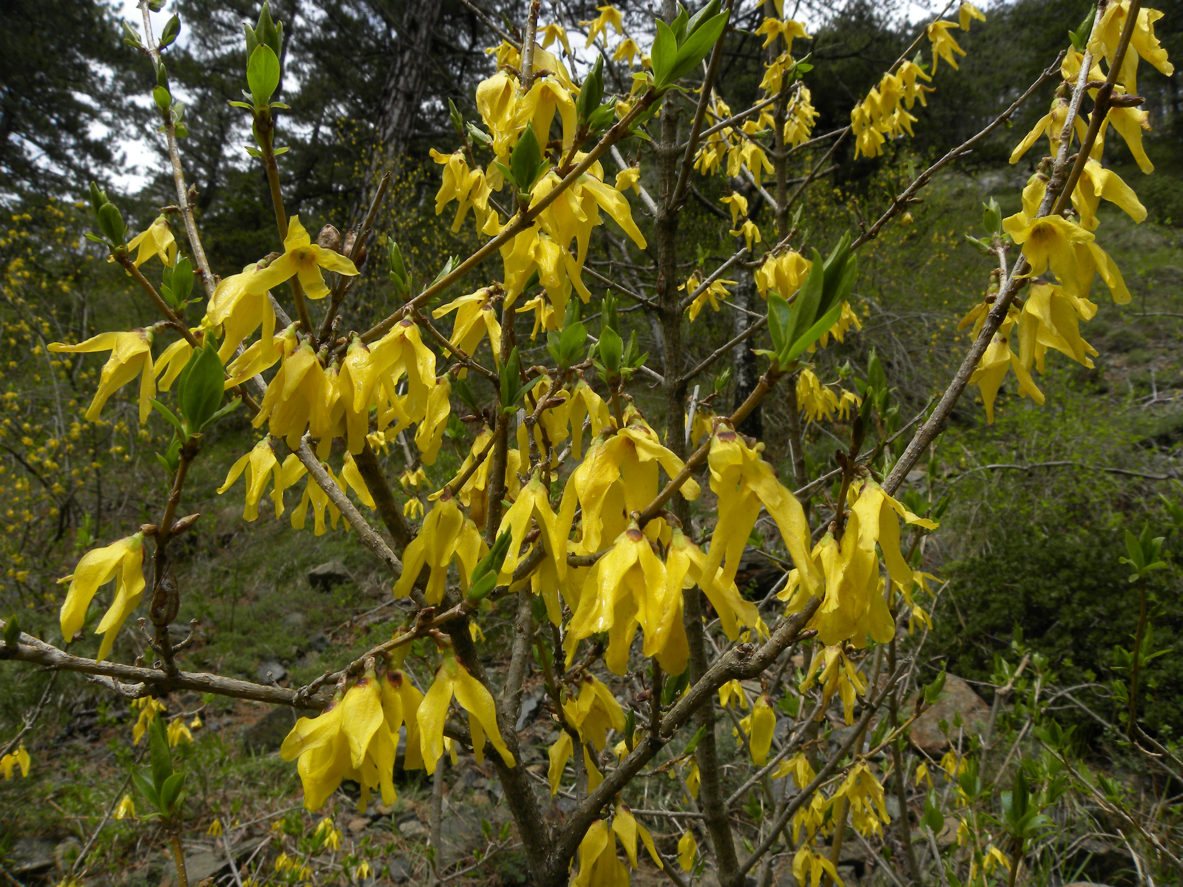
Close up view of yellow Forsythia europaea flowers on thin woody branches against a blurry forest background.
European forsythia (Forsythia europaea) in bloom within Shtamë Pass Nature Park.

Shtamë Pass Nature Park history and protected-area timeline

The protected area now known as Shtamë Pass Nature Park was formally established on 15 January 1996 by the Albanian government, initially as a national park classification. It was created to safeguard the pass's forests, water resources, and associated wildlife in a country whose protected-area framework was still being rebuilt in the post-communist period. The site falls under the oversight of the National Agency of Protected Areas, Albania's principal body for managing the country's natural reserves.

In 2022 the area underwent a significant administrative transformation. The original national park designation was reorganized and expanded into a broader nature park, reflecting modern Albanian conservation practice that distinguishes strict national park protections from multi-use nature park categories. This redefinition enlarged the territory and adjusted the management approach, while preserving the area's core ecological importance.

The pass also carries a layered cultural-historical memory. The local spring known as Kroi i Nenës Mbretëreshë, the Source of the Queen Mother, has long been associated with the Albanian royal family, particularly with King Zog, who was born in the Mat region on the eastern side of the pass. A Vienna-based laboratory reportedly recognized the water's quality in 1932, and the area later became home to a recreation villa linked to the royal family.

A darker historical episode occurred on 29 April 1997, during the collapse of public order following the Albanian Rebellion of 1997. A network of Cold War-era tunnels on the eastern side of the pass, originally used by the communist military as an ammunition and weapons storage site, had been partially dismantled in the 1990s. During the unrest, local residents lacking proper training attempted to recover metals from the tunnels for sale, triggering an explosion that killed 23 people, many of them young villagers from the nearby settlement of Selishtë. The event remains a significant local memory tied to the park's modern history.

Shtamë Pass Nature Park landscape and geographic character

The landscape of Shtamë Pass Nature Park is shaped by a high mountain corridor that connects the Kruja massif with the broader interior highlands. The pass itself sits at around 1,250 meters, providing a relatively accessible route through otherwise rugged terrain. From this central spine, the land rises sharply northward, producing some of the more dramatic topographic relief within the park, including steep forested ridges and rocky upper slopes.

The highest summit in the park is Maja e Liqenit at approximately 1,724 meters, accompanied by the nearby secondary peak Maja i Rjepat e Qetkolës at about 1,686 meters. These elevations lend the northern section of the park a distinctly alpine feel, with cooler microclimates, exposed ridgelines, and seasonal snow. South of the pass road, the terrain descends more gradually, blending into forested foothills that connect the park visually and ecologically with neighboring protected areas.

Water plays a defining role in the park's scenery. Small mountain lakes dot the higher elevations, while numerous springs discharge along the slopes. The most celebrated of these is the spring known as Kroi i Nenës Mbretëreshë, whose clear, cold waters have long contributed to the area's reputation for purity. Streams and seeps combine to create a moist understory in many forested areas, shaping both vegetation patterns and the visual texture of the landscape.

The road from Kruja to Burrel runs directly through the park, giving travelers an unusually direct experience of the protected scenery. Wooded slopes rise immediately on either side, while viewpoints along the route reveal layered ridgelines and, in clear weather, distant panoramas toward Tirana and the coastal lowlands.

Shtamë Pass Nature Park ecosystems, habitats, and plant life

The ecological character of Shtamë Pass Nature Park is dominated by extensive montane and sub-alpine forest. Mature European black pine stands are the defining vegetation type, with individual trees reaching around 20 meters in height and ages of roughly 60 years. These black pines form the structural backbone of the forest community, contributing to canopy closure, soil stability, and the visual identity of the park.

Oak species are a significant secondary component, broadening the habitat mix within the broader forest mosaic. Together, pine and oak woodland cover most of the park's undeveloped mountain land, with the densest and tallest stands concentrated north of the pass road. Understory and edge habitats support additional plant diversity, including notable botanical elements such as Forsythia europaea, a European forsythia species that occurs within the park.

Aquatic and wetland habitats add a second ecological layer. Small lakes situated in the higher elevations, together with the network of springs along the slopes, support moisture-dependent plant communities and provide water sources for wildlife. The chemistry and clarity of these highland waters, particularly at the Source of the Queen Mother, are considered exceptional and have contributed to the area's reputation for environmental quality.

The continuity of forest cover across the pass and into adjacent protected areas, including Dajti National Park to the southeast and the Kraste-Verjon Protected Landscape to the southwest, strengthens the broader ecological coherence of central Albania's mountain systems.

Shtamë Pass Nature Park wildlife and species highlights

Wildlife in Shtamë Pass Nature Park reflects the maturity and continuity of its forest habitats. The dense stands of black pine and oak provide refuge for a number of large mammals that depend on extensive wooded terrain. Among these, the brown bear is one of the most notable species, using the park's forested cover and seasonal food resources as part of its wider range through the Albanian highlands. Wolves, the region's other apex predator, are also present, supporting natural predator-prey dynamics that help maintain ecological balance.

Red foxes are a common presence across the park, occupying forest edges and transitional habitats. These medium-sized carnivores contribute to small-mammal population control and add to the overall activity of the forest ecosystem. Smaller carnivores, herbivores, and insectivores typical of central Albanian mountain forests round out the mammalian community, although detailed population data for many species remains limited.

Birdlife in the park is varied, supported by the combination of mature coniferous forest, broadleaf stands, ridge habitats, and water features. Forest interior, edge, and highland species all contribute to a rich avian community, while the lake and spring systems offer habitat for water-associated birds. This diversity of habitats gives the park significant ornithological value, particularly during migration seasons when altitudinal movements bring additional species into the area.

The wildlife of the park faces ongoing pressure, most notably from illegal deforestation, which fragments cover and reduces habitat quality. Maintaining healthy forests is therefore central not only to the park's biodiversity but also to its role in supporting viable populations of larger mammals and bird species.

Shtamë Pass Nature Park conservation status and protection priorities

Shtamë Pass Nature Park plays an important conservation role in central Albania, protecting an interconnected mosaic of pine and oak forest, highland lakes, and freshwater springs. Its designation under IUCN Category IV, as a habitat and species management area, underscores its function in maintaining ecological processes and supporting viable populations of native species, including brown bears, wolves, and forest-dependent birds.

The park's conservation value is closely tied to its mature black pine woodlands, which are among the more significant in the country and serve as a key natural resource for water retention, soil protection, and biodiversity. By keeping these forest stands intact, the park contributes to watershed health in a region where spring water is a critical natural and economic asset.

A major conservation challenge for the park is illegal deforestation, which threatens the structural integrity of the forest and the habitat it provides for wildlife. Continued management under the National Agency of Protected Areas is essential to monitoring and addressing these pressures, particularly given the park's proximity to key roads and settlements.

The park also forms part of a broader conservation network in central Albania through its adjacency to Dajti National Park and the Kraste-Verjon Protected Landscape. This connectivity enhances gene flow for wide-ranging species and strengthens the long-term resilience of highland ecosystems in the region.

Shtamë Pass Nature Park cultural meaning and human context

The cultural identity of Shtamë Pass is closely tied to water and to the memory of the Albanian royal family. The spring known as Kroi i Nenës Mbretëreshë, the Source of the Queen Mother, is linked in local tradition to Queen Mother Sadije Toptani, mother of King Zog, and more broadly to the royal family's appreciation of the area's water. The water's reported recognition by a Vienna laboratory in 1932 added to its stature, and a recreation villa associated with the royal family was reportedly built in the vicinity.

King Zog himself was born in the Mat region on the eastern side of the pass, reinforcing the area's importance in national memory. The pass has therefore long been more than simply a geographical feature; it has functioned as a symbol of royal heritage, traditional beliefs about curative water, and local pride in the area's natural gifts.

This cultural legacy is reinforced by the modern bottling of the spring's water under the Qafshtama brand, which gives the area a continuing economic and symbolic presence in Albanian daily life. Together, the royal associations, legends, and bottling heritage give the park a cultural depth unusual for a purely mountainous protected area.

Top sights and standout views in Shtamë Pass Nature Park

Shtamë Pass Nature Park combines extensive mature black pine forest, highland lakes, and renowned freshwater springs within a single accessible mountain corridor. Its summit of Maja e Liqenit, at roughly 1,724 meters, offers notable alpine scenery, while the Source of the Queen Mother anchors the park's identity around clean, historically celebrated spring water.

Wildlife presence is meaningful rather than incidental, with brown bears, wolves, and red foxes supported by continuous forest cover, and birdlife enriched by the diversity of habitats from forest interior to open water. The park's position between Dajti National Park and the Kraste-Verjon Protected Landscape adds wider ecological value, and the road from Kruja to Burrel makes the area unusually approachable for visitors interested in hiking, scenery, and a layered cultural landscape shaped by royal-era memory.

Best time to visit Shtamë Pass Nature Park

The park's highland character means that summer and early autumn are generally the most rewarding periods for visiting, when mountain roads and trails are most accessible and the forests are at their greenest. These months tend to bring milder temperatures and the clearest views of ridgelines and the Maja e Liqenit area. Spring can also be attractive as the forest understory awakens and water levels in springs and small lakes are at their highest, though conditions can be wetter and cooler.

Winter brings colder conditions and, at higher elevations, snow, which can limit access along the pass road and make trail walking more demanding. Late autumn, after the first cold spells, can offer crisp visibility and quieter conditions, but visitors should plan for shorter daylight and rapidly changing mountain weather. Across all seasons, layering clothing and preparing for sudden shifts in mountain weather is important, given the park's elevation range.
Monthly climate preview

Long term representative point measurements for temperature and precipitation patterns

Shtamë Pass Nature Park Climate Normals and Annual Temperature Rhythm

Recorded baseline data for Shtamë Pass Nature Park reveals a wide thermal range alongside shifting monthly precipitation averages across the monitored coordinate. Examining the complete twelve month climate profile provides deeper context for long term environmental normals.
Annual mean12 °C
2 °C24 °C
Jan
Feb
Mar
Apr10°
May15°
Jun20°
Jul23°
Aug24°
Sep18°
Oct13°
Nov
Dec
Warmest month
August

23.6 °C

Coolest month
January

1.9 °C

Wettest month
November

3.8 mm/day

Driest month
August

1 mm/day

Park location guide

Geography guide, regional context, and park location map for Shtamë Pass Nature Park

Shtamë Pass Nature Park park geography, regions, and map view in Albania

Understand where Shtamë Pass Nature Park sits in Albania through a broader geographic reading of the surrounding landscape, nearby location context, and its mapped position within the national park landscape.

How Shtamë Pass Nature Park fits into Albania

Albania is a unitary parliamentary republic in Southeast Europe, situated on the Balkan Peninsula along the Adriatic and Ionian coastal regions. With a population of approximately 2.4 million people, it borders Montenegro, Kosovo, North Macedonia, and Greece. The country features varied landscapes ranging from the Albanian Alps to fertile coastal plains, with Tirana as its capital and largest city.

Wider geography shaping Shtamë Pass Nature Park in Albania

Albania occupies the western part of the Balkan Peninsula in Southeast Europe. The country features a varied terrain with rugged mountain ranges including the Albanian Alps (Accursed Mountains), Korab, Skanderbeg Mountains, Pindus, and Ceraunian Mountains. Fertile lowland plains extend along the Adriatic and Ionian coastal regions. The country borders Montenegro to the northwest, Kosovo to the northeast, North Macedonia to the east, and Greece to the south.

Map view of Shtamë Pass Nature Park

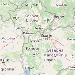
Use this park location map to pinpoint Shtamë Pass Nature Park in Albania, understand its exact geographic position, and read its mapped placement within the surrounding landscape more clearly.

Pigeon | © OpenStreetMap contributors

Visualizing the rugged topography, black pine forests, and alpine terrain of central Albania

Shtamë Pass Nature Park Photos and Mountain Scenery Imagery

Visual records reveal the diverse terrain, highland pine forests, and dramatic mountain ridgelines defining Shtamë Pass Nature Park. Photographic documentation provides clear reference points for understanding the protected landscapes, water corridors, and natural habitats spanning this Albanian mountain region.

Close up view of yellow Forsythia europaea flowers on thin woody branches against a blurry forest background.

Park atlas

Compare regional park geography, highland forests, and connected protected landscapes.

Exploring Other Parks Near Shtamë Pass Nature Park and Surrounding Mountain Protected Areas

Visitors exploring Shtamë Pass Nature Park can continue examining adjacent mountain reserves and regional protected landscapes across the central highlands. Comparing these neighboring conservation zones reveals broader ecological patterns and topographic continuity throughout the surrounding mountain chain.
A minimalist watercolor painting showing a tranquil lake surrounded by gentle hills and trees against a soft, pale sky.
Nature reserveDibër County
About 17 km away#1 closest

North

Lake Ulza Nature Park: Mapped Geography and Protected Area Overview in Dibër County

Analyzing the reservoir and river valley landscapes of central Albania

Lake Ulza Nature Park represents a significant protected mosaic where the Mat River creates a corridor of reservoirs, oak forests, and stony uplands. This overview examines the park geography, offering a structured look at how water bodies and mountainous terrain converge to form a unique inland habitat in Dibër County. Explore the physical relief and environmental boundaries that define this essential Albanian natural landmark.

Area
42.06 km²
Established
2013
IUCN
IV
Relief
Mixed relief
National parkAlbania
About 18 km away#2 closest

South

Dajti Mountain National Park: Albania's Accessible Protected Mountain Landscape for Geographic Discovery

Explore the mapped terrain and diverse ecosystems of this significant national park.

Dajti Mountain National Park is a prime example of a protected mountain landscape central to Albania's geography. Situated near Tirana, its rugged karst topography, steep limestone ridges, and varied elevation create distinct ecological zones. This atlas-focused entry details the park's terrain, notable geological features like Pellumbas Cave, and its role as a significant protected area offering rich mapped landscape context.

Area
293.84 km²
Established
1966
IUCN
II
Relief
Mountain
An abstract watercolor painting showing a horizontal landscape with grassy foreground and distant rolling hills in soft green, yellow, and purple tones.
Nature reserveDibër County
About 21 km away#3 closest

Southeast

Mali me Gropa-Bizë-Martanesh Nature Park: Karst Plateau and Mountain Geography in Central Albania

A diverse nature reserve in the heart of the Albanian highlands

This protected area features a unique mosaic of karst landscapes, including the distinctive Mali me Gropa plateau, alongside deep canyons and glacial features. It provides essential habitat for large carnivores and represents a vital ecological link within the mountain terrain of central Albania, offering a structured look at the region's vertical landscape zonation and natural monuments.

Area
252.66 km²
Established
2007
IUCN
IV
Relief
Mountain
A minimalist watercolor painting depicting a soft-focus landscape with green marshes, pale yellow flats, and light pink rolling hills in the background.
Nature reserveLezhë County
About 34 km away#4 closest

Northwest

Kunë-Vain-Talë-Patok-Fushëkuqe-Ishëm Nature Park: Mapped Geography and Coastal Wetlands

Protected lagoon and forest landscapes in Lezhë County, Albania

Examine the protected territory of Kunë-Vain-Talë-Patok-Fushëkuqe-Ishëm Nature Park, defined by its dynamic lagoon systems, alluvial forests, and coastal dunes along the Adriatic shore. This area provides deep insight into deltaic hydrology and the preservation of Mediterranean woodland habitats within a regional geographic context.

Area
43.93 km²
Established
2010
IUCN
IV
Relief
Lowland
Watercolor illustration of rolling green hills and distant mountains under a soft sky
National parkDibër County
About 43 km away#5 closest

Northeast

Lurë-Dejë Mountain National Park: Mapped Protected Landscape and Glacial Lake Geography

Dibër County's alpine protected area with unique glacial lakes.

Delve into the detailed geographic context and mapped protected area of Lurë-Dejë Mountain National Park, an essential natural landscape in Albania's Dibër County. This park is renowned for its rare chain of twelve glacial lakes, situated at high elevations amidst dramatic alpine terrain. Its protected status ensures the preservation of significant old-growth forest ecosystems, including the critically endangered Balkan pine, contributing to its recognition as an Important Bird and Plant Area. Explore the park's distinctive terrain, from its soaring mountain peaks to its unique alpine meadows, all within a comprehensive geographic atlas framework.

Area
202.42 km²
Established
1966
IUCN
II
Relief
Mountain
National parkNorth Macedonia
About 56 km away#6 closest

East

Mavrovo National Park: North Macedonia's Extensive Protected Alpine Terrain and Wildlife

Mapped geography of Alpine peaks, gorges, and unique endemic species.

Mavrovo National Park, North Macedonia's largest protected area, offers a deep dive into a complex Alpine geography. Dominated by the Šar, Korab, and Bistra mountain systems, the park features towering peaks and the dramatic Radika River gorge. This protected landscape is globally significant for its role in conserving the rare Balkan lynx and harbors endemic tertiary relic plant species like Macedonian pine. Explore the mapped boundaries, glacial lakes, and distinct terrain that define this vital conservation area.

Area
730.88 km²
Established
1949
IUCN
II
Relief
Mountain
A horizontal watercolor painting of a serene river landscape with green trees on both banks and small boats floating on the water at sunset.
Protected landscapeShkodër County
About 57 km away#7 closest

Northwest

Buna River-Velipojë Protected Landscape: Albania Coastal and Wetland Geography

Mapped protected landscape in Shkodër County

The Buna River-Velipojë Protected Landscape encompasses the crucial junction of riverine systems and the Adriatic Sea. This protected area features a mosaic of marshes, lagoons, and alluvial forests that form a significant migratory corridor in northwestern Albania.

Area
230.27 km²
Established
2005
IUCN
V
Relief
Lowland
Watercolor painting showing hills, green fields, a body of water, and vegetation under a soft sky
National parkAlbania
About 60 km away#8 closest

Southwest

Divjakë-Karavasta National Park: Albania's Expansive Coastal Wetland and Pelican Breeding Site

Mapping Albania's largest Mediterranean lagoon and its vital bird sanctuaries.

Divjakë-Karavasta National Park is a key protected coastal wetland in western Albania, centered around Karavasta Lagoon, one of the largest in the Mediterranean. This Ramsar site provides critical habitats for numerous bird species, including a globally significant population of the endangered Dalmatian pelican, making it a premier destination for understanding regional wetland geography and protected area dynamics.

Area
222.3 km²
Established
2007
IUCN
II
Relief
Lowland

Common questions about visiting, size, designation, and location context for Shtamë Pass Nature Park

Shtamë Pass Nature Park FAQs for park facts, access, geography, and protected area context

Find quick answers about Shtamë Pass Nature Park, including protected-area facts, park geography, trail and visitor context, and how the park fits into its surrounding country and regional landscape.
MoriAtlas Explorer

Continue Your Protected Areas Search Across the Global Atlas

Deepen your exploration by continuing the structured search for national parks and protected areas worldwide. Utilize the comprehensive filtering capabilities to compare different conservation landscapes and refine your understanding of global park geography. Discover more about the distribution and characteristics of protected natural areas.

Global natural geography