
Mori Atlas logo
Biosphere reserveSierra La Laguna

Analyzing the rugged granite terrain, pine-oak forests, and essential aquifer recharge systems

Sierra La Laguna Biosphere Reserve and Mountain Landscape Geography in Baja California Sur

(Reserva de la Biosfera Sierra La Laguna)

Sierra La Laguna stands as a distinct mountain massif in southern Baja California Sur, serving as the state's highest point and a critical ecological refuge. The biosphere reserve encompasses a complex mosaic of pine-oak woodland, tropical forest, and cactus scrub that contrasts sharply with the surrounding desert landscape. This area acts as the primary hydrological source for the southern peninsula, with its rugged granite slopes and deep canyons protecting vital groundwater recharge zones for local populations.

biosphere reservepine-oak forestbiodiversitytropical forestpalm grovesmountain range
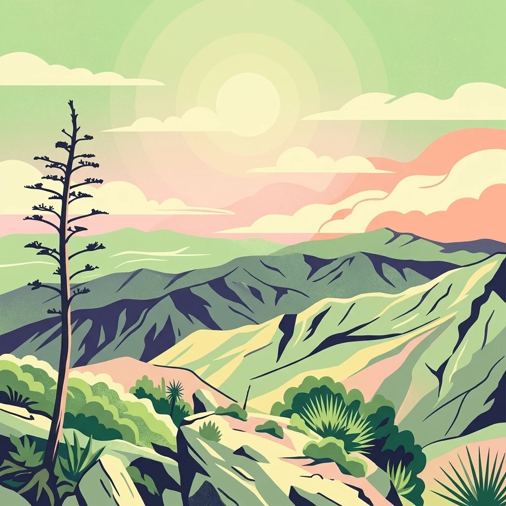
A stylized digital illustration of the rugged Sierra La Laguna mountains under a pastel sky with a tall desert plant in the foreground.

Sierra La Laguna

Biosphere reserve

Park overview

Structured park overview, official facts, and landscape profile for Sierra La Laguna

Sierra La Laguna park facts, protected area profile, and essential visitor context

Review the core facts for Sierra La Laguna, including designation, size, terrain, visitor scale, habitats, and operating context in one park-focused overview.

About Sierra La Laguna

Sierra La Laguna sits in the southern half of the Baja California Peninsula, in the Mexican state of Baja California Sur, and forms the highest massif between the municipalities of La Paz and Los Cabos. The range belongs to the Peninsular Ranges system and is composed mainly of intrusive igneous rocks of Mesozoic age, dominated by coarse-grained granites and syenites that are believed to be part of a Cretaceous batholith underlying much of the peninsula. Its peaks rise close to 2,080 meters above sea level, giving the area a noticeably cooler and wetter microclimate compared to the arid lowlands that surround it.

The reserve's ecological significance is shaped by this elevation contrast. Sierra La Laguna contains the only pine-oak forest, the only tropical forest, and the only palm forest present in the state of Baja California Sur, alongside cactus scrub and oak woodland. Mexican national biodiversity inventories record more than two thousand plant and animal species within its boundaries, including species found in risk categories under Mexico's official ecological standard. The reserve encompasses fifteen sub-watersheds and represents the most important groundwater recharge area in the region: it supplies the majority of the freshwater used by the state's population.

As a biosphere reserve, Sierra La Laguna has been formally protected since 1994, with a designated core zone and buffer zones intended to safeguard its ecosystems and hydrogeological function. While mining operations are excluded from the core zone, the buffer areas have faced pressure from tourism development along the southern coast, including large resort projects near Cabo San Lucas. The reserve is accessed via the highway between La Paz and Los Cabos, passing near the town of Todos Santos. Beyond its ecological and hydrological roles, Sierra La Laguna is also known for archaeological remains scattered across the range, suggesting long-term human presence in what is otherwise a remote and rugged landscape.

Quick facts and research context for Sierra La Laguna

Sierra La Laguna is the highest mountain range in the Mexican state of Baja California Sur, with a maximum elevation near 2,080 meters above sea level. The range crosses the municipalities of La Paz and Los Cabos in the southern portion of the Baja California Peninsula. The protected area was decreed as a biosphere reserve on 6 June 1994, covering roughly 112,000 hectares, including a core zone and surrounding buffer zones. The reserve is divided into 15 sub-watersheds and supplies a large share of the state's freshwater through aquifer recharge.

Protection and recognition

Documented terrestrial protection scope and official UNESCO Biosphere Reserve records

Sierra La Laguna Protection Status and International Recognition Data

Sierra La Laguna preserves documented terrestrial protection parameters and official UNESCO Biosphere Reserve recognition sources. Verified administrative records outline the governance scope and international designation details for this protected area.

International recognition

Protection details

Protection scope
Terrestrial
Designated year
2003
Transboundary protection
No
Core area
325.19 km²
Buffer area
799.17 km²
Park context

Deeper park guide and search-rich context for Sierra La Laguna

Sierra La Laguna history, landscape, wildlife, and travel context

Explore Sierra La Laguna through its history, landscape character, ecosystems, wildlife, conservation priorities, cultural context, and seasonal travel timing in a structured park guide built for atlas discovery and search intent.

Why Sierra La Laguna stands out

Sierra La Laguna is best known for being the only place in Baja California Sur where pine-oak forest, tropical forest, oak woodland, and palm groves occur together in a single protected landscape. The reserve harbors more than two thousand recorded plant and animal species, including a notable share of endemics. Its highland climate, with cooler temperatures and a strong summer rainy season, distinguishes it sharply from the surrounding desert peninsula. The range is also recognized as the principal aquifer recharge zone for the southern Baja California Peninsula, supporting a large part of the state's population.
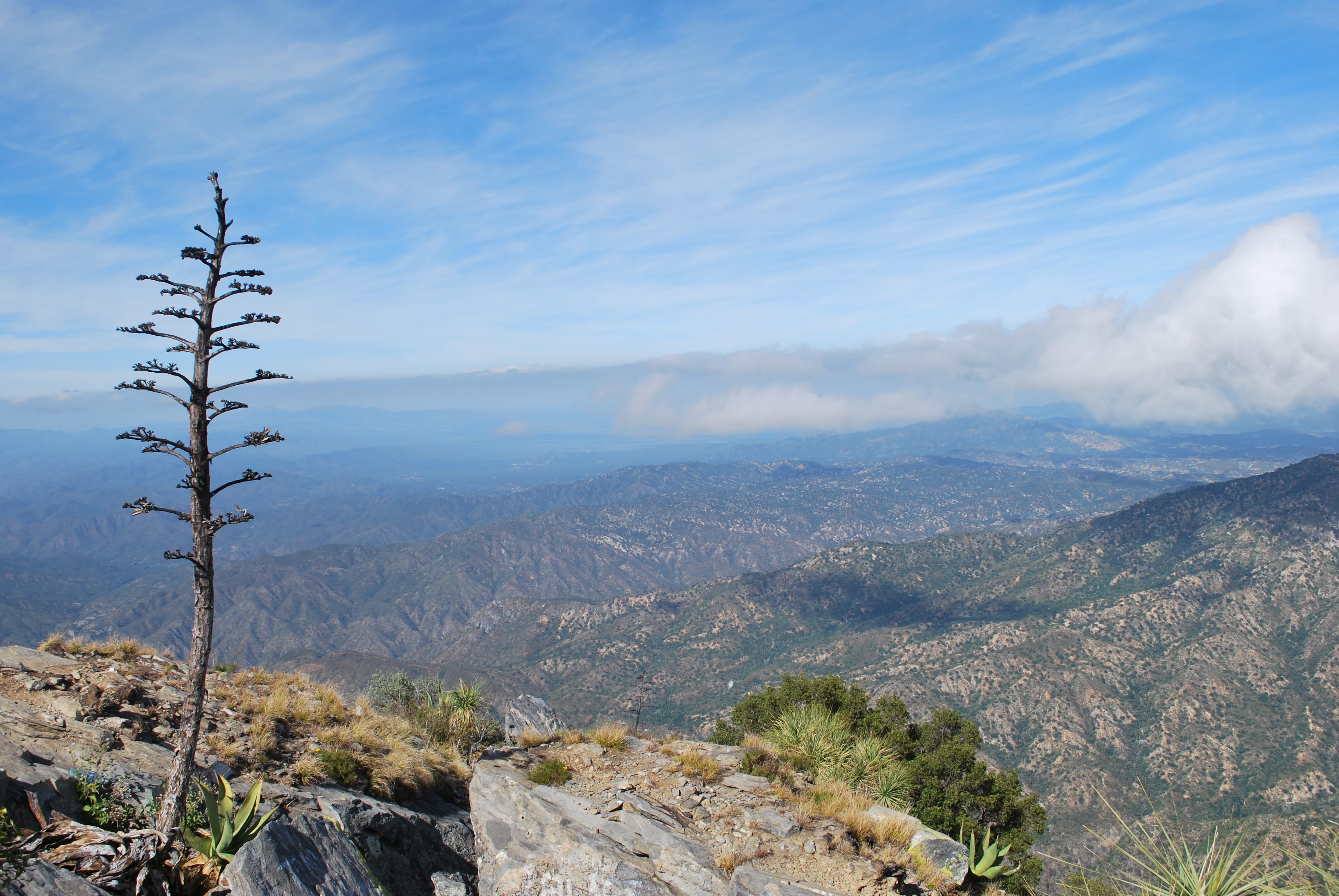
A high vantage point view looking out over rugged mountain ranges under a partly cloudy sky, with a tall, slender, bare agave stalk standing in the foreground.
A panoramic view from the heights of El Picacho in Sierra La Laguna, showcasing the mountainous terrain and vegetation.

Sierra La Laguna history and protected-area timeline

Sierra La Laguna has long been a hydrological and ecological landmark in southern Baja California Sur, known locally even before its formal protection as the principal recharge zone for regional aquifers. The area contains archaeological vestiges that indicate long-standing human presence in the range, even though the remote and rugged character of the highlands limited large-scale settlement.

Modern conservation history began on 6 June 1994, when the Mexican federal government decreed the establishment of the Reserva de la Biosfera Sierra La Laguna. The decree set aside a core zone of approximately 32,500 hectares and two buffer zones totaling roughly 80,000 additional hectares, creating a layered protection system around the most ecologically sensitive areas. Since its designation, the reserve has been managed as a key biodiversity and water-resource site for the state, and conservation concerns have increasingly shifted toward regulating large-scale tourism development in the surrounding lowlands, where proposed mega-resorts have periodically threatened the integrity of the buffer zones.

Sierra La Laguna landscape and geographic character

Sierra La Laguna is a compact, rugged mountain massif in the southern Baja California Peninsula, with a maximum elevation close to 2,080 meters above sea level that makes it the highest point in the state of Baja California Sur. The range is built primarily from intrusive igneous rocks, with massive granites and syenites of Mesozoic age forming the dominant surface geology. These coarse-grained, well-consolidated rocks are thought to be part of a Cretaceous batholith that underlies much of the peninsula, and they create steep slopes, deep drainages, and exposed rocky terrain.

Soils across the range are generally shallow and poorly developed, especially on the steepest slopes, where thin soils over bedrock support only limited vegetation. The relief is broken by canyons, hills, and abrupt transitions from highland to coastal plain, giving the reserve strong topographic contrast in a relatively regional area. Fifteen sub-watersheds are nested within the reserve, and the network of streams that drains these highlands represents the largest portion of the river system in this part of the peninsula, fed by seasonal rainfall that accumulates at higher elevations.

Sierra La Laguna ecosystems, habitats, and plant life

Ecologically, Sierra La Laguna stands out as a biodiversity enclave within an otherwise arid peninsula. The reserve encompasses an unusual mosaic of vegetation types for Baja California Sur, including the state's only pine-oak forest, its only tropical forest, palm groves, oak woodland, and cactus scrubland. Lower slopes support deciduous shrubland and denser plant cover, while higher elevations support conifer woodlands. This combination of ecosystems within a single protected area gives the range an unusually high density of habitat types for the region.

Mexican national biodiversity records indicate that more than two thousand plant and animal species are present in the reserve, with dozens falling within official Mexican risk categories and a smaller number classified as exotic species. Characteristic plant species include black oak, pinyon pine, madrone, sotol, and various shrubs and cacti that occupy the slope-dependent vegetation zones. Because the park includes both tropical and temperate vegetation types, the reserve functions as an important ecological island, sustaining species and habitats not found elsewhere in the southern peninsula.

Sierra La Laguna wildlife and species highlights

The fauna of Sierra La Laguna reflects the range's unusual mix of tropical, temperate, and arid influences. Mammals in the reserve include deer, coyotes, black-tailed hares, puma, and gray fox. The birdlife is diverse, featuring white-winged doves, collared doves, vultures, hawks, and small owls. Reptiles are also well represented, with around forty recorded reptile species complemented by a substantial insect fauna that includes spiders and tarantulas.

The endemism in the reserve, combined with the ecological contrast between highlands and the surrounding lowlands, gives the wildlife of Sierra La Laguna a distinctive regional importance. Many of the species documented here are tied to habitats that exist nowhere else in the state, which is why the reserve's protection is critical both for resident fauna and for broader patterns of biodiversity in the Baja California Peninsula.

Sierra La Laguna conservation status and protection priorities

Sierra La Laguna carries strong conservation significance because of the unusual concentration of habitat types and endemic species within its boundaries, supported by a biosphere reserve designation that protects an extensive core zone plus buffer areas. Its designation in 1994 recognized both its biodiversity and its function as the principal aquifer recharge zone for the region, supplying the majority of freshwater used by the population of Baja California Sur.

Conservation pressures are concentrated outside the core zone, where mining activities have been proposed but not approved, and where large tourism developments along the southern coast, including proposed mega-resort complexes in the Cabo Cortés area, have threatened buffer zones. The layered structure of the reserve, with a strictly protected core and surrounding buffer areas, is intended to safeguard both ecosystems and hydrological function against these external pressures, while also preserving archaeological and cultural resources associated with the landscape.

Sierra La Laguna cultural meaning and human context

Although best known for its ecological value, Sierra La Laguna also holds a cultural dimension. The range contains archaeological vestiges that indicate human presence in the highlands well before modern settlement patterns. These remains, combined with the reserve's small rural communities and surrounding towns such as Todos Santos, connect the protected landscape to a longer regional history of human interaction with the rugged southern peninsula. The range is not only a natural refuge but also a physical anchor for the identity and water security of surrounding communities in Baja California Sur.

Top sights and standout views in Sierra La Laguna

Sierra La Laguna distinguishes itself as the highest range in Baja California Sur, the state's only pine-oak forest, and the principal freshwater source for the southern peninsula. Its compact mosaic of pine-oak woodland, tropical forest, palm groves, oak woodland, and cactus scrub supports far more biodiversity than any other protected landscape in the state. Combined with its archaeological sites and layered protection system, the reserve serves as a critical ecological, hydrological, and cultural reference point for southern Baja California.

Best time to visit Sierra La Laguna

The climate of Sierra La Laguna is strongly altitude-driven, with higher elevations experiencing a temperate, subtropical highland climate that is noticeably cooler than the surrounding desert. Conditions are generally mild year-round at higher altitudes, while rainfall is concentrated in the summer months, with July through September bringing the bulk of annual precipitation. For visitors interested in cooler temperatures, greener vegetation, and active streams, late summer and early autumn are the strongest seasons, while the cooler, drier months of late autumn through early spring offer more stable weather for accessing the higher elevations.

Monthly climate preview

Long-term monthly temperature averages and precipitation patterns measured at a representative coordinate

Sierra La Laguna Climate Normals, Annual Temperature and Precipitation Rhythm

Representative coordinate records show average monthly temperatures ranging from 19.3 degrees Celsius to nearly 28.8 degrees Celsius alongside distinct precipitation patterns across the year. Exploring the complete monthly dataset provides detailed context on long-term temperature ranges and precipitation normals.
Annual mean24 °C
19 °C29 °C
Jan19°
Feb20°
Mar21°
Apr23°
May25°
Jun27°
Jul29°
Aug29°
Sep28°
Oct27°
Nov24°
Dec20°
Warmest month
August

28.8 °C

Coolest month
January

19.3 °C

Wettest month
September

3.3 mm/day

Driest month
April

0 mm/day

Park location guide

Geography guide, regional context, and park location map for Sierra La Laguna

Sierra La Laguna park geography, regions, and map view in Mexico

Understand where Sierra La Laguna sits in Mexico through a broader geographic reading of the surrounding landscape, nearby location context, and its mapped position within the national park landscape.

How Sierra La Laguna fits into Mexico

Mexico, officially the United Mexican States, is a country in North America spanning the Sierra Madre mountain ranges, coastal plains, and tropical regions. It borders the United States to the north, Guatemala and Belize to the southeast, and has coastlines along the Pacific Ocean, Gulf of Mexico, and Caribbean Sea. With a population exceeding 130 million, Mexico is home to one of the world's most significant concentrations of Indigenous languages alongside Spanish.

Wider geography shaping Sierra La Laguna in Mexico

Mexico occupies a land area of 1,972,550 km2, making it the thirteenth-largest country in the world. The terrain is highly diverse, featuring the Sierra Madre Occidental and Sierra Madre Oriental mountain ranges, the Mexican Plateau, coastal lowlands along the Pacific and Gulf/Caribbean margins, and the Yucatan Peninsula. The country spans multiple climate zones from desert in the north to tropical rainforest in the south.

Map view of Sierra La Laguna

Use this park location map to pinpoint Sierra La Laguna in Mexico, understand its exact geographic position, and read its mapped placement within the surrounding landscape more clearly.

Pigeon | © OpenStreetMap contributors

Location context for Sierra La Laguna

Baja California Sur
Recorded earthquake history

Browse the Sierra La Laguna Earthquake History and Seismic Records

Examine the historical catalogue of seismic events recorded in proximity to the Sierra La Laguna biosphere reserve. This MoriAtlas resource allows for the focused review of epicentre data and earthquake magnitude records across the surrounding Baja California Sur region.

Sierra La Laguna Earthquake History

Catalogued events

18 events

Strongest magnitude

Magnitude 5

Most recent event

Sep 1, 2025

This history includes earthquakes recorded inside the park or within 50 km of its borders

Visualizing the rugged granite terrain, highland microclimate, and diverse ecosystems of the Baja California Sur biosphere reserve.

Sierra La Laguna Photos and Landscapes: Protected Area Scenery

Visual documentation reveals the sharp topographic contrast between high elevation pine forests and the surrounding arid peninsula. Examining these protected area views provides a clear understanding of the geological relief and vegetative mosaic that define the region.

A high vantage point view looking out over rugged mountain ranges under a partly cloudy sky, with a tall, slender, bare agave stalk standing in the foreground.

Park atlas

Compare surrounding protected landscapes and neighboring regional terrain.

Parks Near Sierra La Laguna and Related Protected Areas in Regional Geography

Browse nearby national parks and protected areas sharing ecological ties with Sierra La Laguna. Continue exploring adjacent regional geography to compare mountain habitats and desert boundaries across the peninsula.
National parkBaja California Sur
About 28 km away#1 closest

East

Cabo Pulmo National Park: National Park Atlas and Protected Landscape Discovery

Explore its mapped geographic boundaries and regional context.

Cabo Pulmo National Park represents a vital protected natural landscape offering unique atlas exploration opportunities. Understand its specific geographic placement within Baja California Sur and explore its mapped boundaries as a national park. This destination provides a focused look at protected natural areas and their significance in regional geography.

Area
71.11 km²
Established
1995
IUCN
II
Relief
Lowland
A watercolor painting showing a coastal scene with low-lying green hills in the midground, a strip of water in the foreground, and distant purple-hued mountains under a pale yellow sky.
Protected areaBaja California Sur
About 33 km away#2 closest

Northwest

El Mogote Protected Area: Coastal Geography and Wetland Mapping in Baja California Sur

Sand barriers, mangrove fringes, and arid dune systems.

El Mogote is a defining landform of the Bay of La Paz, showcasing the intersection of extreme arid environments and sheltered estuarine habitats. This protected area provides a distinct study of coastal morphology, where wind-driven dunes meet the quiet, vital channels of a Ramsar-recognized wetland system that sustains regional marine health.

Established
2008
Relief
Lowland
Climate
Arid
Access
Moderate access
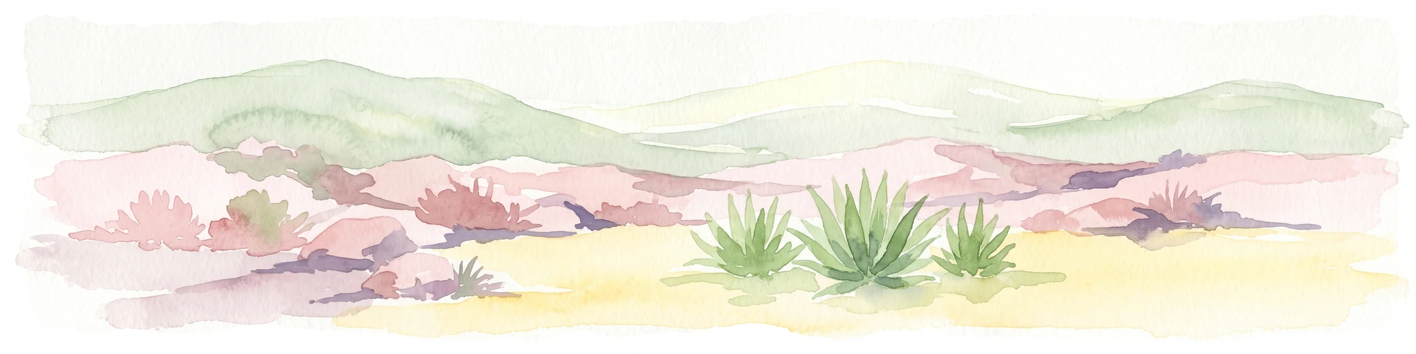
A horizontal watercolor painting showing a desert landscape with rolling hills in the background and agave plants in the foreground.
Wildlife reserveBaja California Sur
About 48 km away#3 closest

North

Área de protección de flora y fauna Balandra: Wildlife Reserve and Gulf Coast Geography

Protected mangrove lagoon landscapes in Baja California Sur

Discover the ecological significance of Área de protección de flora y fauna Balandra, a protected coastal area near La Paz. This site features a unique convergence of mangrove forests, shallow sandy bays, and arid desert coastal scrub that defines its status as a significant wildlife reserve in northwestern Mexico.

Area
25.125 km²
Established
2012
Relief
Lowland
Climate
Arid
National parkBaja California Sur
About 236 km away#4 closest

Northwest

Bahía de Loreto National Park: National Park Protected Landscape and Geographic Identity

Explore its mapped boundaries and regional context.

Bahía de Loreto National Park offers a distinct focus on its protected natural landscape and geographic features within Baja California Sur. This destination provides detailed mapping and regional context, enabling a focused exploration of its boundaries and natural environment. It is ideal for users seeking to understand the specific protected area identity and its geographical placement as part of a broader atlas of conservation landscapes.

Area
2,065.81 km²
Established
1996
IUCN
II
Relief
Mixed relief
Regional parkSinaloa
About 282 km away#5 closest

East

Ceuta Regional Park: Coastal Geography and Protected Nesting Habitats in Sinaloa

Coastal protection and agricultural valley landscape analysis.

Ceuta Regional Park stands as a key protected area on the Sinaloa coast of Mexico, noted for its long-standing sea turtle conservation initiatives and importance to migratory shorebirds. The park geography spans low-lying coastal plains and beach environments, framed by the agricultural heart of the Elota municipality. This entry provides a structural overview of the terrain, boundaries, and ecological context defining this coastal reserve.

Area
15 km²
Established
2002
Relief
Lowland
Access
Access unknown
Wildlife reserveSinaloa
About 308 km away#6 closest

East

Meseta de Cacaxtla Flora and Fauna Protection Area: Sinaloa Protected Landscape Overview

Mapping dry forests and Pacific coastal ecosystems

Meseta de Cacaxtla Flora and Fauna Protection Area is a significant wildlife reserve in Sinaloa, characterized by its transition from an elevated inland plateau to a complex coastal fringe of mangroves and lagoons. Spanning 508 square kilometers, this protected area preserves an essential blend of arid tropical ecosystems and marine habitats along the Mexican Pacific coast, providing a clear geographic view of regional conservation efforts.

Area
508.62 km²
Established
2000
IUCN
VI
Relief
Lowland
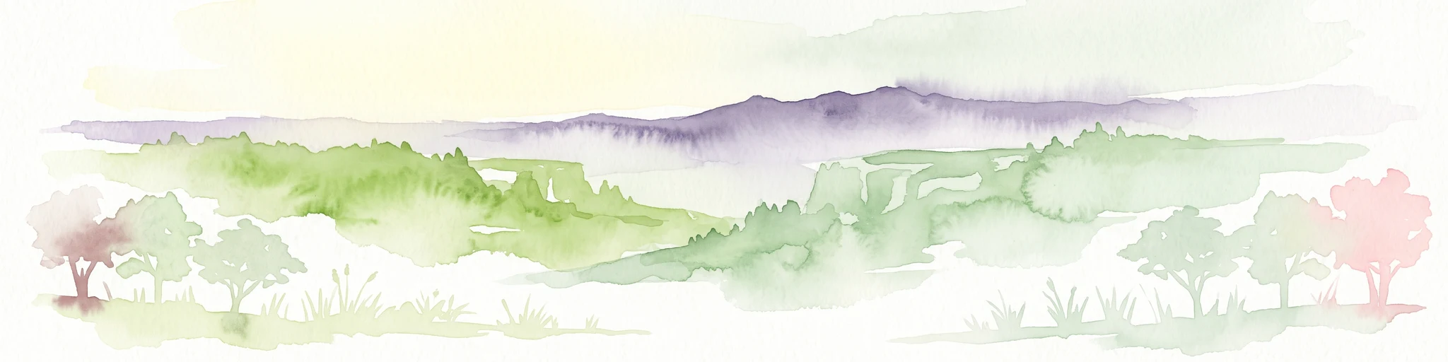
A soft watercolor illustration of rolling green hills, distant purple mountains, and stylized trees.
Protected areaChihuahua
About 368 km away#7 closest

Northeast

Cerro Mohinora: Protected Volcanic Summit and Alpine Geography in Chihuahua

An analysis of volcanic terrain and high-elevation protected ecosystems.

Cerro Mohinora dominates the skyline as a prominent volcanic landmark within the Sierra Madre Occidental. This record details the protected area's geographic reach, examining its complex igneous history and the dramatic vertical transition from pine-covered slopes to its snowy summit, offering a clear map-oriented view of this significant Chihuahua natural landmark.

Established
2012
Relief
Mountain
Water
Minor water
Season
Seasonal
Protected areaSonora
About 386 km away#8 closest

North

Área de protección de flora y fauna Sierra de Álamos-Río Cuchujaqui: Geography and Park Boundaries

Detailed atlas view of the Sonora biodiversity enclave and canyon systems.

Spanning over 92,000 hectares in Sonora, this protected area is defined by its dramatic transition from coastal plains to the Sierra Madre range. The geography centers on the deep, moisture-trapping barrancas of the Cuchujaqui River, which sustain a rare mixture of Neotropical and temperate species. Examine the structural complexity of these forested slopes and river-carved valleys that function as a essential habitat for large predators and diverse flora alike.

Area
928.9 km²
Established
1996

Common questions about visiting, size, designation, and location context for Sierra La Laguna

Sierra La Laguna FAQs for park facts, access, geography, and protected area context

Find quick answers about Sierra La Laguna, including protected-area facts, park geography, trail and visitor context, and how the park fits into its surrounding country and regional landscape.
MoriAtlas Explorer

Continue Your Protected Areas Search Across the Global Atlas

Deepen your exploration by continuing the structured search for national parks and protected areas worldwide. Utilize the comprehensive filtering capabilities to compare different conservation landscapes and refine your understanding of global park geography. Discover more about the distribution and characteristics of protected natural areas.

Global natural geography