
Mori Atlas logo
Protected landscapeSiuslaw National Forest

Mapping the geographic transition from temperate rainforests to the Pacific coastal dunes

Siuslaw National Forest: A Protected Landscape Mapping the Oregon Coast Range and Dunes

Siuslaw National Forest encompasses a diverse expanse of protected land in western Oregon, stretching from the wind-shaped Pacific coastal dunes to the forested ridges of the Oregon Coast Range. This landscape includes old growth remnants, salmon-bearing river corridors, and the prominent peaks of the coastal mountains. Understanding the geography of this federally managed forest provides insight into the layered ecosystems and varied terrain that define the central Oregon coastline.

coastal foresttemperate rainforestsand dunesOregon CoastPacific Northwestold growth
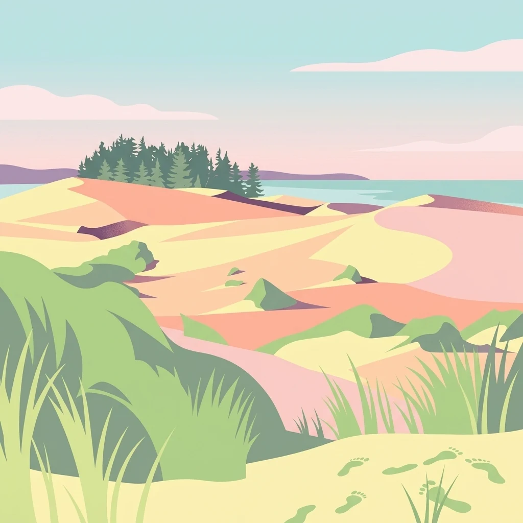
A flat, stylized digital illustration of a coastal landscape with rolling sand dunes, patches of green coastal grass, and a line of evergreen trees in the distance under a pale sky.

Siuslaw National Forest

Protected landscape

Park overview

Structured park overview, official facts, and landscape profile for Siuslaw National Forest

Siuslaw National Forest park facts, protected area profile, and essential visitor context

Review the core facts for Siuslaw National Forest, including designation, size, terrain, visitor scale, habitats, and operating context in one park-focused overview.

About Siuslaw National Forest

Siuslaw National Forest is one of the most scenically and ecologically varied national forests in the Pacific Northwest, occupying a long band of western Oregon that follows the central Oregon Coast. It extends from the Coos Bay area in the south to Tillamook County in the north, and in some areas pushes eastward beyond the crest of the Oregon Coast Range toward the Willamette Valley. This geography places the forest at the meeting point of marine, coastal mountain, and valley environments, allowing it to support an unusually broad mix of habitats within a single management unit.

The forest is administered by the United States Forest Service and is organized into two ranger districts: the Hebo Ranger District in the north and the larger Central Coast Ranger District in the south. These districts oversee recreation, timber, watershed, and wilderness management across more than 630,000 acres of federal land. While Siuslaw is often discussed alongside other Oregon national forests, its identity is shaped above all by its coastal position, which subjects it to the milder, wetter climate that drives the lush temperate vegetation of the Pacific Northwest.

Ecologically, the forest is defined by two contrasting vegetation zones. Closer to the ocean, moisture-laden air supports coastal forests dominated by Sitka spruce, while the interior is characterized by stands of western hemlock and Douglas fir, with western red cedar, red alder, and bigleaf maple as important secondary species. This vegetation pattern overlays a landscape of steep Coast Range ridges, river valleys, estuaries, beaches, and an extraordinary dune system. The result is a national forest where visitors can move in a single day from rainforest trails to the open sand of the Oregon Dunes and from salt-spray tide pools to high mountain viewpoints.

Siuslaw also has notable conservation and recreation significance. Its wilderness areas preserve some of the oldest and least-disturbed forest in the Coast Range, while its rivers and streams, totaling around 1,200 miles, support salmon and other native fish. At the same time, the forest is a major outdoor recreation destination, drawing visitors for its campgrounds, beaches, dunes, trails, and the scenic byways that wind through its forests and along its coastline.

Quick facts and research context for Siuslaw National Forest

Siuslaw National Forest is a United States Forest Service property in western Oregon, established on July 1, 1908. It covers more than 630,000 acres along roughly 150 miles of the central Oregon Coast, with its supervisor's office in Corvallis.

The forest spans parts of Lane, Lincoln, Tillamook, Douglas, Yamhill, Benton, Coos, and Polk counties, and includes the Oregon Dunes National Recreation Area and the Sand Lake Recreation Area. Two main ranger districts, Hebo and Central Coast, manage its day-to-day operations, and three congressionally designated wilderness areas protect its most intact old growth and stream habitat.

Protection and recognition

Examine the recorded designation history, administrative scope, and official recognition data.

Siuslaw National Forest Protection Status and Documented Conservation Management

Siuslaw National Forest protection status details compile verified conservation history and administrative scope records. Documented recognition data outlines official designations associated with the protected landscape.

Protection details

Transboundary protection
No
Park context

Deeper park guide and search-rich context for Siuslaw National Forest

Siuslaw National Forest history, landscape, wildlife, and travel context

Explore Siuslaw National Forest through its history, landscape character, ecosystems, wildlife, conservation priorities, cultural context, and seasonal travel timing in a structured park guide built for atlas discovery and search intent.

Why Siuslaw National Forest stands out

Siuslaw National Forest is best known for being the Oregon Coast's signature national forest, where temperate rainforest meets one of North America's most striking dune landscapes. The forest frames the Oregon Dunes National Recreation Area, a vast expanse of wind-shaped sand that rises directly behind the Pacific shoreline. It is also recognized for its old growth forests, particularly within the Cummins Creek and Rock Creek wilderness areas, and for Marys Peak, the tallest summit in the Oregon Coast Range. The combination of salmon-supporting rivers, coastal Sitka spruce stands, inland Douglas fir and western hemlock forests, and dramatic sand dunes gives Siuslaw a layered identity rarely matched by other national forests in the contiguous United States.
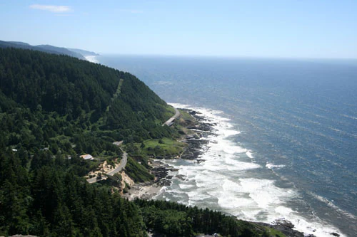
An elevated coastal view showing a dense evergreen forest meeting a rocky shoreline with crashing waves and a winding road following the coastline.
A scenic overlook of the rugged Oregon coastline from Cape Perpetua within Siuslaw National Forest.

Siuslaw National Forest history and protected-area timeline

The Siuslaw National Forest was officially established on July 1, 1908, becoming one of the older national forests in Oregon under the early twentieth century program of federal forest reserves. From its inception, it was part of the United States Forest Service's effort to manage the timber, watersheds, and recreation resources of the Pacific Northwest as a unified federal estate, rather than leaving them to scattered private ownership.

Over the following decades, the forest's role evolved with shifting national priorities. Logging of its Douglas fir, western hemlock, and Sitka spruce stands supported regional timber economies, while concerns about sustaining fish habitat, protecting remaining old growth, and providing outdoor recreation gradually expanded its management mission.

A significant milestone came in 1984, when three wilderness areas within the forest, Drift Creek, Cummins Creek, and Rock Creek, were formally designated as part of the National Wilderness Preservation System, protecting sections of old growth forest and key watersheds. The inclusion of the Oregon Dunes National Recreation Area within the forest's boundaries further cemented Siuslaw's profile as a destination for both conservation and outdoor recreation, ensuring that its sand dune landscapes and coastal forests would remain under coordinated federal stewardship.

Siuslaw National Forest landscape and geographic character

Siuslaw's landscape is shaped by its position along the central Oregon Coast, where the Pacific Ocean meets the forested ridges of the Oregon Coast Range. The forest runs more than a hundred miles along the coast and extends inland to the range's crest in places, with Marys Peak rising to 4,097 feet as the highest point in the entire Coast Range. From the shoreline inland, the terrain steps up through a narrow coastal plain, steep forested ridges, and the rolling highlands of the range itself.

One of the most visually striking features of the Siuslaw landscape is the Oregon Dunes National Recreation Area, where massive wind-shaped sand dunes climb inland directly from the beach. These dunes form a unique landscape of bare sand, partially vegetated ridges, and dune-backed lakes, with the adjacent coastal forest standing in sharp contrast to the open sand. Together, the dunes, rocky headlands, and sheltered coves of the coast give the forest a Pacific shoreline character found in few other national forests.

Inland, the landscape shifts to a deeply forested mountain environment. Steep ridges cut by rivers and streams drain the Coast Range, with the Alsea, Nestucca, Siuslaw, and Umpqua rivers among the major waterways flowing through or alongside the forest. Approximately 1,200 miles of rivers and streams wind through the forest, and roughly 30 lakes add still water to the scene. This combination of marine frontage, dune systems, river valleys, and forested mountains gives Siuslaw a layered and constantly shifting scenery that defines its visual identity.

Siuslaw National Forest ecosystems, habitats, and plant life

Siuslaw National Forest lies in a temperate maritime climate zone where mild temperatures and abundant rainfall support some of the most productive forest ecosystems in the United States. The forest's natural setting can be understood as two broad vegetation zones: a coastal zone dominated by Sitka spruce, shaped by salt spray and persistent moisture, and an interior zone dominated by western hemlock and Douglas fir.

In the coastal stands, Sitka spruce forms the backbone of forests that fringe the dunes and line the rivers approaching the sea. Inland, western hemlock often grows beneath towering Douglas fir, creating multilayered canopies that shade the forest floor and generate the cool, humid conditions associated with Pacific Northwest temperate rainforest. Western red cedar, red alder, and bigleaf maple add diversity to these stands, contributing to a rich understory and a steady supply of woody debris that feeds stream ecosystems.

Beyond the forests, the dunes of the Oregon Dunes National Recreation Area support a very different ecological community, with specialized plants stabilizing shifting sand and a network of dune lakes and wetlands forming behind the beach. Old growth forest, estimated at roughly 33,800 acres in a 1993 Forest Service assessment, survives most intact within the forest's designated wilderness areas, providing reference habitats for the ecological character of the broader Coast Range.

Siuslaw National Forest wildlife and species highlights

The combination of marine shoreline, river systems, dunes, and old growth forest gives Siuslaw National Forest a wealth of habitat types for wildlife. Rivers and streams that flow through the forest, including the Alsea, Nestucca, Siuslaw, and Umpqua, support salmon and other native fish, making the forest a significant area for aquatic species as well as for the animals that depend on healthy streams.

The coastal forests shelter typical Pacific Northwest mammals such as black-tailed deer, elk, raccoons, and smaller forest mammals associated with coniferous understories. Raptors and songbirds are common throughout the tree canopy, while seabirds, shorebirds, and waterfowl use the estuaries, tide pools, beaches, and dune lakes along the coast. Tide pool exploration is a recognized recreational activity within the forest, reflecting the rich intertidal life found along its shoreline.

The wilderness areas of Siuslaw are particularly important for wildlife because they preserve large blocks of undisturbed old growth. These quiet, structurally complex forests offer denning sites, canopy cover, and foraging habitat that benefit species sensitive to human disturbance. By keeping significant stretches of coast, dunes, and old growth together within a single national forest, Siuslaw supports a continuous wildlife landscape that links marine, riparian, and mountain habitats.

Siuslaw National Forest conservation status and protection priorities

Siuslaw National Forest represents an important conservation link in western Oregon, protecting a continuous corridor of coastal habitat from the Pacific shoreline inland to the crest of the Coast Range. By holding dune systems, temperate rainforests, salmon-supporting rivers, and old growth stands under a single management framework, the forest helps safeguard biodiversity at multiple ecological scales.

The three congressionally designated wilderness areas, Drift Creek, Cummins Creek, and Rock Creek, are central to its conservation profile. Established in 1984, these wilderness areas lock in protective status for some of the oldest and least disturbed forests in the Coast Range, maintaining habitat structure and watershed functions that would otherwise be vulnerable to fragmentation. The preservation of old growth in particular is a defining conservation concern in this region, and the wilderness areas serve as reservoirs of the kind of mature forest that supports countless species.

Beyond wilderness, conservation in Siuslaw extends to watershed protection, salmon habitat, and dune ecology. The forest's 30 lakes and roughly 1,200 miles of rivers and streams are managed in part to maintain water quality and fish passage, while the Oregon Dunes National Recreation Area preserves one of the most distinctive dune ecosystems in North America. Together, these efforts position Siuslaw as a working landscape where timber, recreation, and ecological preservation intersect, but where substantial natural values are formally protected.

Siuslaw National Forest cultural meaning and human context

Although Siuslaw National Forest is best described through its natural landscapes, the area carries a layered human history. Like much of western Oregon, the land has long been home to Indigenous peoples whose presence predates federal forest management, and their relationship with rivers, salmon, and coastal resources continues to shape regional cultural identity.

The early twentieth century brought a new chapter when the Siuslaw was formally established as a national forest in 1908, reflecting the rise of federal forestry and the integration of the Oregon Coast into a national framework of timber management, watershed protection, and later outdoor recreation. Timber, fishing, and coastal industry have all left their imprint on communities bordering the forest.

In more recent decades, the forest has become part of Oregon's outdoor recreation culture, with residents and visitors alike associating Siuslaw with the iconic scenery of the Oregon Coast. The presence of the Oregon Dunes, Cape Perpetua, and Marys Peak within or adjacent to the forest has helped embed the Siuslaw into regional identity as a place where natural beauty, working forests, and public access coexist.

Top sights and standout views in Siuslaw National Forest

Siuslaw's strongest highlights all converge on its coastal and dune environments. The Oregon Dunes National Recreation Area is the forest's signature attraction, offering a rare landscape of massive dunes rising behind the Pacific shoreline and providing opportunities for off highway vehicle recreation, hiking, and exploration. Cape Perpetua and other sea-facing viewpoints along the coast give visitors front-row access to waves, tide pools, and old growth spruce framing the cliffs.

Inland, Marys Peak stands out as the tallest point in the Oregon Coast Range and a defining landmark visible from much of the forest, offering panoramic views and a centerpiece for hiking. The three wilderness areas, Drift Creek, Cummins Creek, and Rock Creek, anchor Siuslaw as a refuge of old growth and quiet forest, contrasting with the more active dune and beach landscapes and rounding out the forest's identity as both a recreation destination and a conservation resource.

Best time to visit Siuslaw National Forest

The character of a visit to Siuslaw National Forest shifts meaningfully with the seasons. Summer is the most popular window, bringing drier weather, stable trails, accessible backcountry roads, and warm beach conditions that make the Oregon Dunes and tide pool exploration especially inviting. Long daylight hours and clearer skies reward visitors heading to Marys Peak or driving the coastal byways.

Spring and early summer can be excellent for seeing the forest at its greenest, with wildflowers in coastal meadows, full river flows, and active salmon runs in streams such as the Alsea, Nestucca, Siuslaw, and Umpqua. Fall brings quieter conditions, salmon returning to spawn in many of the same rivers, and larch and bigleaf maples adding color contrast to the evergreen canopy, while winter, although wet and mild, offers storm watching along the coast and a dramatic, atmospheric experience of the rainforest and dunes.
Monthly climate preview

Long-term monthly temperature and precipitation data for Oregon

Siuslaw National Forest Climate Normals and Annual Weather Patterns

Historical climate records from 1991 to 2000 outline the measured monthly temperature progression and precipitation rhythm across representative coordinate points in Siuslaw National Forest. Examining the complete twelve-month meteorological profile reveals detailed average minimum and maximum readings for seasonal comparison.
Annual mean10 °C
5 °C16 °C
Jan
Feb
Mar
Apr
May11°
Jun14°
Jul16°
Aug16°
Sep14°
Oct11°
Nov
Dec
Warmest month
August

15.7 °C

Coolest month
December

5.3 °C

Wettest month
December

8.8 mm/day

Driest month
July

0.4 mm/day

Park location guide

Geography guide, regional context, and park location map for Siuslaw National Forest

Siuslaw National Forest park geography, regions, and map view in United States of America

Understand where Siuslaw National Forest sits in United States of America through a broader geographic reading of the surrounding landscape, nearby location context, and its mapped position within the national park landscape.

How Siuslaw National Forest fits into United States of America

The United States of America is a federal presidential republic and one of the world's largest countries by area and population. It consists of 50 states across a vast territory spanning multiple time zones, with its capital in Washington, D.C. and largest city in New York City. The nation has a diverse economy, influential political system, and significant cultural and military presence globally.

Wider geography shaping Siuslaw National Forest in United States of America

The United States occupies a vast territory in North America, bordered by Canada to the north and Mexico to the south. The 48 contiguous states stretch from the Atlantic to the Pacific Ocean, while Alaska occupies the northwestern region and Hawaii is an archipelago in the Pacific. The country encompasses diverse terrain including the Rocky Mountains, Appalachian Mountains, Great Plains, and extensive river systems.

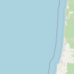
Map view of Siuslaw National Forest

Use this park location map to pinpoint Siuslaw National Forest in United States of America, understand its exact geographic position, and read its mapped placement within the surrounding landscape more clearly.

Pigeon | © OpenStreetMap contributors

Location context for Siuslaw National Forest

Oregon
Recorded earthquake history

View Historical Earthquake Records for Siuslaw National Forest

Access the comprehensive collection of historical seismic activity associated with Siuslaw National Forest. MoriAtlas provides these recorded event logs to help users examine regional earthquake history and proximity data across the diverse terrain of the central Oregon coast.

Siuslaw National Forest Earthquake History

Catalogued events

26 events

Strongest magnitude

Magnitude 4.9

Most recent event

Nov 23, 2025

This history includes earthquakes recorded inside the park or within 50 km of its borders

Visualizing temperate rainforests, sand dunes, and coastal mountain terrain

Siuslaw National Forest Photos and Landscape Scenery

Visual documentation reveals the complex protected landscape of Siuslaw National Forest, where coastal Sitka spruce stands meet massive wind-shaped sand dunes. Exploring these photographs provides direct insight into the diverse habitats, river valleys, and mountain elevations defining the Pacific Northwest region.

An elevated coastal view showing a dense evergreen forest meeting a rocky shoreline with crashing waves and a winding road following the coastline.

Wide shot of rolling light-colored sand dunes under a clear blue sky, with clumps of tall beach grass in the foreground and a small group of evergreen trees on a ridge in the midground.

Park atlas

Compare regional coastal forests, mountain ranges, and protected landscapes

Explore Other Parks Near Siuslaw National Forest and Surrounding Protected Areas

Continue browsing nearby national forests and protected areas that share the striking geographic traits of the Oregon Coast. Comparing adjacent wildlands reveals broader ecological patterns across Pacific Northwest mountain ridges and marine shorelines.
Wildlife reserveOregon
Mapped location lies within the park boundary#1 closest

North

Drift Creek Wilderness: Protected Wildlife Reserve and Old Growth Geography in Oregon

Mapping the old growth forests and stream corridors of the Coast Range.

Deep within Oregon's Coast Range, Drift Creek Wilderness stands as a significant protected landscape known for its intact old growth Sitka spruce and western hemlock stands. The terrain is characterized by steep, dissected slopes and narrow valleys that form a complex, moss-heavy temperate rainforest ecosystem. This area provides essential habitat for Roosevelt elk, northern spotted owls, and wild salmon populations, offering a compact yet dense look at the region's unique coastal wilderness geography.

Area
23.46 km²
Established
1984
IUCN
Ib
Relief
Upland
A soft watercolor painting of a coastal landscape with pale sandy dunes, patches of green grasses, and distant hills under a white background.
Protected landscapeOregon
Park boundaries overlap#2 closest

South

Oregon Dunes National Recreation Area: Mapped Geography and Coastal Landscape Atlas

Protected temperate sand dunes along the Pacific coast

Examine the expansive dune fields and aquatic habitats within the Oregon Dunes National Recreation Area. This atlas provides a detailed look at the geographic distribution of wetlands, coastal forests, and massive sand formations that shape this unique protected landscape in Oregon.

Area
127.74 km²
Established
1972
Visitors
1.5M annual
Relief
Lowland
Wildlife reserveOregon
Mapped location lies within the park boundary#3 closest

Southwest

Rock Creek Wilderness: Coastal Forest Geography and Protected Terrain

Oregon wilderness with undisturbed temperate rainforest watersheds

Discover the geographic identity of Rock Creek Wilderness, a congressionally designated area on the Oregon Coast. This protected block of temperate rainforest is characterized by its trail-free, road-free interior and its role as a sanctuary for old growth Douglas-fir and rare butterfly habitat. The watershed terrain, centered around Rock and Big Creeks, preserves a continuous ecological gradient stretching from inland ridges to the Pacific maritime climate.

Area
30.29 km²
Established
1984
IUCN
Ib
Relief
Upland
Protected landscapeOregon
63 km away#4 closest

East

Willamette National Forest: Geography and Protected Landscapes of the Central Oregon Cascades

Mapped terrain, old-growth forests, and protected wilderness boundaries.

Explore the expansive territory of Willamette National Forest, a primary protected area extending over 100 miles along Oregon's Cascade Range. This region features volcanic peaks exceeding 10,000 feet, extensive old-growth Douglas-fir stands, and a dense network of Wild and Scenic rivers, providing a detailed look at the geographic character and ecological heritage of the Pacific Northwest.

Area
6,790.75 km²
Established
1933
Visitors
1.7M annual
Relief
Mountain
An artistic watercolor illustration showing a line of green evergreen trees in the foreground with hazy, distant mountains in the background against a light, neutral sky.
Protected landscapeOregon
65 km away#5 closest

South

Rogue River, Siskiyou National Forest: Mapped Geography and Protected Area Overview

Tracing volcanic peaks and river-carved mountain terrain in Oregon

Spanning nearly 7,300 square kilometers, the Rogue River, Siskiyou National Forest acts as a crucial ecological anchor in the Pacific Northwest. This overview details its unique mountain geography, the extensive wilderness tracts within its boundaries, and the river systems that define its mountainous character.

Area
6,973.46 km²
Established
2004
Visitors
915K annual
Relief
Mountain
Wildlife reserveOregon
76 km away#6 closest

East

Middle Santiam Wilderness: Geographic Atlas and Protected Landscape Overview of the Oregon Cascades

Old-growth forest basins and volcanic landmarks in the Willamette National Forest.

Middle Santiam Wilderness represents a distinct segment of the central Oregon Cascades. The area is defined by its substantial old-growth coniferous forests, including 450-year-old Douglas-fir and western hemlock stands, alongside the striking 4,965-foot volcanic plug known as Chimney Peak. This map-focused record traces the river-cut valleys and high-ridge topography that shape this protected habitat.

Area
34.57 km²
Established
1984
IUCN
Ib
Relief
Mountain
Watercolor painting of a rolling mountain landscape with coniferous trees in the foreground and a hazy range of hills in the background.
Wildlife reserveOregon
About 77 km away#7 closest

East

Menagerie Wilderness Wildlife Reserve: Oregon Cascade Range Geography and Rock Pinnacles

Protected Cascade mountain terrain and unique crag clusters

Situated in the central Cascade Range of Oregon, Menagerie Wilderness provides a compact, highly defined landscape of rising rock pinnacles and lush coniferous forest. This resource traces the unique topography and protected boundaries of this specialized wilderness area, offering insight into the geological features and forest ecosystems that distinguish it from surrounding mountainous terrain.

Area
20.37 km²
Established
1984
IUCN
Ib
Relief
Mountain
A watercolor painting showing a snowy mountain peak in the background rising above rolling green hills and pine forests in the foreground.
Protected landscapeOregon
77 km away#8 closest

Northeast

Mount Hood National Forest: Atlas of Protected Landscapes and Volcanic Geography

Exploring the Cascade Range terrain and wilderness boundaries in Oregon.

Mount Hood National Forest encompasses a vast, rugged expanse of the Oregon Cascades, anchored by the iconic, glacier-clad Mount Hood. This protected landscape contains extensive old-growth forests, high-alpine lakes, and deep river canyons. Discover the geographic extent of these wilderness areas and mountain terrain within the MoriAtlas database of protected lands.

Area
4,318.17 km²
Established
1908
Visitors
4.4M annual
Relief
Mountain

Common questions about visiting, size, designation, and location context for Siuslaw National Forest

Siuslaw National Forest FAQs for park facts, access, geography, and protected area context

Find quick answers about Siuslaw National Forest, including protected-area facts, park geography, trail and visitor context, and how the park fits into its surrounding country and regional landscape.
MoriAtlas Explorer

Continue Your Protected Areas Search Across the Global Atlas

Deepen your exploration by continuing the structured search for national parks and protected areas worldwide. Utilize the comprehensive filtering capabilities to compare different conservation landscapes and refine your understanding of global park geography. Discover more about the distribution and characteristics of protected natural areas.

Global natural geography