
Why Skallingen stands out
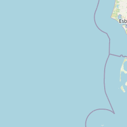
Skallingen is best known as a striking example of naturally formed, still-evolving Wadden Sea land. Its combination of open sandy beaches, active dunes, extensive salt marshes laced with tidal channels known locally as 'loer', and complete lack of permanent settlement gives it a raw, almost primeval coastal character. It is also well known for its unusual modern history: the peninsula was the site of Denmark's last minefield, a legacy of the German-built Atlantic Wall during the Second World War. Decades of slow clearance, complicated by shifting sands and erosion, eventually led to the minefield being declared cleared in 2012.
Skallingen history and protected-area timeline
Skallingen's history begins not with the land, but with the sea. Before the seventeenth century, the waters of what is now the Wadden Sea off Ho were navigable and used by local fishing communities, including the small settlement of Sønderside, located to the south of modern Ho. In 1634, a violent storm surge swept the region and destroyed Sønderside, while simultaneously initiating a new phase of coastal evolution.
In the wake of the 1634 flood, ocean currents and winds began depositing sand in the lee of the existing coastline. Slowly, this accumulated material built up into a low sandy peninsula that gradually extended along what had been open water. Over the following four centuries, this formation matured into the present-day Skallingen, with the old shoreline preserved as a wet drainage feature known as Havnegrøften, marking where land and sea once met.
The early twentieth century brought the only sizable human infrastructure the peninsula ever supported. In 1901, a lighthouse was constructed at Skalling Ende, the outer tip of the peninsula, to guide ships through the increasingly shallow and shifting waters. A small cluster of houses was built nearby for the lighthouse personnel and associated staff. This brief experiment in settlement lasted only eight years; by 1909, coastal erosion and storm-driven sand movement had undermined the area, and both the lighthouse and the dwellings were lost to the advancing sea.
Skallingen's most prominent modern chapter began during the Second World War. Under German occupation, Denmark became part of the Atlantic Wall defensive system. In connection with these fortifications, a large minefield was laid across Skallingen, reportedly containing around 72,000 mines. Clearance efforts began after the war: by 1947, about 61,000 of the mines had been located and removed, but the rest proved far more difficult.
The sandy, shifting nature of the peninsula meant that mines could be buried, uncovered, or carried into the tidal flats by erosion and sediment movement. Despite the obligations of the Ottawa Convention to clear anti-personnel mines by 2009, removal progressed slowly in phases managed by the Danish Coastal Authority (Kystdirektoratet) using private contractors from 2006 onward. In 2012, Skallingen's minefield was officially declared cleared, and access restrictions were lifted, although isolated finds continued to occur, including a mine discovered by a German tourist in August 2013.
Skallingen landscape and geographic character
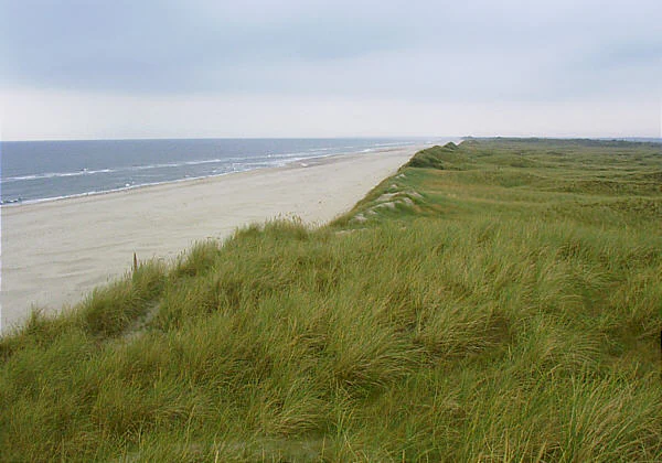
Skallingen's landscape is shaped almost entirely by sand, tide, and wind. The peninsula stretches northward as a long, low sandy spit, bounded on its inner side by the calmer waters of Ho Bay and on its seaward side by the open Wadden Sea. Its elevation is everywhere modest, never rising into true hills or cliffs; instead, the land expresses itself through horizontal layers of beach, dune, and marsh that grade into one another.
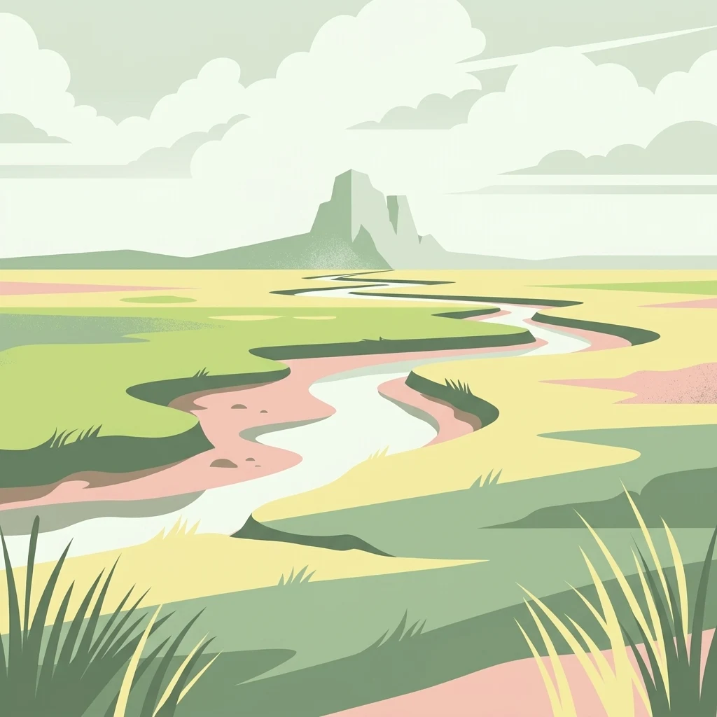
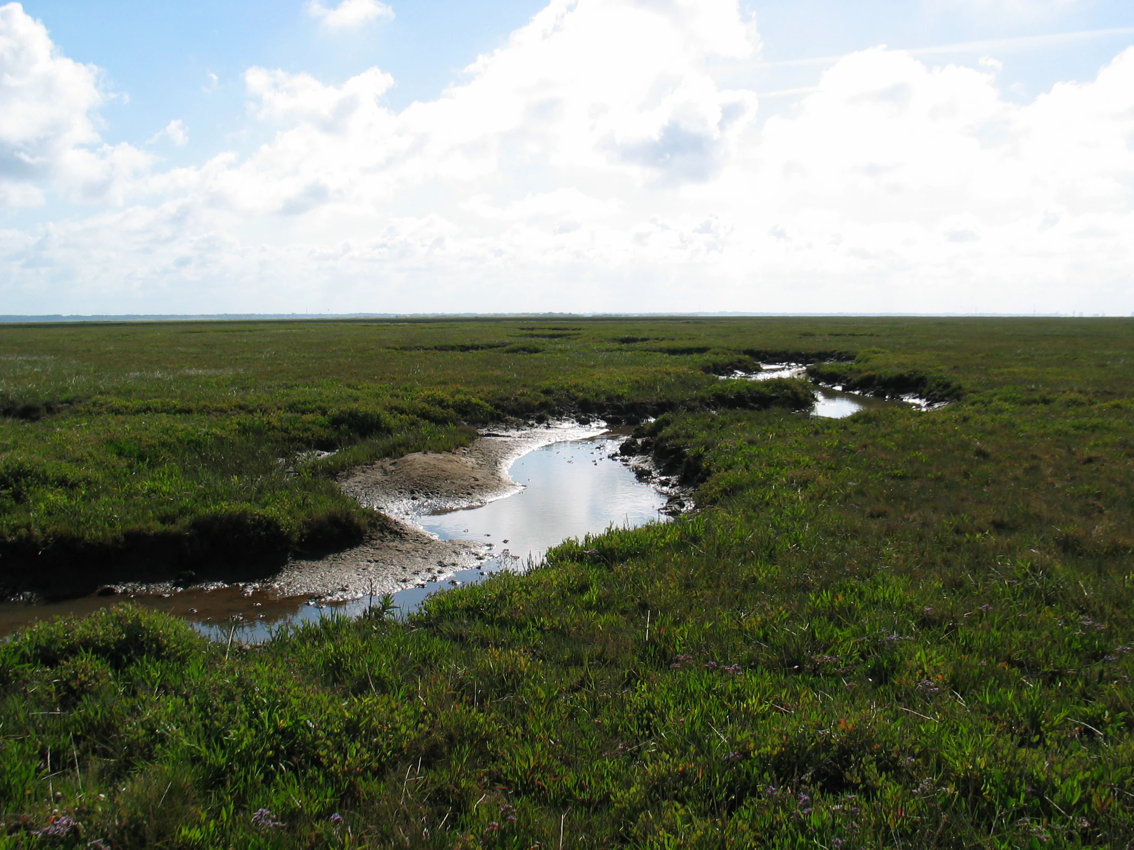
The outer coast is characterized by broad sandy beaches, backed by an active dune belt where wind continually rearranges the surface. Sparse dune grasses and other pioneer plants stabilize some areas, while bare sand dominates in places where erosion is currently active. Inland from the dunes, the landscape transitions into salt marshes, flat, low-lying grasslands that are regularly flooded by the tide. These marshes are incised by a network of tidal channels, locally referred to as 'loer', which meander through the marshland and shift over time as sediments are deposited or scoured away.
The most inland edge of Skallingen, closest to the mainland, is bordered by a watercourse called Havnegrøften, which marks the line of the old pre-1634 coast. Beyond this channel, the terrain rises gently toward the older land around Oksby and Ho. The contrast between the older, more stable inland landscape and the young, dynamic peninsula beyond Havnegrøften is one of the defining spatial features of the area.
Because the peninsula is so flat and open, the visual experience of Skallingen is dominated by sky, sea, and subtle changes in vegetation and surface texture. There are no towns, roads, or tall structures on the peninsula itself; the landscape reads as a continuous sweep of sand, salt marsh, and tidal water.
Skallingen ecosystems, habitats, and plant life
Ecologically, Skallingen is a textbook example of a young, successional coastal ecosystem. Because the land itself is only a few centuries old, the biological communities here are still in active development, with different zones of the peninsula representing different stages in the colonization of newly formed land.
Closest to the sea, the beaches and outer dunes host a sparse, hardy community of pioneer plants adapted to salt spray, shifting sand, and low nutrient availability. Moving inland, more stable dune surfaces support denser grassy and herbaceous vegetation, while the salt marshes behind the dunes are characterized by salt-tolerant grasses and herbs that thrive under regular tidal inundation. The tidal channels running through the marshes create varied microhabitats, withstanding different levels of flooding, salinity, and sediment deposition.
The wider significance of Skallingen lies in its integration with the Wadden Sea ecosystem, one of the largest intertidal systems in the world. The peninsula's salt marshes and tidal flats contribute to the mosaic of habitats that support rich populations of migratory birds, fish, and invertebrates, and the relatively undisturbed nature of the area, free from roads, settlements, and intensive land use, gives ecological processes unusual room to operate. For this reason, the peninsula is valued not only as a Danish natural area, but also as a component of the broader international Wadden Sea conservation context.
Skallingen wildlife and species highlights
Because Skallingen sits within the Wadden Sea, its wildlife character is dominated by the intertidal zones and the open coastal habitats. The tidal flats and salt marshes around the peninsula support large populations of typical Wadden Sea invertebrates, fish, and shorebirds, contributing to the broader ecological productivity of the region.
The open beaches and dunes, though sparsely vegetated, host specialized insect and plant communities adapted to sandy, salty conditions. Salt marshes provide feeding and roosting habitat for wading birds and waterfowl, while the surrounding shallow seas serve as nursery and feeding grounds for fish species typical of the Wadden Sea.
Although the peninsula itself is uninhabited and offers a refuge from direct human disturbance, its wildlife is best understood as part of the larger Wadden Sea animal communities rather than as an isolated ecosystem. The combination of protected status, lack of permanent infrastructure, and continuing natural change makes Skallingen a place where coastal wildlife can persist in relatively undisturbed conditions.
Skallingen conservation status and protection priorities
Skallingen is formally protected under Danish nature conservation law and is owned and managed by the Danish Nature Agency (Naturstyrelsen). Its designation reflects both its ecological value and its geological uniqueness as a young, actively forming coastal land within the Wadden Sea.
From a conservation perspective, the peninsula's importance lies in the combination of habitat diversity and freedom from long-term human pressure. With no permanent settlements, roads, or intensive land use, the area allows tidal, dune, and salt marsh processes to function with minimal interference. The result is a relatively intact coastal system in which ecological succession and physical land-building can be observed as ongoing processes.
Skallingen is also significant in a wider international context, as part of the Wadden Sea, which is recognized for its global importance for migratory waterbirds and intertidal ecology. While Skallingen is only a small piece of that larger system, its protected status contributes to the regional network of conservation areas along the Danish, German, and Dutch coasts. The long process of clearing wartime mines from the peninsula, completed in 2012, also represents an unusual intersection of conservation and post-conflict environmental remediation in Denmark.
Skallingen cultural meaning and human context
Skallingen's cultural footprint is unusually light and shaped largely by absence. The peninsula has no permanent population, and the only meaningful episode of human settlement, the lighthouse and its support buildings at Skalling Ende between 1901 and 1909, ended when the sea swallowed them. This brief, failed attempt to inhabit the peninsula has become a recurring local story, an illustration of how dynamic and unforgiving this stretch of coast can be.
The disappearance of the older fishing settlement of Sønderside in the 1634 storm surge also carries cultural weight. While the settlement itself is long gone, the event is part of the broader history of coastal communities along the Wadden Sea, where severe floods have repeatedly reshaped both land and livelihood. Modern Skallingen, managed by the state and visited mainly by people with an interest in nature, walking, and the sea, reflects a shift in how this landscape is valued: from a working, vulnerable coastal zone to a protected natural area studied and appreciated for its ecological and geological character.
Top sights and standout views in Skallingen
Skallingen stands out as one of the clearest examples in Denmark of land that is genuinely still being made. Its beaches, dunes, and salt marshes form a continuous gradient of coastal habitats within a relatively small area, making it an unusually compact place to see the full sequence of Wadden Sea coastal development. The lack of any roads, buildings, or infrastructure beyond the modern visitor use of the area amplifies the sense of an open, self-organizing landscape.
Equally distinctive is the peninsula's wartime legacy. As the site of Denmark's last minefield, Skallingen became a stage for one of the country's longest postwar clearance operations, only concluded in 2012. The combination of a young, evolving natural landscape with a long, very modern story of remediation gives the peninsula a layered character that sets it apart from many other Danish coastal areas.
Best time to visit Skallingen
Skallingen's character shifts with the seasons in ways closely tied to its coastal setting. Spring and early summer tend to bring active dune and salt marsh vegetation, with growing cover on the marshes and a fresh green tone across the landscape. This period is generally favorable for walking and observing the different habitat zones along the peninsula.
Late summer and autumn often bring stronger winds and higher tides, which can visibly reshape the outer beaches and tidal channels. Migratory bird activity along the surrounding Wadden Sea is typically pronounced around these seasons, adding a wildlife component to a visit. Winter brings the most exposed conditions, with storm-driven sand movement and a sparse, austere atmosphere, though access and weather conditions may be more challenging. As always in such flat, exposed terrain, conditions can change quickly with the weather.