
Mori Atlas logo
Natural monumentSlepičí vršek

Examining the ecological significance, eolian terrain, and protected sandy habitat of the Třeboňsko region

Slepičí vršek Natural Monument: A Rare Inland Sand Dune Landscape in the South Bohemian Basin

(Přírodní památka Slepičí vršek)

Slepičí vršek stands as an isolated, undulating inland sand dune rising above the otherwise flat, water-rich terrain of the Třeboň Basin in Jihočeský kraj. This rare natural monument acts as a critical refugium for specialized sand-loving plant and insect communities that require specific, dry microclimates to thrive. By mapping its unique eolian morphology, visitors can understand the layered glacial history of the region and the ecological importance of protecting this fragile, sandy desert-like enclave within the European Třeboňsko site network.

sand duneinland dunepsammophilous habitatprotected landscapeTřeboňskoSouth Bohemia
A flat-style vector illustration of a dramatic mountain valley with two cascading waterfalls, a winding river, and a dense pine forest in the foreground.

Slepičí vršek

Natural monument

Park overview

Structured park overview, official facts, and landscape profile for Slepičí vršek

Slepičí vršek park facts, protected area profile, and essential visitor context

Review the core facts for Slepičí vršek, including designation, size, terrain, visitor scale, habitats, and operating context in one park-focused overview.

About Slepičí vršek

Slepičí vršek is a small but ecologically distinctive protected natural monument in the South Bohemian Region of the Czech Republic. Although it covers only about 1.9 hectares, the site has an outsized conservation role because it preserves a relic inland sand dune in an otherwise wet, fishpond-dominated landscape. The dune lies about half a kilometer north of the village of Lužnice in the district of Jindřichův Hradec, within the larger Třeboňsko Protected Landscape Area, the Třeboň Special Protection Area for birds, and the European Important Site known as Třeboňsko – střed.

The monument's defining landform is an isolated eolian sand dune, roughly elliptical and elongated north–south for about 200 meters, with a width of around 60 meters. Its crest rises approximately four to five meters above the surrounding terrain. The sand originated from the Pleistocene gravel and sand deposits of the Lužnice River, which were reworked by wind at the close of the last glaciation to form the elongated dune seen today. The substrate and resulting soils, including thin arenic cambisols and regosols, are exceptionally dry, giving the site a near-continental microclimate that contrasts sharply with the marshy Třeboň Basin around it.

Because of these dry, nutrient-poor sands, Slepičí vršek supports a characteristic assemblage of psammophilous and thermophilous species. The open eastern half of the dune is dominated by sparse sand grasslands featuring plants such as grey hair-grass (Corynephorus canescens), Morison's spurrey (Spergula morisonii), fine-leaved fescues (Festuca filiformis and Festuca brevipla), small cudweed (Filago minima), sand teesdalia (Teesdalia nudicaulis) and the protected least sandwort (Arnoseris minima). The western half carries a thin woodland of Scots pine (Pinus sylvestris), pedunculate oak (Quercus robur), silver birch (Betula pendula) and aspen (Populus tremula), with scattered juniper (Juniperus communis). Together these communities create the habitat mosaic that has made the dune a refugium for rare and specialized flora, fungi, and insects, and a continuing subject of active conservation management.

Beyond its ecological interest, the monument is valued for its accessibility and interpretability. A red-marked tourist trail passes directly through the site, allowing visitors to observe the dune, its sand-loving plant communities, and its insect life in close proximity. The protected area remains open to low-intensity public access, because light trampling actually helps maintain open sand surfaces, an example of how careful visitor use can complement active habitat management.

Quick facts and research context for Slepičí vršek

Slepičí vršek is a Czech natural monument (přírodní památka) covering about 1.9 hectares, situated roughly 0.5 km north of the village of Lužnice in the Jindřichův Hradec district of the South Bohemian Region. It lies within the Třeboňsko Protected Landscape Area, the Třeboň Bird Protection Area, and the European Important Site Třeboňsko – střed. The protected feature is an isolated eolian sand dune, elongated north–south about 200 meters long and roughly 60 meters wide, rising about four to five meters above the surrounding terrain at elevations of 420 to 426 meters. The dune originated from wind-blown sand reworked from Pleistocene Lužnice River deposits during the last glaciation. Originally proclaimed as a state nature reserve on 5 August 1955 by the Ministry of Culture, the site is now administered as a natural monument by AOPK ČR through the South Bohemia Regional Office.

Protection and recognition

Documented management scope and conservation baseline for Slepičí vršek

Slepičí vršek Protection Status and Terrestrial Conservation Framework

Terrestrial conservation records for Slepičí vršek outline the documented protection status and associated designation history. Structured facts compile available recognition parameters to provide clear baseline context for international natural areas.

Protection details

Protection scope
Terrestrial
Transboundary protection
No
Park context

Deeper park guide and search-rich context for Slepičí vršek

Slepičí vršek history, landscape, wildlife, and travel context

Explore Slepičí vršek through its history, landscape character, ecosystems, wildlife, conservation priorities, cultural context, and seasonal travel timing in a structured park guide built for atlas discovery and search intent.

Why Slepičí vršek stands out

Slepičí vršek is best known as one of the very few surviving inland sand dunes in the Czech Republic, harboring a relict community of sand-loving plants, ground-nesting wasps and bees, sand-dwelling butterflies and beetles, and a strong population of sand lizards in a setting otherwise dominated by the wet Třeboň Basin. The site's ecological interest lies in the combination of dry, nutrient-poor sandy soils with a continental microclimate that has allowed psammophilous and thermophilous species to persist in a refugial setting. Management of the open sandy surface has also revealed new national records, including the fungus Inocybe stenospora and the sand wasp Bembecinus hungaricus, underscoring the conservation value of this small dune within the broader Třeboň Protected Landscape Area.
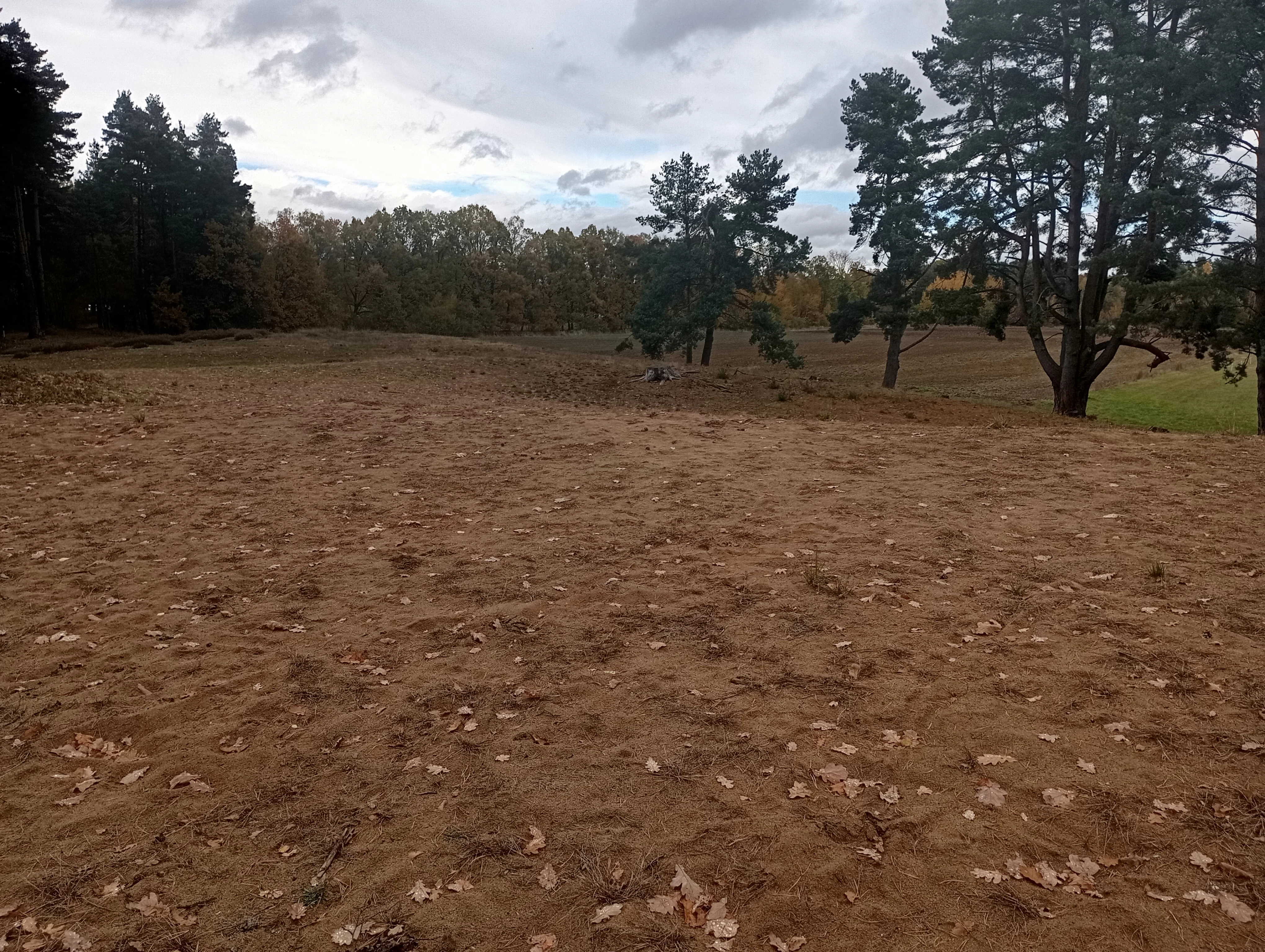
A wide view of a sandy, sparsely vegetated dune area bordered by pine trees under a cloudy sky.
The sandy dune landscape of Slepičí vršek.

Slepičí vršek history and protected-area timeline

Slepičí vršek was first proclaimed as a specially protected area on 5 August 1955, when the Ministry of Culture designated it as a state nature reserve. At that time the site was recognized for the unusual character of its inland sand dune and the rare sand-loving flora and fauna it supported. Although the early postwar conservation system in Czechoslovakia was reorganized several times, the site's protected status was preserved through these transitions.

Later, when the 1992 Ministry of the Environment decree (395/1992 Sb) re-categorized all formerly protected areas into the new system of national nature reserves, national natural monuments, and nature reserves, the decree's annexes did not directly mention Slepičí vršek. Under Section 22 of that decree, the former state nature reserve therefore automatically received the status of přírodní památka, or natural monument, the category it still holds today. The site is administered by the Agency for Nature Conservation and Landscape Protection of the Czech Republic through its regional office for South Bohemia.

The dune itself bears the marks of long-term human interaction with the landscape. In the past, the area was used for grazing livestock, which kept the dune's surface open and free from forest cover; small quantities of sand were also extracted for local construction. Without continued management, including removal of invasive woody regrowth, the dune would gradually become overgrown and lose its open, sandy character and the specialist species that depend on it.

Slepičí vršek landscape and geographic character

The landscape of Slepičí vršek is defined by a single, isolated sand dune that rises abruptly from the otherwise flat terrain of the Třeboň Basin. The dune has an oval, slightly elongated form, measuring roughly 200 meters from north to south and about 60 meters from west to east, with a crest some four to five meters above the surrounding land at an elevation of 420 to 426 meters. Its surface undulates in soft waves that echo the original eolian morphology, although localized sand extraction and trampling have smoothed or reshaped some sections.

Geologically, the dune is the surface expression of a layered system: Upper Cretaceous sediments of the Třeboň Basin are overlain by Pleistocene gravels and sands deposited by the Lužnice River, which are in turn capped by a mantle of windblown (eolian) sand originating from the same fluvial sediments near the end of the last glacial period. Soils on the dune are thin, sandy, and prone to rapid drying: they are classified largely as arenic cambisols and regosols, and in places active eolian processes continue to shape the surface. Hydrologically, the area includes only a tiny artificial watercourse of about 0.01 hectares; groundwater sits deep in the gravel-sand strata and does not emerge at the surface, which is why the dune is markedly drier than its surroundings.

The local climate is mildly warm and moderately humid, with annual precipitation of about 570 mm and a mean temperature of around 7.8 °C, slightly higher than would be expected for its elevation because of the influence of the many open water bodies of the Třeboň region. Relative humidity is rarely below 75 percent in summer due to those fishponds, while in colder months temperature inversions and calms produce thick fogs that frequently cloak the basin.
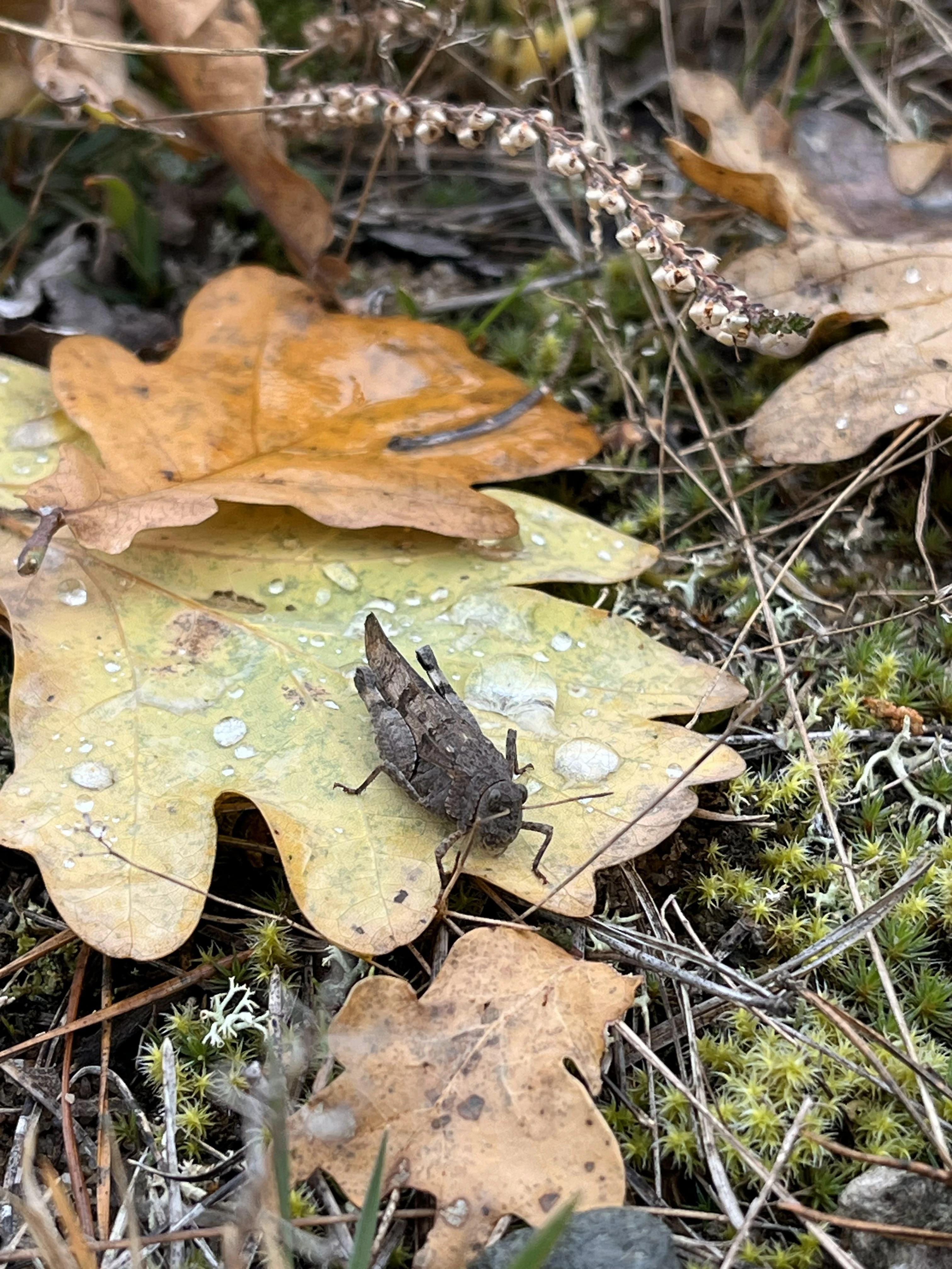
A brown grasshopper resting on a fallen, dew-spotted oak leaf among moss and dry forest debris.
A grasshopper camouflaged on a dew-covered oak leaf at Slepičí vršek.

Slepičí vršek ecosystems, habitats, and plant life

The natural value of Slepičí vršek rests on its unusual combination of dry, sandy soils and a mosaic of open and lightly wooded habitats set within a regionally wet landscape. The eastern half of the monument preserves an open sand-dune plant community historically known in Czech ecology as a refugium for psammophilous, or sand-loving, species that have largely disappeared from the modern countryside.

Vegetation on this open dune is dominated by grey hair-grass (Corynephorus canescens), which forms characteristic tufts in the loose sand, accompanied by Morison's spurrey (Spergula morisonii), fine-leaved fescues such as Festuca filiformis and Festuca brevipila, small cudweed (Filago minima), the field pepperwort (Lepidium campestre), smooth crabgrass (Digitaria ischaemum), sand teesdalia (Teesdalia nudicaulis) and thrift (Armeria vulgaris). At its margins, fescue swards blend into grassy vegetation enriched by mouse-ear hawkweed (Hieracium pilosella) and wavy hair-grass (Avenella flexuosa). The protected least sandwort (Arnoseris minima) and common juniper (Juniperus communis) are among the conservation-relevant species recorded here.

The wooded western half of the monument supports a sparse, low-productivity forest: Scots pine (Pinus sylvestris) and pedunculate oak (Quercus robur) form the structural backbone, with an admixture of silver birch (Betula pendula) and aspen (Populus tremula). Light-demanding invasives, especially colonizing pines and oaks from the surroundings, are a constant management concern. Together, the open sand and the thin forest create the fine-scale habitat heterogeneity that supports the site's exceptionally rich psammophilous insect fauna and its reptile populations.
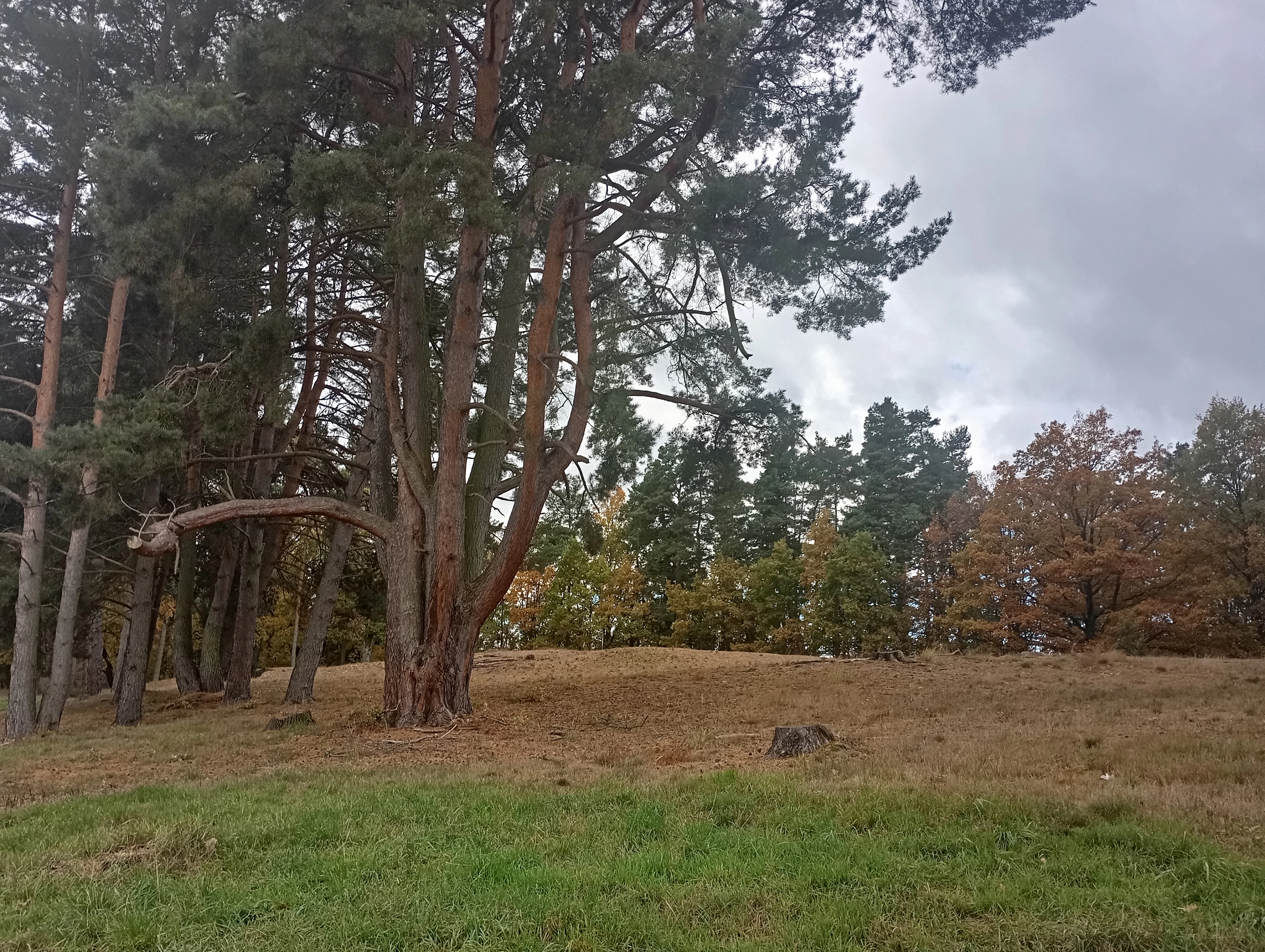
A slightly elevated sandy knoll with scattered dry grass and tall pine trees under an overcast sky.
The sandy landscape of Slepičí vršek, featuring mature pine trees and autumnal vegetation.

Slepičí vršek wildlife and species highlights

Faunal interest at Slepičí vršek is dominated by sand-loving invertebrates, whose presence on the open dune is the principal reason for the monument's ecological importance. Surveys have documented about 115 species of butterflies from 31 families, including the characteristic psammophilous moths Pediasia fascelinella and Agriphila poliellus. The beetle fauna is similarly diverse, with notable records from click beetles (Elateridae), ground beetles (Carabidae), longhorn beetles (Cerambycidae) such as the narrow wasp beetle (Clytus lama), ladybirds (Coccinellidae), jewel beetles (Buprestidae) including Aphanisticus pusillus, and weevils (Curculionidae) such as Ceutorhynchus pumilio and Pissodes castaneus.

The site is also one of the most important locations in the Czech Republic for sand-nesting Hymenoptera. Solitary bees, digger wasps, and ants are abundant on the warm, open sand, including Bembecinus hungaricus, for which Slepičí vršek is the only documented locality in the country. Orthopterans such as the blue-winged sand grasshopper (Sphingonotus caerulans) further emphasize the dry, warm character of the habitat.

The most conspicuous vertebrate is the sand lizard (Lacerta agilis), which maintains a strong population thanks to the open, sun-warmed sand. Grass snakes (Natrix natrix) are also recorded at the margins, while common bird species pass through the small area on migration, and hoopoes (Upupa epops) have been confirmed as breeding visitors. Among protected invertebrates, the dune hosts species such as the forest puss moth (Phymatopus hecta), the peacock prominent (Peridea anceps), the green hairstreak (Callophrys rubi), the heath tiger beetle (Cicindela sylvatica), and the sand wasp Bembecinus hungaricus, giving the site disproportionate conservation weight relative to its size.
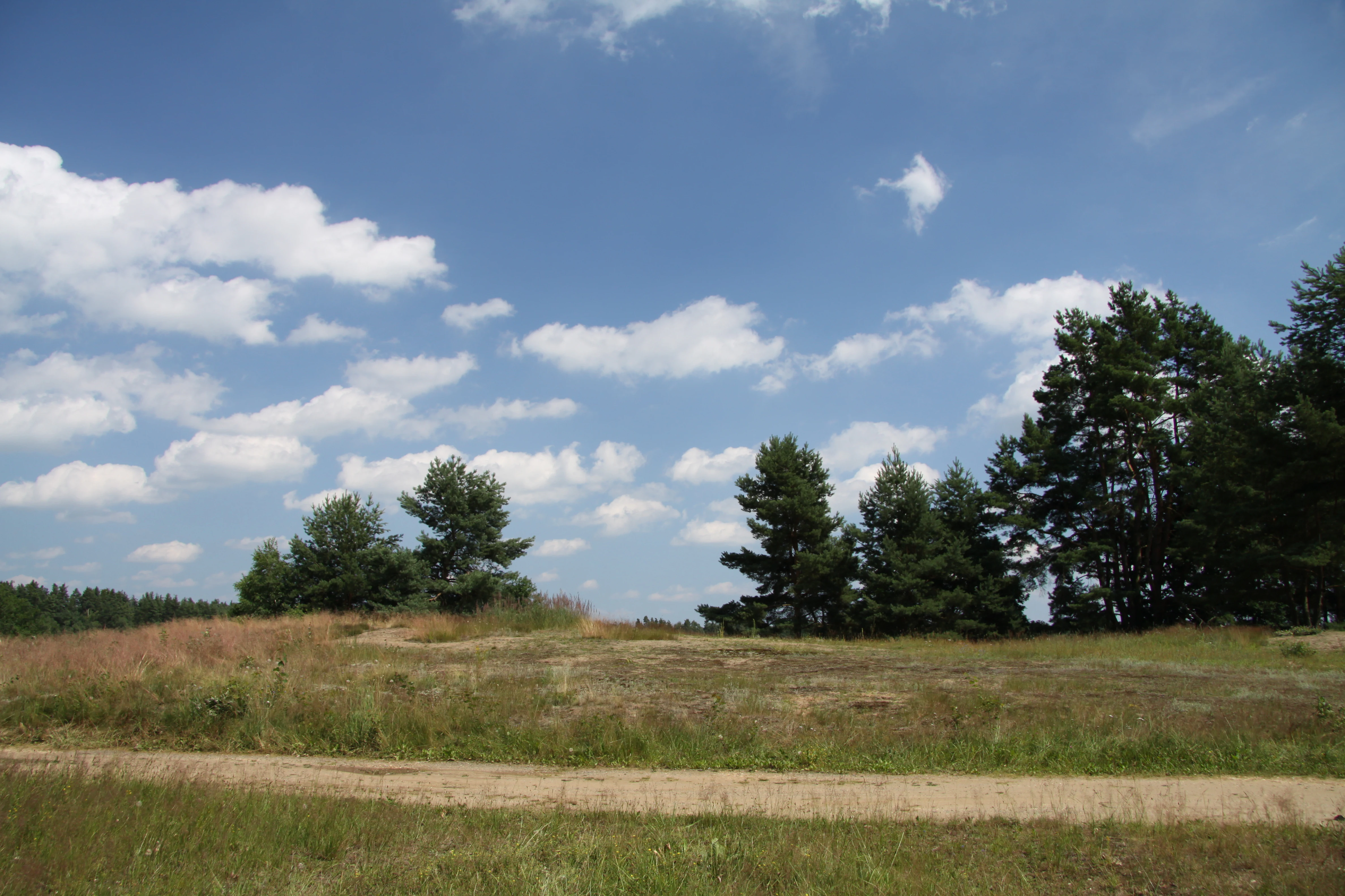
A wide, grassy landscape with small sandy patches, scattered pine trees, and a dirt path in the foreground under a blue sky with scattered clouds.
A summer view of the protected sand dune landscape at Slepici vrsek.

Slepičí vršek conservation status and protection priorities

Slepičí vršek's conservation significance lies in its role as a refugium for an entire psammophilous community: open sand, dry soils, and the specialized flora and fauna that depend on them. The site's legal status as a přírodní památka, and its location within the Třeboňsko Protected Landscape Area, the Třeboň Special Protection Area for birds, and the European Important Site Třeboňsko – střed, place it within a layered national and European network of protected areas.

Active management focuses on keeping the dune open. Established conservation tasks include the regular removal of colonizing woody species, the clearing of leaf litter and organic debris to prevent eutrophication, and the deliberate disturbance of the surface turf to maintain loose sand and support natural eolian dynamics. Where necessary, seeds of protected plants such as the least sandwort (Arnoseris minima) are collected and sown on suitable open patches to reinforce populations. Selective, low-impact forestry is applied to the wooded half of the monument to maintain its natural structure and species diversity without compromising the open sand.

Because the dune's biological communities depend directly on the persistence of bare sand, even modest encroachment by shrubs and trees, or the accumulation of organic matter, can rapidly degrade habitat quality. The combination of legal protection and targeted habitat management has therefore been crucial in preserving a small but nationally important inland dune ecosystem in the middle of one of Central Europe's most intensively used fishpond landscapes.

Slepičí vršek cultural meaning and human context

The cultural context of Slepičí vršek is closely tied to the long history of human land use in the Třeboň Basin. Although today the area is famed for its fishpond systems and protected wetlands, the dune itself bears the marks of traditional rural practices: historical grazing kept the sandy surface open and free of woody regrowth, while occasional small-scale extraction of sand for local construction also left minor surface changes. Modern conservation policy continues to draw on this legacy by tolerating light trampling along the marked tourist path, recognizing that gentle, regular disturbance helps maintain the open sand habitats that define the site.

Top sights and standout views in Slepičí vršek

An isolated inland sand dune in the Třeboň Basin, rising four to five meters above an otherwise wet landscape; a refugium for sand-loving plants such as grey hair-grass, Morison's spurrey, sand teesdalia, and the protected least sandwort; exceptional sand-nesting Hymenoptera, including the only Czech locality for the sand wasp Bembecinus hungaricus; rich psammophilous beetle and butterfly communities; a notable population of sand lizards and grass snakes in an unusually dry setting; layered protection inside the Třeboňsko Protected Landscape Area, the Třeboň Special Protection Area, and the European Important Site Třeboňsko – střed.

Best time to visit Slepičí vršek

The monument can be visited year-round along the red-marked tourist trail (route 0124) that runs through the Třeboň region and crosses the site itself. Spring and early summer are particularly rewarding for observing the open dune flora in bloom and for warm-weather activity of sand-loving insects. Summer brings both high humidity in the surrounding fishpond landscape and the warmest, driest conditions on the dune itself, ideal for thermophilous reptiles and insects. Autumn and winter visits offer calmer conditions and better visibility of the dune's sculpted sandy surface, while the frequent Třeboň fogs in colder months can add atmospheric depth to a walk through the basin.

Monthly climate preview

Long-term representative measurements and monthly climate patterns for Jihočeský kraj

Slepičí vršek Climate Normals, Annual Temperature and Precipitation Rhythm

Representative coordinates record measured monthly temperature swings from freezing winter minimums to warm summer maximums alongside varying daily precipitation rates. Detailed multi-year climate profiles provide complete twelve-month temperature averages and precipitation totals for deeper environmental comparison.
Annual mean8 °C
-3 °C19 °C
Jan-3°
Feb-2°
Mar
Apr
May13°
Jun17°
Jul19°
Aug19°
Sep13°
Oct
Nov
Dec-2°
Warmest month
July

18.7 °C

Coolest month
January

-3 °C

Wettest month
July

2.9 mm/day

Driest month
February

1.1 mm/day

Park location guide

Geography guide, regional context, and park location map for Slepičí vršek

Slepičí vršek park geography, regions, and map view in Czechia

Understand where Slepičí vršek sits in Czechia through a broader geographic reading of the surrounding landscape, nearby location context, and its mapped position within the national park landscape.

How Slepičí vršek fits into Czechia

Czech Republic is a landlocked Central European country with a population of approximately 10.9 million people. The nation was established as an independent state on January 1, 1993, following the dissolution of Czechoslovakia. Its capital and largest city is Prague, with other major urban centers including Brno, Ostrava, Plzeň, and Liberec.

Wider geography shaping Slepičí vršek in Czechia

The Czech Republic is a landlocked country in Central Europe. It is bordered by Germany to the west, Austria to the south, Poland to the northeast, and Slovakia to the southeast. The landscape is predominantly hilly, with the territory covering 78,871 square kilometers.

Map view of Slepičí vršek

Use this park location map to pinpoint Slepičí vršek in Czechia, understand its exact geographic position, and read its mapped placement within the surrounding landscape more clearly.

Pigeon | © OpenStreetMap contributors

Location context for Slepičí vršek

Jihočeský kraj

Explore protected area views, rare sand habitats, and terrain across South Bohemia.

Slepičí vršek Photos and Landscape Scenery: Visualizing an Inland Sand Dune

Visual documentation captures the rare inland sand dune formation and dry psammophilous habitats of Slepičí vršek. Photographic records reveal the distinct topography and specialized plant communities thriving within the wider Třeboň Basin.

A wide view of a sandy, sparsely vegetated dune area bordered by pine trees under a cloudy sky.

A close-up, top-down view of a small young oak tree seedling with green leaves, surrounded by dry grasses and fallen brown oak leaves on sandy ground.

A brown grasshopper resting on a fallen, dew-spotted oak leaf among moss and dry forest debris.

A slightly elevated sandy knoll with scattered dry grass and tall pine trees under an overcast sky.

A wide, grassy landscape with small sandy patches, scattered pine trees, and a dirt path in the foreground under a blue sky with scattered clouds.

A dirt trail winds through a forest with autumn foliage and pine trees, leading toward a sandy clearing.

Park atlas

Compare nearby protected landscapes and regional conservation areas across South Bohemia

Parks Near Slepičí Vršek and Protected Areas in the Surrounding South Bohemian Basin

Visitors exploring Slepičí vršek can continue browsing adjacent protected areas and regional conservation landscapes to compare distinct sandy habitats and lowland terrains. Expanding the search reveals interconnected natural monuments across the surrounding Třeboň Basin and neighboring river valleys.
A watercolor painting showing a soft, panoramic view of a wetland with sparse trees, low bushes, and distant rolling hills in pale green and pink tones.
Nature reserveJihočeský kraj
About 9.5 km away#1 closest

Northwest

Rašeliniště Hovízna: Protected Peatland and Regional Geography in Jihočeský kraj

Ecological sanctuary and spring-fed wetland landscape.

Rašeliniště Hovízna is a notable nature reserve in the Czech Republic, renowned for its distinctive spring-fed peat formation. Situated near the historic Zlatá stoka canal and the Třeboň Basin, this protected area preserves rare bog habitats and essential groundwater-driven ecosystems within the undulating lowlands of Jihočeský kraj.

Area
0.071 km²
Established
1995
IUCN
IV
Relief
Lowland
Natural monumentJihočeský kraj
About 12 km away#2 closest

North

Ve Farářském Natural Monument: Wetland Geography and Protected Pond Margins in South Bohemia

Detailed protected wetland terrain in the Tábo district

Ve Farářském preserves a distinctive gradient of waterlogged meadow and marsh habitats along the Farářský pond in the Czech Republic. This natural monument illustrates the ecological transition from mesotrophic grassland to willow-lined littoral zones, offering a clear view of specialized wetland plant communities within the broader South Bohemian landscape context.

Area
0.038 km²
Established
1988
IUCN
III
Relief
Lowland
Nature reserveCzechia
About 22 km away#3 closest

Northwest

Veselská blata Nature Reserve: Basin Peatland and Wetland Geography in South Bohemia

A core protected mire site within the Czechia regional landscape.

Located in the Tábor District, Veselská blata protects rare transitional peatland ecosystems and bog pine woodlands. This reserve offers a clear view of basin mire hydrology, featuring a diverse mosaic of flooded pools and waterlogged meadows that remain vital to regional ecological conservation efforts in South Bohemia.

Area
4.538 km²
Established
2011
Relief
Lowland
Climate
Temperate
Natural monumentJihočeský kraj
About 24 km away#4 closest

West

Vrbenská tůň Natural Monument: Wetland Geography and Protected Landscape Analysis

A significant oxbow wetland fragment in the South Bohemian region.

Vrbenská tůň functions as a protected natural monument focused on the conservation of lowland pond ecosystems. Located within the Jihočeský kraj, this area offers a window into the hydrology of the České Budějovice Basin, supporting specialized amphibian populations and aquatic flora within its restored basin and surrounding buffer zones.

Area
0.009 km²
Established
1974
IUCN
III
Relief
Lowland
Natural monumentJihočeský kraj
About 28 km away#5 closest

East

Vosecký rybník Natural Monument: Protected Wetland Geography in Jihočeský kraj

Rare drawdown-bottom flora and aquatic ecosystems

Located in the Javořická vrchovina highlands, Vosecký rybník is a protected natural monument known for its specialized pond-bottom vegetation. The site serves as a vital ecological corridor for threatened species within the broader mosaic of historic Bohemian fishpond landscapes.

Area
0.071 km²
Established
2022
IUCN
III
Relief
Upland
A soft watercolor illustration of a pond landscape with grassy banks, reeds, and soft green vegetation in the background.
Nature reserveJihočeský kraj
About 29 km away#6 closest

West

Rybník Motovidlo Nature Reserve: Geographic Overview and Protected Area Profile

A critical aquatic landscape within the Jihočeský kraj region

Rybník Motovidlo is a specialized nature reserve in the Czech Republic, recognized for its role in conserving endangered aquatic vegetation and providing a refuge for diverse amphibian fauna. Its geographic position within the České Budějovice Basin links it to the broader network of South Bohemian ponds. The site serves as a vital case study for the integration of traditional pond management with modern biodiversity protection in a wetland-focused environmental context.

Area
0.116 km²
Established
2022
IUCN
III
Relief
Lowland
Watercolor painting of a soft landscape with rolling hills and patches of deciduous trees in shades of green, yellow, and faint red, set against a plain white background.
Natural monumentJihočeský kraj
About 30 km away#7 closest

South

Sokolí hnízdo a bažantnice Natural Monument: A South Bohemian Protected Broadleaf Woodland

Mapping the ecological boundaries and woodland history of this South Bohemian protected area.

Sokolí hnízdo a bažantnice constitutes a critical natural monument in the South Bohemian region of the Czech Republic. Positioned along the Stropnice River, this protected landscape preserves mature deciduous woodland habitats and essential invertebrate populations that define the biodiversity character of the Třeboň Basin.

Area
0.475 km²
Established
2014
Relief
Lowland
Climate
Temperate
Nature reserveJihočeský kraj
About 32 km away#8 closest

Southwest

Vltava u Blanského lesa: Protected Natural Monument and River Valley Geography

Mapping the riparian landscape and conservation corridors in Jihočeský kraj

Situated in the Jihočeský kraj, Vltava u Blanského lesa is a designated nature reserve encompassing a unique river valley corridor. This area bridges the transition between aquatic river habitats and surrounding terrestrial meadows, protecting a structural mosaic essential for threatened plant and animal populations across several kilometers of the upper Vltava.

Area
4.78 km²
Established
2014
IUCN
III
Relief
Upland

Common questions about visiting, size, designation, and location context for Slepičí vršek

Slepičí vršek FAQs for park facts, access, geography, and protected area context

Find quick answers about Slepičí vršek, including protected-area facts, park geography, trail and visitor context, and how the park fits into its surrounding country and regional landscape.
MoriAtlas Explorer

Continue Your Protected Areas Search Across the Global Atlas

Deepen your exploration by continuing the structured search for national parks and protected areas worldwide. Utilize the comprehensive filtering capabilities to compare different conservation landscapes and refine your understanding of global park geography. Discover more about the distribution and characteristics of protected natural areas.

Global natural geography