
Mori Atlas logo
Nature reserveSpeyerer Auwald

Mapping the hardwood and softwood floodplains along the Upper Rhine in Rhineland-Palatinate

Speyerer Auwald Nature Reserve: A Protected Rhine Floodplain and Alluvial Forest Ecosystem

The Speyerer Auwald represents a classic Upper Rhine alluvial landscape, characterized by its mosaic of softwood willow-poplar floodplains and hardwood ash-oak-elm forests. Located within Rhineland-Palatinate, this protected area includes oxbow lakes, reedbeds, and historic alluvial meadows that sustain diverse migratory bird populations and sensitive amphibian species. This atlas entry provides a detailed geographic overview of the floodplain forest boundaries, backwater systems, and the interconnected protected habitats that define this ecologically significant region.

floodplain forestalluvial forestUpper Rhinesoftwood floodplainhardwood floodplainNatura 2000
A flat-style digital illustration depicting a mountain valley featuring a waterfall, a winding river, evergreen trees in the foreground, and a pale sun in the sky.

Speyerer Auwald

Nature reserve

Park overview

Structured park overview, official facts, and landscape profile for Speyerer Auwald

Speyerer Auwald park facts, protected area profile, and essential visitor context

Review the core facts for Speyerer Auwald, including designation, size, terrain, visitor scale, habitats, and operating context in one park-focused overview.

About Speyerer Auwald

The Speyerer Auwald is a floodplain forest belonging to the city of Speyer, extending along the Upper Rhine and the Berghäuser Altrhein. It lies within the southern part of the Speyer municipal area, bounded in the south by the boundary with the Verbandsgemeinde Römerberg, then follows the main embankment northward between the embankment and the Berghäuser Altrhein, and after that arm's confluence with the Rhine runs between the embankment and the active river channel up to the Neuer Hafen of Speyer.

The forest illustrates a complete Upper Rhine floodplain sequence. Along the river margin and the connected backwaters you find softwood floodplain (Weichholzaue) dominated by silver willows, willows, and poplars, while the older, higher-elevation parts such as Insel Horn carry a hardwood floodplain (Hartholzaue) of ash, sycamore maple, oak, and characteristic elements of the pedunculate oak-field elm floodplain community (Querco-Ulmetum). Reedbeds line the Goldgrube, the Schluten (oxbow remnants) within Insel Horn, and the Runkedebunk arm. Stromtalwiesen (special floodplain meadows) such as the Sick'sche Wiese and the large meadow in the western part of the An der Lußheimer Fahrt parcel contribute herb-rich open habitat to the mosaic.

The site is also shaped by old backwaters and relic water bodies named for past uses: the Goldgrube takes its name from historic Rhine gold and extinguishing sand extraction; the Lausgrube is a depression that periodically fills with seepage water (Druckwasser); the Berghäuser Altrhein and the now-disconnected Runkedebunk arm cut off the Insel Horn; and the name Salmengrund recalls Speyer's once-important salmon fishery. The shape of the Färchenwärtel is determined by the first of the two harbour basins of the Neuer Hafen, near the Braun shipyard and a yacht harbour. The Rheinhäuser Fähre, a seasonal passenger ferry for hikers and cyclists connecting Speyer with Rheinhausen, lands within the Auwald.

The Speyerer Auwald is integrated into European nature conservation networks. It is part of the EU Birds Directive site DE 6716-402 "Berghäuser und Lingenfelder Altrhein" and the FFH site DE 6716-301 "Rheinniederung Germersheim-Speyer". The union of habitat types qualifies it as a core section of the Rhine floodplain landscape between Germersheim and Speyer.

Quick facts and research context for Speyerer Auwald

Speyerer Auwald is an alluvial forest (Auwald) in the city territory of Speyer, Rhineland-Palatinate, situated between the Rhine main embankment and the active river channel, and west of the embankment along the Berghäuser Altrhein and the cut-off Runkedebunk arm. The upper tree layer of the Speyer Rhine floodplain forest consists of roughly 29% ash, 26% poplars, 20% oaks, 16% maples, 3% walnuts, 2% beeches, and 4% other species, mainly willows.

Ownership of the forest is split among the city of Speyer, the state of Rhineland-Palatinate, and the federal republic (along the active river course). It is managed by different forest offices for municipal, state, and federal shares. The Speyerer Auwald forms part of the EU Birds Directive site DE 6716-402 and the FFH site DE 6716-301.

Protection and recognition

Documented terrestrial protection scope and management records for Speyerer Auwald

Speyerer Auwald Protection Status and International Recognition Data

Terrestrial protection records and management frameworks for Speyerer Auwald provide structured insight into its official conservation status. Verified data profiles compile available designation history and international recognition sources for detailed landscape analysis.

Protection details

Protection scope
Terrestrial
Transboundary protection
No
Park context

Deeper park guide and search-rich context for Speyerer Auwald

Speyerer Auwald history, landscape, wildlife, and travel context

Explore Speyerer Auwald through its history, landscape character, ecosystems, wildlife, conservation priorities, cultural context, and seasonal travel timing in a structured park guide built for atlas discovery and search intent.

Why Speyerer Auwald stands out

The Speyerer Auwald is best known for its mosaic of Rhine floodplain habitats: softwood willow-poplar floodplain (Weichholzaue), hardwood ash-oak-elm floodplain (Hartholzaue), alluvial meadows (Stromtalwiesen), reed-fringed oxbows like the Goldgrube and Runkedebunk, and old oaks with woodpecker cavities. It is recognized as an important breeding, resting, and stopover area for waterbirds, waders, and songbirds, and as one of the key amphibian sites in the Upper Rhine valley, with notable concentrations of natterjack toads and tree frogs.
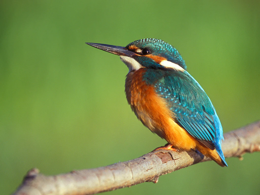
A close up view of a common kingfisher with vibrant blue and orange plumage, perched on a thin tree branch against a soft green out of focus background.
A common kingfisher perched on a branch, reflecting the biodiversity found in the Speyerer Auwald floodplain.

Speyerer Auwald history and protected-area timeline

Modern landscape planning for the Speyerer Auwald began in 1977, when the Goldgrube was placed under protection as a protected landscape element through an ordinance under section 16 of the Landespflegegesetz (state landscape conservation act), with the objective of preserving the water surface, shoreline, and surrounding terrain for their landscape character and as a habitat of rare plant communities. In 1987, the city of Speyer designated roughly 55 oaks of about 100 years old in the Auwald as protected landscape components, reflecting growing attention to old trees and deadwood as habitat. The broader landscape of the Pfälzische Rheinauen was placed under landscape protection in 1983.

The Speyer municipal council adopted further conservation targets for the city forest on 7 December 1993, explicitly aligning forest management with Natura 2000 obligations, the landscape plan accompanying the Speyer land-use plan, and the care and development plan for the Rhine floodplain between Speyer and Germersheim. The targets included increasing biotope diversity through species choice reflecting small-scale site differences, raising the share of veteran trees, old-growth groups, and deadwood, refraining from firewood harvesting in designated areas, and maintaining certification standards. For the floodplain forest specifically, the council called for preservation and restoration of near-natural silver willow stands, regular five-year coppicing of pollard willows, gradual conversion of black walnut and sycamore maple working forests toward site-typical species, sparing use of cultivated poplars with preference for older black-poplar-related varieties, and removal of poplars between the towpath and the cut-off arm to develop a silver willow floodplain forest.

A 2006 landscape plan (Landschaftsplan zum Flächennutzungsplan), prepared by Carola Schnug-Bögerding on behalf of the city of Speyer, continued to direct integrated planning for the area. Beyond ecological milestones, the Auwald reflects long human use: historical salmon fishing (giving rise to the Salmengrund name), the Herrenwiese as a former excursion ground of open-air concerts and dances, and a Cold War floating emergency bridge at the Rheinhäuser Fähre landing within a now-declassified military restricted area.

Speyerer Auwald landscape and geographic character

The Speyerer Auwald lies on the flat alluvial floor of the Upper Rhine Graben (Oberrheingraben). Its physical setting is defined by the active Rhine channel to the east, the main embankment (Rheinhauptdeich) running north-south, and a series of former river arms and backwaters to the west, including the Berghäuser Altrhein, the disconnected Runkedebunk, and the relic water bodies Goldgrube and Lausgrube. The Neuer Hafen of Speyer, with two harbour basins, cuts into the northern end and shapes the spit-like Färchenwärtel parcel.

Within this framework, the forest shows a clear altitudinal and hydrological gradient. Low-lying channels and inactive arms carry softwood floodplain vegetation of willows and poplars that is regularly influenced by groundwater and occasional summer flooding, as visible in the Weichholzaue of Insel Horn. Higher, older levee surfaces support a hardwood floodplain of ash, oak, and field elm with a near-natural Querco-Ulmetum character. Stromtalwiesen, special flood-distributed meadows, occupy open parcels such as the Sick'sche Wiese and the western An der Lußheimer Fahrt, while reedbeds fringe the Goldgrube, the Schluten of Insel Horn, and the Runkedebunk.

The Auwald faces both the active Rhine, with views across to Rheinhausen and the Speyer Cathedral above the tree line, and the inner backwater system with its still water surfaces and characteristic sedge, reed, and willow fringes. The land is a mosaic of named localities: from south to north, Hintere Hammelweid and Sick'sche Wiese, Im Hechenich with the Runkedebunk and Insel Horn, the Goldgrube and Lausgrube, Im Unteren Hechenich and Im Salmengrund at the Rheinhäuser Fähre, Schänzel and the Ratswört/Rheinanlage (the Anlach) with the Herrenwiese, and finally An der Lußheimer Fahrt and Färchenwärtel beside the harbour.
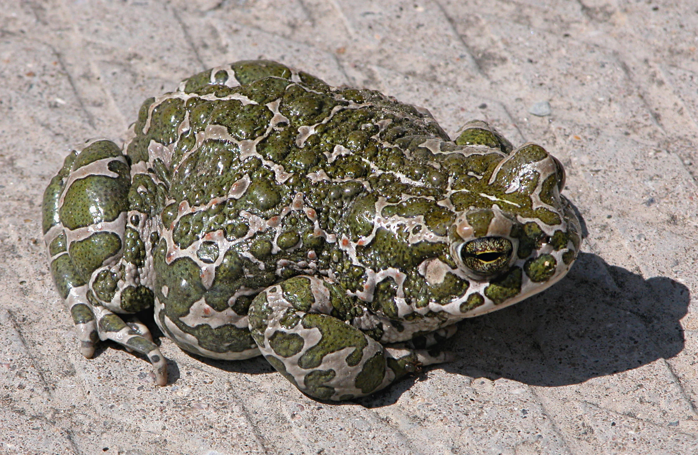
A close-up view of a European green toad, featuring distinctive warty green and white mottled skin, resting on a flat, textured concrete surface.
A European green toad resting on a concrete surface.

Speyerer Auwald ecosystems, habitats, and plant life

Ecologically, the Speyerer Auwald represents a near-complete sequence of Rhine floodplain ecosystem types in a compact area. The canopy of the Speyer Rhine floodplain forest is dominated by ash, poplars, oaks, and sycamore maple, with smaller shares of walnut, beech, and willows. Within this matrix, the softwood floodplain, dominated by silver willows and poplars, occupies the wettest zones along active and former river arms, while the older hardwood floodplain of ash, field elm, and oak occupies higher terraces. Insel Horn alone contains 81 trees with woodpecker cavities, distributed across poplars, oaks, ashes, willows, birches, grey poplars, and pear trees.

The aquatic and semi-aquatic habitats are equally important. Reedbeds of Phragmites line the Goldgrube, the Schluten within Insel Horn, and the Runkedebunk arm. Silberweiden-Gesellschaften (silver willow communities) characterize the Goldgrube and Lausgrube area, with a narrow belt of Weichholzauenwald of the Silberweidenauenwald type along the Berghäuser Altrhein on Insel Horn and at the northern edge of Insel Flotzgrün. The Speyer municipal forest management explicitly promotes the conversion of poplar stands to silver willow floodplain forest and the conservation of pollard willows.

The interplay of forest, meadow, reedbed, and open water creates the habitat mosaic that makes the Auwald ecologically significant: a single landscape that supports breeding wetland birds in reed-fringed backwaters, cavity-nesting birds in old trees, foraging bats in mature woodland, amphibians in seasonal pools and meadows, and migrating waterbirds on open water and mudflats.
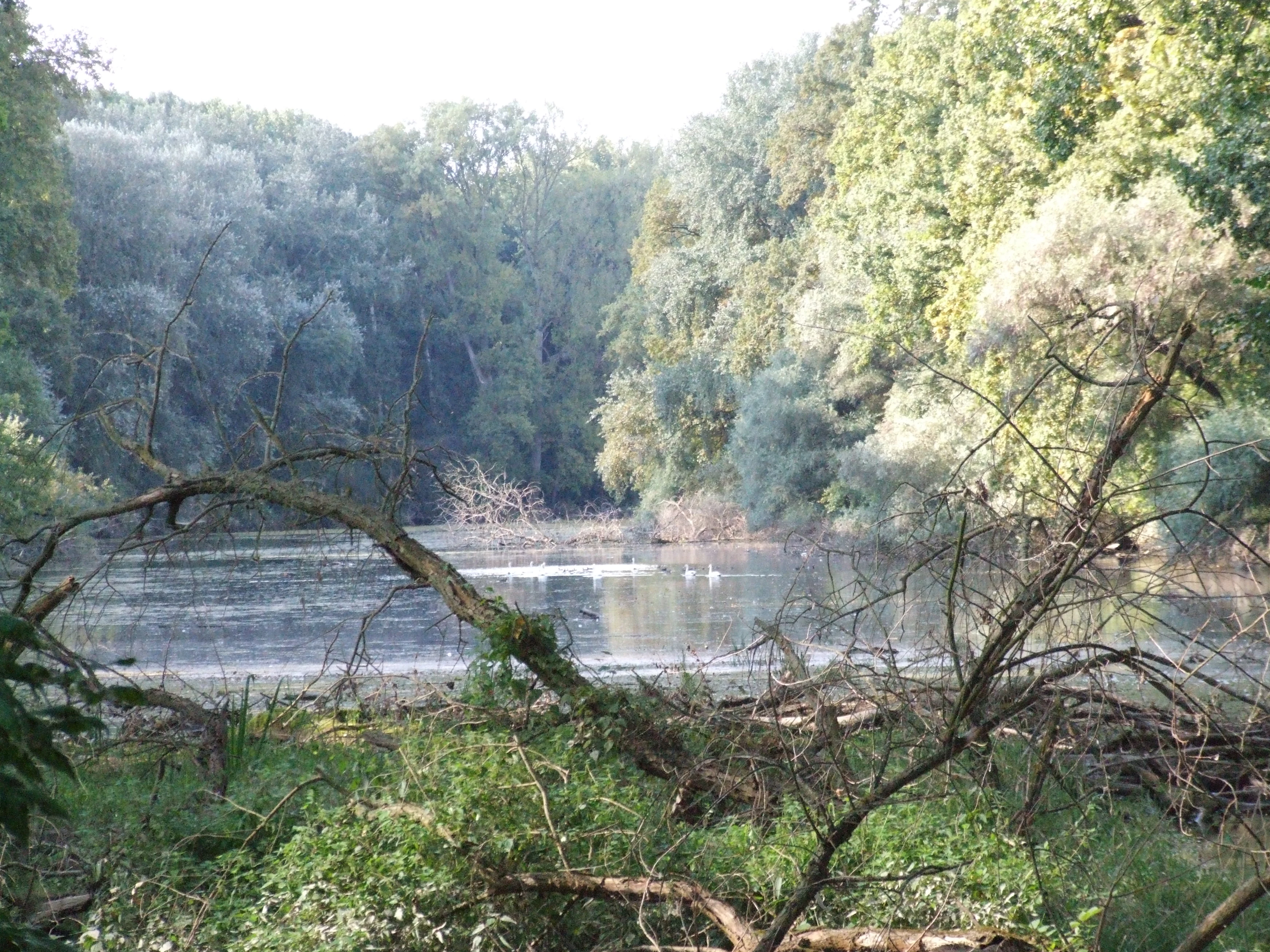
A calm oxbow lake surrounded by dense forest, with fallen branches in the foreground and light reflecting off the water surface.
A view of the Rundedebunk oxbow lake within the Speyerer Auwald floodplain forest.

Speyerer Auwald wildlife and species highlights

The bird fauna of the Speyerer Auwald is unusually rich for an inland European site. In the core area around Im Hechenich, Runkedebunk, Insel Horn, and Goldgrube, surveys recorded 15 strictly protected bird species and 11 other specially protected or endangered species, including seven listed in Annex I of the EU Birds Directive. Protected species include the purple heron (Runkedebunk), black kite (Goldgrube), goshawk (Insel Horn), sparrowhawk and common buzzard (Goldgrube, Insel Horn), common and hobbies (Goldgrube), green and wood sandpiper (Goldgrube), kingfisher (Goldgrube, Runkedebunk), wryneck (Goldgrube), grey-headed, green, black, and middle spotted woodpeckers, and red-backed shrike.

Among other specially protected species, the area supports little and great crested grebes, grey heron (Goldgrube, Runkedebunk), teal and water rail (Goldgrube), lesser spotted woodpecker (Insel Horn), melodious warbler and golden oriole (Insel Horn, Goldgrube), penduline tit and rook (Goldgrube), and large numbers of Laro-Limikolen (gulls, terns, and waders, around 50 species) and waterfowl (around 40 species). The EU Birds Directive summary lists the site as a key area for black kite, kingfisher, middle spotted woodpecker, bluethroat, purple heron, honey buzzard, marsh harrier, grey-headed and black woodpecker, red-backed shrike, corncrake, water rail, wryneck, sedge and great reed warbler, penduline tit, terns, divers, diving and dabbling ducks, geese, cormorant, and gulls.

Bats are also significant. Detector and netting surveys on Insel Horn recorded ten bat species, including Bechstein's bat (with confirmed breeding based on a pregnant female and the species' small action radius), brown long-eared bat, common and lesser noctules, greater mouse-eared bat (uncertain detector record), whiskered bat, Nathusius' pipistrelle, common pipistrelle, Daubenton's bat, and soprano pipistrelle. The reed-rimmed Goldgrube and Lausgrube, the Runkedebunk, and the Berghäuser Altrhein all host amphibians protected under the EU Habitats Directive, including great crested newt (Goldgrube, relict population), garlic toad, natterjack toad (Goldgrube, Sick'sche Wiese, seepage depressions, with several hundred individuals forming a distribution focus), European tree frog (northern range limit in the Rhine floodplain), moor frog (critically endangered), and pool frog. Reptiles include grass snake in the Goldgrube and Runkedebunk and sand lizard on the embankment near Insel Horn and on the Sick'sche Wiese. Invertebrate rarities include the blue-winged grasshopper (Blaue Ödlandschrecke) at the edge of the Sick'sche Wiese and the large copper butterfly (Großer Feuerfalter, Annex II Habitats Directive) in a wet meadow near the Dammwachthaus.
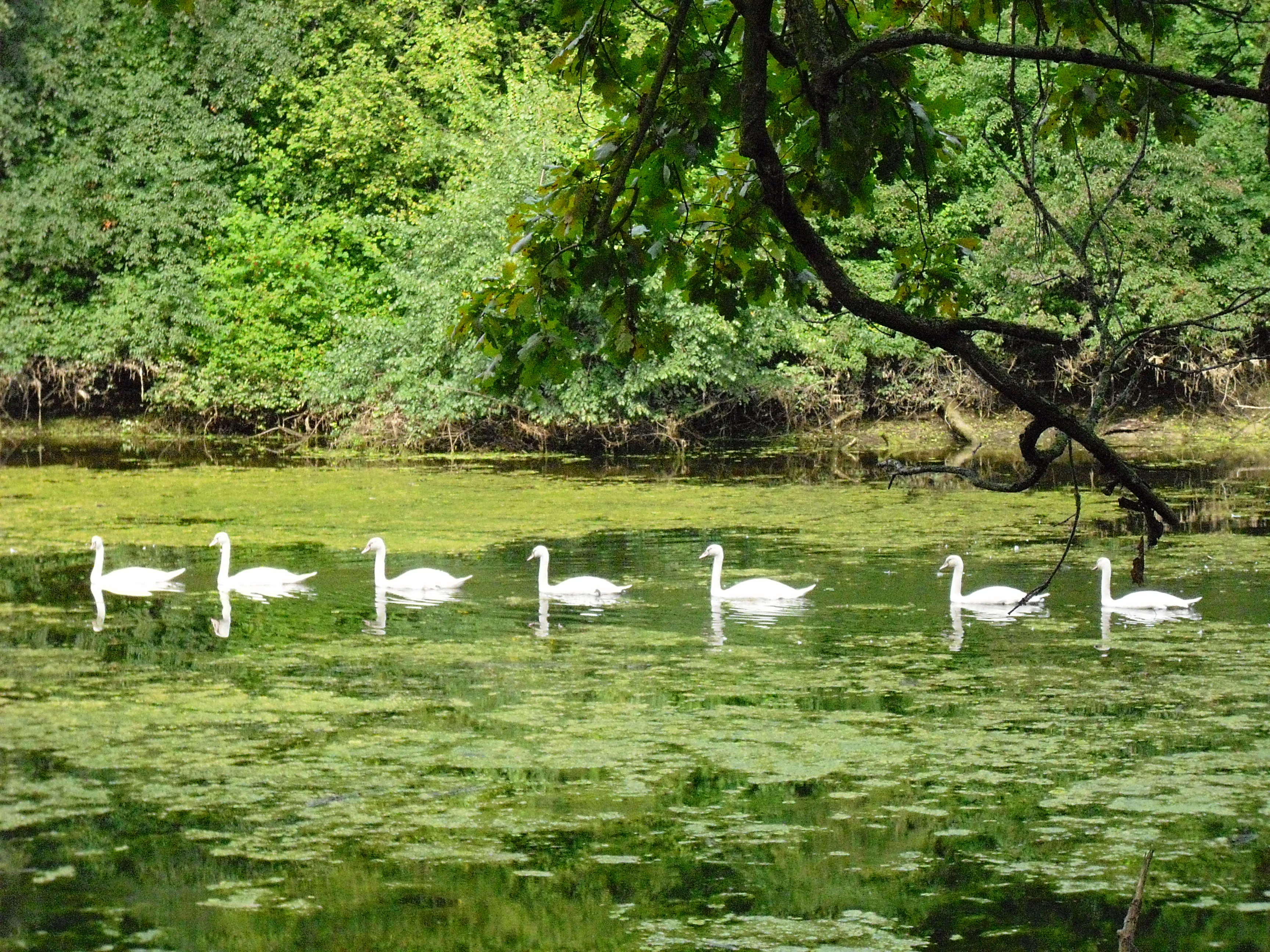
A horizontal row of seven white swans swimming in a line across a calm, algae-covered pond within a forest.
A line of swans swimming through the Goldgrund area of the Speyerer Auwald.

Speyerer Auwald conservation status and protection priorities

The Speyerer Auwald is, in conservation terms, a recognized component of two European ecological networks. It is part of the EU Birds Directive site DE 6716-402 "Berghäuser und Lingenfelder Altrhein", valued for its substantial breeding populations of reed- and tree-nesting target species, its oxbows and large mudflats as indispensable resting and staging habitat for Laro-Limikolen, ducks, geese, and other waterfowl, and its preservation target of a structurally rich floodplain landscape forming a natural mosaic of shallow water zones, mud and gravel banks, reedbeds, and soft- and hardwood floodplain forests, as defined by the Rhineland-Palatinate state ordinance on conservation objectives for Natura 2000 sites.

It is also part of the FFH site DE 6716-301 "Rheinniederung Germersheim-Speyer", characterized as a Rhine floodplain landscape with extensive hardwood floodplain forests, former river arms, clay-pit waters, and reedbeds. The site's worthiness is documented through rarely encountered plant communities, animal occurrences of supra-regional importance, habitats for migratory fish, particular relevance as a stopover and resting area for birds, bat habitats, and old-wood-rich floodplain forests.

At the local level, the city of Speyer has layered additional protection: the 1977 protection of the Goldgrube as a protected landscape element, the 1987 designation of about 55 century-old oaks as protected landscape components, the 1993 municipal council targets tying forest management to Natura 2000 obligations, and ongoing conversion of poplar working forests toward silver willow floodplain forest and site-typical hardwood species. Totholz (deadwood), Überhälter (veteran trees left standing beyond normal rotation), and Altholzgruppen are all part of the management approach aimed at increasing habitat complexity.

Speyerer Auwald cultural meaning and human context

Several place names in the Speyerer Auwald preserve the cultural memory of Speyer's historical relationship with the Rhine. The Salmengrund name recalls Speyer's once-significant salmon fishery. The Goldgrube takes its name from historic extraction of Rhine gold and extinguishing sand, reflecting pre-modern use of floodplain resources.

Within the Auwald, the Herrenwiese served as a traditional excursion ground for the city's inhabitants, hosting open-air concerts and dances; the cultural memory of this recreational use still attaches to the site. At the north of the Im Salmengrund parcel, during the Cold War a floating emergency bridge was stationed in a fenced military restricted area for defense contingencies, a reminder of the strategic position of the Rhine in that period. Today the site of the Rheinhäuser Fähre is again a cultural link, connecting Speyer via a seasonal passenger ferry to Rheinhausen for walkers and cyclists.
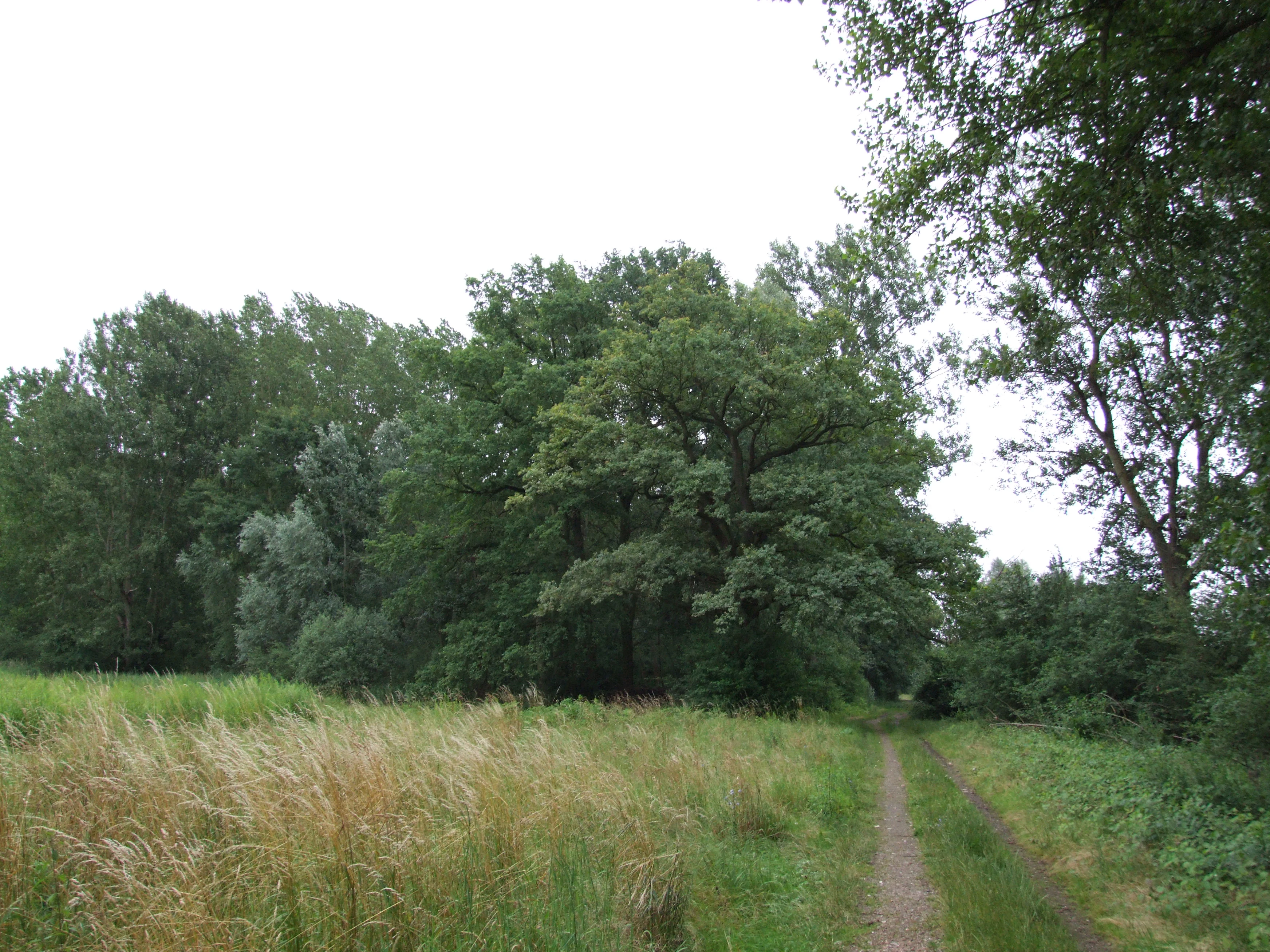
A dirt path leads alongside a meadow of tall grass into a dense, green floodplain forest.
A view of the Sick'sche Wiese, a floodplain meadow within the Speyerer Auwald.

Top sights and standout views in Speyerer Auwald

The Speyerer Auwald's signature combination is a near-natural mosaic of silver willow floodplain, hardwood ash-oak-elm floodplain, Stromtalwiesen, relic oxbows, and over 80 old cavity-bearing trees concentrated on Insel Horn. Within a few square kilometres it supports Annex I species such as kingfisher, purple heron, middle spotted and black woodpeckers, and red-backed shrike, alongside a confirmed breeding population of Bechstein's bat and one of the most important natterjack toad populations in the Upper Rhine valley.

Conservation-wise, the Auwald stands out as a documented part of two Natura 2000 sites (DE 6716-402 Birds Directive and DE 6716-301 Habitats Directive), supported by decades of local protection dating back to 1977 and 1987 ordinances in Speyer. The Rheinhäuser Fähre landing within the forest also makes it a gateway for visitors exploring the Rhine floodplain by foot, bicycle, or river crossing.
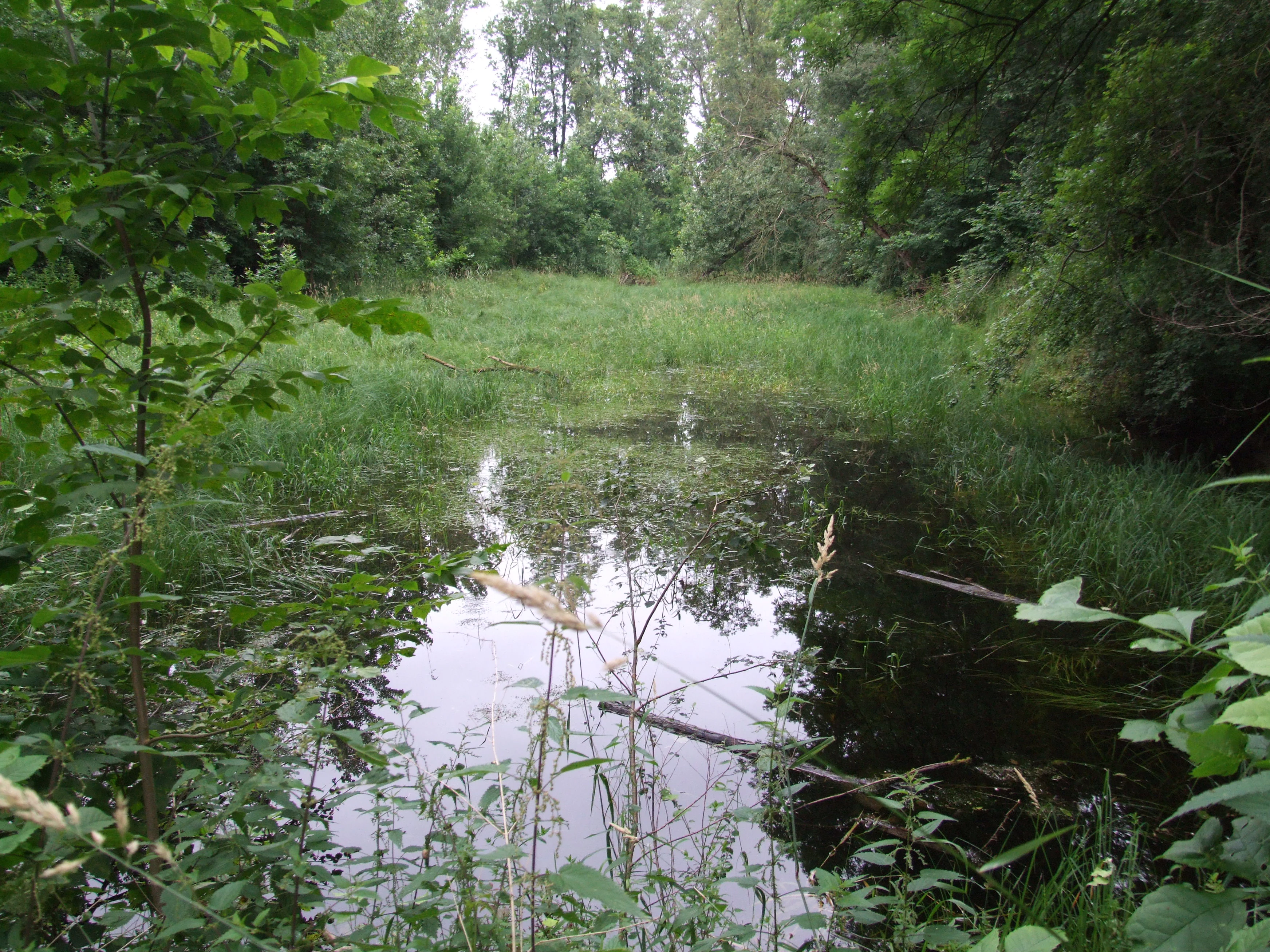

A stagnant, partially vegetated secondary water channel surrounded by dense green forest foliage.
A silting secondary water channel, or schlute, within the lush alluvial forest of the Speyerer Auwald.
Monthly climate preview

Long term temperature and precipitation records across representative coordinates

Speyerer Auwald Climate Normals and Annual Temperature Patterns

Representative coordinates for Speyerer Auwald record mean monthly temperatures spanning from near freezing up to twenty degrees Celsius alongside steady daily precipitation averages. Detailed monthly climate normals supply complete seasonal temperature and rainfall patterns for the protected area.
Annual mean10 °C
0 °C20 °C
Jan
Feb
Mar
Apr
May14°
Jun18°
Jul20°
Aug20°
Sep15°
Oct10°
Nov
Dec
Warmest month
July

20.3 °C

Coolest month
January

0.1 °C

Wettest month
July

2.4 mm/day

Driest month
April

1.5 mm/day

Park location guide

Geography guide, regional context, and park location map for Speyerer Auwald

Speyerer Auwald park geography, regions, and map view in Germany

Understand where Speyerer Auwald sits in Germany through a broader geographic reading of the surrounding landscape, nearby location context, and its mapped position within the national park landscape.

How Speyerer Auwald fits into Germany

Germany is a federal republic in Western and Central Europe with a population of over 83 million across sixteen constituent states. It is Europe's largest economy by nominal GDP and a major global exporter and importer. The capital is Berlin, and the country borders Denmark, Poland, Czech Republic, Austria, Switzerland, France, Luxembourg, Belgium, and the Netherlands.

Wider geography shaping Speyerer Auwald in Germany

Germany is located in Western and Central Europe, spanning 357,022 km². It borders Denmark to the north, Poland and the Czech Republic to the east, Austria and Switzerland to the south, and France, Luxembourg, Belgium, and the Netherlands to the west. The country has coastlines on the Baltic Sea and North Sea to the north, with the Alps located in the southern region.

Map view of Speyerer Auwald

Use this park location map to pinpoint Speyerer Auwald in Germany, understand its exact geographic position, and read its mapped placement within the surrounding landscape more clearly.

Pigeon | © OpenStreetMap contributors

Location context for Speyerer Auwald

Rhineland-Palatinate

Explore photographic records of alluvial forests, oxbows, and protected river habitats

Speyerer Auwald Photos and Landscapes: Visualizing the Rhine Floodplain

Visual documentation captures the complex mosaic of softwood floodplains, hardwood tree stands, and reed-fringed oxbows defining the protected terrain. Photographic study reveals the distinct hydrological gradients, seasonal wetland changes, and habitat structures shaping the natural reserve.

A close up view of a common kingfisher with vibrant blue and orange plumage, perched on a thin tree branch against a soft green out of focus background.

A male sand lizard with vibrant green flanks and a patterned brown back resting on a grey stone next to green leaves.

A close-up view of a European green toad, featuring distinctive warty green and white mottled skin, resting on a flat, textured concrete surface.

A calm oxbow lake surrounded by dense forest, with fallen branches in the foreground and light reflecting off the water surface.

A horizontal row of seven white swans swimming in a line across a calm, algae-covered pond within a forest.

A close up view of a weathered, dead tree trunk showing decaying bark, deep fissures, and boreholes from insects.

A dirt path leads alongside a meadow of tall grass into a dense, green floodplain forest.

A stagnant, partially vegetated secondary water channel surrounded by dense green forest foliage.

A wide view of a dense, lush green riverine forest bordering a wide river with two white swans swimming near the bank.

A close-up view of a Bechstein's bat hanging upside down, showing its pale, fuzzy belly and dark wings folded against a textured rock surface.

A green frog sitting on wet soil and low-lying vegetation surrounded by tall blades of dried grass.

A passenger ferry boat navigating the Rhine River with a dense green forest lining the far bank under a cloudy sky.

A paved path runs along the bottom foreground next to a grassy field with scattered trees, leading toward a cultivated wheat field in the midground and dense woodland in the background under an overcast sky.

Park atlas

Compare surrounding alluvial forests, river oxbows, and connected conservation areas

Parks Near Speyerer Auwald and Related Protected Landscapes in the Upper Rhine Valley

Browsing parks near Speyerer Auwald reveals a diverse network of protected riparian zones and alluvial habitats along the Upper Rhine Graben. Extending the geographic comparison helps trace similar floodplain ecosystems, oxbow networks, and regional conservation corridors.
Nature reserveRheinland-Pfalz
About 2.2 km away#1 closest

West

Flotzgrün Nature Reserve: Protected Floodplain Landscapes and Rhine Geography in Rheinland-Pfalz

Mapping historical island creation and modern conservation polders

Flotzgrün serves as a compelling geographic entity within the Upper Rhine, functioning as both an active flood management polder and a protected riparian environment. This site offers insights into the intersection of 19th-century river straightening and modern ecological restoration, revealing a landscape defined by controlled wetlands, old river arms, and managed floodplain habitats.

Area
3.4 km²
Relief
Lowland
Scope
Terrestrial
Water
Major water bodies
A pale, atmospheric watercolor painting showing a quiet river scene with green trees and a hanging branch in the foreground, rendered in a light and airy style.
Nature reserveRhineland-Palatinate
About 6.5 km away#2 closest

Southwest

Schwarzwald Nature Reserve: A Protected Rhine Floodplain Landscape in Rhineland-Palatinate

Geographic atlas of alluvial forests and oxbow river dynamics

Schwarzwald represents a significant nature reserve in Germany, characterized by its position between the modern Rhine and the Lingenfelder Altrhein. The area contains a rich collection of floodplain features, including alluvial forests, pollarded willows, and standing gravel pit lakes, offering a comprehensive look at the riparian geography of the Upper Rhine.

Area
3.41 km²
Established
1997
A horizontal watercolor painting showing a stylized, soft-focus forest landscape with green trees against a pale, warm-toned ground.
Protected areaRhineland-Palatinate
About 6.6 km away#3 closest

Northwest

Speyerer Wald: Protected Alluvial Forest and Inland Sand Dune Landscape

Regional geography and protected area context in Rhineland-Palatinate.

Speyerer Wald offers a look into the formation of Rhine Plain alluvial fans and the survival of forest ecosystems on poor, sandy soils. This protected expanse showcases the intersection of inland dunes, dry sand grasslands, and riparian stream corridors. It serves as a key case study in regional landscape evolution, highlighting how ice age deposits continue to dictate current habitat distribution and nature conservation priorities.

Established
1981
Relief
Lowland
Climate
Temperate
Access
Easy access
Watercolor painting showing a calm river shoreline with soft green trees and light pinkish ground accents.
Protected areaRhineland-Palatinate
About 7.1 km away#4 closest

North

Angelhofer Altrhein: Protected Riparian Environment in Rhineland-Palatinate

Historic river oxbow, floodplain forests, and Natura 2000 habitats

Located in the heart of the Upper Rhine plain, the Angelhofer Altrhein constitutes an essential protected area known for its distinct floodplain meadow and forest ecosystems. This backwater environment, once a main channel of the Rhine, provides critical habitat for diverse species and serves as a natural contrast to the surrounding industrial and recreational landscapes of the region.

Relief
Lowland
Climate
Temperate
Access
Easy access
Scope
Terrestrial
A horizontal watercolor painting depicting a soft-focus landscape with a central tree, calm water, and rolling hills in the background.
Nature reserveRhineland-Palatinate
About 9 km away#5 closest

Southwest

Brückenkopf Nature Reserve: An Atlas of Protected Floodplain Geography in Rhineland-Palatinate

Detailed mapping of rare wetland habitats and regional floodplain zones

Brückenkopf offers a unique look at small-scale habitat conservation in the Germersheim district. This nature reserve protects a vital fragment of the Upper Rhine floodplain, serving as a sanctuary for specific wetland flora and rare invertebrates. Gain a better understanding of its location between major infrastructure corridors and the river, marking it as a significant component of regional conservation strategy.

Area
0.357 km²
Established
1982
IUCN
IV
Relief
Lowland
A watercolor painting showing a rolling landscape with purple hills, green vegetation, and light yellow fields.
Protected landscapeBaden-Württemberg
About 11 km away#6 closest

Southeast

Obere Lußhardt Protected Landscape: Geography and Regional Woodland Mapping

A study of forest biotopes and meadow stream corridors

The Obere Lußhardt area stands as a central protected landscape on the Hardt plain, spanning municipalities within the Baden-Württemberg district. Through forest conservation and open grassland corridors like the Gemswiesen, the site provides a distinct look at the transition between Rhine lowland forest and local stream valley ecology.

Area
5.862 km²
Established
1973
IUCN
V
Relief
Lowland
Watercolor painting of a tranquil wetland landscape with soft green vegetation and a calm water body, reflecting the floodplain environment of the Rhine river.
Nature reserveLandkreis Germersheim
About 12 km away#7 closest

Southwest

Hördter Rheinaue Nature Reserve: Landscape and Geographic Context in Landkreis Germersheim

Examining the hydrology and floodplain forest of the German Rhine.

Hördter Rheinaue serves as a critical node in the Palatinate Rhine floodplains, preserving a vast mosaic of willow and poplar forests alongside stable hardwood stands. Analyze the mapped terrain shaped by centuries of river activity, including the meandering Michelsbach and associated oxbow systems that define this essential protected corridor in western Germany.

Area
8.18 km²
Established
1966
IUCN
IV
Relief
Lowland
A soft watercolor illustration of a rolling meadow landscape featuring green grasses and pink flowers against a light background.
Protected landscapeBaden-Württemberg
About 12 km away#8 closest

Southeast

Hambrücker Wiesen Protected Landscape: A Geographical Atlas of Baden-Württemberg Terrain

Mapped meadows, wetland corridors, and regional landscape boundaries

Spanning 107 hectares in the Hardtebenen, Hambrücker Wiesen functions as a critical protected landscape in Baden-Württemberg. The area anchors a diverse geographic profile featuring lowland hay meadows, reed beds along the Wagbach, and open agricultural terrain. Discover how this site integrates into the broader network of protected zones within the Upper Rhine Plain while preserving its traditional rural character against development.

Area
1.066 km²
Established
1991
IUCN
V
Relief
Lowland

Common questions about visiting, size, designation, and location context for Speyerer Auwald

Speyerer Auwald FAQs for park facts, access, geography, and protected area context

Find quick answers about Speyerer Auwald, including protected-area facts, park geography, trail and visitor context, and how the park fits into its surrounding country and regional landscape.
MoriAtlas Explorer

Continue Your Protected Areas Search Across the Global Atlas

Deepen your exploration by continuing the structured search for national parks and protected areas worldwide. Utilize the comprehensive filtering capabilities to compare different conservation landscapes and refine your understanding of global park geography. Discover more about the distribution and characteristics of protected natural areas.

Global natural geography