
Mori Atlas logo
Protected landscapeSpring Mountains National Recreation Area

Explore the dramatic alpine terrain and forested mountain geography rising above the Las Vegas Valley

Spring Mountains National Recreation Area: A High Elevation Protected Landscape in Southern Nevada

Spring Mountains National Recreation Area encompasses over 316,000 acres of rugged topography, transitioning from arid desert foothills to the nearly 12,000 foot summit of Mount Charleston. This protected landscape serves as a significant mountain anchor in southern Nevada, providing a cool alpine environment with mixed conifer forests and deep canyons. Visitors and geography enthusiasts can trace the vertical relief and ecological gradients that distinguish this mountain range from the surrounding Mojave terrain.

Spring MountainsSky islandMount CharlestonAlpine environmentMountain recreation areaNevada mountains
A digital illustration of a multi-tiered waterfall cascading down between steep rock cliffs, surrounded by evergreen trees and a sunlit sky.

Spring Mountains National Recreation Area

Protected landscape

Park overview

Structured park overview, official facts, and landscape profile for Spring Mountains National Recreation Area

Spring Mountains National Recreation Area park facts, protected area profile, and essential visitor context

Review the core facts for Spring Mountains National Recreation Area, including designation, size, terrain, visitor scale, habitats, and operating context in one park-focused overview.

About Spring Mountains National Recreation Area

Spring Mountains National Recreation Area is a U.S. national recreation area located in the Spring Mountains of southern Nevada, west of the Las Vegas Valley. Spanning Clark and Nye counties, it is one of the largest protected natural landscapes in the state and functions as a green, elevated refuge above the Mojave Desert basin.

The recreation area encompasses more than 316,000 acres and is dominated by Mount Charleston, the highest peak in the range at 11,918 feet. From low meadows on its lower slopes at roughly 3,000 feet to the alpine zones near the summit, the SMNRA contains a remarkable range of elevation, climate, and vegetation within a relatively short horizontal distance. The result is a landscape where pinyon-juniper woodland, ponderosa pine forest, mixed conifer stands, and high-country bristlecone and limber pine groves all coexist across the same mountain block.

Administratively, the SMNRA is part of the Humboldt-Toiyabe National Forest and is managed by the U.S. Forest Service. It sits immediately adjacent to the Red Rock Canyon National Conservation Area, a separately administered Bureau of Land Management unit to the south that protects colorful Aztec Sandstone cliffs. Together, these two protected landscapes form a substantial natural corridor on the western edge of the Las Vegas metropolitan area.

The recreation area serves both conservation and recreation purposes. It protects habitat for threatened and sensitive plant and animal species, supports the Mount Charleston Wilderness, and offers an unusually broad menu of outdoor activities. Visitors come for hiking on trails such as the South Loop to Charleston Peak and the North Loop Trail, for camping at sites like McWilliams and Hilltop campgrounds, for picnicking in Kyle Canyon, for mountain biking along the Bristlecone Trail system, and for skiing at Lee Canyon. Its accessibility from Las Vegas makes it one of the most heavily used natural areas in Nevada, while its elevation and ecological character keep it feeling like a world apart from the city below.

Quick facts and research context for Spring Mountains National Recreation Area

Spring Mountains National Recreation Area covers more than 316,000 acres across Clark and Nye counties in Nevada, lying west of Las Vegas. The area stretches from low meadows at roughly 3,000 feet in elevation to the summit of Mount Charleston at about 11,918 feet, producing a dramatic ecological range within a relatively compact footprint.

The recreation area is part of the Humboldt-Toiyabe National Forest and is administered by the U.S. Forest Service. It includes the Mount Charleston Wilderness and adjoins the Red Rock Canyon National Conservation Area, which is managed separately by the Bureau of Land Management. The area was first established as the Charleston Forest Reserve in 1906 and was expanded and redesignated as the Spring Mountains National Recreation Area by Congress in 1993.

Protection and recognition

Explore documented designation timelines, management scope, and recognition data.

Spring Mountains National Recreation Area Protection Status and History

Terrestrial protection status for Spring Mountains National Recreation Area became officially established following its 1993 designation year. Conservation records outline the administrative management scope and international recognition sources for this protected landscape.

Protection details

Protection scope
Terrestrial
Designated year
1993
Transboundary protection
No
Park context

Deeper park guide and search-rich context for Spring Mountains National Recreation Area

Spring Mountains National Recreation Area history, landscape, wildlife, and travel context

Explore Spring Mountains National Recreation Area through its history, landscape character, ecosystems, wildlife, conservation priorities, cultural context, and seasonal travel timing in a structured park guide built for atlas discovery and search intent.

Why Spring Mountains National Recreation Area stands out

Spring Mountains National Recreation Area is best known for the striking environmental contrast it provides: a forested, snow-prone mountain range towering directly above the desert city of Las Vegas. Its defining feature is Mount Charleston, the highest peak in the range at 11,918 feet, which anchors a high-elevation landscape of pine and fir forests, rocky cliffs, alpine trails, and seasonal snowfall. Beyond its scenic drama, the area is recognized for the ecological role it plays in an otherwise arid region. It shelters populations of plants and animals that depend on cool, moist mountain conditions, and its protection under the National Recreation Area designation reflects both its conservation value and its importance as a regional outdoor playground within easy reach of a major metropolitan area.
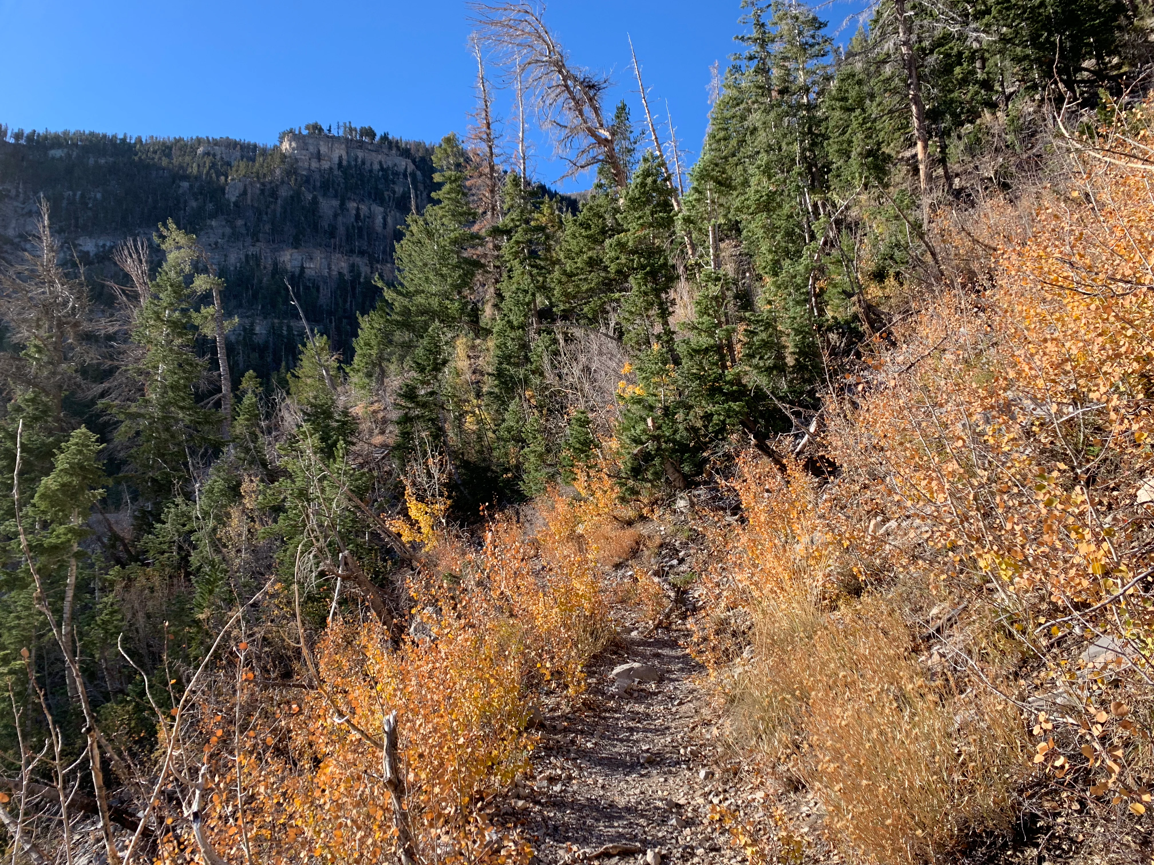
A narrow dirt hiking trail winds through a mountain forest with golden autumn leaves and evergreen trees under a clear blue sky.
Autumn foliage lines the South Loop Trail in the Spring Mountains National Recreation Area.

Spring Mountains National Recreation Area history and protected-area timeline

The history of Spring Mountains National Recreation Area begins with early federal recognition of the region's ecological significance. The area was first designated as the Charleston Forest Reserve in 1906, placing the forested mountains around Mount Charleston under formal federal stewardship during the era of early American forest conservation.

Over the following decades, additional land was incorporated into the reserve. In 1989, land additions expanded the area substantially, enlarging the base that would become the modern recreation area. By the early 1990s, the growing recognition of the range's ecological importance, recreational value, and proximity to the rapidly expanding Las Vegas Valley prompted federal action to strengthen its protection.

In 1993, the U.S. Congress formally designated the area as Spring Mountains National Recreation Area, cementing its status as a national-level protected landscape and integrating it into the framework of the Humboldt-Toiyabe National Forest. The Mount Charleston Wilderness, which had been a key driver of the recreation area's establishment because of its importance for threatened species and sensitive high-country ecosystems, exists within the broader SMNRA footprint.

Today, the recreation area reflects the layered history of American conservation policy in the West: a century-old forest reserve transformed into a modern national recreation area, balancing ecological protection, wilderness preservation, and intensive public use near one of the fastest-growing metropolitan regions in the United States.

Spring Mountains National Recreation Area landscape and geographic character

The Spring Mountains are one of the most prominent mountain ranges in southern Nevada, rising sharply from the desert floor of the Las Vegas Valley to form a high, forested skyline west of the city. The Spring Mountains National Recreation Area follows this dramatic topography from roughly 3,000 feet in elevation up to 11,918 feet at the summit of Mount Charleston, creating one of the steepest and most ecologically varied elevation gradients found in any U.S. national recreation area.

The lower slopes of the range are defined by pinyon pine and Utah juniper woodland, with rocky outcrops and rugged canyons characteristic of the eastern Mojave region. As elevation increases, the vegetation transitions into ponderosa pine and mixed conifer forest, with cooler, moister conditions supporting denser stands of trees, flowing creeks, and seasonal waterfalls. Higher still, the landscape gives way to a true alpine environment, where bristlecone and limber pine cling to exposed ridges near the summit of Mount Charleston.

Canyons carved into the range, including Kyle Canyon and Lee Canyon, are central to the recreation area's character, providing access corridors for roads, trails, campgrounds, and the Lee Canyon ski area. To the south, the Spring Mountains descend toward the bright red and cream sandstone cliffs of Red Rock Canyon, which lies just outside the recreation area's boundary but forms a visual and geological companion landscape of its own.
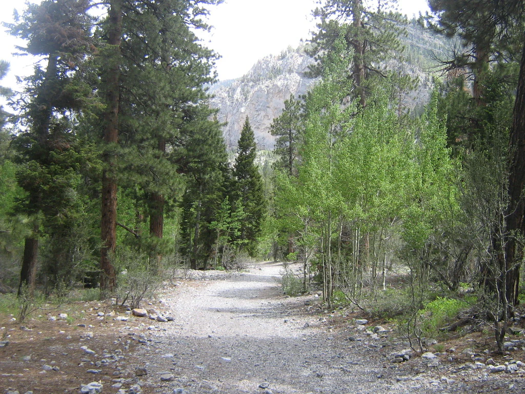
A wide gravel trail stretches through a forest with tall pine trees on the left and a mix of pines and young green aspen trees on the right, leading toward a rocky mountain slope in the distance.
A gravel hiking trail winding through a coniferous and aspen forest in Spring Mountains National Recreation Area.

Spring Mountains National Recreation Area ecosystems, habitats, and plant life

The defining ecological feature of Spring Mountains National Recreation Area is the way it compresses multiple elevation zones into a single mountain block. This compression creates unusually high ecological diversity for a desert state, allowing vegetation communities and wildlife habitats that would typically be separated by hundreds of miles to occur within a short drive of one another.

On the lower slopes, the recreation area supports pinyon-juniper woodland and montane chaparral typical of the transition zone between the Great Basin and the Mojave Desert. Mid-elevation zones are dominated by ponderosa pine and mixed conifer forest, with cooler temperatures, deeper soils, and greater moisture supporting richer understory vegetation. At the highest elevations near Mount Charleston, subalpine and alpine environments host bristlecone pine, limber pine, and other hardy conifers adapted to harsh mountain conditions.

The area's streams, springs, and meadows are particularly important ecologically, sustaining vegetation and wildlife that would not survive in the surrounding desert. The Mount Charleston Wilderness, embedded within the SMNRA, was specifically created to protect these fragile high-country habitats and the species that depend on them. Because of this ecological concentration, the Spring Mountains are sometimes described as a 'sky island,' a high-elevation habitat isolated by surrounding desert lowlands.
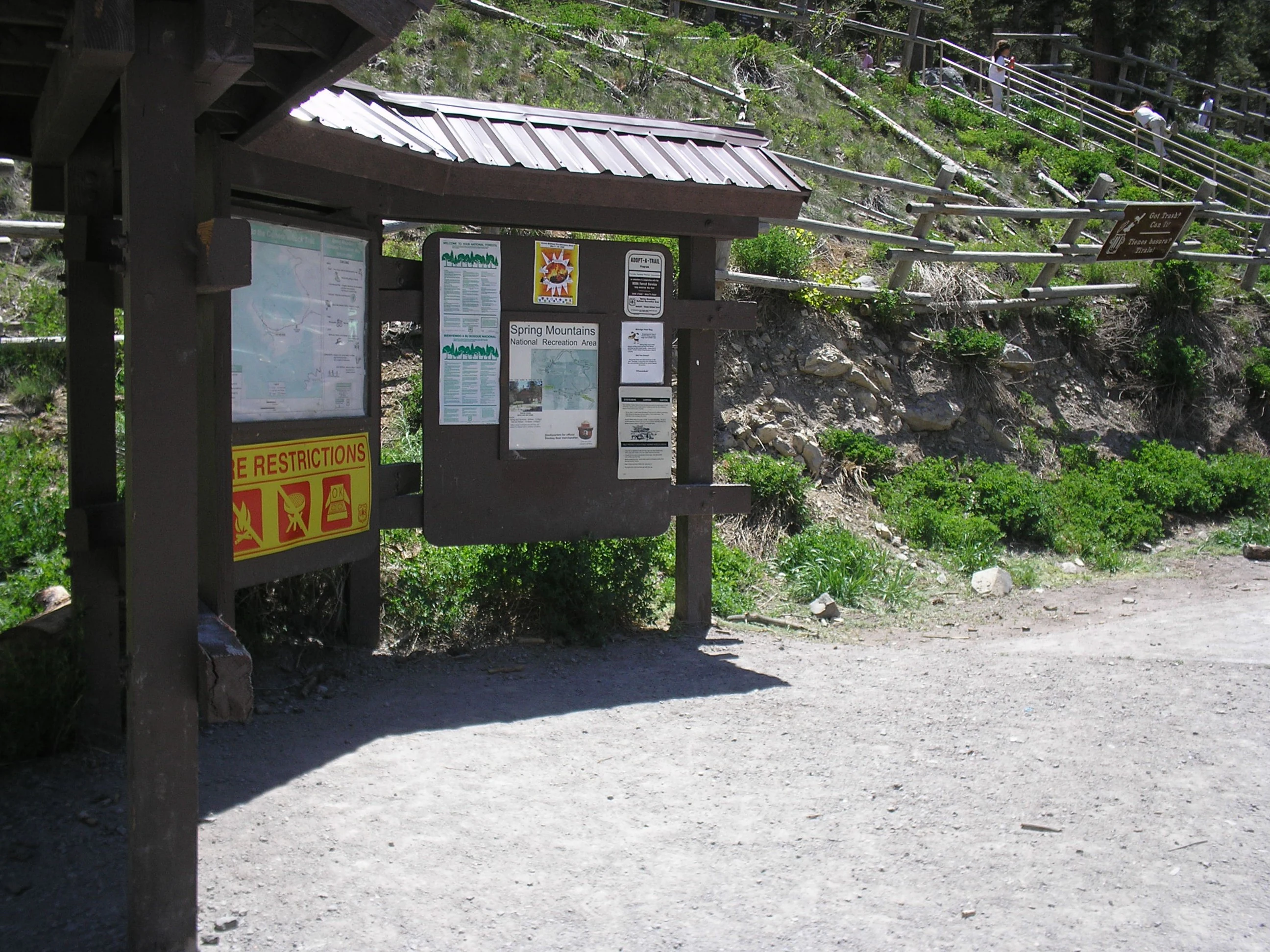
A wooden informational kiosk with multiple signs and maps stands near a dirt path at the base of a forested hillside with a wooden fence.
An informational kiosk displaying park rules and area maps at Spring Mountains National Recreation Area.

Spring Mountains National Recreation Area wildlife and species highlights

Spring Mountains National Recreation Area supports a distinctive mix of wildlife shaped by the contrast between its desert surroundings and its cool, forested interior. Species found here range from those adapted to the hot, dry lower canyons to those that depend on the cold, coniferous forests near the summit of Mount Charleston.

Among the recreation area's most sensitive wildlife are species such as the Mount Charleston blue butterfly, which exists only in the high elevations of the Spring Mountains and which was a key catalyst for the establishment of the Mount Charleston Wilderness. The area also provides habitat for desert bighorn sheep in its rugged lower canyons, mule deer across its forested slopes, and mountain lions, coyotes, and bobcats in its more remote terrain.

Birdlife is similarly varied, with species ranging from desert-adapted birds in the lower canyons to montane and alpine species in the higher forests. The combination of spring seeps, summer meadows, and forested ridges supports a rich seasonal cycle of bird activity, while the sharp environmental gradients give the recreation area an outsized ecological importance for wildlife conservation in southern Nevada.
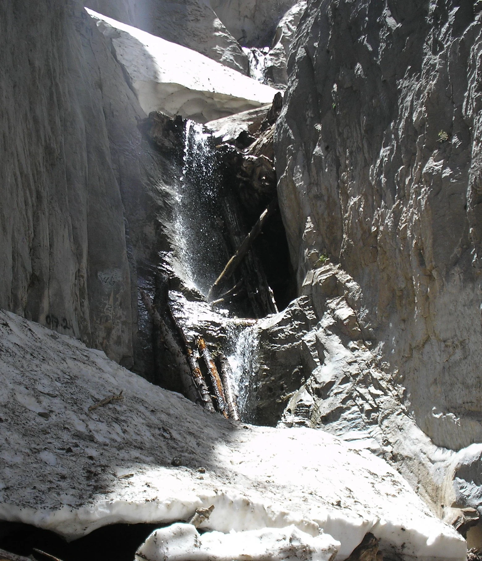
A small waterfall flowing between two high, steep rocky cliffs, with patches of snow remaining at the base and sides.
A narrow waterfall cascading over rocky terrain at Little Falls in the Spring Mountains.

Spring Mountains National Recreation Area conservation status and protection priorities

Spring Mountains National Recreation Area was established in part because the Spring Mountains are a focal point of biological diversity and endemism in an otherwise arid region. The protection of its high-elevation habitats, in particular, has been central to conserving species that exist nowhere else or that depend on conditions entirely different from those found in the surrounding Mojave Desert.

The Mount Charleston Wilderness, fully contained within the SMNRA, represents the core of the recreation area's conservation role. It preserves some of the most ecologically fragile terrain in the range and protects habitat for threatened and sensitive species, including endemic invertebrates and plants adapted to the cold, high-elevation forests. Beyond the wilderness boundary, the broader recreation area provides additional buffers, migration corridors, and management zones that reduce fragmentation across the range.

Since 1993, the recreation area has also played an important conservation role in managing human pressure near a major urban area. Proximity to Las Vegas means the SMNRA absorbs heavy recreational use, and balancing protection with public access is an ongoing conservation challenge. The presence of the U.S. Forest Service, integration into the Humboldt-Toiyabe National Forest, and coordinated planning with adjacent protected areas, including Red Rock Canyon, reflect the conservation framework within which the area operates.

Top sights and standout views in Spring Mountains National Recreation Area

Spring Mountains National Recreation Area stands out for the sheer vertical drama of its landscape, climbing from roughly 3,000 feet in the Mojave foothills to nearly 12,000 feet at the summit of Mount Charleston within the bounds of a single protected area. This range of elevation, combined with its location directly above one of the fastest-growing cities in the American Southwest, gives the SMNRA a unique role as both a conservation refuge and an outdoor escape.

Among its most distinctive features are the Mount Charleston Wilderness, the Bristlecone and Sawmill trail systems, the historic Kyle and Lee canyons, and the Lee Canyon ski area, which together make the recreation area accessible across every season. The adjacency of the SMNRA to the Red Rock Canyon National Conservation Area further strengthens its identity as part of a major network of protected landscapes on the western edge of the Las Vegas Valley.

Best time to visit Spring Mountains National Recreation Area

The Spring Mountains provide sharply different experiences across the four seasons, and the best time to visit depends largely on what kind of landscape a visitor wants to see. Late spring and early summer typically bring mild temperatures, wildflower displays in the meadows, and comfortable hiking conditions at mid and upper elevations, making these months ideal for exploring the network of trails around Mount Charleston and the main canyon corridors.

Summer remains popular because it offers a cool refuge from the extreme heat of the Las Vegas Valley below, and temperatures on the mountain can be markedly lower than those on the desert floor. Fall brings strong color in the higher forests and crisp hiking conditions, while winter, with its snowfall at the upper elevations, transforms the area into a regional skiing destination and produces some of the most scenic vistas of the year. Because the SMNRA sits within easy reach of Las Vegas, it is usable as a year-round outdoor area, although visitors should be prepared for rapidly changing conditions as elevation increases.

Monthly climate preview

Long-term representative temperature and precipitation records across twelve months

Spring Mountains National Recreation Area Climate Normals and Annual Weather Patterns

Spring Mountains National Recreation Area records measured monthly variations in average temperature and precipitation based on long-term coordinate sampling. Accessing the complete twelve-month profile provides detailed climate normals for deeper geographic analysis of the terrain.
Annual mean14 °C
3 °C27 °C
Jan
Feb
Mar
Apr12°
May18°
Jun24°
Jul27°
Aug26°
Sep22°
Oct15°
Nov
Dec
Warmest month
July

27.2 °C

Coolest month
December

2.8 °C

Wettest month
February

1.1 mm/day

Driest month
June

0.1 mm/day

Park location guide

Geography guide, regional context, and park location map for Spring Mountains National Recreation Area

Spring Mountains National Recreation Area park geography, regions, and map view in United States of America

Understand where Spring Mountains National Recreation Area sits in United States of America through a broader geographic reading of the surrounding landscape, nearby location context, and its mapped position within the national park landscape.

How Spring Mountains National Recreation Area fits into United States of America

The United States of America is a federal presidential republic and one of the world's largest countries by area and population. It consists of 50 states across a vast territory spanning multiple time zones, with its capital in Washington, D.C. and largest city in New York City. The nation has a diverse economy, influential political system, and significant cultural and military presence globally.

Wider geography shaping Spring Mountains National Recreation Area in United States of America

The United States occupies a vast territory in North America, bordered by Canada to the north and Mexico to the south. The 48 contiguous states stretch from the Atlantic to the Pacific Ocean, while Alaska occupies the northwestern region and Hawaii is an archipelago in the Pacific. The country encompasses diverse terrain including the Rocky Mountains, Appalachian Mountains, Great Plains, and extensive river systems.

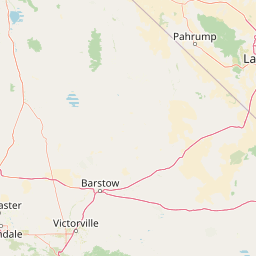
Map view of Spring Mountains National Recreation Area

Use this park location map to pinpoint Spring Mountains National Recreation Area in United States of America, understand its exact geographic position, and read its mapped placement within the surrounding landscape more clearly.

Pigeon | © OpenStreetMap contributors

Location context for Spring Mountains National Recreation Area

Nevada
Recorded earthquake history

Explore Recorded Seismic Activity Near Spring Mountains National Recreation Area

Consult the historical database of earthquakes associated by proximity with Spring Mountains National Recreation Area. MoriAtlas provides a clear, data-focused look at recorded seismic events, enabling users to examine event dates, magnitudes, and epicentre distances within the context of this Nevada mountain landscape.

Spring Mountains Earthquake History

Catalogued events

122 events

Strongest magnitude

Magnitude 5.8

Most recent event

Aug 9, 2026

This history includes earthquakes recorded inside the park or within 50 km of its borders

Visual reference guide to mountain scenery, alpine habitats, and rugged Nevada topography.

Spring Mountains National Recreation Area Photos and Landscapes

Visual records capture the striking elevation gradient of Spring Mountains National Recreation Area, spanning low desert woodlands to high alpine forests. Photographic documentation helps reveal the diverse terrain and ecological contrast defining this protected mountain landscape above the Mojave Desert.

A narrow dirt hiking trail winds through a mountain forest with golden autumn leaves and evergreen trees under a clear blue sky.

A wooden brown and beige entrance sign for the Spring Mountains Visitor Center, mounted on wooden posts with a mountain backdrop.

A wide gravel trail stretches through a forest with tall pine trees on the left and a mix of pines and young green aspen trees on the right, leading toward a rocky mountain slope in the distance.

A wooden informational kiosk with multiple signs and maps stands near a dirt path at the base of a forested hillside with a wooden fence.

A small waterfall flowing between two high, steep rocky cliffs, with patches of snow remaining at the base and sides.

Park atlas

Compare nearby protected landscapes and regional mountain terrain

Explore Other Parks Near Spring Mountains National Recreation Area

Visitors exploring Spring Mountains National Recreation Area can examine adjacent protected areas to compare mountain ranges, arid terrain, and regional conservation zones. Expanding the geographic scope reveals connected ecosystems and broader patterns across the surrounding desert region.
A watercolor painting showing soft green hills, distant pink-hued mountains, and a pale blue lake in a serene, stylized landscape.
Protected landscapeNevada
Park boundaries overlap#1 closest

North

Humboldt, Toiyabe National Forest: Protected Landscape and Regional Mountain Geography

A vast network of Nevada mountain ranges and alpine wilderness

Humboldt, Toiyabe National Forest serves as a defining public land entity across Nevada and eastern California. As the largest national forest in the contiguous United States, it preserves a striking collection of isolated mountain ranges, including the Ruby Mountains and the rugged Jarbidge wilderness, within a broader basin-and-range landscape. Examine the boundaries and terrain that characterize this complex, high-desert ecosystem.

Area
25,454 km²
Established
1908
Relief
Mountain
Access
Easy access
Watercolor painting showing stylized green mountains, pine trees, and soft yellow and purple tones in the landscape.
Wildlife reserveNevada
Park boundaries overlap#2 closest

Northeast

Mount Charleston Wilderness: Protected Mountain Geography and Spring Mountains Atlas

High-altitude wilderness and ancient forest landscapes in southern Nevada

Spanning the crest of the Spring Mountains, Mount Charleston Wilderness stands as a protected natural landmark in Nevada. This area offers an atlas-focused view of subalpine ridges, ancient bristlecone pine forests, and steep fault-block terrain that contrast significantly with the arid Mojave Desert basins located below.

Area
232.46 km²
Established
1989
IUCN
Ib
Relief
Mountain
National parkCalifornia
25 km away#3 closest

West

Death Valley National Park: Exploring California's Mapped Protected Landscape

View the geographic boundaries and desert terrain.

Access a detailed atlas perspective of Death Valley National Park, a protected national park situated in California. Understand the park's distinct mapped boundaries and its role within the regional geography. This resource highlights the unique desert landscape, offering focused insights into its protected-area identity and natural terrain for geographic discovery.

Area
13,848.4 km²
Established
1994
IUCN
II
Visitors
1.1M annual
A watercolor painting showing a soft-toned landscape with a winding river in the foreground, a forested middle ground, and rolling mountains in the distance.
Protected landscapeUnited States of America
50 km away#4 closest

East

Lake Mead National Recreation Area: Desert Reservoir and Protected Landscape Atlas

United States protected geography and reservoir terrain

Spanning the lower Colorado River, Lake Mead National Recreation Area represents a unique convergence of desert ecosystems and large-scale water management. Its geography includes extensive reservoir shorelines, deep canyon corridors, and volcanic basin terrain that provide a foundational look at the arid environments of the American Southwest. The area remains a significant study of how engineered water features alter and interact with complex desert landscapes.

Area
6,053.31 km²
Established
1936
IUCN
V
Visitors
6.4M annual
Wildlife reserveNevada
About 53 km away#5 closest

East

Jimbilnan Wilderness: Geographic Overview and Protected Desert Landscape in Nevada

Mapping the canyons, washes, and plateaus of the Black Mountains

Jimbilnan Wilderness offers a dense mosaic of Mojave Desert habitats within a compact protected footprint. Located in Clark County, this Nevada wildlife reserve features a transition from deep, rocky canyons carved into the Black Mountains to wide desert washes and benches near Lake Mead. The area is notable for its botanical diversity, including rare milkvetch and buckwheat, serving as a critical link between upland desert systems and the lacustrine environment of the reservoir.

Area
76.4 km²
Established
2002
IUCN
Ib
Relief
Mountain
Wildlife reserveNevada
About 65 km away#6 closest

Southeast

Ireteba Peaks Wilderness: Protected Desert Mountains and Lake Mohave Reservoir Shoreline

Mapping the Eldorado Mountains within southern Nevada desert protected areas.

Spanning the southern Eldorado Mountains and the northern shores of Lake Mohave, Ireteba Peaks Wilderness represents a critical Mojave Desert protected area. This landscape integrates rugged, rocky ridgelines with arid desert slopes and reservoir inlets. Its geographic character, shaped by both federal wilderness designation and proximity to the Avi Kwa Ame National Monument, preserves a vital slice of Nevada desert terrain and native ecological habitat.

Area
132.51 km²
Established
2002
IUCN
Ib
Relief
Mountain
A horizontal watercolor painting depicting soft desert hills in shades of green, yellow, and soft pink.
Wildlife reserveClark County
About 72 km away#7 closest

East

Muddy Mountains Wilderness: Geographic Atlas and Protected Desert Landscape Map

Exploration of sandstone terrain and Clark County topography.

Navigate the complex desert geography of the Muddy Mountains Wilderness, a protected area characterized by its vivid red cliffs, ancient cross-bedded sandstone, and steep elevation gains. This atlas entry provides essential context on the wilderness boundaries, regional landscape patterns, and environmental features that define this significant Mojave Desert refuge.

Area
194.87 km²
Established
2002
Relief
Mountain
Water
Minor water
Wildlife reserveClark County
About 117 km away#8 closest

East

Jumbo Springs Wilderness: Geographic Profile and Protected Landscape Atlas

A rugged desert preserve in Clark County, Nevada

Jumbo Springs Wilderness preserves a dense concentration of desert geology within a compact footprint. Users can analyze the protected boundaries, which feature Precambrian metamorphic formations and granitic domes that rise above arid drainages. This area functions as a critical desert refuge near the Lake Mead reservoir, providing a distinct look at the transition between rocky mountain slopes and water-influenced desert microhabitats.

Area
18.74 km²
Established
2002
IUCN
Ib
Relief
Upland

Common questions about visiting, size, designation, and location context for Spring Mountains National Recreation Area

Spring Mountains National Recreation Area FAQs for park facts, access, geography, and protected area context

Find quick answers about Spring Mountains National Recreation Area, including protected-area facts, park geography, trail and visitor context, and how the park fits into its surrounding country and regional landscape.
MoriAtlas Explorer

Continue Your Protected Areas Search Across the Global Atlas

Deepen your exploration by continuing the structured search for national parks and protected areas worldwide. Utilize the comprehensive filtering capabilities to compare different conservation landscapes and refine your understanding of global park geography. Discover more about the distribution and characteristics of protected natural areas.

Global natural geography