
Mori Atlas logo
Nature reserveStemmbruch

A compact lowland bog and moorland ecosystem situated along the Seeve floodplain periphery

Stemmbruch Nature Reserve and Protected Hanging Spring Bog Landscape in Lower Saxony, Germany

(Naturschutzgebiet Stemmbruch)

Stemmbruch constitutes a significant 56 hectare nature reserve located within the Harburg district of Lower Saxony. This protected area preserves a distinct hanging spring bog perched on a sandy geest ridge, offering a focused look at lowland moor heath and alder swamp woodland ecology. The site provides a vital ecological buffer within the broader landscape protection zone of the Seeve river basin.

nature reservelowland boghanging spring bogmoor heathswamp woodlandbirch woodland
Digital vector illustration of a valley featuring a waterfall, surrounding cliffs, pine trees, and a river, rendered in a stylized, colorful aesthetic.

Stemmbruch

Nature reserve

Park overview

Structured park overview, official facts, and landscape profile for Stemmbruch

Stemmbruch park facts, protected area profile, and essential visitor context

Review the core facts for Stemmbruch, including designation, size, terrain, visitor scale, habitats, and operating context in one park-focused overview.

About Stemmbruch

Stemmbruch is one of many small nature reserves scattered through the Harburg district, but its particular character comes from its position and habitat type. The reserve sits on a sandy geest ridge, the typical slightly elevated, mostly sandy terrain that forms the dry backbone of the North German plain. Along the edge of this ridge, where the ground drops toward the wetter Seeve lowland, groundwater seeps out and feeds a hanging spring bog. This kind of habitat, called a Hangquellmoor in German, depends on a continuous supply of clean, slightly acidic groundwater and produces a distinctive mosaic of open bog pools, low moor heath, and wet woodland.

Within its 56 hectares, Stemmbruch harbors the classic elements of such a bog. Moorkolke, or bog pools, are small water-filled hollows within the peat surface. Surrounding them are areas of Moorheide, a low, open heath vegetation shaped by the bog's acidic, nutrient-poor conditions. Where the bog grades into wetter ground, birch and alder swamp woodland (Birken- und Erlenbruchwald) takes over, with trees adapted to waterlogged, peaty soils.

The broader setting of the reserve is shaped as much by human infrastructure as by natural landforms. To one side runs the freight railway corridor associated with the Maschen marshalling yard, one of the largest rail freight hubs in Germany. To the other side, the A 39 motorway cuts through the northeastern part of the protected area. Despite this pressure, the reserve has retained a coherent mosaic of bog habitats and continues to function as a hydrological buffer between the geest ridge and the Seeve floodplain. Its water leaves the site through the Kohlenbach, which feeds the Ashauser Mühlenbach, itself a tributary of the Seeve.

Quick facts and research context for Stemmbruch

Stemmbruch is a roughly 56-hectare nature reserve in the Harburg district of Lower Saxony, designated on October 17, 1989 under the code NSG LÜ 042. It lies on a geest ridge east of Maschen and west of Stelle, between a busy freight rail line and the A 39 motorway, and is fully surrounded by the Buchwedel und Umgebung landscape protection area.

Protection and recognition

Terrestrial protected area records, management framework, and official recognition data

Stemmbruch Protection Status and Documented Conservation Scope

Stemmbruch maintains documented terrestrial protection metrics within international conservation databases. Structured records assemble verified designation details, management frameworks, and baseline administrative data.

Protection details

Protection scope
Terrestrial
Transboundary protection
No
WDPA ID
82638
Park context

Deeper park guide and search-rich context for Stemmbruch

Stemmbruch history, landscape, wildlife, and travel context

Explore Stemmbruch through its history, landscape character, ecosystems, wildlife, conservation priorities, cultural context, and seasonal travel timing in a structured park guide built for atlas discovery and search intent.

Why Stemmbruch stands out

Stemmbruch is best known for preserving a hanging spring bog (Hangquellmoor) on a geest ridge at the edge of the Seeve floodplain. Its main interest lies in the combination of bog pools, moor heath, and birch and alder swamp woodland that characterize this small lowland bog system in northern Germany.
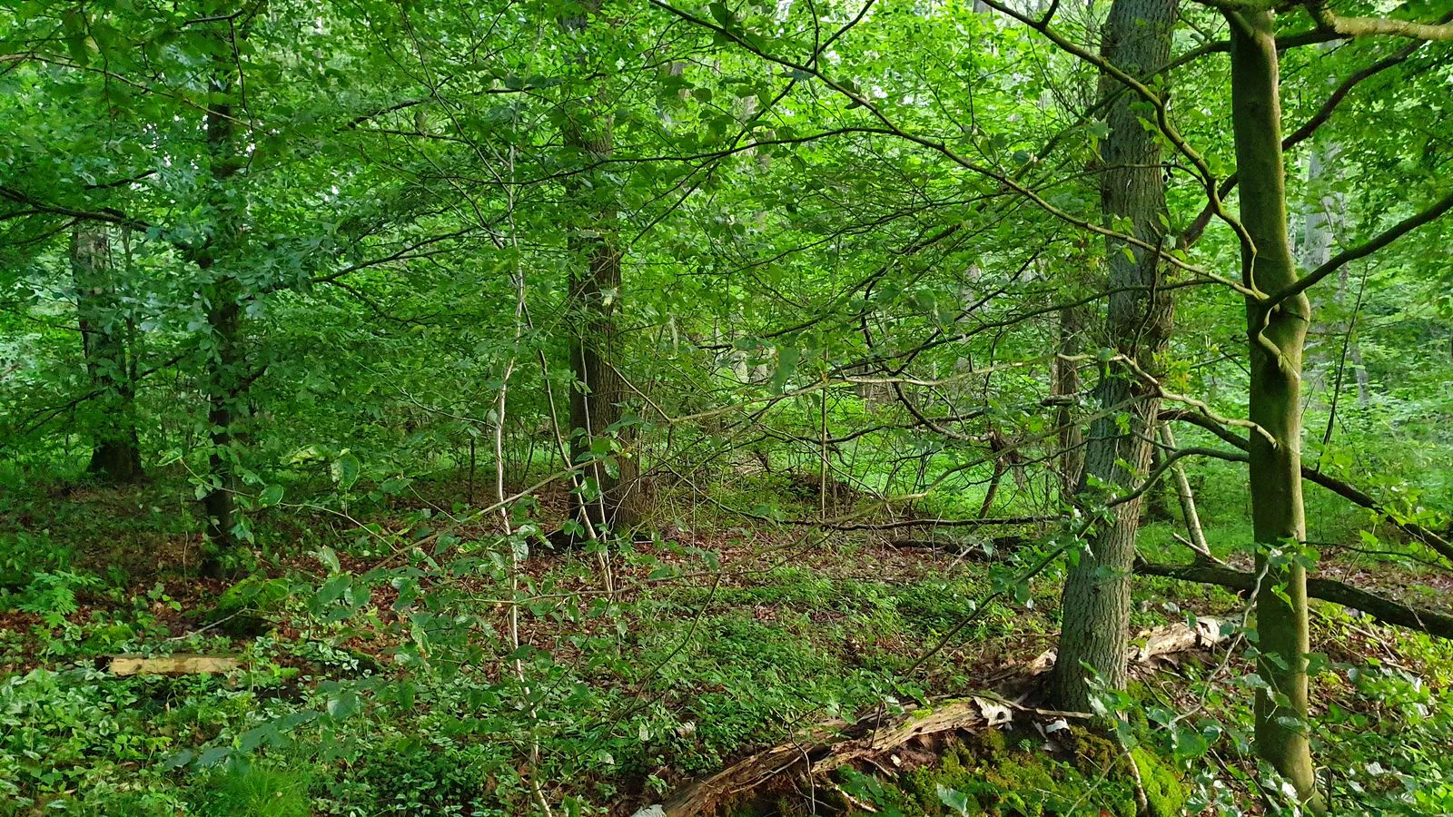
A dense, green deciduous forest interior with sunlight filtering through leaves and a forest floor covered in moss, low-lying greenery, and fallen branches.
A lush, green forest interior within the Stemmbruch nature reserve.

Stemmbruch history and protected-area timeline

Stemmbruch was formally placed under nature protection on October 17, 1989, when it was designated as the Naturschutzgebiet NSG LÜ 042. The reserve has been managed since then by the lower nature conservation authority of the Harburg district, with technical oversight from the Lower Saxony State Office for Water Management, Coastal Protection, and Nature Conservation (NLWKN). Designation came as part of a broader effort in Lower Saxony to secure surviving fragments of lowland bog and associated wetland habitat against drainage, agricultural conversion, and infrastructure expansion.

Stemmbruch landscape and geographic character

The landscape of Stemmbruch is shaped by the contrast between a dry sandy geest ridge and the wetter edge where it meets the Seeve floodplain. Elevations within the reserve range only from about 8 to 18 meters above sea level, but this small drop is enough to create the seepage zone that feeds the bog.

The terrain is gently undulating rather than dramatic. Bog pools, low moor heath, and patches of birch and alder swamp woodland give the surface its texture. To the north and east, the reserve is bounded by the corridors of major transport infrastructure, including the freight rail line connecting the Maschen marshalling yard with Buchholz in der Nordheide and the A 39 motorway, which passes through the northeastern corner of the protected area.

Stemmbruch ecosystems, habitats, and plant life

The habitat mosaic of Stemmbruch is typical of small lowland bogs in the North German plain. The reserve preserves three interlinked vegetation types: open bog pools (Moorkolke) where peat is exposed at the surface, areas of moor heath (Moorheide) shaped by acidic, nutrient-poor conditions, and fringes of birch and alder swamp woodland (Birken- und Erlenbruchwald) where the bog grades into wetter, more waterlogged ground.

The surrounding landscape protection area, Buchwedel und Umgebung, completely encloses the reserve and adds a wider buffer of protected countryside. Together, the two designations help to maintain the hydrological regime on which the bog depends, particularly the clean groundwater seepage at the edge of the geest ridge.

Stemmbruch wildlife and species highlights

The source material does not provide detailed species-level information about the fauna of Stemmbruch. As a small lowland hanging bog with bog pools, moor heath, and birch and alder swamp woodland, the reserve belongs to a habitat type that typically supports wetland-adapted invertebrates, amphibians associated with bog pools, and bird species typical of northern German bog and wet woodland mosaics, but specific records are not documented in the available content.

Stemmbruch conservation status and protection priorities

Stemmbruch is protected as a nature reserve (Naturschutzgebiet) under the code NSG LÜ 042, which is the formal legal category used in Germany for areas of high conservation value requiring active protection. It is classified at the international level as IUCN Category IV, a Habitat/Species Management Area, reflecting its role in conserving a specific habitat type rather than a broad natural system.

The reserve is fully surrounded by the Buchwedel und Umgebung landscape protection area, which limits damaging land use changes in the immediate surroundings and helps to maintain the hydrological conditions that sustain the bog. Responsibility for the site lies with the lower nature conservation authority of the Harburg district, with the NLWKN providing technical support. Its location between a major freight rail line and the A 39 motorway makes the protected area a particularly important refuge of bog habitat within a heavily used transport corridor.

Top sights and standout views in Stemmbruch

The most distinctive feature of Stemmbruch is its hanging spring bog perched on the edge of a geest ridge above the Seeve floodplain. The combination of bog pools, moor heath, and birch and alder swamp woodland within a compact 56-hectare site, fully surrounded by the Buchwedel und Umgebung landscape protection area, gives the reserve a coherent and well-buffered ecological identity despite the heavy transport infrastructure that frames it.

Best time to visit Stemmbruch

The source material does not provide specific seasonal guidance for visiting Stemmbruch. As a bog nature reserve with bog pools, moor heath, and swamp woodland, the site is primarily of interest for ecological and conservation reasons rather than scenic tourism, and typical visitation patterns for small protected wetland sites in northern Germany would favor the milder months when wet ground is easier to traverse and bog vegetation is most active, but this is general context rather than documented guidance.

Monthly climate preview

Long-term representative measurements showing monthly temperature and precipitation patterns

Stemmbruch Climate Normals, Annual Temperature and Precipitation Rhythm

Stemmbruch exhibits a measured annual temperature range from sub-zero winter minimums to warm summer maximums alongside steady year-round precipitation. Reviewing the complete monthly climate profile reveals detailed temperature averages and precipitation metrics across all twelve periods.
Annual mean9 °C
1 °C18 °C
Jan
Feb
Mar
Apr
May13°
Jun16°
Jul18°
Aug18°
Sep14°
Oct
Nov
Dec
Warmest month
July

18 °C

Coolest month
January

0.5 °C

Wettest month
July

2.6 mm/day

Driest month
April

1.4 mm/day

Park location guide

Geography guide, regional context, and park location map for Stemmbruch

Stemmbruch park geography, regions, and map view in Germany

Understand where Stemmbruch sits in Germany through a broader geographic reading of the surrounding landscape, nearby location context, and its mapped position within the national park landscape.

How Stemmbruch fits into Germany

Germany is a federal republic in Western and Central Europe with a population of over 83 million across sixteen constituent states. It is Europe's largest economy by nominal GDP and a major global exporter and importer. The capital is Berlin, and the country borders Denmark, Poland, Czech Republic, Austria, Switzerland, France, Luxembourg, Belgium, and the Netherlands.

Wider geography shaping Stemmbruch in Germany

Germany is located in Western and Central Europe, spanning 357,022 km². It borders Denmark to the north, Poland and the Czech Republic to the east, Austria and Switzerland to the south, and France, Luxembourg, Belgium, and the Netherlands to the west. The country has coastlines on the Baltic Sea and North Sea to the north, with the Alps located in the southern region.

Map view of Stemmbruch

Use this park location map to pinpoint Stemmbruch in Germany, understand its exact geographic position, and read its mapped placement within the surrounding landscape more clearly.

Pigeon | © OpenStreetMap contributors

Location context for Stemmbruch

Lower Saxony
Recorded earthquake history

Examine the Documented Earthquake History Associated with Stemmbruch

MoriAtlas provides a curated, historical record of seismic events detected in the vicinity of Stemmbruch. Consult this detailed catalogue to analyze documented earthquake occurrences, magnitude trends, and geographic epicentre distributions near this protected wetland area.

Stemmbruch Earthquake History

Catalogued events

1 event

Strongest magnitude

Magnitude 3.8

Most recent event

Jun 2, 1977

This history includes earthquakes recorded inside the park or within 50 km of its borders

Explore protected habitat views, hanging spring bogs, and swamp woodland terrain.

Stemmbruch Photos and Landscape Scenery: Visualizing Northern Germany Lowland Bogs

Visual records capture the distinctive terrain, bog pools, and moor heath defining the Stemmbruch nature reserve in Lower Saxony. Examining these protected area views reveals the ecological structure and habitat mosaic of a compact lowland wetland environment.

A dense, green deciduous forest interior with sunlight filtering through leaves and a forest floor covered in moss, low-lying greenery, and fallen branches.

Park atlas

Compare nearby lowland bogs, protected wetlands, and regional nature reserves

Parks Near Stemmbruch and Related Protected Areas in the Surrounding Region

Visitors exploring Stemmbruch can continue their geographic review by browsing adjacent protected areas and regional lowland nature reserves. Examining these neighboring conservation zones provides a broader understanding of the local wetland habitats and river floodplains.
Nature reserveHamburg
About 8.2 km away#1 closest

East

Zollenspieker Nature Reserve: Geographic Overview and Protected Riverine Landscapes

Tidal Elbe floodplain and inland brack wetland ecology

Located in the Hamburg borough of Bergedorf, Zollenspieker protects a significant stretch of the tidal Elbe. This nature reserve contains approximately 80 hectares of diverse terrain, from freshwater mudflats exposed at low tide to sheltered oak-dominated forests and old brack wetlands known as Carlsbrack and Riepenburger Brack.

Area
0.8 km²
Established
1988
IUCN
IV
Relief
Lowland
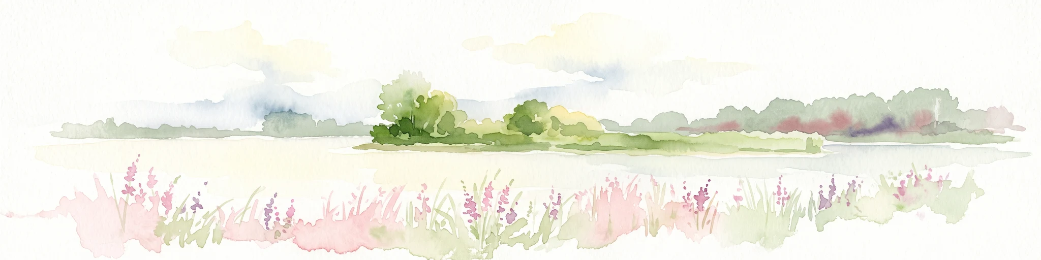
A watercolor painting showing a panoramic view of a calm river with a small, vegetated island in the center and pink wildflowers in the foreground.
Nature reserveHamburg
About 10 km away#2 closest

North

Schweenssand Nature Reserve: Protected Elbe Floodplain Geography in Hamburg Germany

Tidal freshwater wetlands, reedbeds, and riverine forest mosaics

Spanning 35 hectares along the Süderelbe, Schweenssand acts as a vital protected area within the Hamburg city boundary. Its geography consists of freshwater tidal flats, mudflats, and ancient-looking floodplain forests that are continuously shaped by the Elbe river tide. This site offers a clear view into the ecological complexity of urban-fringe river landscapes and European Natura 2000 protected zones.

Area
0.4 km²
Established
1993
IUCN
IV
Relief
Lowland
Nature reserveLandkreis Harburg
16 km away#3 closest

Northwest

Wulmstorfer Heide mit Bornberg: Protected Nature Reserve and Glacial Landscape Map

Regional geography and habitat network in Landkreis Harburg, Lower Saxony

This protected area features a unique mosaic of dry heath, nutrient-poor grassland, and mature broadleaf woodland. Located near the Hamburg border, it provides an essential habitat refuge within the Harburger Berge, characterized by sandy glacial soils and former military training terrain that supports specialized reptiles, amphibians, and bird species.

Area
2.72 km²
Established
2024
IUCN
IV
Relief
Upland
Nature reserveLower Saxony
About 17 km away#4 closest

Southeast

Wittsaal Nature Reserve: Mapped Wetland Geography and Protected Landscape in Lower Saxony

A rare mosaic of moor ponds and swamp woodland

Wittsaal is a specialized nature reserve in the Lüneburg region of Lower Saxony, Germany. The area protects a peat-cut moor pond currently undergoing natural silting, surrounded by willow-dominated swamp woodland, reedbeds, and sedge marshes. This compact site provides a critical, quiet refuge for wetland ecology within a wider landscape of agricultural fields and transitional glacial terrain.

Area
0.13 km²
Established
1985
IUCN
IV
Relief
Lowland
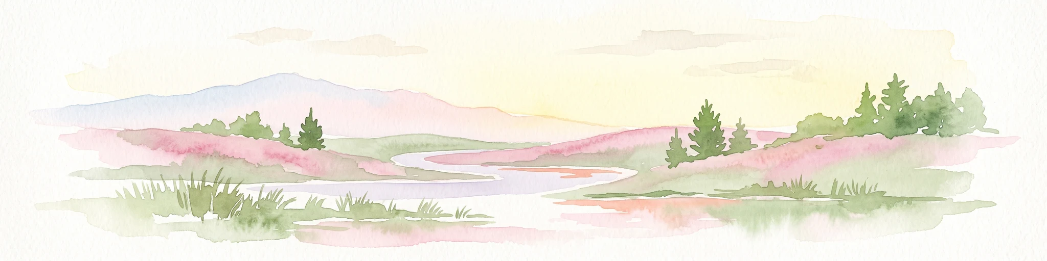
A horizontal watercolor painting depicting a rolling heathland landscape with purple heather, evergreen trees, and a central water feature under a soft sky.
Protected landscapeLower Saxony
About 24 km away#5 closest

South

Naturpark Lüneburger Heide: Protected Landscape Map and Regional Geography

An expansive cultural landscape in northern Lower Saxony

Spanning over 1,000 square kilometers, Naturpark Lüneburger Heide preserves the largest contiguous inland heathlands in Central Europe. Use this atlas resource to understand the park's glacial terrain, including karst sinkholes and natural springs, as well as its status as a model region for sustainable conservation and traditional land management practices.

Area
1,097.85 km²
Established
1922
IUCN
V
Relief
Lowland
Nature reserveLower Saxony
About 25 km away#6 closest

Southeast

Streitmoor Nature Reserve Geography and Mapped Protected Land in Lower Saxony

A study in compact bog and wetland succession

Streitmoor provides a detailed look at a terrestrialized pond moor within the Lüneburg district. The site contains a layered sequence of peat mosses, cottongrass, and woodland, mapping the natural transition between open bog basins and dry forest margins in northwestern Germany.

Area
0.13 km²
Established
1972
IUCN
IV
Relief
Lowland
Nature reserveLandkreis Rotenburg (Wümme)
34 km away#7 closest

Southwest

Wümmeniederung mit Rodau, Wiedau und Trochelbach: Protected Wetland and Heath Landscape

Regional geography and floodplain connectivity in Landkreis Rotenburg

This nature reserve protects a sprawling lowland landscape characterized by the Wümme, Rodau, Wiedau, and Trochelbach rivers. The terrain features a mosaic of near-natural meandering streams, species-rich wet meadows, and rare raised bog remnants, providing a comprehensive overview of northern German lowland ecology.

Area
28.96 km²
Established
2020
IUCN
IV
Relief
Lowland
Nature reserveLandkreis Stade
About 35 km away#8 closest

West

Steinbeckforst Nature Reserve: Geography and Protected Area Context in Landkreis Stade

Ancient beech forests and lowland brook valley landscapes.

Steinbeckforst serves as a critical nature reserve in Lower Saxony, characterized by century-old beech stands and sandy ground moraine topography. This geographic profile examines how the forest and Steinbeck brook valley function as a protected habitat corridor within the wider district of Stade.

Area
0.7 km²
Established
2018
IUCN
IV

Common questions about visiting, size, designation, and location context for Stemmbruch

Stemmbruch FAQs for park facts, access, geography, and protected area context

Find quick answers about Stemmbruch, including protected-area facts, park geography, trail and visitor context, and how the park fits into its surrounding country and regional landscape.
MoriAtlas Explorer

Continue Your Protected Areas Search Across the Global Atlas

Deepen your exploration by continuing the structured search for national parks and protected areas worldwide. Utilize the comprehensive filtering capabilities to compare different conservation landscapes and refine your understanding of global park geography. Discover more about the distribution and characteristics of protected natural areas.

Global natural geography