
Peaks
Park geography
Analyzing the regional geography, mountain terrain, and protected landscape extent
Detailed Geographic Profile and Mapped Boundaries of Suchedniowsko-Oblęgorski Park Krajobrazowy
This geographic profile examines the 198.95 square kilometer extent of Suchedniowsko-Oblęgorski Park Krajobrazowy in the Świętokrzyskie Voivodeship. It highlights the park terrain with a maximum elevation of 449 meters, documenting the distribution of forest habitats, mountain peaks, and distinct geological features situated within its protected boundaries.
Related tags
landscape parkŚwiętokrzyskiecentral Polandprotected forestforests
A forested Świętokrzyskie landscape park preserving ancient woodlands, old industrial heritage, and the sources of several regional rivers.
Suchedniowsko-Oblęgorski Landscape Park
Suchedniowsko-Oblęgorski Landscape Park is a protected landscape area in the Świętokrzyskie Voivodeship of central southern Poland. It covers the western part of the Suchedniowski Plateau, the Kołomańskie and Tumlińskie hills, and the Oblęgorskie Range, whose highest summit, Siniewska Góra, rises to roughly 449 meters above sea level. The park was created in 1988 to safeguard the natural and cultural remnants of the historic Staropolskie Industrial District, an early center of iron and non-ferrous metal smelting. Forests dominate about 91 percent of its territory, growing on fertile soils that support rare native stands of Polish larch. The area is also a regional hydrographic node, hosting the headwaters of the Krasna, Bobrza, and Kamionka rivers. Within and around the park lie several strict nature reserves protecting the most valuable forest fragments, while the broader landscape holds monuments such as the celebrated Bart Oak in Zagnańsk and the sandstone outcrop known as Ciosowa. Industrial-archaeological sites, old ironworking ruins, and the former manor estate at Oblęgorek, associated with the Nobel laureate Henryk Sienkiewicz, give the park a layered cultural character that complements its ecological importance.
- Location
- Poland
- Park type
- Protected landscape
- Established
- 1988
- Area
- 199 km²
- Highest point
- 449 m
Location overview
Administrative memberships across Poland and Świętokrzyskie Voivodeship
Geographic Setting and Regional Location of Suchedniowsko-Oblęgorski Park Krajobrazowy
Suchedniowsko-Oblęgorski Park Krajobrazowy is located within Poland and Świętokrzyskie Voivodeship. Recorded administrative memberships establish the baseline location data for this protected area.
- Countries
- Poland
- Regions
- Świętokrzyskie Voivodeship
- Primary location
- Świętokrzyskie Voivodeship
- Geographic setting
- Inland
Boundary and coordinates
A 198.95 km² outline with spatial context
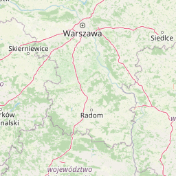
Suchedniowsko-Oblęgorski Park Krajobrazowy mapped boundary and area
Stored boundary geometry maps Suchedniowsko-Oblęgorski Park Krajobrazowy and situates its 198.95 km² protected extent. The database provides one total area, without separate land or marine figures and without a perimeter value.
- Boundary area
- 199 km²
- Boundary perimeter
- 121.9 km
- Northernmost point
- 51.1024° N
- Southernmost point
- 50.9537° N
- Easternmost point
- 20.8366° E
- Westernmost point
- 20.3605° E
- Geographic centre
- 51.0358° N, 20.6602° E
- North–south span
- 16.5 km
- East–west span
- 33.4 km
Elevation and terrain
Explore recorded mountain terrain data and verified natural features.
Suchedniowsko-Oblęgorski Park Krajobrazowy Terrain and Elevation Summary
Examine the recorded elevation summary and highest points mapped within this protected area. Review detailed cards covering peaks, streams, and caves located across the regional terrain.
- Maximum elevation
- 449 m
- Highest point
- 449 m
Selected named natural features
Cave entrances
Rajska Brama
Peaks
Kamienna Góra
349 m
Peaks
Świnia Góra
390.1 m
Streams
Kuźniczka
Peaks
Osieczyńska
407 m
Environmental setting
Temperate forest cover, mountain relief, and habitat classifications across the park landscape
Environmental Classifications and Physical Setting of Suchedniowsko-Oblęgorski Park Krajobrazowy
Recorded classifications combine forest cover, temperate climate zones, and mountain relief as complementary metrics for the physical setting. Connected atlas categories link these recorded environmental attributes to related protected areas.
- Relief
- Mountain
- Climate
- Temperate
- Water
- Minor water
- Forest cover
- Dense forest cover
- Seasonality
- Year-round
Landscape features
Mountains · Hills · Forest · Rivers
Habitat types
Temperate broadleaf forest · Temperate coniferous forest · Montane forest · Riverine habitat
Park atlas
Compare adjacent plateau terrain and woodland reserves across central southern Poland
Other Parks Near Suchedniowsko-Oblęgorski Park Krajobrazowy and Surrounding Protected Landscapes
Browsing nearby protected areas allows visitors to evaluate similar plateau topography, forest ecosystems, and regional river headwaters found around Suchedniowsko-Oblęgorski Park Krajobrazowy. Expanding the geographic comparison provides a clearer picture of the wider Świętokrzyskie natural and industrial heritage landscape.

National parkŚwiętokrzyskie Voivodeship
4.6 km away#1 closest
Southeast

Świętokrzyski National Park: Protected Mountain Terrain in Świętokrzyskie Voivodeship
Geography and landscape mapping for Poland's oldest mountain range
Świętokrzyski National Park encompasses the highest ridges of the Świętokrzyskie Mountains, showcasing a landscape defined by expansive granite boulder fields and primeval fir forests. This atlas entry provides a detailed look at the park's topography, ranging from the prominent Łysica peak to the protected valley floors, highlighting the geological and biological diversity preserved within this central Polish sanctuary.
- Area
- 76.26 km²
- Established
- 1950
- IUCN
- II
- Visitors
- 168K annual

National parkŚwiętokrzyskie Voivodeship
4.6 km away#2 closest
Southeast
Świętokrzyski Park Narodowy: Protected Forests and Mountain Geography in Central Poland
A preserved landscape of ancient fir forests and rubble fields
Situated within the Świętokrzyskie Voivodeship, this protected area guards the Łysogóry range and its rare forest associations. The landscape is characterized by its dramatic gołoborza rubble fields and dense mixed-woodland terrain, providing a unique look into the natural geography of the region.
- Area
- 76.26 km²
- Established
- 1950
- Visitors
- 168K annual
- Relief
- Mountain
Nature reserveświętokrzyskie
8 km away#3 closest
South
Ostoja Wierzejska Nature Reserve: Protected Forest and Ridge Geography in Świętokrzyskie
Ecological corridors and rare fir forest habitat mapping
Uncover the landscape characteristics of Ostoja Wierzejska, a protected area in Poland featuring quartzite ridges and diverse forest ecosystems. The reserve acts as a crucial ecological link within the Masłowskie Range, sheltering mature tree stands, rare fungi, and specialized invertebrates that define the unique phytosociology of the Świętokrzyskie Mountains.
- Area
- 2.25 km²
- Established
- 2011
- Relief
- Mountain
- Climate
- Temperate
Protected landscapeŚwiętokrzyskie Voivodeship
8.3 km away#4 closest
Southwest
Chęcińsko-Kielecki Park Krajobrazowy: Protected Landscapes and Geological Atlas
Geographical overview of the Świętokrzyskie foothills in Poland
Located in the Świętokrzyskie Voivodeship, this protected area features a unique concentration of rocky hill summits, limestone caves, and forested corridors. The landscape serves as a vital transition zone, linking the regional capital of Kielce with traditional agricultural valleys and historic cultural landmarks. Map the terrain and understand the protected features that define this significant Polish landscape park.
- Area
- 197.816 km²
- Established
- 1996
- Relief
- Upland
- Climate
- Temperate
Nature reserveŚwiętokrzyskie Voivodeship
About 10 km away#5 closest
Southwest
Rezerwat przyrody Moczydło Nature Reserve: Geological and Mining Landscape in Poland
Documenting protected limestone ridges and mining heritage
This protected area safeguards a distinct 317-meter limestone hill that preserves both ancient mining remnants and rare xerothermic grasslands. Located within the Chęcińsko-Kielecki Landscape Park, the site provides a concentrated view of the regional geological identity and industrial past of the Holy Cross Mountains, documented here through its specific mapped boundaries and natural terrain features.
- Area
- 0.164 km²
- Established
- 1995
- Relief
- Mountain
- Scope
- Terrestrial
Protected areaŚwiętokrzyskie Voivodeship
15 km away#6 closest
East
Wzgórza Kunowskie: Geographic Atlas of an Essential Polish Protected Area and Habitat Mosaic
Mapping riparian forests and inland dunes in Świętokrzyskie
Wzgórza Kunowskie serves as a crucial Natura 2000 site in Poland, blending sand grasslands, oak-hornbeam forests, and riverine floodplains within a compact landscape. This overview analyzes the topographical gradients and habitat distribution that define the area, from elevated dunes to the moisture-rich valley floors of the Świętokrzyskie region, reflecting the interplay between sandy substrate and river regulation.
- Area
- 18.687 km²
- Water
- Major water bodies
Nature reserveświętokrzyskie
About 16 km away#7 closest
Southwest
Rezerwat przyrody Milechowy: Protected Nature Reserve and Karst Landscape Atlas
Exploration of forested ridges and rocky karst terrain in świętokrzyskie, Poland
Rezerwat przyrody Milechowy is a significant nature reserve located in the świętokrzyskie voivodeship, home to diverse ecological habitats ranging from dense woodland ridges to exposed rocky slopes. The area is defined by its karst landscape, featuring multiple caves and rock shelters, alongside rare xerothermic vegetation that flourishes in the warm, sun-exposed terrain of the Holy Cross Mountains region.
- Area
- 1.323 km²
- Established
- 1978
- Relief
- Upland
- Climate
- Temperate
Protected landscapeŚwiętokrzyskie Voivodeship
21 km away#8 closest
Southeast
Cisowsko-Orłowiński Park Krajobrazowy: Protected Landscape and Geological Atlas
Mapping biodiversity and Paleozoic formations in Świętokrzyskie, Poland
Cisowsko-Orłowiński Park Krajobrazowy stands as a center for biodiversity in southeastern Poland, protecting rare peat-bog forests and 200-year-old tree stands. This atlas profile highlights the park's distinct geological character, from the volcanic rock exposures at Sieraków to the fossil-rich sandstone cliffs at Zalesie, offering insight into the complex mosaic of the Góry Świętokrzyskie foothills.
- Area
- 206.93 km²
- Established
- 1988
- Relief
- Mountain
- Climate
- Temperate
MoriAtlas Explorer
Discover the Landscape Geography of Suchedniowsko-Oblęgorski Park Krajobrazowy
Continue your geographic exploration by examining the terrain, river systems, and protected forest boundaries of this notable Polish landscape. MoriAtlas provides a focused look at the unique environmental and historical layers that define the Suchedniowsko-Oblęgorski Park Krajobrazowy within the broader Świętokrzyskie region.
Browse next
Global natural geography
Explore related park routes
Explore MoriAtlas Global ParksBrowse All MoriAtlas ParksGlobal Park Map DiscoveryMoriAtlas: Browse All CountriesBrowse All MoriAtlas ContinentsNational Park Environment AtlasGrand Canyon National Park AtlasYellowstone National Park AtlasYosemite National Park Atlas and GeographySerengeti National Park AtlasGalápagos National Park Protected LandscapeBanff National Park Geography and AtlasKruger National Park Atlas EntryUluṟu-Kata Tjuṯa National Park AtlasExplore Uluru-Kata Tjuta National Park GeographyPlitvice Lakes National Park AtlasFiordland National Park Protected LandscapeGreat Smoky Mountains National Park AtlasAfghanistan National Parks and Protected AreasAlbania National Parks and Protected AreasAlgeria National Parks and Protected AreasAmerican Samoa National Parks and Protected AreasAndorra National Parks and Protected AreasAngola National Parks and Protected AreasAntarctica National Parks and Protected AreasAntigua and Barbuda Park List