Mori Atlas logo
Protected areaTaldykol

Mapping the ecological boundaries and riparian features of a significant migratory bird habitat

Taldykol Protected Area and the Steppe Wetland Landscapes of Northern Kazakhstan's Kostanay Region

Taldykol serves as a central component of the Kulykol-Taldykol lake system in northern Kazakhstan, where it functions as a primary freshwater basin within an otherwise arid steppe environment. This protected landscape is characterized by its gentle topography, a central island, and riparian vegetation that provides crucial nesting and molting grounds for migratory waterfowl. The area sits within the broader Kostanay Region, offering a distinct example of how isolated wetland systems support continental biodiversity through specialized geographic conditions.

freshwater lakesteppe lakeKazakh wetlandsRamsar siteinternational wetlandwaterfowl habitat

Taldykol

Protected area

Park overview

Structured park overview, official facts, and landscape profile for Taldykol Lake

Taldykol Lake park facts, protected area profile, and essential visitor context

Review the core facts for Taldykol Lake, including designation, size, terrain, visitor scale, habitats, and operating context in one park-focused overview.

About Taldykol Lake

Taldykol is a natural freshwater lake in the Kamysty District of Kostanay Oblast, in the northern part of Kazakhstan, where flat steppe terrain is interrupted by scattered lakes and wetland depressions. Situated near the village of Taldykol, the lake occupies a broad basin on the open plain, with dimensions of roughly 3.9 by 3.8 kilometers and a surface area of about 10.5 square kilometers. Despite the generally dry landscape that surrounds it, Taldykol retains freshwater status, and a small island breaks up the otherwise open expanse of water in its interior.

The lake is the most prominent feature of the Kulykol-Taldykol lake system, a regionally connected group of steppe waterbodies that function together as a single ecological unit. Its Kazakh name, Taldykol or Taldyköl, translates roughly as "willow lake," reflecting the willow growth and other riparian vegetation that take hold along parts of its shoreline. This vegetation, set against the surrounding steppe, creates a distinctive habitat contrast that supports a wide range of aquatic and semi-aquatic life.

Ecology is the defining dimension of Taldykol's significance. The lake and its surrounding wetlands function as a critically important site for waterbirds, serving as a nesting area, a staging point during migration, and a place where birds gather to molt outside the breeding season. These seasonal concentrations of waterfowl and other wetland-dependent species are what led, in 2009, to the inclusion of the Kulykol-Taldykol system in the Ramsar List of Wetlands of International Importance, placing Taldykol in a global network of sites recognized for their outstanding wetland values. In this sense, Taldykol is not only a notable Kazakh lake in its own right but also a meaningful node in the broader international system that protects migratory waterbird habitats across continents.

Quick facts and research context for Taldykol Lake

Taldykol is a freshwater steppe lake located in Kamysty District, Kostanay Oblast, in northern Kazakhstan, near the village of Taldykol. Its surface area is approximately 10.5 square kilometers, and the lake measures about 3.9 kilometers at its longest point and 3.8 kilometers at its widest, with a shoreline extending roughly 13 kilometers. A small island sits near the middle of the lake.

The lake is part of the Kulykol-Taldykol lake system, a regionally connected network of waterbodies that supports large concentrations of waterfowl and wetland birds. This system was added to the Ramsar List of Wetlands of International Importance in 2009, recognizing Taldykol for its importance to breeding, migration, and molting waterbird populations.

Protection and recognition

Documented designation records and management scope for Taldykol

Taldykol Protection Status and Terrestrial Conservation History

Taldykol maintains a recorded terrestrial protection status established in two thousand nine. Official records outline the baseline designation history and administrative scope without imported international recognition sources.

Protection details

Protection scope
Terrestrial
Designated year
2009
Park context

Deeper park guide and search-rich context for Taldykol Lake

Taldykol Lake history, landscape, wildlife, and travel context

Explore Taldykol Lake through its history, landscape character, ecosystems, wildlife, conservation priorities, cultural context, and seasonal travel timing in a structured park guide built for atlas discovery and search intent.

Why Taldykol Lake stands out

Taldykol is best known as a key component of the Kulykol-Taldykol lake system, a Ramsar-listed wetland of international importance in the steppe landscapes of northern Kazakhstan. The lake serves as a major nesting, migratory stopover, and molting ground for waterfowl and other waterbirds, drawing significant seasonal concentrations to its open-water and shoreline habitats. The combination of its freshwater character, central island, and surrounding willow-influenced vegetation, suggested by the lake's Kazakh name, makes Taldykol a representative example of the productive yet fragile steppe wetlands that punctuate the dry interior of Kazakhstan. Its recognition under the Ramsar Convention underlines how a relatively modest steppe lake can hold disproportionate ecological value for continental-scale bird migration.

Taldykol Lake history and protected-area timeline

The lake's history as a recognized site is closely tied to the growing international attention paid to Central Asian wetlands in the post-Soviet era. While the lake itself is a long-standing natural feature of the Kamysty District steppe, its ecological significance moved into formal international focus in 2009, when the Kulykol-Taldykol lake system, in which Taldykol is the central waterbody, was inscribed on the List of Wetlands of International Importance under the Ramsar Convention.

This designation reflected scientific recognition that even relatively small steppe lakes in northern Kazakhstan can play an outsized role in supporting migratory and breeding waterbird populations across the wider region. The Ramsar listing effectively marks the most clearly documented milestone in Taldykol's modern institutional history, framing the lake today as both a local natural landmark near the village of Taldykol and a component of a globally monitored wetland system.

Taldykol Lake landscape and geographic character

Taldykol lies in a landscape of wide, open steppe characteristic of northern Kazakhstan, where the terrain is predominantly flat or gently undulating, and where lakes often appear as sudden interruptions in an otherwise continuous dryland environment. With a diameter of roughly four kilometers, Taldykol reads as a substantial oval of water within this setting, bounded by a shoreline that runs for approximately 13 kilometers around its perimeter.

The lake's interior features a small island near its center, breaking the open water and providing an important habitat structure for breeding and roosting birds. Along the margins, willow growth and other riparian vegetation, reflected in the lake's Kazakh name, soften the transition between water and steppe. The surrounding land rises only modestly above the lake at about 249 meters above sea level, leaving the lake exposed to the wide skies and continental climate that define this part of Kazakhstan.

Taldykol Lake ecosystems, habitats, and plant life

The vegetation mosaic around Taldykol is shaped by the contrast between open steppe and a lake-influenced wetland fringe. The lake's shoreline supports willow and other woody riparian plants that can establish themselves where groundwater is accessible, creating narrow bands of green amid the surrounding grasslands. These riparian strips, together with emergent and submerged aquatic vegetation within the lake itself, form the ecological backbone that supports the lake's high wildlife values.

Beyond the immediate shoreline, the wider setting is dominated by dry steppe vegetation, giving the lake's hydrophytic plant communities a particularly important ecological role. Taldykol's freshwater character allows for the development of relatively diverse wetland plant life compared with many of the saline lakes found elsewhere in the Kazakh steppe, and this diversity directly underpins the lake's capacity to sustain large numbers of waterbirds across the seasons.

Taldykol Lake wildlife and species highlights

Taldykol's wildlife profile is dominated by its importance for waterbirds, which use the lake throughout much of the annual cycle. During the breeding season, the lake and its central island provide nesting habitat for waterfowl and other wetland-dependent species, while during migration the open water, shoreline shallows, and fringing vegetation serve as staging areas where birds rest and feed in large numbers. Outside the breeding season, the lake also acts as a molting site, when birds shed and renew their flight feathers and rely on safe open-water habitats to complete this vulnerable process.

These seasonal uses combine to make Taldykol a significant node for waterfowl along the broader Central Asian flyway. The concentrations the lake supports, when viewed together with the neighboring lakes of the Kulykol-Taldykol system, are large enough to have qualified the area as a wetland of international importance under the Ramsar Convention, underscoring that Taldykol's wildlife significance extends well beyond the local district into a larger continental conservation context.

Taldykol Lake conservation status and protection priorities

Taldykol's principal conservation significance is bound up with the Kulykol-Taldykol lake system and its 2009 listing under the Ramsar Convention as a wetland of international importance. The Ramsar designation recognizes the system for its outstanding values as a habitat for waterbirds, particularly in supporting nesting, migration, and molting, three life-cycle phases in which secure, productive wetlands are essential.

By belonging to a Ramsar-listed system, Taldykol sits within a global conservation framework that obligates attention to the maintenance of its ecological character. The lake's freshwater status, combined with its central island and willow-fringed shoreline, gives it a conservation profile distinct from many saltier and more uniform steppe lakes in the region, making it an important reference site for understanding how productive steppe wetlands can be protected through international recognition as well as through local stewardship.

Taldykol Lake cultural meaning and human context

The lake's name, Taldykol or Taldyköl in Kazakh, translates roughly as "willow lake," and offers a small but meaningful window into the local cultural perception of the landscape. In Kazakh, the use of descriptive waterbody names tied to vegetation or landform features is common, and such names often encode generations of observation about where reliable water and useful plant growth occur across the steppe.

The village of Taldykol, located near the lake, takes its name directly from the waterbody, anchoring the lake as a local identity marker for the surrounding rural community. While there is little documented cultural tradition specific to Taldykol Lake itself, its presence clearly shapes the geographic and everyday reference points of the district's inhabitants.

Top sights and standout views in Taldykol Lake

Taldykol stands out for being a freshwater lake with a central island set within a wider, largely dry steppe landscape, creating a sharp ecological contrast that drives its high wildlife values. Its Kazakh name, meaning essentially "willow lake," hints at the riparian vegetation that gives its margins their distinctive character.

Equally important is Taldykol's place within the Kulykol-Taldykol lake system, a Ramsar-listed wetland of international importance since 2009, recognized specifically for its role in supporting waterbird nesting, migration, and molting. The combination of a relatively modest surface area with outsized ecological importance is one of Taldykol's defining features.

Best time to visit Taldykol Lake

The character of a visit to Taldykol is shaped strongly by the seasons of the Central Asian steppe. Spring brings the arrival of migratory waterfowl and the start of the breeding cycle, when bird activity around the lake's shoreline and central island is most intense. Summer, with warm temperatures and long daylight hours, offers the fullest experience of the lake's open-water and riparian habitats, though steppe conditions can be hot and exposed.

Autumn corresponds with the southward migration period, when the lake once again hosts large numbers of waterbirds staging before continuing their journey, while winter transforms the surrounding steppe into a cold, often snow-covered landscape. For visitors primarily interested in the lake's birdlife and wetland character, the spring and autumn migration periods tend to be the most rewarding seasons, while those drawn to the broader steppe atmosphere may favor the calm and openness of the warmer months.

Monthly climate preview

Track multi-year temperature ranges and precipitation patterns across the year

Taldykol Climate Normals and Long-Term Monthly Weather Profiles

Historical data records long-term average temperatures ranging from severe winter lows to warm summer peaks alongside measured monthly precipitation levels at representative coordinates. Opening the full climate profile provides detailed twelve-month breakdowns for comprehensive environmental analysis.
Annual mean4 °C
-16 °C22 °C
Jan-16°
Feb-14°
Mar-6°
Apr
May15°
Jun21°
Jul22°
Aug21°
Sep13°
Oct
Nov-5°
Dec-13°
Warmest month
July

22.3 °C

Coolest month
January

-15.9 °C

Wettest month
May

1.2 mm/day

Driest month
January

0.6 mm/day

Park location guide

Geography guide, regional context, and park location map for Taldykol Lake

Taldykol Lake park geography, regions, and map view in Kazakhstan

Understand where Taldykol Lake sits in Kazakhstan through a broader geographic reading of the surrounding landscape, nearby location context, and its mapped position within the national park landscape.

How Taldykol Lake fits into Kazakhstan

Kazakhstan is a Central Asian country spanning vast steppes and plains, bordered by Russia, China, Kyrgyzstan, Uzbekistan, and Turkmenistan, with a coastline along the Caspian Sea. It gained independence from the Soviet Union in 1991 and has a population of approximately 20.5 million people. The country is officially secular but predominantly Muslim, with Kazakh and Russian as official languages.

Wider geography shaping Taldykol Lake in Kazakhstan

Kazakhstan occupies a vast territory in Central Asia, extending into Eastern Europe. Its terrain consists largely of hilly plateaus and plains, with lowlands covering about a third of the area. The southern and eastern regions are mountainous. The country borders Russia to the north and west, China to the east, Kyrgyzstan to the southeast, Uzbekistan to the south, and Turkmenistan to the southwest. It has a coastline along the Caspian Sea.

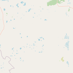
Map view of Taldykol Lake

Use this park location map to pinpoint Taldykol Lake in Kazakhstan, understand its exact geographic position, and read its mapped placement within the surrounding landscape more clearly.

Pigeon | © OpenStreetMap contributors

Location context for Taldykol Lake

Kostanay Region
Park atlas

Compare adjacent steppe habitats, regional waterbird reserves, and connected wetland ecosystems.

Explore Other Parks Near Taldykol and Surrounding Protected Wetland Landscapes

Browsing other protected areas near Taldykol reveals the wider ecological network of northern steppe wetlands and continental flyway habitats. Comparing these regional reserves offers deeper context into the shallow lakes and riparian zones shaping the surrounding geography.
Protected areaKostanay Region
About 7.7 km away#1 closest

West

Kulykol Protected Area: Mapping the Shallow Steppe Wetlands of Northern Kazakhstan

Geography of the Kostanay Region saline lake systems

Trace the landscape of Kulykol, a sprawling shallow-water ecosystem situated in the Kamysty District. This protected wetland, defined by its saline chemistry and expansive reed-lined margins, represents a core element of the Kulykol-Taldykol lake system. The data provides a detailed look at the lake's basin topography, its intermittent connection to surrounding water bodies, and its status as a managed habitat within the open grasslands of the Tobil basin.

Area
33 km²
Established
2009
Relief
Lowland
Water
Water-dominated
Wildlife reserveKostanay Region
About 232 km away#2 closest

North

Mikhaylovsky Zakaznik: Geographic Overview of the Kostanay Region Wildlife Reserve

A protected forest steppe sanctuary in northern Kazakhstan.

Mikhaylovsky Zakaznik acts as an enduring zoological refuge within the Kostanay Region, protecting a rich tapestry of woodland and meadow steppe environments. This reserve supports native ungulates and game birds by maintaining a stable, low-profile landscape of birch and pine groves that function as critical corridors for biodiversity across the borderlands.

Area
768 km²
Established
1967
Relief
Upland
Access
Access unknown
Protected areaKostanay Region
About 294 km away#3 closest

Northeast

Koibagar-Tyntyugur Lakes: Protected Wetland Geography in Northern Kazakhstan

Steppe-wetland mosaic and Ramsar-recognized migratory habitat

Located in the Kostanay Region, the Koibagar-Tyntyugur Lakes represent a complex system of shallow, interconnected basins. These protected landscapes illustrate the dramatic hydrological cycles of the Saryarka edge, shifting from open water to reed-filled marshes. The region remains a benchmark for conservation, featuring essential waterbird habitats and rare fragments of pristine feather-grass steppe.

Area
623.45 km²
Established
2005
Relief
Lowland
Scope
Terrestrial
Nature reserveKostanay Region
About 304 km away#4 closest

Southeast

Altyn Dala Nature Reserve: Mapping Steppe Biodiversity and Migratory Corridors in Kazakhstan

A comprehensive look at the three-cluster protected landscape and regional geography

Spanning over 489,000 hectares, Altyn Dala Nature Reserve preserves diverse habitats ranging from the Sarykopa lake system to the vast Uly-Zhylyanshyk semi-desert steppe. This detail page tracks the reserve's unique cluster structure, geographic boundaries, and essential role in maintaining the historical integrity of northern Kazakhstan's grassland and river corridor ecosystems.

Area
4,897.66 km²
Established
2012
IUCN
VI
Relief
Lowland
Nature reserveAktobe Region
About 375 km away#5 closest

South

Irgiz-Turgay Nature Reserve: Geographic Map and Protected Land Overview in Kazakhstan

Significant nature reserve within Aktobe Region featuring vast desert and river valley ecosystems.

Irgiz-Turgay Nature Reserve functions as a flagship protected territory for Kazakhstan, spanning vast semi-desert plains and the Turgay River valley. This geographic analysis highlights its role as a crucial sanctuary for steppe wildlife, detailing how its protected boundaries encompass unique wetland meadows, saltwort fields, and arid terrain within the broader northern desert zone.

Area
11,735.1 km²
Established
2007
IUCN
VI
Relief
Lowland
Watercolor painting of a lush green landscape featuring a flowing river, conifer trees, rolling hills, and a small waterfall on the right side.
National parkBashkortostan
About 414 km away#6 closest

Northwest

Bashkiriya National Park: Protected Karst Landscapes and Ural Mountain Geography

Southern Ural forest ecosystems and karst cave networks

Bashkiriya National Park protects over 900 square kilometers of mountainous terrain and river valleys in the Republic of Bashkortostan. The park serves as a prime example of the Southern Ural transition, featuring an intricate mix of karst sinkholes, surface streams, and mature broadleaf forests that support diverse temperate wildlife and avian communities.

Area
920 km²
Established
1986
IUCN
II
Visitors
30K annual
Watercolor painting showing a scenic landscape with mountains, a river, and trees
National parkBashkortostan
About 414 km away#7 closest

Northwest

Bashkiriya National Park: Mapping Karst Landscapes and Ural Forest Geography

Exploring protected terrain in the Bashkortostan region

Bashkiriya National Park anchors a critical conservation area along the southern Ural Mountains, characterized by its deep canyons, limestone grottoes, and vast subterranean cave networks. The park serves as a bridge for biodiversity at the continental edge, where river-carved valleys and dense taiga forests create a distinct, protected landscape for regional research and geographic study.

Area
920 km²
Established
1986
IUCN
II
Relief
Mixed relief
Watercolor illustration of a landscape with green hills, a body of water, and grassy foreground under a pink-hued sky
National parkAqmola Region
About 418 km away#8 closest

Northeast

Kokshetau National Park: A Protected Granite Mountain and Forest-Steppe Landscape in Kazakhstan

Explore Aqmola Region's unique protected geography and mapped terrain.

Kokshetau National Park stands as a remarkable protected landscape within Kazakhstan, defined by its ancient granite mountains and its unique position as a forest-steppe island surrounded by open plains. This national park preserves a rich tapestry of boreal forests, lake-filled depressions, and geological wonders, including some of the planet's most ancient rock formations. MoriAtlas provides a structured view of Kokshetau National Park, detailing its mapped boundaries and geographic context within the Aqmola Region, offering users a deep dive into its protected area identity and ecological significance.

Area
1,821 km²
Established
1996
IUCN
II
Relief
Upland

Common questions about visiting, size, designation, and location context for Taldykol Lake

Taldykol Lake FAQs for park facts, access, geography, and protected area context

Find quick answers about Taldykol Lake, including protected-area facts, park geography, trail and visitor context, and how the park fits into its surrounding country and regional landscape.
MoriAtlas Explorer

Continue Your Protected Areas Search Across the Global Atlas

Deepen your exploration by continuing the structured search for national parks and protected areas worldwide. Utilize the comprehensive filtering capabilities to compare different conservation landscapes and refine your understanding of global park geography. Discover more about the distribution and characteristics of protected natural areas.

Global natural geography