Why Tanbi Wetland Complex stands out
The Tanbi Wetland Complex is best known for its extensive mangrove forest ecosystem, one of the most significant coastal wetland systems in West Africa. The reserve serves as a critical habitat for over 360 bird species, including notable species such as Pel's fishing owl, brown-necked parrot, blue-bellied roller, and pygmy sunbird. The wetlands support significant populations of western reef egrets, black-winged stilts, various gull species, and terns, earning the site Important Bird Area status. The complex also provides crucial habitat for the western red colobus monkey, West African manatee, African clawless otter, and represents an important breeding area for the shrimp species Farfantepenaeus notialis. Its designation as a Ramsar site underscores its international importance as a coastal wetland ecosystem.
Tanbi Wetland Complex history and protected-area timeline
The Tanbi Wetland Complex was established as a protected national park in 2001, representing The Gambia's commitment to preserving its coastal wetland heritage. The designation came as recognition of the area's ecological significance and the critical ecosystem services the wetlands provide to the Banjul region. In February 2007, the complex received additional international recognition through its designation as a Ramsar site, joining the global network of wetlands of international importance under the Ramsar Convention. This dual designation as both a national park and a Ramsar site reflects the site's value for biodiversity conservation and its role in supporting sustainable human use. The wetland's importance has been further acknowledged through its designation as an Important Bird Area by BirdLife International, recognizing the significant bird populations it supports.
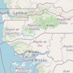
Tanbi Wetland Complex landscape and geographic character
The Tanbi Wetland Complex presents a distinctive coastal wetland landscape characterized by extensive mangrove forests dominating approximately 80 percent of its area. The terrain consists of a complex network of tidal creeks, locally known as bolongs, which meander through the mangrove stands and connect to broader tidal lagoons and estuarine mudflats. The northern portion of the complex skirts along Kankujeri Road and includes Cape Creek, while the reserve extends to encompass the western shores of St Mary Island before stretching southeast toward Lamin and Mandinari Village. As the habitat progresses westward and southward, the vegetation transitions from dense mangrove forest to bare tidal flats, saltmarsh, and dry woodland savanna. The landscape features occasional prominent individual trees, including baobab and Borassus aethiopum palms, standing on the relatively drier elevated ground within the wetland matrix. Agricultural land encroaches around the fringes of the complex, marking the boundary between the protected wetland system and surrounding land uses.
Tanbi Wetland Complex ecosystems, habitats, and plant life
The Tanbi Wetland Complex supports a rich and diverse ecological system centered on its extensive mangrove forest habitat. The mangroves are composed of multiple species including Avicennia africana, Conocarpus erectus, Laguncularia racemosa, Annona glabra, and various Rhizophora species, creating a layered and complex vegetative structure. This mangrove ecosystem serves as a highly productive habitat that supports numerous species throughout their life cycles. The vegetation gradually transitions westward and southward into bare tidal flats, saltmarsh communities, and dry woodland, creating a gradient of habitat types within the complex. The wetland system plays a crucial ecological role in nutrient cycling, sediment retention, and water purification, while providing critical habitat for both resident and migratory species. The tidal hydrology creates dynamic conditions that support high biological productivity and contribute to the overall ecological significance of the area.
Tanbi Wetland Complex wildlife and species highlights
The Tanbi Wetland Complex supports remarkable wildlife diversity across multiple taxonomic groups. The mammal population includes troops of western red colobus monkeys, along with the West African manatee, marsh mongoose, and African clawless otter. Reptile inhabitants include West African crocodiles alongside various snake and lizard species. The wetlands serve as an important breeding ground for the shrimp species Farfantepenaeus notialis, supporting local fisheries. The bird fauna is exceptionally diverse with over 360 species recorded, including notable residents such as Pel's fishing owls, brown-necked parrots, blue-bellied rollers, and pygmy sunbirds. During the northern winter, Palearctic migrants including ospreys and black-tailed godwits join the resident avifauna. The site has been designated an Important Bird Area due to its significant populations of western reef egrets, black-winged stilts, slender-billed gulls, grey-headed gulls, Caspian terns, and royal terns.
Tanbi Wetland Complex conservation status and protection priorities
The Tanbi Wetland Complex holds significant conservation value at both national and international levels, reflected in its dual designation as a national park and a Ramsar site. The wetland's designation as an Important Bird Area by BirdLife International recognizes its critical role in supporting significant populations of colonial waterbirds and migratory species. The complex provides essential ecosystem services, including coastal protection, flood mitigation, water filtration, and carbon sequestration, that benefit both wildlife and human communities in the Banjul region. However, the site faces considerable conservation challenges from climate change, with sea level rise posing a particular threat to the low-lying coastal wetland ecosystem. The 2022 IPCC Sixth Assessment Report identified Tanbi Wetland Complex among African natural heritage sites at risk from flooding and coastal erosion, highlighting the urgent need for climate adaptation measures to protect this valuable wetland system.
Tanbi Wetland Complex cultural meaning and human context
The Tanbi Wetland Complex exists within a landscape shaped by traditional human activities and local community practices. The surrounding areas and the wetland itself support livelihoods through shrimp fishing, market gardening, and rice cultivation, which represent important economic activities for local communities. A particularly notable traditional practice occurs during the dry season when women from the Jola ethnic group harvest oysters from the mangrove forests. These women forage for, roast, and sell oysters as a seasonal income-generating activity, collecting the firewood needed for cooking during the same harvesting trips. This sustainable use of wetland resources represents a traditional practice that has continued for generations, demonstrating the connection between local communities and the wetland ecosystem. The Jola people's traditional oyster harvesting exemplifies how human activities can be integrated with wetland conservation when conducted sustainably.
Top sights and standout views in Tanbi Wetland Complex
The Tanbi Wetland Complex stands as a premier destination for observing West African mangrove ecosystems and their associated biodiversity. The extensive mangrove forest, covering nearly 80 percent of the reserve, creates a unique and visually striking environment of interconnected channels, tidal creeks, and coastal mudflats. Birdwatchers can encounter over 360 species, including the rare Pel's fishing owl, colorful brown-necked parrots, and impressive congregations of wading birds such as western reef egrets and black-winged stilts. The wetland provides one of the best opportunities in The Gambia to observe West African manatees and African clawless otters in their natural habitat. The site's Ramsar designation underscores its international significance as a coastal wetland of importance, while the traditional oyster harvesting by Jola women offers visitors insight into how local communities sustainably interact with this coastal ecosystem.
Best time to visit Tanbi Wetland Complex
The Tanbi Wetland Complex can be visited year-round, though different seasons offer distinct experiences. The dry season, from November to May, typically provides more comfortable conditions for exploration and coincides with the presence of Palearctic migratory birds including ospreys and black-tailed godwits that winter in the wetlands. This period also coincides with the traditional oyster harvesting season when Jola women collect oysters from the mangroves. The wet season brings increased rainfall that refreshes the landscape and supports the area's ecological functions, though higher water levels may affect someaccessibility. The period immediately after the rains can offer excellent birdwatching as conditions remain favorable and wildlife remains active. Overall, the cooler dry season months from December through February generally offer the most pleasant conditions for field visits and wildlife observation.