
Mori Atlas logo
Wildlife reserveTanjung Tuan

A rare lowland dipterocarp forest and raptor migration corridor along the Strait of Malacca.

Tanjung Tuan Wildlife Reserve: Protected Coastal Landscapes and Maritime History in Malacca

Tanjung Tuan serves as a critical coastal wildlife reserve within Malacca, defined by its rare lowland dipterocarp forest, steep wooded ridges, and mangrove-fringed shoreline. The area functions as a primary geographic bottleneck for migratory raptors traveling between the Asian mainland and the Indonesian archipelago. Beyond its ecological significance, the cape preserves deep maritime heritage, including the site of the 1606 naval battle and the historic Cape Rachado Lighthouse, which has guided navigation through the strait for centuries.

coastal capeforest reservewildlife sanctuarydipterocarp forestmangrove ecosystemraptor migration
A colorful digital illustration of a white lighthouse, the Cape Rachado Lighthouse, set against a blue ocean, distant cliffs, and palm trees.

Tanjung Tuan

Wildlife reserve

Park overview

Structured park overview, official facts, and landscape profile for Tanjung Tuan

Tanjung Tuan park facts, protected area profile, and essential visitor context

Review the core facts for Tanjung Tuan, including designation, size, terrain, visitor scale, habitats, and operating context in one park-focused overview.

About Tanjung Tuan

Tanjung Tuan sits on the western coast of Peninsular Malaysia, projecting into the Strait of Malacca from a stretch of coastline that is otherwise part of Negeri Sembilan. Although the cape falls within the state boundary of Malacca, the surrounding land belongs to Port Dickson District, making Tanjung Tuan a semi-exclave of Malacca and an unusually compact territorial feature on Malaysia's map.

The cape's identity is built on three intertwined layers: navigation and maritime heritage, surviving lowland forest, and migratory bird ecology. The Cape Rachado Lighthouse, which still stands on the headland, anchors the historical layer. Built by Portuguese colonial authorities soon after their conquest of Malacca in 1511, the lighthouse was one of the earliest formal navigational structures in the region and has remained in continuous service through subsequent Dutch, British, and Malaysian administrations. The 1606 Battle of Cape Rachado, fought just offshore between the Dutch East India Company and the Portuguese fleet, marked the beginning of a sustained campaign that ended only when Portuguese Malacca itself fell to the Dutch in 1641.

Ecologically, Tanjung Tuan contains one of the few surviving stands of coastal hill dipterocarp forest remaining in Malaysia, characterized by lowland species such as mengkulang siku keluang and meranti tembaga. Mangroves line portions of the shoreline, and the Batu Putih peak offers short hiking routes popular with weekend visitors. Two small islets, Intan Island to the south and Masjid Island to the east, extend the marine interface of the reserve.

Since 1921, the area has been protected under successive forestry and wildlife ordinances. It was first gazetted as a permanent forest reserve, later partially degazetted for public use, and then re-designated as a wildlife sanctuary in 1971 under Malaysia's Birds and Wild Life Protection Ordinance. A private development concession was assigned in 1996, and the Malaysian Nature Society has been active in promoting conservation awareness at the site.

Quick facts and research context for Tanjung Tuan

Tanjung Tuan is a coastal cape and forest reserve in Alor Gajah District, Malacca, Malaysia, administered as a semi-exclave within bordering Negeri Sembilan. Its cape-fronting position on the Strait of Malacca gives it strong historical, navigational, and ecological significance. The reserve holds one of the few remaining patches of coastal hill dipterocarp forest in Malaysia and is gazetted both as a forest reserve and as a wildlife sanctuary. It is recognized internationally by BirdLife International as an Important Bird Area because of its role as a major raptor migration corridor.

Protection and recognition

Documented terrestrial protection metrics established in 1971

Tanjung Tuan Protection Status and Designated Area History

Terrestrial protection status for Tanjung Tuan is anchored by a formal designation year of 1971 within the protected area framework. Historical records outline the conservation scope and management parameters without relying on external international recognitions.

Protection details

Protection scope
Terrestrial
Designated year
1971
Transboundary protection
No
Park context

Deeper park guide and search-rich context for Tanjung Tuan

Tanjung Tuan history, landscape, wildlife, and travel context

Explore Tanjung Tuan through its history, landscape character, ecosystems, wildlife, conservation priorities, cultural context, and seasonal travel timing in a structured park guide built for atlas discovery and search intent.

Why Tanjung Tuan stands out

Tanjung Tuan is best known as one of Southeast Asia's most important raptor migration bottlenecks, where large numbers of migratory hawks and eagles funnel along the coast between mainland Asia and the Indonesian archipelago. It is equally recognized for the Cape Rachado Lighthouse, a Portuguese-built navigation aid from the early sixteenth century that still operates today, making it the oldest continuously operating lighthouse in Malaysia. Ecologically, the cape is also notable for preserving a small, intact fragment of coastal hill dipterocarp forest with characteristic tree species, complemented by mangrove fringes along its shoreline. Together, these features combine maritime heritage, colonial-era navigation history, and significant bird conservation value within a single small geographic area.
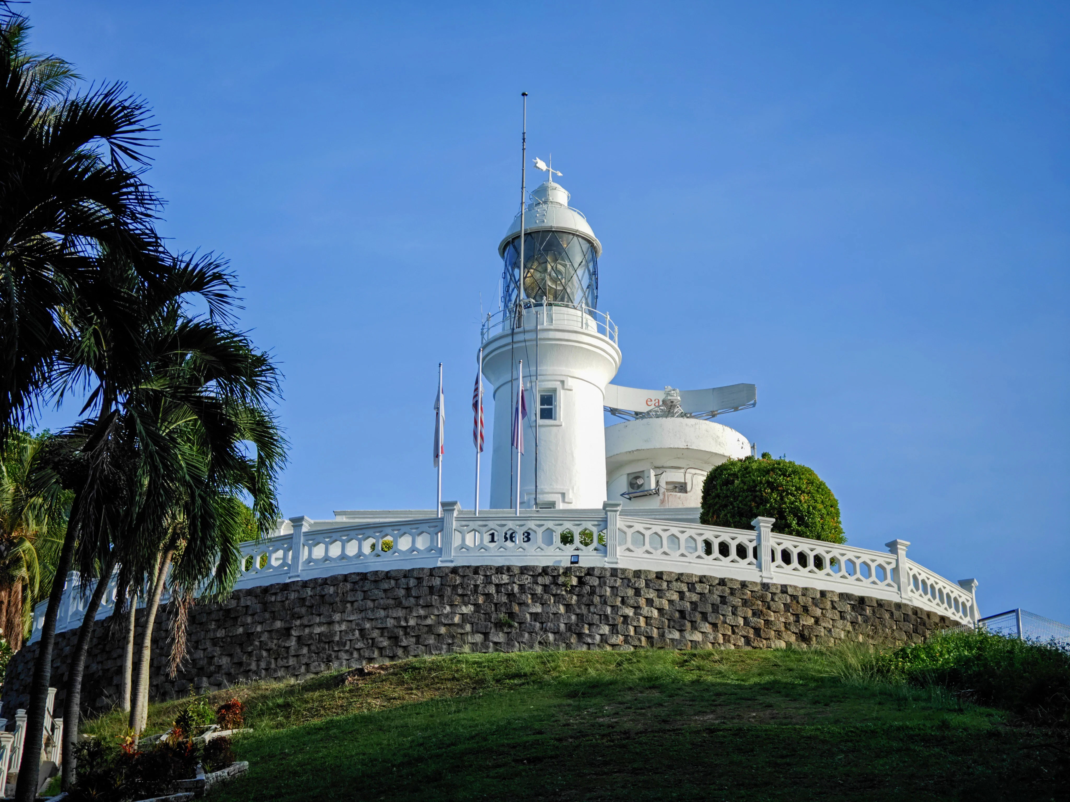
A white cylindrical lighthouse with a lantern room atop a stone base, surrounded by palm trees and a low white railing against a clear blue sky.
The historic Cape Rachado Lighthouse standing within the Tanjung Tuan forest reserve.

Tanjung Tuan history and protected-area timeline

Tanjung Tuan has a long history shaped by its commanding position over the Strait of Malacca. Its colonial-era European name, Cape Rachado, came from Portuguese sailors who named the headland after the broken silhouette or fragmented nature of the coastline.

After the Portuguese conquest of the Malacca Sultanate in 1511, the cape became strategically important for maritime traffic approaching Malacca. Between 1528 and 1529, the Portuguese built a lighthouse there to guide ships into port, establishing what is today regarded as the oldest lighthouse in Malaysia still in continuous operation. With successive changes of colonial power, control of the lighthouse passed to the Dutch after 1641 and then to the British in 1824.

The cape also carries a significant naval history. In 1606, the waters off Cape Rachado became the site of a battle between the Dutch East India Company fleet and a Portuguese squadron, marking the opening of the protracted Dutch Johor campaign that ultimately forced the Portuguese to surrender Malacca to the VOC in 1641.

On land, the area's modern protected history began in 1921 when it was gazetted as the Cape Rachado Forest Reserve. Subsequent adjustments carved out space for public recreation, and in 1971 the remaining forest was designated a wildlife sanctuary under PERHILITAN. In 1996, a private company was assigned to commercially develop parts of the park. Local tradition also associates the cape with the legendary or historical burial place of Parameswara, the last ruler of Singapura and founder of the Malacca Sultanate, although this claim is debated and is sometimes attributed to other sites in the region.

Tanjung Tuan landscape and geographic character

Tanjung Tuan is a small but varied coastal landscape. The peninsula projects into the Strait of Malacca, with steep wooded slopes descending toward the sea and a series of coves and beaches along its flanks. The Linggi River estuary lies just to the north, shaping the surrounding coastal scenery and providing a broad water-level view across to the cape.

The interior of the cape is forested, dominated by coastal hill dipterocarp forest rather than open terrain. The Batu Putih peak is the most prominent ridge feature, popular as a short hiking destination and giving visitors a clear overview of the peninsula's forest canopy and the strait beyond. Two small offshore islets, Intan Island to the south and Masjid Island to the east, extend the cape's maritime character.

Along the shoreline, the landscape shifts between sandy beach, rocky points, and mangrove fringes. Tanjung Biru beach is shared administratively between Negeri Sembilan and Malacca, reflecting the unusual border position of the cape. The combination of cape, headland forest, mangroves, islets, and a major river estuary makes Tanjung Tuan a compact but visually diverse coastal environment on the otherwise long and linear western seaboard of Peninsular Malaysia.
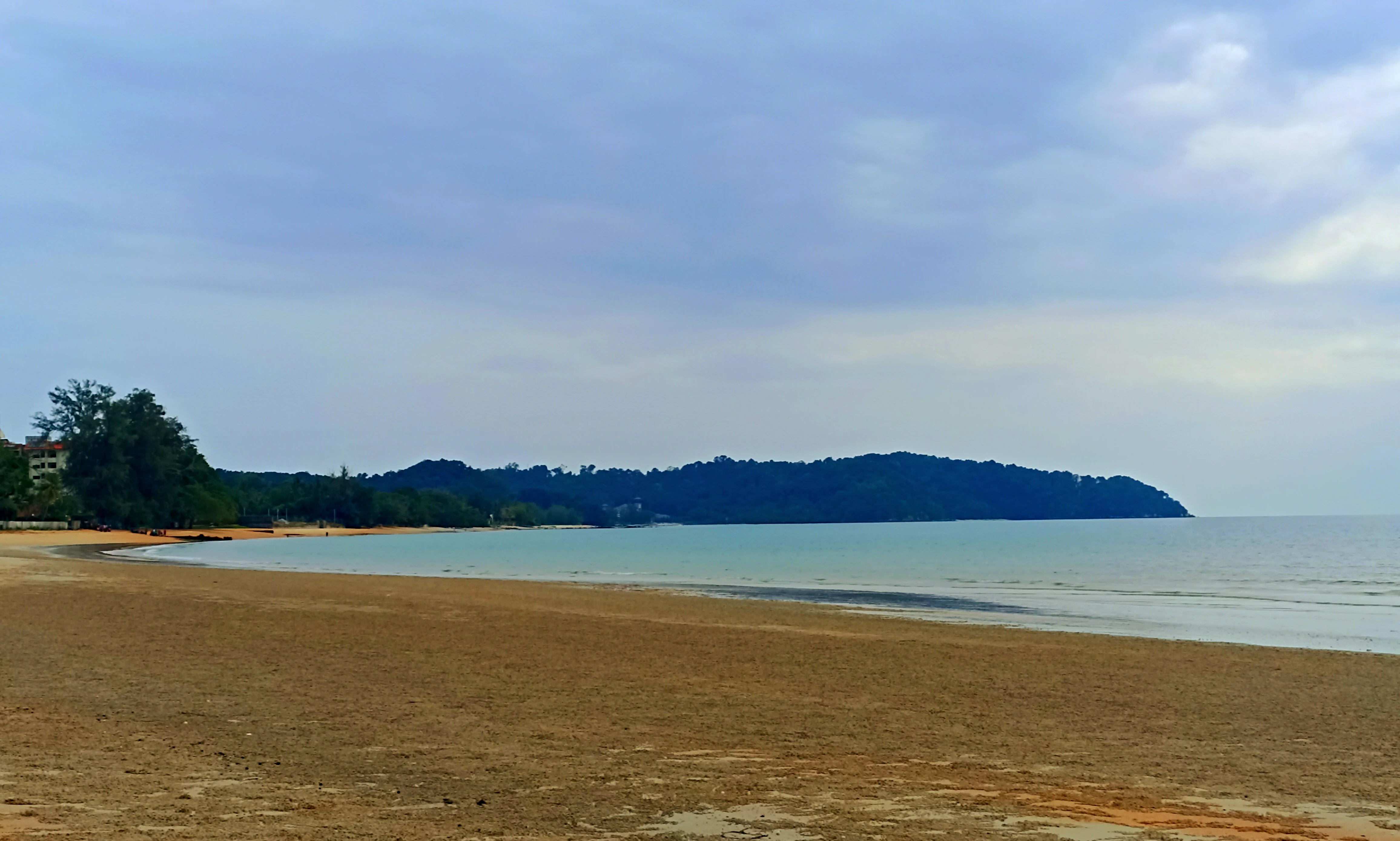
A wide view of a sandy beach in the foreground leading to calm water and a dark, forested cape in the distance under a cloudy sky.
The Tanjung Tuan cape viewed from across the water at Sri Purnama Beach.

Tanjung Tuan ecosystems, habitats, and plant life

Tanjung Tuan preserves what is widely described as one of the last remaining patches of coastal hill dipterocarp forest in Malaysia. This forest type is characterized by lowland dipterocarp species adapted to seasonally dry coastal conditions, with mengkulang siku keluang and meranti tembaga among the more characteristic trees recorded in the reserve.

Mangroves line portions of the cape, including Avicennia stands with prominent pneumatophores along the tidal edge, providing a transitional habitat between the forest interior and the open sea. The combination of intact lowland forest, mangrove fringe, beach, offshore islets, and adjacent Linggi River estuary creates a layered coastal ecosystem within a very small area.

The reserve's ecological importance, however, is defined primarily by its avian significance rather than by trees alone. The cape lies along a critical migration corridor between mainland Asia and the Indonesian archipelago, and its position makes it one of the most concentrated raptor passages in the region. Approximately 54 bird species have been recorded resident in the forest, while the broader flyway brings a much larger total of visitors each season. This dual profile, a rare surviving dipterocarp fragment combined with a major bird flyway, gives the small reserve disproportionate conservation value.
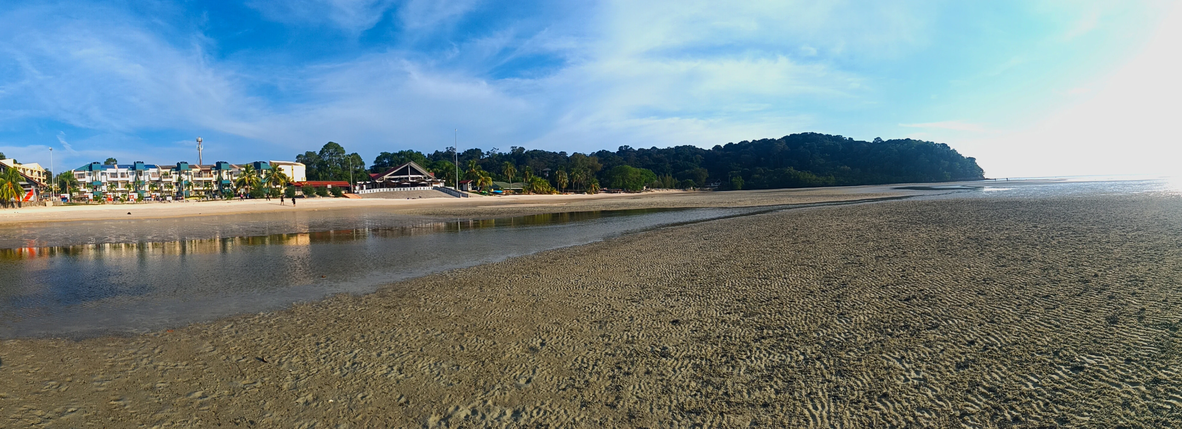
A panoramic photograph showing a wide, sandy beach at low tide with a reflective pool of water in the midground, backed by a treelined coast and buildings.
A wide view of Blue Lagoon Beach at Tanjung Tuan during low tide.

Tanjung Tuan wildlife and species highlights

Wildlife at Tanjung Tuan is most famous for its role as a raptor migration bottleneck. Each migration season, around 300,000 birds are estimated to pass through or near the cape, with raptors forming the most prominent and regularly observed group.

Species recorded along this flyway include the black-crested baza, grey-faced buzzard, Chinese sparrowhawk, oriental honey buzzard, and Japanese sparrowhawk, among others. These migratory raptors use the headland as both a navigational funnel and a roosting area, often gathering in large numbers in the forested ridge and along the coastal edge. About 54 bird species are considered resident within the forest itself.

Mammals recorded in and around the reserve include the dusky leaf monkey, which is regularly observed within the Tanjung Tuan Recreational Forest area. The combination of intact dipterocarp canopy, mangrove edge, and offshore islets supports a moderate but ecologically meaningful mammal and reptile presence in addition to the more conspicuous bird life. Because of these features, the cape has been recognized by BirdLife International as an Important Bird Area.
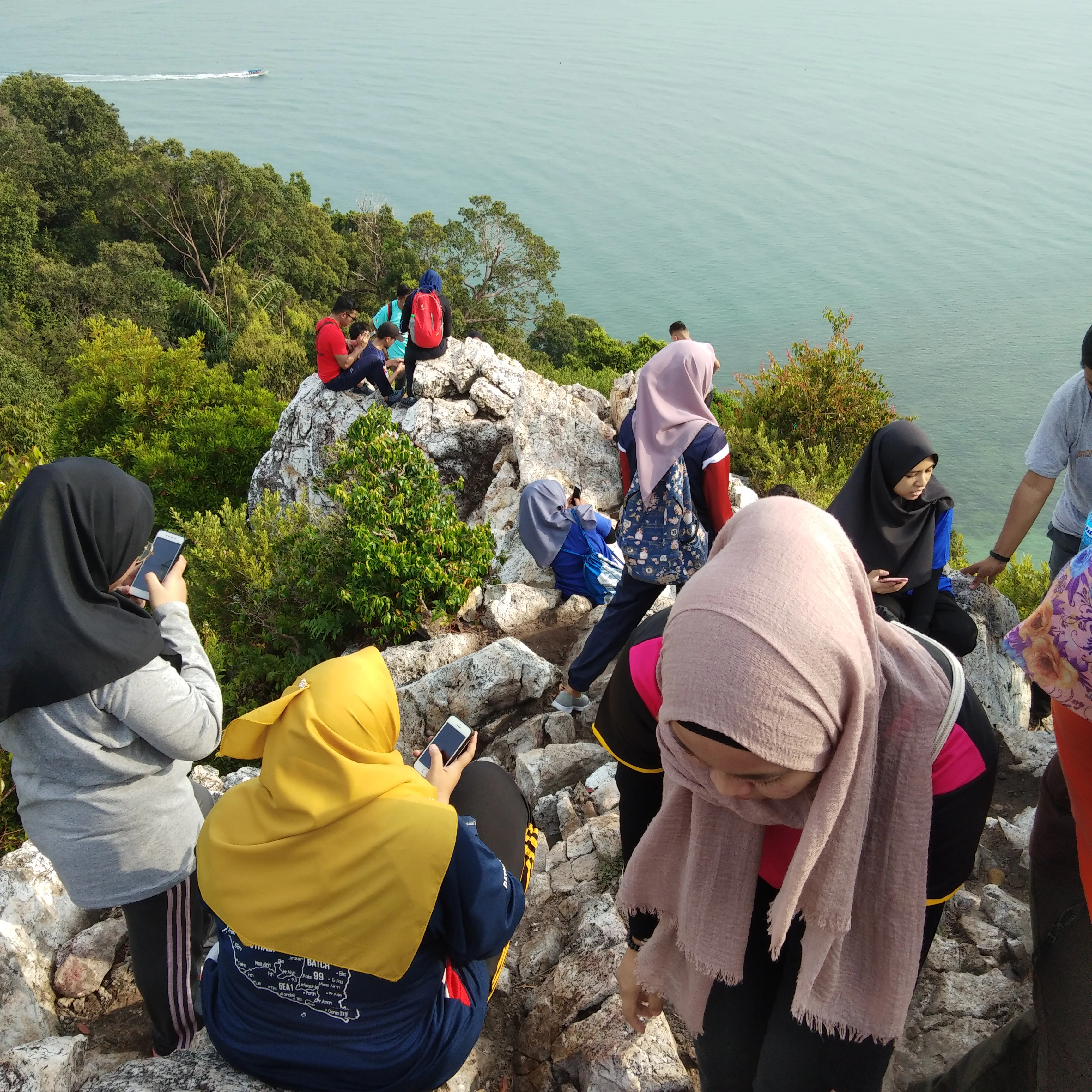
A group of people wearing hijabs and casual hiking clothes standing and sitting on a rocky, uneven summit overlooking a forested coastline and calm ocean.
Visitors gather on the rocky summit of Batu Putih, overlooking the sea at Tanjung Tuan.

Tanjung Tuan conservation status and protection priorities

Tanjung Tuan's conservation profile rests on its layered legal protection and its recognized international bird importance. The area was originally gazetted as a permanent forest reserve in 1921, and although a portion was later degazetted for public use, the remaining area was re-designated as a wildlife sanctuary in 1971 under PERHILITAN, Malaysia's wildlife and national parks authority.

This legal status operates under Malaysia's Birds and Wild Life Protection Ordinance 1955, providing formal protection against disturbance, habitat destruction, and hunting of bird and other wildlife. Additional protection has come through the area's recognition by BirdLife International as an Important Bird Area, a designation reserved for sites of significant global conservation value for birds.

A private commercial development concession was assigned in 1996, marking a shift toward managed recreational and tourism use alongside conservation. The Malaysian Nature Society has also been active at the site, promoting conservation awareness, education, and citizen birdwatching activities. Together, these formal protections, international recognition, and active civil society engagement make Tanjung Tuan one of the more closely monitored small protected areas on the west coast of Peninsular Malaysia.

Tanjung Tuan cultural meaning and human context

Tanjung Tuan carries cultural meaning on multiple levels. Locally, the Malay name 'Tanjung Tuan' has sometimes been linked to the legend of a fisherman of spiritual standing, or keramat, who reputedly could navigate the dangerous whirlpools offshore during the full moon period, when ordinary fishermen were lost. This folk association has given the cape a place in regional maritime folklore separate from its colonial and conservation identities.

In broader Malay historical tradition, the cape has been associated with the burial place of Parameswara, the last king of Singapura and founder of the Malacca Sultanate, though that attribution is contested and some traditions link his burial to sites such as Fort Canning Hill in Singapore, or alternatively suggest Hindu cremation rather than burial.

The cape also belongs to the early modern colonial history of Southeast Asia, where Portuguese geographic naming, Dutch strategic campaigns, and British handover of Malacca in 1824 all converge on a single small headland. The continued use of the Portuguese-origin name Cape Rachado alongside the Malay name Tanjung Tuan keeps this layered maritime and colonial heritage visible in everyday reference to the place.

A vibrant sunset over a calm body of water with a dark silhouette of a coastal headland visible on the horizon.
Sunset over the coastline near Tanjung Tuan.

Top sights and standout views in Tanjung Tuan

Tanjung Tuan's highlights cluster around a remarkably compact set of features: one of the oldest continuously operating lighthouses in Malaysia, a rare surviving coastal hill dipterocarp forest, and a globally recognized raptor migration corridor. Two offshore islets, mangrove fringes, the Linggi River estuary, and the Batu Putih hiking peak make the small reserve visually and ecologically varied.

The site also carries significant historical weight, from its Portuguese naming and 1528 lighthouse construction to the 1606 naval battle and its role as an entry point into the wider Dutch-Portuguese struggle for Malacca. Combined with active involvement from the Malaysian Nature Society and its status as a BirdLife International Important Bird Area, the highlights of Tanjung Tuan span heritage, ecology, and conservation in a single small coastal peninsula.
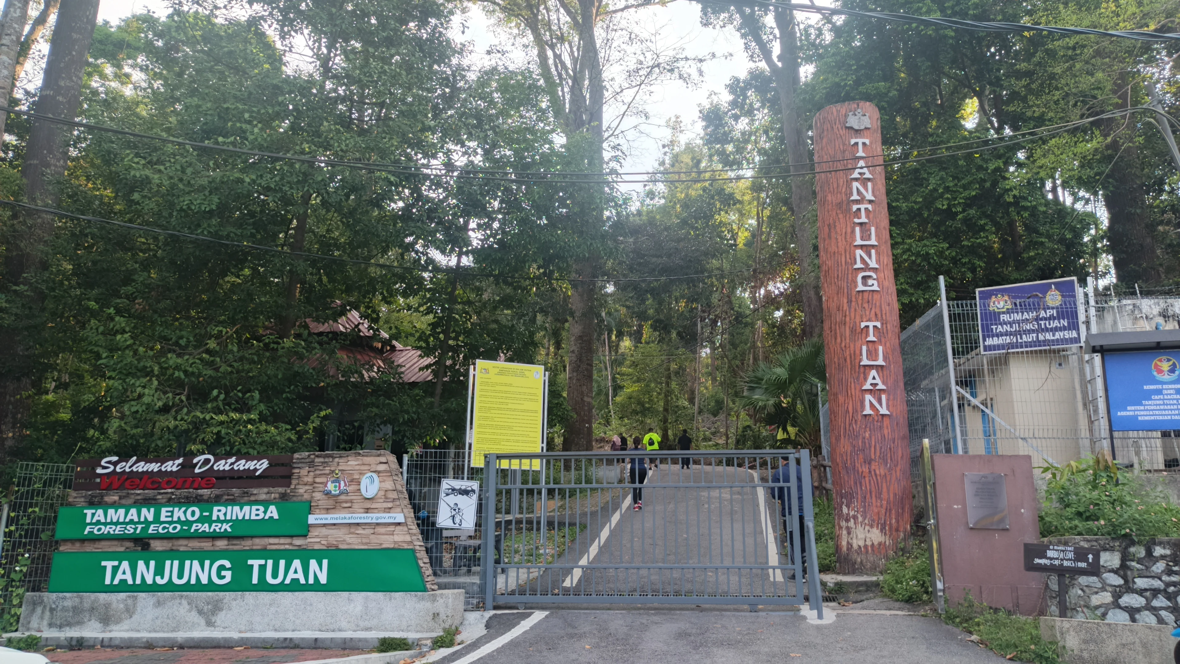
An entrance gate for Tanjung Tuan Forest Eco-Park, featuring green signs and a tall vertical log post with the name Tanjung Tuan engraved on it.
The main entrance to Tanjung Tuan Forest Eco-Park, featuring signage and a gated access point.

Best time to visit Tanjung Tuan

The most distinctive seasons at Tanjung Tuan align with the raptor migration periods, when large numbers of hawks and eagles pass along the cape and gather over the forested ridge and shoreline. These migration windows, broadly corresponding to the northward and southward movements between mainland Asia and the Indonesian archipelago, are the times when the park's birdlife is most active and most rewarding to observe.

For general recreation, including the popular short hike up Batu Putih peak and beach visits along Tanjung Biru and the cape's shores, conditions are most comfortable during the drier interludes between the heavier monsoon periods, when forest trails are more accessible and the coastal scenery is clearer. Marine and mangrove scenery remains attractive year-round, but migratory bird viewing is strongly seasonal, making the migration windows the most thematically distinctive times to plan a visit.

Monthly climate preview

Long-term representative records tracking monthly temperature and precipitation patterns across Tanjung Tuan

Tanjung Tuan Climate Normals, Annual Temperature and Precipitation Rhythm

Historical monitoring data from 1991 through 2020 establishes measured baseline temperatures between 22.48 degrees Celsius and 32.26 degrees Celsius alongside consistent daily precipitation rates. Examining the full twelve-month profile provides complete contextual clarity regarding annual meteorological variations at this coordinate.
Annual mean27 °C
26 °C28 °C
Jan26°
Feb27°
Mar27°
Apr28°
May28°
Jun28°
Jul27°
Aug27°
Sep27°
Oct27°
Nov27°
Dec26°
Warmest month
May

28 °C

Coolest month
January

26.3 °C

Wettest month
November

9.7 mm/day

Driest month
February

4.7 mm/day

Park location guide

Geography guide, regional context, and park location map for Tanjung Tuan

Tanjung Tuan park geography, regions, and map view in Malaysia

Understand where Tanjung Tuan sits in Malaysia through a broader geographic reading of the surrounding landscape, nearby location context, and its mapped position within the national park landscape.

How Tanjung Tuan fits into Malaysia

Malaysia is a federal constitutional monarchy located in Southeast Asia. The country consists of 13 states and three federal territories, divided by the South China Sea into Peninsular Malaysia on the Indochinese Peninsula and East Malaysia on the island of Borneo. With a population of over 34 million, it achieved independence from Britain in 1957 and became a modern federation in 1963. The country is recognized for its multicultural population, tropical climate, and significant economic role in the region.

Wider geography shaping Tanjung Tuan in Malaysia

Malaysia occupies a strategic position in Southeast Asia, split by the South China Sea into two distinct regions. Peninsular Malaysia lies on the Indochinese Peninsula, sharing a land border with Thailand to the north and maritime borders with Singapore, Vietnam, and Indonesia. East Malaysia occupies the northern portion of Borneo, sharing land borders with Brunei and Indonesia, and maritime borders with the Philippines and Vietnam. The country's terrain includes coastal plains, mountain ranges such as the Titiwangsa in the peninsula, and extensive tropical rainforests.

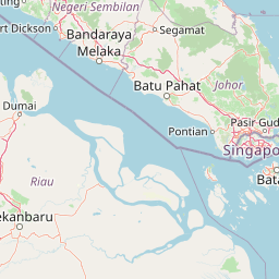
Map view of Tanjung Tuan

Use this park location map to pinpoint Tanjung Tuan in Malaysia, understand its exact geographic position, and read its mapped placement within the surrounding landscape more clearly.

Pigeon | © OpenStreetMap contributors

Location context for Tanjung Tuan

Malacca

Visual exploration of coastal hill dipterocarp forests, mangrove shorelines, and maritime heritage

Tanjung Tuan Landscape Photos, Coastal Scenery, and Protected Forest Views

Photographic documentation reveals the diverse terrain, forest canopy, and coastal habitats defining Tanjung Tuan across the Strait of Malacca. Detailed visual records help researchers and visitors examine the protected cape environment, lighthouse heritage, and raptor migration corridor more clearly.

A white cylindrical lighthouse with a lantern room atop a stone base, surrounded by palm trees and a low white railing against a clear blue sky.

A white lighthouse with a lantern room and a nearby communications structure set atop a stone-walled elevation, framed by palm fronds under a clear sky.

A wide view of a sandy beach in the foreground leading to calm water and a dark, forested cape in the distance under a cloudy sky.

A panoramic photograph showing a wide, sandy beach at low tide with a reflective pool of water in the midground, backed by a treelined coast and buildings.

A group of people wearing hijabs and casual hiking clothes standing and sitting on a rocky, uneven summit overlooking a forested coastline and calm ocean.

A sandy beach meets calm water with a dense forest line and rocky shore under an overcast sky.

A vibrant sunset over a calm body of water with a dark silhouette of a coastal headland visible on the horizon.

An entrance gate for Tanjung Tuan Forest Eco-Park, featuring green signs and a tall vertical log post with the name Tanjung Tuan engraved on it.

Park atlas

Compare regional coastal reserves and protected habitats across the surrounding territory.

Explore Parks Near Tanjung Tuan and Related Protected Landscapes

Browse other national parks and protected areas near Tanjung Tuan to examine wider coastal ecosystems and regional forest reserves. Continuing the geographic comparison reveals broader ecological patterns and connected wildlife habitats across the surrounding peninsula.
Nature reserveSelangor
About 65 km away#1 closest

Northwest

Kuala Langat North Forest Reserve: Mapped Boundaries and Ecological Terrain Overview

Ancient lowland peat swamp geography in Selangor, Malaysia

Kuala Langat North Forest Reserve is an ecologically vital peat swamp remnant that shelters a range of endemic species within its 8,000 year old forest canopy. Located in the lowland terrain of Selangor, the reserve exists as a critical forest island surrounded by a matrix of development. This overview provides mapped context for the reserve's internal landscape and its role as a protected area within the shifting geography of the Klang Valley.

Area
9.576 km²
Established
1927
Relief
Lowland
Climate
Tropical
Nature reserveMalaysia
About 81 km away#2 closest

Northeast

Pasoh Forest Reserve: Lowland Dipterocarp Protected Area in Peninsular Malaysia

Mapping tropical rainforest boundaries and ecological research zones

Situated in the interior of Peninsular Malaysia, Pasoh Forest Reserve protects a vital fragment of lowland dipterocarp rainforest. The reserve is globally recognized for its long-term forest dynamics plot, which tracks hundreds of thousands of trees to inform modern understanding of rainforest ecology. The mapped landscape displays clear boundaries between the dense protected forest and surrounding agricultural plantations, offering a distinct view of land use and tropical conservation.

Area
24.5 km²
Established
1987
Relief
Upland
Scope
Terrestrial
Nature reserveSelangor
About 101 km away#3 closest

North

Templer Park: Protected Hill Forest Reserve and Landscape Geography in Selangor, Malaysia

Mature forest canopy and tropical stream terrain

Templer Park preserves a critical patch of mature lowland and hill forest within Selangor. Featuring multi-tiered waterfalls, shaded riverbanks, and limestone caves, the reserve supports high biological interest including rare endemic species. Its mapped boundaries reflect an essential green refuge amidst regional development, offering a window into the natural forest geography north of Kuala Lumpur.

Area
12.14 km²
Established
1954
Relief
Upland
Climate
Tropical
State or regional parkSelangor
About 103 km away#4 closest

North

Selangor State Park: Protected Rainforest and Geological Landscape Discovery

Highland water catchment and quartz ridge geography in Selangor

Selangor State Park forms a massive block of continuous tropical rainforest serving as the principal water supply for the Klang Valley. This protected area features rugged slopes, diverse river basins, and the dramatic 14-kilometer Klang Gates Quartz Ridge. Use this map-integrated record to understand the park's critical role in regional hydrological regulation and its significance as a research-anchored highland ecosystem.

Area
914.41 km²
Established
2007
Relief
Highland
Climate
Tropical
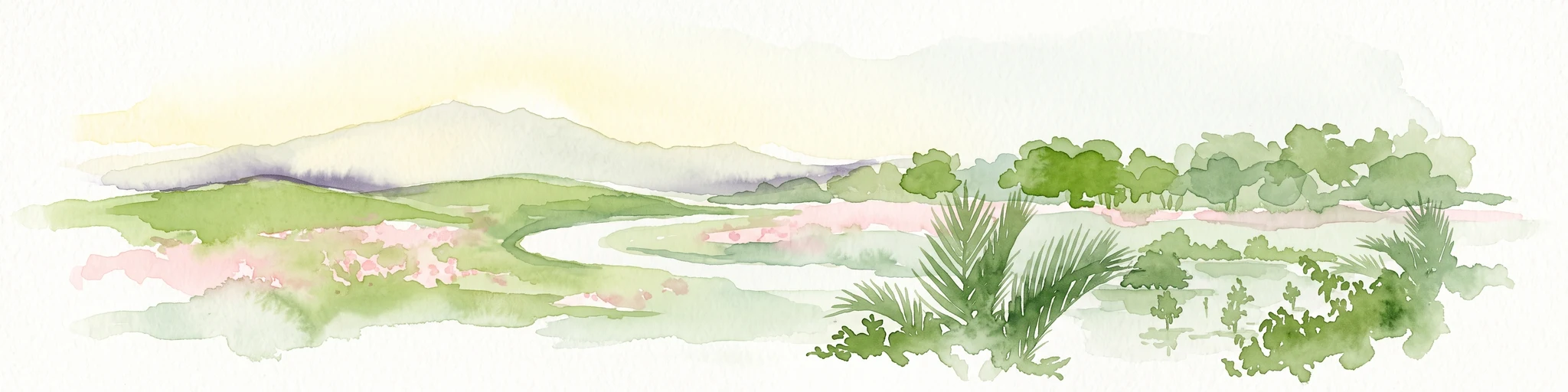
A watercolor painting showing a winding river flowing through green wetlands and forests with distant rolling hills.
Nature reserveSelangor
About 135 km away#5 closest

Northwest

Kuala Selangor Nature Park: Mapping the Coastal Wetland and Forest Mosaic of Selangor

A Managed Nature Reserve at the Selangor River Estuary

Kuala Selangor Nature Park represents a key protected landscape in Malaysia, where secondary forest meets an intricate system of estuarine wetlands. This atlas provides a detailed look at the park, focusing on the interplay between its freshwater ponds, mangrove fringes, and the coastal bunds that govern the habitat. It serves as an essential site for understanding coastal restoration and wetland ecology in the region of Selangor.

Area
2.4 km²
Established
1987
Relief
Lowland
Climate
Tropical
National parkJohor
About 140 km away#6 closest

East

Endau-Rompin National Park: Ancient Tropical Rainforest Protected Landscape in Johor, Malaysia

Explore unique mapped geography and ancient geological features.

Endau-Rompin National Park in Johor, Malaysia, is a testament to Earth's ancient history, housing tropical rainforests built upon geological formations around 248 million years old. This protected area offers a detailed look at rugged mountainous terrain, vital river systems, and a diverse mapped landscape, crucial for understanding regional geography and conservation. Its status as one of the oldest rainforest complexes makes it a significant site for exploring the planet's prehistoric natural heritage and protected land distribution.

Area
870 km²
Established
1993
IUCN
II
Relief
Mountain
Wildlife reservePahang
About 150 km away#7 closest

North

Tengku Hassanal Wildlife Reserve: Protected Forest and Mountain Geography in Pahang

Mapping a vast lowland dipterocarp forest sanctuary.

Spanning over 600 square kilometers, Tengku Hassanal Wildlife Reserve stands as a core protected area within Pahang. Its landscape includes riverine valleys and the steep montane terrain of the Benom Complex, supporting unique biodiversity and active wildlife conservation. This overview traces the park's geographic footprint and its role as an ecological corridor within the broader Titiwangsa mountain system.

Area
605.52 km²
Established
1923
Relief
Mountain
Climate
Tropical
A soft watercolor painting of a serene lake scene with rolling hills in the background, green vegetation along the banks, and pale pink blooms, likely lotus flowers, in the water.
Biosphere reservePahang
About 163 km away#8 closest

Northeast

Chini Lake Biosphere Reserve: Protected Freshwater Geography in Pahang, Malaysia

Examining the interconnected lake basins and tropical wetland terrain

Chini Lake is an essential protected freshwater system in Pahang, Malaysia, comprising a series of twelve connected lake basins and tropical forest margins. This landscape is a recognized UNESCO Biosphere Reserve, characterized by seasonal lotus blooms, peat-influenced wetlands, and deep cultural connections to the indigenous Jakun communities. Discover the geography and environmental context of this river-fed ecosystem.

Area
50.85 km²
Established
2019
Relief
Lowland
Climate
Tropical

Common questions about visiting, size, designation, and location context for Tanjung Tuan

Tanjung Tuan FAQs for park facts, access, geography, and protected area context

Find quick answers about Tanjung Tuan, including protected-area facts, park geography, trail and visitor context, and how the park fits into its surrounding country and regional landscape.
MoriAtlas Explorer

Continue Your Protected Areas Search Across the Global Atlas

Deepen your exploration by continuing the structured search for national parks and protected areas worldwide. Utilize the comprehensive filtering capabilities to compare different conservation landscapes and refine your understanding of global park geography. Discover more about the distribution and characteristics of protected natural areas.

Global natural geography