
Why Te Kopahou Reserve stands out
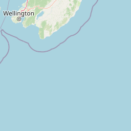
Te Kopahou Reserve is best known for the dramatic juxtaposition of wild coastal scenery and forested hill country right on the edge of Wellington. Visitors come for sweeping views across Cook Strait toward the South Island, the ridgeline walking and mountain biking tracks between Hawkins Hill and Te Kopahou, and the distinctive red rocks and fur seal colony at Pariwhero / Red Rocks and Sinclair Head. It is also recognised as one of the most accessible natural escapes from central Wellington, offering rugged terrain, ocean panoramas, and ecological variety within a short distance of the city's southern suburbs.
Te Kopahou Reserve history and protected-area timeline
The area that now forms Te Kopahou Reserve has a long history of use and modification, particularly along its coastal edge, where quarrying and early twentieth-century settlement left visible traces such as a small group of historic cottages from the early 1900s on the approach to Pariwhero / Red Rocks. These remnants reflect a period when the rugged south coast supported small-scale extractive and residential activity rather than formal conservation.
Over time, the surrounding land was progressively brought under public administration, with the Wellington City Council becoming the principal governing body for the reserve. The resulting protected area linked Brooklyn, Ōwhiro Bay, and the western coastal strip into a single contiguous landscape.
In more recent decades, the council has focused on managing the reserve as both a conservation area and a recreational resource. A notable milestone came in 2020 and 2021, when the Wellington City Council consulted the community over a draft long-term plan for the development and improvement of tracks across Te Kopahou Reserve, signalling an intent to formalise and enhance the network of walking and mountain biking routes that connect the hills to the coast.
Te Kopahou Reserve landscape and geographic character
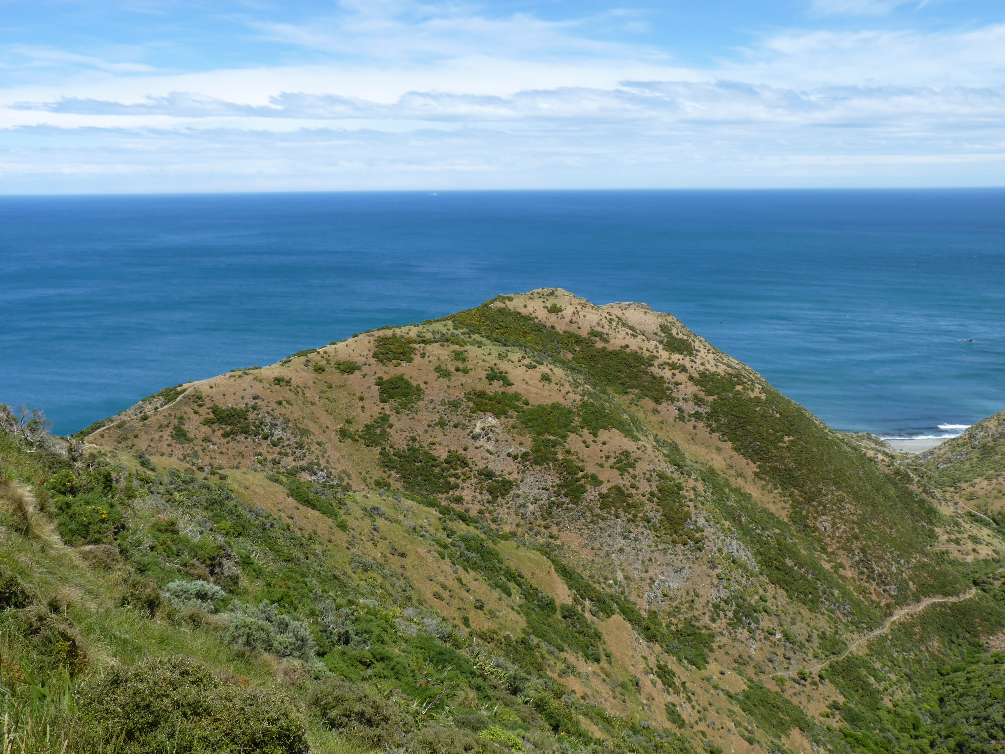
Te Kopahou Reserve's landscape is defined by the steep transition between Wellington's coastal hills and the open waters of Cook Strait. From the ridgeline, the terrain drops rapidly through bush-filled gullies and exposed scrub slopes toward a rugged shoreline of cliffs, shingle beaches, and wave-cut platforms. The reserve incorporates both Te Kopahou at 485 metres and Hawkins Hill at 495 metres, the latter being the highest peak within Wellington City.
The coastal section is among the reserve's most striking features. From the Ōwhiro Bay entrance, a flat beach track leads past an old quarry and surviving early-1900s cottages toward the red rocks of Pariwhero / Red Rocks and onward around Sinclair Head / Rimurapa to a locality known as Devil's Gate. The distinctive reddish coloration of rocks in this area, together with the dramatic headland scenery, gives the southern end of the reserve a strongly individual character.
Viewpoints from the hilltops and ridgelines look south across Cook Strait toward the South Island, and these elevated panoramas are a defining element of the reserve's identity. The combination of forested gullies, exposed ridgeline scrub, cliff coast, and open sea makes Te Kopahou unusually varied for a reserve of its size, even though the marine conditions along Cook Strait can be harsh and the coastal vegetation is correspondingly tough and wind-shaped.
Te Kopahou Reserve ecosystems, habitats, and plant life
The reserve protects a gradient of ecosystems that runs from steep coastal cliffs up through regenerating hill bush to exposed ridgeline vegetation. Lower gullies retain patches of native forest and regenerating bush, with tree cover offering shaded conditions in marked contrast to the open slopes above.
As elevation increases, vegetation thins into the hardier scrub and grassland communities typical of Wellington's coastal hills, where wind, salt spray, and thin soils shape plant communities into low, resilient forms. The proximity of the reserve to the sea means that maritime influences are felt well inland, producing a noticeable ecological transition from sheltered gullies to exposed coastal heath within a short distance.
The southern coastal strip, including Pariwhero / Red Rocks and the area around Sinclair Head / Rimurapa, hosts specialised intertidal and cliff communities adapted to the strong wave action and shifting sediments of Cook Strait. The combination of bush, scrub, cliff, and shore ecosystems within a single administrated reserve gives Te Kopahou substantial ecological variety for its footprint on Wellington's edge.
Te Kopahou Reserve wildlife and species highlights
Te Kopahou's most visible wildlife feature is the colony of New Zealand fur seals (known in Māori as Kekeno) at and around Devil's Gate in the southern coastal section of the reserve. The seals haul out on the rocky shoreline near Sinclair Head / Rimurapa, making this one of the most accessible seal-viewing locations close to Wellington.
Seabirds and shorebirds are also part of the reserve's fauna profile, drawn by the mix of cliffs, shoreline, and open water at the Cook Strait edge. Inland, regenerating bush provides habitat for native forest birds and invertebrates typical of Wellington's coastal hill forests, while the transition between sheltered gullies and exposed ridgelines supports a range of bird species adapted to different levels of cover and exposure.
The juxtaposition of marine wildlife, coastal birdlife, and bush habitat within a short distance of central Wellington gives Te Kopahou a strong wildlife identity, particularly along the southern coast where fur seals and seabirds are relatively easy to observe.
Te Kopahou Reserve conservation status and protection priorities
Te Kopahou Reserve plays a meaningful conservation role as a continuous swathe of protected landscape immediately adjacent to a major urban area. By holding together bush-clad gullies, ridgeline vegetation, coastal cliffs, and beaches under a single administrative framework, the reserve protects an unusually varied set of habitats within Wellington City. The southern strip, including the Pariwhero / Red Rocks Scientific Reserve, has particular scientific and ecological value because of its distinctive geology, red rock coloration, and the presence of a breeding population of New Zealand fur seals.
Management by the Wellington City Council, including community consultation on a long-term track development plan in 2020 and 2021, reflects an approach that integrates conservation, recreation, and infrastructure. The presence of the Hawkins Hill radar dome also illustrates how the reserve functions as a working landscape, balancing ecological values with regionally important aviation infrastructure.
The reserve therefore has value not only for the habitats and species it protects, but also as a living demonstration of how a rugged coastal and hill environment can be conserved alongside city living, recreation, and infrastructure use.
Te Kopahou Reserve cultural meaning and human context
Te Kopahou Reserve carries both Māori and Pākehā cultural layers. The reserve's own name, Te Kopahou, is Māori, as are the names of surrounding features such as Ōwhiro Bay, Pariwhero / Red Rocks, Sinclair Head / Rimurapa, and the New Zealand fur seals Kekeno, all of which reflect the continuing visibility of te reo Māori in the landscape.
At the same time, remnants of early twentieth-century Pākehā settlement, in the form of a small group of historic cottages from the early 1900s near the southern coast, point to a period when quarrying and small-scale coastal communities were part of life here. The reserve now holds these sites within a protected landscape that is also shaped by ongoing community engagement, including council consultation on the future of its track network and its appearance as a visual setting in local creative work, such as the 2021 music video Townbelt by Wellington-based artist Lake South.
Top sights and standout views in Te Kopahou Reserve
Te Kopahou Reserve's standout qualities lie in the combination of rugged Wellington scenery, accessible wildlife, and varied recreation all within a short distance of the city centre. The ridgeline between Hawkins Hill and Te Kopahou provides commanding views across Cook Strait toward the South Island, while the southern coast delivers distinctive red rocks, seal colonies at Devil's Gate, and a sweeping walk past early-1900s cottages and former quarry sites.
Equally distinctive is the reserve's infrastructure presence: the white radome on Hawkins Hill, which provides primary and secondary radar for Wellington Airport, marks the peak as both a natural and functional landmark. With walking and mountain biking tracks linking hilltop, bush gully, and shoreline environments, Te Kopahou offers a strongly layered experience of Wellington's southern edge.
Best time to visit Te Kopahou Reserve
Te Kopahou Reserve is an all-weather coastal and hill landscape, and its character shifts noticeably with the seasons. Summer and early autumn typically offer the most settled conditions for the longer ridgeline and coastal walks, with warmer temperatures, calmer seas, and clear views across Cook Strait toward the South Island. These periods also tend to be the most popular for mountain biking on the hill tracks.
Winter and spring bring cooler, often wetter, and more changeable conditions, with stronger winds on exposed ridgelines and rougher seas along the south coast. While this can make some tracks more demanding, it can also produce dramatic coastal scenery and a quieter atmosphere for those prepared for shifting weather. Fur seals at Devil's Gate and seabirds along the coast can be observed year-round, though calm conditions generally make wildlife viewing easier.