
Why Te Muri Regional Park stands out
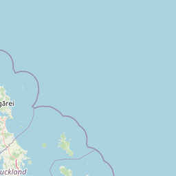
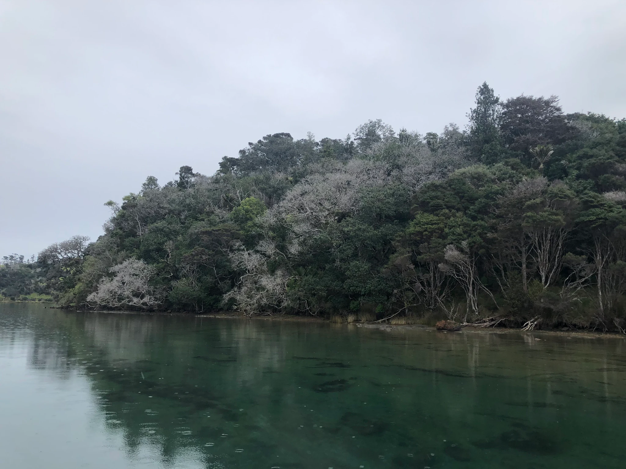
Te Muri is best known for its coastal forest ecosystem, particularly as part of the Wenderholm and Te Muri Coastal Forest biodiversity focus area, where native bush transitions into estuarine and shoreline environments. The park is also notable for its position as a connective peninsula between the Puhoi River and Te Muri-O-Tarariki Stream estuaries, giving it a distinct geographic identity within Auckland's regional park network.
Te Muri Regional Park history and protected-area timeline
Te Muri's protected landscape history begins in 1973, when the Auckland Regional Authority acquired just over 63 hectares along Te Muri Beach. This initial purchase secured a stretch of coastline and laid the groundwork for later expansion, though the broader peninsula remained in private hands.
During the 1980s, planners considered linking Te Muri to its neighboring regional parks, Mahurangi West and Wenderholm, through concrete bridges across each of the estuaries. These ambitious bridge proposals were part of an earlier vision for fully connected coastal parkland between the Puhoi River and the Te Muri-O-Tarariki Stream, though the bridges themselves were never built in that form.
The modern Te Muri Regional Park took shape in 2010, when the Auckland Regional Council purchased about 382 hectares of the adjoining Schischka family farm. Combined with the earlier coastal reserve, this acquisition established the park at its present size and confirmed Te Muri as a formal regional park within Auckland's conservation network.
Te Muri Regional Park landscape and geographic character
The shape of Te Muri Regional Park is dictated by water. The Puhoi River flows past its southern boundary, and the smaller Te Muri-O-Tarariki Stream frames the north, with both emptying into tidal estuaries that indent the coastline. This combination of two converging estuaries gives the park its peninsula form and defines the way its terrain falls gently toward the sea.
Inland, the landscape rises from low coastal flats and tidal margins to rolling hill country. The highest elevation in the park is the Pūhoi hill, reaching about 138 metres, which lifts the terrain above the surrounding estuarine flats and offers elevated vantage points across the canopy. The eastern coastline itself is marked by Te Muri Beach, an open coastal edge where the forest meets the Hauraki Gulf.
Vegetation patterns reinforce these landscape forms. Native coastal forest dominates the elevated spine of the peninsula, with tall emergent trees such as taraire contributing to a closed canopy, while the lower margins along the estuaries shift toward estuarine and shoreline plant communities. This layered terrain, from estuary edge to forested hill to open coast, gives the park a varied topography within a relatively small area.
Te Muri Regional Park ecosystems, habitats, and plant life
Te Muri's ecological identity is shaped by its position at the boundary between land and sea. The peninsula hosts native coastal forest on its inland slopes, where mature broadleaf species such as taraire form a significant part of the canopy. This forest zone functions as a true transition area, with species composition shifting as elevation and exposure to salt influence change.
Along the estuarine fringes, vegetation becomes more influenced by tides and saltmarsh dynamics, blending with the surrounding coastal forest. The result is a mosaic of habitats within a relatively narrow coastal strip, supporting communities of plants and animals that depend on having both forest interior and estuarine edge available.
The park is part of an 82-hectare Wenderholm and Te Muri Coastal Forest biodiversity focus area, recognized for its ecological value in maintaining the transition between native forest and shoreline environments. This designation highlights the park's role in protecting coastal forest remnants that have become increasingly rare in the heavily modified Auckland region.
Te Muri Regional Park wildlife and species highlights
Native forest birds are the most visible wildlife inhabitants of Te Muri. The park supports kererū, the large native pigeon that depends on coastal broadleaf forest for fruit and nesting; kākā, which range through native bush patches; tūī, common throughout the canopy; and smaller insectivorous and nectar-feeding species such as riroriro (grey warblers) and pīwakawaka (fantails).
The coastal edge adds a different wildlife dimension. Kororā, New Zealand's small blue penguins, occasionally nest in the area around Te Muri Beach, linking the park's marine-adjacent habitats with the broader shorebird and seabird communities of the Hauraki Gulf coastline.
Taken together, the birdlife reflects the park's transitional habitat structure. Forest interior species move through the canopy, while shoreline species occasionally appear along the coast and estuaries, creating a bird community shaped by both native bush and proximity to the sea.
Te Muri Regional Park conservation status and protection priorities
Te Muri Regional Park plays a significant conservation role within the Auckland Region as one of the remaining areas where coastal forest meets estuarine and shoreline environments. Its inclusion in the Wenderholm and Te Muri Coastal Forest biodiversity focus area, covering 82 hectares across both parks, marks it out as a recognized site for protecting native coastal forest communities under growing regional pressure.
The park's value lies in its ability to maintain a continuous cover of native vegetation across a coastal landscape that has otherwise been heavily modified for agriculture and settlement. By combining the older beach reserve with the 2010 farmland acquisition, the park now protects a connected block of coastal forest and estuarine margin, reducing fragmentation along this stretch of the Hauraki Gulf coastline.
Placed alongside Mahurangi West and Wenderholm Regional Parks, Te Muri extends Auckland's network of protected coastal land, helping to sustain ecological connectivity between estuaries and to safeguard habitat for native birds and plant communities that depend on intact coastal forest.
Te Muri Regional Park cultural meaning and human context
The eastern coastline of Te Muri carries strong cultural significance. Te Muri Beach is the location of Te Muri urupa, a traditional Māori burial ground, which reflects the long-standing importance of this coastal stretch to local iwi and hapū. The presence of the urupa shapes how the beach and its surrounding landscape are understood and respected, adding a layer of cultural meaning beyond the park's natural values.
The Māori place names that define the park, including Te Muri-O-Tarariki Stream and the broader area itself, reflect ongoing cultural connection between local communities and this coastline. While the park is relatively new as a formal regional park, the place has long-standing associations that predate its conservation designation.
Top sights and standout views in Te Muri Regional Park
Te Muri Regional Park stands out for the way it occupies a complete coastal peninsula, bounded by the Puhoi River and the Te Muri-O-Tarariki Stream and capped by the Pūhoi hill at about 138 metres. Its combination of mature native coastal forest, estuarine margins, and a culturally significant beach creates a compact but layered landscape.
The park's recognition within the Wenderholm and Te Muri Coastal Forest biodiversity focus area gives it clear conservation weight, while its role in linking Mahurangi West and Wenderholm Regional Parks establishes it as a key connector in Auckland's coastal park chain. Its native birdlife, from kererū and kākā in the canopy to occasional kororā penguins along the shore, further defines its character as a meeting point between forest and sea.
Best time to visit Te Muri Regional Park
Te Muri's character shifts gently with the seasons in step with its coastal forest setting. Spring brings active bird movement and new growth across the canopy, while summer offers the most settled conditions for walking between the estuarine margins, forest interior, and Te Muri Beach. The transitional nature of the park means native birds such as kererū, tūī, and pīwakawaka tend to be present across much of the year rather than only in a narrow season.
Cooler months can bring quieter conditions under the taraire-dominated canopy and crisp coastal light along the estuaries, while avoiding the busiest Auckland summer periods can make the peninsula feel more secluded. Because the park has a strong estuarine and coastal character, weather and tidal conditions influence how accessible the shoreline feels more than any single calendar window.