Mori Atlas logo
National parkTesso Nilo National Park

Discover the mapped boundaries and regional atlas significance of this Indonesian national park.

Tesso Nilo National Park: Protected Landscape Identity and Geographic Context in Riau Province

Tesso Nilo National Park stands as a significant protected area within the geographic landscape of Riau Province, Indonesia. This page offers a dedicated focus on its identity as a national park, providing detailed insights into its mapped boundaries and regional context for atlas-driven exploration. Understand its place within the broader protected lands of the archipelago and its contribution to the geographic landscape of Sumatra.

Lowland RainforestCritically Endangered SpeciesSumatran ElephantSumatran TigerTropical BiodiversityProtected Area

Tesso Nilo National Park

National park

Park overview

Structured park overview, official facts, and landscape profile for Tesso Nilo National Park

Tesso Nilo National Park park facts, protected area profile, and essential visitor context
Review the core facts for Tesso Nilo National Park, including designation, size, terrain, visitor scale, habitats, and operating context in one park-focused overview.

About Tesso Nilo National Park

Tesso Nilo National Park occupies a critical position in Sumatra's ecological landscape, representing one of the last substantial refuges of lowland rainforest on an island that has experienced catastrophic deforestation over the past several decades. The park is situated in Riau Province, a region that has seen extensive conversion of natural forest to oil palm plantations and other agricultural uses. Despite its relatively recent establishment as a national park in 2004, Tesso Nilo has become internationally significant due to its exceptional biodiversity. Scientific surveys conducted by the Indonesian Institute of Sciences (LIPI) throughout Sumatra confirmed that Tesso Nilo harbors the highest species diversity of any forest area on the island, while the Center for Biodiversity Management's global tropical forest plot surveys found that no other surveyed plot worldwide contains as many vascular plant species. The park's expansion to 1,000 square kilometers reflects its importance as an ecological anchor for the region.

Quick facts and research context for Tesso Nilo National Park

Tesso Nilo National Park is located in Riau Province, Sumatra, Indonesia, approximately at 0°5′S 101°36′E. The park was established in 2004 and covers an area that has been expanded to 1,000 square kilometers from an original 385.76 square kilometers. It contains the most biodiverse lowland rainforest surveyed anywhere in the world, with vascular plant diversity exceeding any other tropical forest plot studied by the Center for Biodiversity Management. The park is home to critically endangered Sumatran elephants and Sumatran tigers, both species facing extreme extinction risk in the wild.

Park context

Deeper park guide and search-rich context for Tesso Nilo National Park

Tesso Nilo National Park history, landscape, wildlife, and travel context
Explore Tesso Nilo National Park through its history, landscape character, ecosystems, wildlife, conservation priorities, cultural context, and seasonal travel timing in a structured park guide built for atlas discovery and search intent.

Why Tesso Nilo National Park stands out

Tesso Nilo National Park is renowned for its extraordinary plant diversity, holding the distinction of having the highest recorded vascular plant species count of any tropical forest plot surveyed globally. The park represents one of the last remaining coherent lowland rainforest ecosystems on Sumatra, a island that has lost the vast majority of its original forest cover to agricultural expansion. It serves as a crucial stronghold for two of Indonesia's most endangered megafauna species: the Sumatran elephant and the Sumatran tiger, both listed as critically endangered. The park's conservation value is amplified by its position as a living laboratory for understanding tropical rainforest biodiversity patterns.

Tesso Nilo National Park history and protected-area timeline

Tesso Nilo National Park was officially declared a national park by the Indonesian government in 2004, representing a recognition of the area's exceptional ecological value amid accelerating forest loss across Sumatra. The original designated area covered 385.76 square kilometers, though authorities immediately recognized that a larger protected boundary was needed to maintain ecological connectivity and protect viable populations of endangered species. In November 2009, the park was expanded by 44,492 hectares, significantly increasing its protected territory. The Belgian government has contributed to the park's conservation efforts, committing 200,000 euros toward the construction of a Sumatran elephant conservation center within the park boundaries, with funding beginning in 2011. This project was designed to facilitate the relocation of tame elephants from Minas in Siak District, where their habitat had been lost to oil palm plantations and oil mining operations.

Tesso Nilo National Park landscape and geographic character

The park protects extensive lowland rainforest terrain characteristic of central Sumatra's tropical environment. The landscape features flat to gently rolling terrain typical of lowland river basins, with forest canopy that historically reached heights of over 60 meters in mature areas. The region experiences equatorial climate with high rainfall throughout the year, supporting dense vegetation and complex forest structure. While the park's underlying geology reflects Sumatra's volcanic origin, the surface terrain has been shaped by fluvial processes creating the flat, low-lying characteristics that make this area suitable for lowland rainforest development. The landscape has been significantly impacted by encroachment in recent decades, with approximately a third of the original park area already deforested before conservation expansion efforts.

Tesso Nilo National Park ecosystems, habitats, and plant life

Tesso Nilo contains what scientists consider the most botanically diverse lowland rainforest in the world. The Center for Biodiversity Management's survey of over 1,800 tropical forest plots globally found no other location with as many vascular plant species as Tesso Nilo, making it a globally significant repository of plant biodiversity. The forest represents the climax ecosystem type for lowland Sumatra, characterized by multiple canopy layers, diverse epiphytes, and complex root systems adapted to the wet tropical environment. The park's biodiversity significance extends beyond plants to encompass the full spectrum of tropical rainforest organisms, from microorganisms to large mammals, making it a critical reference site for understanding Southeast Asian tropical forest ecology.

Tesso Nilo National Park wildlife and species highlights

The park provides critical habitat for two of Sumatra's most endangered megafauna species. Sumatran elephants (Elephas maximus sumatranus) inhabit the forest in significant numbers, with population estimates ranging from approximately 200 individuals in 2009 to 120-150 individuals as of 2012, reflecting the ongoing pressure on their habitat. Sumatran tigers (Panthera tigris sumatrae) also persist within the park, though their numbers are less well documented due to their secretive nature. Both species are listed as critically endangered, making Tesso Nilo's protected forest habitat essential for their survival. The park's diverse forest structure supports numerous other wildlife species, though detailed species inventories remain incomplete due to the challenges of conducting surveys in dense tropical forest.

Tesso Nilo National Park conservation status and protection priorities

Tesso Nilo National Park faces severe conservation challenges from illegal logging, agricultural encroachment, and habitat conversion. Approximately 28,600 hectares, roughly one-third of the original park area, had already been deforested before expansion efforts. Oil palm plantations now cover 36,353 hectares within the broader forest complex, with two major business groups (Asian Agri and Wilmar Groups) identified as involved in trading palm oil illegally grown inside the national park boundary. Additionally, around 50 mills operating around the forest complex have been identified as part of the supply chain for illegally produced palm oil. The forest remains vulnerable to wildfires during drought periods, with significant fire damage occurring in October 2006. Conservation efforts focus on expansion of protected territory, anti-encroachment enforcement, and the development of the elephant conservation center to protect remaining populations of endangered species.

Top sights and standout views in Tesso Nilo National Park

The park stands as one of the last great lowland rainforest strongholds in Sumatra, containing the world's most species-rich tropical forest plot for vascular plants. It provides crucial habitat for critically endangered Sumatran elephants and tigers, representing one of the most important conservation areas in Indonesia. The expansion to 1,000 square kilometers reflects its recognized significance, though ongoing threats from palm oil expansion and illegal encroachment mean that its long-term protection requires sustained effort.

Best time to visit Tesso Nilo National Park

The park can be visited year-round given its equatorial location, though the dry season (typically June to September) generally offers easier access to forest trails and clearer conditions for wildlife observation. The wet season brings heavy rainfall that can make some areas difficult to access but also supports the lush forest conditions that characterize the park's ecological character. Visitors interested in elephant viewing should note that conservation activities, including the elephant relocation program, may influence access to certain areas of the park.

Park location guide

Geography guide, regional context, and park location map for Tesso Nilo National Park

Tesso Nilo National Park park geography, regions, and map view in Indonesia
Understand where Tesso Nilo National Park sits in Indonesia through a broader geographic reading of the surrounding landscape, nearby location context, and its mapped position within the national park landscape.

How Tesso Nilo National Park fits into Indonesia

Indonesia is a vast archipelagic nation in Southeast Asia and Oceania, spanning over 17,000 islands between the Indian and Pacific Oceans. As the world's fourth-most populous country with 288 million people, it features extraordinary cultural and biological diversity, withJavanese and Sundanese being the largest ethnic groups. The country gained independence from the Netherlands in 1945 and operates as a unitary presidential republic.

Wider geography shaping Tesso Nilo National Park in Indonesia

Indonesia is situated in Southeast Asia and Oceania, spanning the equatorial region between the Indian Ocean to the west and the Pacific Ocean to the east. The archipelago includes major islands such as Sumatra, Java, Sulawesi, and parts of Borneo and New Guinea. It borders Papua New Guinea, Timor-Leste, and Malaysia by land, with extensive maritime boundaries throughout the region.

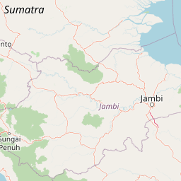
Map view of Tesso Nilo National Park

Use this park location map to pinpoint Tesso Nilo National Park in Indonesia, understand its exact geographic position, and read its mapped placement within the surrounding landscape more clearly.

Pigeon | © OpenStreetMap contributors

Location context for Tesso Nilo National Park

Riau ProvinceSumatra
Park atlas

Browse the unique protected landscapes and lowland rainforests surrounding Tesso Nilo in Sumatra's rich equatorial region

Explore More National Parks and Protected Areas Near Tesso Nilo National Park
Browse other national parks and protected areas situated in the broader Sumatran region, offering diverse ecological contexts and conservation landscapes beyond Tesso Nilo National Park. Compare adjacent lowland rainforests and critical habitats to understand the regional spread of protected zones and their significance for tropical biodiversity discovery.
National parkIndonesia

Bukit Tigapuluh National Park: Protected Area Identity and Indonesian Geographic Context

Explore mapped boundaries and regional landscape features.

Bukit Tigapuluh National Park stands as a protected natural area within Indonesia. This entry provides detailed geographic information, focusing on its mapped extent and its contribution to the nation's conservation atlas. Understanding its place within Indonesia's broader geography highlights the significance of its protected landscape and its role in regional natural resource mapping.

Area
1,432.23 km²
Established
1995
IUCN
II
Relief
Lowland
National parkJambi

Bukit Duabelas National Park: Jambi's Protected Lowland Tropical Rainforest Landscape

Explore its mapped terrain and vital water catchment geography.

Bukit Duabelas National Park is a protected area in Jambi, Sumatra, safeguarding critical lowland tropical rainforest ecosystems. Its name reflects the hilly terrain that defines its landscape, acting as an essential water catchment for the Batang Hari River. This park offers an atlas-focused view of Sumatra's threatened forest heritage and its importance within regional geography, including unique timber species and the ancestral lands of the Orang Rimba people.

Area
605 km²
Established
2000
IUCN
II
Relief
Lowland
National parkWest Sumatra

Kerinci Seblat National Park: National Park Protected Landscape in West Sumatra

Explore its mapped geography and regional atlas context.

Kerinci Seblat National Park represents a critical protected area, identified as a national park within Indonesia's West Sumatra province. This page provides a deep dive into its geographic footprint and landscape characteristics, serving as a key entry point for understanding the park's specific context. Users can leverage this detailed information for map-based exploration and to grasp its significance within the larger atlas of protected natural lands, focusing on its distinct geographical identity.

Area
13,750 km²
Established
1999
IUCN
II
Relief
Mountain
National parkNorth Sumatra Province

Batang Gadis National Park: North Sumatra Province Protected Landscape Atlas

Explore its national park status and mapped boundaries.

Batang Gadis National Park serves as a vital protected area within North Sumatra Province, contributing significantly to the regional geography and natural landscape atlas. This detail page focuses on its designation as a national park, highlighting its mapped geographic footprint and its place within the broader regional context. Users can explore its protected boundaries and understand its unique landscape characteristics for structured geographic discovery.

Area
1,080 km²
Established
2004
IUCN
II
Relief
Mountain
National parkWest Sumatra

Siberut National Park: Isolated Island Ecosystem and Endemic Wildlife Atlas

Discover the mapped geography and unique landscapes of this West Sumatra protected area.

Siberut National Park in West Sumatra, Indonesia, presents a distinct protected landscape forged by long-term geographic isolation. This national park covers a significant portion of Siberut Island, showcasing a rich tapestry of lowland dipterocarp rainforest, swamp forest, and coastal mangrove ecosystems. Explore its unique terrain, river systems, and protected boundaries to understand the extraordinary concentration of endemic species, particularly its globally significant primate populations.

Area
1,905 km²
Established
1992
IUCN
II
Climate
Tropical
National parkJambi

Berbak National Park National Park: Discover Protected Landscape Geography in Jambi

Explore mapped boundaries and regional context for this Sumatran protected area.

Berbak National Park is an officially designated national park within Indonesia's Jambi province. This page provides detailed geographic context, focusing on the park's mapped boundaries and its role as a protected landscape. Users can explore its placement within the broader regional geography of Sumatra, understanding how it contributes to the conservation landscape of the Jambi area for atlas-based discovery.

Area
1,627 km²
Established
1992
IUCN
II
Relief
Lowland
National parkSumatra

Sembilang National Park: A Mapped Protected Landscape within Sumatra's Geography

Understanding its park boundaries and regional natural context.

Delve into the atlas-level details of Sembilang National Park, a protected national park situated on the island of Sumatra. This exploration focuses on its geographic footprint, mapped boundaries, and its significance as a component of Indonesia's broader protected natural landscapes. Discover how this park contributes to the regional geography and offers a distinct protected-area identity within the Indonesian archipelago.

Area
2,051 km²
Established
2001
IUCN
II
Relief
Lowland
National parkPahang

Taman Negara National Park: Pahang Protected Area with Mapped Boundaries for Geographic Discovery

Explore the unique landscape context within Pahang, Malaysia.

Delve into Taman Negara National Park, a significant protected area situated in Pahang, Malaysia. This detailed view highlights the park's mapped boundaries and its contribution to the regional geography. Understand the protected landscape and its place within the natural terrain of Peninsular Malaysia, essential for atlas-based geographic exploration.

Area
4,343 km²
Established
1938
IUCN
II
Relief
Mixed relief

Common questions about visiting, size, designation, and location context for Tesso Nilo National Park

Tesso Nilo National Park FAQs for park facts, access, geography, and protected area context
Find quick answers about Tesso Nilo National Park, including protected-area facts, park geography, trail and visitor context, and how the park fits into its surrounding country and regional landscape.
MoriAtlas Explorer

Continue Your Protected Areas Search Across the Global Atlas

Deepen your exploration by continuing the structured search for national parks and protected areas worldwide. Utilize the comprehensive filtering capabilities to compare different conservation landscapes and refine your understanding of global park geography. Discover more about the distribution and characteristics of protected natural areas.

Global natural geography