

Mori Atlas logo
National parkKerinci Seblat National Park

Discover the mapped boundaries and regional geography of this vital protected area in West Sumatra.

Kerinci Seblat National Park: National Park Protected Landscape and Geographic Atlas

(Taman Nasional Kerinci Seblat)

Kerinci Seblat National Park stands as a significant protected natural landscape within Indonesia's West Sumatra province. As a designated national park, it offers a unique opportunity to explore its geographic scope, mapped park boundaries, and distinctive regional context. This detailed view helps users understand the park's place within the broader atlas of protected areas, providing a foundation for geographic discovery and landscape appreciation.

volcanic landscapetiger conservationmontane forestWorld Heritage SiteASEAN Heritage Siterainforest protection

Kerinci Seblat National Park

National park

Park overview

Structured park overview, official facts, and landscape profile for Kerinci Seblat National Park

Kerinci Seblat National Park park facts, protected area profile, and essential visitor context
Review the core facts for Kerinci Seblat National Park, including designation, size, terrain, visitor scale, habitats, and operating context in one park-focused overview.

About Kerinci Seblat National Park

Kerinci Seblat National Park represents the pinnacle of Sumatra's protected area network, spanning an enormous tract of approximately 1.38 million hectares that crosses provincial boundaries and encompasses remarkable ecological diversity. The park lies within the Barisan mountain range, a volcanic arc that forms the geological backbone of Sumatra, and contains more than five active volcanoes including Mount Kerinci, the island's loftiest summit. This dramatic terrain creates a mosaic of ecosystems ranging from lowland rainforests through montane zones to sub-alpine vegetation, with the park completely encircling the inhabited Kerinci Valley. The combination of volcanic soils, abundant rainfall, and extreme elevation gradients has produced extraordinary biodiversity, with over 4,000 plant species documented within the park's boundaries. The park's global significance was recognized when it became part of the Tropical Rainforest Heritage of Sumatra World Heritage Site in 2004, though concerns over habitat loss and poaching have led to its inclusion on the World Heritage in Danger list since 2011.

Quick facts and research context for Kerinci Seblat National Park

Kerinci Seblat National Park covers roughly 1.38 million hectares across four provinces in central Sumatra, making it the largest national park on the island. The park contains Mount Kerinci, Sumatra's highest peak at 3,805 meters, and is part of the volcanic Barisan mountain range with more than five active volcanoes. It protects Lake Gunung Tujuh, the highest caldera lake in Southeast Asia, and the Great Sumatran Fault runs through the park. The park was officially established in 1999 after being declared in 1982 and forms part of a UNESCO World Heritage Site. The area is also recognized as an ASEAN Heritage Site.

Park context

Deeper park guide and search-rich context for Kerinci Seblat National Park

Kerinci Seblat National Park history, landscape, wildlife, and travel context
Explore Kerinci Seblat National Park through its history, landscape character, ecosystems, wildlife, conservation priorities, cultural context, and seasonal travel timing in a structured park guide built for atlas discovery and search intent.

Why Kerinci Seblat National Park stands out

Kerinci Seblat National Park is best known for protecting the highest tiger population in Sumatra, with an estimated 165-190 individuals representing the highest density of Sumatran tigers anywhere on the island. The park is also famous for its remarkable plant diversity, including the world's largest flower, Rafflesia arnoldii, and the titan arum, which holds the record for the largest unbranched inflorescence in the plant kingdom. The park's dramatic volcanic landscapes centered around Mount Kerinci, coupled with Lake Gunung Tujah caldera lake, make it a unique combination of highland and montane ecosystems. It serves as one of the 12 most important protected areas in the world for tiger conservation under the Global Tiger Initiative.

Kerinci Seblat National Park history and protected-area timeline

Kerinci Seblat National Park has a complex establishment history spanning nearly two decades. The area was first declared as a candidate national park at the Third World National Parks Congress in Bali in 1982, when the Minister of Agriculture designated approximately 1.42 million hectares as a proposed national park. This initial designation consolidated numerous separate protected areas including nature reserves, wildlife sanctuaries, watershed protection forests, tourist forests, and production forests. After a lengthy review and restructuring process, the Minister of Forestry confirmed the park's borders in 1996 through decree No. 192/KptsII/1996, establishing approximately 1.36 million hectares as the official park boundary. The park was formally established in 1999 through decree No. 901/Kpts-II/1999, which set the final area at approximately 1.38 million hectares. Additional adjustments occurred in 2004 when the Sipurak Hook production forest area of approximately 14,160 hectares was incorporated into the park. The park was inscribed as a UNESCO World Heritage Site in 2004 as part of the Tropical Rainforest Heritage of Sumatra, alongside Gunung Leuser and Bukit Barisan Selatan National Parks. In 2011, the World Heritage site was placed on the Danger List due to ongoing threats from poaching, encroachment, and habitat degradation.

Kerinci Seblat National Park landscape and geographic character

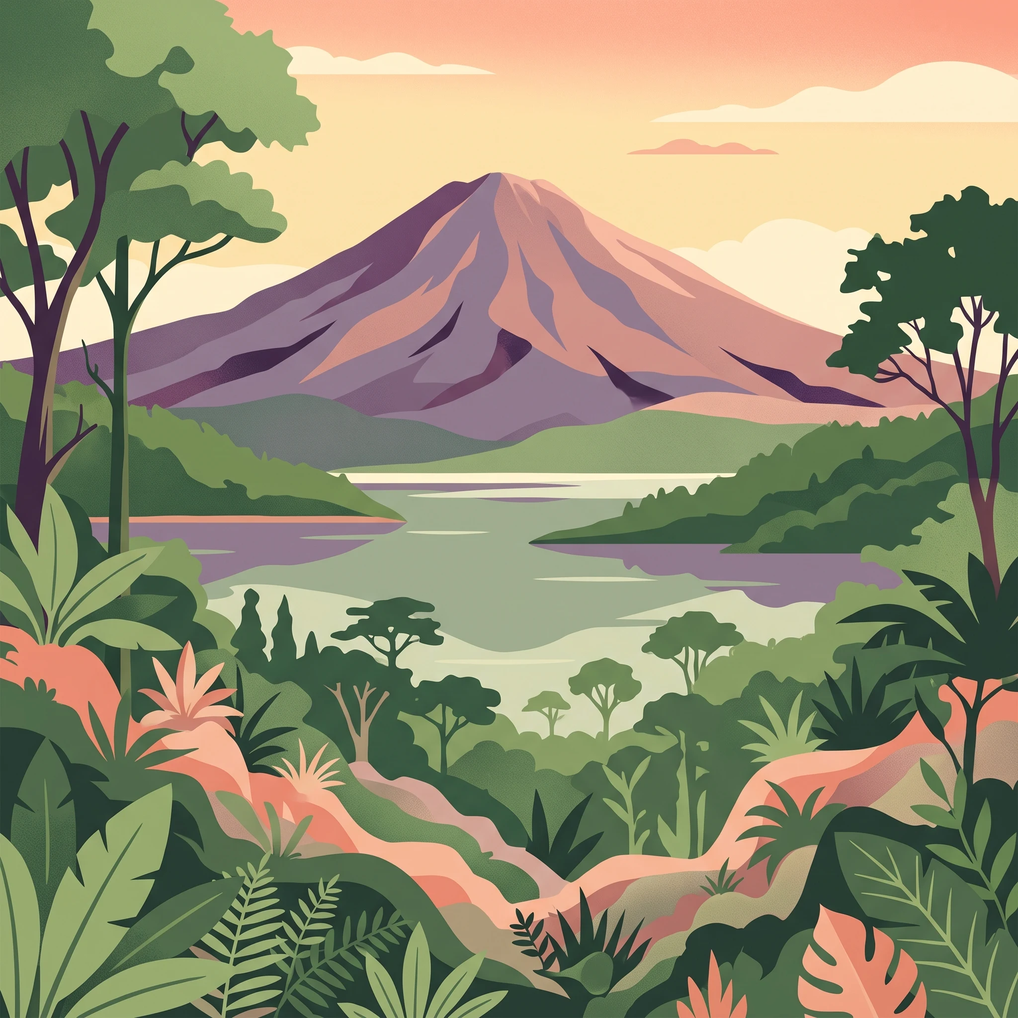
The landscape of Kerinci Seblat National Park is dominated by the dramatic topography of the Barisan mountain range, a volcanic arc that runs the entire length of Sumatra. The park's terrain is characterized by extreme steepness, with approximately 70% of the area having slopes exceeding 60%, and elevations ranging from 200 meters to 3,805 meters at Mount Kerinci's summit. The central portion of the park features a distinctive enclosed valley spanning roughly 140,000 hectares, completely surrounded by the peaks of Mount Kerinci and other volcanic cones. This valley, known as the Kerinci Valley, is surrounded by higher terrain on all sides and represents a unique basin within the park. Lake Gunung Tujuh, the highest caldera lake in Southeast Asia, occupies a volcanic crater in the northern section of the park. The park contains approximately 30 named mountains and volcanic peaks, with Mount Kerinci being the most prominent. The Great Sumatran Fault, a major geological structure, passes through the park, making it of particular interest to geologists. Rivers originating in the park flow both eastward toward the Sumatran interior plains and westward toward the coast, creating a complex watershed system.

Kerinci Seblat National Park ecosystems, habitats, and plant life

The ecological character of Kerinci Seblat National Park reflects the extraordinary diversity of Sumatra's montane and lowland rainforests. The park spans multiple vegetation zones from lowland dipterocarp forests through montane forests to sub-alpine ecosystems, with the most important forest type being the tropical rainforest dominated by Dipterocarpaceae species found below 1,000 meters elevation. These forests contain species such as Shorea parvifolia, Dipterocarpus, Parashorea, and Koompassia malaccensis. Between 1,000 and 1,500 meters, the forest transitions to lower montane rainforests with Hopea and Shorea species giving way to Lauraceae and Euphorbiaceae. Above 1,500 meters, upper montane forests are dominated by Podocarpus, Castanopsis, and Ericaceae. The park also contains unique peat swamp ecosystems at Rawa Ladeh and Rawa Bento, the highest peat swamps in Sumatra, located at approximately 1,950 meters elevation. More than 4,000 plant species have been documented in the park, including the iconic Rafflesia arnoldii, the titan arum, and numerous orchid species.

Kerinci Seblat National Park wildlife and species highlights

Kerinci Seblat National Park supports exceptional wildlife diversity, most notably serving as the most important stronghold for Sumatran tigers on the island. Recent surveys indicate the park contains 165-190 tigers, representing the highest population density in Sumatra and more tigers than exist in all of China, Laos, Cambodia, and Vietnam combined. The park protects a complete guild of Sumatra's felids including the Sunda clouded leopard, marbled cat, leopard cat, and Asian golden cat, with the Asian golden cat being particularly widespread and adaptable. Other critically endangered species include the Sumatran elephant, Malayan tapir, Malayan sun bear, and Sumatran dhole. The park was historically home to the Sumatran rhinoceros, with population estimates around 500 individuals in the 1980s, though the population is now considered extinct due to poaching. In 2008, the Sumatran muntjac was rediscovered in the park after not being recorded since the 1920s, subsequently recognized as a distinct species. The avifauna includes more than 370 bird species, with 17 of Sumatra's 20 endemic species present, making the Kerinci area particularly significant for ornithologists.

Kerinci Seblat National Park conservation status and protection priorities

Kerinci Seblat National Park occupies a critical position in global conservation, designated as one of the 12 most important protected areas for tiger conservation worldwide under the Global Tiger Initiative. The park's inclusion in the UNESCO World Heritage Site Tropical Rainforest Heritage of Sumatra reflects its irreplaceable ecological value, though its listing as World Heritage in Danger since 2011 highlights significant ongoing threats. Conservation challenges include poaching for the illegal wildlife trade, which has devastated populations of tigers and other species, encroachment from agricultural expansion, and habitat fragmentation. The park's management operates through a zoning system that includes core zone, wilderness zone, utilization zone, rehabilitation zone, special zone, and traditional use zone, with the core zone covering approximately 738,831 hectares. The park is also recognized as an ASEAN Heritage Site, providing additional international conservation framework. Conservation efforts focus on protecting the remaining tiger population, preventing the extinction of other endangered species, and maintaining the connectivity of Sumatran rainforest ecosystems.

Kerinci Seblat National Park cultural meaning and human context

Kerinci Seblat National Park surrounds the densely populated Kerinci Valley, an agricultural region where local communities have maintained traditional relationships with the surrounding landscape for generations. The park encompasses areas traditionally used by local communities, with a traditional use zone covering approximately 11,606 hectares in the 2017 zoning revision. The Kerinci people inhabit the valley floor and lower slopes, cultivating rice paddies and other crops in the fertile volcanic soils. The park's establishment involved consolidation of numerous former protection forests, wildlife reserves, and other designations that had various levels of community involvement and traditional use. The area contains significant cultural sites and the local community maintains connections to the mountain and forest areas that are reflected in traditional practices and land use patterns.

Top sights and standout views in Kerinci Seblat National Park

The defining highlights of Kerinci Seblat include the dramatic volcanic peak of Mount Kerinci rising to 3,805 meters as Sumatra's highest point, the extraordinary tiger population representing the species' last major stronghold, and the presence of the world's largest flower Rafflesia arnoldii in the park's lush rainforests. Lake Gunung Tujuh offers a spectacular caldera lake setting at high elevation, while the complete range of elevation from 200 to 3,805 meters creates remarkable ecological zonation. The park's status as part of a World Heritage Site and its position as Sumatra's largest protected area underscore its regional and global significance. The diversity of big cat species, from tigers to clouded leopards to golden cats, makes this one of the most remarkable places for felid conservation anywhere in Asia.

Best time to visit Kerinci Seblat National Park

The best time to visit Kerinci Seblat National Park corresponds to the dry season, which typically runs from April to October, though the park receives rainfall throughout the year. The wetter months from November to March bring heavier precipitation and can make some trails more difficult, though the rainforest remains green and vibrant. The climate varies with elevation, with the Kerinci Valley experiencing temperatures between 16 and 28 degrees Celsius, while higher elevations are noticeably cooler. The park's montane character means that mist and cloud cover are common, particularly in the morning and evening, adding atmosphere to the landscape. Visitors seeking to climb Mount Kerinci should plan for the drier months to maximize safe access to the summit. Wildlife viewing can be productive year-round, though the drier season may concentrate animals around water sources.
Park location guide

Geography guide, regional context, and park location map for Kerinci Seblat National Park

Kerinci Seblat National Park park geography, regions, and map view in Indonesia
Understand where Kerinci Seblat National Park sits in Indonesia through a broader geographic reading of the surrounding landscape, nearby location context, and its mapped position within the national park landscape.

How Kerinci Seblat National Park fits into Indonesia

Indonesia is a vast archipelagic nation in Southeast Asia and Oceania, spanning over 17,000 islands between the Indian and Pacific Oceans. As the world's fourth-most populous country with 288 million people, it features extraordinary cultural and biological diversity, withJavanese and Sundanese being the largest ethnic groups. The country gained independence from the Netherlands in 1945 and operates as a unitary presidential republic.

Wider geography shaping Kerinci Seblat National Park in Indonesia

Indonesia is situated in Southeast Asia and Oceania, spanning the equatorial region between the Indian Ocean to the west and the Pacific Ocean to the east. The archipelago includes major islands such as Sumatra, Java, Sulawesi, and parts of Borneo and New Guinea. It borders Papua New Guinea, Timor-Leste, and Malaysia by land, with extensive maritime boundaries throughout the region.

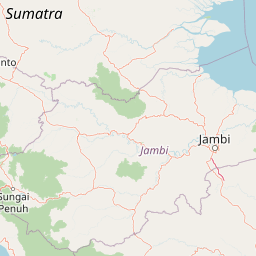
Map view of Kerinci Seblat National Park

Use this park location map to pinpoint Kerinci Seblat National Park in Indonesia, understand its exact geographic position, and read its mapped placement within the surrounding landscape more clearly.

Pigeon | © OpenStreetMap contributors

Location context for Kerinci Seblat National Park

SumatraWest Sumatra
Park atlas

Browse adjacent protected areas and trace the regional spread of conservation landscapes across Sumatra.

Discover Other National Parks and Protected Areas Surrounding Kerinci Seblat National Park
Continue your exploration from Kerinci Seblat National Park by browsing other national parks and protected areas across Sumatra's Barisan mountain range and its diverse ecosystems. This regional view allows you to compare conservation landscapes, trace geographic features, and understand the spread of protected montane and volcanic terrain.
National parkJambi

Bukit Duabelas National Park: Jambi's Protected Lowland Tropical Rainforest Landscape

Explore its mapped terrain and vital water catchment geography.

Bukit Duabelas National Park is a protected area in Jambi, Sumatra, safeguarding critical lowland tropical rainforest ecosystems. Its name reflects the hilly terrain that defines its landscape, acting as an essential water catchment for the Batang Hari River. This park offers an atlas-focused view of Sumatra's threatened forest heritage and its importance within regional geography, including unique timber species and the ancestral lands of the Orang Rimba people.

Area
605 km²
Established
2000
IUCN
II
Relief
Lowland
National parkIndonesia

Bukit Tigapuluh National Park: Protected Area Identity and Indonesian Geographic Context

Explore mapped boundaries and regional landscape features.

Bukit Tigapuluh National Park stands as a protected natural area within Indonesia. This entry provides detailed geographic information, focusing on its mapped extent and its contribution to the nation's conservation atlas. Understanding its place within Indonesia's broader geography highlights the significance of its protected landscape and its role in regional natural resource mapping.

Area
1,432.23 km²
Established
1995
IUCN
II
Relief
Lowland
National parkRiau Province

Tesso Nilo National Park: Exploring Its Protected Landscape and Geographic Identity in Riau Province

Mapped boundaries and regional park atlas context.

Uncover the core identity of Tesso Nilo National Park, a designated national park situated within Riau Province. This entry focuses on its role as a protected landscape, detailing its mapped geographic footprint and offering insights relevant for atlas exploration. Understand how its protected area status contributes to the regional geography and landscape context of Indonesia, providing a focused view for geographic discovery.

Area
1,000 km²
Established
2004
IUCN
II
Relief
Lowland
National parkWest Sumatra

Siberut National Park: Isolated Island Ecosystem and Endemic Wildlife Atlas

Discover the mapped geography and unique landscapes of this West Sumatra protected area.

Siberut National Park in West Sumatra, Indonesia, presents a distinct protected landscape forged by long-term geographic isolation. This national park covers a significant portion of Siberut Island, showcasing a rich tapestry of lowland dipterocarp rainforest, swamp forest, and coastal mangrove ecosystems. Explore its unique terrain, river systems, and protected boundaries to understand the extraordinary concentration of endemic species, particularly its globally significant primate populations.

Area
1,905 km²
Established
1992
IUCN
II
Climate
Tropical
National parkJambi

Berbak National Park National Park: Discover Protected Landscape Geography in Jambi

Explore mapped boundaries and regional context for this Sumatran protected area.

Berbak National Park is an officially designated national park within Indonesia's Jambi province. This page provides detailed geographic context, focusing on the park's mapped boundaries and its role as a protected landscape. Users can explore its placement within the broader regional geography of Sumatra, understanding how it contributes to the conservation landscape of the Jambi area for atlas-based discovery.

Area
1,627 km²
Established
1992
IUCN
II
Relief
Lowland
National parkSumatra

Sembilang National Park: A Mapped Protected Landscape within Sumatra's Geography

Understanding its park boundaries and regional natural context.

Delve into the atlas-level details of Sembilang National Park, a protected national park situated on the island of Sumatra. This exploration focuses on its geographic footprint, mapped boundaries, and its significance as a component of Indonesia's broader protected natural landscapes. Discover how this park contributes to the regional geography and offers a distinct protected-area identity within the Indonesian archipelago.

Area
2,051 km²
Established
2001
IUCN
II
Relief
Lowland
National parkNorth Sumatra Province

Batang Gadis National Park: North Sumatra Province Protected Landscape Atlas

Explore its national park status and mapped boundaries.

Batang Gadis National Park serves as a vital protected area within North Sumatra Province, contributing significantly to the regional geography and natural landscape atlas. This detail page focuses on its designation as a national park, highlighting its mapped geographic footprint and its place within the broader regional context. Users can explore its protected boundaries and understand its unique landscape characteristics for structured geographic discovery.

Area
1,080 km²
Established
2004
IUCN
II
Relief
Mountain
National parkSumatra

Bukit Barisan Selatan National Park: Sumatra's Critical Tropical Rainforest Corridor

Explore mapped boundaries and regional geography within this protected area.

Bukit Barisan Selatan National Park is a substantial national park located in Sumatra, Indonesia, designated as a protected landscape along the southern Bukit Barisan mountain range. Spanning a considerable area, it functions as a crucial corridor of tropical rainforest, playing a pivotal role in conservation efforts and the preservation of Sumatra's unique geographic identity. This page serves as a dedicated entry point for understanding the park's protected area status and its mapped presence within the broader regional geography of Indonesia.

Area
3,568 km²
Established
1982
IUCN
II
Relief
Mountain

Common questions about visiting, size, designation, and location context for Kerinci Seblat National Park

Kerinci Seblat National Park FAQs for park facts, access, geography, and protected area context
Find quick answers about Kerinci Seblat National Park, including protected-area facts, park geography, trail and visitor context, and how the park fits into its surrounding country and regional landscape.
MoriAtlas Explorer

Continue Your Protected Areas Search Across the Global Atlas

Deepen your exploration by continuing the structured search for national parks and protected areas worldwide. Utilize the comprehensive filtering capabilities to compare different conservation landscapes and refine your understanding of global park geography. Discover more about the distribution and characteristics of protected natural areas.

Global natural geography