
Rivers
Park geography
Analyzing the terrain, elevation peaks, and environmental features of this protected region.
Kerinci Seblat National Park: Comprehensive Geographic Profile and Mapped Boundaries
Kerinci Seblat National Park covers a vast mountain landscape across West Sumatra with a recorded area of 13,750 square kilometers. This geographic profile details the park boundaries, spanning significant tropical forest terrain and diverse natural features including volcanoes, rivers, and peaks like Gunung Kerinci reaching 3,805 meters.
Related tags
volcanic landscapetiger conservationmontane forestWorld Heritage SiteASEAN Heritage Site
Sumatra's largest national park protecting the island's highest peak and a global tiger stronghold
Kerinci Seblat National Park
Kerinci Seblat National Park is the largest national park on the island of Sumatra, Indonesia, spanning approximately 1.38 million hectares across four provinces: West Sumatra, Jambi, Bengkulu, and South Sumatra. The park encompasses a significant portion of the Barisan mountain range, which forms the western spine of Sumatra, and includes Mount Kerinci, the island's highest peak at 3,805 meters above sea level. This montane protected area features diverse landscapes including hot springs, fast-flowing rivers, caves, scenic waterfalls, and the highest caldera lake in Southeast Asia, Lake Gunung Tujuh. The park was declared a UNESCO World Heritage Site in 2004 as part of the Tropical Rainforest Heritage of Sumatra, though it has been listed as World Heritage in Danger since 2011. The park completely encircles the populated Kerinci Valley and represents one of the most ecologically significant protected areas in Southeast Asia.
- Location
- Indonesia
- Park type
- National park
- Established
- 1999
- Area
- 13,750 km²
- Highest point
- 3,805 m
Location overview
Regional membership and territorial placement in Sumatra and Indonesia
Geographic Position of Kerinci Seblat National Park in Sumatra
Kerinci Seblat National Park is located within Indonesia and American Samoa, spanning Sumatra and West Sumatra. Factual records detail the regional boundaries and confirm the inland, non-marine status of the protected territory.
- Countries
- Indonesia
- Regions
- Sumatra, West Sumatra
- Primary location
- West Sumatra
- Geographic setting
- Inland
Boundary and coordinates
A 13,750 km² outline with geographic extent context
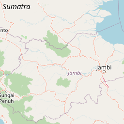
Kerinci Seblat National Park mapped boundary and area
Kerinci Seblat National Park’s mapped geometry spans an immense recorded area of 13,750 km². The outline communicates the national park’s geographic reach for atlas use without claiming legal-boundary precision.
- Boundary area
- 13,606.2 km²
- Boundary perimeter
- 2,457.8 km
- Northernmost point
- 1.0737° S
- Southernmost point
- 3.451° S
- Easternmost point
- 102.8571° E
- Westernmost point
- 100.5808° E
- Geographic centre
- 2.3384° S, 101.68° E
- North–south span
- 262.9 km
- East–west span
- 253.2 km
Elevation and terrain
Mountain topography and recorded peak distribution
Kerinci Seblat National Park Terrain and Elevation Range
Elevation summary records mountain relief reaching up to 3805 meters across the protected area. Linked feature cards supply names, types, and spatial relationships for interior peaks and volcanoes.
- Maximum elevation
- 3,805 m
- Highest point
- 3,805 m
Selected named natural features
Streams
Batang Ganeh
Rivers
Air Bal
Rivers
Air Pebelek Kecil
Peaks
Bukit Runcing
2,221 m
Rivers
Sungai Jarnih
Environmental setting
Stored tropical mountain relief, forest cover, and water systems
Kerinci Seblat National Park Environmental Classifications and Physical Setting
Recorded landscape features and habitat types frame the physical setting of Kerinci Seblat National Park across tropical mountain terrain. Associated classification categories link directly to relevant atlas destinations for regional comparison.
- Relief
- Mountain
- Climate
- Tropical
- Water
- Major water bodies
- Forest cover
- Mostly forested
Landscape features
Mountains · Rivers · Waterfalls · Lakes · Cave · Volcano · Forest · Cliffs
Habitat types
Tropical forest · Montane forest · Riverine habitat · Lacustrine habitat
Park atlas
Browse adjacent protected areas and trace the regional spread of conservation landscapes across Sumatra.
Discover Other National Parks and Protected Areas Surrounding Kerinci Seblat National Park
Continue your exploration from Kerinci Seblat National Park by browsing other national parks and protected areas across Sumatra's Barisan mountain range and its diverse ecosystems. This regional view allows you to compare conservation landscapes, trace geographic features, and understand the spread of protected montane and volcanic terrain.
National parkJambi
About 104 km away#1 closest
East

Bukit Duabelas National Park: Jambi's Protected Lowland Tropical Rainforest Landscape
Explore its mapped terrain and vital water catchment geography.
Bukit Duabelas National Park is a protected area in Jambi, Sumatra, safeguarding critical lowland tropical rainforest ecosystems. Its name reflects the hilly terrain that defines its landscape, acting as an essential water catchment for the Batang Hari River. This park offers an atlas-focused view of Sumatra's threatened forest heritage and its importance within regional geography, including unique timber species and the ancestral lands of the Orang Rimba people.
- Area
- 605 km²
- Established
- 2000
- IUCN
- II
- Relief
- Lowland
National parkIndonesia
About 113 km away#2 closest
Northeast
Bukit Tigapuluh National Park: Protected Area Identity and Indonesian Geographic Context
Explore mapped boundaries and regional landscape features.
Bukit Tigapuluh National Park stands as a protected natural area within Indonesia. This entry provides detailed geographic information, focusing on its mapped extent and its contribution to the nation's conservation atlas. Understanding its place within Indonesia's broader geography highlights the significance of its protected landscape and its role in regional natural resource mapping.
- Area
- 1,432.23 km²
- Established
- 1995
- IUCN
- II
- Relief
- Lowland
National parkRiau Province
About 147 km away#3 closest
North
Tesso Nilo National Park: Exploring Its Protected Landscape and Geographic Identity in Riau Province
Mapped boundaries and regional park atlas context.
Uncover the core identity of Tesso Nilo National Park, a designated national park situated within Riau Province. This entry focuses on its role as a protected landscape, detailing its mapped geographic footprint and offering insights relevant for atlas exploration. Understand how its protected area status contributes to the regional geography and landscape context of Indonesia, providing a focused view for geographic discovery.
- Area
- 1,000 km²
- Established
- 2004
- IUCN
- II
- Relief
- Lowland
National parkSumatra
148 km away#4 closest
Southeast
Bukit Barisan Selatan National Park: Sumatra's Critical Tropical Rainforest Corridor
Explore mapped boundaries and regional geography within this protected area.
Bukit Barisan Selatan National Park is a substantial national park located in Sumatra, Indonesia, designated as a protected landscape along the southern Bukit Barisan mountain range. Spanning a considerable area, it functions as a crucial corridor of tropical rainforest, playing a pivotal role in conservation efforts and the preservation of Sumatra's unique geographic identity. This page serves as a dedicated entry point for understanding the park's protected area status and its mapped presence within the broader regional geography of Indonesia.
- Area
- 3,568 km²
- Established
- 1982
- IUCN
- II
- Relief
- Mountain
National parkWest Sumatra
About 184 km away#5 closest
West
Siberut National Park: Isolated Island Ecosystem and Endemic Wildlife Atlas
Discover the mapped geography and unique landscapes of this West Sumatra protected area.
Siberut National Park in West Sumatra, Indonesia, presents a distinct protected landscape forged by long-term geographic isolation. This national park covers a significant portion of Siberut Island, showcasing a rich tapestry of lowland dipterocarp rainforest, swamp forest, and coastal mangrove ecosystems. Explore its unique terrain, river systems, and protected boundaries to understand the extraordinary concentration of endemic species, particularly its globally significant primate populations.
- Area
- 1,905 km²
- Established
- 1992
- IUCN
- II
- Climate
- Tropical
National parkNorth Sumatra Province
198 km away#6 closest
Northwest
Batang Gadis National Park: North Sumatra Province Protected Landscape Atlas
Explore its national park status and mapped boundaries.
Batang Gadis National Park serves as a vital protected area within North Sumatra Province, contributing significantly to the regional geography and natural landscape atlas. This detail page focuses on its designation as a national park, highlighting its mapped geographic footprint and its place within the broader regional context. Users can explore its protected boundaries and understand its unique landscape characteristics for structured geographic discovery.
- Area
- 1,080 km²
- Established
- 2004
- IUCN
- II
- Relief
- Mountain
National parkSumatra
About 236 km away#7 closest
East
Sembilang National Park: A Mapped Protected Landscape within Sumatra's Geography
Understanding its park boundaries and regional natural context.
Delve into the atlas-level details of Sembilang National Park, a protected national park situated on the island of Sumatra. This exploration focuses on its geographic footprint, mapped boundaries, and its significance as a component of Indonesia's broader protected natural landscapes. Discover how this park contributes to the regional geography and offers a distinct protected-area identity within the Indonesian archipelago.
- Area
- 2,051 km²
- Established
- 2001
- IUCN
- II
- Relief
- Lowland
National parkJambi
About 253 km away#8 closest
East
Berbak National Park National Park: Discover Protected Landscape Geography in Jambi
Explore mapped boundaries and regional context for this Sumatran protected area.
Berbak National Park is an officially designated national park within Indonesia's Jambi province. This page provides detailed geographic context, focusing on the park's mapped boundaries and its role as a protected landscape. Users can explore its placement within the broader regional geography of Sumatra, understanding how it contributes to the conservation landscape of the Jambi area for atlas-based discovery.
- Area
- 1,627 km²
- Established
- 1992
- IUCN
- II
- Relief
- Lowland
MoriAtlas Explorer
Continue Your Protected Landscape Discovery for Kerinci Seblat National Park
Delve deeper into the geographic specifics and protected landscape identity of Kerinci Seblat National Park. Understanding its mapped boundaries and regional context offers valuable insight for atlas-driven exploration of natural areas, allowing for a more structured appreciation of this significant national park's place in West Sumatra.
Browse next
Global natural geography
Explore related park routes
Explore MoriAtlas Global ParksBrowse All MoriAtlas ParksGlobal Park Map DiscoveryMoriAtlas: Browse All CountriesBrowse All MoriAtlas ContinentsNational Park Environment AtlasGrand Canyon National Park AtlasYellowstone National Park AtlasYosemite National Park Atlas and GeographySerengeti National Park AtlasGalápagos National Park Protected LandscapeBanff National Park Geography and AtlasKruger National Park Atlas EntryUluṟu-Kata Tjuṯa National Park AtlasExplore Uluru-Kata Tjuta National Park GeographyPlitvice Lakes National Park AtlasFiordland National Park Protected LandscapeGreat Smoky Mountains National Park AtlasAfghanistan National Parks and Protected AreasAlbania National Parks and Protected AreasAlgeria National Parks and Protected AreasAmerican Samoa National Parks and Protected AreasAndorra National Parks and Protected AreasAngola National Parks and Protected AreasAntarctica National Parks and Protected AreasAntigua and Barbuda Park List