

Why Tiefwerder-Wiesen stands out
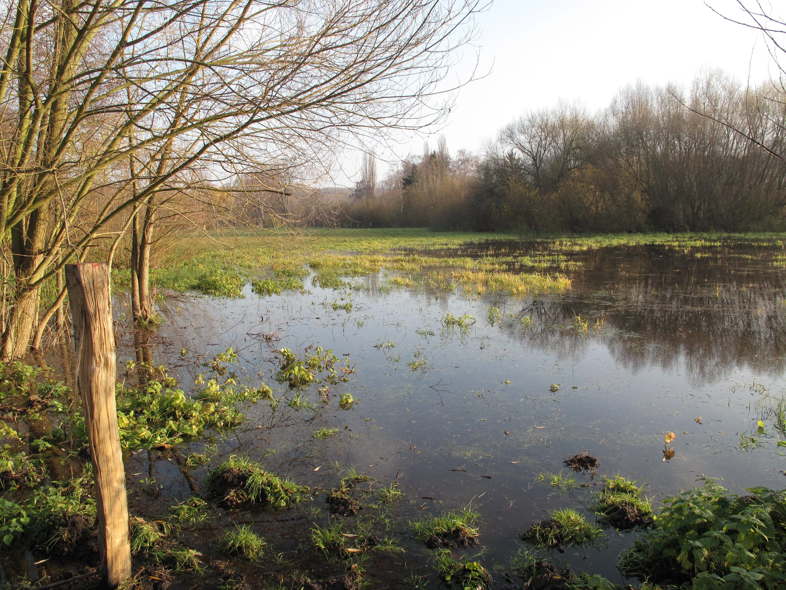
The Tiefwerder-Wiesen are best known as Berlin's last remaining pike spawning meadows, a function closely tied to the natural flood dynamics of the Havel. Each spring, pike historically ascended from the main channels to deposit their eggs on submerged grasses and submerged roots, making the periodic flooding of these meadows essential to the reproductive cycle of one of Berlin's signature freshwater predators. The meadows are equally valued as one of the last intact examples of a Spree-Havel floodplain within the city. Extensive reed belts, sedge meadows, softwood floodplain remnants along old Havel arms, and rare plant species such as the bladder sedge give the site an ecological character that is rare in an urban setting. Its role as a stepping stone in the Havel biotope network, for fish, dragonflies, bats, beavers, otters, and wetland birds, reinforces its importance as a living ecological corridor.
Tiefwerder-Wiesen history and protected-area timeline
The Tiefwerder-Wiesen carry traces of human presence reaching back to the early medieval period, with pottery finds from the sixth to eighth centuries indicating a Slavic settlement on the eastern shore of what was then called the Wirchen See. The Slavic roots of the place names, including the former lake name, point to long-standing human attachment to this river landscape.
Following German colonization around 1180, the water level of the Havel rose significantly due to the milling dam at Brandenburg an der Havel, increasing flood events in the meadows. Through the early modern period, the network of old river arms continued to dominate the lowlands, and an 1832 canal later known as the Elsgraben connected the Spree directly to the Fauler See, regulating Spandau's flood risk while maintaining the meadows' flood dynamics.
The decisive transformation came in the late 19th and early 20th centuries. Between 1880 and 1881 the heavily meandering Havel was canalized, and in 1908 the southern Spandau harbor was built on the Tiefwerder, both progressively cutting off flooding episodes. Industrial development from 1910, construction of the Heerstraße between 1910 and 1912, and groundwater drawdown by the Tiefwerder waterworks from 1914 further reduced the natural hydrology of the meadows.
In 1960 the Berlin Senate placed the area under landscape protection, formalizing its ecological value. Since 1990, however, the Havel water table has dropped significantly, gradually reducing the meadows' accessibility for spawning pike. A planned federal waterway project, the Verkehrsprojekt Deutsche Einheit Nr. 17, threatened to deepen this trend further, prompting an ongoing debate and planning for artificial watering systems to preserve the flood dynamics. Since 2007 the Berlin administration has considered upgrading the site's protection to a nature reserve.
Tiefwerder-Wiesen landscape and geographic character
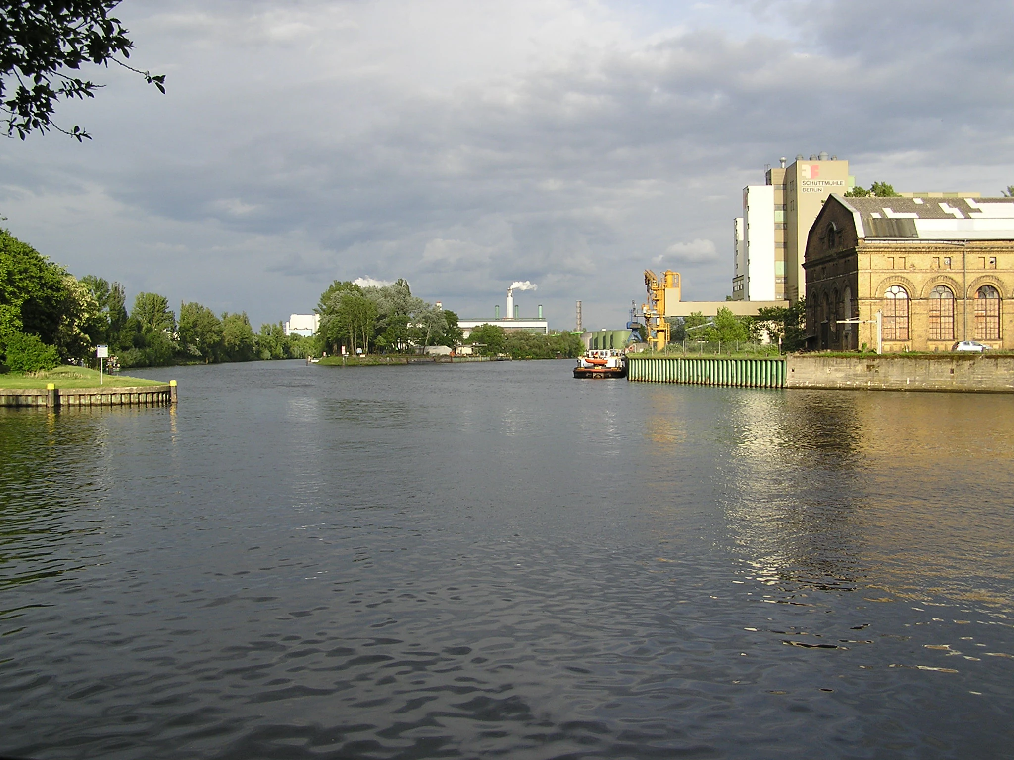
The Tiefwerder-Wiesen form part of the Berlin glacial valley, an ancient ice-age meltwater corridor filled with thick sand deposits that can reach more than twenty meters in depth. At its southern mouth, the Spree flows into the Havel, which curves through the valley in a glacial channel rather than running along its axis. The flat terrain and the Havel's extremely low gradient, averaging only about five centimeters per kilometer, have historically allowed water to spread freely across the meadows during high-water periods.
The protected area is interspersed with old river arms and modern drainage channels such as the Fauler See, the Toter Mantel, the Hauptgraben, and the Kleiner Jürgengraben. The Fauler See originated as a Havel arm and now serves as a quiet oxbow lake within the meadows. On the higher ground of the Schanzenwald to the east, push and end moraines of the Teltow plateau rise above the floodplain, while the western side opens onto the low-lying swampy meadows of the former Börnicker Lake, where the Südpark was laid out in 1923.
The mosaic of meanders, oxbows, ditches, reed belts, sedge meadows, and softwood floodplain remnants gives the area a layered, water-rich character that contrasts sharply with the dense urban fabric of Spandau and Charlottenburg just beyond its borders.
Tiefwerder-Wiesen ecosystems, habitats, and plant life
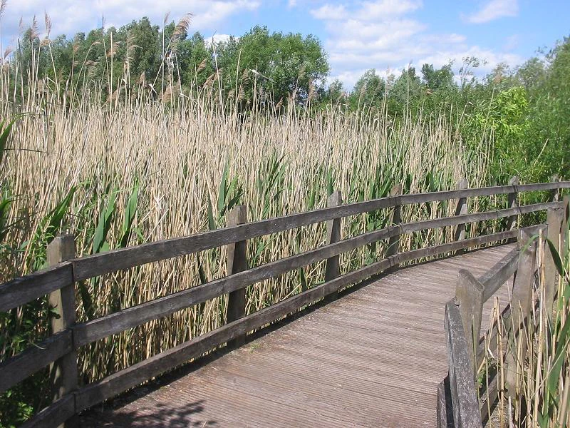
The Tiefwerder-Wiesen represent a rare surviving example of a Spree-Havel floodplain ecosystem within an urban environment. Sedge meadows, tall reed belts, softwood floodplain fragments, and open water form a tightly interlinked mosaic of habitats. Once dominated by tall great sedge meadows, the area has gradually shifted toward slender sedge meadows and reed grass stands as flooding has become less frequent.
In the open water and along the ditches, yellow water lilies spread across the surface, while water Schwaden reeds tower up to two meters in the wettest zones. Willow shrubs and remnants of the original softwood floodplain, including silver willow and fluttering elm, line the old Havel arms, with strips of intact softwood floodplain surviving especially along the Toter Mantel arm. Diversity of plant communities is enriched by species such as marsh sedge, bloodweed, and the locally threatened bladder sedge, alongside common wetland wildflowers such as cuckoo campion, marsh marigold, yellow meadow rue, and purple marsh thistle.
The invasive glandular touch-me-not has spread widely along moist, nutrient-rich edges, sometimes forming dense near-monocultures, demonstrating how fragile urban wetland habitats can be. Despite this pressure, the meadows continue to function as a key biotope hub within Berlin, supporting species that would otherwise struggle to survive in such a dense metropolitan setting.
Tiefwerder-Wiesen wildlife and species highlights
The floodplain is home to a wide variety of fish, amphibians, reptiles, insects, birds, and mammals. Its most famous function is as a spawning ground for pike, although reduced flooding since 1990 has made the meadows accessible to spawning adults only in especially wet years. White fish, perch, and other species populate the channels and old river arms, while protected species such as the spined loach and the asp depend on the continuity and quality of the wetland waters.
The Havel corridor also serves as a flight path and hunting ground for bats, including the greater mouse-eared bat and the Daubenton's bat, which travel between roosts at places such as the Spandau Citadel and the Pfaueninsel to feed in the insect-rich meadows. Otters appear sporadically in the old river arms, and beavers, once occasional visitors from the Tegeler See, are now considered established residents of the area, with their presence reinforcing the wetland's ecological value.
Among the birdlife, the reed beds host marsh warblers, reed warblers, dunnocks, coots and little grebes, while sandpipers forage over the open waters. The area also provides seasonal habitat for gray herons preparing for their autumn migration, and rare species such as the kingfisher have been observed here, a small but symbolic presence for an urban nature reserve.
Tiefwerder-Wiesen conservation status and protection priorities
The Tiefwerder-Wiesen were placed under landscape protection in 1960 through a local ordinance aimed at preserving the area's natural floodplain character. Since 2007 the Berlin administration has been examining whether to upgrade the protection to a stricter nature reserve status, reflecting the growing awareness of the site's ecological vulnerability. The meadows are part of the water protection zone around the Tiefwerder waterworks, which supplies drinking water to several Berlin districts, adding an additional layer of regulatory importance.
Conservation efforts focus on maintaining or simulating the natural flood dynamics that once defined the area, including proposals for artificial Havel water transfers and fish passes to compensate for federal waterway expansion plans. Following the dismantling of dams, roads and allotment garden huts in the 1980s, most parcels have been cleared to allow restoration of reed beds and sedge meadows. Since 2014, regular mowing has been replaced by grazing with water buffalo, sheep and goats to keep the meadows open, although this has required extensive fencing.
The site's real conservation significance, however, lies in its role as an inner-city link in the broader Havel biotope network. By connecting a chain of landscape and nature protection areas along the Havel and linking Berlin's protected wetlands with larger FFH and bird protection areas downstream, the Tiefwerder-Wiesen serve as both a refuge for threatened urban species and a stepping stone for ecological movement across the densely built metropolis.
Tiefwerder-Wiesen cultural meaning and human context
The cultural landscape around the Tiefwerder-Wiesen reflects centuries of interplay between river, flood and settlement. Slavic settlers inhabited these banks as early as the sixth century, leaving pottery traces and shaping local place names, including the historical name of the Fauler See. The medieval mill dam at Brandenburg an der Havel later became a decisive cultural force, raising the Havel water table and changing the rhythm of life in the meadows.
The village of Tiefwerder itself, founded in 1816 on a slightly elevated, flood-free spot, illustrates how communities adapted to living on the margins of a floodplain. Throughout the 20th century the area absorbed industrial expansion, military railways built in anticipation of the 1916 Olympics, post-war rubble filling, allotment gardens, and waterworks infrastructure, each layer leaving visible traces in the landscape.
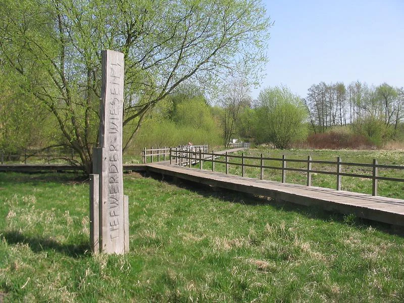
Today the meadows are part of Berlin's wider cultural geography of urban nature. Walking paths, boardwalks and planned green corridors such as the Bullengrabengrünzug connect the wetlands with surrounding neighborhoods, offering residents a place to experience a centuries-old floodplain landscape in the heart of the city.
Top sights and standout views in Tiefwerder-Wiesen
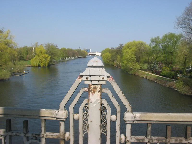
Beyond their biological richness, the Tiefwerder-Wiesen harbor a striking cultural and ecological history. Slavic archaeological finds along the Fauler See, the 1832 Elsgraben canal and the early 20th-century canalization of the Havel all tell a story of how a working floodplain gradually became a protected relic of a vanishing landscape.
What sets the site apart today is this layering of past and present: a once-functional flood-driven ecosystem reshaped by urban growth and now striving to recover its natural rhythms through restoration, artificial watering plans, and grazing management. Nestled between Berlin's dense neighborhoods yet open to the wider Havel corridor, the Tiefwerder-Wiesen offer an unusually compact and layered encounter with the natural and cultural forces that have shaped Spandau for more than a millennium.
Best time to visit Tiefwerder-Wiesen
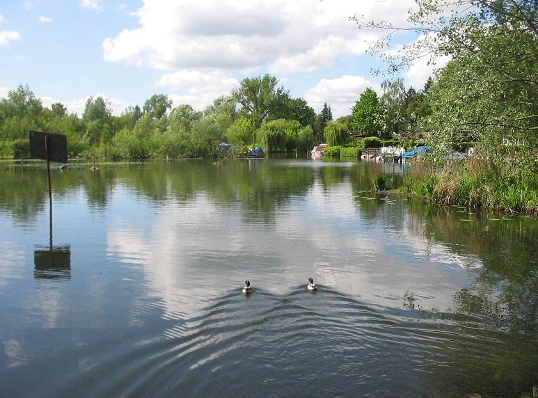
The meadows change character noticeably with the seasons, though winter and spring remain the most ecologically meaningful periods. Late winter to early spring is when rising Havel water levels can still occasionally bring the flooding needed for pike to reach the spawning meadows, a phenomenon that has become increasingly rare since 1990.
Late spring and early summer offer the most colorful wetland display, with marsh marigold, cuckoo campion and other meadow flowers brightening the sedge stands and reed margins. Summer brings tall reeds, dragonflies, bat activity at dusk, and peak bird song from reed warblers and other wetland species. Autumn rewards visitors with quieter trails, gathering waterfowl and the soft amber tones of fading reed beds, while winter reveals the clear geometry of channels, boardwalks and bare willows against the open landscape.
