Mori Atlas logo
Nature reserveTimbavati Private Nature Reserve

Tracing the unfenced boundaries and savanna bushveld ecology within the Greater Kruger system

Timbavati Private Nature Reserve: Mapped Protected Landscapes and Regional Geographic Context

Timbavati Private Nature Reserve sits on the western edge of the Greater Kruger complex in South Africa, covering over 500 square kilometres of undulating Lowveld savanna. This protected area features a mosaic of acacia, mopane, and combretum woodlands that create a distinct ecological corridor. By maintaining open boundaries with public conservation lands, the reserve supports extensive wildlife movement and represents a critical segment of the regional geography in Mpumalanga.

private nature reserveGreater KrugerMpumalangasavanna bushveldBig Five reservewhite lion heritage

Timbavati Private Nature Reserve

Nature reserve

Park overview

Structured park overview, official facts, and landscape profile for Timbavati Private Nature Reserve

Timbavati Private Nature Reserve park facts, protected area profile, and essential visitor context

Review the core facts for Timbavati Private Nature Reserve, including designation, size, terrain, visitor scale, habitats, and operating context in one park-focused overview.

About Timbavati Private Nature Reserve

Timbavati Private Nature Reserve is a substantial privately protected area in northeastern South Africa, occupying a strategic position along the western boundary of Kruger National Park in Mpumalanga Province. The reserve's 534 square kilometres are composed of fifty adjoining tracts of land, each owned by a member of the Timbavati Association, and the unified management of these properties has turned what was once a patchwork of degraded farmland into a continuous stretch of restored Lowveld wilderness.

The reserve forms the heart of a much larger interconnected conservation landscape. To the east lies Kruger National Park, to the north the Klaserie and Umbabat Game Reserves, and to the west the Thornybush Game Reserve. The removal of internal fences between Timbavati and Kruger in 1993 was a landmark moment for southern African conservation, effectively merging thousands of square kilometres of public and private land into one of the continent's most important protected ecosystems. Wildlife now ranges freely across this Greater Kruger complex, which extends south toward Eswatini and reaches the boundaries of Zimbabwe and Mozambique.

Ecologically, Timbavati showcases classic South African savanna bushveld. The terrain is gently undulating, with elevations ranging roughly between 300 and 500 metres above sea level, and the landscape includes six broadly recognised vegetation types: acacia woodland, open woodland, mopane woodland, combretum woodland, mixed combretum woodland, and mixed veld on gabbro soils. This habitat diversity supports an exceptionally rich fauna, including the Big Five and a wide variety of antelope species, from common impala to the rarer roan antelope, eland, and tsessebe. The reserve is also notable for occasional visits by Cape wild dogs, one of Africa's most endangered carnivores.

Alongside its ecological significance, Timbavati has a strong tourism identity. Twelve luxury lodges operate within the reserve, offering high-end safari experiences within an unspoiled setting that was never permanently settled by humans. The reserve's founding story, in which concerned landowners rehabilitated land damaged by past crop and cattle farming, reinforces its reputation as a model for landscape restoration and private-led conservation in South Africa.

Quick facts and research context for Timbavati Private Nature Reserve

Timbavati Private Nature Reserve lies in Mpumalanga Province, South Africa, between latitudes roughly 24°03′S and 24°34′S and longitudes 31°03′E and 31°31′E. It was established in 1956 through the founding of the Timbavati Association and currently unites more than fifty private landowner members across approximately 534 square kilometres.

The reserve sits at the western boundary of Kruger National Park and is part of the Greater Kruger National Park complex, sharing open borders with Kruger, Klaserie, Umbabat, and Thornybush reserves. It is characterised as savanna bushveld with undulating terrain between about 300 and 500 metres in elevation, and it harbours the Big Five along with numerous antelope species and the endangered Cape wild dog.

Protection and recognition

Documented terrestrial protection scope, management framework, and international designations

Timbavati Private Nature Reserve Protection Status and Recognition Data

Timbavati Private Nature Reserve holds documented terrestrial protection status within an established conservation framework. Official records compile available management parameters and international recognition metrics for the protected area.

Protection details

Protection scope
Terrestrial
Transboundary protection
No
Park context

Deeper park guide and search-rich context for Timbavati Private Nature Reserve

Timbavati Private Nature Reserve history, landscape, wildlife, and travel context

Explore Timbavati Private Nature Reserve through its history, landscape character, ecosystems, wildlife, conservation priorities, cultural context, and seasonal travel timing in a structured park guide built for atlas discovery and search intent.

Why Timbavati Private Nature Reserve stands out

Timbavati is best known for being one of the first private reserves to drop fences with Kruger National Park, creating a vast, open Greater Kruger ecosystem. This pioneering unfenced model, adopted in 1993, allowed free movement of wildlife between public and private land and helped restore natural migration patterns across the Lowveld. The reserve is also internationally associated with the white lion, a rare colour variant of the Southern African lion first observed in Timbavati in the mid-1970s. Combined with the reserve's full Big Five complement, healthy populations of antelope, regular sightings of Cape wild dogs, and a strong reputation for safari tourism within a pristine savanna bushveld setting, these qualities define Timbavati's distinct identity among South African private reserves.
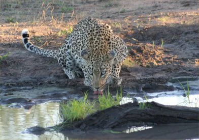
A leopard with a spotted coat crouching at the edge of a muddy water pool to drink, with its tail curled upward.
A leopard drinking from a watering hole in the Timbavati bushveld.

Timbavati Private Nature Reserve history and protected-area timeline

The history of Timbavati Private Nature Reserve is rooted in mid-twentieth century conservation action. In 1956, a group of like-minded landowners came together to form the Timbavati Association, responding to the visible decline of a once pristine wilderness. Years of insensitive land use, primarily crop and cattle farming, had caused widespread soil erosion, the loss of indigenous plant species, and disruption of natural water systems through damming and rerouting of streams. As a result, much of the native wildlife had disappeared from the area.

Association members committed to reclaiming the land for conservation. Over the following decades, every landowner in the region was encouraged to join the effort, and today more than fifty members manage the reserve collectively. Their work has restored the landscape and allowed diverse and sometimes rare wildlife species to once again make the area their home.

A turning point came in 1993, when, in recognition of the ecological importance of the area, the fences between Timbavati and Kruger National Park were removed. This allowed natural species migration between the reserves and effectively integrated Timbavati into the broader Greater Kruger conservation landscape. The reserve's history of human activity is also notably brief: while archaeological evidence shows early Stone Age presence in the Lowveld, large tracts of land, including those that now make up Timbavati, were never permanently settled. This makes Timbavati unusual among modern reserves, as much of it represents genuinely unspoiled wild land rather than heavily restored or restocked terrain.

Timbavati Private Nature Reserve landscape and geographic character

Timbavati's landscape is a textbook example of Lowveld savanna bushveld, set on gently undulating terrain that varies in elevation between roughly 300 and 500 metres above sea level. The reserve's topography is shaped by subtle ridges, valleys, and seasonal drainage lines typical of this part of northeastern South Africa, producing a varied mosaic of habitats across its 534 square kilometres.

The vegetation structure is defined by six major landscape types: acacia woodland, open woodland, mopane woodland, combretum woodland, mixed combretum woodland, and mixed veld on gabbro soils. Each of these supports a different plant and animal community, and their intermingling gives Timbavati its characteristic patchwork of wooded hills, more open grassy stretches, and dense thicket zones. Gabbro-derived soils in particular support distinctive mixed veld communities that contribute to the reserve's botanical diversity.

The climate reinforces the bushveld character of the landscape. A summer wet season from October to March, peaking between December and February, replenishes rivers and watering points and brings dramatic late afternoon thunderstorms. Winters from April to September are dry, with cooler mornings and evenings and warm daytime temperatures, during which animals concentrate around remaining water sources, shaping both the ecology and the atmosphere of the reserve.

Timbavati Private Nature Reserve ecosystems, habitats, and plant life

Timbavati's ecological identity is firmly that of a savanna bushveld system, marked by the coexistence of multiple woodland types within a relatively compact area. The acacia-dominated zones support heavy browsing and grazing pressure, while mopane woodland contributes broad-leaved vegetation resilient to drier conditions. Combretum-rich areas add diversity of form and structure, and the mixed veld on gabbro soils introduces a distinctive edaphic community that complements the surrounding bushveld.

This habitat diversity creates conditions for rich biodiversity across multiple groups of organisms. The reserve supports over forty mammal species, more than seventy-nine reptile species, forty-nine fish species, and at least eighty-five tree species, reflecting the broader ecological richness of the Greater Kruger landscape. The unfenced integration with Kruger National Park also means that Timbavati functions as a living part of a much larger ecosystem, where animal movement, gene flow, and seasonal migrations unfold across thousands of square kilometres of continuous habitat.

Timbavati Private Nature Reserve wildlife and species highlights

Timbavati harbours a full suite of southern Africa's most iconic large mammals. African elephants, African buffaloes, and healthy populations of lion, African leopard, and both South African cheetah and spotted hyena ensure the Big Five are well represented. The reserve also supports an unusually rich antelope community, including kudu, Burchell's zebra, blue wildebeest, Cape giraffe, impala, waterbuck, warthog, and, in smaller numbers, the rarer roan antelope, common eland, and tsessebe.

Among carnivores, the Cape wild dog, Africa's most endangered large predator, is a regular visitor, adding considerable conservation importance to the reserve's wildlife profile. The discovery in the mid-1970s of the white lion, a rare colour variant of the Southern African lion, brought Timbavati international attention and remains strongly associated with the reserve's identity, even though lions were absent for many years before returning in 2006.

Beyond mammals, the reserve's herpetological and aquatic fauna is significant. More than seventy-nine reptile species and forty-nine fish species reflect the diversity of microhabitats across the bushveld. Together, these wildlife assets make Timbavati one of the most ecologically complete private reserves within the South African lowveld.

Timbavati Private Nature Reserve conservation status and protection priorities

Timbavati Private Nature Reserve stands as a leading example of private-led conservation in South Africa. Its founding in 1956 was a deliberate response to environmental degradation, and the reserve's subsequent success in restoring soils, vegetation, and indigenous wildlife demonstrates what coordinated private land management can achieve over decades. The removal of fences with Kruger National Park in 1993 further enhanced its conservation role by enabling natural wildlife migration and embedding Timbavati within a vast, ecologically functional Greater Kruger system.

The reserve also plays a recognised role in biodiversity protection at a regional scale. It supports populations of endangered and vulnerable species such as the Cape wild dog and rare antelope, and its habitat diversity contributes to the resilience of broader species populations across the open border with Kruger. Timbavati additionally serves as a node in ongoing wildlife health surveillance, particularly for bovine tuberculosis and tick-borne diseases, both of which have been studied in the reserve as part of wider monitoring efforts across southern African protected areas. Combined with active malaria vector control for staff and visitors, these measures underscore the reserve's broader contribution to conservation science and protected-area management.

Timbavati Private Nature Reserve cultural meaning and human context

Although Timbavati is fundamentally a natural wilderness, its cultural context is shaped by the history of Lowveld land use and the modern ethos of private conservation. The reserve's founding, in response to the damaging legacy of colonial and post-colonial crop and cattle farming, reflects a broader twentieth-century shift in South Africa toward landscape restoration and wildlife-based economies.

Archaeologically, the area has only fleeting human history. Early Stone Age evidence indicates brief human presence in the broader Lowveld, but the lands now making up Timbavati were never permanently settled by communities and have remained only lightly inhabited. This absence of long-term human pressure contributes to the reserve's reputation as genuinely unspoiled wild land, and supports its identity as a place where conservation values, tourism, and cultural heritage connected to early human history converge with the region's natural heritage.

Top sights and standout views in Timbavati Private Nature Reserve

Timbavati's strongest qualities include its pioneering unfenced connection with Kruger National Park, its large and ecologically diverse 534 square kilometre footprint, and its status as a Big Five reserve with a particularly rich antelope community. The reserve is also distinguished by regular sightings of Cape wild dogs and by its enduring international association with the rare white lion, first documented in the area during the 1970s.

Equally notable is the reserve's landscape diversity, with six recognised woodland and veld types ranging from acacia and mopane to mixed veld on gabbro soils, all set within gently undulating Lowveld topography. Combined with a network of twelve luxury lodges and a strong base of conservation research and disease monitoring, these qualities position Timbavati as one of the most distinctive private reserves within the Greater Kruger National Park complex.

Best time to visit Timbavati Private Nature Reserve

The character of a visit to Timbavati shifts significantly with the seasons. The summer wet season, running roughly from October through March and peaking in December to February, brings high temperatures often around 32°C, dramatic late afternoon thunderstorms, lush vegetation, and abundant water across the bushveld. This is a vibrant time visually, with green landscapes and active birdlife.

The dry winter months, from April to September, are widely associated with more predictable game viewing. As natural water sources diminish, wildlife tends to congregate around remaining waterholes and river points, making animal sightings more consistent. While daytime temperatures can still reach around 28°C, mornings and evenings can drop to around 10°C, requiring warm clothing. For visitors prioritising predator sightings and classic bushveld atmosphere, the dry winter season offers a particularly rewarding experience.
Monthly climate preview

Long-term monthly temperature and precipitation patterns across representative terrain

Timbavati Private Nature Reserve Climate Normals and Annual Temperature Rhythm

Representative coordinate measurements reveal distinct annual temperature swings and monthly precipitation shifts across Timbavati Private Nature Reserve. Examining the full twelve-month profile provides deeper analytical context for long-term climate normals and seasonal weather variations.
Annual mean22 °C
17 °C25 °C
Jan25°
Feb25°
Mar24°
Apr22°
May19°
Jun17°
Jul17°
Aug19°
Sep22°
Oct23°
Nov25°
Dec25°
Warmest month
December

25.3 °C

Coolest month
July

16.8 °C

Wettest month
January

3.9 mm/day

Driest month
June

0.3 mm/day

Park location guide

Geography guide, regional context, and park location map for Timbavati Private Nature Reserve

Timbavati Private Nature Reserve park geography, regions, and map view in South Africa

Understand where Timbavati Private Nature Reserve sits in South Africa through a broader geographic reading of the surrounding landscape, nearby location context, and its mapped position within the national park landscape.

How Timbavati Private Nature Reserve fits into South Africa

South Africa is the southernmost country in Africa, spanning 1.22 million km² with a population of over 63 million. The country operates with three capital cities, Pretoria (executive), Cape Town (legislative), and Bloemfontein (judicial), and is renowned for its biodiversity, national parks, and multicultural society.

Wider geography shaping Timbavati Private Nature Reserve in South Africa

South Africa occupies the southernmost region of Africa, with coastline along both the Atlantic Ocean to the west and the Indian Ocean to the east. The interior features elevated plateaus including the Highveld, with the Drakensberg escarpment marking the eastern highlands. The country shares borders with Namibia, Botswana, Zimbabwe, Mozambique, Eswatini, and Lesotho.

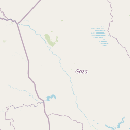
Map view of Timbavati Private Nature Reserve

Use this park location map to pinpoint Timbavati Private Nature Reserve in South Africa, understand its exact geographic position, and read its mapped placement within the surrounding landscape more clearly.

Pigeon | © OpenStreetMap contributors

Location context for Timbavati Private Nature Reserve

Mpumalanga

Visual reference guide to Lowveld bushveld terrain, woodland habitats, and protected landscapes

Timbavati Private Nature Reserve Photos and Savanna Scenery

Visual documentation of Timbavati Private Nature Reserve reveals the rolling Lowveld terrain and diverse woodland habitats that define the unfenced Greater Kruger ecosystem. Examining these protected area photographs provides clear insight into the savanna bushveld vegetation, seasonal watercourses, and regional wildlife environments.

A leopard with a spotted coat crouching at the edge of a muddy water pool to drink, with its tail curled upward.

A golden sunset glowing behind dark, silhouetted savanna trees against a cloudy sky.

Park atlas

Compare adjacent Lowveld savanna reserves and connected conservation landscapes

Explore Parks Near Timbavati Private Nature Reserve and Surrounding Protected Areas

Browse other parks near Timbavati Private Nature Reserve to compare neighboring Lowveld habitats and connected conservation lands across the region. Expanding your geographic view helps trace regional biodiversity patterns and protected-area boundaries throughout northeastern South Africa.
National parkSouth Africa
About 5.2 km away#1 closest

Northeast

Kruger National Park: South Africa's Iconic National Park for Geographic Discovery

Explore savanna landscapes and mapped protected area boundaries.

Kruger National Park serves as a paramount example of a protected landscape, offering a rich tapestry of savanna ecosystems and varied terrain across South Africa's Lowveld. This canonical entry details its vast geographic scope, approximately 19,623 square kilometres, and its status as the nation's first national park. Understand the park's environmental context, from the Lebombo Mountains to the Limpopo River, and its integral role within larger transfrontier conservation initiatives, providing critical insight for atlas-based geographic exploration.

Area
19,623 km²
Established
1926
IUCN
II
Visitors
1.7M annual
Wildlife reserveLimpopo
About 30 km away#2 closest

Southwest

Thornybush Game Reserve: A Protected Wildlife Landscape in Limpopo, South Africa

Mapped savanna corridors and riverine ecological zones

Located in the Limpopo province of South Africa, Thornybush Game Reserve is an essential private wildlife area known for its open savanna and rich riparian vegetation. By maintaining an unfenced boundary with the neighboring national park, it acts as a critical extension of the Greater Kruger wilderness. This entry details its geographical scope, terrain features, and its function as a managed, integrated component of the regional conservation landscape.

Area
140 km²
Water
Minor water
Wildlife reserveLimpopo
About 31 km away#3 closest

West

Kapama Game Reserve: Geographic Atlas and Protected Landscape Map of Limpopo

Explore the diverse terrain and riverine ecosystems of this South African wildlife reserve

Kapama Game Reserve sits within the Limpopo Lowveld, featuring a complex mix of open savanna, mixed bushveld, and dense riverine corridors shaped by the Blyde River. This record provides a detailed look at the reserve as a functional piece of the greater regional conservation landscape, highlighting its topography and its role in protecting South Africa's native habitat.

Area
130 km²
Established
1993
Scope
Terrestrial
Wildlife reserveMpumalanga
About 34 km away#4 closest

South

Manyeleti Game Reserve: Protected Area Boundaries and Lowveld Landscape Mapping

Ecological connectivity within the Mpumalanga conservation mosaic.

Manyeleti Game Reserve offers significant insights into the Lowveld landscape of Mpumalanga. Known for its unfenced connection to neighboring wildlife areas, the reserve provides a case study in contiguous protected land management and bushveld geography that sustains large mammal populations across regional boundaries.

Area
227.5 km²
Established
1967
Water
Minor water
Season
Year-round
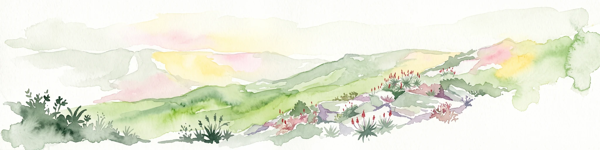
A soft watercolor illustration showing rolling green hills with sparse native vegetation, set against a pale, warm-toned horizon.
Biosphere reserveLimpopo
About 40 km away#5 closest

Northwest

Kruger to Canyons Biosphere: An Atlas of Protected Lands and Geographic Diversity in Limpopo

Integrated conservation across savanna, canyon, and montane ecosystems

Covering the stretch between the Letaba and Sabie Rivers, this biosphere reserve serves as a vital conservation landscape in South Africa. Its unique geography captures the transition from rugged escarpment cliffs to open bushveld, showcasing a high density of protected land and biodiversity. Use this map-oriented resource to understand the structural role of the biosphere as a model for landscape-scale environmental management and its geographic placement within the Limpopo province.

Area
28,748.1 km²
Established
2001
Relief
Mixed relief
Access
Access unknown
Nature reserveLimpopo
About 42 km away#6 closest

Northwest

Balule Nature Reserve: Mapping the Protected Lowveld Savannah and Olifants River Corridor

An open-system wilderness integral to the Greater Kruger ecological network.

Explore the geographic identity of Balule Nature Reserve, a vast protected area in South Africa characterized by its integration with the Greater Kruger wilderness. The terrain encompasses a rich mix of mopane-dominated woodland, riverine forest along the Olifants River, and open subtropical bushveld that supports significant wildlife migrations.

Area
400 km²
Relief
Lowland
Climate
Subtropical
Access
Moderate access
Wildlife reserveMpumalanga
About 55 km away#7 closest

South

Sabi Sand Game Reserve: Geographic Atlas and Protected Landscape Mapping in Mpumalanga

Mapping riparian corridors and savanna ecosystems in eastern South Africa

Sabi Sand Game Reserve provides a foundational study in private conservation landscapes, situated within the Lowveld of Mpumalanga. The reserve is uniquely defined by the Sand and Sabie Rivers, which sculpt the local terrain and support diverse riparian habitats. This atlas-focused entry examines the reserve as a complex, unfenced entity adjacent to Kruger National Park, highlighting its role in regional conservation geography and the spatial distribution of its renowned private concessions.

Area
650 km²
Established
1948
Relief
Lowland
Climate
Subtropical
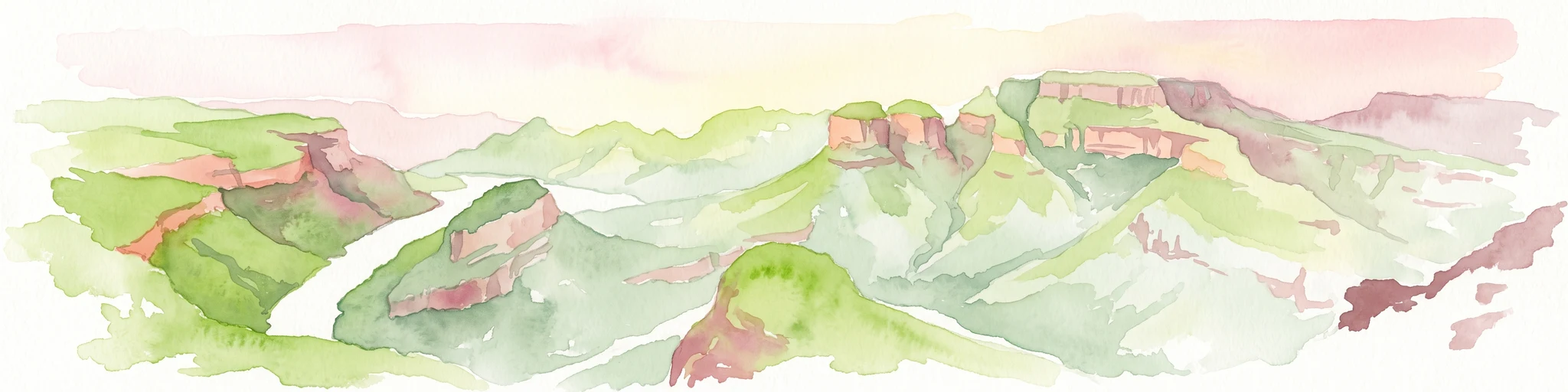
A horizontal watercolor painting depicting the Blyde River Canyon with green slopes, reddish cliff faces, and a winding river.
Nature reserveMpumalanga
About 60 km away#8 closest

Southwest

Blyde River Canyon Nature Reserve: Escarpment Geography and Protected Landscape Map

Mapping river-carved canyons and plateau ecosystems in Mpumalanga

Blyde River Canyon Nature Reserve protects a vast stretch of the Mpumalanga Drakensberg, characterized by vertical cliffs, rocky massifs, and deep river gorges. This atlas-focused resource highlights the reserve's geological landmarks, including the Three Rondavels and Bourke's Luck Potholes, offering a clear view of the complex terrain and protected natural boundaries defining this northeastern South African landscape.

Area
290 km²
Established
1965
Relief
Mountain
Climate
Subtropical

Common questions about visiting, size, designation, and location context for Timbavati Private Nature Reserve

Timbavati Private Nature Reserve FAQs for park facts, access, geography, and protected area context

Find quick answers about Timbavati Private Nature Reserve, including protected-area facts, park geography, trail and visitor context, and how the park fits into its surrounding country and regional landscape.
MoriAtlas Explorer

Continue Your Protected Areas Search Across the Global Atlas

Deepen your exploration by continuing the structured search for national parks and protected areas worldwide. Utilize the comprehensive filtering capabilities to compare different conservation landscapes and refine your understanding of global park geography. Discover more about the distribution and characteristics of protected natural areas.

Global natural geography