


Mori Atlas logo
Nature reserveTsitongambarika

Examining the rugged massif ridges and watershed terrain within the Anosy region

Tsitongambarika Nature Reserve: A Geographical Overview of Southeastern Madagascar's Lowland Forests

(Réserve de Ressources Naturelles de la Forêt Naturelle de Tsitongambarika)

Tsitongambarika Nature Reserve forms a vital expanse of lowland humid evergreen forest in southeastern Madagascar, defined by a series of southwest to northeast aligned ridges. This protected area preserves rare forest cover at elevations below 800 meters and acts as the primary watershed for the surrounding Anosy landscape, including the Manampanihy river system. The geography reveals a complex transition from high-relief forest massifs to the coastal agricultural plains near Fort-Dauphin.

lowland humid forestMadagascarAnosy regionendemic speciesImportant Bird Arealemurs
A digital illustration in a flat, geometric art style showing a waterfall flowing down a rocky cliffside into a river winding through a dense forest under a warm, pastel sky.

Tsitongambarika

Nature reserve

Park overview

Structured park overview, official facts, and landscape profile for Tsitongambarika

Tsitongambarika park facts, protected area profile, and essential visitor context

Review the core facts for Tsitongambarika, including designation, size, terrain, visitor scale, habitats, and operating context in one park-focused overview.

About Tsitongambarika

Tsitongambarika stands as one of the most important forest conservation areas in southeastern Madagascar, a region where the original lowland forest cover has been dramatically reduced by centuries of agricultural expansion. Covering more than 58,000 hectares in the Anosy region just north of Fort-Dauphin, the reserve protects a mountainous landscape of parallel ridges running from southwest to northeast, with the Manampanihy River marking much of its western boundary. Elevations across the site remain relatively modest, with the forest canopy extending from near sea level up to roughly 800 meters, and including the isolated Mount Ivohibe rising to 677 meters.

What sets Tsitongambarika apart from other Malagasy protected areas is its ecological character. The lowland humid evergreen forest found here is considered one of the most threatened vegetation types in Madagascar, yet Tsitongambarika represents the only significant remaining block of this habitat type in the south of the country. Botanical and zoological surveys conducted in the 2000s and 2010s revealed that the area is floristically and faunistically distinct from comparable forests elsewhere on the island, with at least seventy new plant species documented and a high likelihood that many of its amphibian and reptile populations remain undescribed by science.

The reserve's significance extends well beyond its biodiversity. Tsitongambarika's forests anchor the regional water cycle, protecting the catchments of the Manampanihy and Efaho rivers. These waterways sustain the irrigated rice agriculture of the Anosy coastal plain and supply drinking water to Fort-Dauphin, making the forest an irreplaceable natural asset for local livelihoods. Local communities continue to draw on the forest for firewood, charcoal, construction materials, medicinal plants, and bushmeat, underscoring both the deep cultural connection to the land and the pressures facing it.

Recognized as an Important Bird Area by BirdLife International in 2001 and formally protected by national decree in 2015, Tsitongambarika remains a working landscape where biodiversity conservation and human use must coexist. Its continued integrity is tied to the management efforts of Asity Madagascar and to the resilience of the communities that depend on it.

Quick facts and research context for Tsitongambarika

Tsitongambarika is a Natural Resources Reserve covering approximately 58,597 hectares in the Anosy region of southeastern Madagascar, located roughly nine kilometers north of Fort-Dauphin. Governed under IUCN Category VI, it allows sustainable use of natural resources alongside conservation objectives. The reserve is managed by Asity Madagascar, which has worked with local communities on conservation since 2005.

The site was recognized as an Important Bird Area by BirdLife International in 2001 and was formally designated as a national Natural Resources Reserve in 2015 by Decree No. 2015-720. It encompasses the Tsitongambarika massif, a series of ridges aligned from southwest to northeast, bounded to the west by the Manampanihy River. The reserve protects a watershed that feeds both the Manampanihy and Efaho river systems, supplying irrigation for rice farming and drinking water for Fort-Dauphin.

Protection and recognition

Documented terrestrial protection history and formal conservation framework

Tsitongambarika Protection Status and Designated Area Records

Tsitongambarika holds a documented terrestrial protection status established in the year 2015. Recorded designation history provides essential context for analyzing the geographic management scope and formal conservation framework of the protected area.

Protection details

Protection scope
Terrestrial
Designated year
2015
Transboundary protection
No
Park context

Deeper park guide and search-rich context for Tsitongambarika

Tsitongambarika history, landscape, wildlife, and travel context

Explore Tsitongambarika through its history, landscape character, ecosystems, wildlife, conservation priorities, cultural context, and seasonal travel timing in a structured park guide built for atlas discovery and search intent.

Why Tsitongambarika stands out

Tsitongambarika is best known as the only significant lowland humid evergreen forest remaining in southern Madagascar, an ecosystem distinguished by its floristic and faunistic character from lowland forests elsewhere on the island. Its forests descend to unusually low elevations for the southeast of Madagascar, including large tracts below 400 meters, a rare feature in the region. The reserve is also celebrated for its extraordinary biodiversity, with botanical surveys identifying dozens of new species and the area emerging as one of the richest palm sites in southern Madagascar. The Anosy region hosts one of the two highest concentrations of globally threatened amphibian species in Madagascar and is among the richest in the country for reptile diversity. Tsitongambarika's intact habitat supports endangered forest birds such as the brown mesite and scaly ground-roller, alongside endemic lemurs that depend on undisturbed primary evergreen forest.
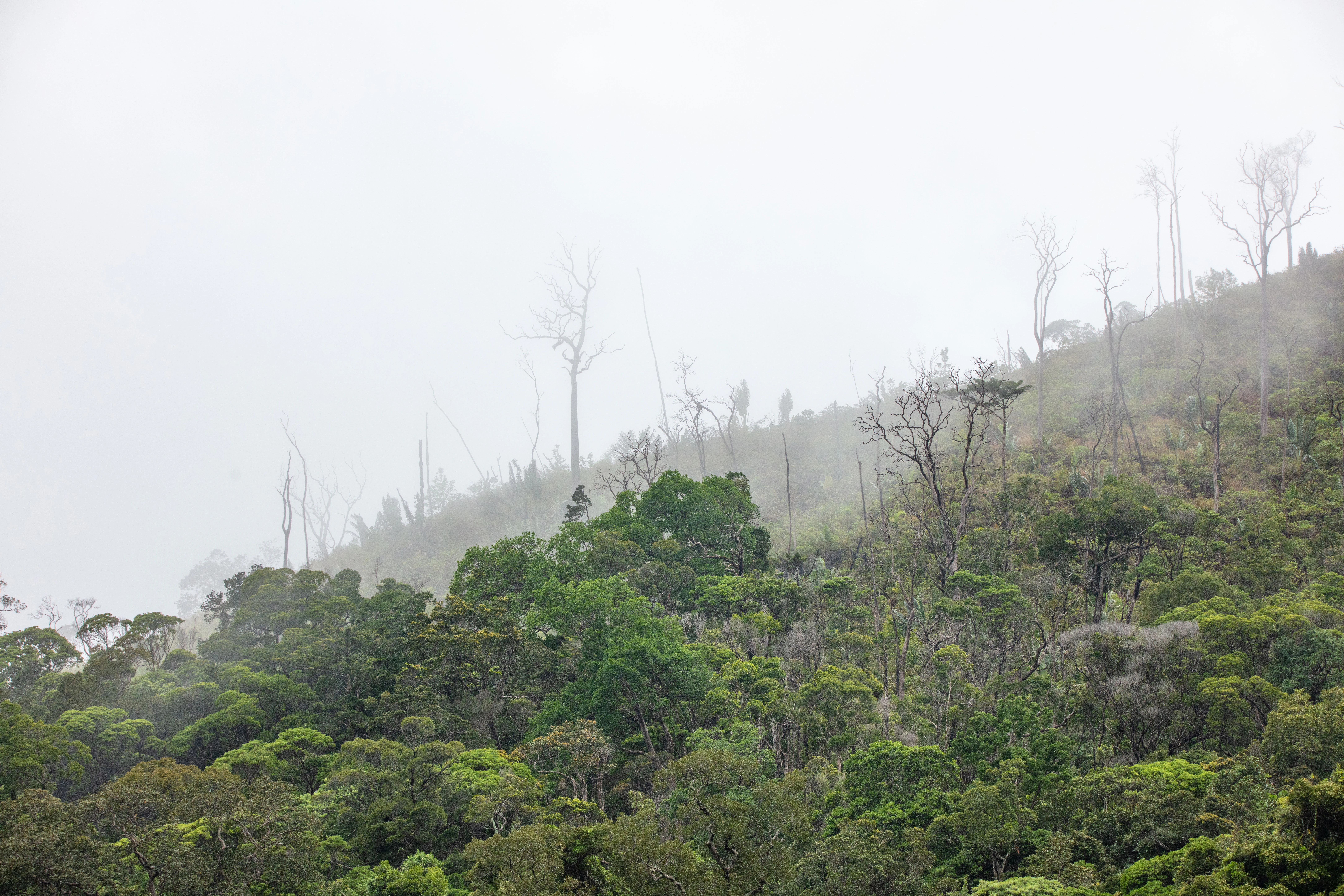
A dense, green, hilly forest landscape in Madagascar covered in thick mist with several tall, bare, leafless trees protruding from the canopy.
Misty view of the dense humid evergreen forest canopy within Tsitongambarika.

Tsitongambarika history and protected-area timeline

The forests of Tsitongambarika were first brought under formal state protection in the 1960s and 1970s through a series of classified forest designations. In 1965, Order No. 3240-MAER/FOR established the Forêt Classée de Tsitongambarika I across 19,530 hectares, followed in 1970 by the designation of Tsitongambarika II through Order No. 2241-MAER/SEGREF/FOR/DOM, covering an additional 29,400 hectares. These classifications laid the institutional groundwork for later conservation efforts but did not prevent ongoing forest loss from agricultural expansion and timber extraction.

In 2001, BirdLife International formally recognized Tsitongambarika as an Important Bird Area, drawing international attention to its significance for forest-dependent bird species and to the threats facing the site. Beginning in 2005, the Malagasy conservation organization Asity Madagascar initiated a long-term program of collaborative management with local communities, marking a shift toward integrated conservation that acknowledged the role of subsistence use in the landscape.

The most significant institutional milestone came in 2015, when the Government of Madagascar issued Decree No. 2015-720 on 21 April, consolidating the earlier classified forest areas into the Réserve de Ressources Naturelles de la Forêt Naturelle de Tsitongambarika. This decree unified the fragmented protections under a single legal framework and brought the total protected area to approximately 58,957 hectares. Despite this formal protection, BirdLife International continues to classify the site as an Important Bird Area in Danger, reflecting the persistent and ongoing pressures from deforestation and land conversion.

Tsitongambarika landscape and geographic character

The landscape of Tsitongambarika is defined by the Tsitongambarika massif, a series of forested ridges aligned in a consistent southwest-to-northeast orientation. This linear topographic pattern shapes the drainage networks of the region, with the Manampanihy River running northward along the western edge of the massif and carving the principal boundary of the reserve. Elevations across most of the protected area remain below 800 meters, a relatively low profile that distinguishes the site from the higher massifs of central and northern Madagascar.

The reserve includes the isolated Mount Ivohibe, a 677-meter peak within the massif that retains a relatively undisturbed forest cover. The surrounding terrain falls in elevation toward the coastal plain to the east, where rice paddies and settlements form part of the broader Anosy landscape. This transition from rugged ridges to lowland agricultural plain is characteristic of southeastern Madagascar, though Tsitongambarika preserves an unusually intact example of the forested middle ground between mountains and coast.

The unusual feature of Tsitongambarika's geography is the extent of low-elevation habitat. While humid forests in southeastern Madagascar are typically found at higher elevations, Tsitongambarika includes significant forest areas below 400 meters, a rare condition for the region. This elevational range contributes to the diversity of forest structures found in the reserve, and supports the watersheds that feed both the Manampanihy and Efaho river systems across the Anosy region.

Tsitongambarika ecosystems, habitats, and plant life

The ecological identity of Tsitongambarika centers on its lowland humid evergreen forest, an ecosystem classified among the most threatened vegetation types in Madagascar. This forest type is floristically and faunistically distinct from comparable lowland forests elsewhere on the island, giving Tsitongambarika a unique position in the country's conservation landscape. The reserve also contains areas of sclerophyllous montane forest at higher elevations, adding structural diversity to the vegetation mosaic.

At lower elevations, the forest canopy typically reaches 15 to 25 meters in height and is dominated by species of Dracaena, Ilex, Oncostemum, Sorindeia, Syzygium, and Tambourissa. At mid-elevations, the canopy is slightly lower, generally between 12 and 20 meters, with trees of Macaranga, Oncostemum, and a notable presence of Guttiferae, Monimiaceae, Moraceae, and Myrtaceae. These layered forest structures create a range of habitat conditions that support the diverse animal communities documented in the area.

A 2010 expedition organized by the Royal Botanic Gardens, Kew to Mount Ivohibe recorded twenty species of palms, marking the site as one of the richest palm locations in southern Madagascar. Sixteen of these palm species are categorized as rare or threatened on the IUCN Red List. Across the broader reserve, botanical surveys in the 2000s identified at least seventy species new to science, underscoring how much of the area's botanical diversity remained undocumented before recent exploration.

Tsitongambarika wildlife and species highlights

Tsitongambarika supports an exceptional concentration of endemic and threatened wildlife, particularly among its amphibian, reptile, and bird communities. The Anosy region in which it sits is one of two areas in Madagascar with the highest number of globally threatened amphibian species, and is also among the richest in the country for reptile diversity, with several species known only from this region. Many of the amphibians and reptiles of Tsitongambarika are likely still undescribed by science, suggesting considerable hidden biodiversity.

The reserve is particularly important for forest-dependent bird species. The brown mesite, a ground-dwelling bird restricted to undisturbed primary evergreen humid forest, is found here and is classified as vulnerable due to fragmentation along Madagascar's eastern seaboard. Other notable bird species include the Madagascar blue-pigeon, Madagascar wood-rail, nelicourvi weaver, nuthatch vanga, red-fronted coua, scaly ground-roller, spectacled tetraka, and white-throated oxylabes, all characteristic birds of intact Malagasy humid forest.

Lemurs and other mammals also find refuge in the reserve's intact forest canopy, though specific details about primate populations are deeply tied to the broader habitat integrity of the site. The presence of so many forest-specialist species across multiple animal groups underscores the reserve's importance as a refuge for Madagascar's endemic fauna, particularly given the rarity of undisturbed lowland forest elsewhere in the south of the island.

Tsitongambarika conservation status and protection priorities

Tsitongambarika holds outsized conservation importance as the last significant lowland humid evergreen forest remaining in southern Madagascar. The protection of this habitat is a national priority because the broader vegetation type is among the most threatened in the country, and the loss of Tsitongambarika would represent an irreplaceable ecological loss for the region.

The conservation framework of the reserve has evolved over decades. Earlier classified forest designations from 1965 and 1970 were consolidated in 2015 under Decree No. 2015-720, creating a unified Natural Resources Reserve whose IUCN Category VI designation explicitly allows for sustainable use of natural resources alongside biodiversity conservation. Asity Madagascar has led on-the-ground management since 2005, working in partnership with local communities to balance ecological protection with the subsistence needs of surrounding populations.

International recognition has reinforced the site's conservation profile. BirdLife International designated Tsitongambarika as an Important Bird Area in 2001, but has since reclassified it as an IBA in Danger, signaling that legal protections alone have not halted ongoing habitat loss. The reserve also plays a critical role in watershed protection, safeguarding the Manampanihy and Efaho catchments that sustain both irrigated agriculture and the drinking water supply of Fort-Dauphin. This combination of biodiversity value and ecosystem service provision makes the conservation stakes at Tsitongambarika exceptionally high.

Tsitongambarika cultural meaning and human context

Tsitongambarika lies at the heart of the Anosy region, an area with deep cultural ties to Madagascar's southeastern traditions. Local communities have long relied on the forest for subsistence needs, drawing on it for firewood, charcoal, construction materials, medicinal plants, and bushmeat. Because the regional economy is largely subsistence-based and poverty levels are high, dependence on forest products is woven into daily life and forms an important part of the cultural relationship with the landscape.

The forest also underpins the agricultural traditions of the Anosy coast. Rivers fed by the Tsitongambarika catchment support the irrigated rice cultivation that defines the coastal plain, integrating the protected area into the economic and food systems of the region. Local forms of forest management and traditional resource use have shaped how conservation efforts have been designed, with organizations like Asity Madagascar adopting community-based approaches that acknowledge these long-standing relationships.

Top sights and standout views in Tsitongambarika

Tsitongambarika is distinctive for being the only significant lowland humid evergreen forest remaining in southern Madagascar, with notable forest cover extending below 400 meters in elevation. The reserve's biodiversity profile is exceptional, having yielded at least seventy new plant species in recent surveys and supporting one of the richest palm communities known in southern Madagascar.

The reserve also stands out for the concentration of threatened wildlife it shelters, particularly among amphibians, reptiles, and forest birds such as the vulnerable brown mesite. Its role as the principal watershed for the Anosy region gives Tsitongambarika an importance that extends well beyond biodiversity, sustaining both irrigation for rice farming and the water supply of Fort-Dauphin.

Best time to visit Tsitongambarika

The climate of southeastern Madagascar features a wet season from roughly November to April and a drier season from May to October. The cooler, drier months are generally the most comfortable for accessing forested terrain and for birdwatching, when trails are more passable and many species are more easily observed along forest edges and clearings.

For those interested in reptiles and amphibians, the warmer early wet season brings greater surface activity among these groups, though heavier rains can make forest trails more difficult. The unique character of Tsitongambarika, ranging from humid lowland forest to montane ridges, means that the forest itself remains a compelling destination throughout much of the year, with each season offering a different perspective on its landscapes and wildlife.
Monthly climate preview

Long term temperature and precipitation cycles across representative coordinates

Tsitongambarika Climate Normals and Monthly Weather Patterns

Tsitongambarika records documented annual temperature ranges alongside measured monthly precipitation averages from representative coordinate data. Examining the complete twelve month profile reveals detailed long term meteorological rhythms across the protected landscape.
Annual mean21 °C
16 °C24 °C
Jan24°
Feb24°
Mar23°
Apr21°
May19°
Jun17°
Jul16°
Aug17°
Sep19°
Oct21°
Nov23°
Dec24°
Warmest month
January

23.8 °C

Coolest month
July

16.5 °C

Wettest month
February

8.2 mm/day

Driest month
September

1.5 mm/day

Park location guide

Geography guide, regional context, and park location map for Tsitongambarika

Tsitongambarika park geography, regions, and map view in Madagascar

Understand where Tsitongambarika sits in Madagascar through a broader geographic reading of the surrounding landscape, nearby location context, and its mapped position within the national park landscape.

How Tsitongambarika fits into Madagascar

Madagascar is an island nation in the Indian Ocean, positioned off the southeastern coast of Africa. As the world's fourth-largest island and second-largest island country, it stands out for its exceptional biodiversity, over 90% of its wildlife is endemic, making it one of 17 megadiverse countries. The population is approximately 32 million, with Antananarivo as both the capital and largest city.

Wider geography shaping Tsitongambarika in Madagascar

Madagascar lies in the Indian Ocean off the southeastern coast of Africa, separated from the mainland by the Mozambique Channel. The island is situated approximately 400 km from the African continent. As the world's fourth-largest island, it also includes numerous smaller peripheral islands.

Map view of Tsitongambarika

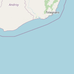
Use this park location map to pinpoint Tsitongambarika in Madagascar, understand its exact geographic position, and read its mapped placement within the surrounding landscape more clearly.

Pigeon | © OpenStreetMap contributors

Location context for Tsitongambarika

Anosy

Visual reference guide to lowland evergreen forest habitats and protected terrain

Tsitongambarika Photos and Landscape Scenery in Madagascar

Visual records illustrate the rugged forested ridges and low-elevation humid habitats that define the landscape of Tsitongambarika. Photographic documentation provides deeper insight into the rare evergreen canopy and protected terrain of the Anosy region.

A dense, green, hilly forest landscape in Madagascar covered in thick mist with several tall, bare, leafless trees protruding from the canopy.

Park atlas

Compare regional biodiversity and neighboring forest reserves in southeastern Madagascar

Exploring Parks Near Tsitongambarika and Surrounding Protected Landscapes

Browsing other protected areas near Tsitongambarika reveals connected lowland humid forests and related conservation landscapes across the Anosy region. Expanding beyond this rugged massif provides essential geographic context for regional wildlife habitats and watershed networks.
Nature reserveMadagascar
About 20 km away#1 closest

Southeast

Sainte Luce Reserve: Mapping Madagascar's Coastal Rainforest and Nature Reserve Boundaries

Coastal littoral forest, rare ebony enclaves, and mangrove ecosystems.

Located on the southeastern coast of Madagascar, Sainte Luce Reserve represents an intensive conservation area for littoral forest ecosystems. The reserve protects a unique linear landscape of Pandanus rainforests, white-sand ebony stands, and riverine mangroves, serving as a sanctuary for endangered palms and various endemic lemur species within its concentrated geographic footprint.

Area
0.4 km²
Established
2009
Visitors
50 annual
Relief
Lowland
Nature reserveMadagascar
About 28 km away#2 closest

South

Mandena Conservation Zone: Protected Littoral Forest and Wetland Geography in Madagascar

A critical nature reserve near the southeastern coastline

Mandena Conservation Zone protects over 200 hectares of rare littoral forest and coastal swamp in southeastern Madagascar. As one of the few remaining fragments of this unique coastal ecosystem, the reserve provides a critical habitat for endemic lemur populations and serves as an important site for understanding the regional geography of the Tolagnaro area.

Area
2.3 km²
Relief
Lowland
Climate
Tropical
Access
Access unknown
National parkMadagascar
About 32 km away#3 closest

West

Andohahela National Park: Protected Landscape and Geographic Atlas Context in Madagascar

Explore the mapped terrain and regional park geography.

Understand Andohahela National Park as a distinct national park entity, focusing on its geographic setting and protected landscape characteristics within Madagascar. This detail page provides structured data on the park's mapped boundaries and its regional importance, offering insights for anyone exploring protected areas and natural terrain through a geographic lens. It is an essential resource for understanding the park's specific context in the broader atlas.

Area
760 km²
Established
1998
IUCN
II
Visitors
1.3K annual
Wildlife reserveAnosy
About 78 km away#4 closest

Southwest

Berenty Reserve Wildlife Reserve in the Anosy Region of Southern Madagascar

Spiny forest ecology and riverine landscape mapping

Berenty Reserve offers a concentrated look at the semi-arid spiny forests of southern Madagascar. This wildlife reserve, located along the Mandrare River in the Anosy region, serves as a vital protected area for observing endemic species within a striking terrain of cactus-like plants, baobabs, and thorny thickets.

Relief
Lowland
Climate
Arid
Access
Moderate access
Scope
Terrestrial
National parkAtsimo-Atsinanana
About 133 km away#5 closest

North

Midongy du sud National Park: National Park in Atsimo-Atsinanana, Madagascar

Explore its protected landscape and mapped geography.

Midongy du sud National Park is a significant protected area located in the Atsimo-Atsinanana region of Madagascar. This entry provides detailed geographic context, focusing on the park's mapped boundaries and its identity as a national park. It supports atlas-based discovery by offering insights into the park's specific landscape and its regional setting within southeastern Madagascar, serving as a factual resource for understanding its protected status.

Area
1,922 km²
Established
1997
IUCN
II
Relief
Mountain
Wildlife reserveMadagascar
About 146 km away#6 closest

North

Kalambatritra Special Reserve: Exploring the Geography of Southern Madagascar Protected Lands

Mapping a unique humid highland forest refuge

The Kalambatritra Special Reserve comprises a significant forested block in southern Madagascar, defined by ridges and valleys that maintain a humid microclimate. This protected area serves as a critical habitat for endemic wildlife, bridging the gap between eastern forest ecosystems and the drier terrain of the southern plateau, providing an essential study in island geography and conservation.

Area
282.55 km²
Established
1959
IUCN
IV
Scope
Terrestrial
Wildlife reserveAndroy
About 209 km away#7 closest

Southwest

Réserve spéciale du Cap Sainte-Marie: Wildlife Reserve and Protected Coastal Landscape in Androy

An essential arid-zone habitat at the southernmost edge of Madagascar

Réserve spéciale du Cap Sainte-Marie protects a fragile ecosystem of spiny thicket and coastal terrain. As a focal point for tortoise conservation in the Androy region, this reserve offers a window into the specialized reptile habitats and harsh environmental conditions that define the southern extremity of the Madagascar landscape.

Area
17.5 km²
Established
1962
IUCN
IV
Scope
Terrestrial
Wildlife reserveAtsimo-Atsinanana
About 225 km away#8 closest

North

Manombo Special Reserve: Protected Geography and Coastal Forest Mapping

Southeastern Madagascar wildlife reserve and humid forest habitat.

Examine the ecological mosaic of Manombo Special Reserve, a protected wildlife area located in the Atsimo-Atsinanana region. This reserve features a distinctive split-parcel configuration across National Route 12, offering insights into lowland rainforest conservation, wetland systems, and the dense endemism of Madagascar's southeastern coastal geography.

Area
53.2 km²
Established
1956
IUCN
IV

Common questions about visiting, size, designation, and location context for Tsitongambarika

Tsitongambarika FAQs for park facts, access, geography, and protected area context

Find quick answers about Tsitongambarika, including protected-area facts, park geography, trail and visitor context, and how the park fits into its surrounding country and regional landscape.
MoriAtlas Explorer

Continue Your Protected Areas Search Across the Global Atlas

Deepen your exploration by continuing the structured search for national parks and protected areas worldwide. Utilize the comprehensive filtering capabilities to compare different conservation landscapes and refine your understanding of global park geography. Discover more about the distribution and characteristics of protected natural areas.

Global natural geography