
Mori Atlas logo
Protected areaTso Kar

A Trans-Himalayan geographic study of saline lake margins, steppe plains, and wetland ecosystems

Tso Kar Protected Area: Mapping the High-Altitude Wetlands of the Ladakh Plateau

(Tso Kar Wetland Complex)

Tso Kar represents a critical high-altitude wetland system situated on the Rupshu Plateau in Ladakh, India. This protected landscape is defined by its signature white salt crust, the adjacent freshwater Startsapuk Tso, and expansive steppe plains framed by 6,000-meter Himalayan peaks. The area functions as a cornerstone habitat within the Central Asian Flyway, providing essential terrain for migratory waterbirds and reflecting the unique geological and climatic conditions of the Trans-Himalayan region.

salt lakeRamsar wetlandhigh-altitude lakeTrans-Himalayan plateauChangthangRupshu Plateau
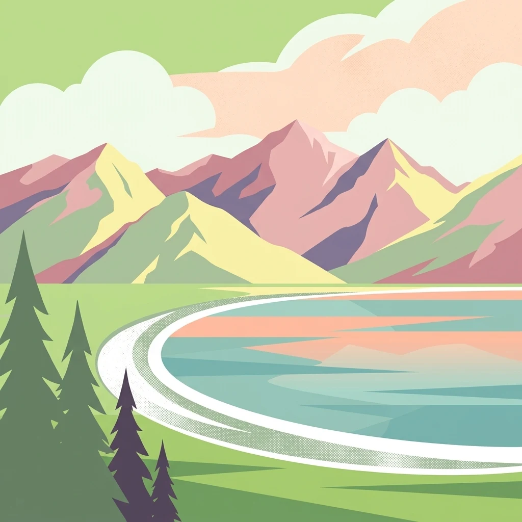
An artistic vector-style illustration of a calm body of water in the foreground with layered mountain ranges in the background, framed by stylized pine trees on the left side under a pastel sky.

Tso Kar

Protected area

Park overview

Structured park overview, official facts, and landscape profile for Tso Kar

Tso Kar park facts, protected area profile, and essential visitor context

Review the core facts for Tso Kar, including designation, size, terrain, visitor scale, habitats, and operating context in one park-focused overview.

About Tso Kar

Tso Kar is a large, fluctuating salt lake occupying a high basin within the Rupshu Plateau of the Changthang region in southern Ladakh. Far from being an isolated water body, it functions as the centerpiece of a broader wetland and steppe ecosystem that stretches across the More Plains. The lake is fed mainly by seasonal streams and glacial meltwater, with the primary inflow stream, Pholokongka Chu, feeding its southwestern end. From this inlet, a small channel connects Tso Kar to the smaller, freshwater Startsapuk Tso, creating a two-lake system with sharply contrasting salinities.

The character of the basin shifts dramatically between seasons and water levels. In some periods the lake expands across the surrounding flatlands, while at other times it retreats to reveal broad salt-encrusted shorelines, giving the area its Tibetan-derived name, which refers to the white salt efflorescence on its margins. The More Plains pool, formed by Tso Kar and Startsapuk Tso, occupies a basin flanked by two imposing peaks: Thugje (6,050 m) and Gursan (6,370 m), whose snow-covered flanks dominate the skyline to the north.

Beyond its geography, Tso Kar is ecologically and culturally significant. It is recognized internationally as a Ramsar wetland, and birdwatchers and naturalists regard it as one of the key stops along the Central Asian Flyway. The surrounding steppe sustains kiang, Tibetan gazelles, Tibetan wolves, foxes, and high-altitude grazers like yaks and sheep tended by the Changpa nomads. Salt harvesting was once an important traditional activity here, with salt from the lake historically exported across the nearby Tibetan border. Today, the area combines protected ecological status, traditional pastoral land use, and growing recognition as a destination for travelers exploring the southern Ladakhi plateau.

Quick facts and research context for Tso Kar

Tso Kar is a high-altitude oligotrophic salt lake in the Rupshu Plateau of southern Ladakh, in far northern India. It lies in what is now the Changthang district and forms the larger, hypersaline northern component of the Tso Kar Wetland Complex, alongside the freshwater Startsapuk Tso to the south. The site was recognized in 2020 as India's 42nd Ramsar Site (reference number 2443), giving it formal international wetland protection status.

Protection and recognition

Documented terrestrial designation history and Ramsar wetland recognition details

Tso Kar Protection Status and International Recognition Records

Terrestrial protection status records for Tso Kar outline the official designation history established in 2020. International recognition details include documented Ramsar wetland listings for the surrounding wetland complex.

International recognition

Protection details

Protection scope
Terrestrial
Designated year
2020
Transboundary protection
No
Park context

Deeper park guide and search-rich context for Tso Kar

Tso Kar history, landscape, wildlife, and travel context

Explore Tso Kar through its history, landscape character, ecosystems, wildlife, conservation priorities, cultural context, and seasonal travel timing in a structured park guide built for atlas discovery and search intent.

Why Tso Kar stands out

Tso Kar is best known as one of the most important high-altitude wetlands in India and as a critical breeding and stopover habitat for migratory birds along the Central Asian Flyway. It is one of the country's most important breeding areas for the black-necked crane, and it also supports breeding grebes, bar-headed geese, ruddy shelducks, brown-headed gulls, and other waterbirds. The lake is equally defined by its harsh Trans-Himalayan setting: a saline lake ringed by white salt deposits, interspersed with steppe pastures, salt flats, and towering peaks such as Thugje and Gursan. This combination of saline lake, steppe, and dramatic mountain backdrop is what makes Tso Kar one of the most distinctive wetland landscapes of the Indian Himalayas.
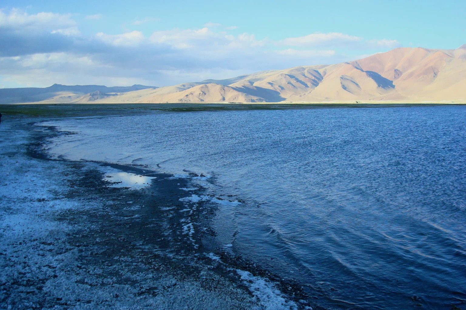
A wide view of a large, blue high-altitude salt lake with a salt-white shoreline and dry, rugged mountains in the distance under a clear sky.
The saline waters and salt-crusted shores of Tso Kar in the Ladakh region.

Tso Kar history and protected-area timeline

Tso Kar has long been part of the high-altitude pastoral landscape of the Changthang region, where the Changpa nomads have traditionally grazed yaks, horses, sheep, and goats across the surrounding steppe. For generations, the lake itself was an important source of salt; nomads harvested the white efflorescence around its margins and exported the salt into Tibet, making the basin part of an ancient cross-border trade network.

In modern times, recognition of the area's ecological value grew steadily. The Tso Kar Basin was classified as an A1 Category Important Bird Area, reflecting its exceptional significance for breeding and migratory waterbirds, especially the black-necked crane. In 2020, the Tso Kar Wetland Complex, comprising Tso Kar along with Startsapuk Tso and surrounding wetlands, was formally designated as India's 42nd Ramsar Site, placing it within the global network of internationally important wetlands.

In August 2025, Tso Kar's remoteness and Mars- and Moon-like environment drew additional attention when India's space agency ISRO, together with a private space technology partner, began operating a space analogue station at the site. The station uses the area's extreme terrain and isolation to test crewed interplanetary mission concepts, placing this traditional salt-lake basin on the frontier of future space exploration research as well as wetland conservation.

Tso Kar landscape and geographic character

Tso Kar sits within a vast, flat-floored basin on the Rupshu Plateau, surrounded by the sweeping More Plains and flanked by massive Himalayan peaks. To the north rise Thugje (6,050 m) and Gursan (6,370 m), whose snow- and ice-covered slopes contrast with the pale, almost lunar surface of the salt-encrusted flats below. The plateau itself is broad and open, giving the lake a sense of scale and exposure that is rare in more enclosed mountain valleys.

The lake's margins are dominated by the white salt crust that gives the basin its name, a stark and almost otherworldly feature against the surrounding browns and ochres of the high steppe. Where freshwater streams enter the basin, the picture changes: lush patches of sedges, buttercups, and pondweeds appear, and in spring these form floating mats of vegetation on the freshwater portions of the system. Toward the south, the freshwater Startsapuk Tso softens the extreme mineral landscape with greener lakeside vegetation, while dry steppe and tragacanth-dominated scrub spread outward across the wider plains.

The regional climate intensifies the visual drama of the landscape. With winter temperatures that can plunge below -40 degrees Celsius and summer days that may rise above 30 degrees Celsius, the basin experiences extreme diurnal and seasonal variation. Precipitation is rare, enhancing the sense of aridity and amplifying the contrasts between white salt flats, blue water, and the dark, rocky ramparts of the encircling mountains.
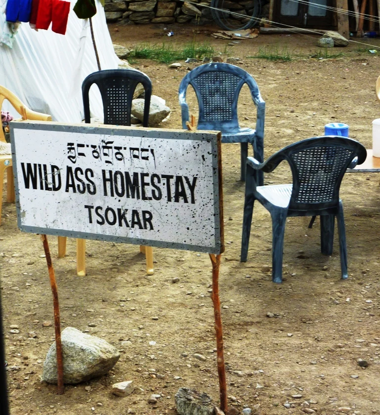
A white metal sign on two thin wooden posts reads Wild Ass Homestay Tsokar in black lettering, with Tibetan script above the English text; several plastic chairs are arranged in the dirt behind it.
Signage for the Wild Ass Homestay located near Tso Kar lake in Ladakh.

Tso Kar ecosystems, habitats, and plant life

The Tso Kar Wetland Complex combines two contrasting ecological worlds within a single basin: the hypersaline Tso Kar to the north and the freshwater Startsapuk Tso to the south. The salinity gradient between them supports different plant communities on either side. Around the inflows, freshwater pondweeds and charales grow, sometimes forming floating vegetation mats in spring before dying back in winter. Along the shores of Startsapuk Tso and the lake's tributaries, sedge meadows and large stands of buttercups flourish, while higher, drier ground transitions into classic high-altitude steppe vegetation, including tragacanth and pea bushes.

Surrounding the lakes, the More Plains develop an open, semi-arid ecological character typical of the western Tibetan Plateau, with sparse but specialized plant cover adapted to intense cold, intense sunlight, and limited moisture. This mosaic of salt flat, freshwater wetland, sedge meadow, and steppe creates habitat diversity within a relatively compact geographic area, supporting distinct ecological communities that would not coexist in less varied terrain.
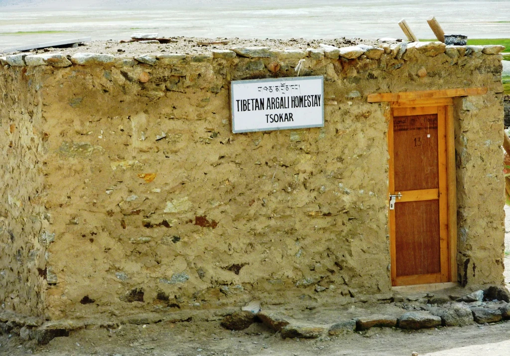
A small, single-story stone structure with a wooden door and a sign reading Tibetan Argali Homestay Tsokar mounted on the wall.
A small stone building identified as the Tibetan Argali Homestay at Tso Kar.

Tso Kar wildlife and species highlights

The Tso Kar basin is one of the most important strongholds of high-altitude waterbird life in India. The lake lies along the Central Asian Flyway, and its combination of saline and freshwater habitats supports both migratory and resident species across the seasons. The site is particularly notable as one of India's most important breeding areas for the black-necked crane, an icon of the Trans-Himalayan wetlands. Around the freshwater edges, large breeding colonies of great crested grebes and brown-headed gulls are joined by bar-headed geese, ruddy shelducks, and various terns, with Tibetan sandgrouse and black-necked cranes also common in the vicinity.

On land, the surrounding steppe and More Plains sustain a community of large and small mammals typical of the Tibetan Plateau. Kiang, the wild Tibetan ass, roam the open flats in significant numbers, while Tibetan gazelles, Tibetan wolves, and foxes move through the same terrain. Himalayan marmots occupy higher reaches, and the area also hosts the endangered saker falcon, the Asiatic wild dog (dhole), and the vulnerable snow leopard in the surrounding mountains. Domesticated yaks, horses, sheep, and goats grazed by the Changpa nomads complete the visible mammal community.
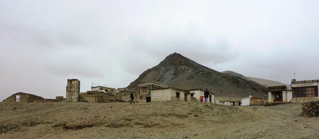
A wide view of a small, rustic village in a dry, mountainous region under a cloudy sky.
A small settlement located near Tso Kar lake in the high-altitude region of Ladakh.

Tso Kar conservation status and protection priorities

The Tso Kar Wetland Complex stands out as a conservation priority because it protects a rare combination of high-altitude wetland types within a single, internationally recognized framework. Designation as India's 42nd Ramsar Site in 2020 gave the lake and Startsapuk Tso global recognition under the Ramsar Convention. At a national and regional level, the basin is also recognized as an A1 Category Important Bird Area, the highest category under BirdLife International criteria, reflecting its exceptional role in supporting threatened and congregatory bird species.

The complex's conservation value rests on several elements: the breeding population of black-necked crane, the presence of breeding grebes, gulls, geese, and plovers, and the mix of saline and freshwater wetlands that together support a uniquely diverse waterbird community. The surrounding steppe also conserves important populations of kiang, Tibetan gazelles, and other plateau mammals. Maintaining these values requires balancing the traditional grazing and salt-related practices of the Changpa nomads with the ecological sensitivities of one of the world's highest-altitude wetland ecosystems.

Tso Kar cultural meaning and human context

Tso Kar lies within the traditional homeland of the Changpa nomads, a Tibetan-speaking pastoral people whose lifestyle is closely tied to the seasonal rhythms of the Changthang plateau. For generations, the Changpa have grazed yaks, horses, sheep, and goats across the More Plains and used the lake as a source of salt, an important commodity that was once exported from this remote corner of Ladakh into Tibet. The settlement of Thugje, located only about 3 kilometers from the lake, reflects this long-standing pastoral presence.

In recent years, the cultural landscape has also been given a new dimension through small-scale tourism. Tented camps along the western shore of Tso Kar offer homestays and accommodation to visitors, allowing encounters with Changpa hospitality and traditional high-altitude life. Beyond these interactions, the very geography of the area, with its Tibetan place names, Buddhist-influenced pastoral culture, and isolated trading history, links the Tso Kar basin culturally as much to the Tibetan Plateau as to the rest of India.

Top sights and standout views in Tso Kar

Tso Kar's defining highlights are its salt-encrusted shoreline, the contrast with the adjacent freshwater Startsapuk Tso, and the surrounding More Plains steppe framed by 6,000-meter-plus Himalayan peaks. The lake is a cornerstone breeding ground for the black-necked crane and a major stopover for waterbirds moving along the Central Asian Flyway.

Visitors and researchers are also drawn by the area's combination of stark, otherworldly scenery and rich biodiversity, from kiang and Tibetan gazelles on the plains to the endangered saker falcon and snow leopard in the surrounding heights. Tso Kar's status as a Ramsar site, its dual lake character, and its working pastoral landscape together make it one of the most distinct wetland destinations in the Indian Himalayas.

Best time to visit Tso Kar

Given the extreme climate of the Rupshu Plateau, the most accessible period to experience Tso Kar is the short high-altitude summer season, when daytime temperatures rise into the warmer range, frozen ground thaws enough for travel, and migratory and breeding birds are most active. During this season, the steppe greens up where freshwater is present, waterfowl populations peak, and the wide-open basin is at its most visually dramatic against the snow-streaked surrounding peaks.

In winter, temperatures regularly plunge well below -40 degrees Celsius and precipitation, though rare, can fall as snow. Such conditions make the lake and surrounding plains largely inaccessible to non-locals, and the wildlife shifts into a quieter, hardier winter regime. Travelers considering the area should think of it as a seasonal, fair-weather destination rather than a year-round one, with the warmer months providing the most rewarding combination of scenery and wildlife.
Monthly climate preview

Long-term representative monthly temperature and precipitation data for Tso Kar in Ladakh

Tso Kar Climate Normals and Measured Annual Temperature Patterns

Representative coordinate measurements reveal marked annual temperature variations alongside consistent low monthly precipitation rates across the high elevation terrain of Tso Kar. Examining the comprehensive twelve-month climate profile provides detailed insight into long-term thermal rhythms and precipitation averages.
Annual mean-6 °C
-19 °C7 °C
Jan-19°
Feb-17°
Mar-13°
Apr-7°
May-2°
Jun
Jul
Aug
Sep
Oct-5°
Nov-11°
Dec-16°
Warmest month
July

7 °C

Coolest month
January

-18.7 °C

Wettest month
August

1.3 mm/day

Driest month
October

0.2 mm/day

Park location guide

Geography guide, regional context, and park location map for Tso Kar

Tso Kar park geography, regions, and map view in India

Understand where Tso Kar sits in India through a broader geographic reading of the surrounding landscape, nearby location context, and its mapped position within the national park landscape.

How Tso Kar fits into India

India is a South Asian country bordered by the Indian Ocean, Arabian Sea, and Bay of Bengal. It shares land borders with Pakistan, China, Nepal, Bhutan, Bangladesh, and Myanmar. The country has a population of over 1.4 billion people and operates as a federal parliamentary republic with its capital in New Delhi.

Wider geography shaping Tso Kar in India

India occupies the Indian subcontinent in South Asia, bordered by the Arabian Sea to the southwest, the Bay of Bengal to the southeast, and the Indian Ocean to the south. It shares land borders with Pakistan to the west, China, Nepal, and Bhutan to the north, and Bangladesh and Myanmar to the east. The territory also includes the Andaman and Nicobar Islands in the Indian Ocean.

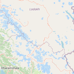
Map view of Tso Kar

Use this park location map to pinpoint Tso Kar in India, understand its exact geographic position, and read its mapped placement within the surrounding landscape more clearly.

Pigeon | © OpenStreetMap contributors

Location context for Tso Kar

Ladakh
Recorded earthquake history

Review the Recorded Earthquake History Associated with the Tso Kar Landscape

Access the MoriAtlas catalogue of historical seismic events associated with the Tso Kar protected area. This resource provides a clear overview of recorded earthquake data, allowing researchers and visitors to examine event magnitudes and epicentre distances relative to the Tso Kar wetland basin and the surrounding Rupshu Plateau.

Tso Kar Earthquake History

Catalogued events

6 events

Strongest magnitude

Magnitude 4.2

Most recent event

Jul 9, 2013

This history includes earthquakes recorded inside the park or within 50 km of its borders

Visual reference for salt flats, steppe pastures, and Trans-Himalayan terrain

Tso Kar Photos and Scenery: Exploring High-Altitude Wetland Landscapes

Photographic documentation reveals the stark salt-encrusted shoreline and expansive steppe plains defining Tso Kar within the Rupshu Plateau. Visual records capture the distinctive character of high-altitude wetland habitats, alpine mountain backdrops, and migratory bird breeding grounds across Ladakh.

A wide view of a large, blue high-altitude salt lake with a salt-white shoreline and dry, rugged mountains in the distance under a clear sky.

A wide panoramic view of a calm, blueish-grey lake in the foreground, with arid, brown, rolling mountain ranges extending across the background under a sky with scattered white clouds.

A white metal sign on two thin wooden posts reads Wild Ass Homestay Tsokar in black lettering, with Tibetan script above the English text; several plastic chairs are arranged in the dirt behind it.

A small, single-story stone structure with a wooden door and a sign reading Tibetan Argali Homestay Tsokar mounted on the wall.

A wide view of a small, rustic village in a dry, mountainous region under a cloudy sky.

A wild Kiang, characterized by its reddish brown and white coat, walking across a rocky, high-altitude landscape.

Park atlas

Compare adjacent high-altitude wetlands, steppe basins, and mountain reserves

Parks Near Tso Kar and Related Protected Areas Across the Trans-Himalayan Plateau

Browse other parks near Tso Kar to examine similar high-altitude wetland complexes and protected steppe ecosystems across the surrounding region. Extending your geographic comparison reveals connected conservation landscapes and wider regional biodiversity patterns.
Protected landscapeLadakh
About 41 km away#1 closest

Southeast

Tso Moriri Protected Landscape: Ladakh Geography and Trans Himalayan Lake Atlas

High altitude wetland and cold desert plateau study

Trace the boundaries and ecological features of Tso Moriri, a major Ramsar site set within the high altitude cold desert of the Ladakh region. The landscape encompasses glacial streams, vast marshy deltas, and open steppe terrain that supports diverse wildlife and traditional pastoral land use.

Area
120 km²
Established
2002
Relief
Mountain
Climate
Arid
National parkLeh district
About 86 km away#2 closest

Northwest

Hemis National Park: Exploring India's Protected National Park Geography

Mapped boundaries and landscape context in Leh district.

Hemis National Park represents a distinct protected national park within the Leh district of India, offering unique geographic and landscape attributes for atlas exploration. This detailed entry focuses on the park's role as a conservation area, detailing its mapped extent and its contribution to the regional geography. Understand how Hemis National Park fits into the broader picture of protected lands, providing valuable context for those studying natural landscapes and territorial conservation across India.

Area
4,400 km²
Established
1981
IUCN
II
Relief
Mountain
A watercolor painting showing soft green hills and blue mountains bordering a calm lake under a pale sky.
Wildlife reserveHimachal Pradesh
About 91 km away#3 closest

South

Chandratal Wildlife Sanctuary: Geography and Protected Landscape Analysis

High-altitude Himalayan wildlife reserve and wetland

Examine the geomorphology of Chandratal Wildlife Sanctuary, home to one of India's most significant high-altitude lake systems. This detailed record highlights the sanctuary's role in conserving cold-arid alpine environments, from its glacial cirque and mountain scree to the seasonal wildflower carpets of the Western Himalaya.

Relief
Mountain
Climate
Alpine
Access
Moderate access
Scope
Terrestrial
National parkIndia
About 124 km away#4 closest

Southwest

Inderkilla National Park: Detailed Protected Landscape and Geographic Atlas Entry

Mapping the natural terrain and protected boundaries across India.

Delve into the protected landscape of Inderkilla National Park, a designated national park located in India. This entry provides essential geographic context, focusing on the park's mapped boundaries and its role within the country's protected areas atlas. Understand the specific natural terrain and regional landscape character that defines Inderkilla National Park for detailed geographic exploration.

Area
46.1 km²
Established
2010
Relief
Mountain
Climate
Alpine
National parkHimachal Pradesh
About 136 km away#5 closest

South

Pin Valley National Park: Remote Himalayan Cold Desert National Park in Himachal Pradesh

Explore its dramatic terrain and unique protected landscape in Spiti Valley.

Pin Valley National Park is a significant protected area covering roughly 675 square kilometers of the cold desert region in Himachal Pradesh, India. Established as a national park, it showcases a remote and rugged Himalayan landscape, characterized by its stark beauty, sparse vegetation, and extreme temperatures typical of high-altitude deserts. The park's geography spans dramatic mountain terrain, steep cliffs, and deep valleys, forming a vital habitat for endangered species and contributing to the unique ecological profile of the Cold Desert Biosphere Reserve.

Area
675 km²
Established
1987
IUCN
II
Relief
Mountain
National parkHimachal Pradesh
142 km away#6 closest

South

Great Himalayan National Park: Protected Landscape and Mapped Geography

Explore this national park's dramatic elevation and rich biodiversity.

Great Himalayan National Park is a vital protected area within India's Himachal Pradesh, celebrated for its exceptional biodiversity and dramatic mountain geography. This national park encompasses a remarkable range of elevations, creating distinct ecological zones from lower forest elevations to high alpine meadows and glacial zones. Its significance as a mapped protected landscape makes it essential for understanding regional natural heritage and conservation efforts within the Himalayas.

Area
1,171 km²
Established
1984
IUCN
II
Relief
Mountain
Watercolor illustration showing mountains, a tree, and a landscape with green and pink tones
National parkHimachal Pradesh
About 144 km away#7 closest

South

Khirganga National Park: Himachal Pradesh National Park Geographic Atlas

Mapped protected area and regional landscape context.

Investigate Khirganga National Park, a designated national park situated within the vast mountain geography of Himachal Pradesh. This atlas-focused entry provides critical details on the park's protected landscape identity, its mapped boundaries, and its significance within the broader regional context of northern India's Western Himalayas. Understand the park's geographic position for detailed landscape exploration.

Area
710 km²
Established
2010
IUCN
II
Relief
Mountain
National parkKishtwar district
About 185 km away#8 closest

West

Kishtwar National Park: Discover Protected Himalayan Wilderness & Geography

Mapped terrain and protected area context in India's Kishtwar district.

Kishtwar National Park is a significant protected landscape situated in the Kishtwar district, India, offering a detailed view of high-altitude Himalayan wilderness. Its dramatic mountainous terrain, from temperate forests to alpine meadows, defines its unique geographic character. Explore the park's mapped boundaries and understand its place within the broader regional geography for comprehensive atlas discovery.

Area
2,190.5 km²
Established
1981
IUCN
II
Relief
Mountain

Common questions about visiting, size, designation, and location context for Tso Kar

Tso Kar FAQs for park facts, access, geography, and protected area context

Find quick answers about Tso Kar, including protected-area facts, park geography, trail and visitor context, and how the park fits into its surrounding country and regional landscape.
MoriAtlas Explorer

Continue Your Protected Areas Search Across the Global Atlas

Deepen your exploration by continuing the structured search for national parks and protected areas worldwide. Utilize the comprehensive filtering capabilities to compare different conservation landscapes and refine your understanding of global park geography. Discover more about the distribution and characteristics of protected natural areas.

Global natural geography