Mori Atlas logo
National parkInderkilla National Park

Mapping the protected boundaries and natural terrain of this Indian national park.

Inderkilla National Park: Protected Landscape & Geographic Context in India

Inderkilla National Park stands as a key protected area within India, contributing to the nation's diverse natural landscapes. This page details the park's geographic identity, enabling exploration of its mapped boundaries and regional setting. Understand the place of Inderkilla National Park within the broader atlas of Indian protected lands, offering context for its unique terrain and conservation significance.

national parkHimachal PradeshTrans-Himalayanconiferous forestssnow leopard habitatHimalayan wildlife

Inderkilla National Park

National park

Park overview

Structured park overview, official facts, and landscape profile for Inderkilla National Park

Inderkilla National Park park facts, protected area profile, and essential visitor context

Review the core facts for Inderkilla National Park, including designation, size, terrain, visitor scale, habitats, and operating context in one park-focused overview.

About Inderkilla National Park

Inderkilla National Park occupies a mountainous landscape within the Kullu Valley, one of the most scenic valleys in Himachal Pradesh. The park's establishment in 2010 marked an important expansion of India's national park system into the Trans-Himalayan region, providing formal protection to an ecosystem characterized by steep terrain, dense forest, and rich biodiversity. The Beas River, a major Himalayan river, flows through the park, providing essential water resources for wildlife and contributing to the ecological character of the area. The park's location in Kullu district places it within a region that has long been recognized for its natural beauty and ecological significance, though the formal protected status is a more recent development in the area's conservation history. Visitors to the park can explore hilly terrain through established hiking routes that traverse the dense woods and open alpine areas, though access and infrastructure details would require local guidance. The park's elevation and location within the Himalayan foothills create a landscape of considerable scenic value, with forested slopes rising to alpine zones and the river valley providing a natural corridor through the mountains.

Quick facts and research context for Inderkilla National Park

Inderkilla National Park spans approximately 46 square kilometers in Kullu district, Himachal Pradesh, India. The park was formally established in 2010 as part of India's efforts to protect Himalayan ecosystems. It lies within the Trans-Himalayan zone and is traversed by the Beas River. The area features hilly terrain with dense woods and is suitable for hiking activities. Over 250 bird species have been recorded within the park boundaries, alongside notable mammal populations including snow leopards, Himalayan brown bears, and Himalayan tahr.

Protection and recognition

Documenting the terrestrial framework and designation timeline established in 2010.

Inderkilla National Park Protection Status and Terrestrial Area Designation

Users can review the official environmental protection status and terrestrial conservation history of Inderkilla National Park. Factual details verify the designation timeline originating in 2010, mapping the local landscape within the broader context of regional protected areas.

Protection details

Protection scope
Terrestrial
Designated year
2010
Transboundary protection
No
Park context

Deeper park guide and search-rich context for Inderkilla National Park

Inderkilla National Park history, landscape, wildlife, and travel context

Explore Inderkilla National Park through its history, landscape character, ecosystems, wildlife, conservation priorities, cultural context, and seasonal travel timing in a structured park guide built for atlas discovery and search intent.

Why Inderkilla National Park stands out

Inderkilla National Park is best known for its population of snow leopards and Himalayan brown bears, two of the most iconic and elusive large mammals of the Himalayan region. The park's dense coniferous and oak forests provide critical habitat for leopards, both common and snow varieties, as well as for Himalayan tahr and musk deer. The area's biodiversity extends to over 250 recorded bird species, making it significant for ornithological diversity. The Trans-Himalayan setting, combined with the presence of the Beas River and diverse vegetation communities ranging from pine forests to alpine meadows, creates a distinctive mountain landscape within India's protected area network.

Inderkilla National Park history and protected-area timeline

Inderkilla National Park was formally established in 2010, representing a relatively recent addition to India's network of protected national parks. The creation of the park reflected growing recognition of the ecological importance of the Trans-Himalayan regions in Himachal Pradesh and the need to provide formal conservation status to the diverse habitats found in the Kullu Valley area. Prior to national park designation, the area likely existed as part of broader forest reserves or wildlife sanctuaries, though specific historical details about earlier protection status are limited in the available source material. The establishment of Inderkilla as a national park aligned with India's broader conservation goals of protecting representative samples of different ecological zones and habitats, with particular emphasis on regions supporting endangered species and significant biodiversity.

Inderkilla National Park landscape and geographic character

The landscape of Inderkilla National Park is defined by its mountainous setting within the Kullu Valley, featuring hilly terrain that rises through forested slopes toward alpine zones. The terrain is characterized by steep inclines, rocky outcrops, and dense forest cover that blankets the valley slopes. The Beas River flows through the park, carving its way through the mountainous terrain and creating riparian corridors that provide water access for wildlife throughout the year. The forest composition includes mixed coniferous woodlands with species such as spruce and fir, oak forests in certain zones, and scattered juniper and rhododendron growth. Alpine pastures appear at higher elevations, creating a vertical zonation of vegetation that reflects the temperature gradients associated with increasing altitude. The combination of the river valley, forested slopes, and alpine meadows creates a diverse and visually striking mountain landscape typical of the Trans-Himalayan zone.

Inderkilla National Park ecosystems, habitats, and plant life

The natural environment of Inderkilla National Park encompasses a range of habitat types that support considerable biodiversity. The park's vegetation includes mixed coniferous forests dominated by spruce, fir, and pine species, interspersed with oak woodlands that provide different ecological niches. Alpine pastures occur at higher elevations, supporting plant communities adapted to harsh mountain conditions. The presence of the Beas River adds a riparian element to the park's ecological character, creating wetland habitats and water sources that attract diverse wildlife. The Trans-Himalayan positioning of the park places it at an ecological crossroads between different biogeographic zones, contributing to the diversity of species found within its boundaries. Notable plant species found in the park include juniper, rhododendron, walnut, and maple, while the rare Bhojpatara tree and various Artemisia species represent specialized components of the alpine flora.

Inderkilla National Park wildlife and species highlights

Inderkilla National Park supports a notable assemblage of mammal species, with several large carnivores occupying prominent positions in the park's ecological community. Snow leopards and common leopards both occur within the park, representing apex predators of the Himalayan ecosystem. Himalayan brown bears and Asian black bears are present, utilizing the forested areas and alpine zones for foraging and shelter. The park provides habitat for Himalayan tahr, a mountain goat-antelope adapted to steep cliff terrain, as well as musk deer whose valuable musk pod has historically made them targets of poaching. Over 250 bird species have been recorded in the park, including the Himalayan griffon, a large vulture species considered endangered and important for ecological function. The combination of forest-dwelling species, alpine inhabitants, and river-associated wildlife creates a diverse mammalian and avian community that reflects the varied habitats within the park's boundaries.

Inderkilla National Park conservation status and protection priorities

Inderkilla National Park serves as an important conservation area within the Trans-Himalayan zone, providing protected status to habitats that support several endangered and threatened species. The presence of snow leopards, Himalayan griffons, and other species of conservation concern gives the park particular significance beyond its relatively recent establishment. The protected area framework helps regulate land use and human activity within the park boundaries, reducing pressures on wildlife populations and their habitats. The Beas River flowing through the park also receives protection as part of the broader ecosystem, supporting aquatic biodiversity and providing water security for wildlife during dry seasons. Conservation challenges in Himalayan protected areas often include managing human-wildlife conflict, preventing poaching and illegal wildlife trade, and balancing ecological preservation with the needs of local communities. The park's designation as a national park provides the institutional framework for addressing these conservation priorities.

Inderkilla National Park cultural meaning and human context

Inderkilla National Park is situated in Himachal Pradesh, a region with deep cultural connections to the Himalayan landscape and traditions that have shaped the relationship between local communities and the mountains for centuries. The Kullu Valley, where the park is located, has a rich cultural heritage reflected in local traditions, religious practices, and the historical development of hill settlements. While the source material does not provide specific details about indigenous communities or historical land use within the park's boundaries, the broader region is home to Himalayan peoples whose livelihoods and cultural practices are intimately connected to the mountain environment. The establishment of the park represents a formalization of conservation that operates within this cultural context, requiring ongoing consideration of how protected area management interacts with traditional land uses and community interests in the region.

Top sights and standout views in Inderkilla National Park

Inderkilla National Park's highlights include the opportunity to encounter snow leopards and Himalayan brown bears in their natural mountain habitat, one of the rarest wildlife experiences in the Himalayan region. The park's over 250 recorded bird species make it a significant destination for birdwatchers, with the endangered Himalayan griffon representing a particularly notable species. The Trans-Himalayan setting offers diverse landscapes ranging from river valleys to alpine meadows, while the Beas River adds a dynamic water element to the mountain terrain. Hiking through dense coniferous forests and open alpine pastures provides access to the scenic beauty of the Kullu Valley from within a protected wilderness area.

Best time to visit Inderkilla National Park

The best time to visit Inderkilla National Park would typically align with the warmer months in the Himalayan region, from spring through autumn, when weather conditions are more favorable for outdoor activities and wildlife viewing. The summer months of May through June offer pleasant temperatures in the valley and are conducive to hiking the park's trails. Autumn brings clear skies and fall foliage colors that enhance the visual appeal of the forested landscapes. Winter visits would be challenging due to snow and cold temperatures at higher elevations, though some visitors may appreciate the winter mountain environment. The monsoonal season from July to September brings rainfall to the Himalayan foothills, which can affect trail conditions and accessibility. Visitors planning trips to Himalayan national parks should consider the variable mountain weather and consult current conditions before finalizing travel plans.
Monthly climate preview

Long-term representative averages tracking annual temperature and precipitation rhythm

Inderkilla National Park Climate Normals and Monthly Temperature Records

Representative coordinates document sustained sub-zero winter temperatures alongside measured summer warmth and distinct monthly precipitation variations across the protected terrain. Analyzing twelve-month climatology records provides detailed baseline measurements for the high-elevation protected landscape.
Annual mean-1 °C
-11 °C9 °C
Jan-11°
Feb-10°
Mar-6°
Apr-1°
May
Jun
Jul
Aug
Sep
Oct
Nov-4°
Dec-8°
Warmest month
July

8.7 °C

Coolest month
January

-11 °C

Wettest month
August

7.2 mm/day

Driest month
November

0.3 mm/day

Park location guide

Geography guide, regional context, and park location map for Inderkilla National Park

Inderkilla National Park park geography, regions, and map view in India

Understand where Inderkilla National Park sits in India through a broader geographic reading of the surrounding landscape, nearby location context, and its mapped position within the national park landscape.

How Inderkilla National Park fits into India

India is a South Asian country bordered by the Indian Ocean, Arabian Sea, and Bay of Bengal. It shares land borders with Pakistan, China, Nepal, Bhutan, Bangladesh, and Myanmar. The country has a population of over 1.4 billion people and operates as a federal parliamentary republic with its capital in New Delhi.

Wider geography shaping Inderkilla National Park in India

India occupies the Indian subcontinent in South Asia, bordered by the Arabian Sea to the southwest, the Bay of Bengal to the southeast, and the Indian Ocean to the south. It shares land borders with Pakistan to the west, China, Nepal, and Bhutan to the north, and Bangladesh and Myanmar to the east. The territory also includes the Andaman and Nicobar Islands in the Indian Ocean.

Map view of Inderkilla National Park

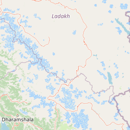
Use this park location map to pinpoint Inderkilla National Park in India, understand its exact geographic position, and read its mapped placement within the surrounding landscape more clearly.

Pigeon | © OpenStreetMap contributors

Location context for Inderkilla National Park

Himachal Pradesh
Park atlas

Browse the geographic spread of protected areas and compare similar Himalayan mountain parks.

Explore Nearby National Parks and Protected Areas Surrounding Inderkilla National Park

After exploring Inderkilla National Park, browse other national parks and protected areas within India's Himachal Pradesh region, encompassing similar mountainous terrains and diverse conservation landscapes. Comparing these protected areas provides valuable geographic context, revealing broader regional patterns of Himalayan biodiversity, forest reserves, and alpine environments.
Watercolor illustration showing mountains, a tree, and a landscape with green and pink tones
National parkHimachal Pradesh
About 28 km away#1 closest

South

Khirganga National Park: Himachal Pradesh National Park Geographic Atlas

Mapped protected area and regional landscape context.

Investigate Khirganga National Park, a designated national park situated within the vast mountain geography of Himachal Pradesh. This atlas-focused entry provides critical details on the park's protected landscape identity, its mapped boundaries, and its significance within the broader regional context of northern India's Western Himalayas. Understand the park's geographic position for detailed landscape exploration.

Area
710 km²
Established
2010
IUCN
II
Relief
Mountain
Wildlife reserveHimachal Pradesh
About 33 km away#2 closest

Northeast

Chandratal Wildlife Sanctuary: Geography and Protected Landscape Analysis

High-altitude Himalayan wildlife reserve and wetland

Examine the geomorphology of Chandratal Wildlife Sanctuary, home to one of India's most significant high-altitude lake systems. This detailed record highlights the sanctuary's role in conserving cold-arid alpine environments, from its glacial cirque and mountain scree to the seasonal wildflower carpets of the Western Himalaya.

Relief
Mountain
Climate
Alpine
Access
Moderate access
Scope
Terrestrial
National parkHimachal Pradesh
About 34 km away#3 closest

South

Great Himalayan National Park: Protected Landscape and Mapped Geography

Explore this national park's dramatic elevation and rich biodiversity.

Great Himalayan National Park is a vital protected area within India's Himachal Pradesh, celebrated for its exceptional biodiversity and dramatic mountain geography. This national park encompasses a remarkable range of elevations, creating distinct ecological zones from lower forest elevations to high alpine meadows and glacial zones. Its significance as a mapped protected landscape makes it essential for understanding regional natural heritage and conservation efforts within the Himalayas.

Area
1,171 km²
Established
1984
IUCN
II
Relief
Mountain
National parkHimachal Pradesh
About 51 km away#4 closest

Southeast

Pin Valley National Park: Remote Himalayan Cold Desert National Park in Himachal Pradesh

Explore its dramatic terrain and unique protected landscape in Spiti Valley.

Pin Valley National Park is a significant protected area covering roughly 675 square kilometers of the cold desert region in Himachal Pradesh, India. Established as a national park, it showcases a remote and rugged Himalayan landscape, characterized by its stark beauty, sparse vegetation, and extreme temperatures typical of high-altitude deserts. The park's geography spans dramatic mountain terrain, steep cliffs, and deep valleys, forming a vital habitat for endangered species and contributing to the unique ecological profile of the Cold Desert Biosphere Reserve.

Area
675 km²
Established
1987
IUCN
II
Relief
Mountain
Protected landscapeLadakh
About 112 km away#5 closest

Northeast

Tso Moriri Protected Landscape: Ladakh Geography and Trans Himalayan Lake Atlas

High altitude wetland and cold desert plateau study

Trace the boundaries and ecological features of Tso Moriri, a major Ramsar site set within the high altitude cold desert of the Ladakh region. The landscape encompasses glacial streams, vast marshy deltas, and open steppe terrain that supports diverse wildlife and traditional pastoral land use.

Area
120 km²
Established
2002
Relief
Mountain
Climate
Arid
Protected areaLadakh
About 124 km away#6 closest

Northeast

Tso Kar Protected Area: Geographic Overview of Ladakh's High-Altitude Salt Lake

Mapping wetland margins, steppe ecology, and Himalayan basin terrain

Tso Kar is a distinct high-altitude salt lake system on the Rupshu Plateau. This protected area features a striking contrast between mineral-rich salt flats, freshwater lagoons, and surrounding alpine peaks. As a vital wetland, it supports diverse migratory bird populations and nomadic cultural landscapes, making it a key study of environmental complexity within the Indian Himalayas.

Area
22 km²
Established
2020
Relief
Highland
Climate
Alpine
Protected areaHimachal Pradesh
About 127 km away#7 closest

West

Pong Dam Lake Protected Area: Geography, Mapped Terrain, and Himachal Pradesh Wetlands

A vast reservoir bordering the Dhauladhar range

Pong Dam Lake is a sprawling reservoir in Himachal Pradesh that serves as a vital protected area for waterfowl and regional ecosystems. Its geography combines high-altitude dam engineering with the natural relief of the Siwalik foothills, offering a distinct landscape of seasonally shifting shorelines, forested ridges, and deep-water habitats that anchor the local environment.

Area
240 km²
Established
1975
Visitors
5K annual
Relief
Upland
Wildlife reservePunjab
About 134 km away#8 closest

Southwest

Nangal Wildlife Sanctuary: A Protected Wetland Refuge in the Punjab Foothills

Mapped riparian landscapes and reservoir habitats in the Sutlej River basin

Located within the Shivalik foothills, Nangal Wildlife Sanctuary preserves a unique man-made reservoir ecosystem. This record details the park's protected boundaries, riparian vegetation, and its role as a essential wetland habitat for regional migratory waterbirds and threatened species in the Punjab river landscape.

Area
1.16 km²
Established
2009
IUCN
IV
Relief
Upland

Common questions about visiting, size, designation, and location context for Inderkilla National Park

Inderkilla National Park FAQs for park facts, access, geography, and protected area context

Find quick answers about Inderkilla National Park, including protected-area facts, park geography, trail and visitor context, and how the park fits into its surrounding country and regional landscape.
MoriAtlas Explorer

Continue Your Protected Areas Search Across the Global Atlas

Deepen your exploration by continuing the structured search for national parks and protected areas worldwide. Utilize the comprehensive filtering capabilities to compare different conservation landscapes and refine your understanding of global park geography. Discover more about the distribution and characteristics of protected natural areas.

Global natural geography