
Mori Atlas logo
Protected landscapeTso Moriri

A comprehensive look at the Trans Himalayan lake basin, glacial deltaic marshes, and high altitude steppe terrain.

Tso Moriri Protected Landscape: Mapping High Altitude Ecosystems within the Ladakh Region of India

(Tso Moriri Wetland Conservation Reserve)

Tso Moriri serves as a vital protected landscape situated atop the Changthang Plateau at 4,500 meters. This high altitude lake remains the largest within India, characterized by slightly brackish waters and expansive marshy fringes fed by glacial meltwater. The site provides essential habitat for threatened wildlife while reflecting the intersection of Trans Himalayan ecology and centuries of nomadic pastoral heritage.

high-altitude lakeRamsar wetlandChangthang PlateauTrans-Himalayacold desertbird sanctuary
A minimalist, flat-style illustration showing a tall waterfall cascading into a large lake, with evergreen trees in the foreground, mountain peaks in the background, and a small cluster of stone buildings on the shore.

Tso Moriri

Protected landscape

Park overview

Structured park overview, official facts, and landscape profile for Tso Moriri

Tso Moriri park facts, protected area profile, and essential visitor context

Review the core facts for Tso Moriri, including designation, size, terrain, visitor scale, habitats, and operating context in one park-focused overview.

About Tso Moriri

Tso Moriri occupies the heart of the remote Changthang Plateau in eastern Ladakh, far from mainstream travel routes and surrounded by some of the highest and most barren landscapes in the Indian Trans-Himalaya. The lake is classified as a remnant Himalayan lake, meaning it represents the surviving portion of a much larger prehistoric water body, and it now sits as a closed basin with no surface outflow. Its slightly brackish but drinkable waters and oligotrophic chemistry reflect this long-isolated hydrological history.

The lake extends roughly 26 kilometers north to south and varies between about 4 and 8 kilometers in width, fringed by mountains that rise to over 6,000 meters. Glacial streams entering from the west, north, and southwest build up extensive deltaic marshes that contrast sharply with the surrounding cold desert plains. Although the basin itself is sparsely vegetated, these wetlands and their adjacent pasturelands support an unusually rich concentration of biodiversity for such a high and arid environment.

Beyond its ecological value, Tso Moriri carries strong cultural and historical weight. Korzok, the principal settlement on its shore, is home to one of Ladakh's older Buddhist monasteries and is the base for Changpa nomads who have used these highlands for generations. The lake's formal recognition as a Ramsar site and its inclusion in the Tso Moriri Wetland Conservation Reserve have made it a focal point for community-led conservation, scientific research, and carefully managed tourism in a landscape where human and ecological pressures are tightly intertwined.

Quick facts and research context for Tso Moriri

Tso Moriri is a high-altitude endorheic lake in the Changthang district of Ladakh, India, designated as a Ramsar wetland since 19 August 2002 under the name "Tsomoriri." It sits at approximately 4,500 meters elevation on the western extension of the Tibetan Plateau and is the largest high-altitude lake entirely within India.

The lake is oligotrophic and slightly alkaline, fed by snowmelt and small glacial streams, and bordered by peaks exceeding 6,000 meters. It is surrounded by pastoral landscapes used by Changpa nomads, with the village of Korzok on its northwestern shore and scattered military outposts along its eastern banks.

Protection and recognition

Documented establishment records, designation timeline, and conservation scope for Tso Moriri

Tso Moriri Protection Status and Designated Terrestrial Conservation History

Established as a terrestrial protected area in 2002, Tso Moriri holds structured records detailing its official designation timeline and management scope. Reviewing these verified facts provides clear insight into the conservation history and recognized boundaries governing the protected landscape.

Protection details

Protection scope
Terrestrial
Designated year
2002
Transboundary protection
No
Park context

Deeper park guide and search-rich context for Tso Moriri

Tso Moriri history, landscape, wildlife, and travel context

Explore Tso Moriri through its history, landscape character, ecosystems, wildlife, conservation priorities, cultural context, and seasonal travel timing in a structured park guide built for atlas discovery and search intent.

Why Tso Moriri stands out

Tso Moriri is best known as a high-altitude Ramsar lake that combines slightly brackish, nutrient-poor waters with surrounding arid steppe and marshland, creating a habitat mosaic that supports black-necked cranes, bar-headed geese, and a suite of Trans-Himalayan mammals. It is equally recognized for its setting within the Changthang cold desert, where traditional Changpa pastoralism, Buddhist monastery heritage at Korzok, and a fragile high-altitude ecosystem intersect. The lake represents one of the most intact examples of a remnant Himalayan lake in the Trans-Himalayan zone.
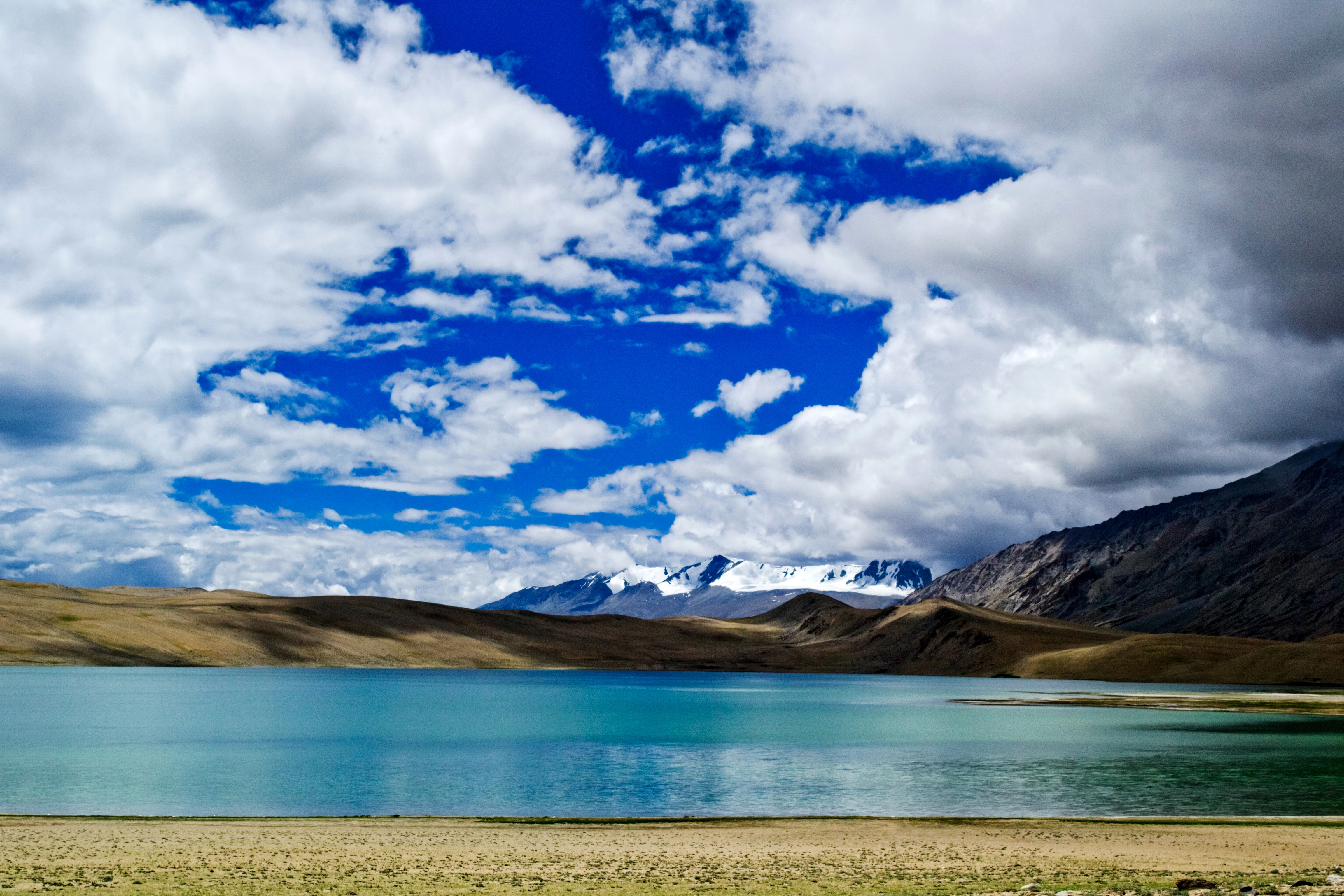
A wide landscape shot of Tso Moriri lake with blue water, surrounded by arid, brown hills and distant snow-capped mountains under a bright blue sky with large white clouds.
A view of the turquoise waters of Tso Moriri lake under a dramatic sky in Ladakh.

Tso Moriri history and protected-area timeline

Tso Moriri has long been part of the seasonal range of the Changpa, a Tibetan-origin nomadic pastoral community whose livelihood is built around yak, sheep, goats, horses, and the prized Pashmina goat. The settlement of Korzok on the northwestern shore of the lake has existed as a year-round community and religious center for generations, anchored by the Korzok Monastery, which has stood for roughly four hundred years and continues to draw Buddhist pilgrims and visitors.

Modern protection of the lake began with its formal designation as a Ramsar Wetland of International Importance on 19 August 2002, recognized under the name "Tsomoriri." The surrounding landscape was subsequently brought under the Tso Moriri Wetland Conservation Reserve, providing legal protection, including prohibitions on hunting that are enforced through checkpoints such as the one at Mahe Bridge. Conservation efforts have combined government institutions, research bodies, and local communities; WWF-India established a field office at Korzok, the Wildlife Institute of India maintains a research station in Leh, and the Tso Moriri Conservation Trust has coordinated local environmental action. A notable symbolic milestone was the local community's declaration of Tso Moriri as a "Sacred Gift for a Living Planet" in 2000, marking a turning point in recognizing the lake's ecological and cultural value at the grassroots level.

Tso Moriri landscape and geographic character

The Changthang Plateau forms the physical stage for Tso Moriri, an elevated extension of the western Tibetan Plateau characterized by cold desert plains, rolling steppe, and vast open vistas above approximately 4,500 meters. The lake itself is a long, north to south oriented water body hemmed in by mountain ridges, with several named peaks rising above 6,000 meters on both the eastern and western flanks, including Mentok Kangri and Lungser Kangri.

Around the lake's edges, three main glacial streams, Karzok Phu from the west, Gyama Phu from the north, and Phirse Phu from the southwest, deposit sediment that has built up soft, flat deltaic areas and shallow marshes. These wetland fringes contrast with the hard, rocky uplands and pasturelands that dominate the broader basin. To the south, the terrain opens into a broad valley that connects with the Pare Chu river system near Nuro Sumdo, a boggy area outside the lake's own drainage basin but visually part of the same high-altitude wetland landscape. Geologically, the lake basin lies in Ordovician rock, and its current form is interpreted as the remnant of a far larger prehistoric lake, giving it an unusually elongated and shallow character for a Himalayan water body of its size.
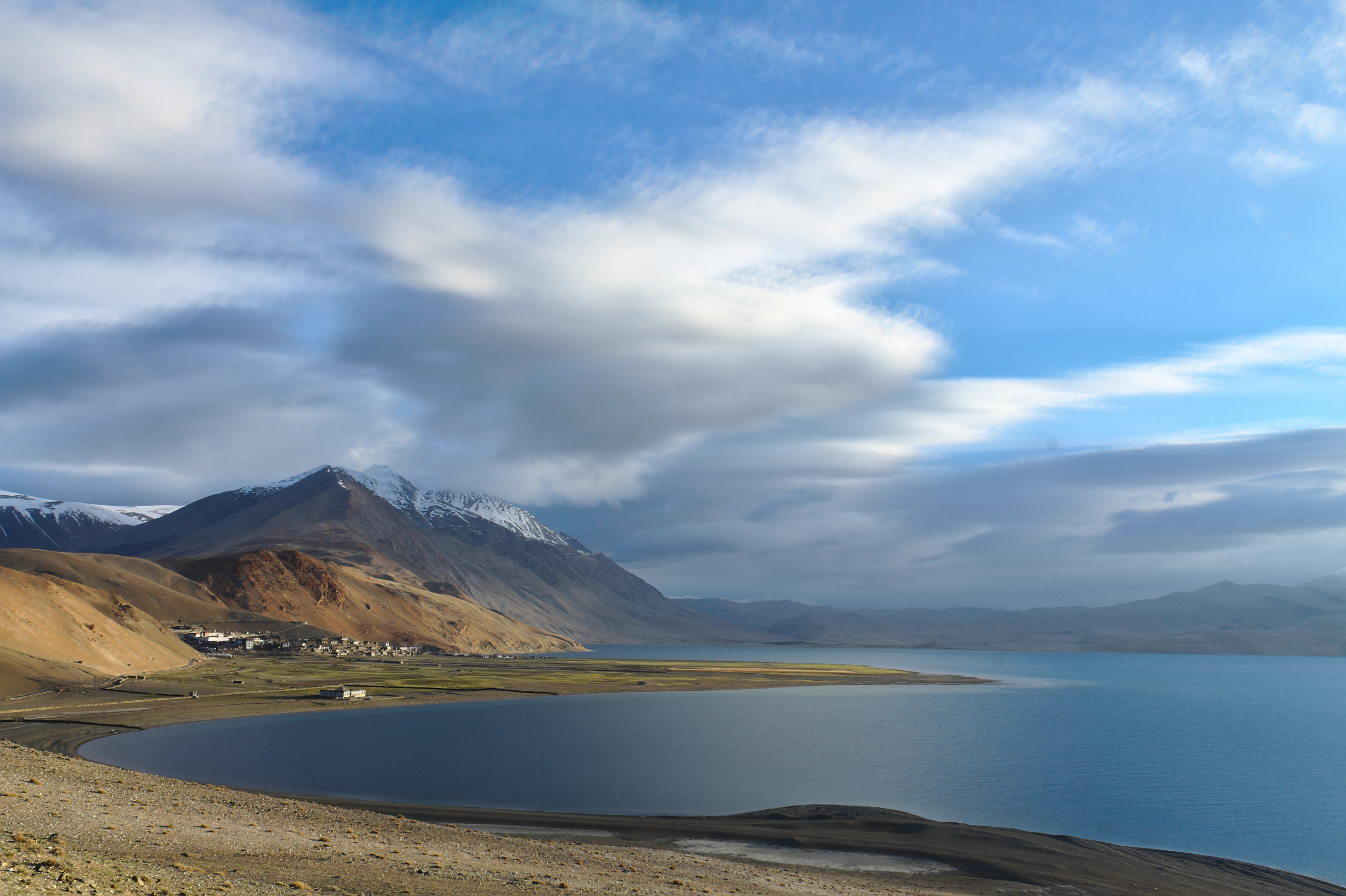
A wide landscape view of Tso Moriri lake, showing deep blue water, a tan rocky shoreline, and snow-capped mountain slopes under a partly cloudy sky.
The expansive high-altitude landscape of Tso Moriri lake in Ladakh, India.

Tso Moriri ecosystems, habitats, and plant life

Tso Moriri's ecology is defined by the interplay of cold, arid Trans-Himalayan steppe and a set of highly specialized high-altitude wetland habitats. The lake is oligotrophic, meaning its waters are nutrient-poor, and slightly alkaline and brackish, conditions that limit aquatic plant growth in deeper areas but support distinct communities in shallow zones and marshes. Aquatic vegetation includes species of Potamogeton in the shallows, while phytoplankton such as Oocystis and diatoms like Cyclotella inhabit the open water.

Surrounding the water body, arid-steppe vegetation dominates, shaped by short growing seasons and low precipitation. Characteristic plant communities include Caragana and Astragalus shrubs on drier slopes, along with sedges such as Carex, low-growing Primula, parasitic Pedicularis, Juncus thomsonii in wetter microsites, and edelweiss-like Leontopodium species in upland areas. Although biomass is low and productivity limited, these plant communities sustain surprisingly large herbivore populations, including both wild ungulates and the livestock that the Changpa pastoralists bring to the summer pastures each year.
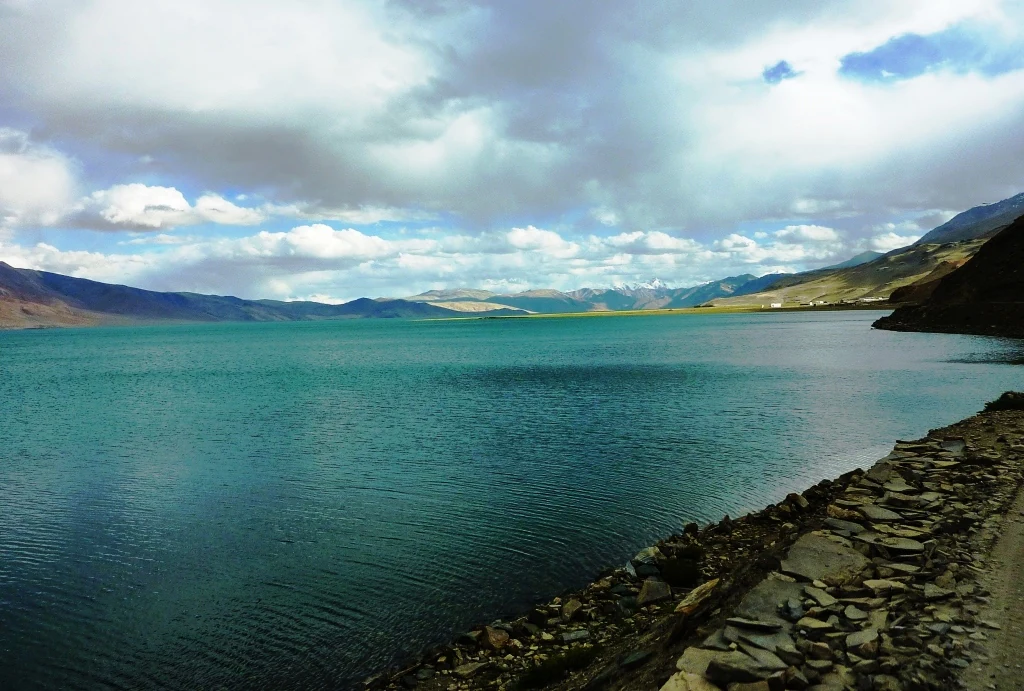
Wide landscape view of Tso Moriri, a vast high altitude lake with turquoise water surrounded by arid mountains under a cloudy sky.
The turquoise waters of Tso Moriri lake in Ladakh, India.

Tso Moriri wildlife and species highlights

The Tso Moriri basin is significant for its populations of large Trans-Himalayan mammals, several of which are of global conservation concern. The snow leopard and the Tibetan wolf range across the higher slopes around the lake, while ungulates include the Tibetan gazelle, the threatened Goa antelope, the Eurasian lynx, the Nayan or argali sheep (Ovis ammon hodgsoni), the bharal or Himalayan blue sheep, and the kiang, the wild ass endemic to the Tibetan Plateau. Smaller mammals are also well represented, with Himalayan marmots common on hillslopes and along roadsides, hares, voles such as Alticola roylei, and several pika species recorded in the surrounding terrain.

The lake and its adjoining Nuro Sumdo wetland are perhaps most notable for their birdlife. An avifaunal survey recorded thirty-four bird species, including fourteen waterbird varieties, several of which are vulnerable or endangered. Black-necked cranes, an endangered species, are among the most emblematic seasonal visitors. Bar-headed geese find their only Indian breeding ground around Tso Moriri, and the lake also supports brown-headed gulls, great crested grebes, ferruginous pochard, and black-necked grebes among its regular waterbird community.
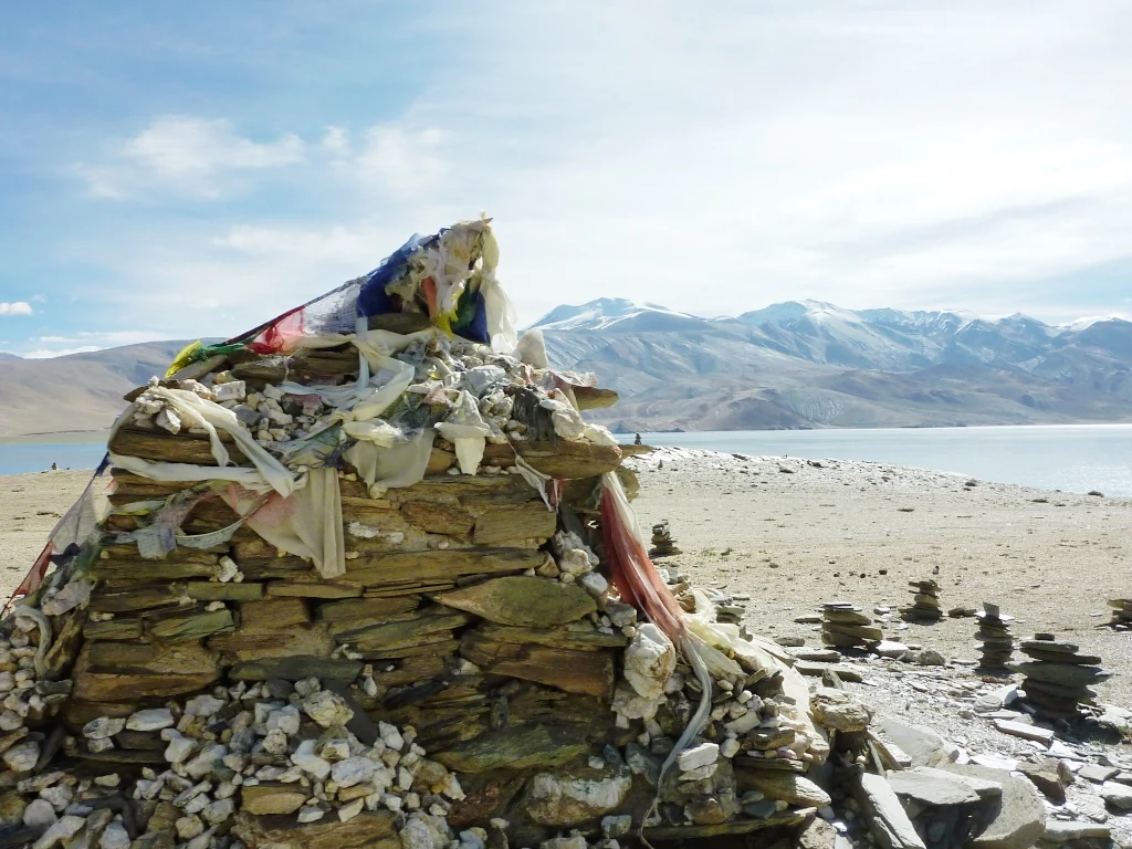
A stone Buddhist shrine topped with colorful prayer flags situated on a rocky shoreline next to a large high-altitude lake with snow-dusted mountains in the distance.
A Buddhist shrine and prayer flags on the shore of Tso Moriri in Ladakh.

Tso Moriri conservation status and protection priorities

Tso Moriri has been at the center of a layered conservation effort that combines international recognition, scientific monitoring, and community-based protection. Its Ramsar designation in 2002 placed it among a select group of wetlands of global importance, and the Tso Moriri Wetland Conservation Reserve provides the legal framework for protection, including hunting prohibitions enforced at checkpoints such as Mahe Bridge.

On-the-ground conservation is shaped by partnerships between WWF-India, which runs a field office at Korzok and conducts ecological surveys and awareness programs, and the Wildlife Institute of India, which maintains a research station in Leh. Local communities have adopted habitat-protective practices, including traditional fencing of sensitive areas and organized cleanup operations, while the Tso Moriri Conservation Trust and a network of school nature clubs extend environmental education across the region. The Indian Army has contributed through a Nature Interpretation Centre in Leh, and the lake's symbolic protection was reinforced by the community's declaration of Tso Moriri as a "Sacred Gift for a Living Planet" in 2000. Vehicular access restrictions, developed through stakeholder consultation, are a key management tool, though the lake continues to face pressure from rising tourist numbers and pastoral intensification.

Tso Moriri cultural meaning and human context

The cultural landscape around Tso Moriri is shaped primarily by the Changpa, a nomadic pastoral community of Tibetan origin whose livelihoods revolve around seasonal migration with yak, sheep, goats, and horses. The Changpa use the surrounding steppe and pastures for grazing and have done so for generations, and their presence gives the lake region much of its living cultural texture. Their arrival in the area in recent decades, alongside the promotion of Pashmina goat production by the Animal Husbandry Department, has significantly increased livestock numbers and reshaped grazing patterns around the lake.

On the northwestern shore, the village of Korzok anchors this cultural geography, combining a small permanent settlement with the historic Korzok Monastery, a Buddhist religious site roughly four centuries old that draws pilgrims as well as visitors. The lake also holds a broader symbolic resonance, expressed in the local community's 2000 declaration of Tso Moriri as a "Sacred Gift for a Living Planet," which frames the wetland as both a spiritual and ecological inheritance that the local population is committed to protecting.
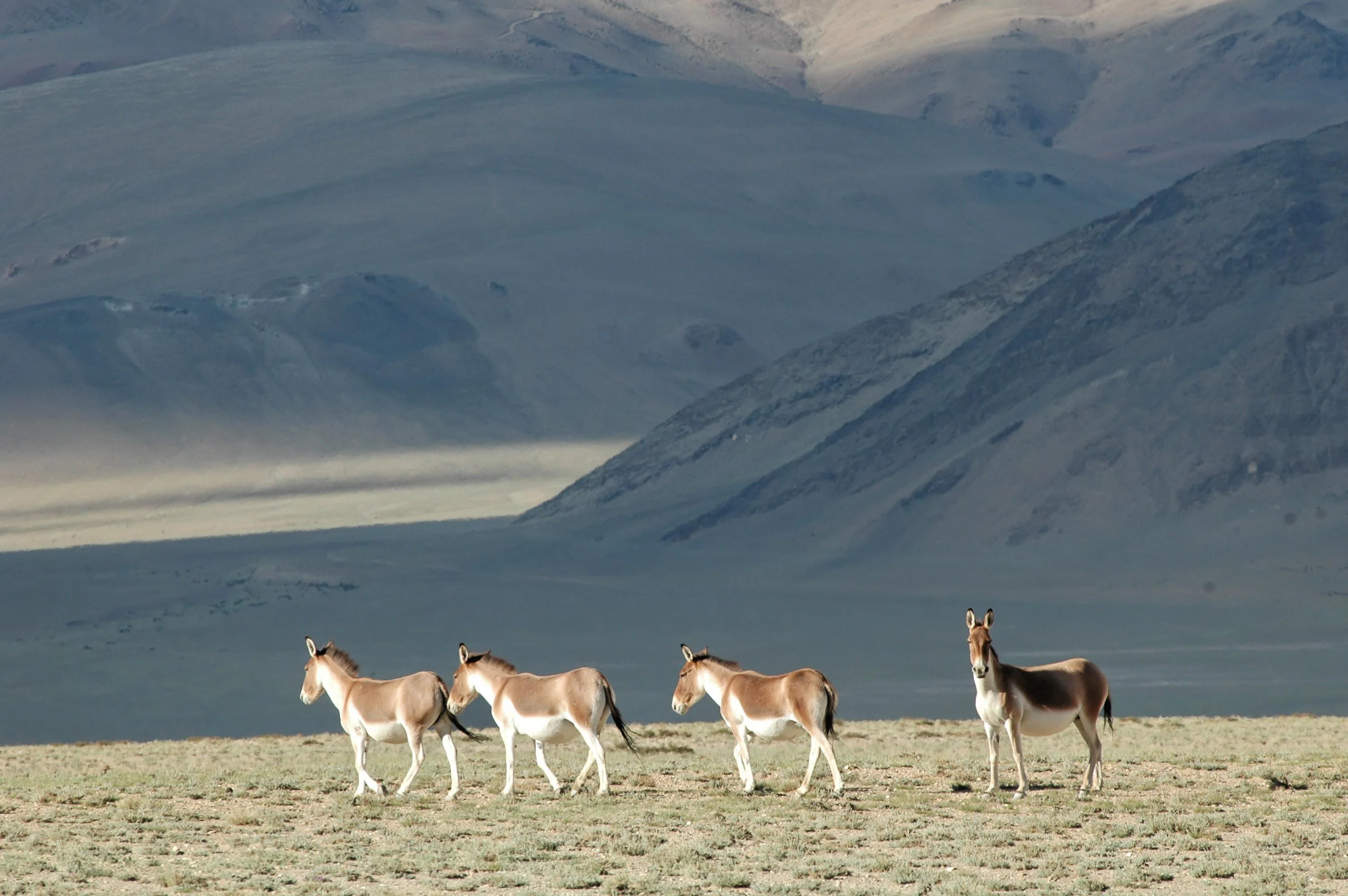
A group of four Tibetan wild asses standing in a sparse, dry, high-altitude landscape with large rolling hills in the background.
A small group of Tibetan wild asses, or kyang, grazing in the arid landscape of Tso Moriri.

Top sights and standout views in Tso Moriri

Tso Moriri stands out for its combination of extreme altitude, ecological rarity, and cultural depth. It is the largest high-altitude lake entirely within India, sits on the Changthang cold desert plateau above 4,500 meters, and has been a Ramsar wetland since 2002.

The reserve is distinguished by its slightly brackish, oligotrophic lake chemistry, its expansive deltaic marshes fed by glacial streams, and its role as a refuge for endangered black-necked cranes, bar-headed geese, and the kiang. Layered on top of this natural significance is the centuries-old Korzok Monastery and the continuing presence of the Changpa nomads, making Tso Moriri a meeting point of fragile ecology and enduring high-altitude pastoral culture.
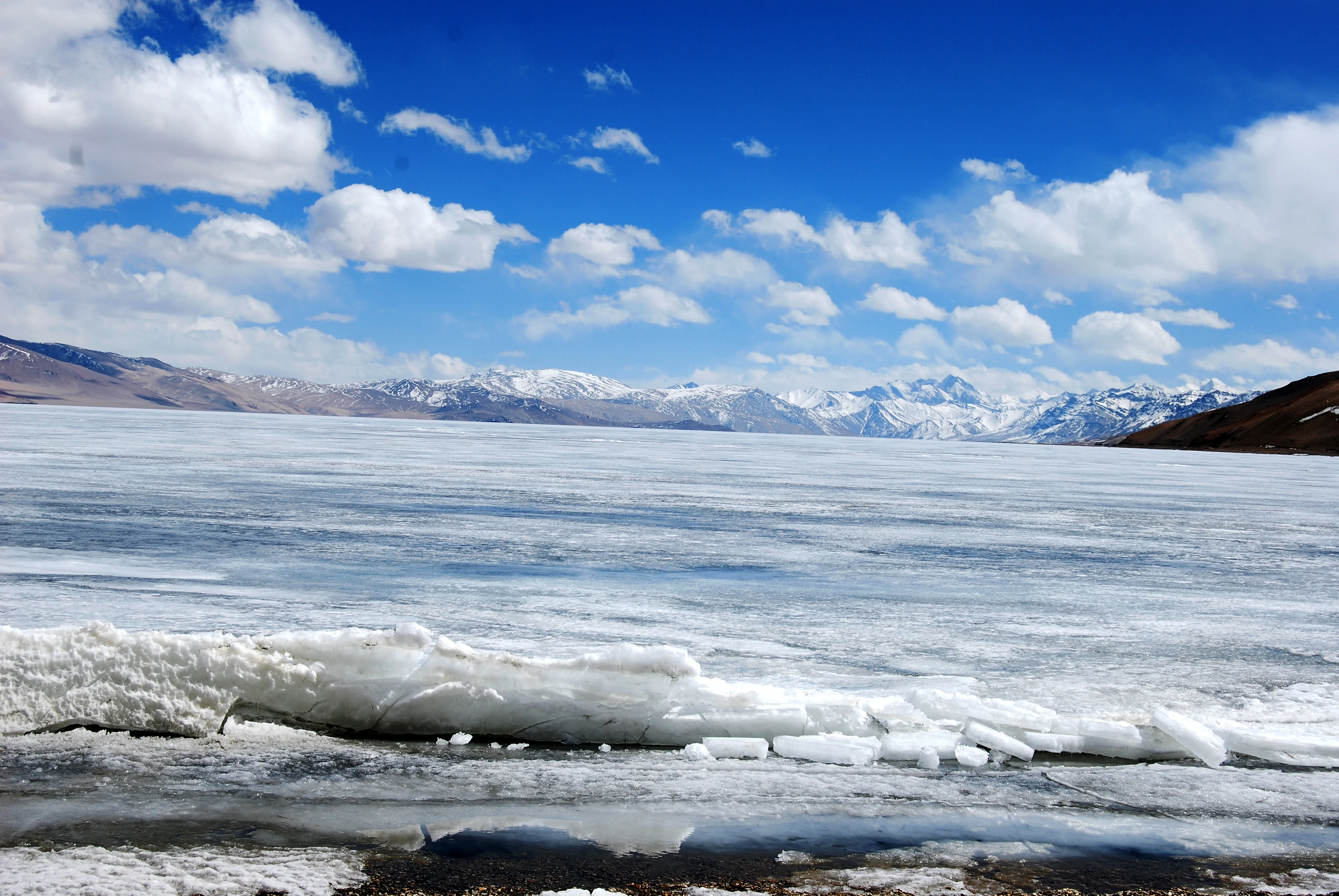
A wide, eye-level shot of a vast, frozen high-altitude lake. The foreground consists of chunks of broken ice along the shore, leading out to a wide expanse of frozen, white ice across the lake. In the distance, snow-capped mountain peaks rise beneath a bright blue sky filled with scattered white clouds.
The expansive, frozen surface of Tso Moriri lake under a clear, bright sky.

Best time to visit Tso Moriri

The most accessible conditions at Tso Moriri occur during the warmer months, roughly from May through September, when roads are most reliably open and the lakeside environment is at its most hospitable. Summer temperatures in the lake region span from near freezing at night up to around 30 degrees Celsius during the day, allowing travelers to experience the area without the extremes of the long winter.

Outside this window the region becomes extremely cold, with winter temperatures reportedly dropping well below freezing, and the lake surface itself can freeze over. The harsh winter climate reflects the broader cold desert character of the Changthang Plateau and explains why year-round settlement in the basin is limited to Korzok and a few military outposts.
Monthly climate preview

Examine long-term representative temperature ranges and monthly precipitation patterns across high-altitude terrain.

Tso Moriri Climate Normals, Annual Temperature and Precipitation Rhythm

Representative coordinate records reveal deep sub-zero winter minimums alongside modest summer warmth, paired with consistent low daily precipitation values throughout the year. Reviewing the complete monthly climate profile provides detailed historical context regarding temperature fluctuations and precipitation totals at high elevation.
Annual mean-7 °C
-19 °C6 °C
Jan-19°
Feb-18°
Mar-14°
Apr-7°
May-3°
Jun
Jul
Aug
Sep
Oct-6°
Nov-12°
Dec-17°
Warmest month
July

6.1 °C

Coolest month
January

-19.5 °C

Wettest month
August

2.1 mm/day

Driest month
October

0.2 mm/day

Park location guide

Geography guide, regional context, and park location map for Tso Moriri

Tso Moriri park geography, regions, and map view in India

Understand where Tso Moriri sits in India through a broader geographic reading of the surrounding landscape, nearby location context, and its mapped position within the national park landscape.

How Tso Moriri fits into India

India is a South Asian country bordered by the Indian Ocean, Arabian Sea, and Bay of Bengal. It shares land borders with Pakistan, China, Nepal, Bhutan, Bangladesh, and Myanmar. The country has a population of over 1.4 billion people and operates as a federal parliamentary republic with its capital in New Delhi.

Wider geography shaping Tso Moriri in India

India occupies the Indian subcontinent in South Asia, bordered by the Arabian Sea to the southwest, the Bay of Bengal to the southeast, and the Indian Ocean to the south. It shares land borders with Pakistan to the west, China, Nepal, and Bhutan to the north, and Bangladesh and Myanmar to the east. The territory also includes the Andaman and Nicobar Islands in the Indian Ocean.

Map view of Tso Moriri

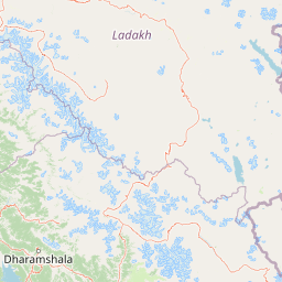
Use this park location map to pinpoint Tso Moriri in India, understand its exact geographic position, and read its mapped placement within the surrounding landscape more clearly.

Pigeon | © OpenStreetMap contributors

Location context for Tso Moriri

Ladakh

Explore protected area views, cold desert terrain, and high altitude lake scenery in Ladakh

Tso Moriri Photos and Landscapes: Visualizing the High Altitude Trans Himalayan Wetland

Visual records capture the stark terrain, glacial streams, and high altitude wetland habitats defining Tso Moriri. Examining these protected area images reveals the remote Trans Himalayan topography, fragile steppe ecosystems, and vast open vistas of the Changthang Plateau.

A wide landscape shot of Tso Moriri lake with blue water, surrounded by arid, brown hills and distant snow-capped mountains under a bright blue sky with large white clouds.

A wide, low-angle shot of Kyagar Lake featuring a clear reflection of white clouds and deep blue sky on the water surface, flanked by brown, barren mountain hills.

A wide landscape view of Tso Moriri lake, showing deep blue water, a tan rocky shoreline, and snow-capped mountain slopes under a partly cloudy sky.

Wide landscape view of Tso Moriri, a vast high altitude lake with turquoise water surrounded by arid mountains under a cloudy sky.

A stone Buddhist shrine topped with colorful prayer flags situated on a rocky shoreline next to a large high-altitude lake with snow-dusted mountains in the distance.

Panoramic landscape view of a vast, calm turquoise lake nestled beneath high mountain ranges with snow-capped peaks under a cloudy sky.

A group of four Tibetan wild asses standing in a sparse, dry, high-altitude landscape with large rolling hills in the background.

A wide, eye-level shot of a vast, frozen high-altitude lake. The foreground consists of chunks of broken ice along the shore, leading out to a wide expanse of frozen, white ice across the lake. In the distance, snow-capped mountain peaks rise beneath a bright blue sky filled with scattered white clouds.

A white metal sign with green text and the logo of the Department of Wildlife Protection, J&K Government, detailing rules for the Tsomoriri Wetland Conservation area.

A green park information sign stands in the foreground on a grassy plain beside a bright turquoise lake, with large, snow-capped mountains under a cloudy sky in the background.

Park atlas

Compare high-altitude landscapes, cold desert terrain, and regional wildlife habitats.

Explore Parks Near Tso Moriri and Surrounding Trans-Himalayan Protected Areas

Browse nearby national parks and protected areas sharing the extreme elevations of the Changthang Plateau. Continuing into these adjacent reserves reveals broader regional patterns across the high-altitude Trans-Himalayan landscape.
Protected areaLadakh
About 41 km away#1 closest

Northwest

Tso Kar Protected Area: Geographic Overview of Ladakh's High-Altitude Salt Lake

Mapping wetland margins, steppe ecology, and Himalayan basin terrain

Tso Kar is a distinct high-altitude salt lake system on the Rupshu Plateau. This protected area features a striking contrast between mineral-rich salt flats, freshwater lagoons, and surrounding alpine peaks. As a vital wetland, it supports diverse migratory bird populations and nomadic cultural landscapes, making it a key study of environmental complexity within the Indian Himalayas.

Area
22 km²
Established
2020
Relief
Highland
Climate
Alpine
A watercolor painting showing soft green hills and blue mountains bordering a calm lake under a pale sky.
Wildlife reserveHimachal Pradesh
About 80 km away#2 closest

Southwest

Chandratal Wildlife Sanctuary: Geography and Protected Landscape Analysis

High-altitude Himalayan wildlife reserve and wetland

Examine the geomorphology of Chandratal Wildlife Sanctuary, home to one of India's most significant high-altitude lake systems. This detailed record highlights the sanctuary's role in conserving cold-arid alpine environments, from its glacial cirque and mountain scree to the seasonal wildflower carpets of the Western Himalaya.

Relief
Mountain
Climate
Alpine
Access
Moderate access
Scope
Terrestrial
National parkHimachal Pradesh
About 107 km away#3 closest

South

Pin Valley National Park: Remote Himalayan Cold Desert National Park in Himachal Pradesh

Explore its dramatic terrain and unique protected landscape in Spiti Valley.

Pin Valley National Park is a significant protected area covering roughly 675 square kilometers of the cold desert region in Himachal Pradesh, India. Established as a national park, it showcases a remote and rugged Himalayan landscape, characterized by its stark beauty, sparse vegetation, and extreme temperatures typical of high-altitude deserts. The park's geography spans dramatic mountain terrain, steep cliffs, and deep valleys, forming a vital habitat for endangered species and contributing to the unique ecological profile of the Cold Desert Biosphere Reserve.

Area
675 km²
Established
1987
IUCN
II
Relief
Mountain
National parkIndia
About 112 km away#4 closest

Southwest

Inderkilla National Park: Detailed Protected Landscape and Geographic Atlas Entry

Mapping the natural terrain and protected boundaries across India.

Delve into the protected landscape of Inderkilla National Park, a designated national park located in India. This entry provides essential geographic context, focusing on the park's mapped boundaries and its role within the country's protected areas atlas. Understand the specific natural terrain and regional landscape character that defines Inderkilla National Park for detailed geographic exploration.

Area
46.1 km²
Established
2010
Relief
Mountain
Climate
Alpine
National parkHimachal Pradesh
About 116 km away#5 closest

Southwest

Great Himalayan National Park: Protected Landscape and Mapped Geography

Explore this national park's dramatic elevation and rich biodiversity.

Great Himalayan National Park is a vital protected area within India's Himachal Pradesh, celebrated for its exceptional biodiversity and dramatic mountain geography. This national park encompasses a remarkable range of elevations, creating distinct ecological zones from lower forest elevations to high alpine meadows and glacial zones. Its significance as a mapped protected landscape makes it essential for understanding regional natural heritage and conservation efforts within the Himalayas.

Area
1,171 km²
Established
1984
IUCN
II
Relief
Mountain
Watercolor illustration showing mountains, a tree, and a landscape with green and pink tones
National parkHimachal Pradesh
About 125 km away#6 closest

Southwest

Khirganga National Park: Himachal Pradesh National Park Geographic Atlas

Mapped protected area and regional landscape context.

Investigate Khirganga National Park, a designated national park situated within the vast mountain geography of Himachal Pradesh. This atlas-focused entry provides critical details on the park's protected landscape identity, its mapped boundaries, and its significance within the broader regional context of northern India's Western Himalayas. Understand the park's geographic position for detailed landscape exploration.

Area
710 km²
Established
2010
IUCN
II
Relief
Mountain
National parkLeh district
About 145 km away#7 closest

Northwest

Hemis National Park: Exploring India's Protected National Park Geography

Mapped boundaries and landscape context in Leh district.

Hemis National Park represents a distinct protected national park within the Leh district of India, offering unique geographic and landscape attributes for atlas exploration. This detailed entry focuses on the park's role as a conservation area, detailing its mapped extent and its contribution to the regional geography. Understand how Hemis National Park fits into the broader picture of protected lands, providing valuable context for those studying natural landscapes and territorial conservation across India.

Area
4,400 km²
Established
1981
IUCN
II
Relief
Mountain
National parkUttarakhand
About 183 km away#8 closest

Southeast

Gangotri National Park: Uttarakhand National Park and Protected Landscape Discovery

Explore its mapped geography and regional protected area context.

Gangotri National Park serves as a crucial point of reference for understanding protected areas within Uttarakhand, India. As a national park, its defined geographic boundaries and the surrounding natural landscape provide valuable data for regional geography and atlas exploration. This entry offers a detailed look at the park's protected status and its role within the mapped terrain of the Himalayan region.

Area
2,390 km²
Established
1989
IUCN
II
Relief
Mountain

Common questions about visiting, size, designation, and location context for Tso Moriri

Tso Moriri FAQs for park facts, access, geography, and protected area context

Find quick answers about Tso Moriri, including protected-area facts, park geography, trail and visitor context, and how the park fits into its surrounding country and regional landscape.
MoriAtlas Explorer

Continue Your Protected Areas Search Across the Global Atlas

Deepen your exploration by continuing the structured search for national parks and protected areas worldwide. Utilize the comprehensive filtering capabilities to compare different conservation landscapes and refine your understanding of global park geography. Discover more about the distribution and characteristics of protected natural areas.

Global natural geography