
Mori Atlas logo
Protected areaTwierdza Wisłoujście

Tracing the layered architectural history and river-mouth geography of this historic Baltic stronghold.

Twierdza Wisłoujście: Mapping the Coastal Fortifications and Protected Landscapes of Gdańsk

Twierdza Wisłoujście serves as a vital historical and ecological anchor on the right bank of the Martwa Wisła. Situated at the mouth of the Vistula River, this complex reflects centuries of harbor engineering and river-channel shifts that shaped the coastal terrain of the Pomeranian Voivodeship. Beyond its role as a historic maritime fortress, the site provides essential protected habitat for regional bat colonies as part of the Natura 2000 network, blending complex masonry evolution with vital environmental conservation.

maritime fortresshistoric lighthouseGdańsk harborcoastal fortificationGothic and Renaissance architecturebat hibernation site
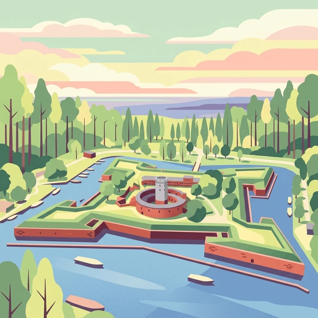
A stylized, colorful illustration showing an aerial view of a star shaped fortress with a central round tower, surrounded by a moat, trees, and a body of water with boats.

Twierdza Wisłoujście

Protected area

Park overview

Structured park overview, official facts, and landscape profile for Twierdza Wisłoujście

Twierdza Wisłoujście park facts, protected area profile, and essential visitor context

Review the core facts for Twierdza Wisłoujście, including designation, size, terrain, visitor scale, habitats, and operating context in one park-focused overview.

About Twierdza Wisłoujście

Twierdza Wisłoujście stands at the meeting point of the Vistula River, the Martwa Wisła, and the Bay of Gdańsk, on a narrow strip of reclaimed and reshaped land that has functioned as a defensive gateway for centuries. Its position at the western arm of the Vistula's former mouth, before the river's course was redirected by human engineering in the nineteenth century, made it the natural checkpoint for every vessel entering or leaving the harbor of Gdańsk.

The fortress grew gradually from a wooden guard post, attested in medieval Gdańsk city records from the late fourteenth century, into a multi-ring fortification system. Its 1482 cylindrical brick lighthouse tower, the so-called Wieża-latarnia, is the oldest surviving structure and was originally crowned by a fire basket used for navigation. Around that core, Gdańsk's authorities built concentric defenses: an artillery ring known as the Wieniec in 1562, then Fort Carré with its four bastions by 1608, and finally the outer Eastern Szańiec earthworks in the 1620s. Moats fed by the river wrapped the rings of walls, bastions, and ravelins together into a layered system that withstood sieges during the wars of the seventeenth and early nineteenth centuries.

The architecture visible today tells the story of repeated destruction and reconstruction. Fires consumed the lighthouse in 1709 and lightning destroyed its later baroque helmet in 1889; a major artillery assault in 1945 during the Soviet capture of Gdańsk left much of the structure in ruins. Restoration work has been ongoing since the 1960s, accelerated by international support after the fortress appeared on the World Monuments Watch list of 100 most endangered sites in 1999 and was designated a Polish Historic Monument in 2018. The site now functions as a museum branch, a seasonal visitor attraction, a venue for historical reenactments, and an unexpected sanctuary for protected bat species that hibernate within its centuries-old walls.

Quick facts and research context for Twierdza Wisłoujście

Twierdza Wisłoujście is a maritime fortress located in Gdańsk on the Martwa Wisła, opposite the Nowy Port district and roughly 5.5 kilometers from the historic city center. Its oldest element, a cylindrical brick tower-lighthouse, dates to 1482 and functioned as a navigational beacon until 1758. The surrounding Fort Carré, a square redoubt with four casemated bastions, was completed in 1608 and is enclosed by water-filled moats fed from the Martwa Wisła.

The complex was registered as a protected heritage site in 1959 and was granted the status of a Polish Historic Monument (Pomniki Historii) by presidential decree in 2018. It also forms part of the European Natura 2000 network because of its importance as a bat hibernation site, with hundreds of individuals of several protected species wintering inside its masonry walls. The fortress is managed by the Museum of Gdańsk and opens seasonally from May to September.

Protection and recognition

Terrestrial protection status, management scope, and recognition history

Twierdza Wisłoujście Protection Status and Designated History Records

Twierdza Wisłoujście features documented terrestrial protection status established in the year 2018. Official recognition records outline the geographic management scope and administrative designation history.

Protection details

Protection scope
Terrestrial
Designated year
2018
Transboundary protection
No
Park context

Deeper park guide and search-rich context for Twierdza Wisłoujście

Twierdza Wisłoujście history, landscape, wildlife, and travel context

Explore Twierdza Wisłoujście through its history, landscape character, ecosystems, wildlife, conservation priorities, cultural context, and seasonal travel timing in a structured park guide built for atlas discovery and search intent.

Why Twierdza Wisłoujście stands out

Twierdza Wisłoujście is best known as the historic guardian of Gdańsk's port, where a medieval brick tower-lighthouse once guided ships into one of the most important harbors on the Baltic Sea. The fortress is also distinguished by its layered architectural history, with visible Gothic, Renaissance, and Baroque elements built and rebuilt on wooden crib foundations over more than five centuries. The site has gained additional modern recognition as a major bat hibernation roost in the Pomeranian region and as a Natura 2000 area. Annual historical reenactments, including a large-scale naval battle spectacle known as the Twierdza Wisłoujście Sea Battle, have made it a prominent cultural landmark on the Gdańsk waterfront.
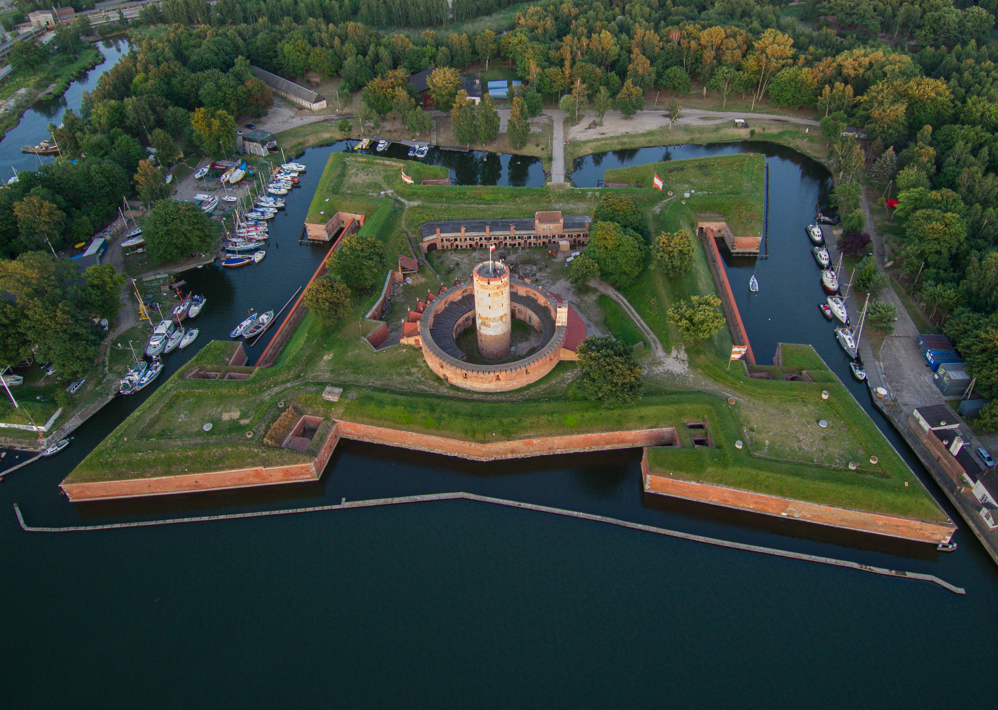
An aerial photograph of a star-shaped brick fortress with a central round tower, surrounded by dark water, with boats docked along the inner canals and green trees in the background.
Aerial view of the historic star-shaped Wisłoujście Fortress in Gdańsk, featuring a central round tower and surrounded by water and docked boats.

Twierdza Wisłoujście history and protected-area timeline

The earliest written reference to Wisłoujście comes from the late fourteenth-century Kämmereibuch records of the city of Gdańsk, which mention a Teutonic official called the "master of the mouth" who collected harbor duties. Wooden guard structures on the site were destroyed by Hussite forces in 1433 and again by a storm in 1465, after which the city began replacing them with masonry defenses.

In 1482 a cylindrical brick lighthouse tower was erected, the oldest surviving element of the present complex. Around 1517 stone-and-fill fortifications with gun ports were added, and in 1562 they were replaced by the circular artillery Wieniec that still encloses the tower. By 1608 Gdańsk had completed Fort Carré, a square fort with four casemated bastions (Artillery, Ostroróg, South-East, and Water Gate) reaching wall thicknesses of about 5.5 meters. The outer Eastern Szańiec was built in 1624-1626 to counter the growing threat of the Swedish navy.

The fortress proved its strategic value repeatedly. It held out against King Stefan Batory's forces during the 1577 siege of Gdańsk, played a logistical role in the 1627 Battle of Oliwa, and survived the Swedish Deluge siege of 1655 without falling. Russian troops occupied it after the 1734 siege of Gdańsk during the War of the Polish Succession. It endured Napoleon's 1807 siege, resisted a Russian assault in 1813, and was eventually returned to Prussia under the Congress of Vienna settlement.

In the nineteenth century the fortress lost much of its military relevance as concrete batteries took over defensive roles, and parts of the structure were converted into a political prison. During the interwar Free City of Gdańsk period, most outlying earthworks were demolished for industrial reuse. In World War II the German Kriegsmarine used the site for stores, barracks, and a field hospital, and Soviet artillery in March 1945 left the tower, the Wieniec ring, and the officers' houses largely in ruins. After the war, neglect and postwar scavenging completed much of the damage.

Systematic preservation began in 1955. In 1959 the fortress was placed on Poland's heritage register and reconstruction of the tower and barracks began. From 1974 it has been managed by what is now the Museum of Gdańsk. Restoration accelerated in the 1990s with support from the World Monuments Fund and the Norwegian Fund, and again in 2010-2011 with European Regional Development Fund financing. A major 2020-2024 conservation project addressed the Fort Carré tower, ring wall, and officers' houses. In 2018 the President of Poland granted the site Historic Monument status.

Twierdza Wisłoujście landscape and geographic character

The fortress occupies a low, flat stretch of land on the right bank of the Martwa Wisła, opposite the Nowy Port district of Gdańsk, with the waters of the Bay of Gdańsk only a short distance to the north. The setting is shaped entirely by water and by centuries of human effort to control it. Until 1840 the Martwa Wisła was in fact the main Gdańsk arm of the Vistula; later nineteenth-century canal works, including the great Vistula Cut of 1895, redirected the river's main outflow and left this channel as a tidally influenced dead branch of the delta.

The built landscape of Twierdza Wisłoujście mirrors this watery environment. Concentric rings of brick and stone rise out of marshy ground fed by the river, with water-filled moats tracing the outer line of the defenses. At the structural heart stands the cylindrical brick lighthouse tower, enclosed by the three-story circular Wieniec wall pierced with gunloops, which is in turn wrapped by the roughly square perimeter of Fort Carré and its four corner bastions. Eastward, the remains of the Eastern Szańiec and its surviving ravelin extend the line of fortification into open ground.

The original foundations of the structure are themselves a landscape feature: stone-filled wooden cribs known as kaszyce, sunk into the soft delta soils to bear the immense weight of masonry that would otherwise have been impossible on such ground. Above the walls, the visual profile has changed dramatically over time, with successive crowns from a Renaissance helmet through a baroque cupola to a slate-clad cone and finally the open viewing terrace that crowns the restored tower today.
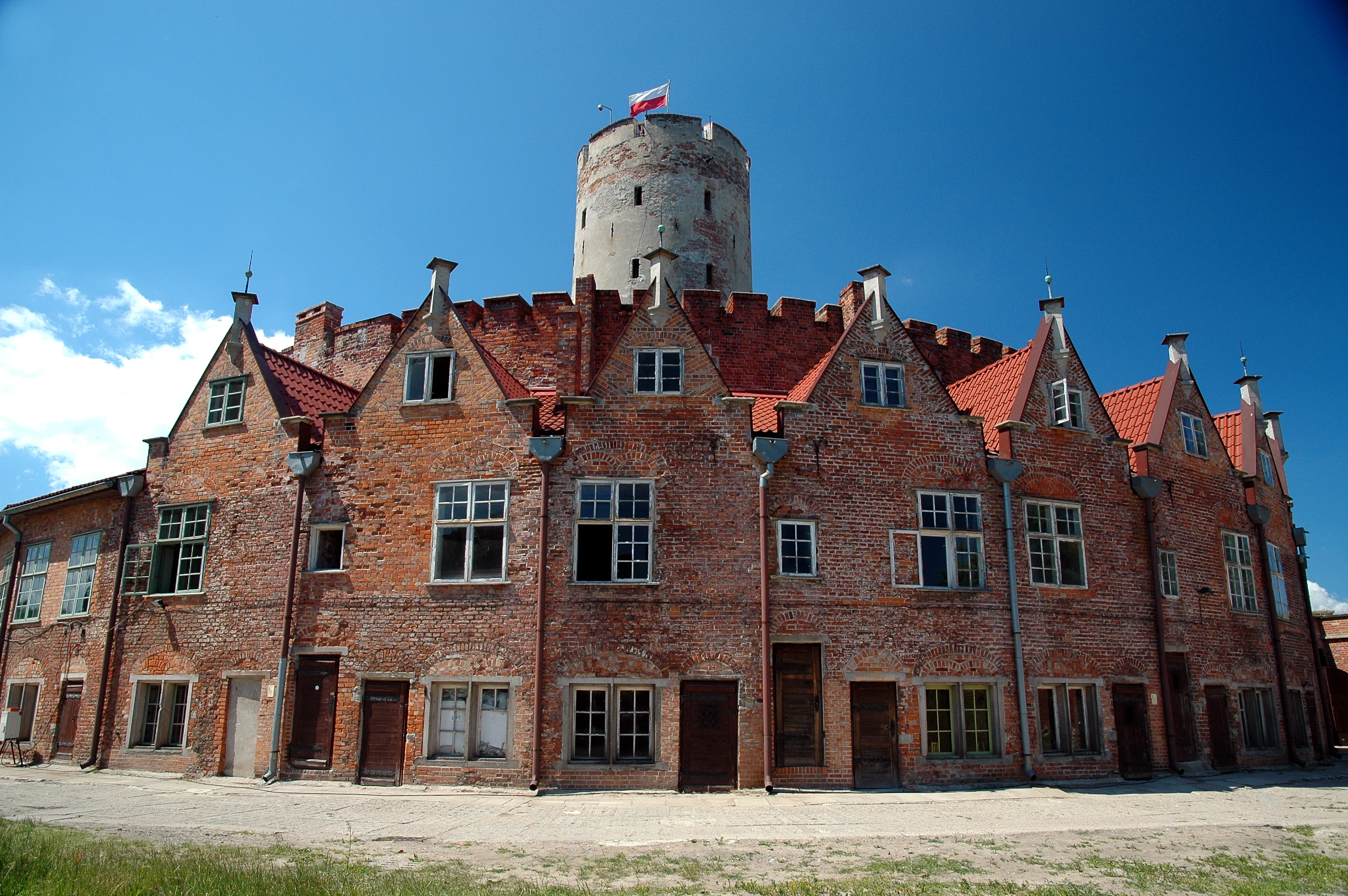
A wide-angle shot of a large, curved red brick building with multiple gabled roofs and a tall cylindrical stone tower rising from the center, topped with a flag, set against a blue sky.
The historic curved brick facade and central tower of the Wisłoujście Fortress under a clear blue sky.

Twierdza Wisłoujście ecosystems, habitats, and plant life

Ecologically, Twierdza Wisłoujście is defined less by vegetation than by the interplay between built masonry and the surrounding tidal waters of the Martwa Wisła and the Bay of Gdańsk. The grounds around the fortress include managed green space within the Fort Carré interior and along the Eastern Szańiec, where lawns and plantings tolerate the brackish, humid coastal climate. The wider site sits within a heavily transformed industrial harbor district, where the ecological value of the fortress lies primarily in the dark, stable, frost-free interior spaces of its bastions rather than in any extensive habitat of plants or open water.

The fortress's most important ecological role is as a hibernation site for bats. The thick brick walls, casemates, and underground chambers provide the cool, humid, disturbance-free microclimate that several protected species require to overwinter. Because of this role the site has been incorporated into the European Natura 2000 network. Survey work in 2005 counted 313 hibernating individuals, and the species composition shows a particular concentration of mouse-eared and whiskered bat groups adapted to masonry roosts.
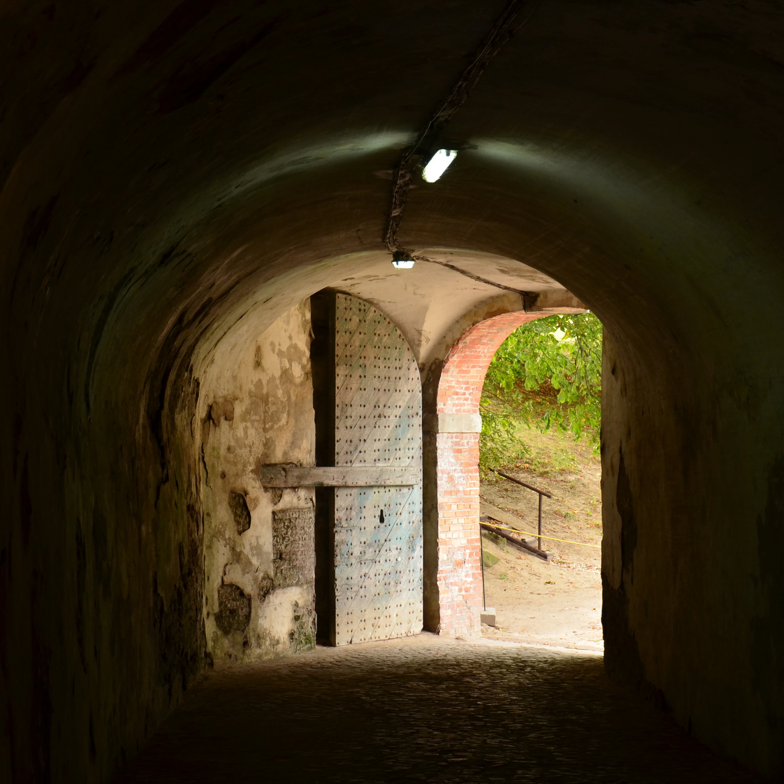
Dark arched stone tunnel with a large door on the left and an opening showing green vegetation outside.
View through the arched postern tunnel of Wisłoujście Fortress, featuring a heavy door and brick archway leading to the outside.

Twierdza Wisłoujście wildlife and species highlights

The wildlife profile of Twierdza Wisłoujście is dominated by its bat population, which makes the fortress one of the most important winter shelters for bats in the Pomeranian Voivodeship. A 2005 census recorded 313 hibernating individuals inside the walls, with Natterer's bat as the most numerous species and both the soprano pipistrelle's relative, the whiskered bat group, and the greater mouse-eared bat complex also well represented.

Several strictly protected species use the bastion casemates and the South-East Bastion in particular as a winter roost. Among them are individuals listed under Annex II of the EU Habitats Directive, a designation that underpins the site's recognition as a Natura 2000 area. In spring 2003 a single female Brandt's bat was recorded here, marking the first confirmed occurrence of the species in the eastern part of the Southern Baltic Coastal region.

Outside the bat population, the visible wildlife of the fortress grounds reflects the broader harbor and estuary environment of Gdańsk: waterbirds frequenting the nearby channel, common urban species along the embankments, and the seasonal movement of wildlife through the industrial waterfront zone that surrounds the monument.
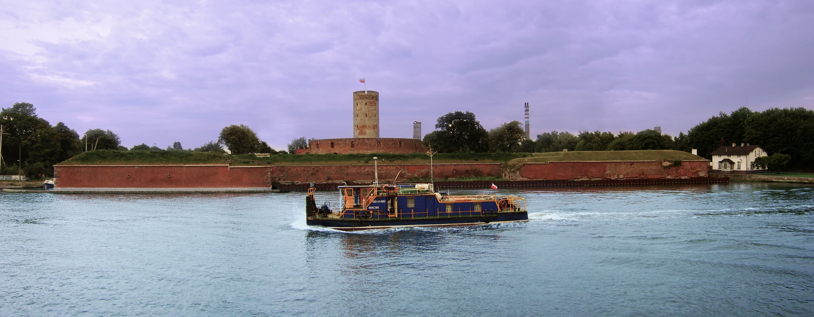
A wide panoramic photograph showing a large red brick fortress with a central tower situated on a riverbank under a cloudy sky, with a blue and black boat moving across the water in the foreground.
A panoramic view of the historic Wisłoujście Fortress across the water with a boat passing in the foreground.

Twierdza Wisłoujście conservation status and protection priorities

Twierdza Wisłoujście is significant from a conservation perspective on two parallel tracks: architectural heritage protection and ecological habitat protection. On the heritage side, it has been listed in Poland's register of monuments since 1959, was placed on the World Monuments Watch list of 100 most endangered sites in 1999, and received the honorary designation of Pomnik Historii, a Polish Historic Monument, by presidential decree in 2018. International support from the World Monuments Fund and the Norwegian Fund, together with European Regional Development Fund financing in 2010-2011, has underwritten successive waves of structural restoration, and a major 14.6-million-złoty project running from 2020 through 2024 completed conservation work on the Fort Carré tower, the Wieniec ring, and officers' housing.

On the ecological side, the fortress is recognized within the European Natura 2000 network because of its role as a hibernation roost for protected bat species. The presence of species listed in Annex II of the EU Habitats Directive, including the vulnerable whiskered bat group in Poland, gave the site's bat population a formal conservation status that complements its cultural-heritage protection. Together, these two frameworks mean the fortress is conserved not only as a monument illustrating the military and maritime history of Gdańsk, but also as a living habitat of regional biodiversity importance.

Twierdza Wisłoujście cultural meaning and human context

Twierdza Wisłoujście occupies a distinctive place in the cultural memory of Gdańsk and the Polish Baltic coast. In the early modern period it was called the "Gate to the Republic," a name that captured its identity as the symbolic and physical threshold through which goods, travelers, and armies entered the Polish-Lithuanian Commonwealth via the great mercantile port of Gdańsk.

The fortress also carries a powerful legacy of contested sovereignty. It changed hands among Royal Prussia, the Polish Crown, Sweden, Napoleon's France, the Russian Empire, the Free City of Gdańsk, Nazi Germany, and postwar Poland, and each transition left marks on its architecture and on local memory. In the nineteenth century its casemates served as a political prison for Polish activists and insurgents, embedding it in narratives of national resistance. Today, as a branch of the Museum of Gdańsk and a venue for large-scale historical reenactments such as the Sea Battle of Twierdza Wisłoujście and the Wisłoujście 1628 dramatization, the fortress remains an active stage on which Gdańsk tells its own layered story to visitors.

Top sights and standout views in Twierdza Wisłoujście

The fortress's greatest highlight is the layered history visible in its masonry itself: a 1482 lighthouse tower enclosed by a 1562 artillery ring, surrounded by a 1608 square fort with bastions named after their functions, and ringed further out by the surviving earthworks of a 1620s szańiec. Few sites on the Baltic coast compress so much architectural evolution into so compact an outline.

The site is also notable for two less obvious attractions. Its casemates shelter a bat hibernation colony of regional and European ecological significance, and its waterfront location makes it one of the few places where visitors can watch large-scale historical naval reenactments set against an authentic harbor backdrop. Combined with its status as a Polish Historic Monument, these qualities make Twierdza Wisłoujście both a heritage landmark and a living cultural-ecological site.

Best time to visit Twierdza Wisłoujście

Twierdza Wisłoujście operates as a seasonal museum branch of the Museum of Gdańsk and is open to visitors from May through September. The late spring and summer months offer the warmest conditions for walking the open courtyards, bastions, and viewing terrace atop the restored lighthouse tower, as well as for taking in views over the Martwa Wisła and the Bay of Gdańsk.

Summer is also when the fortress comes most fully alive culturally, with historical reenactment groups, traditional craft workshops, lectures, and the dramatic annual naval battle reenactment staged on the waters in front of the walls. Outside the May-to-September visitor season the site is generally not open to the public, so planning a visit during this window is essential for experiencing the fortress as both a monument and a public attraction.

Monthly climate preview

Long-term representative monthly averages and temperature spans across the year

Twierdza Wisłoujście Climate Normals, Annual Temperature and Precipitation Rhythm

Representative baseline data documents recorded temperature swings from sub-zero winter minimums to warm summer maximums alongside moderate daily precipitation rates. Examining the full twelve-month profile provides complete historical context for measured annual climatology patterns.
Annual mean8 °C
0 °C18 °C
Jan
Feb
Mar
Apr
May11°
Jun15°
Jul18°
Aug18°
Sep14°
Oct
Nov
Dec
Warmest month
August

18.3 °C

Coolest month
January

-0.5 °C

Wettest month
July

2.5 mm/day

Driest month
April

1.3 mm/day

Park location guide

Geography guide, regional context, and park location map for Twierdza Wisłoujście

Twierdza Wisłoujście park geography, regions, and map view in Poland

Understand where Twierdza Wisłoujście sits in Poland through a broader geographic reading of the surrounding landscape, nearby location context, and its mapped position within the national park landscape.

How Twierdza Wisłoujście fits into Poland

Poland, officially the Republic of Poland, is a Central European country spanning from the Baltic Sea in the north to the Carpathian Mountains in the south. It borders Germany, Czech Republic, Slovakia, Ukraine, Belarus, Lithuania, and Kaliningrad Oblast. The country has a temperate climate, diverse landscapes, and is known for its rich history, cultural heritage, and strong economic position within the EU.

Wider geography shaping Twierdza Wisłoujście in Poland

Poland occupies 312,696 km2 in Central Europe, extending from the Baltic Sea coast in the north to the Sudetes and Carpathian Mountains in the south. It borders Germany to the west, Czech Republic and Slovakia to the south, Ukraine and Belarus to the east, and Lithuania and Kaliningrad Oblast to the northeast. The landscape includes lowland plains, uplands, and mountain ranges.

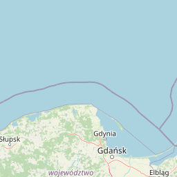
Map view of Twierdza Wisłoujście

Use this park location map to pinpoint Twierdza Wisłoujście in Poland, understand its exact geographic position, and read its mapped placement within the surrounding landscape more clearly.

Pigeon | © OpenStreetMap contributors

Location context for Twierdza Wisłoujście

Pomeranian Voivodeship

Explore photographic records of the Vistula river delta terrain, brick masonry, and protected wetland habitats.

Twierdza Wisłoujście Photos and Landscape Scenery: Visualizing the Historic Coastal Fortress

Photographic collections reveal the distinctive low island terrain, water-filled defensive moats, and layered Gothic masonry that define the coastal environment. Visual documentation allows researchers to examine the protected landscape character and river delta setting surrounding the historic fortress.

An aerial photograph of a star-shaped brick fortress with a central round tower, surrounded by dark water, with boats docked along the inner canals and green trees in the background.

A stone archway with a large metal gate set into a brick and grass fortification, with a round brick tower flying a flag behind it.

A wide-angle shot of a large, curved red brick building with multiple gabled roofs and a tall cylindrical stone tower rising from the center, topped with a flag, set against a blue sky.

Dark arched stone tunnel with a large door on the left and an opening showing green vegetation outside.

A wide panoramic photograph showing a large red brick fortress with a central tower situated on a riverbank under a cloudy sky, with a blue and black boat moving across the water in the foreground.

A long, two-story red brick building with multiple chimneys and arched openings surrounding a grassy courtyard at a historic fortress.

Park atlas

Compare regional coastal geography and adjacent protected areas in northern Poland

Parks Near Twierdza Wisłoujście and Surrounding Protected Landscapes

Visitors exploring Twierdza Wisłoujście can examine adjacent coastal reserves and protected areas across the Pomeranian region. Comparing neighboring river delta landscapes provides broader geographic context for the Baltic seaboard.
Nature reserveGdańsk
About 9.3 km away#1 closest

Southwest

Zbiornik Wody Stara Orunia: A Protected Industrial Heritage Site and Nature Reserve in Gdańsk

Historic brick architecture meeting urban bat conservation zones

Built in 1869, this historic underground reservoir in the Orunia district of Gdańsk combines rare Prussian engineering with a vital role as a Natura 2000 protected habitat. The site serves as a key component of the regional water trail, offering a look into the complex relationship between industrial infrastructure, urban landscape development, and the protection of essential wildlife hibernation cycles.

Area
0.001 km²
Established
1869
Relief
Upland
Climate
Temperate
Nature reservePomeranian Voivodeship
About 9.9 km away#2 closest

West

Dolina Strzyży Nature Reserve Protected Forest and Stream Valley Geography

Natural riparian forest in Pomeranian Voivodeship

Explore the geographic profile of Dolina Strzyży Nature Reserve, a protected valley woodland in the Pomeranian Voivodeship of Poland. This reserve maintains dense oak-hornbeam habitats and stream-side ecosystems, functioning as a vital green connection between urban Gdańsk and the expansive Trójmiejski Park Krajobrazowy, preserving historic forest remnants.

Area
0.385 km²
Established
2007
Relief
Upland
Climate
Temperate
Protected landscapePomeranian Voivodeship
About 11 km away#3 closest

West

Trójmiejski Park Krajobrazowy: Protected Landscape and Glacial Geography in Pomerania

Exploring the forested moraine upland near the Baltic coast

Covering nearly 20,000 hectares, Trójmiejski Park Krajobrazowy forms an essential green belt along the Kashubian moraine. Its terrain is defined by dramatic erosion, including 80-meter deep ravines and extensive pine-beech forests that host rare relic plant species and protected peatland habitats.

Area
199.3 km²
Established
1979
Relief
Upland
Climate
Temperate
A horizontal watercolor illustration showing a gentle river landscape with soft green meadows, trees, and rolling hills in the background.
Nature reservePomeranian Voivodeship
About 16 km away#4 closest

Northwest

Kacze Łęgi Nature Reserve: Mapped Protected Woodland and River Valley Geography

Riparian floodplain forest in the Pomeranian Voivodeship of Poland

Kacze Łęgi functions as a crucial nature reserve that maintains an unusually well-preserved fragment of elm and alder floodplain forest. Nestled along the Kacza River valley in Gdynia, this site offers a concentrated look at the original vegetation of Baltic river valleys. It remains a key component of the regional protected landscape, providing a deep study of moisture-loving woodland within the larger context of the Pomeranian coastal lowlands.

Area
0.09 km²
Established
1983
Relief
Lowland
Scope
Terrestrial
A soft watercolor painting of a marshy coastal landscape with tall grasses, calm water, and distant dunes under a bright, clear sky.
Nature reservePomeranian Voivodeship
About 19 km away#5 closest

East

Rezerwat przyrody Mewia Łacha: Protected Coastal Geography and Vistula Estuary Map

Dynamic Baltic sandbars and migratory bird habitat in Pomerania

Rezerwat przyrody Mewia Łacha occupies a vital coastal strip where river discharge meets the Gulf of Gdańsk. This nature reserve serves as an essential site for migratory waterfowl and nesting terns, defined by its shifting sandbars, dune slacks, and brackish pools. It stands as a key example of the varied estuarine geography found within the Pomeranian Voivodeship.

Area
1.505 km²
Established
1991
Relief
Lowland
Climate
Temperate
Nature reservePomeranian Voivodeship
About 25 km away#6 closest

South

Dolina Kłodawy Nature Reserve: Geography and Botanical Protected Areas in Pomeranian Voivodeship

Glacial river gorge landscapes in Northern Poland

This protected area centers on a 1.6 kilometer section of the Kłodawa stream, showcasing complex forest ecosystems including ash-alder woodlands and oak-hornbeam slopes. The site remains a vital reference for regional botanical geography, highlighting how glacial moraine hills create unique habitats for rare plants within the Pomeranian Voivodeship landscape.

Area
0.104 km²
Established
1999
Relief
Lowland
Climate
Temperate
Nature reservePomeranian Voivodeship
About 28 km away#7 closest

Northwest

Mechelińskie Łąki Nature Reserve: Coastal Geography and Protected Baltic Wetland Atlas

Pomeranian Voivodeship coastal dune and marsh landscape exploration

Investigate the protected topography of Mechelińskie Łąki Nature Reserve, where saline meadows meet the Baltic shoreline of Puck Bay. This faunistic reserve preserves an essential mosaic of dunes, marshes, and reedbeds in northern Poland, serving as a significant habitat for nesting shorebirds and rare amphibian species within the Pomeranian Voivodeship.

Area
1.135 km²
Established
2000
Relief
Lowland
Climate
Temperate
Protected landscapePoland
About 45 km away#8 closest

East

Zalew Wiślany i Mierzeja Wiślana Protected Landscape and Vistula Coastal Geography

A coastal mosaic of lagoon waters, sand dunes, and bog forests

Understand the physical landscape of Zalew Wiślany i Mierzeja Wiślana, featuring an aquatic environment where three quarters of the territory consists of brackish water. Trace the geography of the Vistula Sandspit as it transitions through dune successions, pine-birch woodlands, and sensitive estuarine meadows along the Polish coast.

Area
408.623 km²
Relief
Lowland
Climate
Temperate
Scope
Mixed

Common questions about visiting, size, designation, and location context for Twierdza Wisłoujście

Twierdza Wisłoujście FAQs for park facts, access, geography, and protected area context

Find quick answers about Twierdza Wisłoujście, including protected-area facts, park geography, trail and visitor context, and how the park fits into its surrounding country and regional landscape.
MoriAtlas Explorer

Continue Your Protected Areas Search Across the Global Atlas

Deepen your exploration by continuing the structured search for national parks and protected areas worldwide. Utilize the comprehensive filtering capabilities to compare different conservation landscapes and refine your understanding of global park geography. Discover more about the distribution and characteristics of protected natural areas.

Global natural geography