
Mori Atlas logo
National parkPark Narodowy „Ujście Warty”

Explore the expansive riverine floodplains, marshy terrain, and protected wetland geography

Park Narodowy „Ujście Warty” National Park in Lubusz Voivodeship, Poland: A Wetland Atlas

Park Narodowy „Ujście Warty” represents a vital protected landscape where the Warta River meets the Oder in western Poland. This geographic overview highlights the unique floodplain ecosystem, shaped by seasonal water cycles and the Postomia River. The area provides essential, mapped habitat for waterfowl across its vast, open meadows and marshes within the Lubusz Voivodeship, serving as a primary site for wetland conservation and environmental study.

wetlandsfloodplainriver confluencebirdwatchingwaterfowlmigratory birds
A flat vector illustration of a winding river flowing through a marshy landscape at sunset, with a wooden gazebo and dock on the left, grassy banks, and trees under a pastel sky.

Park Narodowy „Ujście Warty”

National park

Park overview

Structured park overview, official facts, and landscape profile for Warta River Mouth National Park

Warta River Mouth National Park park facts, protected area profile, and essential visitor context

Review the core facts for Warta River Mouth National Park, including designation, size, terrain, visitor scale, habitats, and operating context in one park-focused overview.

About Warta River Mouth National Park

Warta River Mouth National Park encompasses the broad, low-lying floodplains at the confluence of the Warta and Oder rivers in western Poland. The terrain is flat, water-rich, and shaped over centuries by the seasonal dynamics of the Warta, its tributary the Postomia, and especially by flood events that spread water across grasslands and create temporary marshes and oxbows. This is not a park of dramatic elevation or scenic cliffs; instead, it offers the wide horizons, shimmering meadows, and muted skies characteristic of European river lowlands.

The park was established in 2001 through the combination of the long-standing Słońsk nature reserve and a portion of the earlier Ujście Warty Landscape Park. Its relatively recent creation reflects both the growing recognition of Polish floodplain wetlands as internationally significant habitats and the need for stronger protection in a region shaped by centuries of agricultural drainage.

Ecologically, the park is dominated by wet meadows, sedge and reed communities, riparian thickets, and open waterways. These habitats are kept in their characteristic condition through a combination of natural flooding cycles and active management, including traditional grazing by horses and cattle, which prevents shrub encroachment and maintains the open landscape that waterbirds depend on.

The park sits in a transboundary context, facing Germany across the Oder, and connects ecologically with adjacent protected landscapes to form part of a larger corridor along the Oder valley. This geographic position gives the reserve a particular role in conserving migratory bird populations moving between northern breeding grounds and southern wintering areas.

Visitors come primarily for birdwatching, quiet walking, and cycling, with a network of marked trails, educational paths, observation hides, and viewpoints accessible from nearby villages such as Słońsk and from Kostrzyn nad Odrą. Although the park is relatively young, it has quickly established itself as one of the defining sites of Polish wetland conservation and a reference point for floodplain protection in Central Europe.

Quick facts and research context for Warta River Mouth National Park

Warta River Mouth National Park lies in Lubuskie Voivodeship in western Poland, near the tri-border area with Germany, and lies within the Gorzów and Freienwald basins. It was established on 1 July 2001, making it one of the most recent additions to Poland's national park system.

The park's core protected area covers roughly 80 square kilometers of floodplain, wet meadows, and marshes, surrounded by a buffer zone of around 104 square kilometers. The administrative center is located in Chyrzyno near Kostrzyn nad Odrą, and park lands fall within several municipalities including Kostrzyn, Słońsk, Witnica, and, in the buffer zone, Górzyca.

The reserve is governed under Poland's national park framework, with strictly protected, actively managed, and landscape-level protection zones dividing the territory. Its ecological character is defined by the confluence of the Warta and Postomia water systems and by seasonal flooding cycles.

Protection and recognition

Examine the documented terrestrial protection framework and management parameters.

Park Narodowy „Ujście Warty” Protection Status and Conservation Scope

Park Narodowy „Ujście Warty” maintains a documented terrestrial protection status within its regional conservation landscape. Official management parameters and administrative records outline the governance framework governing this protected area.

Protection details

Protection scope
Terrestrial
Transboundary protection
No
Core area
6.82 km²
Buffer area
104.54 km²
Park context

Deeper park guide and search-rich context for Warta River Mouth National Park

Warta River Mouth National Park history, landscape, wildlife, and travel context

Explore Warta River Mouth National Park through its history, landscape character, ecosystems, wildlife, conservation priorities, cultural context, and seasonal travel timing in a structured park guide built for atlas discovery and search intent.

Why Warta River Mouth National Park stands out

The park is best known as one of the most important sites in Poland for migrating, breeding, and wintering waterfowl and wetland birds. The floodplain meadows and marshes around the Warta, Oder, and Postomia rivers host enormous flocks of geese during migration seasons, alongside breeding populations of globally threatened species. It also stands out for being Poland's principal wintering refuge for the tundra swan, an Arctic-breeding species that gathers here in large numbers, and for the presence of white-tailed eagles that winter in the area, drawn by concentrations of wildfowl. The combination of large open meadows, natural flooding patterns, and traditional grazing creates a mosaic of habitats that consistently supports exceptional bird diversity.
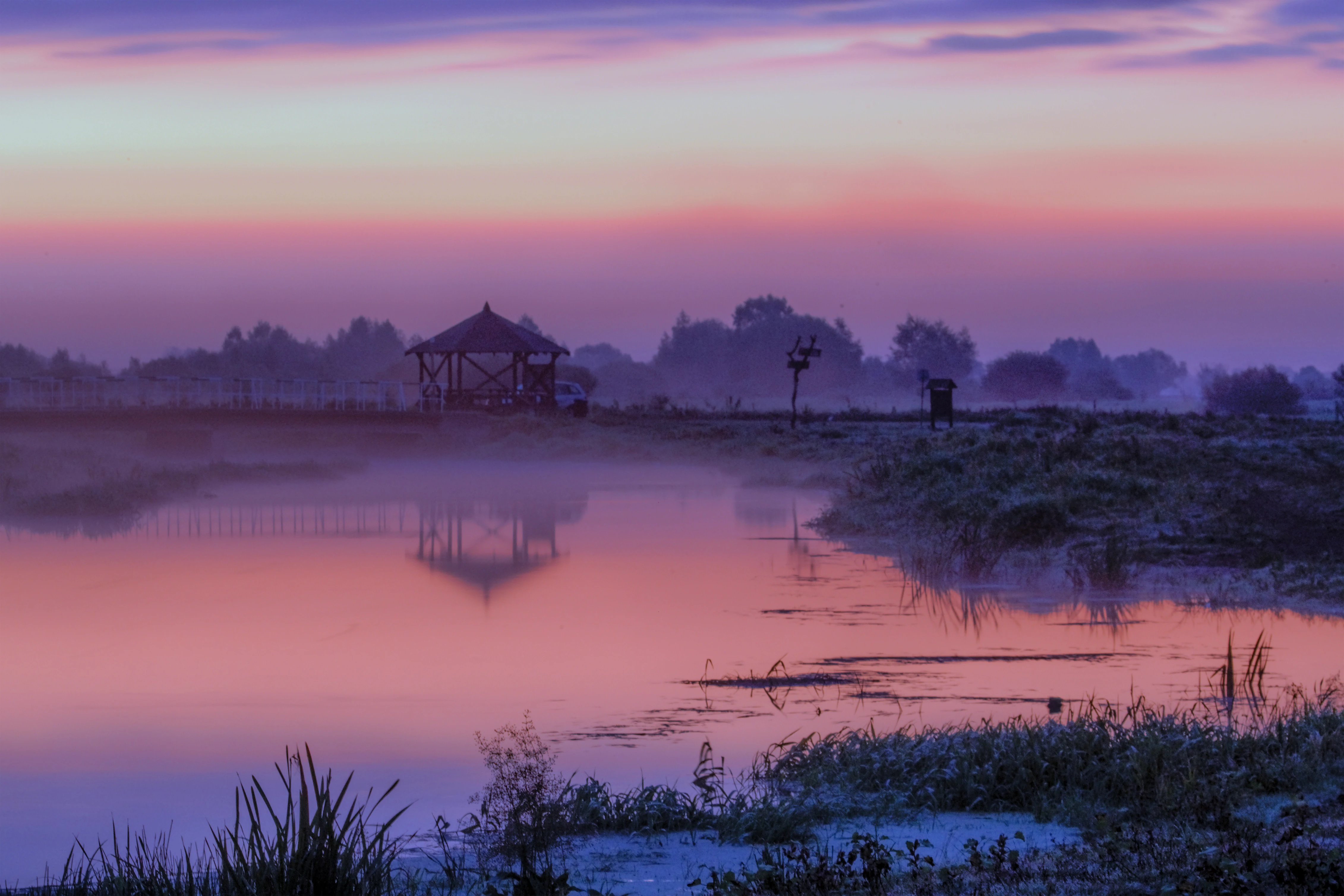
A peaceful sunrise scene over a still river and wetland area, with a wooden bird observation shelter silhouetted against a purple and orange sky.
Sunrise over the marshlands of Ujscie Warty National Park, featuring a bird observation structure along the Postomia River.

Warta River Mouth National Park history and protected-area timeline

The areas protected today under Warta River Mouth National Park have a layered conservation history. The core of the reserve grew out of the Słońsk nature reserve, a long-standing site recognized for its wetland birdlife, while the surrounding floodplain was previously managed within the Ujście Warty Landscape Park, a broader form of regional protection covering the wider river mouth area.

On 1 July 2001, the Polish government merged these two entities into a single national park, formalized through a Council of Ministers regulation. This made the new park one of the youngest entries in Poland's national park system and represented a major strengthening of protection for the floodplain, which had previously been vulnerable to agricultural drainage and land-use changes.

The creation of the park also marked a shift toward more active ecological management, including the maintenance of open meadows through grazing, the restoration of natural flood dynamics, and the development of infrastructure for bird observation and public education. Since then, the reserve has continued to develop its role in national and international bird monitoring networks.

Warta River Mouth National Park landscape and geographic character

The landscape of Warta River Mouth National Park is defined by the broad, flat floodplain where the Warta discharges into the Oder. Elevations are low, and the horizon is wide, giving the area a distinctly lowland character typical of large Central European river systems.

The Postomia River plays an outsized role in shaping the terrain: its seasonal overflows contribute significantly to the flooding patterns that create the park's wetlands, marshes, and shallow lateral channels. The combination of permanent and temporary water bodies produces a shifting mosaic of saturated meadows, reedbeds, and open water that changes visibly with the seasons and the water cycle.

Viewpoints, including the observation tower in Chyrzyno, offer expansive vistas across the floodplain, while paths along the Postomia and within the former Słońsk reserve allow close contact with the open landscapes. Although not visually dramatic in the mountain sense, the terrain has a quiet, atmospheric quality shaped by water, sky, and uninterrupted views across grasslands.
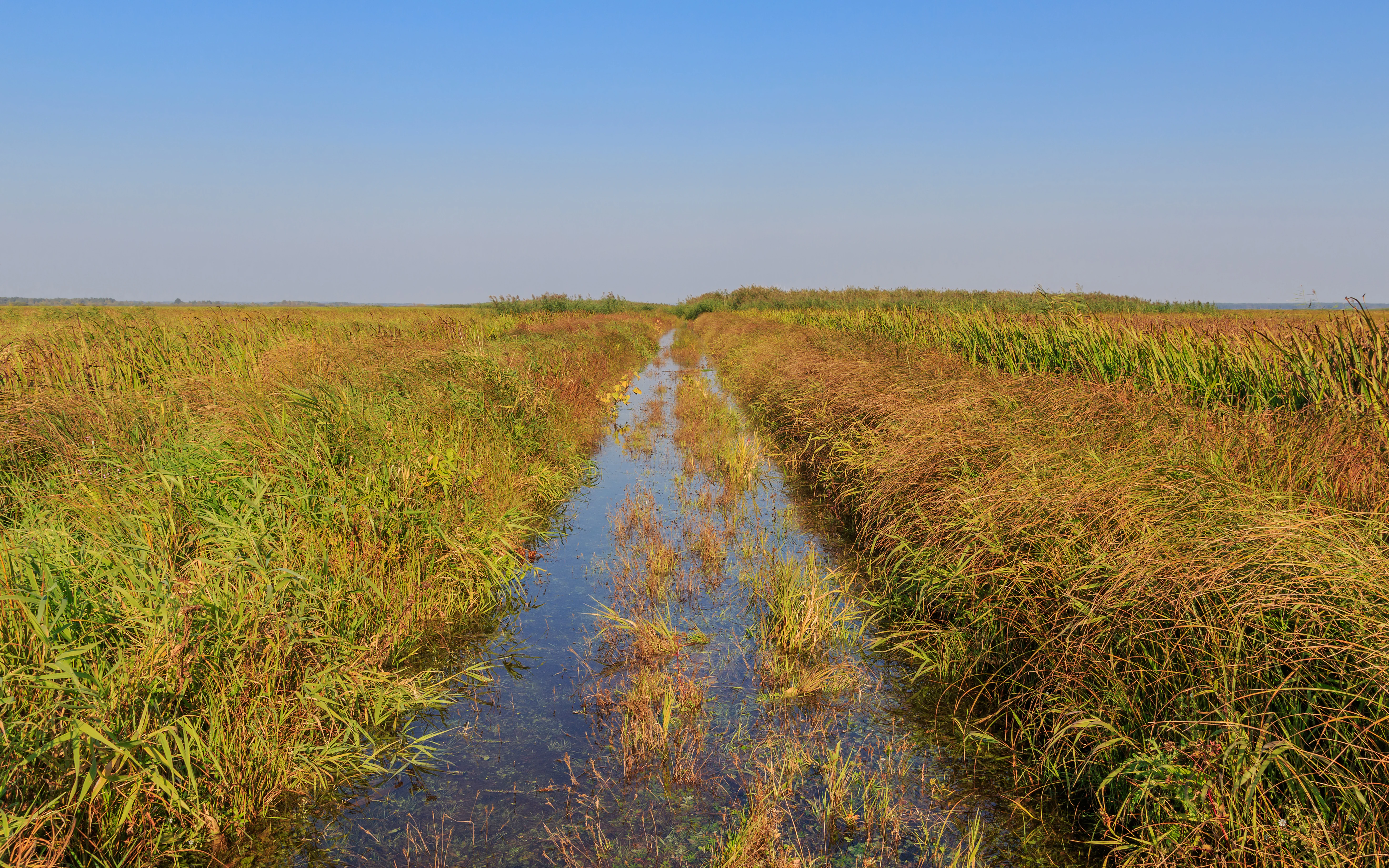
A narrow water channel flowing through dense, golden and green marshland vegetation under a clear blue sky in Ujście Warty National Park.
A drainage channel winding through the marshes of Ujście Warty National Park.

Warta River Mouth National Park ecosystems, habitats, and plant life

The park's ecological identity is that of a large, actively managed floodplain wetland. The dominant habitats are wet meadows, sedge marshes, reedbeds, and riparian shrub communities, all sustained by the seasonal hydrology of the Warta, Oder, and Postomia river systems.

These habitats support a high level of biodiversity despite the apparent simplicity of the open landscape. The mosaic of water and grassland creates ecological gradients that favor both aquatic and terrestrial species, while the absence of intensive forestry or urbanization leaves large tracts of relatively undisturbed habitat.

Active management, including extensive grazing by horses and cattle, is an integral part of the park's ecological character. Grazing prevents the succession of open meadows toward shrubs and woodland, maintaining the habitat conditions on which the park's bird and plant communities depend. This blend of natural hydrology and traditional land use gives the reserve a distinctive semi-natural character that is shaped by both ecological processes and human stewardship.
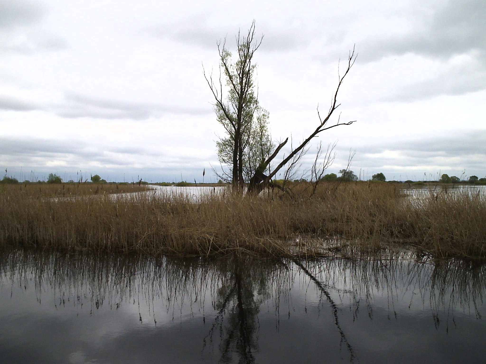
A lone tree stands in the middle of a calm, marshy wetland with tall grasses and reeds under a cloudy sky.
The wetlands and marshy landscape of Ujście Warty National Park.

Warta River Mouth National Park wildlife and species highlights

Warta River Mouth National Park is recognized above all for its birdlife. The reserve hosts a substantial proportion of Poland's recorded bird species, including a large number of breeding species and many that are considered rare or threatened at the European or global scale.

Breeding birds of particular conservation interest include species associated with wet meadows, reedbeds, and shallow marshes. The park's open habitats support globally threatened species that depend on the continued maintenance of wet, unfragmented grassland landscapes.

The park's importance for migratory and wintering birds is equally striking. During migration seasons, very large flocks of geese visit the floodplain, feeding on the meadows and resting on open water. The reserve holds the largest wintering concentration in Poland of the tundra swan, an Arctic-breeding species that returns here from the far north. White-tailed eagles also winter within the park, attracted by abundant populations of ducks and other waterfowl.

Mammals are less conspicuous than birds in this open wetland, but the presence of large grazers, such as horses and cattle, is an integral part of the habitat and an important element of the park's landscape character. Observation hides along the Postomia and elsewhere allow visitors to experience the birdlife up close without disturbing it.
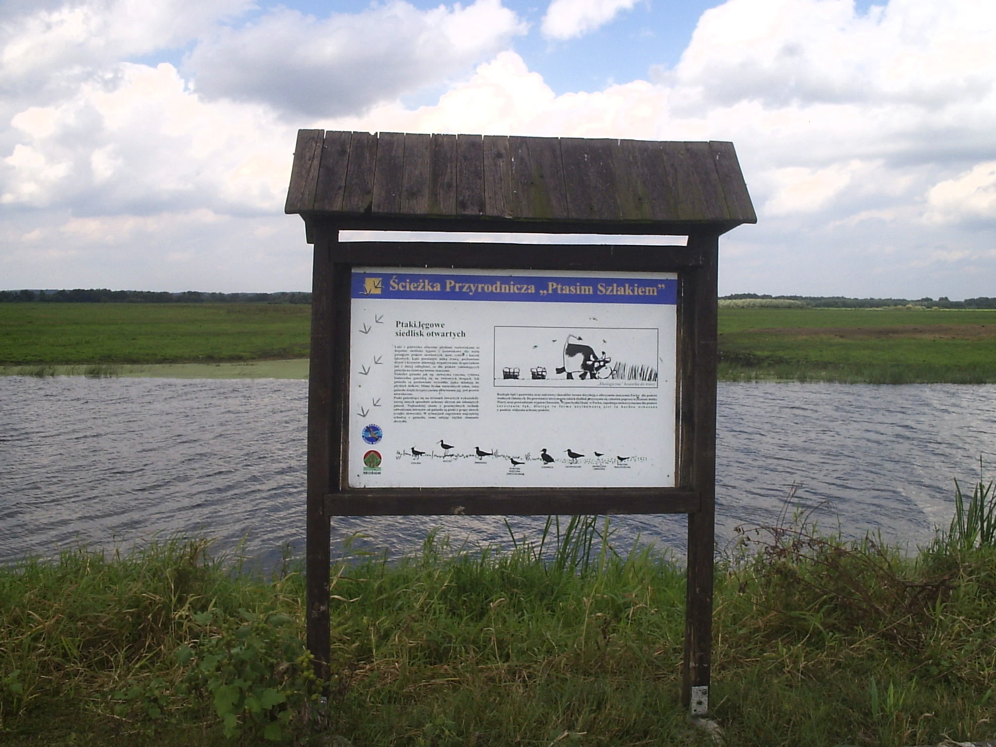
A wooden educational information board stands on the bank of a marshy waterway in a national park.
An educational sign along the Ptasim Szlakiem nature trail in Ujście Warty National Park.

Warta River Mouth National Park conservation status and protection priorities

The park's central conservation purpose is the protection of one of Poland's most valuable lowland wetland complexes. Its establishment in 2001 marked a major upgrade in legal protection for a landscape that had been under various forms of regional protection for decades, but had remained vulnerable to drainage, agricultural intensification, and changes in water management.

Internationally, the reserve's significance is marked by its role as a stronghold for breeding, migrating, and wintering waterbird populations, including species of European and global conservation concern. The combination of extensive wet meadows, marshes, and open water creates conditions that are increasingly rare across Central Europe, where most large floodplains have been heavily modified.

Conservation management in the park combines the protection of natural flooding processes with active measures, including extensive grazing to maintain open habitats and restoration of water dynamics disrupted by past drainage. The park also functions as an important node within the wider ecological corridor of the Oder valley, contributing to connectivity for wildlife moving across the Polish-German border region.

Warta River Mouth National Park cultural meaning and human context

The cultural context of the park is closely tied to the traditional use of the floodplain meadows. Long before the area gained national park status, the wet grasslands were managed through extensive grazing by livestock, including horses and cattle. This practice, often described in local tradition as a defining feature of the landscape, continues today as both an ecological tool and a living cultural heritage.

The surrounding villages, including Słońsk, Witnica, and communities around Kostrzyn nad Odrą, have a long relationship with the river landscape, shaped by agriculture, fishing, and the rhythms of seasonal flooding. The park's educational programs, observation infrastructure, and annual cultural events reflect the integration of this regional identity with modern conservation.
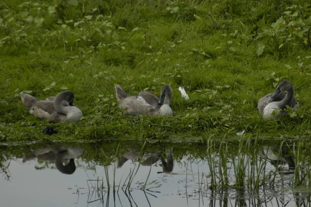
Three young swans with greyish plumage resting on a green grassy bank beside a quiet water channel, with their reflections visible in the water.
Juvenile swans resting on the grassy bank of a wetland in Ujscie Warty National Park.

Top sights and standout views in Warta River Mouth National Park

Warta River Mouth National Park stands out for the sheer scale of its open floodplain landscapes and the exceptional density of birdlife they support. The reserve combines the ecological value of a naturally dynamic river system with active conservation management, producing one of Poland's most vibrant wetland habitats.

Key qualities include one of the country's most important breeding grounds for threatened wetland birds, the largest Polish wintering site for the tundra swan, and the seasonal spectacle of enormous goose flocks on migration. Together with viewpoints, observation hides, and a network of walking and cycling routes, these features make the park a leading destination for nature-based exploration in western Poland.
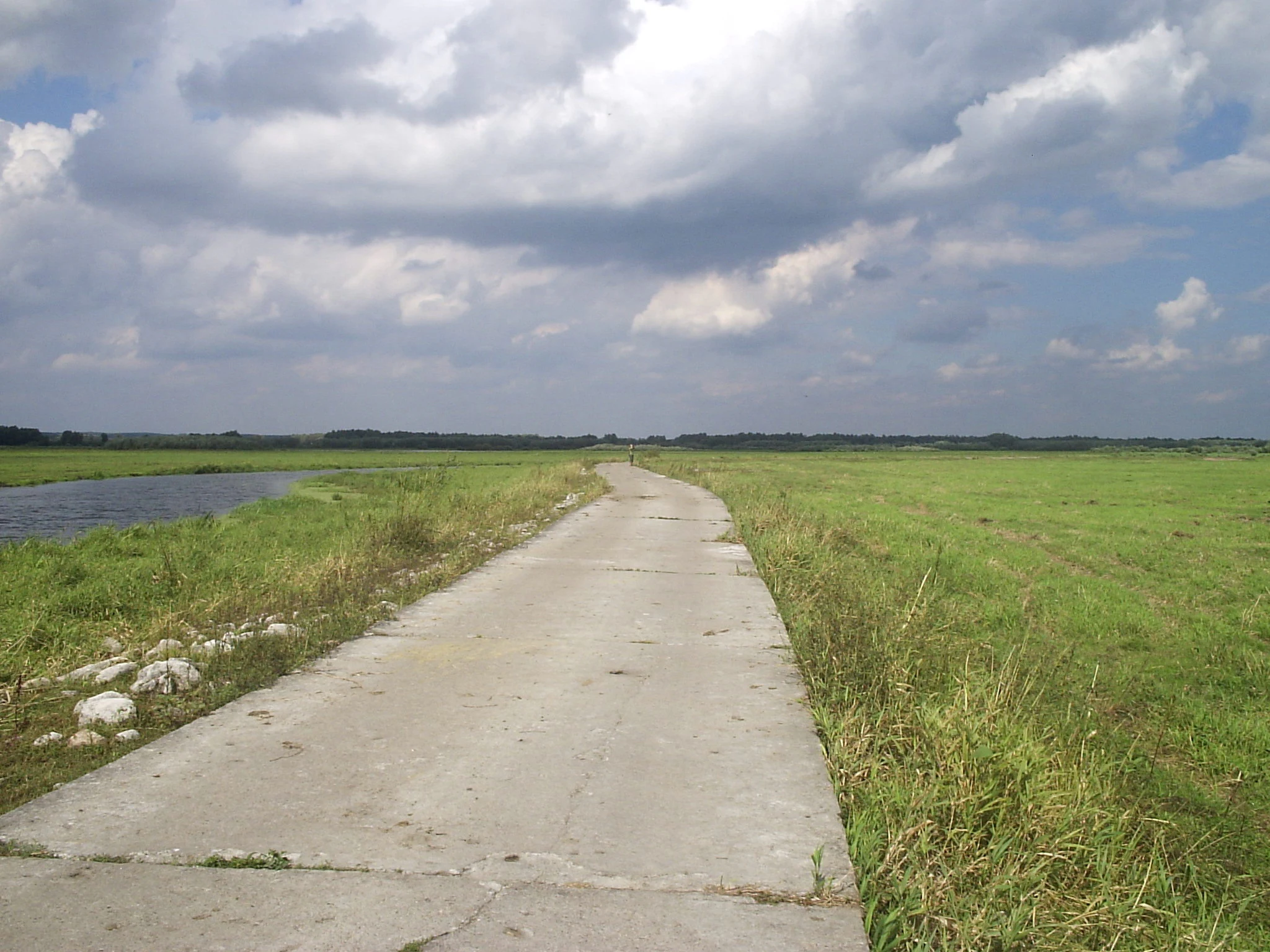
A narrow, worn concrete road stretches into the distance, flanked by lush green grasslands and a small river or waterway on the left under a cloudy sky.
A concrete path winds through the expansive marshlands of Ujście Warty National Park.

Best time to visit Warta River Mouth National Park

Seasonal conditions strongly affect the character of a visit to the park. Spring and early autumn are typically the most dynamic periods for birdwatching, when migrating geese and other waterfowl use the floodplain in large numbers and breeding species are active across the meadows and marshes.

Summer offers a calmer, greener landscape, with wildflowers in the meadows, grazing livestock visible across the grasslands, and the warmest conditions for walking and cycling the park's trails. Winter brings a different kind of quiet beauty, with the floodplain hosting large numbers of tundra swans, wintering ducks, and white-tailed eagles, while open vistas become especially atmospheric under low skies.

In general, the park's open landscapes are evergreen in their appeal, but visitors interested in birdlife will find the migration and wintering seasons particularly rewarding.

Monthly climate preview

Long-term representative measurements of monthly temperature and precipitation cycles

Park Narodowy „Ujście Warty” Climate Normals and Annual Temperature Rhythm

Representative coordinates record measured monthly temperature swings from sub-zero winter minimums to warm summer maximums alongside steady daily precipitation averages. Examining the complete twelve-month climatology profile reveals detailed patterns across the entire annual cycle.
Annual mean9 °C
-1 °C20 °C
Jan-1°
Feb
Mar
Apr
May14°
Jun18°
Jul20°
Aug20°
Sep15°
Oct
Nov
Dec
Warmest month
July

20 °C

Coolest month
January

-1.3 °C

Wettest month
July

2.5 mm/day

Driest month
April

1.1 mm/day

Park location guide

Geography guide, regional context, and park location map for Warta River Mouth National Park

Warta River Mouth National Park park geography, regions, and map view in Poland

Understand where Warta River Mouth National Park sits in Poland through a broader geographic reading of the surrounding landscape, nearby location context, and its mapped position within the national park landscape.

How Warta River Mouth National Park fits into Poland

Poland, officially the Republic of Poland, is a Central European country spanning from the Baltic Sea in the north to the Carpathian Mountains in the south. It borders Germany, Czech Republic, Slovakia, Ukraine, Belarus, Lithuania, and Kaliningrad Oblast. The country has a temperate climate, diverse landscapes, and is known for its rich history, cultural heritage, and strong economic position within the EU.

Wider geography shaping Warta River Mouth National Park in Poland

Poland occupies 312,696 km2 in Central Europe, extending from the Baltic Sea coast in the north to the Sudetes and Carpathian Mountains in the south. It borders Germany to the west, Czech Republic and Slovakia to the south, Ukraine and Belarus to the east, and Lithuania and Kaliningrad Oblast to the northeast. The landscape includes lowland plains, uplands, and mountain ranges.

Map view of Warta River Mouth National Park

Use this park location map to pinpoint Warta River Mouth National Park in Poland, understand its exact geographic position, and read its mapped placement within the surrounding landscape more clearly.

Pigeon | © OpenStreetMap contributors

Location context for Warta River Mouth National Park

Lubusz Voivodeship
Natural feature types

Browse the Comprehensive Natural Feature Collection for Park Narodowy Ujście Warty

Dive into the specific geographic and hydrologic elements that define the landscape of Park Narodowy Ujście Warty. This collection serves as a focused index for examining the wetlands, river basins, and meadows that make up this unique lowland territory within the MoriAtlas database.

Visual reference collection showcasing the wide floodplains, marsh terrain, and protected river ecosystems.

Park Narodowy „Ujście Warty” Photos: Landscape, Scenery, and Wetland Habitats

Visual documentation captures the expansive lowland terrain and dynamic seasonal floodwaters that define Park Narodowy „Ujście Warty”. Examining these protected habitats clarifies the ecological character of the river confluence and the surrounding wetland environment.

A peaceful sunrise scene over a still river and wetland area, with a wooden bird observation shelter silhouetted against a purple and orange sky.

A wide aerial view showing extensive flooded marshlands and winding river channels meandering through lush green and autumnal forest patches.

A narrow water channel flowing through dense, golden and green marshland vegetation under a clear blue sky in Ujście Warty National Park.

A lone tree stands in the middle of a calm, marshy wetland with tall grasses and reeds under a cloudy sky.

A wooden educational information board stands on the bank of a marshy waterway in a national park.

A wide shot of a winding river flowing through vibrant green marshland and meadows under a blue sky with scattered clouds.

Three young swans with greyish plumage resting on a green grassy bank beside a quiet water channel, with their reflections visible in the water.

A narrow, worn concrete road stretches into the distance, flanked by lush green grasslands and a small river or waterway on the left under a cloudy sky.

An expansive, flooded wetland area with scattered trees, a road crossing the water, and an overcast sky.

A medium shot showing a herd of horses standing on a patch of dirt at the edge of a large, green, flat meadow in Ujście Warty National Park.

A wide landscape shot of expansive, flat, water-covered wetlands with small shrubs and marshy vegetation, under a thick, cloudy sky.

Park atlas

Compare surrounding regional geography and connected wetland reserves

Parks Near Park Narodowy „Ujście Warty” and Related Protected Landscapes

Browsing nearby protected areas allows travelers to compare lowland floodplains and river valley reserves across western Poland. Expanding the geographic scope reveals adjacent natural habitats that share similar hydrological terrain and bird conservation values.
Protected landscapePoland
Park boundaries overlap#1 closest

Northwest

Park Krajobrazowy Ujście Warty: Protected Landscape and River Valley Atlas

Mapping wetland ecosystems and floodplain geography in western Poland

Park Krajobrazowy Ujście Warty preserves a significant lowland river valley landscape characterized by vast open pastures, marshes, and rare riparian oak forests. Located primarily within the Lubuskie region, this protected area offers a clear view into the floodplain processes of the Warta river basin, providing a distinct geographic context for wetland conservation and waterbird habitat mapping in Poland.

Area
194.96 km²
Established
1996
Relief
Lowland
Climate
Temperate
Protected areaLubusz Voivodeship
Mapped location lies within the park boundary#2 closest

Southwest

Ujście Warty Protected Area: Geography and Landscape Atlas of the Warta River Valley

Natura 2000 wetland and floodplain mapping in Lubusz Voivodeship

Examine the physical geography of Ujście Warty, a major lowland protected area in western Poland. This landscape features a unique layering of river arms, alluvial forests, and dry grasslands, serving as a vital ecological corridor within the broader Oder basin. Use this mapped overview to study the terrain features and structural connectivity of these significant floodplain habitats.

Area
332.15 km²
Water
Water-dominated
Watercolor illustration showing a river winding through rolling green hills with sparse vegetation
National parkLubusz Voivodeship
Park boundaries overlap#3 closest

Southwest

Warta Mouth National Park: A National Park Protecting Vital European Wetlands

Explore mapped protected areas and bird habitats in Lubusz Voivodeship.

Warta Mouth National Park, located in Poland's Lubusz Voivodeship, is a significant protected landscape safeguarding the ecologically rich confluence of the Warta and Oder rivers. As the nation's most recently established national park, it provides critical habitat for a vast array of migratory and breeding bird species within its extensive marshlands and floodplains. This park offers a unique opportunity for atlas-driven exploration of Central European wetland geography and the mapped boundaries of a vital conservation area.

Area
80.38 km²
Established
2001
IUCN
II
Visitors
52K annual
Watercolor illustration showing a winding river through a soft, green wetland landscape with distant rolling hills and scattered trees.
Protected areaLubusz Voivodeship
1.3 km away#4 closest

North

Ostoja Witnicko-Dębniańska: Mapped Protected Area and Regional Geography

An extensive mosaic of lowland forest and wetland habitats in Poland

The Ostoja Witnicko-Dębniańska sanctuary serves as a critical protected landscape, defined by its blend of managed forest stands, transitional peatlands, and dystrophic lakes. Positioned along the Warta river valley, this area provides a rich geographic context for understanding the wetland ecosystems of the Lubusz Voivodeship and the surrounding western Polish lowlands.

Area
469.93 km²
Established
2007
Scope
Terrestrial
Water
Major water bodies
Nature reserveLubusz Voivodeship
About 5.2 km away#5 closest

East

Dolina Postomii Nature Reserve: Geography, Protected Forests, and River Valley Mapping

Mapping the protected landscapes of Lubusz Voivodeship

Dolina Postomii Nature Reserve is a significant protected area situated within the river-focused geography of western Poland. The reserve preserves a distinct mosaic of oak-hornbeam forests, acidophilous woodlands, and rich floodplain meadows. This compact landscape offers a window into the natural ecological transition between higher forested terraces and the wetland floor, providing essential habitats for breeding birds and rare beetles within the regional Warta basin.

Area
0.687 km²
Established
2005
Relief
Lowland
Scope
Terrestrial
Nature reserveLubusz Voivodeship
About 12 km away#6 closest

Northeast

Rezerwat przyrody Dębowa Góra: Protected Oak and Beech Woodland Geography in Lubusz Voivodeship

Analysis of a near-natural deciduous forest reserve in western Poland.

Rezerwat przyrody Dębowa Góra is a protected fragment of mature deciduous woodland located in Gorzów County. Its landscape preserves essential oak-lime-hornbeam forest stands, providing a glimpse into the natural lowland ecology of the Lubusz Voivodeship through structured active conservation and forest management.

Area
0.113 km²
Established
1995
Relief
Lowland
Climate
Temperate
Watercolor painting showing a winding river through a wetland with trees and hills in the background.
Nature reserveLubusz Voivodeship
About 19 km away#7 closest

South

Mokradła Sułowskie Nature Reserve: Mapping Wetland Protected Areas in Lubusz Voivodeship

A comprehensive geographic atlas of Polish peatland and forest marsh habitats

The Mokradła Sułowskie nature reserve protects a vital cluster of eutrophic lakes and waterlogged mires in western Poland. This atlas entry provides a detailed look at its unique landscape, where divided northern and southern sections showcase diverse stages of marshland succession and regional biodiversity within the broader Lubusz Voivodeship.

Area
0.451 km²
Established
1990
Water
Water-dominated
A watercolor painting showing a quiet wetland with calm water, scattered dark tree stumps, reeds in the foreground, and rolling green hills in the distance under a pale sky.
Nature reserveBrandenburg
21 km away#8 closest

Southwest

Booßener Teichgebiet Nature Reserve: Regional Geography and Protected Landscape Analysis

Glacial meltwater valleys and pond ecosystems in eastern Brandenburg

Discover the geographic footprint of Booßener Teichgebiet, a 104-hectare nature reserve in Brandenburg. This protected area features a unique combination of managed stream corridors, impoundment ponds, and xerothermic biotopes nestled within a glacial meltwater valley near the German-Polish border.

Area
1.04 km²
Established
2008
IUCN
IV
Relief
Lowland

Common questions about visiting, size, designation, and location context for Warta River Mouth National Park

Warta River Mouth National Park FAQs for park facts, access, geography, and protected area context

Find quick answers about Warta River Mouth National Park, including protected-area facts, park geography, trail and visitor context, and how the park fits into its surrounding country and regional landscape.
MoriAtlas Explorer

Continue Your Protected Areas Search Across the Global Atlas

Deepen your exploration by continuing the structured search for national parks and protected areas worldwide. Utilize the comprehensive filtering capabilities to compare different conservation landscapes and refine your understanding of global park geography. Discover more about the distribution and characteristics of protected natural areas.

Global natural geography