Why Umpqua National Forest stands out
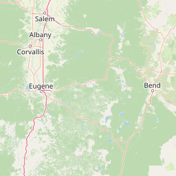
Umpqua National Forest is best known for the dramatic transition from lowland ponderosa pine and oak woodlands to high-elevation forests of western hemlock, true fir, Douglas-fir, and cedar along the crest of the southern Cascades. Its skyline is defined by heavily eroded volcanic landmarks such as Mount Thielsen and Mount Bailey, where basalt and andesite have weathered into remarkable monolithic spires such as Eagle Rock, Rattlesnake Rock, and Old Man. Equally distinctive are its cold, salmon-bearing rivers and the steep, forested canyons of the North Umpqua, which became part of the National Wild and Scenic Rivers System in 1988. The forest is also notable for its extensive old-growth coverage and for being surrounded by other major Pacific Northwest landscapes, including Crater Lake National Park and the Rogue River-Siskiyou National Forest.
Umpqua National Forest history and protected-area timeline
The human history of the Umpqua area long predates the creation of the national forest. Indigenous peoples, including ancestors of the Umpqua, Southern Molala, Yoncalla, and the Cow Creek Band of Umpqua Tribe of Indians, lived in these mountains and valleys for thousands of years. Their world was shaped by the eruption of Mount Mazama nearly 7,000 years ago, which left the modern Crater Lake as its caldera. The Umpqua people and their neighbors adapted to the volcanic, river-filled landscape and are the source of the name "Umpqua," which has been translated as both "thundering waters" and "across the waters."
In 1856, in the closing years of the federal Oregon Territory, Native communities were moved to reservations, and European-American settlers soon acquired much of the valley land. Over the following decades, tribal members were further displaced and became farmers and ranchers in the Umpqua Valley. The lands that would eventually form the national forest remained relatively intact as public domain until the early twentieth century.
Umpqua National Forest was created by act of the United States Congress and signed into law by President Theodore Roosevelt on July 2, 1907. Under the U.S. Forest Service, staff began building trails, constructing bridges, fighting fires, monitoring grazing, and erecting fire protection lookouts. Commercial logging and mining were not permitted until 1925, eighteen years after the forest's establishment. During the 1930s, the Civilian Conservation Corps, a New Deal program under President Franklin D. Roosevelt, was active in the forest, building roads, bridges, and recreation facilities that shaped the modern recreation landscape. In 1988, the Oregon Omnibus Wild and Scenic Rivers Act added a 26-mile stretch of the North Umpqua River to the National Wild and Scenic Rivers System.
Umpqua National Forest landscape and geographic character
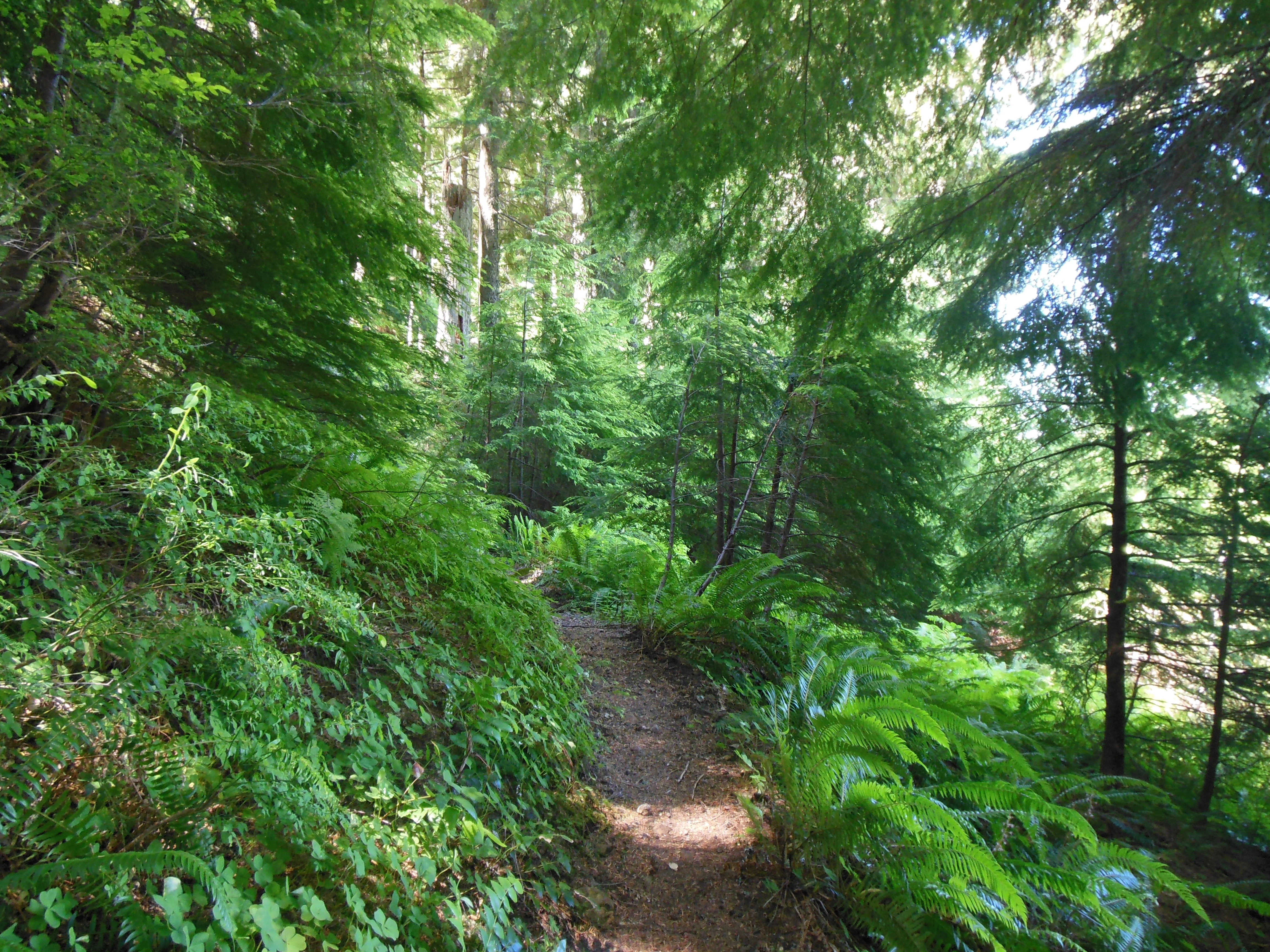
Umpqua National Forest is a textbook example of Cascade Range topography, where elevation, volcanic geology, and moisture combine to produce a layered landscape. Deep timbered valleys carved by the Umpqua River and its tributaries give way to mixed conifer slopes and, higher up, to dense stands of hemlock, fir, and cedar. The lower slopes hold old-growth ponderosa pine and oak groves that are unusual for the otherwise conifer-dominated Cascades.
Above the forests rise several prominent volcanic peaks, chief among them Mount Thielsen at 9,182 feet, one of the most eroded shields in the range, and Mount Bailey at 8,363 feet. The forest's geology is heavily volcanic, with scattered basalt and andesite monoliths that have been given descriptive names such as Eagle Rock, Rattlesnake Rock, and Old Man. Deep pumice deposits from the eruption of Mount Mazama still blanket parts of the Mount Thielsen Wilderness, giving some trails an unusually soft, ash-like surface.
The forest also serves as a continental divide of sorts, separating the watersheds of the Umpqua and Rogue rivers. The Rogue-Umpqua Divide Wilderness marks this ridgeline at elevations ranging from roughly 3,200 to nearly 6,900 feet, with subalpine meadows, old-growth stands, and panoramic views of both drainages.
Umpqua National Forest ecosystems, habitats, and plant life
Ecologically, Umpqua National Forest reflects the meeting point of two great forest systems of the Pacific Northwest. Its higher, wetter zones resemble the classic western Cascades, dominated by western hemlock, Douglas-fir, true firs, and western redcedar, much of it in old-growth condition. Descending in elevation, the forest transitions into mixed conifer-hardwood stands and then into the drier ponderosa pine and oak woodlands more typical of southern Oregon's interior valleys.
A 1993 Forest Service study estimated that old-growth forest covered roughly 535,300 acres of the national forest, with about 82,200 acres classified as mountain hemlock forest. This extensive old-growth base supports complex habitat structure, from large, decaying logs on the forest floor to multi-layered canopies, and contributes to the watershed health of the Umpqua and Rogue river systems. Wet meadows, subalpine parklands, and riparian zones along cold, clear streams add further ecological variety.
Umpqua National Forest wildlife and species highlights
The forest's combination of old growth, dense conifer cover, oak woodlands, meadow margins, and salmon-bearing rivers supports more than 250 wildlife species. Large ungulates and carnivores, including Roosevelt elk, mule deer, black bear, and cougar, are emblematic residents of the backcountry. Smaller mammals such as squirrels, foxes, raccoons, and bats are common throughout the forest and its edges.
Raptors nest and forage across the forest, with owls, bald eagles, ospreys, and even peregrine falcons occasionally encountered. The river systems are equally alive: coho and Chinook salmon, along with steelhead, rainbow, brown, and cutthroat trout, swim, feed, and spawn in the cold waters of the North Umpqua and its tributaries. The presence of these anadromous fish species adds significant conservation value to the forest, especially in the Wild and Scenic corridor of the North Umpqua.
Umpqua National Forest conservation status and protection priorities
Umpqua National Forest plays a substantial conservation role in the southern Cascades. Its large blocks of old-growth forest, especially the mountain hemlock stands and mixed-conifer ancient forests, are core elements of habitat connectivity in the region. The forest's three designated wilderness areas, Boulder Creek, Rogue-Umpqua Divide, and Mount Thielsen, protect a combined area of more than 100,000 acres from roadbuilding and most forms of development, preserving ecological processes and watersheds that feed both the Umpqua and the Rogue.
Conservation of aquatic resources is equally important. The 26-mile stretch of the North Umpqua River designated under the Wild and Scenic Rivers Act in 1988 safeguards habitat for coho and Chinook salmon and for steelhead, while the surrounding forest filters runoff and moderates stream temperatures. The forest's setting adjacent to Crater Lake National Park and the Rogue River-Siskiyou National Forest reinforces its role as part of a much larger network of protected public land in the Pacific Northwest.
Umpqua National Forest cultural meaning and human context
The cultural roots of the Umpqua region run deep. The Umpqua, Southern Molala, Yoncalla, and Cow Creek peoples lived throughout these mountains for millennia, developing an intimate knowledge of the river valleys, salmon runs, and high-country resources. Their displacement to reservations in 1856 and the subsequent fragmentation of those communities into smaller agricultural groups fundamentally reshaped the region's demographics. Today, the Cow Creek Band of Umpqua Tribe of Indians remains an important part of the area's living heritage.
The forest itself grew out of the early twentieth-century American conservation movement, signed into being by President Theodore Roosevelt in 1907. The Depression-era work of the Civilian Conservation Corps later left an enduring mark on its trails, bridges, and recreation sites. Today, the Rogue-Umpqua National Scenic Byway ties the forest into a broader narrative of scenic travel and regional identity in southern Oregon.
Top sights and standout views in Umpqua National Forest
Among Umpqua National Forest's standout features are its three designated wilderness areas, Boulder Creek, Rogue-Umpqua Divide, and Mount Thielsen, each offering contrasting experiences from low-elevation ponderosa benches to high volcanic ridges. The 26-mile Wild and Scenic section of the North Umpqua River anchors the forest's reputation as one of the premier salmon and steelhead watersheds in the Pacific Northwest.
The forest's old-growth forests, including extensive mountain hemlock stands, are another defining highlight, supporting both biodiversity and the structure of its famous waterfalls, rapids, and forested canyons. Combined with the Rogue-Umpqua National Scenic Byway, the Pacific Crest Trail corridor, and the proximity of Crater Lake, Umpqua offers an unusually concentrated southwestern Oregon outdoor experience.
Best time to visit Umpqua National Forest
Summer and early fall are typically the most accessible and visually rewarding seasons in Umpqua National Forest. Roads, trailheads, and campgrounds are usually fully open, snow is largely gone from mid- and lower-elevation country, and river flows on the North Umpqua settle into clear, fishable conditions. Wildflower displays in the high meadows of the Mount Thielsen and Rogue-Umpqua Divide wildernesses are usually at their best from mid-July into August.
Winter transforms the forest into a quieter, snow-covered landscape, with cross-country and downhill skiing, snowshoeing, and snowmobiling taking over as the main activities. Spring brings rushing water, active salmon and steelhead runs, and blooming hardwoods in the lower valleys, though snow can linger well into June at higher elevations, especially on Mount Thielsen.