Mori Atlas logo
Wildlife reserveUrsula Island Game Refuge and Bird Sanctuary

Mapping the lowland rainforest and mangrove boundaries of this critical wildlife reserve

Ursula Island Game Refuge and Bird Sanctuary: A Protected Island Ecosystem in the Sulu Sea

Ursula Island Game Refuge and Bird Sanctuary is a protected landscape situated in the Sulu Sea off the southern coast of Palawan. This seventeen hectare reserve preserves vital lowland rainforest and coastal mangrove habitats, serving as a sanctuary for declining populations of rare Philippine bird species. The refuge offers significant insight into the geographic importance of small island ecosystems and the challenges of managing isolated biodiversity hotspots within the Philippine archipelago.

bird sanctuaryisland reserveoffshore islandlowland rainforestmangrove forestPhilippine endemic birds

Ursula Island Game Refuge and Bird Sanctuary

Wildlife reserve

Park overview

Structured park overview, official facts, and landscape profile for Ursula Island Game Refuge and Bird Sanctuary

Ursula Island Game Refuge and Bird Sanctuary park facts, protected area profile, and essential visitor context

Review the core facts for Ursula Island Game Refuge and Bird Sanctuary, including designation, size, terrain, visitor scale, habitats, and operating context in one park-focused overview.

About Ursula Island Game Refuge and Bird Sanctuary

Ursula Island Game Refuge and Bird Sanctuary sits on a small island in the Sulu Sea, off the southwestern coast of Palawan, the largest and westernmost major island of the Philippines. The reserve lies far from major population centers, about 250 kilometers southwest of Puerto Princesa, the provincial capital, and roughly 20 kilometers from the coastal municipality of Brooke's Point. Its remote offshore position has helped isolate its ecosystems from much of the mainland disturbance affecting other parts of Palawan, yet it has also made the island vulnerable to overharvesting, invasive species, and unregulated human activity.

Established in 1970 as a combined game refuge and bird sanctuary, Ursula Island represents a focused rather than expansive conservation strategy. Rather than protecting a large national park-scale landscape, the reserve concentrates on a single small island whose ecological value is tied to its role as a refuge for tropical island birds. The island's vegetation is dominated by lowland tropical rainforest, with extensive mangrove forest fringes along the coast. Together these habitats support breeding populations of several Philippine endemic and island-specialist bird species that have lost habitat elsewhere in the country.

The sanctuary has also become a notable case study in Philippine conservation because of the severity of its ecological decline. In the roughly seven decades preceding the early 2000s, the island's bird population is estimated to have collapsed from around 150,000 individuals to only a few thousand. In response to ongoing disturbance, illegal fishing in surrounding waters, and the introduction of invasive species, the reserve was closed to tourists and local residents in 2003. Today Ursula Island functions primarily as a strictly managed, low-profile protected site rather than as a public destination, and is recognized as part of the broader MIMAROPA network of Palawan protected areas.

Quick facts and research context for Ursula Island Game Refuge and Bird Sanctuary

Ursula Island Game Refuge and Bird Sanctuary is a combined game refuge and bird sanctuary located on Ursula Island in the Sulu Sea, approximately 20 kilometers offshore from Brooke's Point in the southern part of Palawan province. The reserve covers about 17.2 hectares and was formally established on 30 April 1970 under a presidential decree. The protected area is administered by the municipality of Bataraza and lies within the MIMAROPA region of the Philippines.

Protection and recognition

Examine documented protection scope, management frameworks, and official recognition records.

Ursula Island Game Refuge and Bird Sanctuary Protection Status and Designation Data

Examine the documented protection status, mixed management scope, and official designation records established for Ursula Island Game Refuge and Bird Sanctuary. Review structured facts detailing international recognition sources and conservation parameters without speculative outcomes.

Protection details

Protection scope
Mixed
Transboundary protection
No
Park context

Deeper park guide and search-rich context for Ursula Island Game Refuge and Bird Sanctuary

Ursula Island Game Refuge and Bird Sanctuary history, landscape, wildlife, and travel context

Explore Ursula Island Game Refuge and Bird Sanctuary through its history, landscape character, ecosystems, wildlife, conservation priorities, cultural context, and seasonal travel timing in a structured park guide built for atlas discovery and search intent.

Why Ursula Island Game Refuge and Bird Sanctuary stands out

Ursula Island is best known as a critical seabird and island bird refuge in the Sulu Sea, hosting lowland rainforest and mangrove habitats that support rare Philippine endemics such as the Philippine megapode and the grey imperial pigeon. It is also notable for the dramatic decline of its bird populations, which led to the closure of the island to visitors and locals in 2003.

Ursula Island Game Refuge and Bird Sanctuary history and protected-area timeline

Ursula Island Game Refuge and Bird Sanctuary was formally established on 30 April 1970 through the issuance of Presidential Decree No. 14, which created the site as a combined game refuge and bird sanctuary rather than a conventional national park. From the beginning of its protected status, the island was recognized for its importance to birdlife in the Sulu Sea and its value as a refuge for native Philippine island species.

For more than three decades after its creation, the island remained accessible to tourists and local residents, although levels of visitation and local use were never formally developed into a major tourism economy. By the early 2000s, conservation managers concluded that this continued access, combined with illegal fishing in surrounding waters and the introduction of non-native species, was having a serious impact on the island's nesting birds. In 2003, the decision was taken to close Ursula Island to both tourists and local residents, establishing the reserve as a strictly controlled site focused on ecological recovery and the protection of remaining bird populations.

Ursula Island Game Refuge and Bird Sanctuary landscape and geographic character

Ursula Island is a small offshore island in the Sulu Sea, lying about 20 kilometers from the southern Palawan coast, an area characterized by karst-rich terrain, mangrove-fringed shorelines, and scattered islets. Although the island itself covers only around 17 hectares, its topography and vegetation give it a layered structure typical of small tropical islands in the region. The interior rises into lowland terrain supporting tropical rainforest, while the coastal edges transition into extensive mangrove stands that fringe much of the shoreline.

The combination of interior forest and coastal mangrove creates a compact but ecologically varied setting. The rainforest canopy provides interior habitat for land bird species, while the mangrove edges offer both roosting and feeding areas, as well as a buffer against coastal erosion and sea-level variation. The surrounding waters of the Sulu Sea, part of a wider semi-enclosed tropical sea between Palawan and the Sulu archipelago, shape both the climate of the island and the ecological pressures on its shores, including exposure to typhoons and tropical storms common in the region.

Ursula Island Game Refuge and Bird Sanctuary ecosystems, habitats, and plant life

The ecological identity of Ursula Island is defined by its two principal habitat types: lowland tropical rainforest and coastal mangrove forest. The lowland rainforest forms the core terrestrial habitat and supports the nesting and feeding requirements of several native Philippine bird species with limited ranges elsewhere. The mangrove fringe along the coast plays a complementary role, providing feeding habitat, roosting areas, and a transition zone between the marine environment of the Sulu Sea and the island's interior forests.

Together these habitats make the small island disproportionately important for conservation in the region. Even at a size of roughly 17 hectares, the combination of intact lowland forest and healthy mangrove systems represents a habitat complex that has become increasingly rare on inhabited Philippine islands, where forest cover and mangrove extent have been significantly reduced over recent decades. Ursula Island's protected status is intended to preserve both habitat types in a relatively undisturbed state, even if the island is no longer accessible to visitors.

Ursula Island Game Refuge and Bird Sanctuary wildlife and species highlights

Ursula Island is most notable for its birdlife, and historically supported large populations of island-dwelling species. Recorded species known to live and breed on the island include the Barred Rail (Gallirallus torquatus), the Philippine Megapode (Megapodius cumingii), and the Grey Imperial Pigeon (Ducula pickeringii), all of which are birds with restricted or island-focused ranges within the Philippines and surrounding seas. The island has traditionally been considered an important breeding site for these and other native species.

The bird populations of Ursula Island have experienced a dramatic decline over the past several decades. Estimates suggest that numbers have fallen from approximately 150,000 individuals in earlier periods to only a few thousand today. While habitat change has played a role, a significant factor has been the introduction and establishment of the striped bronzeback snake (Dendralaphis caudolineatus), an invasive reptile that has had severe negative impacts on the nesting success and survival of the island's birds. Continued illegal fishing activity in surrounding waters has added further pressure on the broader marine and shoreline ecosystem that supports the reserve's wildlife.

Ursula Island Game Refuge and Bird Sanctuary conservation status and protection priorities

Ursula Island Game Refuge and Bird Sanctuary is a small but strategically important protected area within the Philippine government's national system of game refuges and wildlife sanctuaries. Its primary conservation value lies in preserving lowland rainforest and mangrove habitat on a remote offshore island, outside the direct footprint of Palawan's larger settlements and agricultural zones. The reserve is formally part of MIMAROPA region conservation planning and is referenced by regional bodies such as BirdLife International as an important site for island bird populations.

The most significant conservation story associated with Ursula Island is the collapse of its bird populations and the management response. With the species composition and numbers having deteriorated sharply due to invasive species, disturbance, and fishing pressure, authorities closed the island to both tourists and locals in 2003, prioritizing ecological recovery over any form of public use. This made Ursula Island one of the more restrictive protected areas in the Philippines and highlights the challenges of conserving small island ecosystems that, by virtue of their size, are especially vulnerable to introduced predators and human disturbance.

Top sights and standout views in Ursula Island Game Refuge and Bird Sanctuary

Ursula Island Game Refuge and Bird Sanctuary is distinguished by its combination of lowland rainforest and coastal mangrove on a tiny offshore island, its role as a refuge for declining Philippine endemic birds, and its uncompromising management approach, including a full closure to visitors since 2003 aimed at curbing invasive species, disturbance, and illegal fishing.

Monthly climate preview

Track long-term temperature ranges and monthly precipitation patterns across the sanctuary

Ursula Island Game Refuge and Bird Sanctuary Climate Normals and Weather by Month

Representative coordinate records show average monthly temperatures remaining steady near 27 degrees Celsius alongside distinct precipitation variations across the year. Reviewing the complete twelve-month climatology profile provides deeper insight into measured meteorological trends for this protected island habitat.
Annual mean28 °C
27 °C29 °C
Jan27°
Feb27°
Mar28°
Apr29°
May29°
Jun28°
Jul28°
Aug28°
Sep28°
Oct28°
Nov28°
Dec27°
Warmest month
April

28.7 °C

Coolest month
January

26.9 °C

Wettest month
October

7.7 mm/day

Driest month
March

1.8 mm/day

Park location guide

Geography guide, regional context, and park location map for Ursula Island Game Refuge and Bird Sanctuary

Ursula Island Game Refuge and Bird Sanctuary park geography, regions, and map view in Philippines

Understand where Ursula Island Game Refuge and Bird Sanctuary sits in Philippines through a broader geographic reading of the surrounding landscape, nearby location context, and its mapped position within the national park landscape.

How Ursula Island Game Refuge and Bird Sanctuary fits into Philippines

The Philippines, officially the Republic of the Philippines, is an archipelagic nation in Southeast Asia comprising approximately 7,641 islands categorized into three main geographical divisions: Luzon, Visayas, and Mindanao. Located in the western Pacific Ocean, it shares maritime borders with Taiwan, Japan, Palau, Indonesia, Malaysia, Vietnam, and China. Manila serves as the capital city, while Quezon City is the most populated city, both within Metro Manila.

Wider geography shaping Ursula Island Game Refuge and Bird Sanctuary in Philippines

The Philippines is an archipelagic nation in Southeast Asia, positioned in the western Pacific Ocean. Its islands are bounded by the South China Sea to the west, Philippine Sea to the east, and Celebes Sea to the south. The country shares maritime borders with Taiwan to the north, Japan to the northeast, Palau to the east and southeast, Indonesia to the south, Malaysia to the southwest, Vietnam to the west, and China to the northwest.

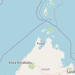
Map view of Ursula Island Game Refuge and Bird Sanctuary

Use this park location map to pinpoint Ursula Island Game Refuge and Bird Sanctuary in Philippines, understand its exact geographic position, and read its mapped placement within the surrounding landscape more clearly.

Pigeon | © OpenStreetMap contributors

Location context for Ursula Island Game Refuge and Bird Sanctuary

Palawan
Park atlas

Discover protected areas and island reserves across the surrounding region

Other Parks Near Ursula Island Game Refuge and Bird Sanctuary for Regional Comparison

Compare Ursula Island Game Refuge and Bird Sanctuary with other protected areas across the surrounding region to evaluate regional biodiversity and coastal habitats. Exploring adjacent reserves provides valuable geographic context for island-based conservation networks.
Marine protected areaSabah
About 127 km away#1 closest

South

Tun Mustapha Marine Park: Mapping the Protected Marine Landscapes of Northern Sabah, Malaysia

An expansive marine protected area across fifty islands

Tun Mustapha Marine Park represents a major conservation landmark off the northern coast of Borneo. This profile details the park's geographic layout, its primary island groups including Banggi and Balambangan, and its position as a critical corridor for marine megafauna and coral reef biodiversity within the Sulu-Sulawesi ecoregion.

Area
8,988 km²
Established
2016
IUCN
II
Relief
Lowland
Wildlife reservePalawan
About 141 km away#2 closest

Northeast

Rasa Island Wildlife Sanctuary: Protected Coastal Landscapes and Island Geography

Integrated marine and terrestrial wildlife reserve in Palawan

Positioned in the Sulu Sea off the coast of Palawan, Rasa Island Wildlife Sanctuary protects a rare concentration of mangrove forests, coastal woodland, and reef flats. This compact land and sea reserve serves as an essential sanctuary for bird species and nesting marine turtles, offering a clear window into the biodiversity of the Palawan island province through its preserved island geography.

Area
19.83 km²
Established
2006
Relief
Lowland
Climate
Tropical
National parkPalawan
About 244 km away#3 closest

Northeast

Puerto Princesa Subterranean River National Park: Palawan's Protected Landscape Discovery

Mapped natural terrain and regional park geography.

Gain a structured understanding of Puerto Princesa Subterranean River National Park, a protected national park located in Palawan. This page details its geographic setting, contributing to a broader atlas of conservation landscapes. Explore the mapped boundaries and natural terrain that define this significant protected area, offering valuable context for regional geographic discovery.

Area
222.02 km²
Established
1999
IUCN
III
Relief
Mountain
National parkMalaysia
About 250 km away#4 closest

South

Turtle Islands National Park: Marine Protected Area and Island Geography in Malaysia

Coastal landscapes and coral reef protected zones

Explore the geographic footprint of Turtle Islands National Park, a marine-focused sanctuary in Malaysia. This protected area encompasses three islands and surrounding Sulu Sea reef ecosystems, providing critical nesting habitat for marine turtles. Learn about the island-based terrain and the marine boundaries that define this protected landscape.

Area
17.4 km²
Established
1977
Relief
Lowland
Climate
Tropical
National parkSabah
About 250 km away#5 closest

South

Turtle Islands National Park: Marine Geography and Protected Island Landscapes in Sabah

A Sulu Sea sanctuary for coral reefs and sea turtle nesting grounds.

Located north of Sandakan, Turtle Islands National Park is a key marine protected area defined by its island geography and extensive coral reef habitat. The park protects critical nesting beaches for green and hawksbill sea turtles, offering a focused look at how marine conservation intersects with tropical island terrain in the Sulu Sea. This geographic profile details the park's offshore environment and its connection to broader maritime conservation efforts in the region.

Area
17.4 km²
Established
1977
IUCN
II
Relief
Lowland
National parkMalaysia
About 261 km away#6 closest

South

Kinabalu National Park: Mapped Boundaries and Protected Landscape Atlas

Exploring Malaysia's Natural Terrain and Park Geography

Delve into the specific protected area identity of Kinabalu National Park, situated within Malaysia. This resource details its geographic scope and mapped terrain, providing a foundation for understanding its role as a national park. Examine the park's protected landscape context, offering valuable insights for anyone exploring regional geography and conservation areas through an atlas lens.

Area
754 km²
Established
1964
IUCN
II
Visitors
611.6K annual
A pale, minimalist watercolor painting depicting a gentle, rolling landscape with green and light red washes, suggesting hills and distant foliage against a soft, bright background.
National parkSabah
About 261 km away#7 closest

South

Kinabalu Park: Geographic Overview and Protected Landscape Mapping in Sabah, Malaysia

A study of vertical mountain terrain and biodiversity boundaries

Kinabalu Park stands as a defining natural entity in Sabah, Malaysia, characterized by its extreme elevation changes and concentration of rare botanical life. This atlas resource maps the park's physical geography, from its cloud-shrouded forests to its rocky summit plateaus, offering a detailed look at one of Southeast Asia's most significant protected mountain environments.

Area
754 km²
Established
1964
IUCN
II
Visitors
611.6K annual
Wildlife reserveTawi-Tawi
About 264 km away#8 closest

South

Turtle Islands Wildlife Sanctuary: Mapping the Protected Archipelago of Tawi-Tawi

Coastal landscapes, marine habitats, and island terrain

Spanning six islands at the maritime boundary of the Philippines and Malaysia, Turtle Islands Wildlife Sanctuary is defined by its extensive nesting beaches and remnant forest. This protected area integrates marine and coastal habitats, ranging from the volcanic activity on Lihiman to the forested shores of Baguan, offering a unique look at the maritime geography of the Tawi-Tawi region.

Area
2,429.67 km²
Established
1999

Common questions about visiting, size, designation, and location context for Ursula Island Game Refuge and Bird Sanctuary

Ursula Island Game Refuge and Bird Sanctuary FAQs for park facts, access, geography, and protected area context

Find quick answers about Ursula Island Game Refuge and Bird Sanctuary, including protected-area facts, park geography, trail and visitor context, and how the park fits into its surrounding country and regional landscape.
MoriAtlas Explorer

Continue Your Protected Areas Search Across the Global Atlas

Deepen your exploration by continuing the structured search for national parks and protected areas worldwide. Utilize the comprehensive filtering capabilities to compare different conservation landscapes and refine your understanding of global park geography. Discover more about the distribution and characteristics of protected natural areas.

Global natural geography