
Mori Atlas logo
Natural monumentV Obouch

A detailed geographic study of riverine terrain, alder floodplain forests, and canyon dynamics.

V Obouch Natural Monument: Mapping the Protected Lomnice River Corridor and Riparian Landscapes

(Přírodní památka V Obouch)

V Obouch represents a vital 3.8 kilometer protected river corridor along the Lomnice River in Jihočeský kraj. This natural monument preserves a near-pristine riparian ecosystem defined by boulder-strewn rapids, deep valley incisions, and rare floodplain forests. Within the broader Otava-Vltava canyon system, the site serves as a essential refuge for protected riverine species and exhibits dynamic geomorphological patterns typical of the South Bohemian landscape.

river valleynatural monumentriparian forestfloodplain forestalder forestboulder river
A flat-style digital illustration of a waterfall flowing into a river through a forested canyon with rocky cliffs and meadow vegetation.

V Obouch

Natural monument

Park overview

Structured park overview, official facts, and landscape profile for V Obouch

V Obouch park facts, protected area profile, and essential visitor context

Review the core facts for V Obouch, including designation, size, terrain, visitor scale, habitats, and operating context in one park-focused overview.

About V Obouch

V Obouch is a small but ecologically rich protected area in the South Bohemian Region of the Czech Republic. It occupies a roughly 3.8 kilometer stretch of the Lomnice River as it flows southeast from the vicinity of Dolní Ostrovec to its confluence with the Skalice River. The site lies within the deep river-valley system carved by the Otava and Vltava rivers, which is one of the defining landscape features of this part of South Bohemia.

The protected area is defined narrowly around the river itself, with the legal boundary sitting just zero to five meters from the banks. Surrounding this narrow corridor is a 50 meter protective buffer that extends into adjacent forests. This tight delimitation emphasizes the site's core identity: a natural river landscape and its immediate riparian environment, retained in an otherwise heavily managed agricultural region.

The river course here is unusually dynamic. The upper segment is narrow and calm, with pastures and meadows along the banks. The middle section swings through a large meander with a flat interior terrace. The lower section is the most dramatic, where the river is deeply incised into the valley, granite boulders fill the channel, and steep rock outcrops approach the stream. This gradation of river character within a short distance is one of the reasons the area has been specifically designated for protection.

In ecological terms, V Obouch is dominated by softwood floodplain forest of the Stellario-Alnetum glutinosae type, dominated by Alnus glutinosa, Ulmus glabra, and Salix fragilis. The canopy also includes rare trees such as Abies alba and Ulmus laevis, with a diverse shrub layer and rich herbaceous understory. Combined with the well-developed boulders-and-rapids river morphology, this vegetation supports a community of protected and rare species that has earned the site recognition as part of the broader Údolí Otavy a Vltavy Important Bird Area.

Quick facts and research context for V Obouch

V Obouch is a Czech natural monument (přírodní památka) established on 1 February 1986 by the Písek District National Committee. It lies in the South Bohemian Region, in the Písek district, southeast of Dolní Ostrovec, between the village and the confluence of the Lomnice and Skalice rivers.

The site covers roughly 5 hectares of protected area, of which almost all consists of the water surface of the Lomnice River and its immediate banks. It sits at 360 to 380 meters above sea level within the geomorphological unit of the Táborská pahorkatina (Tábor Highlands), in the moderately warm climatic zone MT11. Geologically, the river is incised into biotite granodiorite of the Zvíkov type, part of the Central Bohemian Pluton. V Obouch belongs to the Údolí Otavy a Vltavy Important Bird Area and lies within the catchment of the upper Vltava.

Protection and recognition

Explore the documented terrestrial boundaries, management scope, and recognition history for V Obouch.

V Obouch Protection Status and Official Conservation Designation Records

V Obouch maintains structured terrestrial protection parameters within its documented boundary framework. Official recognition data tracks ongoing conservation status and international designation metrics for the area.

Protection details

Protection scope
Terrestrial
Transboundary protection
No
Park context

Deeper park guide and search-rich context for V Obouch

V Obouch history, landscape, wildlife, and travel context

Explore V Obouch through its history, landscape character, ecosystems, wildlife, conservation priorities, cultural context, and seasonal travel timing in a structured park guide built for atlas discovery and search intent.

Why V Obouch stands out

V Obouch is most notable for protecting a long, near-natural section of the Lomnice River with abundant boulder rapids and an intact floodplain forest. The site is a textbook example of a small-scale Czech river protection area that preserves a complete riverine landscape rather than a single habitat patch. Its recognisable botanical features include the threatened Aconitum variegatum (oměj pestrý) and Lilium martagon (lilie zlatohlavá), as well as rarities such as the silver fir (Abies alba) and the white elm (Ulmus laevis) within the otherwise common alder-floodplain forests. The site is also associated with protected fauna, in particular the Eurasian otter, the agile lizard, the common toad, the black stork, and the European kingfisher, making it a meaningful locality for biodiversity conservation in South Bohemia.
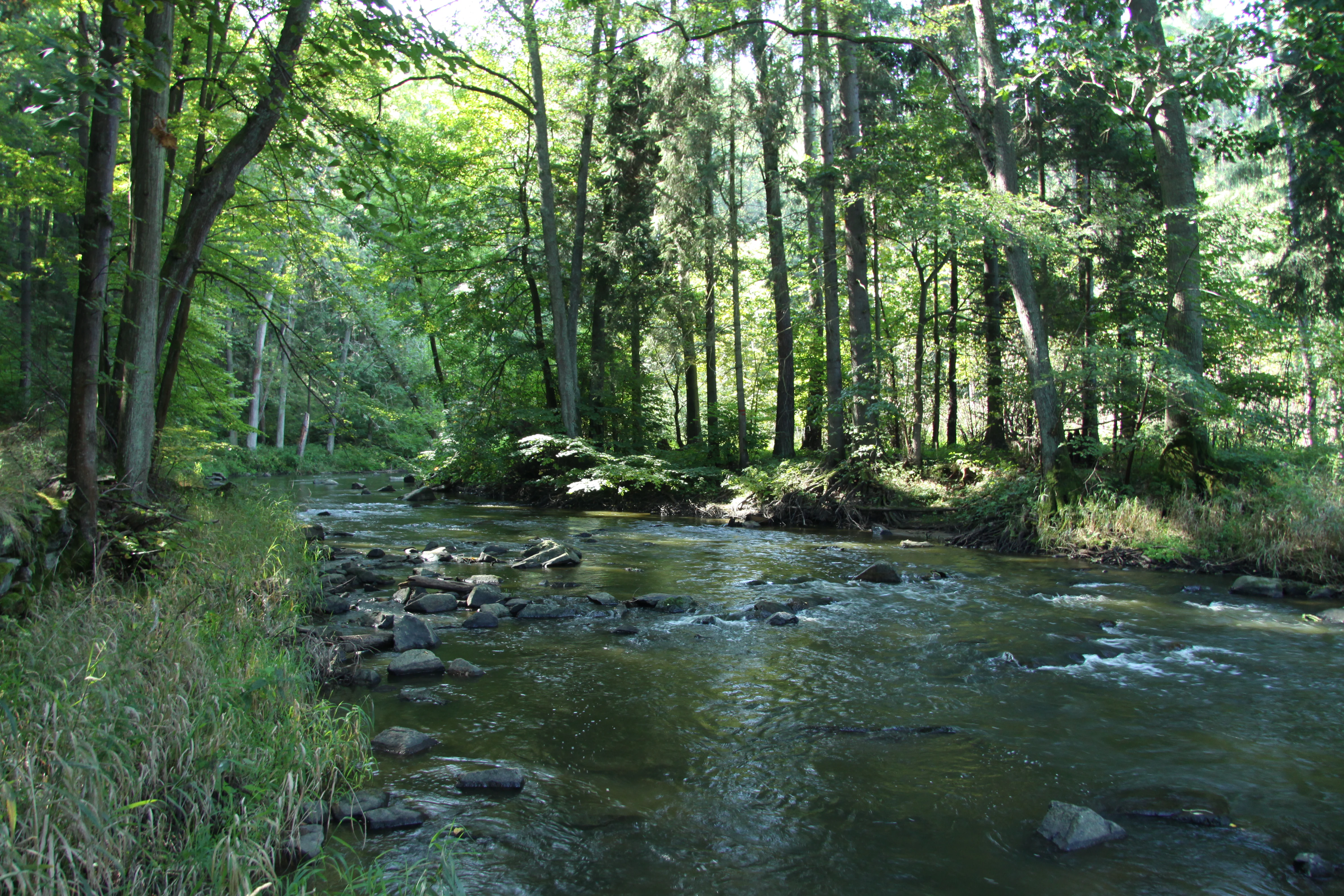
A view of a flowing river winding through a dense, green forest with rocks visible in the water.
The Lomnice river flowing through the woodland area of V Obouch natural monument.

V Obouch history and protected-area timeline

V Obouch was established as a protected site by decree of the Okresní národní výbor Písek (Písek District National Committee) on 4 December 1985, with effect from 1 February 1986. The original designation reflected an interest in preserving a relatively undisturbed section of the Lomnice River together with its associated riparian vegetation.

Before protection, the slopes along the river had been partially altered by artificial planting of Norway spruce (Picea abies), Scots pine (Pinus sylvestris), and the non-native ash-leaf maple (Acer negundo). These plantings have left a lasting imprint on parts of the tree layer and remain a target for gradual restoration.

Under the consolidated Czech nature conservation law (Act No. 114/1992 Sb., on the protection of nature and landscape), the area was reconfirmed as a natural monument covering about 5.1401 hectares. More precise parcel-based calculations later indicated a slightly smaller effective footprint of around 4.457 hectares. The current management plan recommends further interventions, including removal of Acer negundo, restrictions on clear-cutting along the floodplain, and reconsideration of fish stocking practices that are considered inconsistent with the area's conservation goals.

V Obouch landscape and geographic character

The landscape of V Obouch is defined by a single physical element: the deeply incised valley of the Lomnice River as it carves through the bedrock of the Táborská pahorkatina. The river has cut its channel into biotite granodiorite of the Zvíkov type, with secondary intrusions of amphibole-biotite granodiorite, granite porphyry, lamprophyre, and porphyrite. The result is a gorge-like river corridor with exposed granite boulders and frequent outcrops.

Within the protected 3.8 kilometer stretch, the river changes character three times. The upper reach runs through a narrower, calmer section lined with meadows and pastures. The middle reach traces a full meander, enclosing a flat plateau inside the bend. The lower reach is the wildest: steep valley walls close in, rock outcrops approach the water's edge, and the channel fills with granodiorite boulders that generate constant rapids and strong currents.

Above the right bank, a military training area occupies the slopes, while the left bank is flanked by agricultural fields near Dolní Ostrovec. The broader geomorphological setting links V Obouch to the canyon network of the Otava and Vltava rivers, of which this valley is one tributary segment. Two old, partially overgrown forest tracks run along either side of the river, allowing the landscape to be experienced close-up despite its modest scale.
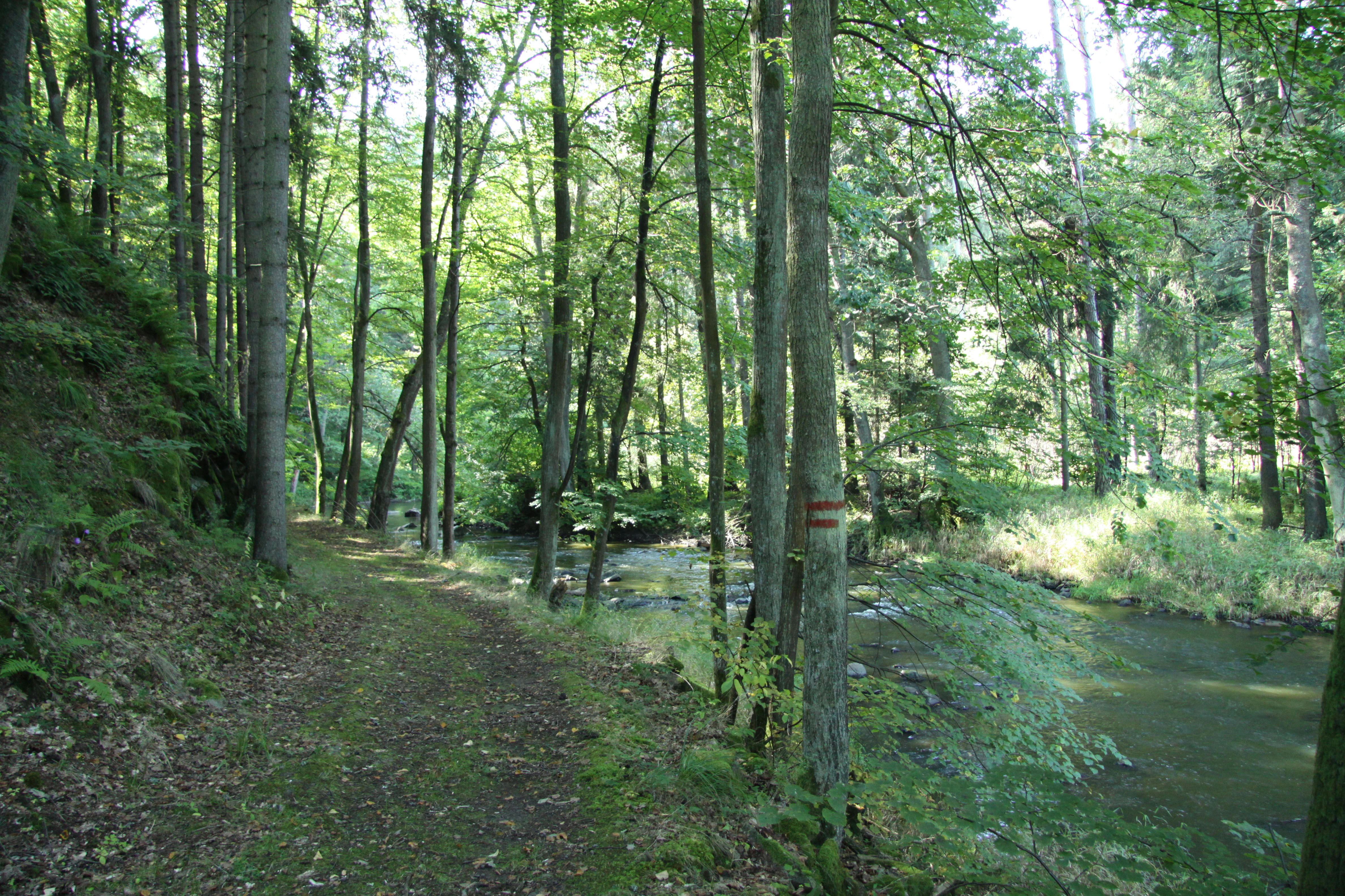
A dirt path runs along the edge of a forested riverbank with dense green trees and a shallow stream visible to the right.
A narrow dirt trail follows the Lomnice river through the wooded valley of the V Obouch natural monument.

V Obouch ecosystems, habitats, and plant life

V Obouch's habitat mosaic is unusually compact. The dominant ecosystem is the Stellario-Alnetum glutinosae alder floodplain forest that lines the riverbanks, with Alnus glutinosa as the main canopy species, Ulmus glabra and Salix fragilis as frequent companions, and rare occurrences of Abies alba and Ulmus laevis adding conservation value to an otherwise typical lowland riparian community. The shrub layer is rich in Corylus avellana, Prunus padus, Prunus spinosa, Rosa pendulina, Daphne mezereum, and Lonicera xylosteum, among others.

The herbaceous layer is exceptionally diverse for such a small site, including rare and sensitive species such as Aconitum variegatum and Lilium martagon, plus an array of woodland grasses, sedges, ferns, and flowering plants typical of Central European deciduous forests. The supporting soil types are sandy-loamy Holocene fluvisols in the floodplain, with cambisols and ranker-like soils on the surrounding slopes.

Beyond the immediate river corridor, wet meadow vegetation in the buffer zone broadens the habitat spectrum, providing conditions for ground-nesting birds, amphibians, and small mammals. The persistence of these habitats is closely tied to the ongoing natural dynamics of the river itself, including flooding and the periodic redistribution of sediment and boulders, which the conservation strategy explicitly aims to preserve.
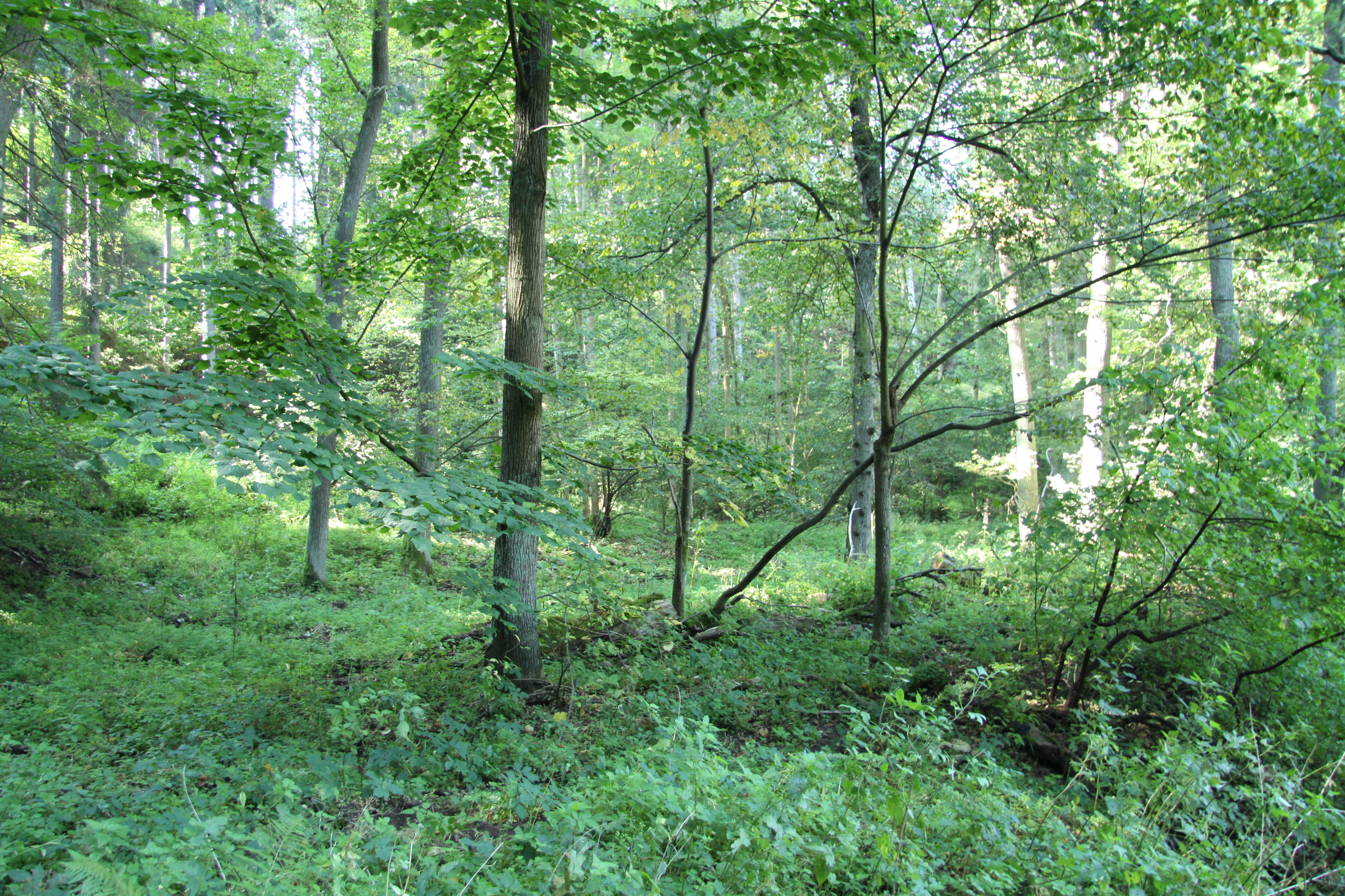
A dense, deciduous forest scene with sunlight filtering through green leaves onto the forest floor covered in low vegetation.
A lush, green forest interior within the V Obouch natural monument.

V Obouch wildlife and species highlights

Wildlife is one of the principal reasons for V Obouch's protected status. The river itself supports a typical cyprinid-dominated fish community of the lower Lomnice, including common carp, bream, roach, gudgeon, tench, chub, eel, dace, pike, pikeperch, perch, burbot, and the protected nase (Chondrostoma nasus) and sunbleak. Annual stocking of about two tons of common carp, plus nase and pike, takes place for angling, though the current management plan calls for shifting stocking toward species more typical of faster-flowing water.

Among mammals, the site has confirmed breeding or resident populations of the Eurasian otter (Lutra lutra), water shrew, wood mice, and common mole, with typical surrounding fauna including roe deer and wild boar. The non-native muskrat is also present. Amphibians and reptiles include the common toad (Bufo bufo) and the agile lizard (Lacerta agilis).

The avifauna is particularly notable. The site lies inside the Údolí Otavy a Vltavy Important Bird Area and supports breeding populations of the strongly threatened black stork (Ciconia nigra) and European kingfisher (Alcedo atthis), as well as grey wagtail (Motacilla cinerea) and black woodpecker (Dryocopus martius). Typical woodland species such as nuthatch, robins, tits, warblers, finches, and the grey heron complete the ornithological profile, making the small river valley disproportionately rich in birdlife for its size.
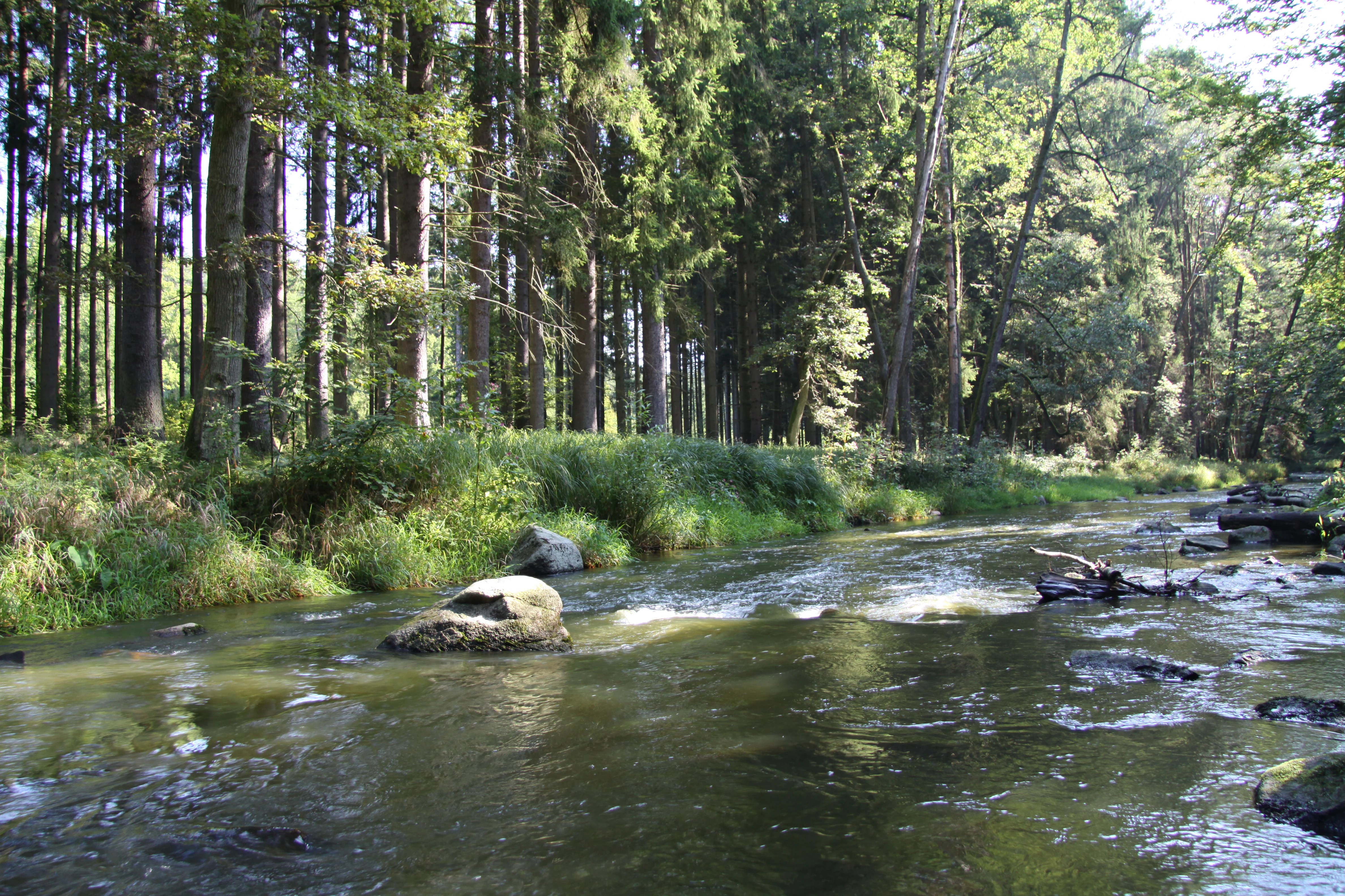
A calm, shallow river flowing through a lush green forest with large rocks visible in the water.
The Lomnice River flowing through the V Obouch natural monument.

V Obouch conservation status and protection priorities

The fundamental conservation goal of V Obouch is to maintain the natural dynamics of the Lomnice River and its narrow floodplain corridor. The site is classified within IUCN Category IV as a Species Management Area, with protection explicitly directed at preserving the boulder-strewn riverbed, the system of low rapids, and the deeply incised valley, while allowing natural processes such as erosion, sediment transport, and flooding to continue operating as undisturbed as possible.

The site's conservation value stems from the combination of a near-natural river morphology with relatively intact floodplain forest. This linkage supports sensitive flora such as Aconitum variegatum and Lilium martagon, as well as protected fauna including the otter, black stork, and kingfisher. As part of the Údolí Otavy a Vltavy Important Bird Area, V Obouch contributes to broader national and European conservation objectives for riverine ecosystems.

Current threats include nutrient-rich surface runoff from surrounding agricultural land, artificial fish stocking that does not match the natural character of the river, localized tree-cutting, and litter accumulation during floods. The management plan therefore recommends removing or modifying a small weir at the upstream boundary, prohibiting clear-cutting along the floodplain, and removing invasive Acer negundo, while recognizing that full control of the invasive Impatiens glandulifera along the entire river is currently impractical.

V Obouch cultural meaning and human context

V Obouch has no documented cultural or historical identity beyond its role within the broader South Bohemian river landscape. The area lies in a region whose rural villages, including the cadastral areas of Dědovice, Dolní Ostrovec, and Horní Ostrovec, have long coexisted with the lower Lomnice valley, but the protected site itself does not host any notable built heritage, traditional land-use patterns, or local cultural markers. The surrounding landscape is shaped by ordinary agricultural activity and by a military training area above the right bank, neither of which gives the protected site a distinctive cultural dimension beyond its rural Czech context.

Top sights and standout views in V Obouch

V Obouch compresses a remarkable range of natural values into a very small footprint, anchored by an intact, boulder-rich river corridor and a near-natural alder floodplain forest. Its combination of rare plants, protected bird species, and confirmed otter presence gives it an ecological significance well beyond its size.

The site offers a striking visual journey through three distinct river landscapes in just a few kilometers, from gentle meandering channels to a rocky gorge-like lower course. Embedded within the Otava-Vltava canyon system and an Important Bird Area, this small monument represents one of the cleanest surviving examples of how the South Bohemian river valleys once functioned.

Best time to visit V Obouch

V Obouch lies in a moderately warm climatic zone with cold winters and warm summers typical of inland South Bohemia. Late spring and early summer are particularly favorable for observing the floodplain forest's herbaceous layer and for bird activity along the river, when foliage is full and breeding birds, including the black stork and kingfisher, are most conspicuous.

Autumn brings lower water levels that expose more of the dramatic granite boulder landscape in the lower river section, when the surrounding beech and oak forests add seasonal color to the valley. Winter visits are possible along the old forest tracks but offer quieter wildlife encounters. In all seasons, weather conditions directly affect the accessibility of the boulder-strewn lower course.


Monthly climate preview

Monthly temperature ranges and precipitation averages recorded at V Obouch

V Obouch Climate Normals: Long Term Temperature and Precipitation Patterns

Long term data measurements for V Obouch establish average monthly temperatures ranging from sub-zero winter minimums to warm summer maximums alongside varying daily precipitation rates. Examining the full twelve month climate record provides deeper insight into the annual weather rhythm and baseline environmental conditions.
Annual mean8 °C
-3 °C19 °C
Jan-3°
Feb-1°
Mar
Apr
May13°
Jun17°
Jul19°
Aug19°
Sep14°
Oct
Nov
Dec-2°
Warmest month
July

18.9 °C

Coolest month
January

-2.7 °C

Wettest month
June

2.8 mm/day

Driest month
February

1.2 mm/day

Park location guide

Geography guide, regional context, and park location map for V Obouch

V Obouch park geography, regions, and map view in Czechia

Understand where V Obouch sits in Czechia through a broader geographic reading of the surrounding landscape, nearby location context, and its mapped position within the national park landscape.

How V Obouch fits into Czechia

Czech Republic is a landlocked Central European country with a population of approximately 10.9 million people. The nation was established as an independent state on January 1, 1993, following the dissolution of Czechoslovakia. Its capital and largest city is Prague, with other major urban centers including Brno, Ostrava, Plzeň, and Liberec.

Wider geography shaping V Obouch in Czechia

The Czech Republic is a landlocked country in Central Europe. It is bordered by Germany to the west, Austria to the south, Poland to the northeast, and Slovakia to the southeast. The landscape is predominantly hilly, with the territory covering 78,871 square kilometers.

Map view of V Obouch

Use this park location map to pinpoint V Obouch in Czechia, understand its exact geographic position, and read its mapped placement within the surrounding landscape more clearly.

Pigeon | © OpenStreetMap contributors

Location context for V Obouch

Jihočeský kraj

Visual reference guide to boulder rapids, alder floodplain forests, and canyon terrain

V Obouch Photos and Scenery: Exploring the Protected River Landscapes

Visual documentation captures the boulder-strewn river channel and dense riparian forests defining the V Obouch protected area. Photographic records reveal the dramatic transition from gentle meandering waters to rocky gorge terrain along the Lomnice River corridor.

A view of a flowing river winding through a dense, green forest with rocks visible in the water.

A peaceful river flows through a lush, dense forest with green deciduous trees on a clear day.

A dirt path runs along the edge of a forested riverbank with dense green trees and a shallow stream visible to the right.

A dense, deciduous forest scene with sunlight filtering through green leaves onto the forest floor covered in low vegetation.

A calm, shallow river flowing through a lush green forest with large rocks visible in the water.

A dirt forest path runs between a mossy, steep rocky slope on the left and a small river flowing on the right, all shaded by tall trees.

Park atlas

Compare nearby river corridors, riparian forests, and protected regional landscapes

Other Parks Near V Obouch and Protected Areas in the Surrounding South Bohemian Region

Browsing parks near V Obouch reveals a wider network of river valleys and protected natural monuments across South Bohemia. Comparing adjacent protected areas provides deeper geographic context for regional river dynamics and valley conservation.
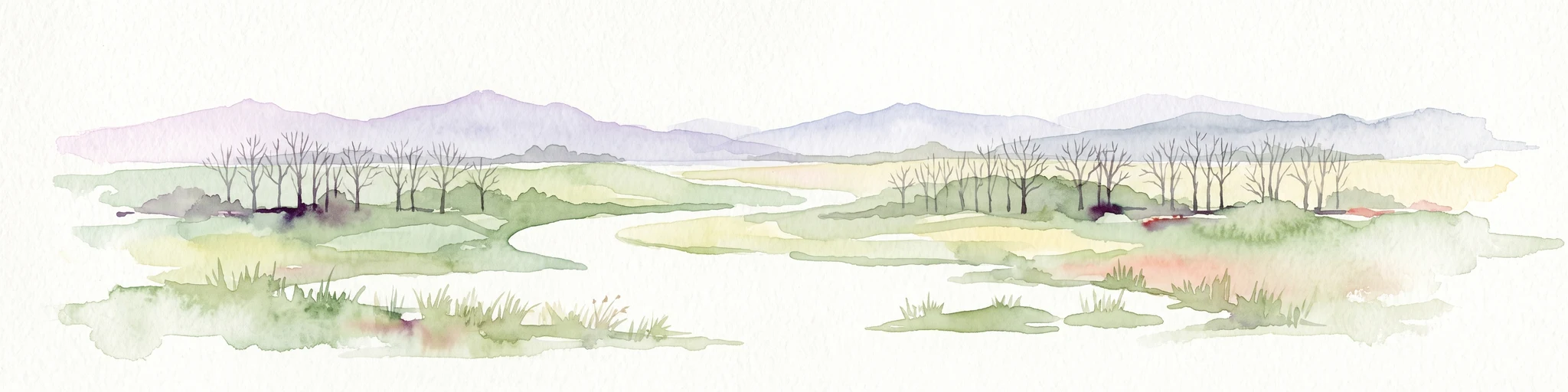
A pale, soft watercolor painting of a rolling, grassy meadow landscape with a prominent green mushroom in the foreground and sparse, leafless trees.
Natural monumentJihočeský kraj
About 9.3 km away#1 closest

Northwest

Malý Kosatín: Protected Botanical Landscapes in the South Bohemian Region of Czechia

A rare fen-meadow sanctuary in the Písek District

Located in the heart of the Czech countryside, Malý Kosatín is a natural monument distinguished by its intense botanical density and traditional meadow management. The site serves as a crucial habitat for threatened orchids and sedge communities, providing a focused view of the ecological character that defines the upland terrain surrounding the Písek District.

Area
0.01 km²
Established
1986
IUCN
IV
Relief
Upland
A horizontal watercolor painting depicting a soft green landscape with scattered trees, rolling hills, and a pale pink sky on a white background.
Natural monumentJihočeský kraj
About 10 km away#2 closest

Northeast

Sobědražský Prales Natural Monument: Protected Woodland Map and Geographic Context

An ancient oak and beech forest remnant in the South Bohemian Region.

Sobědražský prales represents a significant natural monument within the Czech Republic, protecting a rare stand of aged oaks and beeches. This site offers valuable insights into the historical composition of local forests, supporting critical biodiversity such as hole-nesting birds amidst the managed landscapes of the Jihočeský kraj.

Area
0.017 km²
Established
1986
IUCN
IV
Relief
Upland
A minimalist watercolor illustration depicting a soft, light-toned landscape with a row of trees on the right and distant, blurred hills in the background.
Natural monumentJihočeský kraj
About 12 km away#3 closest

East

Rukávečská obora: Natural Monument and Protected Beech Forest in Jihočeský kraj

A historic protected landscape in the Písek Highlands

Located in the Czech Republic, Rukávečská obora represents a significant natural monument defined by its 225-year-old beech stands. This site provides an essential look at the geological and botanical history of the Písek Highlands, serving as a key protected area for local invertebrate and bird species within the Vltava river valley watershed.

Area
0.067 km²
Established
1929
IUCN
V
Relief
Upland
A wide watercolor illustration showing a pale landscape with a stream, rocky banks, distant hills, and pink and green grass in the foreground.
Natural monumentJihočeský kraj
About 13 km away#4 closest

Southwest

Michovka Natural Monument: Protected Limestone Landscapes in the South Bohemian Region

A diverse protected area in the Písek District of the Czech Republic.

Located on the outskirts of Brloh u Drhovle, Michovka encompasses a distinctive mix of fishponds, limestone-rich rocky slopes, and rare short-sedge vegetation. This compact protected area provides a vital habitat for endangered wildlife and represents an important segment of the South Bohemian natural terrain.

Area
0.025 km²
Established
1985
IUCN
IV
Relief
Lowland
Natural monumentJihočeský kraj
About 15 km away#5 closest

South

Velký Potočný: Protected Natural Monument and Wetland Geography in the South Bohemian Region

An essential migratory node and rare plant refuge in the Czech landscape.

Velký Potočný represents a unique intersection of traditional fishpond management and modern biodiversity conservation in Jihočeský kraj. This natural monument supports exceptional shoreline vegetation, including rare species like Cyperus fuscus, and serves as a critical breeding and stopover ground for diverse waterbirds. Its shallow basin geography and hydrologic connection to the Otava River make it a vital point of interest for understanding the ecological function of South Bohemia's inland wetland network.

Area
0.39 km²
Established
1986
IUCN
IV
Relief
Lowland
A watercolor painting showing a panoramic view of a marshy wetland area with sparse bare trees, grassy mounds, and rolling hills in the background.
Natural monumentJihočeský kraj
About 18 km away#6 closest

South

Ražický rybník Natural Monument and Protected Wetland Geography in South Bohemia

Protected pond ecosystems and riparian terrain maps

Ražický rybník is a protected natural monument located in the Písek District of the Czech Republic, encompassing a shallow fishpond and surrounding meadows. This site serves as an essential breeding ground for waterbirds and provides a detailed look at the wetland mosaic characteristic of the Otava river lowlands. The area highlights the intersection of long-standing conservation efforts and habitat restoration through its diverse aquatic microhabitats.

Area
0.291 km²
Established
1986
IUCN
IV
Relief
Lowland
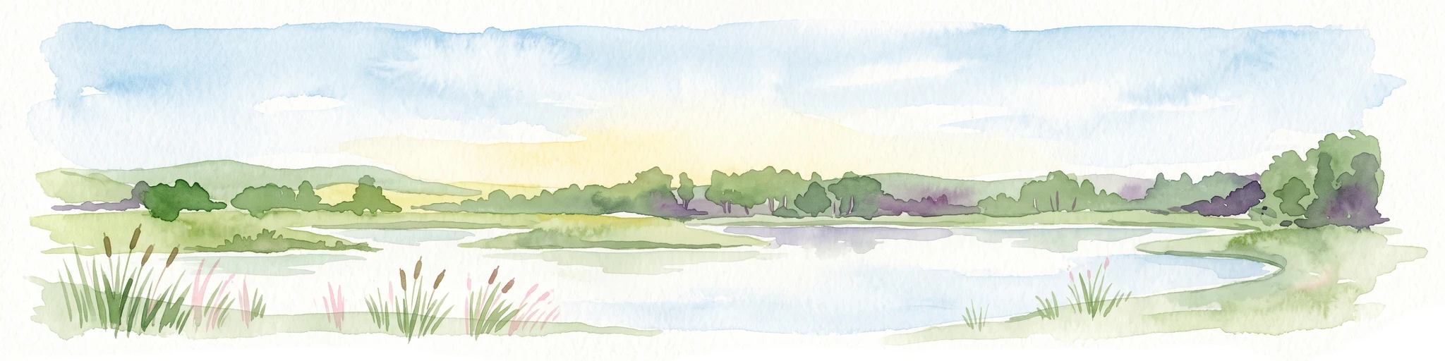
Watercolor painting of a tranquil pond scene with grassy shores, reeds, and rolling hills in the background under a soft sky.
Natural monumentJihočeský kraj
About 21 km away#7 closest

South

Skalský rybník a Klokočínská olšina: Protected Wetland Landscapes and Forested Terrain

Natural Monument site in South Bohemia, Czech Republic

Located in the low-lying Českobudějovická pánev basin, this natural monument protects a tightly linked wetland system. The site encompasses open water, damp meadows, and broadleaf woodland, providing a refuge for protected waterbirds and rare pond-edge vegetation amidst the traditional landscape of South Bohemia.

Area
0.128 km²
Established
1986
IUCN
IV
Relief
Lowland
A watercolor painting of soft green rolling hills and small clusters of pine trees against a light sunset sky.
Natural monumentJihočeský kraj
About 22 km away#8 closest

Southwest

Ryšovy Natural Monument and Botanical Protected Area in Jihočeský kraj

Exploring limestone woodland terrain and rare floral habitats

Ryšovy is a notable natural monument in the Czech Republic, defined by its characteristic limestone bedrock and the resulting diverse herb layer. This protected area creates a significant botanical stronghold within the wider landscape of the Jihočeský kraj, featuring a mosaic of woodland patches and sun-exposed clearings that support protected orchids and other rare thermophilous plant species.

Area
0.35 km²
Established
1990
IUCN
IV
Relief
Upland

Common questions about visiting, size, designation, and location context for V Obouch

V Obouch FAQs for park facts, access, geography, and protected area context

Find quick answers about V Obouch, including protected-area facts, park geography, trail and visitor context, and how the park fits into its surrounding country and regional landscape.
MoriAtlas Explorer

Continue Your Protected Areas Search Across the Global Atlas

Deepen your exploration by continuing the structured search for national parks and protected areas worldwide. Utilize the comprehensive filtering capabilities to compare different conservation landscapes and refine your understanding of global park geography. Discover more about the distribution and characteristics of protected natural areas.

Global natural geography