
Mori Atlas logo
Nature reserveRéserve naturelle régionale de la vallée du Pressoir

A rare mosaic of pioneer grasslands and fossil-rich geological formations in the Deux-Sèvres department

Réserve naturelle régionale de la vallée du Pressoir: Mapping the Protected Limestone Valley Landscape

(Réserve naturelle régionale de la Vallée du Pressoir (RNR340))

Discover the geographic layout and ecological significance of the Réserve naturelle régionale de la vallée du Pressoir. This protected area in Nouvelle-Aquitaine preserves a distinct limestone valley characterized by an interplay of rocky outcrops, the historic Pommiers cascade, and the fossil-rich Champ d'étoiles. MoriAtlas provides a clear view into this protected landscape, mapping the transition from humid valley stream banks to semi-arid pioneer grasslands.

regional nature reserveDeux-SèvresNouvelle-Aquitainelimestone valleypioneer grasslandscalcareous habitats
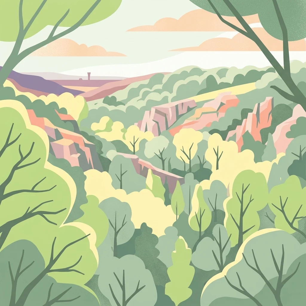
A digital illustration of a forested valley framed by tree branches in the foreground, showing rolling green hills and rocky limestone cliff faces under a soft sky.

Réserve naturelle régionale de la vallée du Pressoir

Nature reserve

Park overview

Structured park overview, official facts, and landscape profile for Vallée du Pressoir Regional Nature Reserve

Vallée du Pressoir Regional Nature Reserve park facts, protected area profile, and essential visitor context

Review the core facts for Vallée du Pressoir Regional Nature Reserve, including designation, size, terrain, visitor scale, habitats, and operating context in one park-focused overview.

About Vallée du Pressoir Regional Nature Reserve

The Vallée du Pressoir Regional Nature Reserve sits in western-central France, in the northern part of the Nouvelle-Aquitaine region, within the Deux-Sèvres department. The 56-hectare reserve runs across the communes of Thouars and Saint-Jacques-de-Thouars, following a shallow limestone valley whose stream, rock outcrops, and surrounding grasslands form a compact and unusually rich ecological unit.

Although the reserve is small, it concentrates a remarkable range of conservation values. The site includes pioneer grasslands on calcareous slabs, semi-arid swards, and acidiphile communities, three quite distinct vegetation types meeting within a short distance. Surveys have identified around 44 habitat types in total, seven of which qualify as habitats of European interest under the EU Habitats Directive. The floristic inventory includes several regionally rare plants adapted to thin, dry, stony soils, including Ophioglossum azoricum, Gagea bohemica, Phedimus spurius, Orchis simia, and Bupleurum tenuissimum.

The reserve's fauna is equally notable for a site of this size. More than a hundred protected animal species have been recorded, with the European otter and the water shrew singled out as particularly important species highlights of the valley's stream and moist bank habitats. Alongside its living biodiversity, the reserve also protects a small but striking geological feature: limestone beds rich in crinoid fossils that form an outcrop nicknamed the "Champ d'étoiles."

The Vallée du Pressoir therefore stands out as a place where ecological rarity, cultural history, and accessible landscape meet at a regional scale. Its small footprint and proximity to Thouars make it a focused conservation site rather than a vast wilderness, but the concentration of rare habitats and protected species within 56 hectares gives the reserve a regional significance well beyond its surface area.

Quick facts and research context for Vallée du Pressoir Regional Nature Reserve

Located in the Deux-Sèvres department in Nouvelle-Aquitaine, the reserve covers approximately 56 hectares across the communes of Thouars and Saint-Jacques-de-Thouars. It protects dry pioneer grasslands on calcareous substrates, an ecologically rare habitat complex in western France. Around 44 habitat types have been recorded in the reserve, including seven of European interest under the Habitats Directive. The site also hosts the registered Pommiers cascade and limestone outcrops rich in crinoid fossils. Visitor numbers roughly tripled between 1995 and 2025, approaching ten thousand by the end of that period.

Protection and recognition

Examine the documented terrestrial protection scope and conservation status records

Protection Status and International Recognition for Réserve naturelle régionale de la vallée du Pressoir

Réserve naturelle régionale de la vallée du Pressoir maintains a documented terrestrial protection scope within the regional protected area framework. Review the recorded designation data and official recognition sources governing this landscape.

Protection details

Protection scope
Terrestrial
Transboundary protection
No
Park context

Deeper park guide and search-rich context for Vallée du Pressoir Regional Nature Reserve

Vallée du Pressoir Regional Nature Reserve history, landscape, wildlife, and travel context

Explore Vallée du Pressoir Regional Nature Reserve through its history, landscape character, ecosystems, wildlife, conservation priorities, cultural context, and seasonal travel timing in a structured park guide built for atlas discovery and search intent.

Why Vallée du Pressoir Regional Nature Reserve stands out

The reserve is best known for its pioneer grasslands growing directly on limestone slabs, an unusual combination of semi-arid, calcareous, and acidic swards in very close proximity. This habitat mosaic supports rare plant species such as Ophioglossum azoricum, Gagea bohemica, and Orchis simia, while the moist valley bottom conceals more than a hundred protected animal species including the European otter and the water shrew. The second defining trait is its intertwined natural and cultural heritage. The valley has been a recognised walking and leisure landscape for around two centuries, the Pommiers cascade has been a registered site since 1932, and fossil-rich limestone exposures create a small but distinctive geoheritage feature called the "Champ d'étoiles."
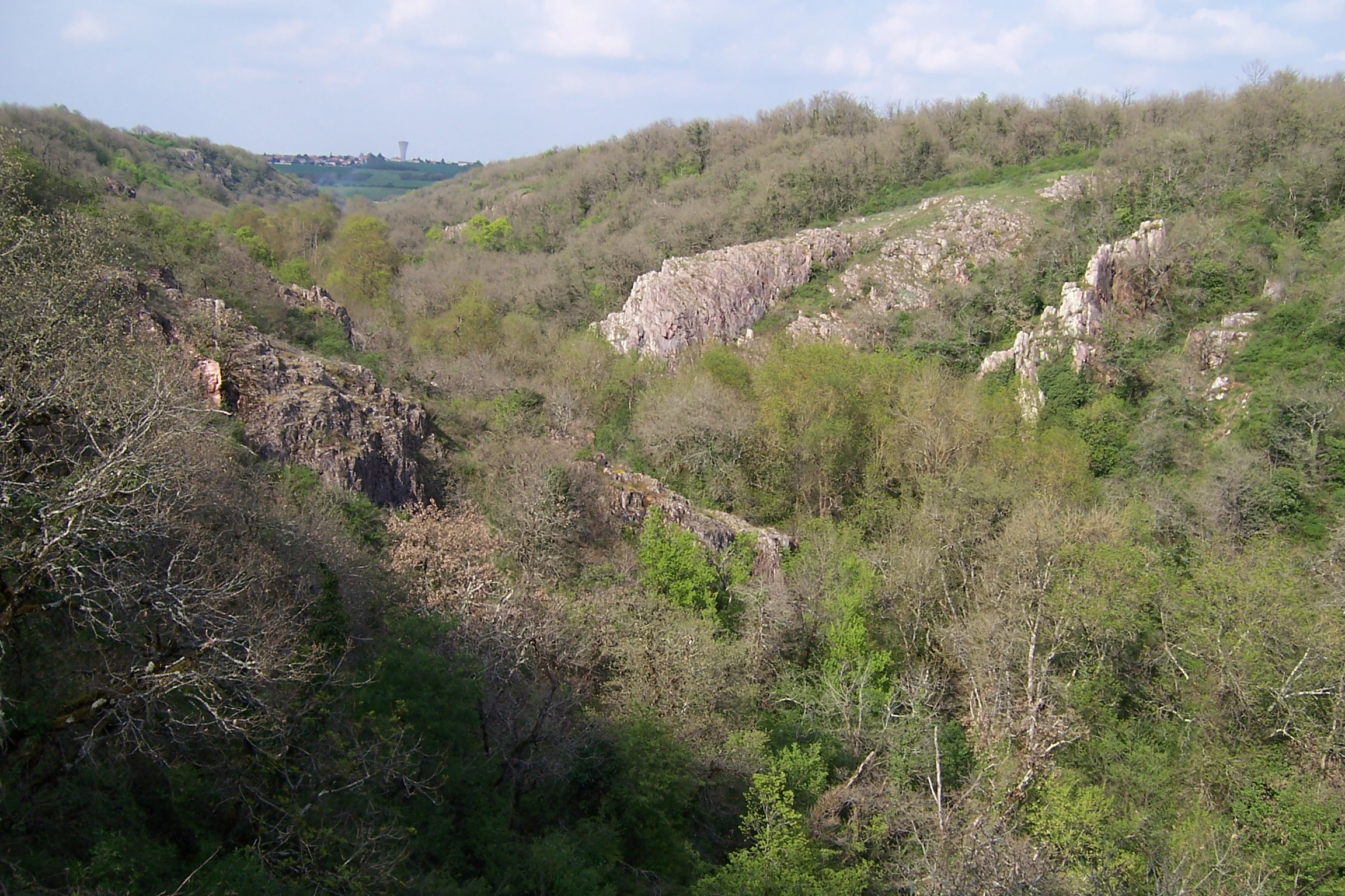
A valley landscape featuring wooded slopes, green foliage, and jagged limestone rock formations under a cloudy sky.
A view of the wooded valley and limestone outcrops within the Vallee du Pressoir Regional Nature Reserve.

Vallée du Pressoir Regional Nature Reserve history and protected-area timeline

The valley of the Pressoir has been a known destination for walking, leisure, and country outings since the nineteenth century, well before any formal conservation designation. Romantic-era interest in cascades, cliffs, and shaded streams helped establish the valley as a local villegiature landscape, an identity it has retained into the modern era. The cultural weight of the site was formally recognised in 1932, when the Pommiers cascade and the surrounding rocks and groves were inscribed as a registered French natural site, extending 150 metres upstream and 300 metres downstream along the stream.

In more recent decades, the valley moved into active conservation management. From 2013, it was classified as an espace naturel sensible, a departmental-level tool for the protection and stewardship of natural areas in France. Under that status, regular vegetation management operations were carried out, particularly to prevent woody species from encroaching on the open, dry grasslands that form one of the site's most distinctive features.

The decisive step in the site's protection came on 17 March 2025, when the Conseil régional de Nouvelle-Aquitaine voted to create the regional nature reserve. This formal classification converted a long-standing landscape of ecological and cultural interest into a legally protected reserve, designated as RNR340. The transition from a sensitive natural area to a regional nature reserve represents the institutional recognition of more than a decade of local management and decades of public affection for the valley.

Visitor interest in the valley has grown in parallel with its conservation history. Tourist numbers roughly tripled between 1995 and 2025, with the reserve approaching close to ten thousand visitors by the mid-2020s, reflecting both increased appreciation of natural sites near Thouars and the broader French appetite for accessible outdoor landscapes.

Vallée du Pressoir Regional Nature Reserve landscape and geographic character

The Vallée du Pressoir is a small limestone valley in the Deux-Sèvres countryside, defined by an interplay of rock, water, and open ground. Thin calcareous slabs and rocky outcrops shape much of the surface, while a modest stream runs along the valley bottom. The depth of the valley and the steepness of its slopes give the site a sense of enclosure unusual for this part of western France.

The most visually striking features of the valley are its water elements. The Pommiers cascade, a registered site since 1932, anchors the identity of the landscape and historically drew visitors to the valley. Above and below the cascade, the stream flows past alternating bands of cliff, grove, and open rock. These transitions between dense vegetation and exposed stone walls, sometimes quite close to the water, give the valley a varied, almost theatrical profile.

The dry, open character of the upper slopes is equally important. Thin soils over limestone support semi-arid pioneer grasslands and acidiphile communities that occupy the more rocky, exposed ground. The combination of these rare vegetation patterns with the more shaded, humid valley bottom creates a compressed landscape mosaic, where rocky crest, sunny slope, grooved stream bank, and wooded fringe can all be present within a short walk. The fossil-rich limestone outcrops known as the "Champ d'étoiles" add a subtle but distinctive geological layer to this scenery.

Vallée du Pressoir Regional Nature Reserve ecosystems, habitats, and plant life

Ecologically, the reserve is structured around the contrast between dry, exposed limestone grasslands and the more sheltered, moisture-influenced valley bottom. The 44 habitat types recorded in the reserve include open pioneer grasslands on calcareous slabs, semi-arid swards, acidiphile communities, rocky outcrops, riparian corridors, and small groves, all packed into a very limited surface area. Seven of these habitats qualify as habitats of European interest under the EU Habitats Directive, which is unusual for a reserve of just 56 hectares.

The dry grasslands are the most distinctive ecological feature. They depend on a combination of shallow soils, south- or west-facing exposures, and ongoing management to prevent succession toward scrub or woodland. Without deliberate interventions, ligneous species would gradually take over, so management work in the former espace naturel sensible and now in the regional nature reserve is directed precisely at maintaining this open, rocky character.

The stream and its banks form the second ecological pole of the reserve. The humid microclimate along the water supports denser vegetation than the slopes above, and the continuity of the watercourse through the broader landscape is essential for the otter and the water shrew. The valley therefore operates as a microcosm in which Mediterranean-flavoured dry habitats and Atlantic-influenced moist habitats coexist across a very short distance.

Vallée du Pressoir Regional Nature Reserve wildlife and species highlights

Despite its small size, the reserve hosts more than a hundred protected animal species, a figure that reflects the high habitat diversity packed into the valley. Two species tend to define the site's wildlife identity. The European otter, a species that has recovered in parts of western France but remains sensitive to water quality and stream continuity, is present along the Pressoir stream. The water shrew, a small and rarely seen insectivorous mammal strongly tied to clean watercourses, is also recorded in the reserve.

The mosaic of open rocky grasslands, scrubby slopes, groves, and streamside vegetation supports a broad range of invertebrate life as well, which in turn sustains insectivorous birds, bats, and small mammals. Although the inventory work emphasises flora and the most charismatic mammal species, the reserve's overall biodiversity pattern is shaped by the way these very different habitats meet at close range. For visitors and naturalists, this means that even short walks through the valley can reveal contrasting ecological scenes: dry, sunny outcrops buzzing with insects on one hand, and shaded, damp banks with secretive aquatic mammals on the other.

The combination of protected species, habitat diversity, and a small but intensively studied site gives the reserve an outsized wildlife profile for its 56-hectare footprint.

Vallée du Pressoir Regional Nature Reserve conservation status and protection priorities

The reservation of the valley as a regional nature reserve is, itself, the central conservation fact. Created by a regional council decision on 17 March 2025, the designation gives the site a legal framework for habitat protection, monitoring, and management that supersedes its earlier status as a departmental sensitive natural area. The IUCN category IV designation reflects its character as a habitat and species management area, where active intervention, such as controlling ligneous encroachment, is needed to maintain key habitats.

The conservation value of the site is grounded in the rarity of its habitats rather than in the vastness of the area. The presence of seven habitats of European interest within a 56-hectare reserve gives the site a significance that exceeds its modest size, and many of the recorded plant species are themselves rare or localised in mainland France. Stream-associated species such as the otter and the water shrew also place the reserve inside broader regional strategies for freshwater and riparian biodiversity.

Management continuity has been a defining element of the site's conservation story. From 2013 as a sensitive natural area to 2025 as a regional nature reserve, the valley has been the subject of regular intervention, in particular vegetation management. This continuity matters for habitats that depend on active upkeep, especially pioneer grasslands on limestone that would otherwise slowly close over. The reserve is therefore not just a passive protection zone, but a place where ongoing stewardship is recognised as essential to maintaining the very features for which it has been classified.

Vallée du Pressoir Regional Nature Reserve cultural meaning and human context

The Vallée du Pressoir has a long-standing place in the local imagination of the Thouars area. As early as the nineteenth century, the valley was already appreciated as a destination for walks and country outings, a role that anticipated today's leisure use of rural French landscapes. Remains of this older reputation are visible in the formal recognition of the Pommiers cascade and the surrounding rocks and groves as a registered natural site in 1932, a heritage designation that emphasised the valley's scenic and cultural value long before the modern conservation framework was put in place.

The valley is also part of the everyday landscape of nearby Thouars and Saint-Jacques-de-Thouars, two communes that share the reserve. Local footpaths, the registered cascade, and the open rocky scenery have shaped a regional identity built around accessible nature and outdoor leisure. The continued growth in visitor numbers, from a historical baseline in the mid-1990s to close to ten thousand visitors by 2025, shows how this older cultural attachment has translated into modern recreational use.

Alongside its natural riches, the reserve carries a small but evocative geological memory. The crinoid-rich limestone outcrops known as the "Champ d'étoiles" mark the valley as a place where deep geological time is locally visible, adding a layer of scientific and educational interest to what began as a leisure landscape.

Top sights and standout views in Vallée du Pressoir Regional Nature Reserve

The reserve's strongest features are its rare pioneer grasslands on calcareous slabs, the unusually high density of habitats of European interest within a very small surface, and the presence of protected species such as the European otter and water shrew along the Pressoir stream. The Pommiers cascade, registered since 1932, and the crinoid-rich "Champ d'étoiles" outcrop give the reserve a layered natural and cultural identity that combines botany, freshwater ecology, and geoheritage in a single short valley.

Best time to visit Vallée du Pressoir Regional Nature Reserve

Spring is the most rewarding season for visiting the Vallée du Pressoir. The dry limestone grasslands come alive with flowering annuals and bulbs in this period, including several of the rare species highlighted in the reserve's botanical inventory, and the warm, sunny weather typical of late spring makes the open rocky slopes comfortable to walk. Late spring and early summer also offer the best conditions for enjoying the cascade and the surrounding streamside vegetation at their greenest.

Early autumn is a secondary, quieter season for visitors. The grasses and herb layer often take on warm tones, the valley is less busy than in summer, and the combination of moderate temperatures and softer light suits the site's scrubby and rocky landscapes. Because the reserve is small and partially used for active habitat management throughout the year, visitors generally benefit from layers and sturdy footwear, especially in wetter periods when the rocks can be slippery and the narrow paths close to the stream more demanding.
Monthly climate preview

Long-term monthly temperature averages and precipitation patterns measured at a representative coordinate

Climate Normals and Annual Temperature Range for Réserve naturelle régionale de la vallée du Pressoir

Historical climatology data reveals measured monthly temperature and precipitation rhythms across Réserve naturelle régionale de la vallée du Pressoir from 1991 to 2020. Examining the complete twelve-month profile provides deeper analytical insight into local meteorological normals.
Annual mean12 °C
4 °C20 °C
Jan
Feb
Mar
Apr10°
May14°
Jun18°
Jul20°
Aug20°
Sep17°
Oct12°
Nov
Dec
Warmest month
August

20 °C

Coolest month
January

4.3 °C

Wettest month
November

2.6 mm/day

Driest month
August

1.5 mm/day

Park location guide

Geography guide, regional context, and park location map for Vallée du Pressoir Regional Nature Reserve

Vallée du Pressoir Regional Nature Reserve park geography, regions, and map view in France

Understand where Vallée du Pressoir Regional Nature Reserve sits in France through a broader geographic reading of the surrounding landscape, nearby location context, and its mapped position within the national park landscape.

How Vallée du Pressoir Regional Nature Reserve fits into France

France is a unitary semi-presidential republic and one of the world's largest economies. It borders Belgium, Luxembourg, Germany, Switzerland, Italy, Monaco, Andorra, and Spain, with a maritime border to the United Kingdom. The country is known for its cultural influence, art, cuisine, and political history spanning centuries.

Wider geography shaping Vallée du Pressoir Regional Nature Reserve in France

France is located in Western Europe. Metropolitan France extends from the Rhine to the Atlantic Ocean and from the Mediterranean Sea to the English Channel and North Sea. The country borders Belgium, Luxembourg, Germany, Switzerland, Italy, Monaco, Andorra, Spain, and has a maritime border with the United Kingdom.

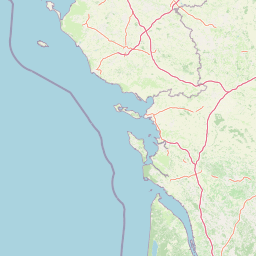
Map view of Vallée du Pressoir Regional Nature Reserve

Use this park location map to pinpoint Vallée du Pressoir Regional Nature Reserve in France, understand its exact geographic position, and read its mapped placement within the surrounding landscape more clearly.

Pigeon | © OpenStreetMap contributors

Location context for Vallée du Pressoir Regional Nature Reserve

Nouvelle-Aquitaine

Explore the terrain, limestone geology, and rare habitats of this protected French valley.

Visualizing Réserve naturelle régionale de la vallée du Pressoir Photos and Scenery

Examine detailed photography showcasing the limestone valley topography, pioneer grasslands, and water features of Réserve naturelle régionale de la vallée du Pressoir. Visual records reveal the distinct ecological character and protected habitats preserved across the surrounding terrain.

A valley landscape featuring wooded slopes, green foliage, and jagged limestone rock formations under a cloudy sky.

Park atlas

Compare surrounding limestone valleys, river corridors, and protected natural reserves in Nouvelle Aquitaine.

Parks Near Réserve Naturelle Régionale De La Vallée Du Pressoir And Regional Protected Areas

Browsing other protected areas near Réserve naturelle régionale de la vallée du Pressoir reveals broader ecological patterns across the regional landscape. Comparing adjacent terrain helps trace connected river habitats, calcareous formations, and local conservation zones.
Nature reserveNouvelle-Aquitaine
About 3 km away#1 closest

North

Réserve naturelle nationale du Toarcien: Protected Jurassic Stratotype and Geological Map

A vital paleontological heritage site in the Nouvelle-Aquitaine region

As the smallest national nature reserve in France, Réserve naturelle nationale du Toarcien provides a concentrated, scientifically essential view of Jurassic marine sediments. The protected quarries preserve ammonite-rich strata and complex geological unconformities, serving as the international definition for the Toarcian geological stage within the Thouet valley landscape.

Area
0.006 km²
Established
1987
IUCN
III
Relief
Lowland
Nature reservePays de la Loire
About 19 km away#2 closest

Northeast

Réserve naturelle régionale Champagne de Méron: Geographic and Protected Area Overview

A regional nature reserve within the Maine-et-Loire department.

Located in the heart of the Anjou countryside, Réserve naturelle régionale Champagne de Méron represents a strategic effort to safeguard biodiversity within western France. Covering 146 hectares, this protected area illustrates the intersection of modern conservation goals and historic rural landscapes, offering a clear view of how regional authorities manage and restore fragmented natural habitats.

Area
1.461 km²
Established
2023
IUCN
IV
Scope
Terrestrial
Nature reserveCentre-Val de Loire
About 37 km away#3 closest

Northeast

Marais de Taligny Regional Nature Reserve: A Protected Wetland in Centre-Val de Loire

Alluvial valley geography and restored marshland habitats

Spanning the Négron valley, this regional nature reserve serves as an vital sanctuary for alkaline fen formations and diverse aquatic species. The site provides a detailed look at the intersection of riverine drainage, alluvial woodland, and the successful ecological restoration of historical French wetland landscapes.

Area
0.354 km²
Established
2014
IUCN
IV
Relief
Lowland
A soft watercolor illustration featuring a calm pond in the foreground, with reeds on the right and a distant treeline and rolling hills in the background.
Nature reservePays de la Loire
About 39 km away#4 closest

North

Réserve naturelle régionale des étang et boisements de Joreau: Protected Area Atlas Profile

Wetland and woodland mosaic in the Pays de la Loire region.

This profile examines the 92-hectare Réserve naturelle régionale des étang et boisements de Joreau, a protected area in the Maine-et-Loire department. The site features a specialized composition of freshwater ponds and mature woodlands, reflecting the traditional riverine landscapes found throughout the broader Loire Valley regional geography.

Area
0.92 km²
Established
2015
IUCN
IV
Nature reserveDeux-Sèvres
About 52 km away#5 closest

South

Réserve naturelle régionale du bocage des Antonins: Protected Landscape and Geographic Atlas

Detailed ecological mapping of the Gâtine armoricaine countryside

The Réserve naturelle régionale du bocage des Antonins occupies a distinct space in the Deux-Sèvres department. This protected area serves as a repository for the traditional bocage countryside, featuring a complex arrangement of pollarded trees, wet meadows, and the historic étang des Forges. The site offers a significant look at the structural history of rural western France through its preserved environmental matrix.

Area
0.226 km²
Established
2015
IUCN
IV
Relief
Lowland
Nature reservePays de la Loire
About 57 km away#6 closest

Northwest

Réserve naturelle régionale de Basses-Brosses et Chevalleries: Protected Area Mapping

A dense bocage landscape in the Pays de la Loire region

This regional nature reserve protects a well-preserved mosaic of meadows, cultivated plots, and wooded hedgerows across 90 hectares. The site serves as a vital ecological anchor in the Maine-et-Loire department, maintaining traditional land patterns and diverse species habitats that define the historic rural character of the Anjou countryside.

Area
0.9 km²
Established
2012
IUCN
IV
A soft watercolor painting of a serene natural landscape with rolling hills, a calm body of water, and forested ridges under a pastel sky.
Nature reserveFrance
About 61 km away#7 closest

Southeast

Réserve naturelle régionale du site de Saint-Cyr: Wetland Geography and Protected Landscapes

Mapping a 39-hectare wetland refuge along the Clain river in France.

Located in the Vienne department, this regional nature reserve provides a critical link for waterbirds moving between the Loire valley and the Atlantic coast. The landscape features a mosaic of ponds, small islands, and alluvial forests that highlight the successful transition from former industrial quarry land into a biodiverse wetland ecosystem.

A soft watercolor painting of a calm pond surrounded by green grasses, shrubs, and rolling hills in the background.
Nature reserveNouvelle-Aquitaine
About 66 km away#8 closest

Southeast

Réserve naturelle nationale du Pinail: Protected Pond and Heathland Mosaic in Nouvelle-Aquitaine

Mapped geography of a unique French nature reserve

Located in the Nouvelle-Aquitaine region, Réserve naturelle nationale du Pinail preserves a rare cultural-ecological landscape. The site features an extraordinary concentration of three thousand small acidic ponds created by medieval millstone quarrying, now surrounded by protected heather and dwarf gorse heathland. This structured overview highlights the terrain, habitat connectivity, and regional importance of this internationally recognized Ramsar wetland site.

Area
1.35 km²
Established
1980
IUCN
IV
Relief
Lowland

Common questions about visiting, size, designation, and location context for Vallée du Pressoir Regional Nature Reserve

Vallée du Pressoir Regional Nature Reserve FAQs for park facts, access, geography, and protected area context

Find quick answers about Vallée du Pressoir Regional Nature Reserve, including protected-area facts, park geography, trail and visitor context, and how the park fits into its surrounding country and regional landscape.
MoriAtlas Explorer

Continue Your Protected Areas Search Across the Global Atlas

Deepen your exploration by continuing the structured search for national parks and protected areas worldwide. Utilize the comprehensive filtering capabilities to compare different conservation landscapes and refine your understanding of global park geography. Discover more about the distribution and characteristics of protected natural areas.

Global natural geography