
Mori Atlas logo
Natural monumentVelká louka

A specialized submontane wetland habitat preserved within the broader mosaic of the Orlické hory range.

Velká louka Natural Monument: Mapping the Protected Peat Meadow Landscapes of Královéhradecký kraj

Velká louka serves as a critical natural monument in the Czech Republic, protecting a rare peat meadow mosaic within the upland terrain of Královéhradecký kraj. This protected area functions as a vital refuge for specialized wetland flora and amphibian breeding habitats that rely on the site's unique moisture-rich submontane conditions. Its mapped boundaries encompass a delicate ecological network that stands out as a distinctive feature of the regional landscape.

peat meadowwet meadowwetlandOrlické MountainsOrlické horynature monument
A flat vector-style illustration of a meadow with a small pond in the foreground, surrounded by coniferous trees and craggy mountains in the distance under a sunset-colored sky.

Velká louka

Natural monument

Park overview

Structured park overview, official facts, and landscape profile for Velká louka

Velká louka park facts, protected area profile, and essential visitor context

Review the core facts for Velká louka, including designation, size, terrain, visitor scale, habitats, and operating context in one park-focused overview.

About Velká louka

Velká louka sits in the upper Orlické Mountains near the Polish border, in a setting shaped by the cool, humid conditions typical of the higher parts of this Central European mountain range. The protected area preserves a fragment of traditionally managed peat meadow that has survived the twentieth-century wave of agricultural intensification and drainage that eliminated most comparable habitats in the region. Its modest size belies the complexity of the ecological mosaic it contains, with transitions between wetter and drier ground, scattered pools, and a layered vegetation structure.

The meadow is characterized by the presence of moisture-loving plant species, including orchids and other wetland-adapted flora. The presence of species such as the May lily (Maianthemum bifolium, here noted in the gallery images as prstnatec májový, more precisely Dactylorhiza majalis) and tall primrose species indicates conditions intermediate between classic peat bog and species-rich submontane meadow. Such vegetation requires stable hydrology, and the protection of the site is in effect a protection of the water regime as much as of the plants themselves.

Within the broader regional context, Velká louka is one of many small nature monuments scattered across the Orlické hory Protected Landscape Area. Together with surrounding forests, springs, and headwater streams, it contributes to the ecological coherence of the protected landscape. The monument demonstrates the Czech conservation principle that even very small sites can carry significant biodiversity value when they protect habitats that have become rare or threatened across the wider countryside.

Quick facts and research context for Velká louka

Velká louka is a Czech přírodní památka (natural monument), the lowest tier of small-scale strict nature protection in the country. It was formally designated on 1 July 1982 by decision of the Rychnov nad Kněžnou District National Committee, reflecting the standard administrative pathway for nature conservation in late twentieth-century Czechoslovakia.

The site covers roughly 2.28 hectares at elevations between about 740 and 758 meters above sea level, placing it firmly within the submontane belt of the Orlické Mountains. It is administered by the Czech Agency for Nature Conservation and Landscape Protection as part of the Orlické hory Protected Landscape Area. Under international classification it is listed as IUCN Category IV, a habitat or species management area, recognizing its role in safeguarding a particular ecological feature rather than a broader ecosystem.

Protection and recognition

Documented protection records and administrative recognition metrics for Velká Louka

Velká Louka Protection Status and Designated Terrestrial Conservation Scope

Velká Louka maintains a documented terrestrial protection scope within official conservation inventories. Structured records assemble verified designation parameters and administrative recognition metrics for detailed analysis.

Protection details

Protection scope
Terrestrial
Transboundary protection
No
Park context

Deeper park guide and search-rich context for Velká louka

Velká louka history, landscape, wildlife, and travel context

Explore Velká louka through its history, landscape character, ecosystems, wildlife, conservation priorities, cultural context, and seasonal travel timing in a structured park guide built for atlas discovery and search intent.

Why Velká louka stands out

Velká louka is known above all for its peat meadow vegetation and the rich botanical composition that develops in this specialized wetland habitat. Such meadows are valued for hosting plant communities that cannot survive in more typical dry or nutrient-rich agricultural grassland, giving the site an outsized botanical importance relative to its small footprint. The site is also recognized for the small pools and wet depressions scattered across the meadow surface, which create breeding habitat for amphibians such as the great crested newt (Triturus cristatus, referred to in Czech as čolek velký). The combination of wet meadow, shallow pools, and varied vegetation structure makes the monument a compact but ecologically distinctive refuge within the Orlické hory landscape.
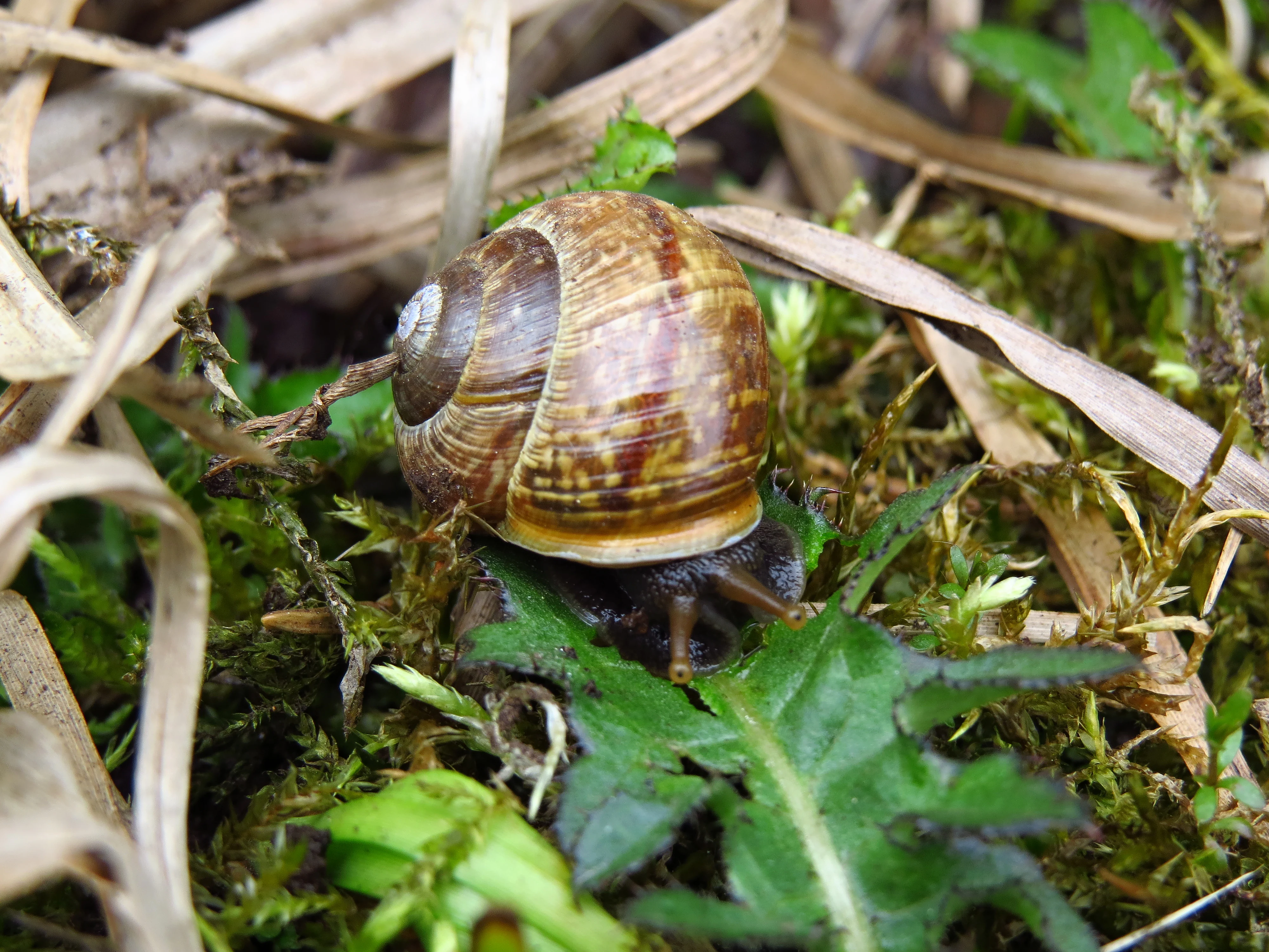
A close-up view of a brown-shelled land snail crawling over moss and green leaves at the Velká louka natural monument.
A land snail crawling through the moss and vegetation of Velká louka.

Velká louka history and protected-area timeline

Velká louka was formally designated as a přírodní památka on 1 July 1982. The decision was issued as resolution 209 by the Okresní národní výbor (District National Committee) in Rychnov nad Kněžnou, the local administrative authority responsible for nature conservation decisions at the district level under the governance structure of the time.

The 1982 designation reflects the era's growing recognition in Czechoslovakia of the conservation value of small, ecologically distinct sites, particularly peat meadows and other wetland remnants that were rapidly disappearing due to draining and conversion to more intensive agricultural use. By securing statutory protection for Velká louka, the district authorities ensured that this particular meadow would remain managed in a manner compatible with its ecological character rather than being subjected to the land-use changes transforming much of the surrounding landscape. In the decades since, the site has continued to be overseen by successive national nature conservation bodies, ultimately administered today by AOPK ČR (Czech Agency for Nature Conservation and Landscape Protection) through the regional administration of the Orlické hory Protected Landscape Area.

Velká louka landscape and geographic character

The landscape of Velká louka is shaped by its position in the upper reaches of the Orlické Mountains, at elevations of roughly 740 to 758 meters above sea level. This places the meadow within the cooler and wetter submontane climate belt where persistent humidity, relatively short growing seasons, and frequent fog or low cloud cover support moisture-dependent habitats that would not survive in the warmer lowlands of the Czech Republic.

The terrain itself is gently undulating rather than dramatic, with shallow depressions and low hummocks that govern the distribution of wet and drier ground. Across the meadow surface, small pools and saturated hollows interrupt the sward, creating the conditions needed for the rich fen vegetation and amphibian breeding habitat for which the site is protected. The surrounding regional landscape is dominated by forested mountain slopes typical of the Orlické hory, with the meadow representing a small but visually conspicuous clearing within that forested matrix.
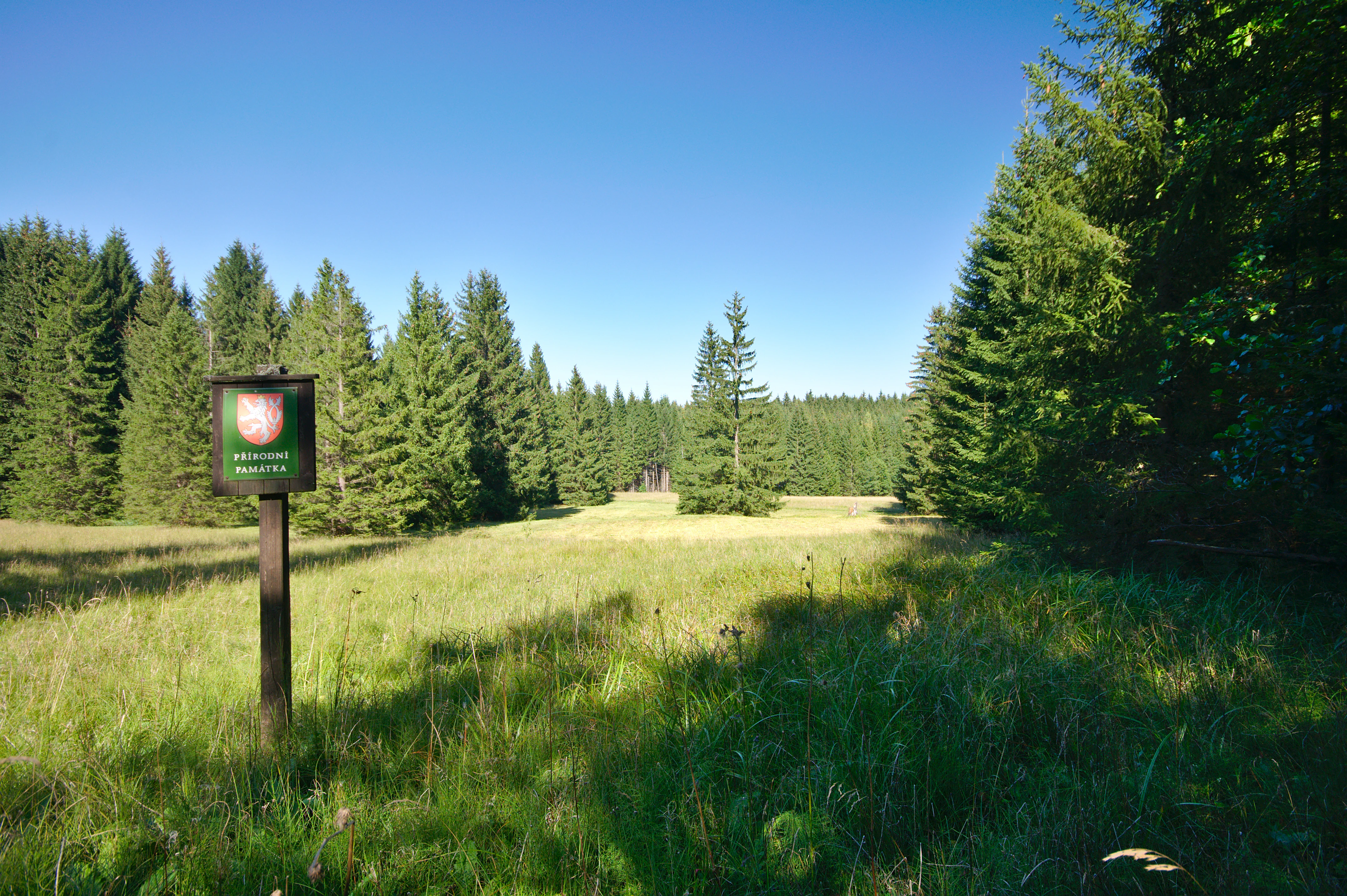
A square sign on a wooden post stands in a grassy meadow, framed by a dense coniferous forest under a clear blue sky.
A small sign marking the Velká louka natural monument, surrounded by meadow and conifer forest.

Velká louka ecosystems, habitats, and plant life

Ecologically, Velká louka is a peat meadow, a habitat type defined by permanently or seasonally waterlogged, often mildly acidic soils built up from partially decomposed plant material. In the Czech context, peat meadows have become a conservation priority because centuries of drainage and agricultural improvement have destroyed the vast majority of historical examples, leaving only scattered fragments such as this one.

The plant communities supported by these conditions are distinctive. Moisture-loving species, including orchids and tall herbaceous perennials, coexist with grasses and sedges adapted to wet ground. The vegetation mosaic shifts over short distances depending on microtopography and water depth, producing a fine-grained patchwork of botanical microhabitats within the very small area of the monument. The presence of ferns and horsetails, along with primroses and other flowering plants visible in seasonal imagery, points to a meadow that retains strong floristic diversity and has not collapsed into a single dominant species.

Hydrology is the key ecological driver. The meadow's continued functioning depends on maintaining the water table close to the surface; any drainage or land-use change that disrupts this balance would rapidly alter the vegetation toward drier, more common grassland types. Conservation management therefore implicitly protects not only the visible flora but the underlying hydrological regime that sustains it.
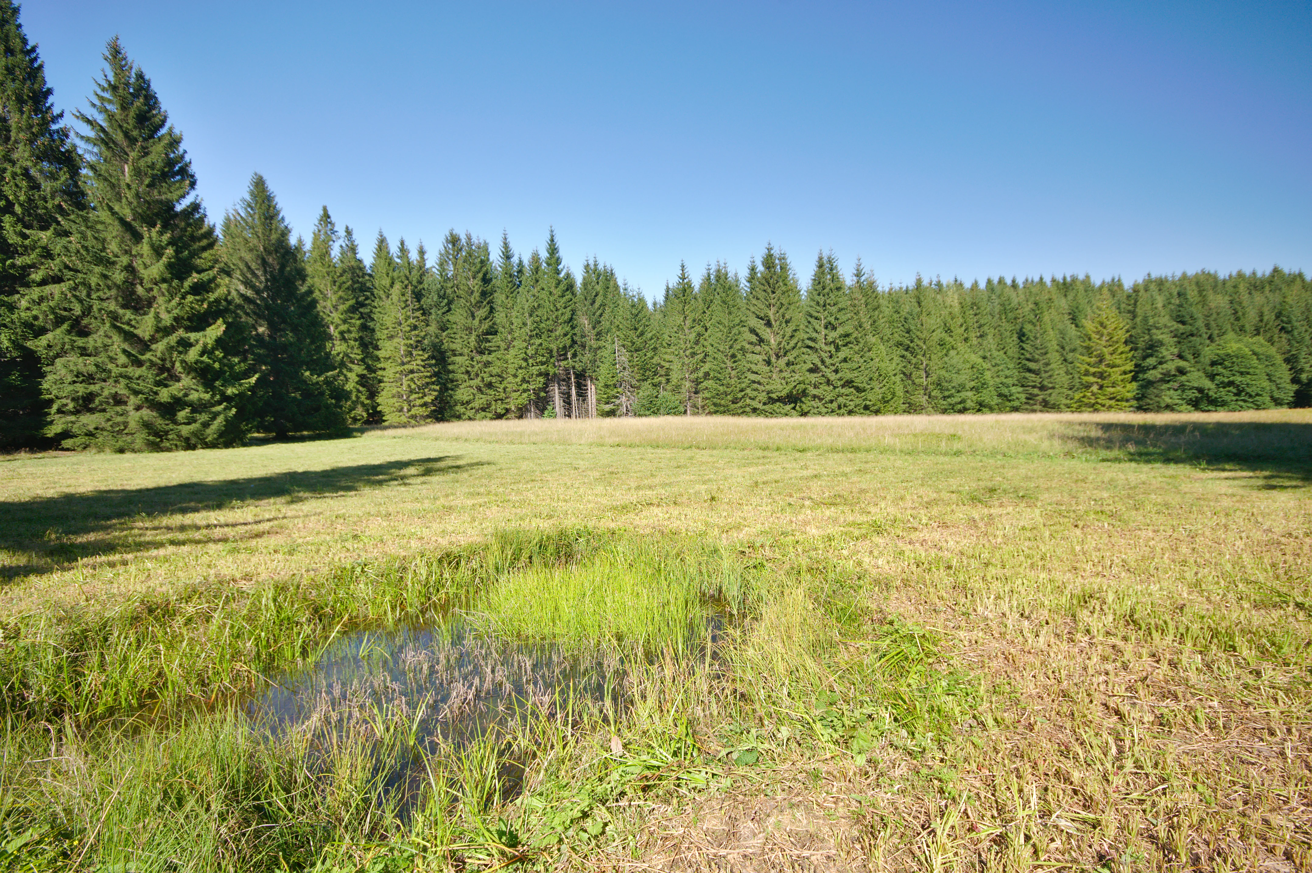
A wide view of a sunny, grassy peat meadow with a small patch of wetland in the foreground, backed by a coniferous forest under a clear blue sky.
A peat meadow at the Velká louka nature monument, bordered by a dense spruce forest.

Velká louka wildlife and species highlights

The most distinctive wildlife interest at Velká louka centers on amphibians. The small pools distributed across the meadow surface serve as breeding habitat for the great crested newt (Triturus cristatus), a species of significant conservation concern across much of Europe and a classic indicator of high-quality small-scale wetland habitats. The combination of fish-free pools with adjacent vegetated terrestrial habitat makes the meadow particularly suitable for newt populations.

Beyond amphibians, the meadow supports a broader community of invertebrates associated with wet grassland, ranging from snails and other small mollusks to a diverse insect fauna pollinating the flowering plants of the sward. Roe deer and other ungulates of the Orlické Mountains visit the site, as evidenced by the occasional appearance of young deer using the meadow as a feeding and resting clearing within the surrounding forests.

Birds typical of mosaic forest-edge and wet-meadow habitats in the Orlické hory are also likely to use the site, though the meadow's small size means it functions more as a feeding patch within a wider forest landscape than as a self-contained bird habitat in its own right. The overall wildlife value of Velká louka is best understood as part of a larger network of small natural features that together sustain biodiversity in the Orlické Mountains.
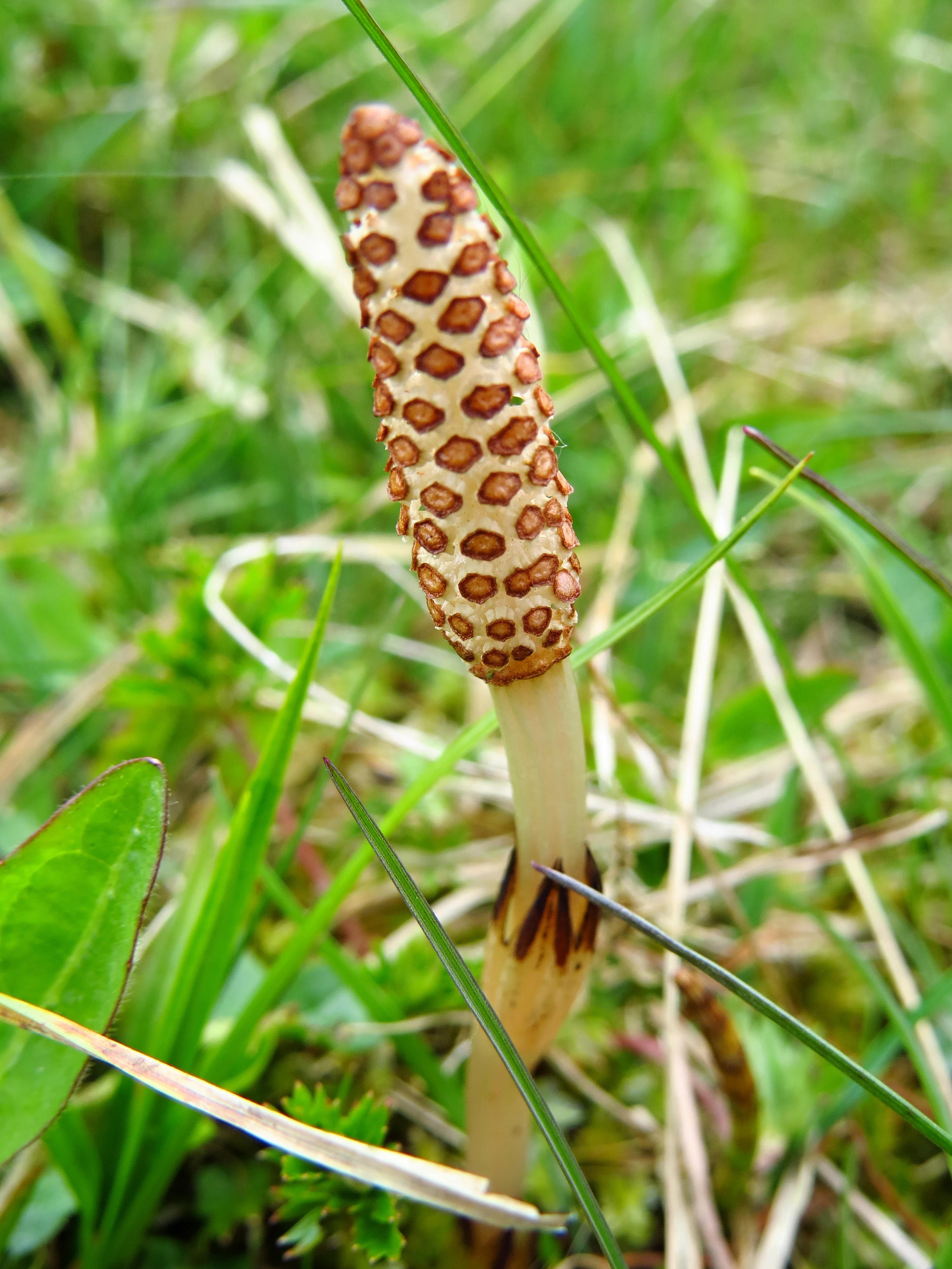
A close up view of the fertile spring stem and cone-like strobilus of a field horsetail plant, Equisetum arvense, growing in a field of green grass.
A close up of a field horsetail, Equisetum arvense, displaying its reproductive strobilus in the grass.

Velká louka conservation status and protection priorities

Velká louka is classified as a přírodní památka, a legal category of small-scale strict nature protection in the Czech Republic used for sites of particular botanical, zoological, geological, or landscape significance whose small size does not warrant designation as a larger nature reserve. It is also classified internationally as IUCN Category IV, a habitat or species management area, signifying that its primary conservation purpose is the preservation of a particular habitat type and the species associated with it.

The underlying motivation for protection is the conservation of a peat meadow, an increasingly rare habitat in Central Europe, along with its characteristic flora and fauna. By safeguarding the hydrological regime, vegetation structure, and species assemblages of even a 2.28 hectare fragment, the designation provides a foothold for habitat-specific species that would otherwise have been lost from the region. The monument is administered by AOPK ČR through the Orlické hory Protected Landscape Area administration, placing it within an integrated framework of landscape-level conservation rather than treating it as an isolated biological island.

In this sense, Velká louka illustrates the principle that small protected sites can carry disproportionate conservation weight when they protect rare habitats. It also reflects the layered Czech conservation system, in which national-level instruments (Protected Landscape Area, nature monument) and international frameworks (IUCN categories) reinforce one another to maintain ecological values across the country.

Top sights and standout views in Velká louka

Velká louka stands out as a textbook example of a small Czech nature monument protecting a peat meadow in an upland mountain setting. Its highlights include the botanical richness of the wetland flora, the presence of breeding pools for the great crested newt, and the broader mosaic of wet and dry microhabitats that fit within just over two hectares of protected ground. The site's position within the Orlické hory Protected Landscape Area gives its small footprint additional regional context and reinforces its value as part of a wider ecological network.
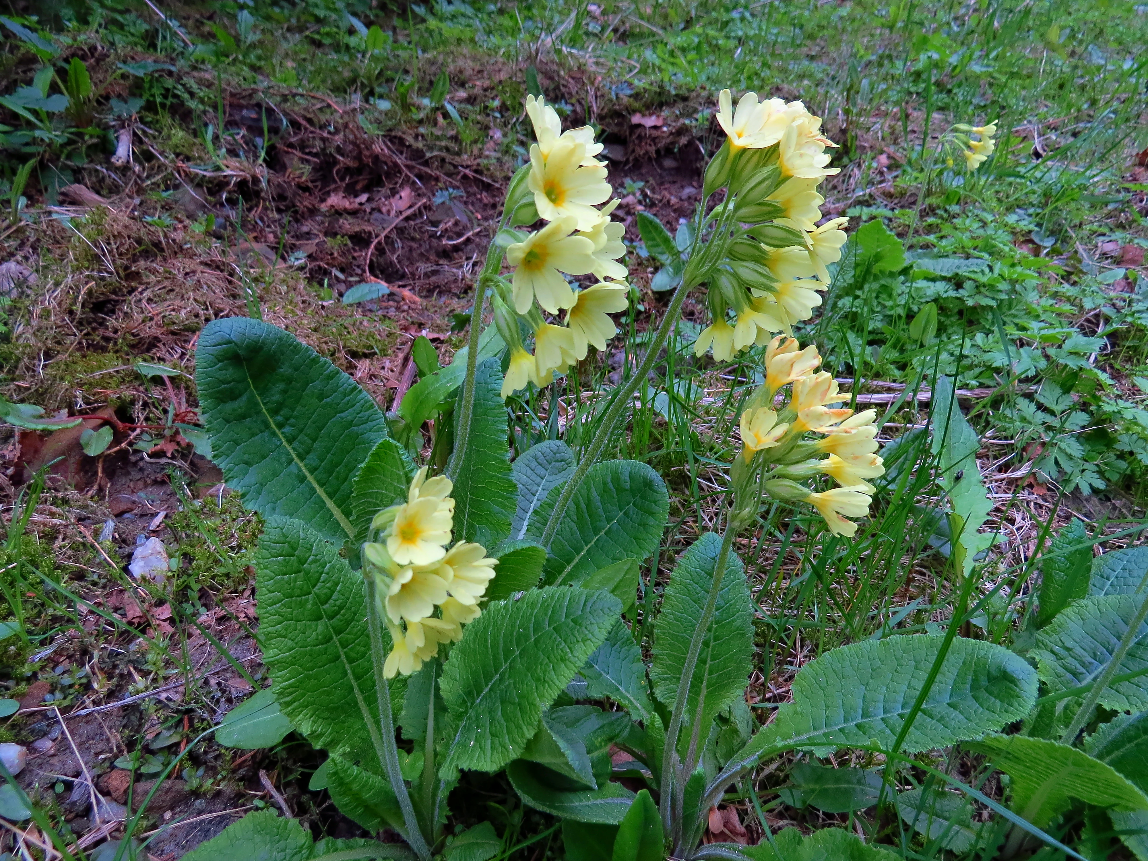
A cluster of yellow oxlip flowers with bright green wrinkled leaves growing from the soil in a meadow.
Oxlip flowers, Primula elatior, blooming in the meadow.

Best time to visit Velká louka

The most rewarding period to experience Velká louka is from late spring through early summer, when the meadow's flowering plants, including orchids, primroses, and other characteristic wetland species, are at their peak. Early morning or late afternoon visits during this period offer the best chance to observe amphibians around the pools and to appreciate the broader mountain landscape that frames the meadow. Outside the growing season, the site's visual appeal is more modest, and wet or wintry conditions can make access difficult; visitors should also respect the protected status of the monument and avoid disturbing the meadow surface or its pools.


Monthly climate preview

Long-term monthly temperature ranges and precipitation patterns for Velká louka

Velká louka Climate Normals, Annual Temperature and Precipitation Profiles

Historical climate data reveals the measured annual temperature and precipitation rhythm sampled at a representative coordinate across twelve distinct monthly intervals. Reviewing complete monthly normals provides deeper insight into temperature swings and precipitation distribution across the protected landscape.
Annual mean7 °C
-4 °C18 °C
Jan-4°
Feb-3°
Mar
Apr
May12°
Jun16°
Jul18°
Aug18°
Sep13°
Oct
Nov
Dec-3°
Warmest month
July

17.9 °C

Coolest month
January

-4 °C

Wettest month
July

3.1 mm/day

Driest month
April

1.5 mm/day

Park location guide

Geography guide, regional context, and park location map for Velká louka

Velká louka park geography, regions, and map view in Czechia

Understand where Velká louka sits in Czechia through a broader geographic reading of the surrounding landscape, nearby location context, and its mapped position within the national park landscape.

How Velká louka fits into Czechia

Czech Republic is a landlocked Central European country with a population of approximately 10.9 million people. The nation was established as an independent state on January 1, 1993, following the dissolution of Czechoslovakia. Its capital and largest city is Prague, with other major urban centers including Brno, Ostrava, Plzeň, and Liberec.

Wider geography shaping Velká louka in Czechia

The Czech Republic is a landlocked country in Central Europe. It is bordered by Germany to the west, Austria to the south, Poland to the northeast, and Slovakia to the southeast. The landscape is predominantly hilly, with the territory covering 78,871 square kilometers.

Map view of Velká louka

Use this park location map to pinpoint Velká louka in Czechia, understand its exact geographic position, and read its mapped placement within the surrounding landscape more clearly.

Pigeon | © OpenStreetMap contributors

Location context for Velká louka

Královéhradecký kraj

Visual reference guide to peat meadow habitats and upland terrain in the Orlické Mountains.

Velká Louka Landscape Photos and Protected Wetland Scenery

Photographic documentation reveals the specialized peat meadow vegetation and scattered breeding pools that define this upland nature monument. Visual exploration highlights the delicate wetland microhabitats and submontane environment preserved within the regional protected area network.

A close-up view of a brown-shelled land snail crawling over moss and green leaves at the Velká louka natural monument.

Close-up view of two shiny, purple-and-green mottled leaves of a western marsh orchid emerging from grass and moss in a peat meadow.

A square sign on a wooden post stands in a grassy meadow, framed by a dense coniferous forest under a clear blue sky.

A wide view of a sunny, grassy peat meadow with a small patch of wetland in the foreground, backed by a coniferous forest under a clear blue sky.

A close up view of the fertile spring stem and cone-like strobilus of a field horsetail plant, Equisetum arvense, growing in a field of green grass.

A young deer with small antlers standing in a grassy field in front of a dense pine forest.

A cluster of yellow oxlip flowers with bright green wrinkled leaves growing from the soil in a meadow.

A small, muddy pond surrounded by grassy meadow and a line of evergreen trees in the background.

Park atlas

Compare nearby wetland habitats and connected mountain landscapes

Parks Near Velká Louka and Other Protected Areas in the Region

Browse other parks and protected areas near Velká louka to discover similar peat meadows, mountain wetlands, and specialized upland habitats. Expanding the search across the surrounding region reveals the broader ecological network and diverse protected landscapes of the Orlické Mountains.
A horizontal watercolor illustration depicting a prominent weathered sandstone rock formation surrounded by forest, set against a soft, light-filled sky.
National parkDolnośląskie
About 12 km away#1 closest

North

Park Narodowy Gór Stołowych: A Geologic Atlas of Table Mountains in Lower Silesia

Mapping sandstone labyrinths and protected forest plateaus in the Sudetes

Explore the definitive map and geographic profile of Park Narodowy Gór Stołowych, a protected area characterized by its horizontal sandstone layers and dramatic rock towers. This atlas entry provides insight into the park's sedimentary landscape, covering iconic summit plateaus, dense forest environments, and the contrasting igneous geology of the surrounding terrain.

Area
63.402 km²
Established
1993
Visitors
1.3M annual
Relief
Mountain
Watercolor artwork depicting a landscape with green hills, distant mountains, and pastel sky
National parkLower Silesian Voivodeship
About 12 km away#2 closest

West

Stołowe Mountains National Park: Explore Poland's Sandstone Rock Cities and Protected Terrain

National Park in Lower Silesian Voivodeship: Geological Wonders.

Stołowe Mountains National Park is a protected national park in Poland celebrated for its unparalleled sandstone geological features. Within the Lower Silesian Voivodeship, the park showcases a dramatic landscape dominated by flat-topped rock plateaus, natural labyrinths, and vertical sandstone formations that create a visually stunning and geologically significant environment. Its protected status ensures the preservation of these unique landforms and the rare ecosystems, such as raised peat bogs, offering extensive opportunities for atlas exploration and understanding the region's distinct natural context.

Area
63.39 km²
Established
1993
IUCN
II
Visitors
1.3M annual
Protected landscapeDolnośląskie
About 23 km away#3 closest

East

Śnieżnicki Park Krajobrazowy: Protected Landscape and Mountain Geography Atlas

Eastern Sudetes protected area in Dolnoslaskie, Poland

Located in the Dolnoslaskie region, Śnieżnicki Park Krajobrazowy protects a striking mosaic of primeval forest and varied mountain relief. This entry maps its core components, from the high peak of Śnieżnik to the intricate karst landforms and deep river valleys that define its regional geographic character.

Area
288 km²
Established
1981
Relief
Mountain
Climate
Alpine
A minimalist, flat-design vector illustration showing a tall waterfall flowing down a rocky canyon flanked by pine trees and layers of cliffs.
Protected landscapeLower Silesian Voivodeship
About 39 km away#4 closest

North

Park Krajobrazowy Sudetów Wałbrzyskich: Protected Mountain Landscape Map

Geographic overview of forested ridges and rock formations

Gain insight into the topography of Park Krajobrazowy Sudetów Wałbrzyskich, where elevations reach 936 meters. This atlas entry details the forested Central Sudetes landscape, highlighting protected geological monuments like Małpia Skała and the unique hydrology of the Rybna river capture.

Area
64.93 km²
Established
1998
Relief
Mountain
Climate
Temperate
A soft, artistic watercolor painting showing a stylized, rolling green landscape with forests, meadows, and a winding path.
Nature reserveOlomouc Region
About 41 km away#5 closest

East

Račí údolí Nature Reserve: A Protected Forest Valley in the Olomouc Region

Geographic boundaries and metamorphic woodland terrain

Račí údolí serves as a vital protected area in the Jeseník foothills, showcasing remnants of oak and beech forests amidst rocky gneiss terrain. This valley map highlights the intersection of natural stream-cut geography and centuries of human cultural presence, providing a dense, immersive look at regional forest conservation and metamorphic geology.

Area
0.62 km²
Established
1998
IUCN
IV
Relief
Upland
Natural monumentKrálovéhradecký kraj
About 42 km away#6 closest

West

Vražba Natural Monument: Botanical Geography and Protected Lands in Královéhradecký Kraj

A rare habitat for critically endangered Central European flora.

Vražba is a specialized protected area located in the Královéhradecký region, designated primarily to stabilize populations of the critically endangered ladybells. Its landscape consists of managed woodland edges and semi-open grassland patches, creating a highly specific environment for rare botanical communities. This site stands as a prime example of targeted habitat management within the broader Czech protected-area network.

Area
0.078 km²
Established
2011
IUCN
III
Watercolor painting of a landscape featuring soft green hills, coniferous trees, and low-lying wetland vegetation in shades of pink and green.
Nature reserveKrálovéhradecký kraj
About 43 km away#7 closest

West

Na Plachtě 3 Nature Reserve: Mapped Protected Landscapes in the Královéhradecký kraj

Explore the diverse sandy habitats and protected terrain of this Czech natural monument

Na Plachtě 3 represents a critical protected enclave in the Královéhradecký kraj, characterized by its mosaic of dry heaths, open sand patches, and peat meadows. This lowland site provides essential hibernation grounds for amphibians and invertebrates, maintaining a rich biological profile that contrasts with the urban-adjacent geography of Hradec Králové. Analyze its protected boundaries, geological history, and early successional landscape character through detailed mapping.

Area
0.17 km²
Established
2012
IUCN
IV
Relief
Lowland
A horizontal watercolor illustration depicting a soft, rolling landscape with clusters of green trees against a pale, light-colored background.
Nature reserveCzechia
About 43 km away#8 closest

West

Na Plachtě Nature Reserve: Mapped Wetlands and Conservation Geography in Czechia

Urban-edge wetland mosaic with ponds and peat meadows

Located in eastern Bohemia, the Na Plachtě nature reserve encompasses a 39-hectare landscape of ponds, marshland, and sandy patches. This important Natura 2000 protected area offers a deep look into specialized amphibian and insect habitats, maintained through active management and community-led conservation efforts.

Area
0.388 km²
Established
2013
Scope
Terrestrial
Water
Major water bodies

Common questions about visiting, size, designation, and location context for Velká louka

Velká louka FAQs for park facts, access, geography, and protected area context

Find quick answers about Velká louka, including protected-area facts, park geography, trail and visitor context, and how the park fits into its surrounding country and regional landscape.
MoriAtlas Explorer

Continue Your Protected Areas Search Across the Global Atlas

Deepen your exploration by continuing the structured search for national parks and protected areas worldwide. Utilize the comprehensive filtering capabilities to compare different conservation landscapes and refine your understanding of global park geography. Discover more about the distribution and characteristics of protected natural areas.

Global natural geography