
Why Venner Moor stands out
Venner Moor is best known as a mosaic of a traditionally exploited peatland and a modern rewetted bog, where hand-cut and industrial peat cutting legacies are still visible in the landscape. The southern zone is recognized for its birch-wooded former hand-cutting area, while the northern zone is recognized for the visible infrastructure of industrial peat extraction, including remnants of the former peat railway. The reserve is equally notable as a working example of mire restoration in Lower Saxony. Drainage ditches have been deliberately infilled and woody vegetation removed to bring water levels back up and let peat-forming processes resume, which is the kind of work that defines the site's contemporary identity. The Venner Moorpfad then links these elements together, turning the bog itself into the core feature that the reserve is recognized for.
Venner Moor history and protected-area timeline
Venner Moor's protection history begins in the early 1980s, when the site was first placed under nature conservation through an ordinance dated 22 July 1983. That initial designation set the stage for what would become a longer, more active era of management. The currently valid ordinance dates to 1 July 1992 and remains the legal foundation for the reserve's status today.
The history embedded in the landscape, however, is considerably older than its protected status. The southern portion of the moor bears the imprint of manual, small-scale peat cutting carried out over generations, and that earlier use is now reflected in birch woods that have colonized the old cutting areas. The northern portion, in contrast, was once exploited by industrial peat mining, and parts of the rails of the peat railway that served that operation are still visible on the ground.
In recent decades, the reserve has become a focus for active renaturation. Drainage ditches have been deliberately infilled, woody vegetation has been removed where it threatens open bog habitat, and the water balance has been steadily reworked toward conditions that favor peat formation again. The Landkreis Osnabruck acts as the lower nature protection authority, while the Niedersachsischer Landesbetrieb fur Wasserwirtschaft, Kusten- und Naturschutz serves as the technical and administrative backbone for the site. The result is a protected area whose history is as much about ongoing intervention as it is about formal designation.
Venner Moor landscape and geographic character
The surface of Venner Moor is flat to gently undulating, a typical expression of a lowland raised bog rather than a dramatic terrain. The whole reserve sits in an elevation band of roughly 43 to 51 meters above sea level, with ground that, despite its modest altitude, behaves hydrologically as a mire and buffer zone between local drainage features rather than as a strongly contoured upland.
The most striking landscape contrast within the reserve is between north and south. The southern sector, shaped historically by hand-cut peat extraction, has a softer, more wooded aspect, with birch stands covering the abandoned dig areas. The northern sector is more open and more obviously engineered, marked by the broader scars and structures of industrial peat mining. Here, the remnants of the former peat railway still run across parts of the bog surface, offering a quiet but persistent reminder of how thoroughly the land was reworked before it was protected.
Surrounding this core, the regional setting is shaped by the mix of villages and farmland that characterizes the northern German countryside around Bramsche, Venne, and Hunteburg. Within the protected boundary itself, however, the goal of the landscape management is to move the visual and functional character back toward an open, waterlogged, peat-forming bog, even where the older extraction landscape still reads clearly on the surface.
Venner Moor ecosystems, habitats, and plant life
Ecologically, Venner Moor belongs to the family of degraded and recovering raised bogs typical of the northwestern German plain. Its nature value lies less in untouched wilderness than in the layered transitions between dry birch woodland, remnant open bog surfaces, and the rewetted peatland zones that active management is gradually restoring.
Two habitat patterns dominate the reserve. In the south, the legacy of historical hand peat cutting has been overlaid by birch woodland, and these areas now read as a more forested, drier habitat within the wider bog complex. In the north, the imprint of industrial peat cutting produces a more open, broken habitat mosaic, where dried surfaces, ditches, and relict infrastructure interact with recovering vegetation. Restoration work, including ditch blocking and the removal of woody encroachment, has been aimed at reversing the drying trajectory and allowing peat-forming conditions to re-establish.
At a broader scale, Venner Moor sits within a regional network of protected peatlands in the Landkreis Osnabruck, alongside reserves such as Hahnenmoor, Herrenmoor, Neuenkirchener Moor, Dievenmoor, and Grasmoor. Within that network, Venner Moor plays a distinct role because of its clearly traceable history of both hand and industrial peat extraction, and because of the visibility of the rewetting work being carried out on the ground.
Venner Moor wildlife and species highlights
The wildlife profile of Venner Moor is closely tied to its character as a managed, recovering peatland. Habitats range from open bog surfaces being kept wet through active rewetting to drier birch woodland on the southern former hand-cutting area, and that variation supports different ecological communities across the reserve.
The interpretive trail through the area emphasizes the animal and plant life that has returned to the bog in the wake of the rewetting program, reflecting the expectation that, as water levels rise and woody encroachment is reduced, bog-adapted species will become more prominent. The mix of open, regenerating peatland and birch woodland also provides habitat for more generalist species typical of the Lower Saxony countryside around Venne and Hunteburg.
The reserve's value for wildlife is best understood in combination with its neighbors in the Landkreis Osnabruck, which together form a network of mire sites under comparable protection. Within that context, Venner Moor stands out as a site where the wildlife interest is inseparable from the management story: the animals and plants that occur here are, in many cases, a direct measure of how successful the rewetting and renaturation efforts have been.
Venner Moor conservation status and protection priorities
Venner Moor is significant from a conservation perspective less as a preserved relic than as a managed, recovering habitat. Under the IUCN system it is listed as a Category IV protected area, a Habitat and Species Management Area, which signals that the design intent is not passive protection alone but the active shaping of habitat conditions to support target species and ecological processes.
The reserve has been formally protected since 22 July 1983, and the current conservation ordinance dates from 1 July 1992. Administratively, it falls under the Landkreis Osnabruck as the lower nature protection authority, with technical oversight and management support from the Niedersachsischer Landesbetrieb fur Wasserwirtschaft, Kusten- und Naturschutz. This institutional framework has been the platform for the site's most important conservation interventions.
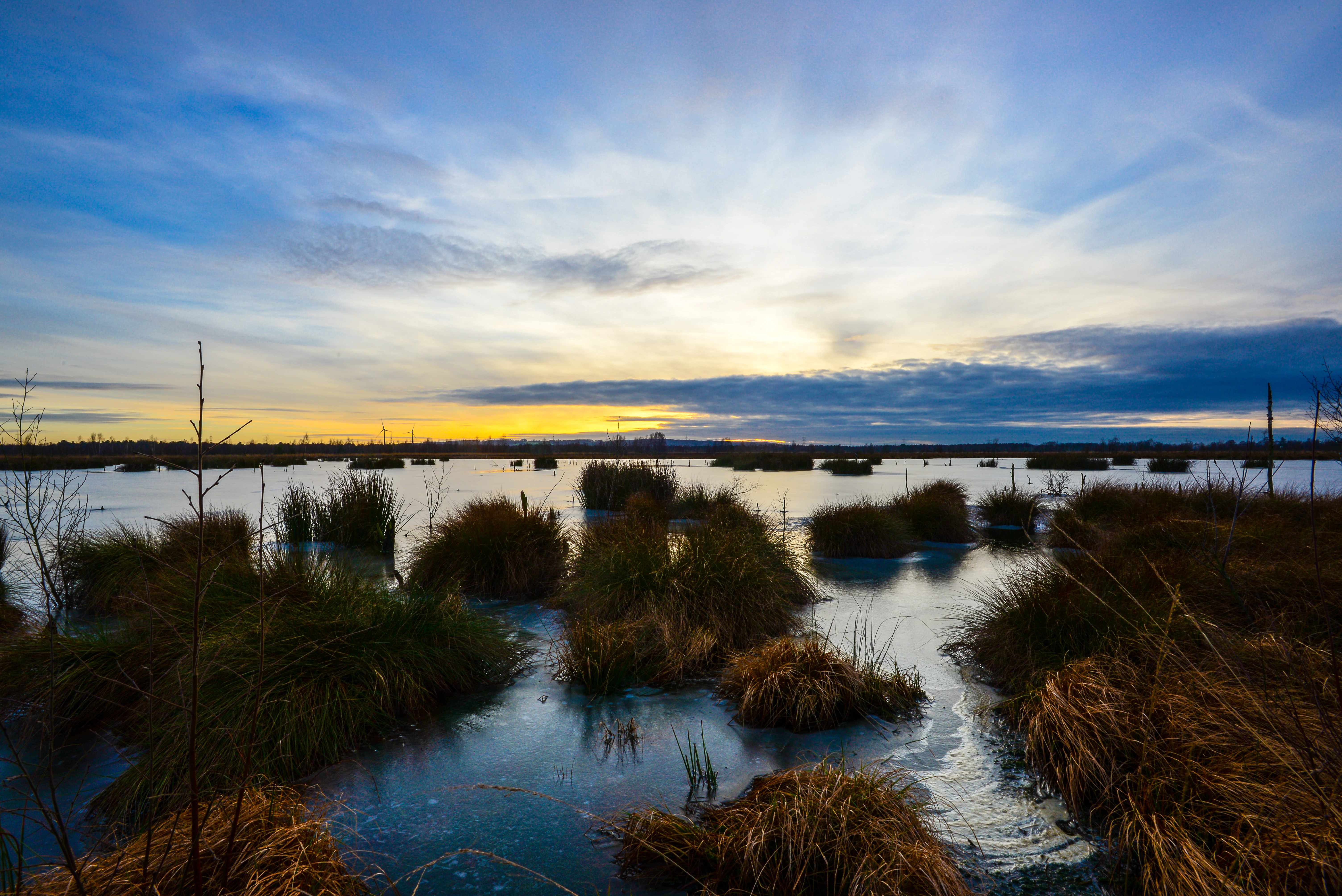
The core conservation work centers on hydrological restoration. Drainage ditches have been filled in, water tables have been raised, and woody encroachment has been actively removed in places to prevent the bog from drying out and turning into forest. Together, these measures constitute a long-running effort to rebuild the peat-forming conditions that distinguish a living raised bog from a drained, degenerating one, and they are the main reason the reserve is recognized as a meaningful conservation site today.
Venner Moor cultural meaning and human context
Venner Moor's cultural dimension is tightly bound to the rural and peat-based economic history of the Osnabrucker Land. For generations, the bog provided peat as a domestic fuel and, in a later phase, as raw material for industrial extraction, and the landscape of the reserve still carries the marks of both phases.
That layered economic use is the foundation of the reserve's interpretive programming. The Venner Moorpfad, roughly 7.2 kilometers long and marked by nine information stations, links visitors to the history of peat cutting alongside the contemporary story of the bog's ecology and rewetting. This makes the cultural framing not a separate addition but an integral part of how the protected area is presented and understood.
At a more local level, the reserve sits between long-established villages such as Venne and Hunteburg, and its identity as a protected landscape is part of the broader rural character of this part of Lower Saxony. The retention of physical traces such as the old peat railway rails is also a deliberate cultural choice, keeping the material history of the site legible in the present-day landscape.
Top sights and standout views in Venner Moor
Venner Moor offers a compact but layered experience of a protected German peatland. The draw of the site is the combination of a modest, low-elevation landscape with unexpectedly rich ecological and historical content, much of it accessible through a single walking circuit.
Standout elements include the contrast between the birch-wooded former hand-cutting area in the south and the more open, industrial-legacy terrain of the north, the still-visible rails of the former peat railway, and the ongoing rewetting and renaturation work that defines the reserve's current management. Layered on top of these is the Venner Moorpfad, with its nine stations tying peat heritage, bog ecology, and conservation practice into a single accessible trail.
Best time to visit Venner Moor
The reserve's character shifts with the seasons in ways typical of northwestern German lowlands. Late spring and summer generally bring the most accessible conditions on the Venner Moorpfad, with longer daylight, active vegetation, and warmer weather favorable to walking the roughly 7.2 kilometer circuit and engaging with each of its interpretive stations.
Autumn can offer a quieter, more atmospheric experience as the birch woodland in the southern part of the reserve takes on fall color against the open bog surfaces, and bird and insect activity around the recovering peatland can still be noticeable. Winter visits are possible but often less rewarding for casual walking, given the shorter days, cooler temperatures, and the muted visibility of the bog's ecological features.
Because the reserve is a sensitive, actively managed peatland, visitors should expect that some areas may be seasonally wet or temporarily affected by ongoing restoration work, regardless of the time of year they choose to come.