
Mori Atlas logo
Natural monumentVodopády Stříbrného potoka

Examining the geomorphology, mountain stream dynamics, and valley terrain of a protected Czech landmark

Vodopády Stříbrného potoka Natural Monument and Mapped Protected Landscapes of Olomouc Region

Vodopády Stříbrného potoka represents a distinct geomorphological landmark within the Rychlebské hory mountain range. This protected natural monument centers on a series of cascades along a narrow valley stream, showcasing sharp bedrock erosion and mountain terrain. Located in the Olomouc Region, the site offers a focused view into the hydrological and geological character defining this border mountain landscape.

waterfallmountain streamgeomorphologyprotected natural monumentRychlebské horyJeseník District
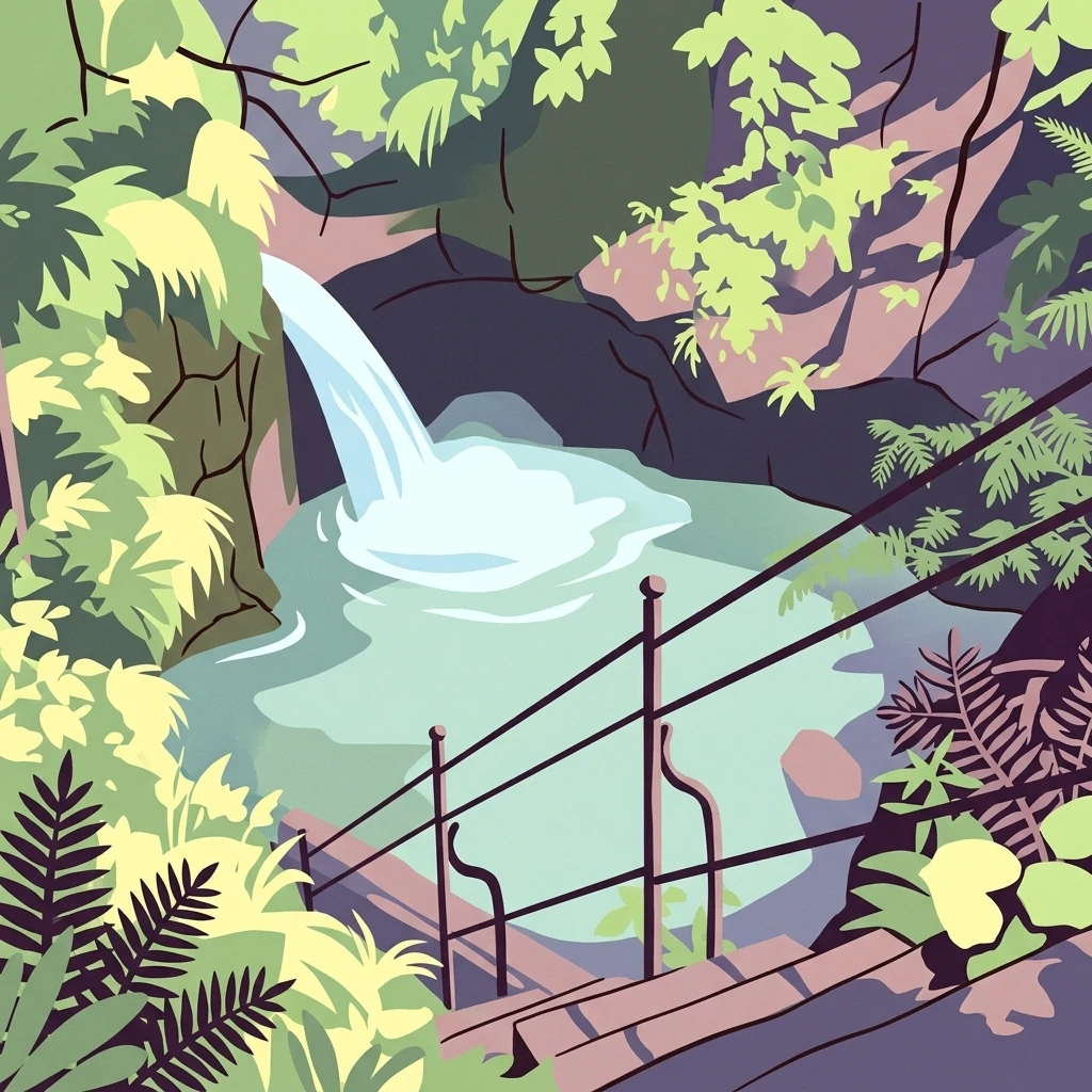
Stylized illustration of a small waterfall cascading into a rocky pool surrounded by lush green foliage and a metal staircase.

Vodopády Stříbrného potoka

Natural monument

Park overview

Structured park overview, official facts, and landscape profile for Vodopády Stříbrného potoka

Vodopády Stříbrného potoka park facts, protected area profile, and essential visitor context

Review the core facts for Vodopády Stříbrného potoka, including designation, size, terrain, visitor scale, habitats, and operating context in one park-focused overview.

About Vodopády Stříbrného potoka

Vodopády Stříbrného potoka is a very small but focused protected natural monument in the western foothills of the Rychlebské hory mountains. It lies in the cadastral territory of Horní Skorošice, part of the municipality of Skorošice, in the Jeseník District of the Olomouc Region. The protected site was declared on 25 May 1965, making it one of the older regionally protected natural features in the area, and has been managed by the central nature conservation authority since the modern Czech system was established.

The protection is justified by the geomorphological character of the valley, which is described as having no equivalent elsewhere in the Rychlebské hory range. The Stříbrný potok, the silver brook that gives the site its name, cuts through this section of the mountains and forms a series of waterfalls and cascades that combine steep bedrock with meandering stream channels. The resulting landscape is compact but visually distinctive within the broader, more uniform forested slopes that surround it.

The monument is closely tied to the network of trails that traverse the border area between the Czech Republic and Poland. A green-marked hiking trail and cycling route 6171 pass directly over the falls, linking the locality to Nýznerov, the nearby sawmill area known as Nýznerovská pila, and the route onward toward the Polská cesta. Another approach comes from Horní Lipová, while a third route descends from the ridge at the cross-border junction known as Sedlo Peklo. Because of this trail integration, the site functions not only as a geomorphological reference point but also as a recognized hiking and nature observation destination within the eastern Jeseníky region.

Although the protected area itself is only a few hectares in extent, its significance lies in the specificity of its geological and hydrological setting rather than in scale. The combination of mountain stream dynamics, exposed bedrock, and clearly defined cascade morphology has kept it under protection for decades, and it remains a referenced locality in regional lists of protected natural monuments of the Jeseník District.

Quick facts and research context for Vodopády Stříbrného potoka

Vodopády Stříbrného potoka is a protected natural monument (přírodní památka) located in the Olomouc Region in the northeast of the Czech Republic, near the Polish border. It was first designated as a protected area on 25 May 1965 by the former Šumperk District National Committee and is now administered by the Agency for Nature Conservation and Landscape Protection of the Czech Republic (AOPK ČR). The protected zone sits at elevations roughly between 495 and 540 meters above sea level and is centered on a stretch of the Stříbrný potok stream.

Protection and recognition

Review the official terrestrial protection framework and documented management scope for Vodopády Stříbrného potoka.

Vodopády Stříbrného potoka Protection Status and Documented Conservation Scope

Terrestrial protection records for Vodopády Stříbrného potoka outline the documented conservation scope and administrative framework governing the landscape. Structured protection facts provide clear reference details regarding the designated environmental status and regulatory boundaries.

Protection details

Protection scope
Terrestrial
Transboundary protection
No
Park context

Deeper park guide and search-rich context for Vodopády Stříbrného potoka

Vodopády Stříbrného potoka history, landscape, wildlife, and travel context

Explore Vodopády Stříbrného potoka through its history, landscape character, ecosystems, wildlife, conservation priorities, cultural context, and seasonal travel timing in a structured park guide built for atlas discovery and search intent.

Why Vodopády Stříbrného potoka stands out

The locality is best known for its remarkable series of waterfalls on the Stříbrný potok brook, which represents a geomorphologically significant feature without parallel in the nearby Rychlebské hory. Its scientific and scenic value comes from the way the stream descends through a narrow valley, producing a visually striking cascade and a strongly localized erosion pattern in the surrounding terrain. The monument also functions as a small but well-known stop on the regional hiking and cycling trail network that follows the Czech-Polish border ridge, giving the waterfalls a recognizable identity as both a natural landmark and a route-side attraction.
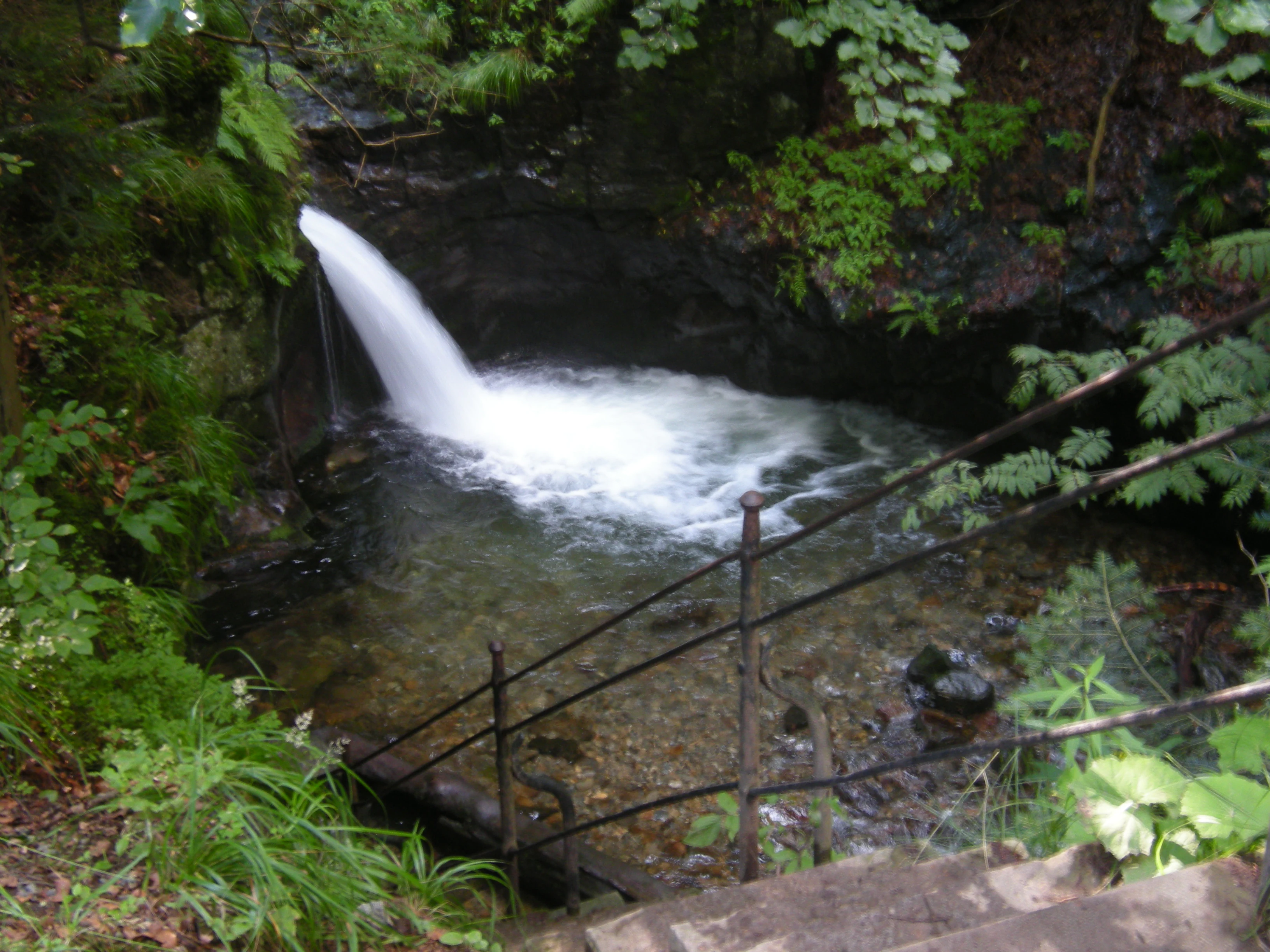
A small waterfall flows into a clear pool surrounded by lush green forest, with a metal railing visible in the foreground.
A cascade of the Stříbrný potok, viewed from a pedestrian trail with a metal railing.

Vodopády Stříbrného potoka history and protected-area timeline

The area was officially designated as a přírodní památka on 25 May 1965 by the then Okresní národní výbor Šumperk, the district national committee of Šumperk. This early date of protection reflects the long-standing recognition of the waterfalls as a geomorphologically valuable feature of the Rychlebské hory. Since the establishment of the modern Czech system of nature conservation, administration has been handled by the Agentura ochrany přírody a krajiny ČR (AOPK ČR).

The motivation for protection, emphasized from the beginning, has been the unusual geomorphological development of the stream valley. Over the decades, the site has become one of the referenced localities in lists of protected natural monuments of the Jeseník District and continues to be recognized as a distinctive cascade feature within the Czech portion of the eastern Sudeten mountain landscape.

Vodopády Stříbrného potoka landscape and geographic character

The landscape of the monument is defined by the steep, narrow valley of the Stříbrný potok, a small mountain stream descending from the western slopes of the Rychlebské hory. Within a relatively short distance, the stream drops through a series of bedrock steps and cascades, producing the waterfall complex for which the site is protected. Bedrock exposure, sculpted channels, and sharply defined erosional forms dominate the visual character of the locality.

Outside the narrow stream corridor, the surrounding terrain consists of the forested mid-elevation slopes typical of the Rychlebské hory. At the protected site itself the elevation is relatively modest, lying roughly in the 495 to 540 meter range, but the contrast between the encircling wooded slopes and the open rocky watercourse gives the valley a focused, enclosed feel. The combination of stream-cut bedrock and forest backdrop is precisely what makes the locality stand out within the broader mountain massif.

Vodopády Stříbrného potoka ecosystems, habitats, and plant life

Ecologically, the protected area is primarily of interest for the habitat mosaic created by the waterfall corridor rather than for large-scale forest or alpine ecosystems. The continuous flow of the Stříbrný potok supports moisture-loving vegetation along the stream banks, while the rock surfaces, spray zones, and damp crevices around the cascades create microhabitats with distinct humidity, light, and substrate conditions.

The narrow protected strip thus acts as a small refuge of biodiverse microenvironments in an otherwise largely forested mountain setting. The conservation reasoning documented for the site continues to focus on the geomorphological value of these habitats, with the ecological character of the valley seen as closely tied to the presence and behavior of the stream itself.

Vodopády Stříbrného potoka conservation status and protection priorities

The conservation significance of Vodopády Stříbrného potoka lies in the preservation of a rare geomorphological phenomenon rather than in large-scale habitat protection. The site has been recognized as a protected natural monument under the IUCN Category III framework, reflecting its status as a specific natural feature of geological and scenic importance. Within the Rychlebské hory, the locality is regarded as unique in its combination of stream valley form and cascade development, making it an irreplaceable reference point for the regional natural heritage.

Long-term protection ensures that the fragile erosional and hydrological features of the valley are not altered by forestry operations, watercourse modification, or uncontrolled visitor impact. The site's integration into the trail network is therefore managed in balance with the need to keep the waterfall complex and its surrounding bedrock intact for scientific documentation and public enjoyment.

Top sights and standout views in Vodopády Stříbrného potoka

Vodopády Stříbrného potoka is a compact but visually striking cascade system on a small mountain stream in the Rychlebské hory. Its defining strengths are its geomorphological uniqueness within the surrounding range, its accessibility via marked regional hiking and cycling trails, and its long-standing protected status dating back to 1965. The locality offers a concentrated example of mountain stream erosion and is widely referenced as one of the notable natural monuments of the Jeseník District.

Despite its very small area, the site carries clear educational and scenic value, demonstrating how a single narrow valley can hold enough geological character to warrant sustained protection for decades.

Best time to visit Vodopády Stříbrného potoka

The waterfalls are a mountain valley feature whose visual character is closely tied to seasonal water flow. Late spring and the snowmelt season, when the Stříbrný potok carries higher volumes of water, tend to show the cascades in their most expressive form. Summer visits offer drier conditions, lush surrounding vegetation, and comfortable hiking weather along the green-marked trail from Nýznerov.

Autumn brings colorful forest surroundings and generally stable trail conditions, while winter visits are possible for experienced hikers but require caution because of snow, ice on the rocks, and the narrower daylight hours typical of the higher eastern Sudeten valleys. The trail network linking the site to Horní Lipová and the cross-border ridge at Sedlo Peklo makes the locality workable as a short stop within a broader day of hiking in the Rychlebské hory.


Monthly climate preview

Long-term monthly temperature and precipitation rhythm recorded at park coordinates

Vodopády Stříbrného potoka Climate Normals and Average Temperature Patterns

Measured coordinates for Vodopády Stříbrného potoka reveal a structured annual temperature cycle ranging from winter lows below freezing to warm summer peaks, alongside recorded monthly precipitation values. Exploring the full twelve-month dataset provides a complete baseline of long-term climate normals across the protected landscape.
Annual mean8 °C
-3 °C19 °C
Jan-3°
Feb-2°
Mar
Apr
May12°
Jun16°
Jul19°
Aug18°
Sep13°
Oct
Nov
Dec-2°
Warmest month
July

18.6 °C

Coolest month
January

-3.4 °C

Wettest month
July

3.1 mm/day

Driest month
February

1.5 mm/day

Park location guide

Geography guide, regional context, and park location map for Vodopády Stříbrného potoka

Vodopády Stříbrného potoka park geography, regions, and map view in Czechia

Understand where Vodopády Stříbrného potoka sits in Czechia through a broader geographic reading of the surrounding landscape, nearby location context, and its mapped position within the national park landscape.

How Vodopády Stříbrného potoka fits into Czechia

Czech Republic is a landlocked Central European country with a population of approximately 10.9 million people. The nation was established as an independent state on January 1, 1993, following the dissolution of Czechoslovakia. Its capital and largest city is Prague, with other major urban centers including Brno, Ostrava, Plzeň, and Liberec.

Wider geography shaping Vodopády Stříbrného potoka in Czechia

The Czech Republic is a landlocked country in Central Europe. It is bordered by Germany to the west, Austria to the south, Poland to the northeast, and Slovakia to the southeast. The landscape is predominantly hilly, with the territory covering 78,871 square kilometers.

Map view of Vodopády Stříbrného potoka

Use this park location map to pinpoint Vodopády Stříbrného potoka in Czechia, understand its exact geographic position, and read its mapped placement within the surrounding landscape more clearly.

Pigeon | © OpenStreetMap contributors

Location context for Vodopády Stříbrného potoka

Olomouc Region

Visualizing the rugged terrain, bedrock cascades, and forest valley environment

Vodopády Stříbrného potoka Landscape Photos and Protected Area Scenery

Examine detailed photographs of the cascading stream, sculpted rock channels, and wooded valley slopes defining Vodopády Stříbrného potoka. Visual records provide clear insight into the geomorphology, topography, and protected natural character of the mountain stream monument.

A small waterfall flows into a clear pool surrounded by lush green forest, with a metal railing visible in the foreground.

Park atlas

Compare regional mountain terrain and connected conservation landscapes

Parks Near Vodopády Stříbrného potoka and Surrounding Protected Areas

Browsing nearby protected areas helps reveal wider geological patterns across the mountain range beyond Vodopády Stříbrného potoka. Comparing adjacent valley habitats provides a comprehensive view of regional stream erosion and forested highland ecosystems.
Protected landscapeDolnośląskie
About 2.3 km away#1 closest

West

Śnieżnicki Park Krajobrazowy: Protected Landscape and Mountain Geography Atlas

Eastern Sudetes protected area in Dolnoslaskie, Poland

Located in the Dolnoslaskie region, Śnieżnicki Park Krajobrazowy protects a striking mosaic of primeval forest and varied mountain relief. This entry maps its core components, from the high peak of Śnieżnik to the intricate karst landforms and deep river valleys that define its regional geographic character.

Area
288 km²
Established
1981
Relief
Mountain
Climate
Alpine
A soft, artistic watercolor painting showing a stylized, rolling green landscape with forests, meadows, and a winding path.
Nature reserveOlomouc Region
About 11 km away#2 closest

North

Račí údolí Nature Reserve: A Protected Forest Valley in the Olomouc Region

Geographic boundaries and metamorphic woodland terrain

Račí údolí serves as a vital protected area in the Jeseník foothills, showcasing remnants of oak and beech forests amidst rocky gneiss terrain. This valley map highlights the intersection of natural stream-cut geography and centuries of human cultural presence, providing a dense, immersive look at regional forest conservation and metamorphic geology.

Area
0.62 km²
Established
1998
IUCN
IV
Relief
Upland
Protected areaOpole Voivodeship
About 24 km away#3 closest

Northeast

Przyłęk nad Białą Głuchołaską: Protected Area and River Landscape Geography in Poland

Mapped riparian habitats within Opole Voivodeship

Focusing on the Biała Głuchołaska river valley, this area preserves a complex system of active river channels, gravel bars, and terrace forests. The landscape transitions from wet willow-poplar galleries to stable oak-hornbeam communities. As a Natura 2000 site in the Opole Voivodeship, the terrain provides a clear look at submontane river processes interacting with lowland forest habitats.

Area
3.193 km²
Relief
Lowland
Climate
Temperate
Scope
Terrestrial
Natural monumentOlomouc Region
About 28 km away#4 closest

South

Sobotín, domov důchodců Protected Natural Monument in the Czech Republic

A specialized Olomouc Region conservation site and habitat refuge

Examine the geographic and ecological boundaries of Sobotín, domov důchodců, a protected natural monument situated in the Olomouc Region. Learn how this site provides essential environmental stability within its broader regional setting, serving as a critical example of small scale habitat conservation in northern Moravia.

Area
0.001 km²
Established
2013
IUCN
III
Relief
Lowland
Protected areaLower Silesian Voivodeship
About 38 km away#5 closest

North

Wzgórza Strzelińskie Protected Area: Geographic Atlas and Regional Landscape Mapping

A diverse Natura 2000 hill landscape in southwestern Poland.

Spanning over 3,800 hectares, Wzgórza Strzelińskie functions as a vital refuge for specialized European habitats. The area features a complex intersection of beech-dominated forests, rocky cliff communities, and traditional meadows that define the local Silesian topography. This record provides a detailed look at the park boundaries, ecosystem distribution, and the natural terrain that shapes this conservation site.

Area
38.362 km²
Relief
Upland
Water
Minor water
Natural monumentMoravskoslezský kraj
About 44 km away#6 closest

Southeast

Uhlířský vrch Natural Monument: Mapping Volcanic Terrain and Heritage in Moravskoslezský kraj

A preserved volcanic cone featuring historic pilgrimage architecture.

Located in the Nízký Jeseník highlands, Uhlířský vrch represents one of the youngest extinct volcanoes in the Czech Republic. The protected area centers on a former tuff quarry revealing basaltic history, while the summit preserves a significant Baroque pilgrimage landscape, including a historic linden avenue and views extending toward the Hrubý Jeseník.

Area
0.035 km²
Established
1966
IUCN
III
Relief
Mountain
Natural monumentKrálovéhradecký kraj
About 45 km away#7 closest

West

Velká louka Natural Monument: Geographic Profile of an Orlické hory Wetland Habitat

Protected peat meadow terrain in the Královéhradecký kraj region.

Velká louka represents a focused protected landscape in the Czech Republic, known for its rare botanical composition and wetland-dependent amphibian pools. The site highlights the importance of small-scale conservation efforts within the mountainous Orlické hory region, offering a clear example of specialized meadow ecology in a submontane climate.

Area
0.023 km²
Established
1982
IUCN
IV
Relief
Upland
A horizontal watercolor illustration depicting a prominent weathered sandstone rock formation surrounded by forest, set against a soft, light-filled sky.
National parkDolnośląskie
About 47 km away#8 closest

Northwest

Park Narodowy Gór Stołowych: A Geologic Atlas of Table Mountains in Lower Silesia

Mapping sandstone labyrinths and protected forest plateaus in the Sudetes

Explore the definitive map and geographic profile of Park Narodowy Gór Stołowych, a protected area characterized by its horizontal sandstone layers and dramatic rock towers. This atlas entry provides insight into the park's sedimentary landscape, covering iconic summit plateaus, dense forest environments, and the contrasting igneous geology of the surrounding terrain.

Area
63.402 km²
Established
1993
Visitors
1.3M annual
Relief
Mountain

Common questions about visiting, size, designation, and location context for Vodopády Stříbrného potoka

Vodopády Stříbrného potoka FAQs for park facts, access, geography, and protected area context

Find quick answers about Vodopády Stříbrného potoka, including protected-area facts, park geography, trail and visitor context, and how the park fits into its surrounding country and regional landscape.
MoriAtlas Explorer

Continue Your Protected Areas Search Across the Global Atlas

Deepen your exploration by continuing the structured search for national parks and protected areas worldwide. Utilize the comprehensive filtering capabilities to compare different conservation landscapes and refine your understanding of global park geography. Discover more about the distribution and characteristics of protected natural areas.

Global natural geography