
Mori Atlas logo
National parkParc national du W du Benin

A cornerstone of the WAP complex, preserving ecological integrity through diverse riverine habitats and savanna plains.

Parc national du W du Benin: Mapping the Protected Sudanian Savannas and River Landscapes

Parc national du W du Benin occupies a vast northern region within Benin, forming an essential link in the transboundary W-Arly-Pendjari protected network. This expansive savanna landscape is shaped by the Mékrou and Alibori river corridors, which create diverse gallery forests and dry woodlands across the Sudano-Sahelian zone. By analyzing the park boundaries and regional topography, one can trace the essential role of this area in supporting large mammal populations and maintaining the ecological connectivity of West African wilderness.

savannaSudanian zonetransboundary reservegallery forestriverine habitatlarge mammals
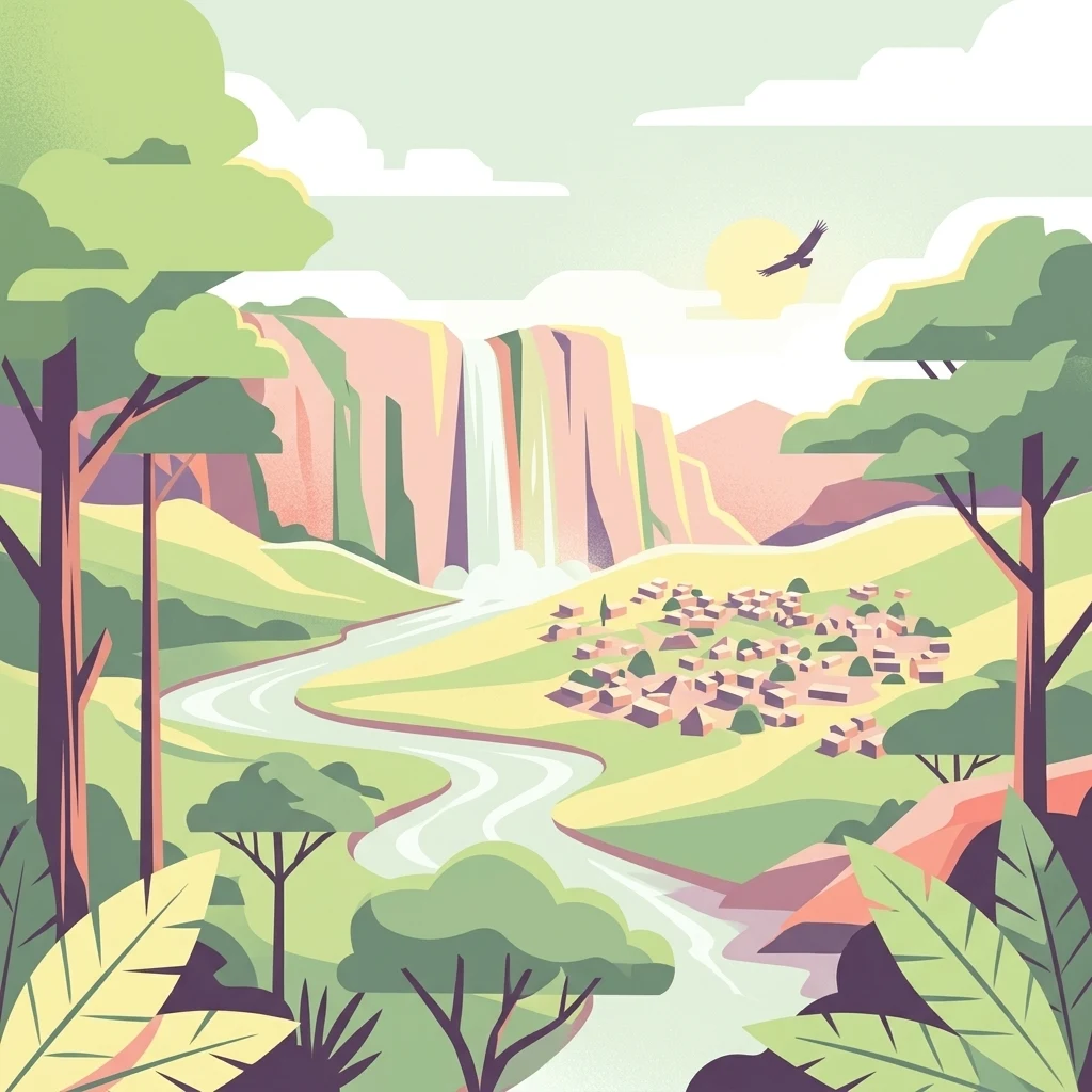
A vector-style digital illustration depicting a winding river leading to a distant waterfall, flanked by trees and a small settlement of houses under a light sky with a single flying bird.

Parc national du W du Benin

National park

Park overview

Structured park overview, official facts, and landscape profile for W National Park of Benin

W National Park of Benin park facts, protected area profile, and essential visitor context

Review the core facts for W National Park of Benin, including designation, size, terrain, visitor scale, habitats, and operating context in one park-focused overview.

About W National Park of Benin

W National Park of Benin is the largest national park in Benin and a central pillar of the country's protected-area network. Located in the country's far north, it extends across the departments of Alibori and Atacora, covering a vast tract of Sudano-Sahelian landscape that is otherwise sparsely protected. The park is the Beninese fraction of the larger W transboundary reserve, which takes its name from the characteristic double bend traced by the Niger River as it passes through the region.

The park is best understood as part of a broader conservation story. Along with the Pendjari and Arly reserves, it makes up the W-Arly-Pendjari complex, the most important contiguous block of protected savanna remaining in West Africa. This complex stretches across Benin, Burkina Faso, and Niger, and has been progressively elevated in international recognition: the Nigerien portion of the W was inscribed as a UNESCO World Heritage Site in 1996, the entire WAP complex was added to that listing in 2017, and the Beninese segment benefits from UNESCO biosphere reserve status alongside its Ramsar wetland designation.

Within Benin, the park's identity is shaped by its combination of broad Sudanian savannas, gallery forests along its main rivers, and the rolling foothills at the southern edge of the Atacora range. The hydrology, anchored by the Mékrou and Alibori rivers, feeds both the vegetation mosaic and the wildlife that the park is famous for. The park is currently classified under IUCN Category II (national park) and is managed in a way that combines biodiversity protection with engagement of surrounding communities, whose presence remains an integral part of the landscape's human geography.

The park's significance extends beyond national boundaries because of its role in maintaining viable populations of large savanna mammals in West Africa, where habitat fragmentation and pressure from expanding agriculture have reduced wild areas elsewhere. For visitors, researchers, and conservationists alike, W National Park of Benin represents both a refuge for species that have largely disappeared from surrounding landscapes and a working example of transboundary conservation in the Sudano-Sahelian belt.

Quick facts and research context for W National Park of Benin

W National Park of Benin lies in northern Benin across the Alibori and Atacora departments and forms the Beninese segment of the transboundary W biosphere reserve shared with Niger and Burkina Faso. It is part of the larger W-Arly-Pendjari (WAP) complex, recognized by UNESCO as a World Heritage Site and as a transboundary biosphere reserve, and is also listed as a Ramsar wetland site.

The park protects Sudano-Sahelian savanna crossed by the Mékrou and Alibori rivers, tributaries of the Niger, and hosts most large mammal species typical of West African savannas, including elephants, lions, leopards, and African buffalo. It is classified as a national park under IUCN Category II and was first established as a protected area in 1950.

Protection and recognition

Documented terrestrial protection scope, transboundary status, and official UNESCO heritage details

Parc national du W du Benin Protection Status and International Recognition

Parc national du W du Benin maintains documented terrestrial protection status with international recognition through the W-Arly-Pendjari Complex UNESCO World Heritage designation. Structured records outline the designation timeline and transboundary management scope established for this protected area.

International recognition

Protection details

Protection scope
Terrestrial
Designated year
2017
Transboundary protection
Yes
WDPA ID
12201
Park context

Deeper park guide and search-rich context for W National Park of Benin

W National Park of Benin history, landscape, wildlife, and travel context

Explore W National Park of Benin through its history, landscape character, ecosystems, wildlife, conservation priorities, cultural context, and seasonal travel timing in a structured park guide built for atlas discovery and search intent.

Why W National Park of Benin stands out

The park is especially known for being a core component of the W-Arly-Pendjari complex, the largest block of interconnected protected savanna in West Africa and one of the last strongholds of the region's emblematic elephant and lion populations. It is also distinctive for the W-shaped double bend of the Niger River that gives the whole transboundary reserve its name. Within Benin specifically, the park is recognized for the contrast between its riverine gallery forests along the Mékrou and Alibori and its drier, fire-maintained Sudanian savannas and atacora foothills, a mosaic that supports a wide range of large mammals and birdlife. The combination of UNESCO World Heritage, biosphere reserve, and Ramsar wetland status reinforces its profile as a flagship protected landscape in northern Benin.
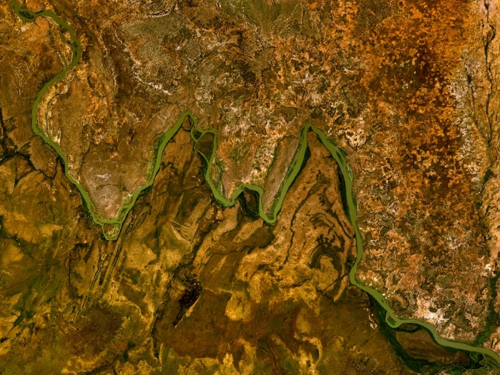
Top-down satellite imagery showing the meandering River Niger winding through arid, textured landscape, forming sharp angular bends.
Satellite view of the River Niger, illustrating the distinctive 'W' shaped bends that define the geography of W National Park.

W National Park of Benin history and protected-area timeline

The protected area that is today W National Park of Benin dates back to 1950, when initial reserve designations were established in what was then a much larger shared colonial landscape across French West Africa. Populations were gradually displaced from the interior of the reserve over the following decades, shaping the social and land-use context that still surrounds the park today.

The reserve gained wider international profile as the Beninese segment of the W transboundary biosphere reserve. The W reserve was recognized as a transboundary biosphere reserve by UNESCO in 2002, building on the Nigerien portion's earlier inscription as a World Heritage Site in 1996. In 2007, parts of the W complex gained Ramsar wetland recognition, underscoring the importance of the park's river systems and seasonal floodplains for waterbirds and broader ecological function.

A major milestone came in 2017, when UNESCO extended the World Heritage inscription to the entire W-Arly-Pendjari (WAP) complex following the 41st session of the World Heritage Committee. The Beninese certificate of inscription was formally received in 2018 in Paris, marking full recognition of the park's contribution to one of West Africa's flagship conservation landscapes. These layered designations, biosphere reserve, Ramsar site, and World Heritage Site, reflect the park's growing role within regional and international conservation frameworks.

W National Park of Benin landscape and geographic character

The landscape of W National Park of Benin is defined by broad, gently undulating Sudanian plains broken by seasonal rivers and the southern fringes of the Atacora range. Topographic relief is modest, with elevation differences generally between 20 and 40 meters and slopes below two percent, giving the park an overall appearance of rolling savanna rather than dramatic terrain. This relative homogeneity is interrupted by natural erosion features known locally as dongas and by the rocky outcrops and cliffs associated with the Atacora chain.

Two river systems dominate the park's physical geography. The Mékrou, around 410 kilometers long, and the Alibori, around 338 kilometers long, both flow toward the Niger River and carve distinct corridors through the savanna. The Mékrou has a relatively regular flow regime, while the Alibori is more intermittent, leaving a chain of pools and ponds along its minor channel during the dry months from February to April. Smaller tributaries such as the Pako, Kompa Gorou, Bédarou, Mali Gorou, Kokodiangou, and Konékoga supplement this network and add local diversity to the hydrological pattern.

Notable landscape features include the terminal extensions of the Atacora chain, the cliffs of the Koudou waterfalls, the rapids of Barou, and the gorge of the Mékrou River. Together with granite-gneiss peneplains and a scattering of low hills, these features give the park a subtle but distinctive topography. The combination of open plateaus, river valleys, rocky slopes, and seasonal wetlands creates the underlying template on which the park's vegetation and wildlife are arranged.
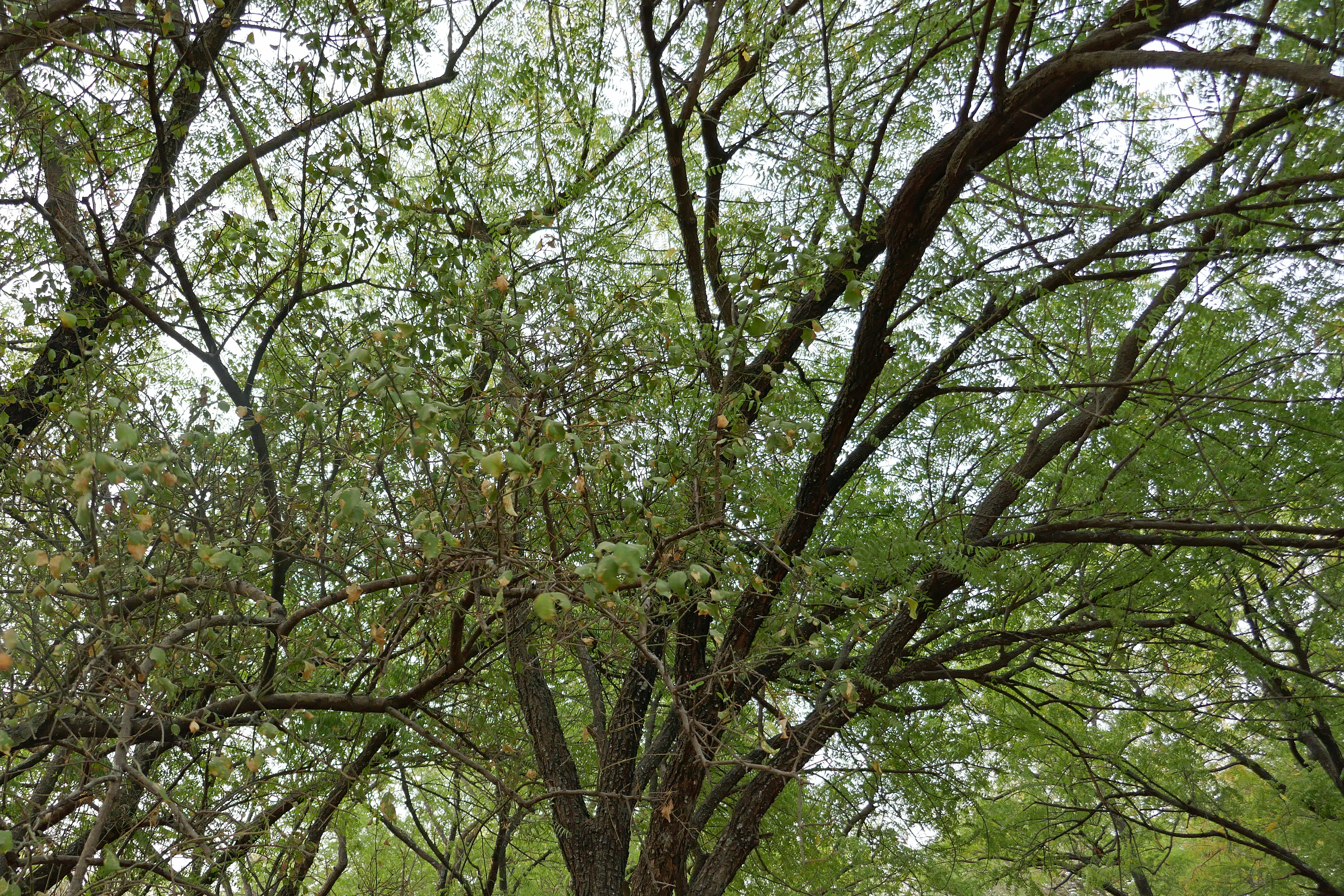
A low-angle view looking up into the canopy of a Balanites aegyptiaca tree, showing dark, textured branches and small green leaves.
A Balanites aegyptiaca tree showcasing its characteristic branches and foliage.

W National Park of Benin ecosystems, habitats, and plant life

Despite receiving an estimated 900 millimeters of rainfall annually, the vegetation of W National Park of Benin is dominated by shrub and grassy savanna, reflecting both the encroachment of Sahelian conditions and the long-term influence of dry-season fires. The park's plant communities form a clear mosaic shaped by soils, rockiness, and proximity to water.

Along the main rivers, narrow strips of riparian forest and denser gallery forest include trees and shrubs of genera such as Cola, Morella, and Syzygium, alongside species like Khaya senegalensis, Diospyros mespiliformis, and Kigelia africana. Away from the rivers, the vegetation grades through open dry woodland with trees typically 8 to 16 meters tall, into wooded savanna with denser canopies and abundant herbaceous layers, and then into tree savanna and shrub savanna with progressively sparser woody cover.

On rocky or cuirassed soils, saxicolous savanna hosts characteristic species such as Burkea africana and Detarium microcarpum, while grass-dominated savanna covers much of the open ground. Along the Atacora cliffs, mature trees such as the African baobab (Adansonia digitata), African birch (Anogeissus leiocarpus), shea (Vitellaria paradoxa), and néré (Parkia biglobosa) testify to former human settlement and cultivation, leaving a visible legacy of the area's longer land-use history within what is now a protected landscape.
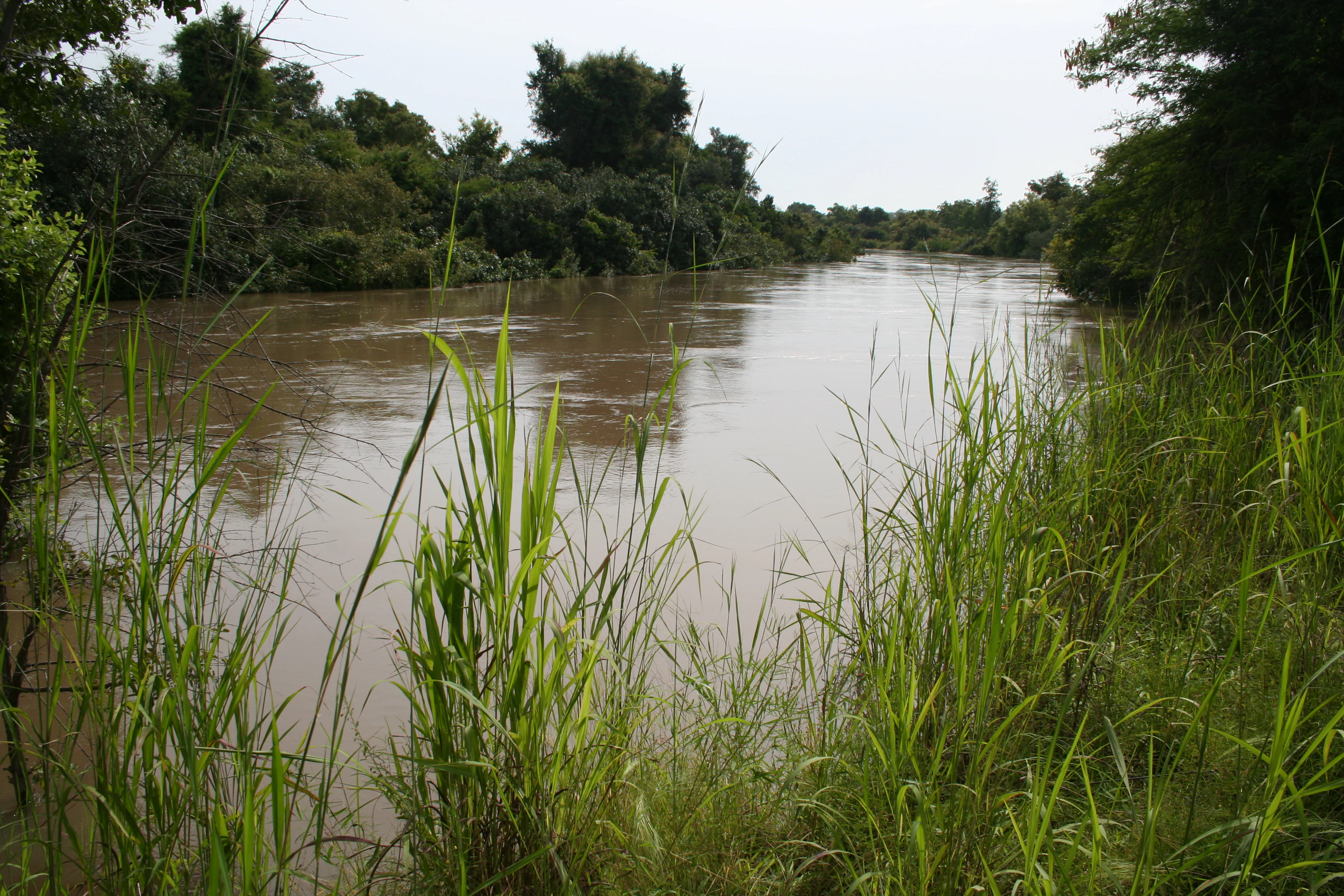
A wide, murky river flows through a dense forest under a cloudy sky, with tall grasses in the foreground.
The Mekrou River flowing through the lush landscape of W National Park in Benin.

W National Park of Benin wildlife and species highlights

W National Park of Benin supports nearly all of the large mammal species typical of West African Sudanian savanna, with the notable exceptions of giraffes, Derby's elands, and red-fronted gazelles. The park is one of the few places in the region where visitors can still hope to encounter four of the traditional African Big Five: the African elephant, the lion, the leopard, and the African buffalo.

Among the most commonly observed mammals are African buffalo (Syncerus caffer), lion (Panthera leo), Defassa waterbuck (Kobus defassa), common warthog (Phacochoerus aethiopicus), olive baboon (Papio anubis), patas monkey (Erythrocebus patas), bushbuck (Tragelaphus scriptus), and African savanna elephant (Loxodonta africana). These species use the park's mix of riverine forest, dry woodland, and open savanna in different ways and across different seasons, making the park a year-round wildlife refuge rather than a strictly seasonal one.

The park's rivers, pools, and seasonal wetlands also attract a rich bird community, which is one of the reasons the area has been designated as a Ramsar site. Although the source focuses primarily on mammals, the combination of intact Sudanian habitats, abundant water, and a relatively unfragmented landscape gives W National Park of Benin outstanding importance for both resident and migratory birdlife in West Africa.

W National Park of Benin conservation status and protection priorities

W National Park of Benin sits at the core of regional efforts to maintain viable populations of West African savanna wildlife, particularly large herbivores and their predators. The park's inclusion in the W-Arly-Pendjari complex means that conservation here is inherently transboundary: elephants, lions, and other wide-ranging species move across borders, and the long-term survival of their populations depends on coordinated protection across Benin, Niger, and Burkina Faso.

The park's overlapping designations, IUCN Category II national park status, UNESCO World Heritage Site, UNESCO transboundary biosphere reserve, and Ramsar wetland site, reflect a layered conservation strategy that combines strict protection, sustainable use in buffer zones, and international recognition. The Ramsar designation in particular highlights the ecological importance of the Mékrou and Alibori river systems and their associated floodplains, while the park's role within the WAP complex places it among the most heavily supported conservation landscapes in West Africa.

Despite this institutional protection, the park faces ongoing pressures. Human population around the reserve is estimated at more than 200,000 people across roughly sixty villages, and conflicts between elephants and farmers occur regularly in the buffer zones around localities such as Kaoubagou (Kérou), Alfakoara-Goungoun, Bénésségou, Angaradébou (Kandi) and Térempo-Ankouamon (Banikoara). These challenges, along with broader issues such as regional insecurity, underline why conservation here is understood not just as fence-and-guard protection, but as continuous engagement with the surrounding communities and the wider WAP landscape.

W National Park of Benin cultural meaning and human context

Although people were progressively removed from the interior of the reserve after 1950, W National Park of Benin remains closely intertwined with the lives and identities of the communities that surround it. More than 200,000 people live in roughly sixty villages around the park, distributed across six major socio-cultural groups that shape land use, farming patterns, and pastoralism in the area. In the south of the park's surroundings the Bariba and Gando peoples predominate, while to the east and north Dendi, Mokolé, and Gourmantché communities are present, and Peul (Fulani) groups are dispersed throughout the wider zone in keeping with their tradition of extensive livestock raising.

These communities are not incidental to the park; they are part of the broader context in which it was created and is managed. Former villages and old cultivated fields are still visible in the vegetation along the Atacora cliffs, where mature shea, néré, baobab, and African birch trees mark the legacy of pre-resettlement land use. Today, the relationship between the park and surrounding communities includes tourism initiatives, buffer-zone agriculture, and recurring human-elephant conflict, all of which make the cultural and human dimension inseparable from the park's ecological story.

Top sights and standout views in W National Park of Benin

W National Park of Benin stands out as the country's premier large-mammal reserve and as the Beninese anchor of the W-Arly-Pendjari complex, the largest connected protected savanna in West Africa. Its combination of Sudanian savanna, gallery forest along the Mékrou and Alibori rivers, and atacora foothills creates a landscape that supports elephants, lions, leopards, buffalo, warthogs, and a rich birdlife within a single protected area.

The park's layered international recognition, with UNESCO World Heritage, biosphere reserve, and Ramsar wetland status, sets it apart from most other Beninese protected areas and reinforces its role as a regional conservation flagship. For travelers and researchers alike, the park offers the rare West African experience of encountering the Big Four in a Sudano-Sahelian setting, framed by the cultural geography of Bariba, Gourmantché, Dendi, and Peul communities around its borders.

Best time to visit W National Park of Benin

The character of a visit to W National Park of Benin shifts meaningfully with the seasons. The rainy season, broadly from mid-May through October, brings greener savanna landscapes, full rivers, and active birdlife, and is often described as the most scenic period for appreciating the park's vegetation and waterways. Annual rainfall averages around 900 millimeters, and this is when the park feels most lush.

The dry season, generally from December to June, is typically recommended for wildlife viewing. As water becomes more concentrated in remaining rivers and pools, large mammals tend to gather in more predictable areas, making elephants, buffalo, lions, and other species easier to observe. Within the dry season, a cooler period dominated by the harmattan wind runs roughly from November to February, followed by a hotter dry period from March to mid-May, each giving the landscape a slightly different atmosphere for visitors.
Monthly climate preview

Long-term representative temperature and monthly precipitation averages

Parc national du W du Benin Climate Normals and Annual Weather Patterns

Representative coordinates record measured monthly variations in long-term temperature and precipitation across the terrain of Parc national du W du Benin. Reviewing the complete twelve-month climatology profile provides detailed insight into annual environmental rhythms at this specific sampling point.
Annual mean28 °C
25 °C32 °C
Jan25°
Feb28°
Mar31°
Apr32°
May31°
Jun29°
Jul27°
Aug26°
Sep26°
Oct27°
Nov27°
Dec25°
Warmest month
April

32.4 °C

Coolest month
December

24.7 °C

Wettest month
August

7.4 mm/day

Driest month
December

0 mm/day

Park location guide

Geography guide, regional context, and park location map for W National Park of Benin

W National Park of Benin park geography, regions, and map view in Benin

Understand where W National Park of Benin sits in Benin through a broader geographic reading of the surrounding landscape, nearby location context, and its mapped position within the national park landscape.

How W National Park of Benin fits into Benin

Benin is a West African nation formerly known as Dahomey. It gained independence from France in 1960 and operates as a unitary presidential republic. The country is known for its coastal location along the Bight of Benin, its historical kingdom of Dahomey, and its agricultural economy centered on palm oil and cotton exports.

Wider geography shaping W National Park of Benin in Benin

Benin is located in West Africa, bordered by Togo to the west, Nigeria to the east, Burkina Faso to the northwest, and Niger to the northeast. The country occupies the southern coastline of the Bight of Benin, which is part of the Gulf of Guinea in the northernmost tropical portion of the Atlantic Ocean. The terrain ranges from coastal plains to hilly uplands in the north.

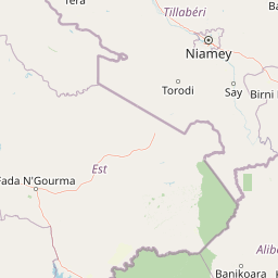
Map view of W National Park of Benin

Use this park location map to pinpoint W National Park of Benin in Benin, understand its exact geographic position, and read its mapped placement within the surrounding landscape more clearly.

Pigeon | © OpenStreetMap contributors

Location context for W National Park of Benin

AliboriAtacora

Visualizing riverine habitats, Sudanian savannas, and protected terrain

Parc national du W du Benin Photos and Landscape Scenery

Visual records capture the expansive Sudanian savannas, gallery forests, and rocky Atacora foothills defining northern Benin. Photographic collections help researchers examine the complex river networks and protected ecosystems supporting regional wildlife.

Top-down satellite imagery showing the meandering River Niger winding through arid, textured landscape, forming sharp angular bends.

A high-angle view looking down over a lush, green valley filled with scattered trees, with a small village visible in the midground and the Atakora mountain range rising on the left.

A low-angle view looking up into the canopy of a Balanites aegyptiaca tree, showing dark, textured branches and small green leaves.

A wide, murky river flows through a dense forest under a cloudy sky, with tall grasses in the foreground.

Park atlas

Compare connected West African savanna reserves and surrounding conservation geography

Explore Parks Near Parc national du W du Benin and Related Protected Landscapes

Browsing other protected areas near Parc national du W du Benin reveals the broader ecological scale of the regional transboundary savanna network. Examining adjacent reserves provides essential geographic context for understanding northern wetland corridors and Sudanian ecosystems.
A horizontal watercolor painting showing a winding river flowing through a lush green landscape with distant rolling hills.
Protected areaBenin
About 11 km away#1 closest

North

Complexe W-Arly-Pendjari: Regional Geography and Transboundary Protected Landscapes

Sudano-Sahelian savanna and riverine conservation corridors.

As a massive transboundary conservation area, the Complexe W-Arly-Pendjari protects nearly 1.5 million hectares of savanna, woodland, and rocky terrain. The complex links national parks across three countries to maintain a continuous habitat for West African megafauna. Its distinctive landscape transitions from lush gallery forests along river systems to open, dry plains, representing an essential geographic gradient for regional biodiversity.

Area
14,948.3 km²
Established
1996
Water
Major water bodies
National parkNiger
About 20 km away#2 closest

North

W National Park: Niger National Park, UNESCO World Heritage Site & Ramsar Wetland

Transborder savanna ecosystem and dramatic Niger River landscape.

W National Park in Niger offers a unique atlas view of a vast protected landscape defined by the Niger River's iconic W-shaped bend. As a UNESCO World Heritage Site and Ramsar Wetland, it protects crucial savanna plains, extensive floodplains, and rocky outcrops. This transborder conservation area is a vital habitat for West African wildlife, providing a rich context for geographic discovery and landscape exploration.

Area
10,000 km²
Established
1954
IUCN
II
Relief
Mixed relief
National parkBenin
About 39 km away#3 closest

Southwest

Pendjari National Park: Mapping Benin's Primary Protected Savanna Ecosystem and Wilderness

Located in northwestern Benin, bordering the WAP transboundary complex.

Pendjari National Park represents a significant conservation landscape in West Africa, featuring a complex geography of river-fed riparian forests, sprawling savanna plains, and the high-elevation cliffs of the Atakora mountain range. This protected area offers a look into an intact savanna wilderness, serving as a vital sanctuary for large mammals and diverse bird species within its clearly defined boundaries.

Area
2,755 km²
IUCN
II
Relief
Highland
Climate
Subtropical
A watercolor painting showing a wide, panoramic landscape featuring dry, open terrain, low rolling hills in the background, and sparse vegetation, including distinctive baobab trees.
National parkAtacora Department
About 39 km away#4 closest

West

Parc national de la Pendjari: Geographic Atlas and Protected Area Overview in Atacora Department

Savanna plains and quartzite mountain ridges in West Africa

Parc national de la Pendjari represents an ecologically vital protected landscape in the Atacora Department of Benin. This atlas overview details its complex geography, ranging from the flat sandstone peneplain to the permanent waters of the Pendjari River. Learn how these boundaries support one of the most significant contiguous savanna ecosystems in West Africa, featuring diverse habitats from gallery forests to open woodlands.

Area
4,700 km²
Established
1961
IUCN
II
Visitors
7K annual
National parkTapoa Province
About 91 km away#5 closest

West

Arli National Park National Park: Mapped Protected Landscape in Tapoa Province

Explore its geographic context and boundaries.

Arli National Park stands as a critical protected area, identified as a national park within Tapoa Province. This detail page serves as an atlas-focused entry point to understanding the park's unique landscape characteristics and its precise geographic location. Users can investigate its mapped boundaries and explore how it fits into the regional geography, offering a foundational understanding for protected-area discovery.

Area
760 km²
Established
1954
IUCN
IV
Relief
Upland
A soft watercolor painting of a winding river flowing through a green woodland savanna with hills in the background.
Protected areaAlibori
About 113 km away#6 closest

East

Forêt classée de la Sota: Exploring Protected Woodlands in the Alibori Department

A historic Sudano-Sahelian savanna and riverine ecosystem

Forêt classée de la Sota stands as a critical protected woodland in northeastern Benin. This expansive 53,000 hectare reserve protects unique Sudano-Sahelian terrain defined by the Sota River basin, supporting a diverse range of savanna wildlife and complex riparian habitats across the Alibori region.

Area
530 km²
Established
1947
Relief
Lowland
Climate
Tropical
Protected areaDosso
About 119 km away#7 closest

Northeast

Feuchtgebiet am mittleren Niger: Protected Wetland Geography and River Floodplain Atlas

Geographic overview of floodplain terrain in Dosso, Niger

Feuchtgebiet am mittleren Niger preserves a vital mosaic of riverine channels, temporary ponds, and floodplain flats. This protected area stands as a distinctive aquatic corridor within the Sahel, characterized by diverse water-based habitats and seasonal vegetation shifts that define the regional geography of Dosso.

Area
521.8 km²
Established
2001
Relief
Lowland
Scope
Terrestrial
Wildlife reserveDosso Region
About 122 km away#8 closest

East

Feuchtgebiet am mittleren Niger II: Wetland Geography and Wildlife Reserve Boundaries

A seasonal floodplain corridor in the Dosso Region of Niger.

Feuchtgebiet am mittleren Niger II offers a clear view into the flood-pulse ecology of the middle Niger River. The reserve comprises a complex network of channels, ponds, and riverine woodlands that shift with the annual rains. This protected site in the Dosso Region acts as a crucial transboundary conservation area, showcasing the unique interaction between riparian forests, baobab groves, and seasonal aquatic terrain.

Area
385.55 km²
Established
2004
Relief
Lowland
Scope
Terrestrial

Common questions about visiting, size, designation, and location context for W National Park of Benin

W National Park of Benin FAQs for park facts, access, geography, and protected area context

Find quick answers about W National Park of Benin, including protected-area facts, park geography, trail and visitor context, and how the park fits into its surrounding country and regional landscape.
MoriAtlas Explorer

Continue Your Protected Areas Search Across the Global Atlas

Deepen your exploration by continuing the structured search for national parks and protected areas worldwide. Utilize the comprehensive filtering capabilities to compare different conservation landscapes and refine your understanding of global park geography. Discover more about the distribution and characteristics of protected natural areas.

Global natural geography