
Why Waldenbachtal stands out
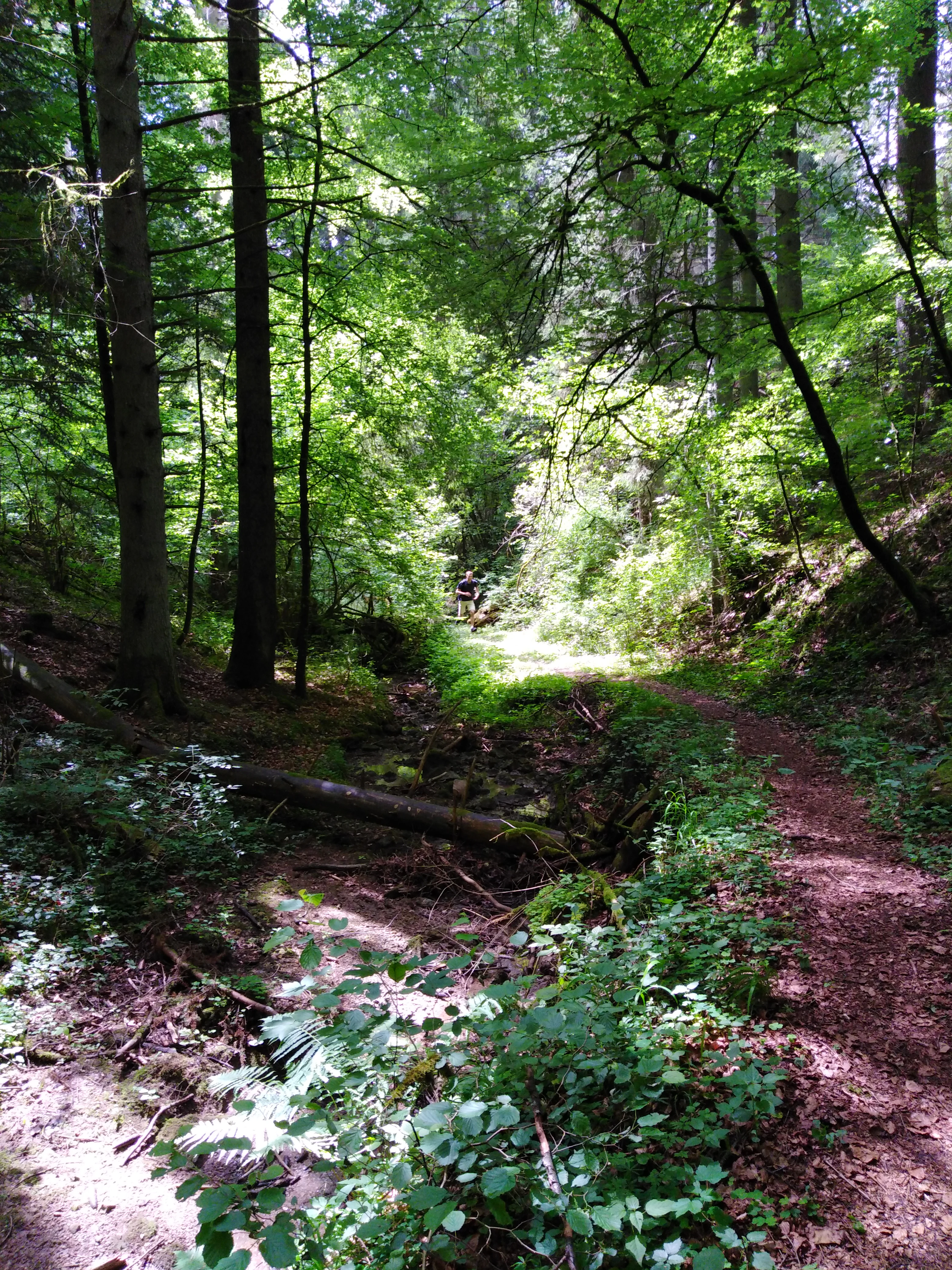
Waldenbachtal is best known for its dramatic, narrow Klingen valley carved into Stubensandstein of the Middle Keuper, where the Waldenbach has incised its course south of Rotenzimmern. The reserve preserves a characteristic forested sandstone gorge with continuous cover of coniferous mixed forest, a scenic stream corridor, and one of the few open, species-rich dry grassland areas (Magerrasen) within the local protected landscape network. The interplay of steep wooded slopes, sandstone outcrops, and the contrast between the closed forest and the northern opening of dry grassland gives the area its strong sense of place. It is valued less as a tourist destination than as a small, ecologically meaningful landscape component within the broader system of protected areas in the Rottweil district.
Waldenbachtal history and protected-area timeline
Waldenbachtal was formally placed under landscape protection by the Landratsamt Rottweil through a Verordnung, or statutory ordinance, dated 17 August 1982. The designation recognized the valley as a representative example of a forested Middle Keuper landscape and a stream corridor of regional value within the municipality of Dietingen.
The protection predates a wider European push for landscape conservation but fits within the long-standing German tradition of designating Landschaftsschutzgebiete to preserve the visual and ecological character of local landscapes. Since its designation, the area has been catalogued under the official identifier 3.25.031 and is registered in the World Database on Protected Areas under WDPA-ID 325544. The reserve remains administered by the Landratsamt Rottweil and continues to be managed within the framework set out at the time of its original ordinance.
Waldenbachtal landscape and geographic character
The landscape of Waldenbachtal is shaped by a single narrow valley carved into Triassic Middle Keuper strata. In the southern part of the reserve, the geology of the Trossingen Formation dominates, with sandstone layers that have been incised by the Waldenbach to expose steeper slopes and benches. Downstream, the valley continues to deepen into the Grabfeld Formation, producing a longer, more pronounced profile along the watercourse.
The hallmark feature is its character as a Klingen valley, the regional term for a steep-sided, narrow gorge typical of the Keuper landscapes of southwestern Germany. Coniferous mixed forest covers almost all of the valley flanks, lending the landscape a closed, green, and distinctly wooded character for most of its length. This continuous forest cover contrasts with the single open dry-grassland clearing near Rotenzimmern that breaks the canopy in the north.
The Waldenbach itself runs as the central axis of the landscape. Its course along the valley floor defines the drainage of the reserve and creates the moist, sheltered microclimate along the valley bottom that supports the surrounding forest. The combination of sandstone bedrock, sandy soils, slope movement, and stream dynamics produces a small-scale but geologically expressive landscape that is typical of the Obere Gäue natural region.
Waldenbachtal ecosystems, habitats, and plant life
The ecological profile of Waldenbachtal is dominated by coniferous mixed forest growing on the acidic sandy soils derived from the Stubensandstein. This forest stretches across nearly the entire protected area, occupying the valley slopes, midslopes, and valley heads. The species composition reflects typical woodland of the upper Gäu plateau, with conifers dominating the canopy and broadleaf companions contributing to a structurally diverse forest mosaic.
In the northern section of the reserve, near the edge of Rotenzimmern, the closed forest opens into a dry grassland, or Magerrasen. This open habitat introduces a very different ecological regime, supporting stress-tolerant grasses and herbs adapted to thin soils, high sun exposure, and low moisture. It represents one of the small but ecologically valuable open-ground habitats within the local protected landscape network.
The Waldenbach stream provides a continuous riparian corridor through the reserve. The cool, moist microclimate along its banks creates conditions that differ from the drier, sun-exposed slopes above, and this contrast between forest, open dry grassland, and the stream corridor underpins the habitat diversity of Waldenbachtal. Together these elements form a small but cohesive ecological system shaped by geology, slope, and hydrology.
Waldenbachtal conservation status and protection priorities
Waldenbachtal is designated as an IUCN Category V protected landscape, reflecting its role in preserving a characteristic traditional landscape rather than a strict nature reserve. Its primary conservation value lies in protecting the morphological integrity of the Waldenbach valley, the continuity of its forested slopes, and the contrast between closed woodland and the dry grassland opening near Rotenzimmern.
The area is significant at the regional level because it safeguards a representative example of a Middle Keuper Klingen valley with associated sandstone outcrops, woodland, dry grassland, and stream habitat. By keeping the valley under landscape protection, the ordinance of 17 August 1982 has ensured that the geological features, slope forests, and species-rich open areas remain intact within the mosaic of agricultural and settled land of the upper Gäu plateau.
Top sights and standout views in Waldenbachtal
Waldenbachtal stands out as a compact, forested Middle Keuper valley with the visual drama of a steep Klingen gorge cut into Stubensandstein. The Waldenbach stream gives the site its linear structure, while the surrounding coniferous mixed forest defines its dominant character. The single Magerrasen opening near Rotenzimmern is a notable highlight, providing an open-habitat contrast in an otherwise wooded reserve.
The reserve's integration into the wider Rottweil district network of protected landscapes, combined with its clear geological story, makes it a useful example of how small valley landscapes contribute to regional conservation strategy.